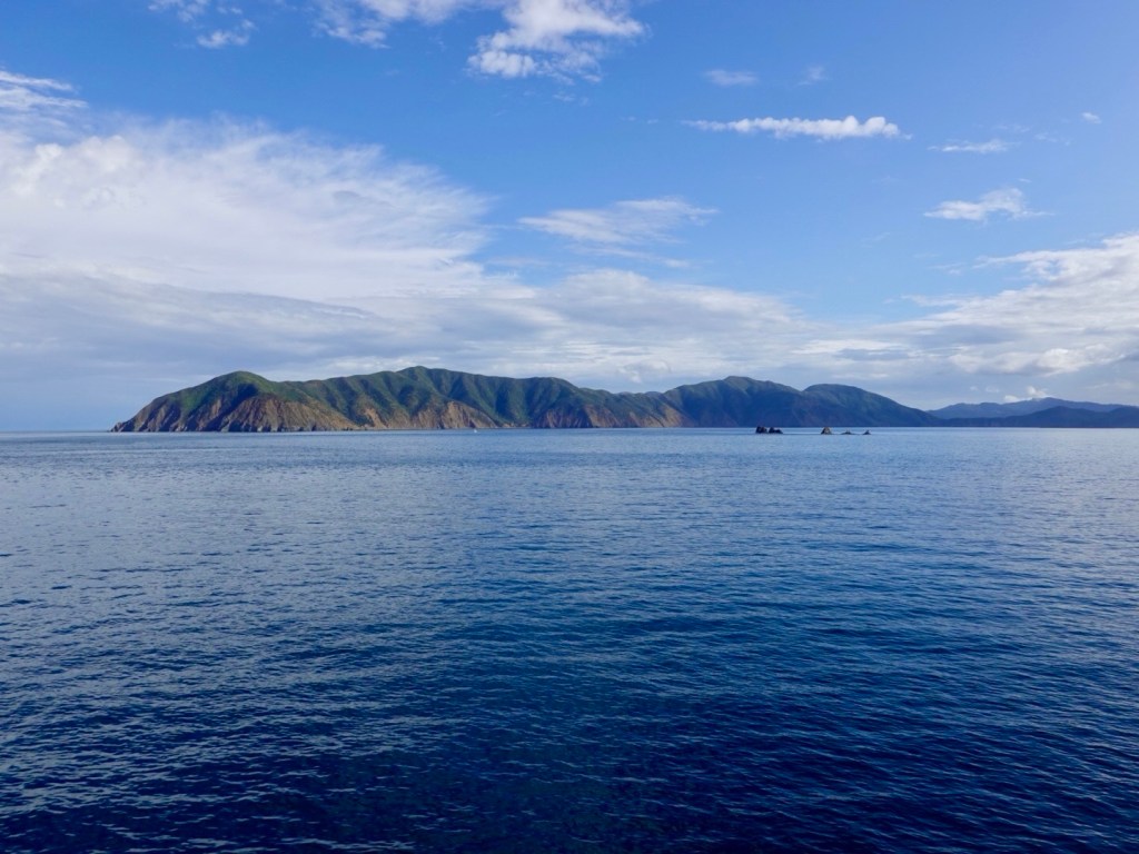
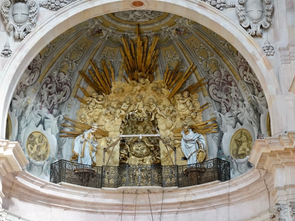
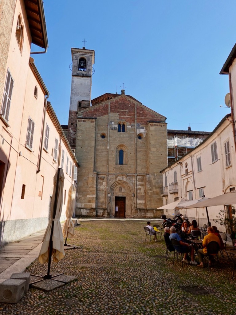
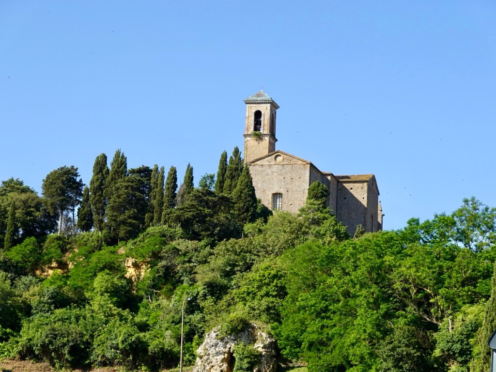
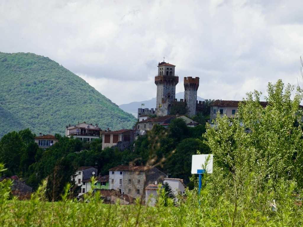
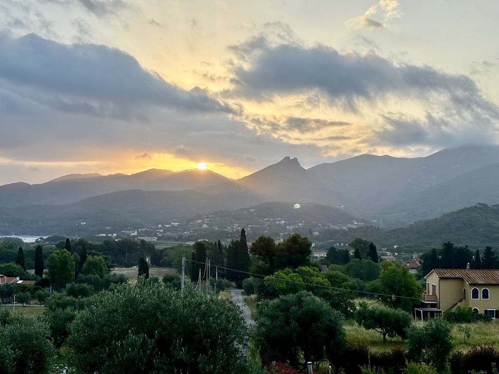
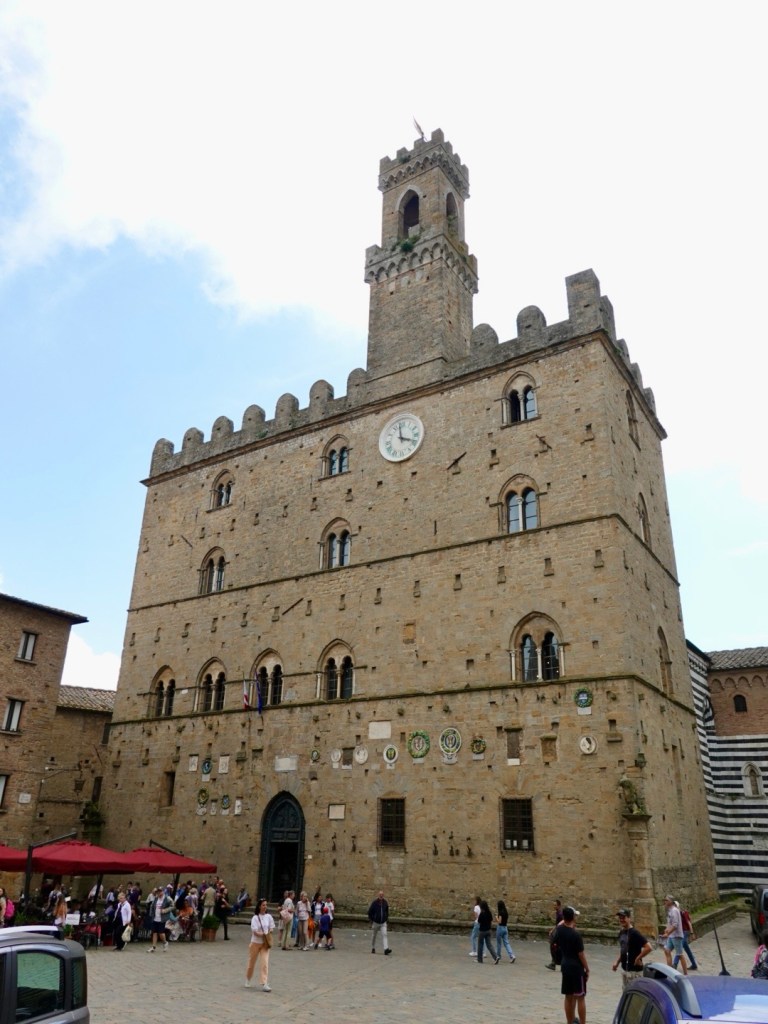
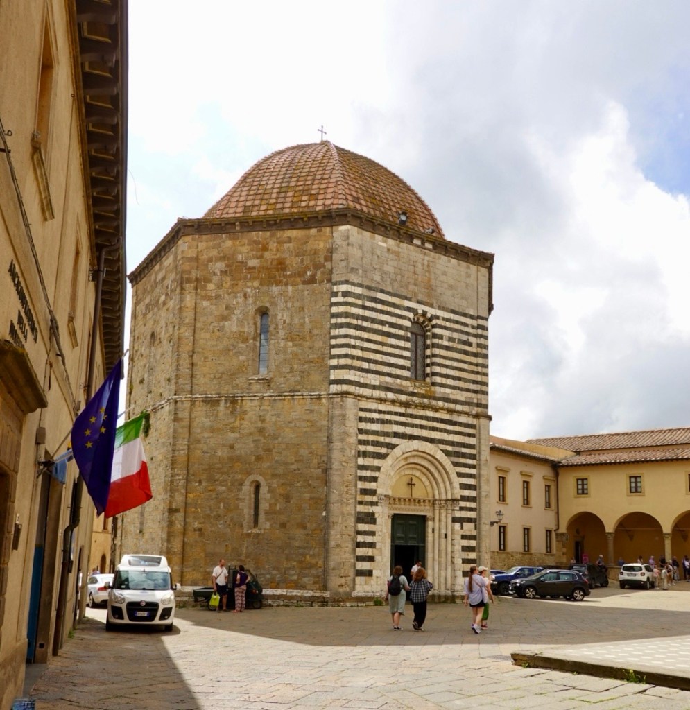
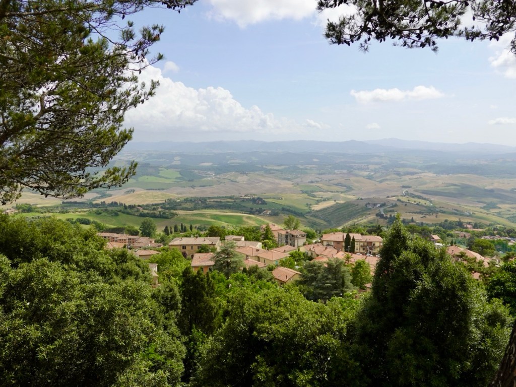
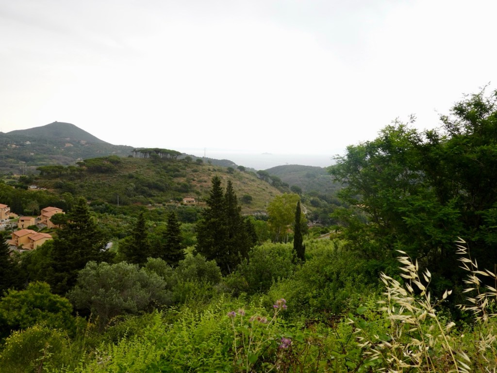
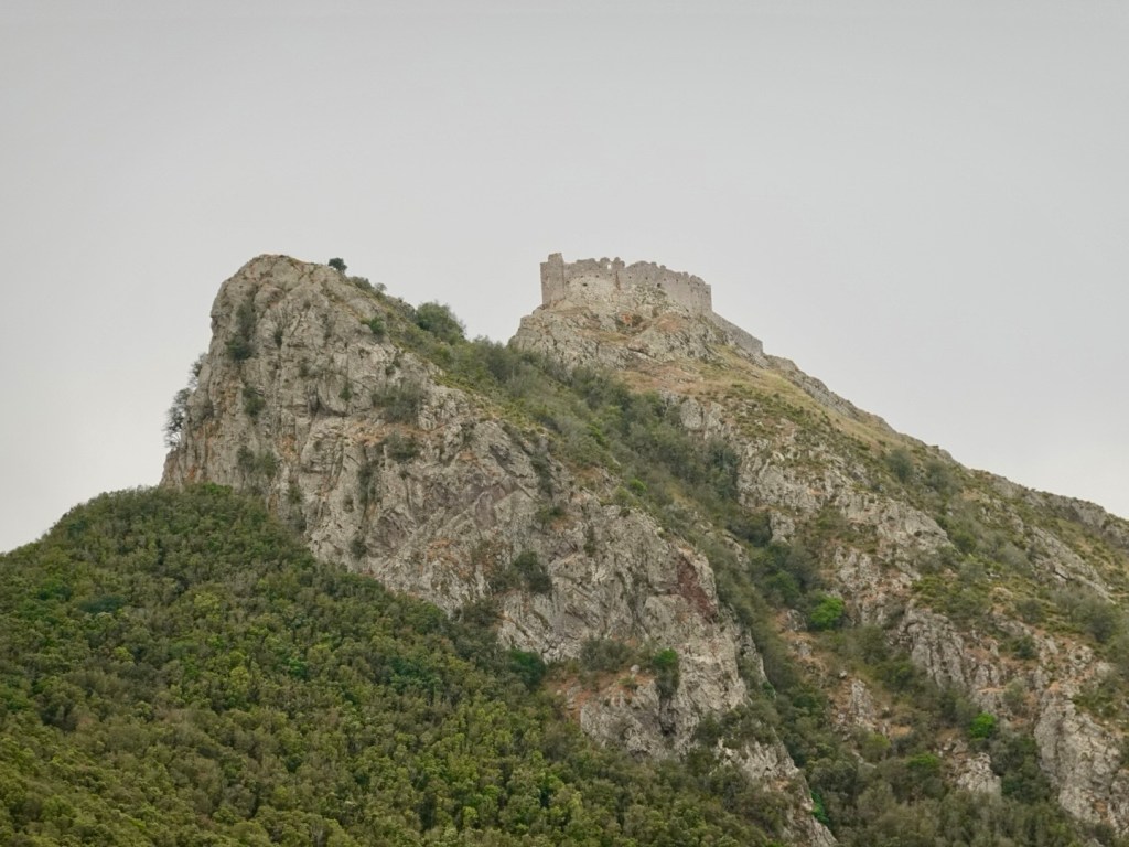
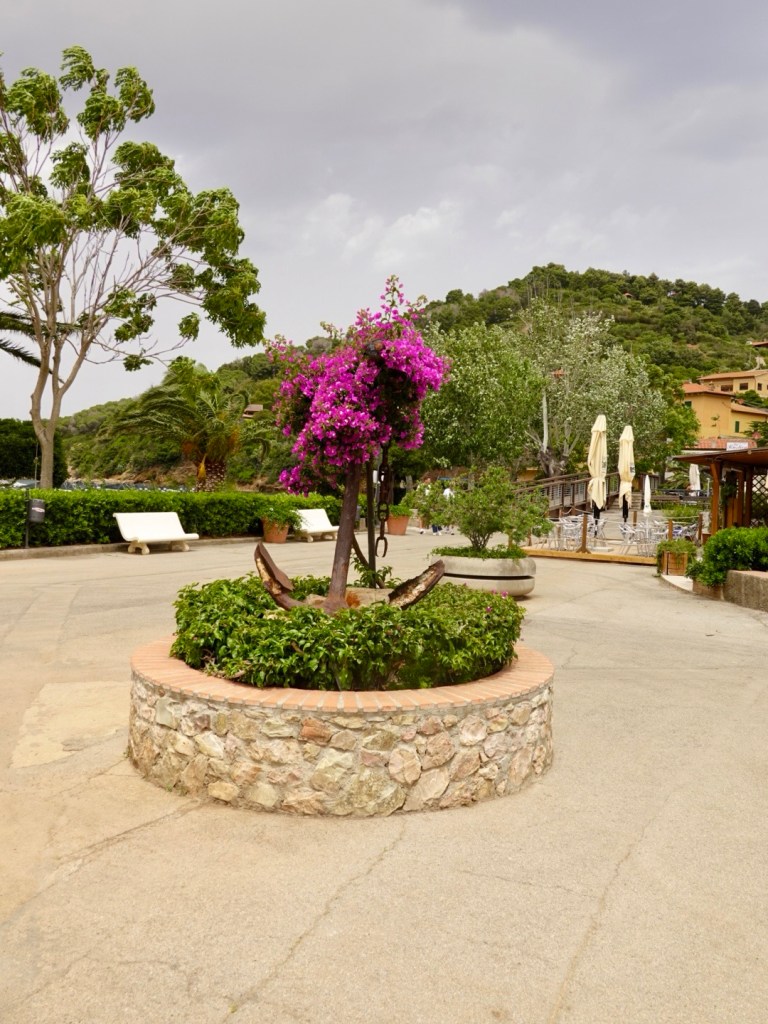
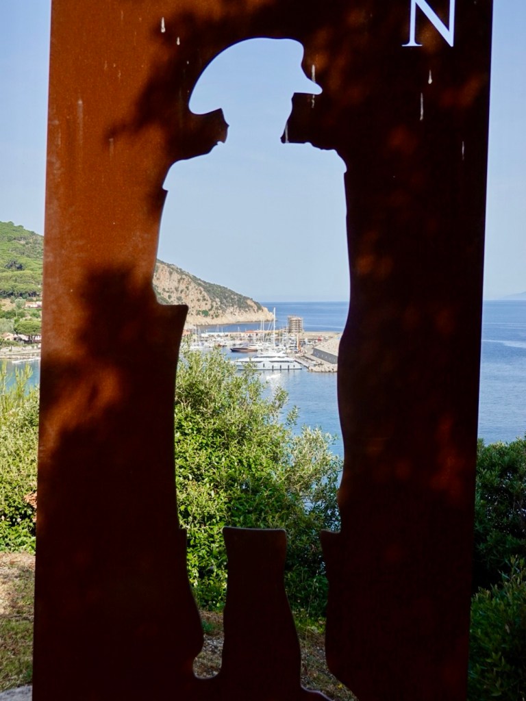
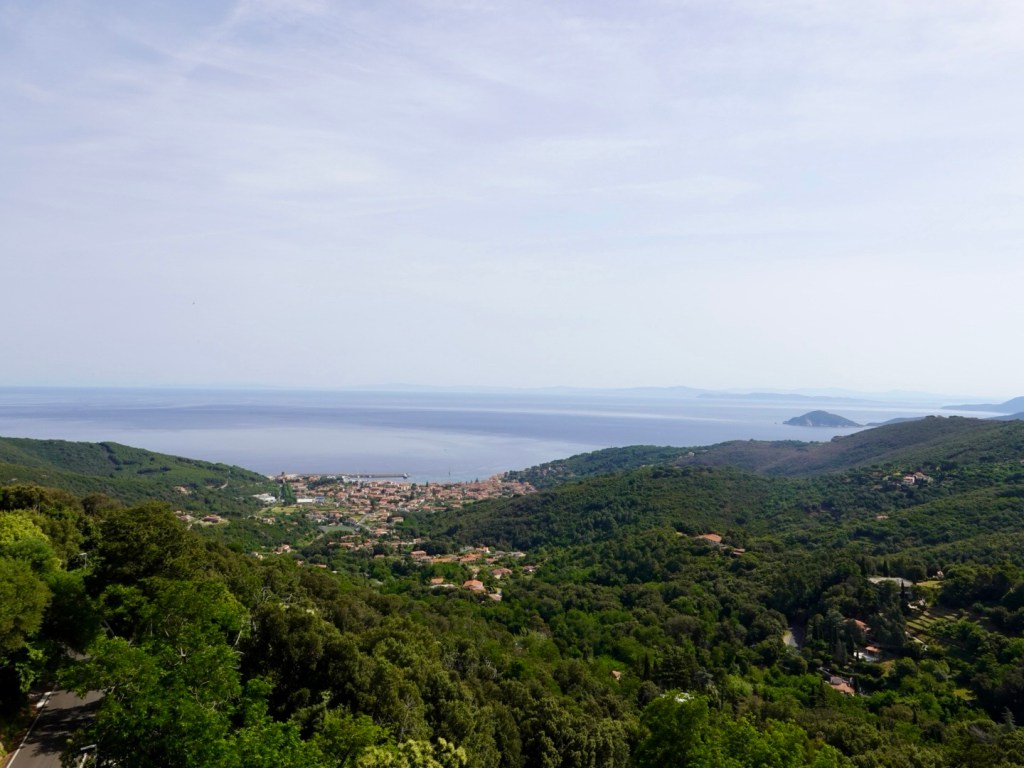
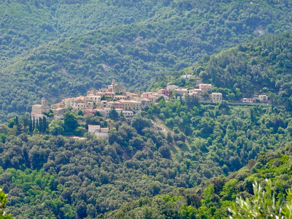
Cape Farewell the most northerly point on the South Island mapped by Abel Tasman and named by Captain Cook. It’s Maori history is a lot older and if more significance.
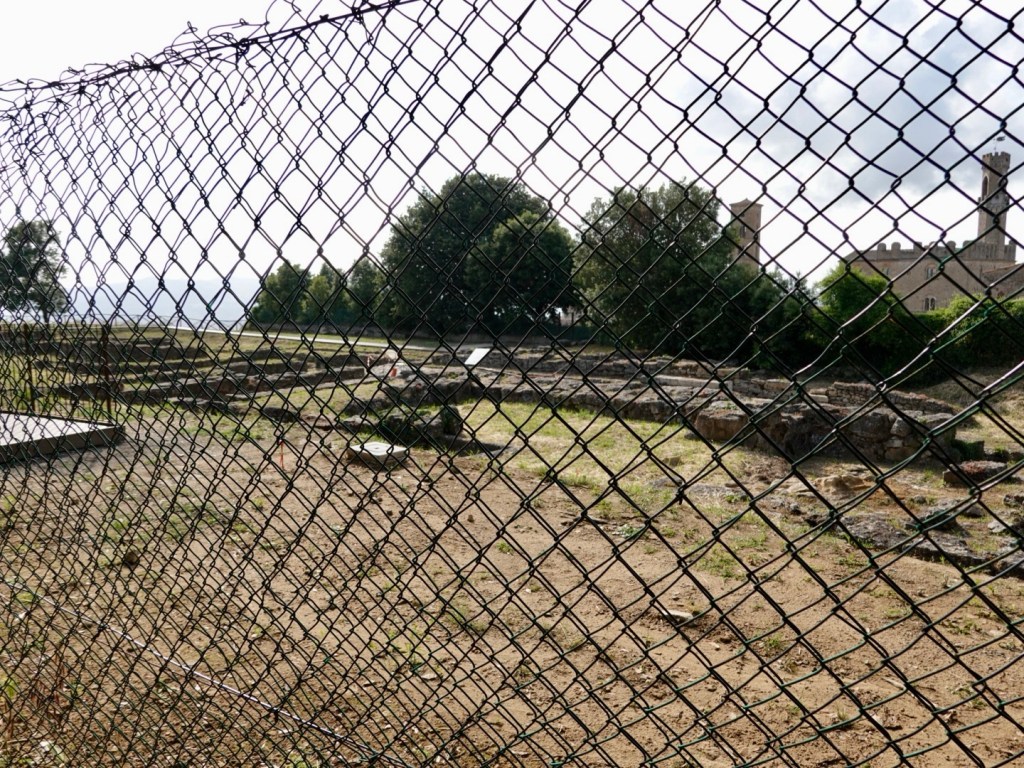
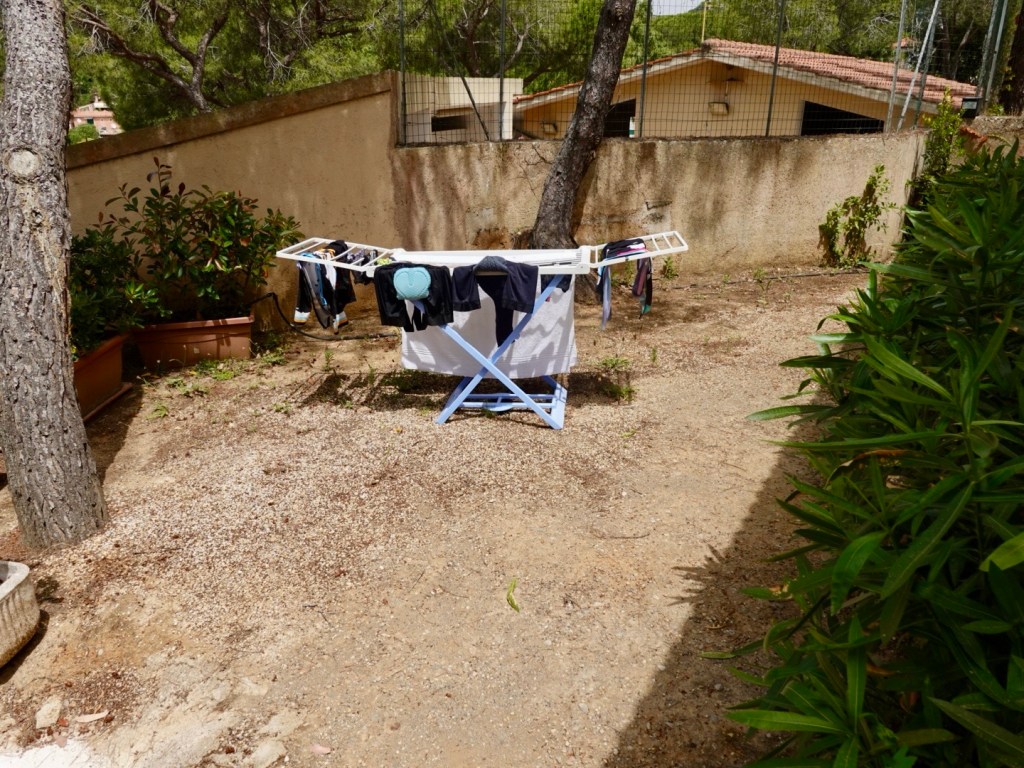
Today the area houses an eco sanctuary enclosed by a predator proof fence.
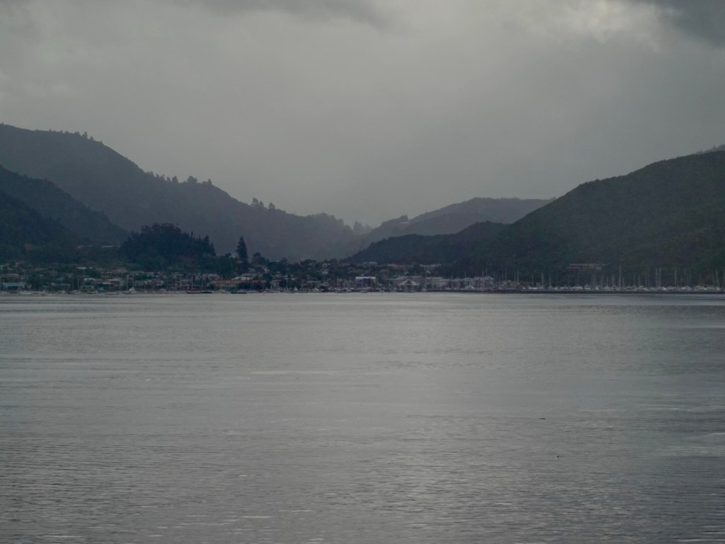
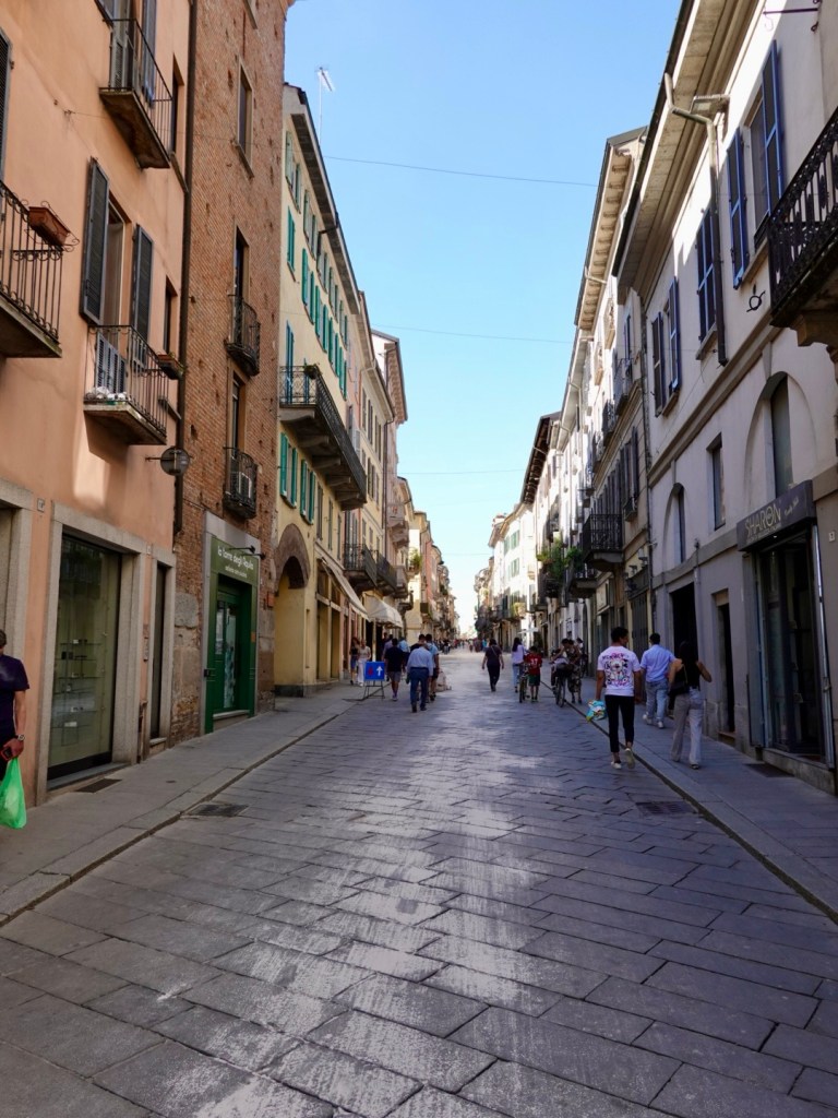
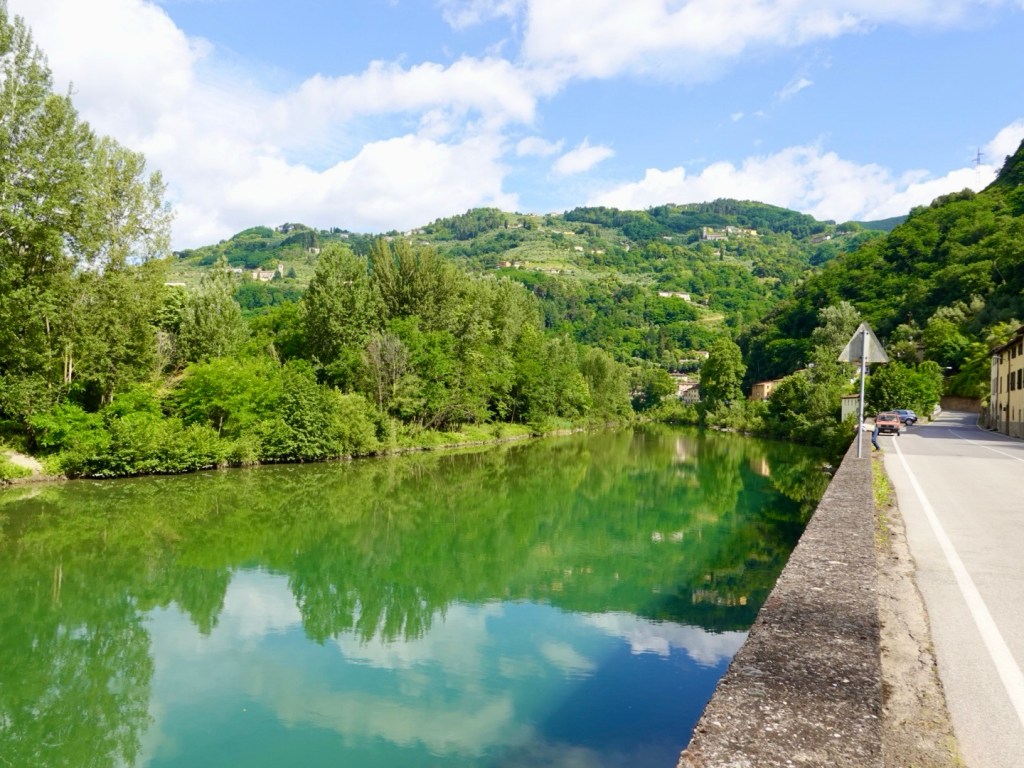
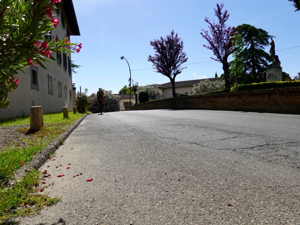
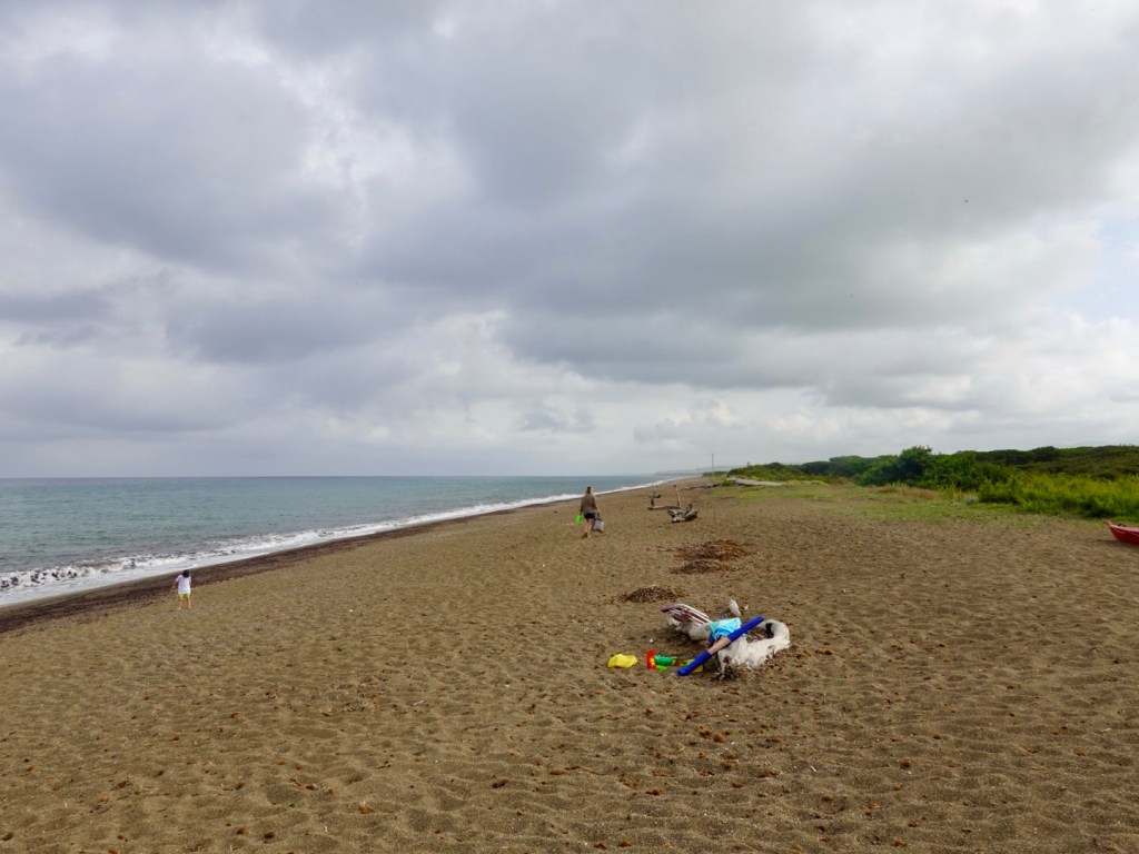
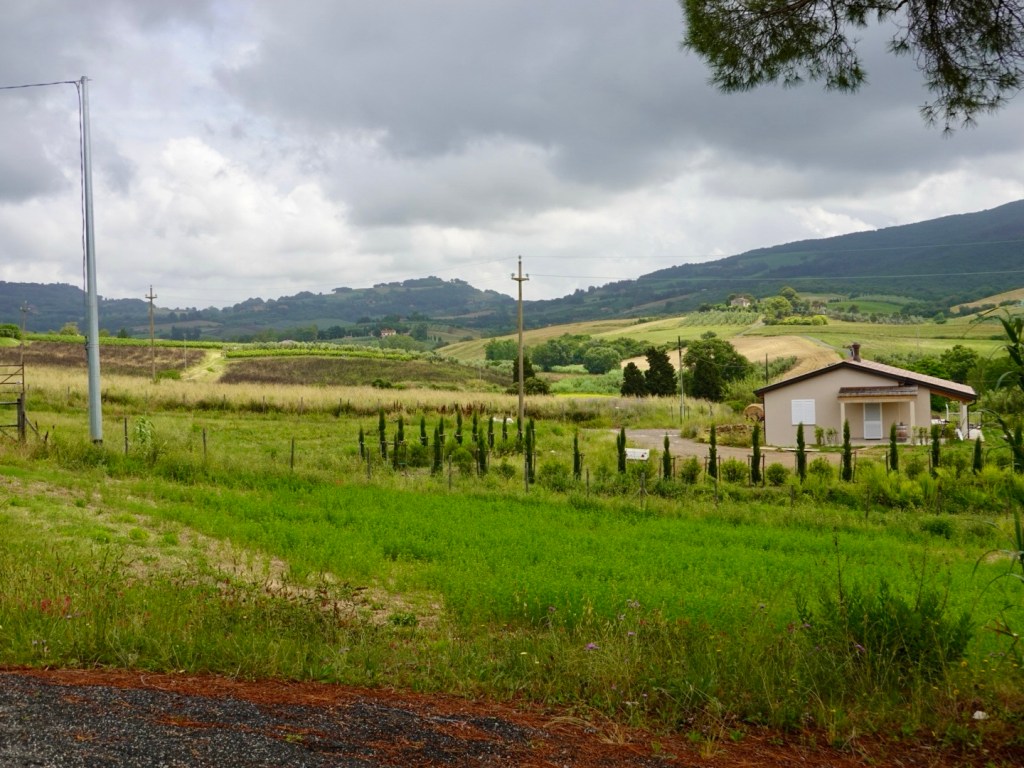
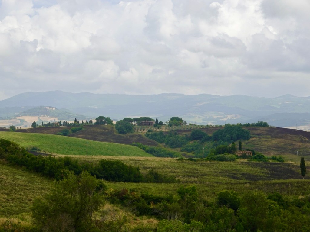
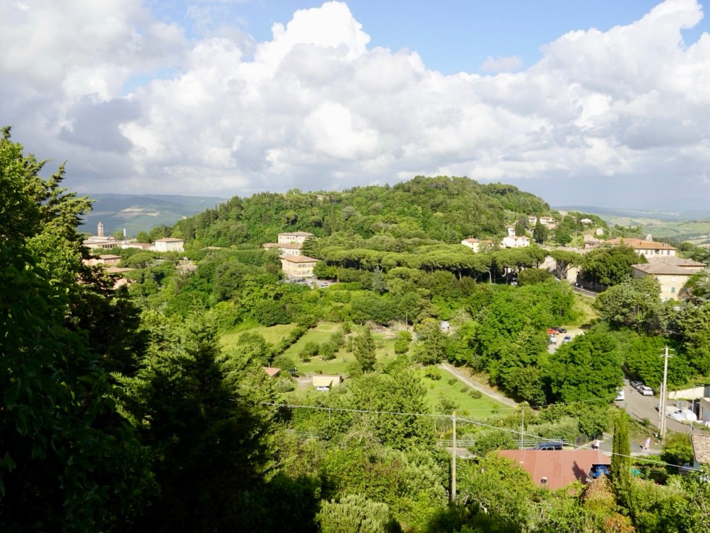
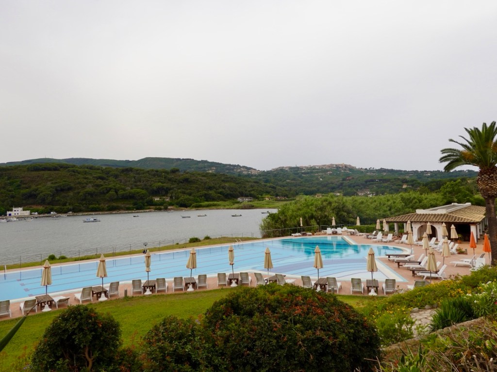
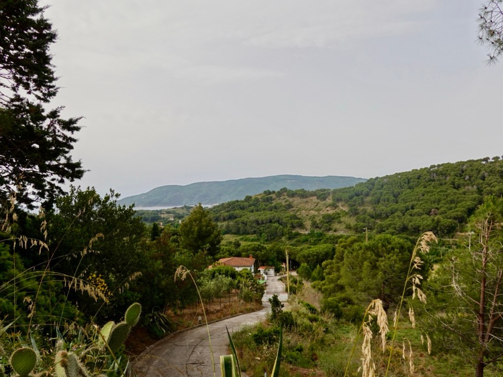
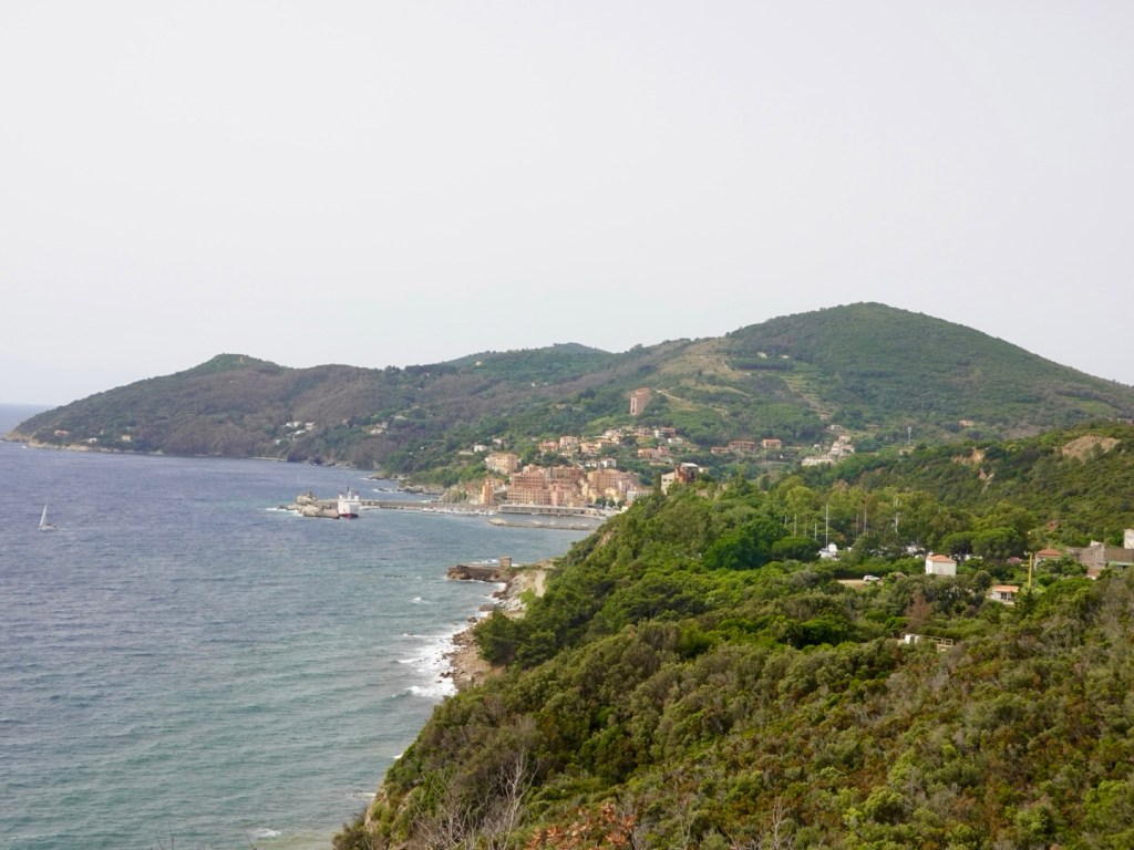
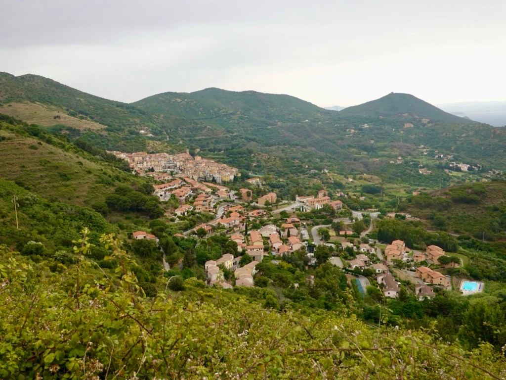
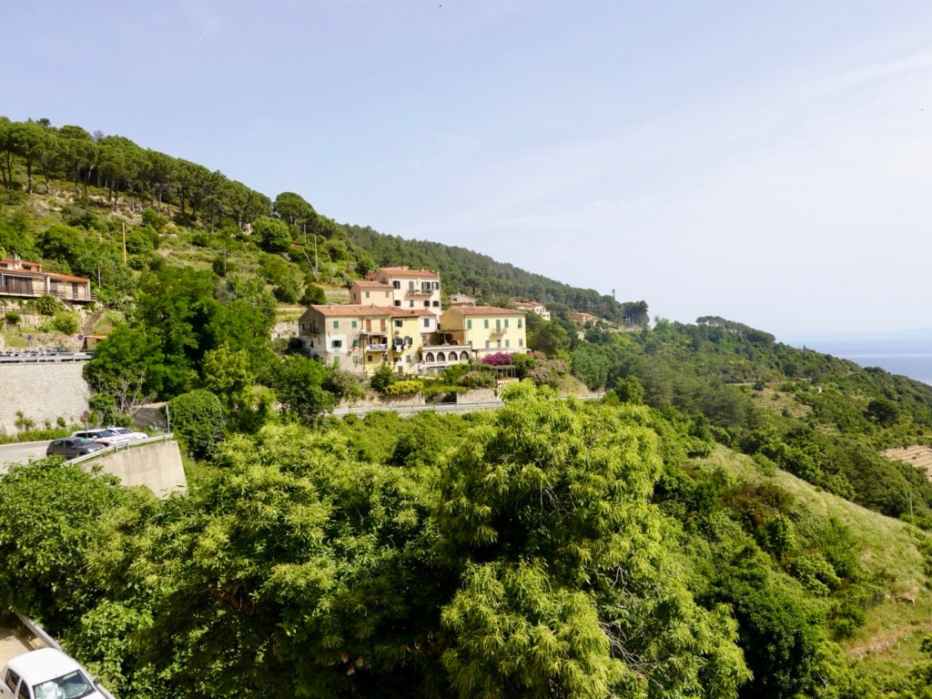
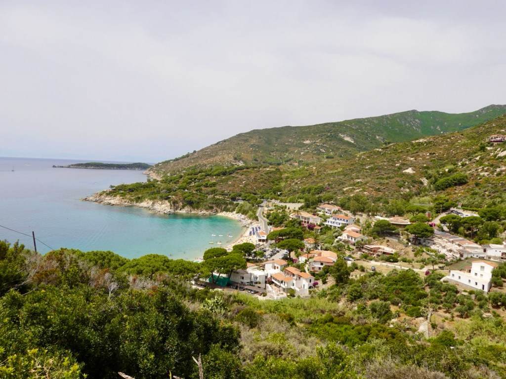
Today we were heading back up towards the Cape and the Spit to explore more.
Unlike yesterday it was very overcast with low cloud.
Humans can be scary as we had found out the previous day.
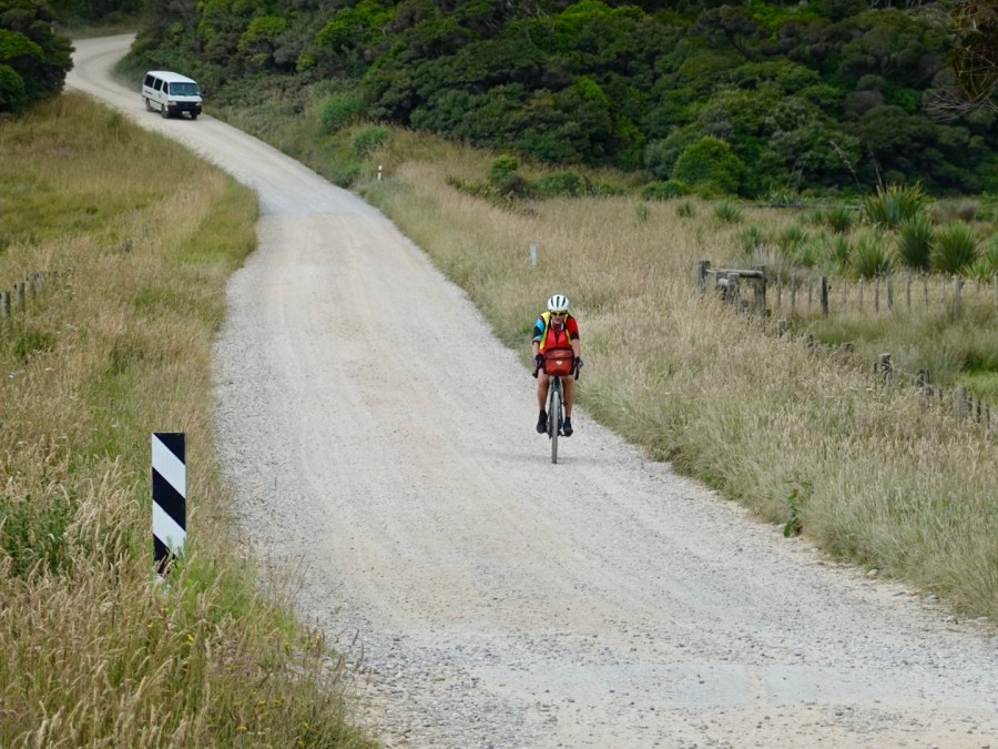
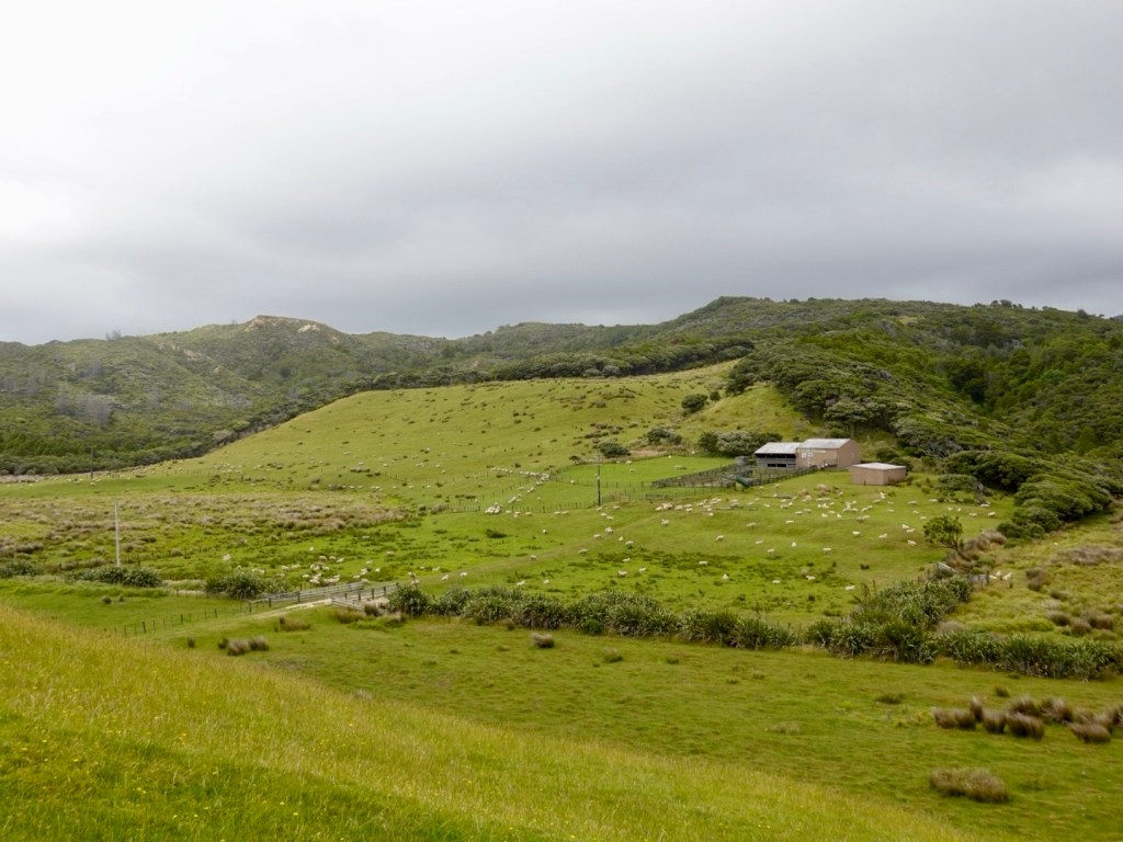
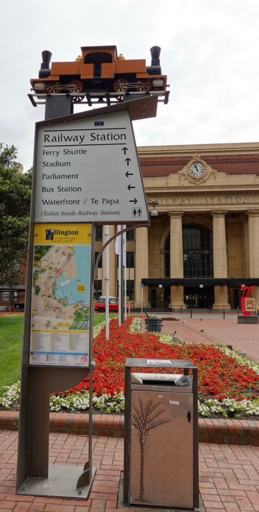
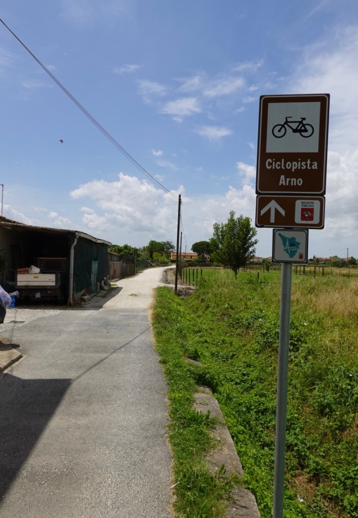
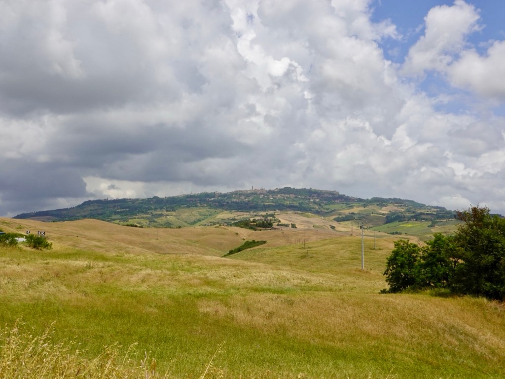
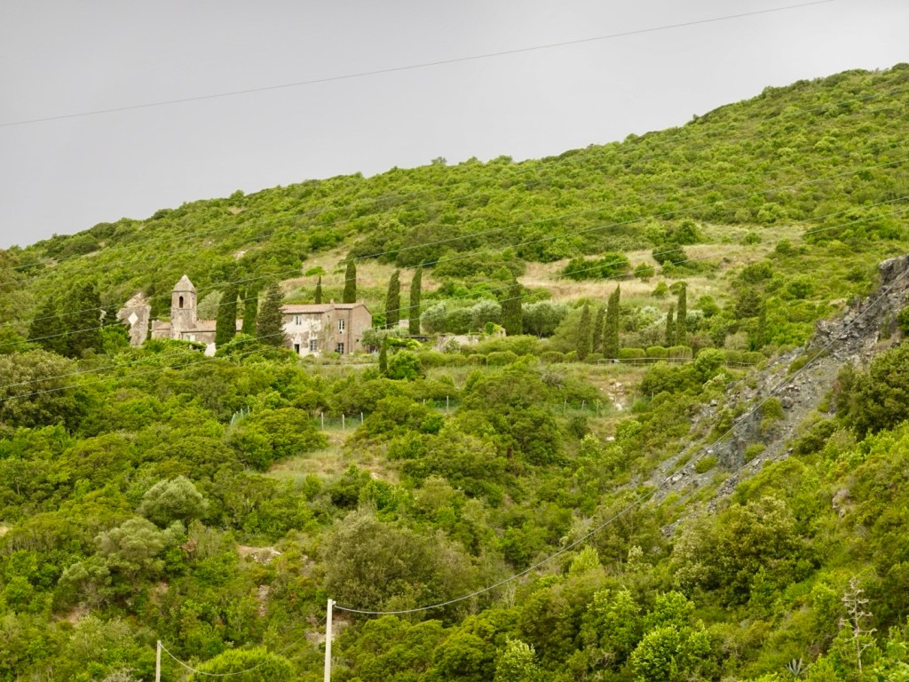
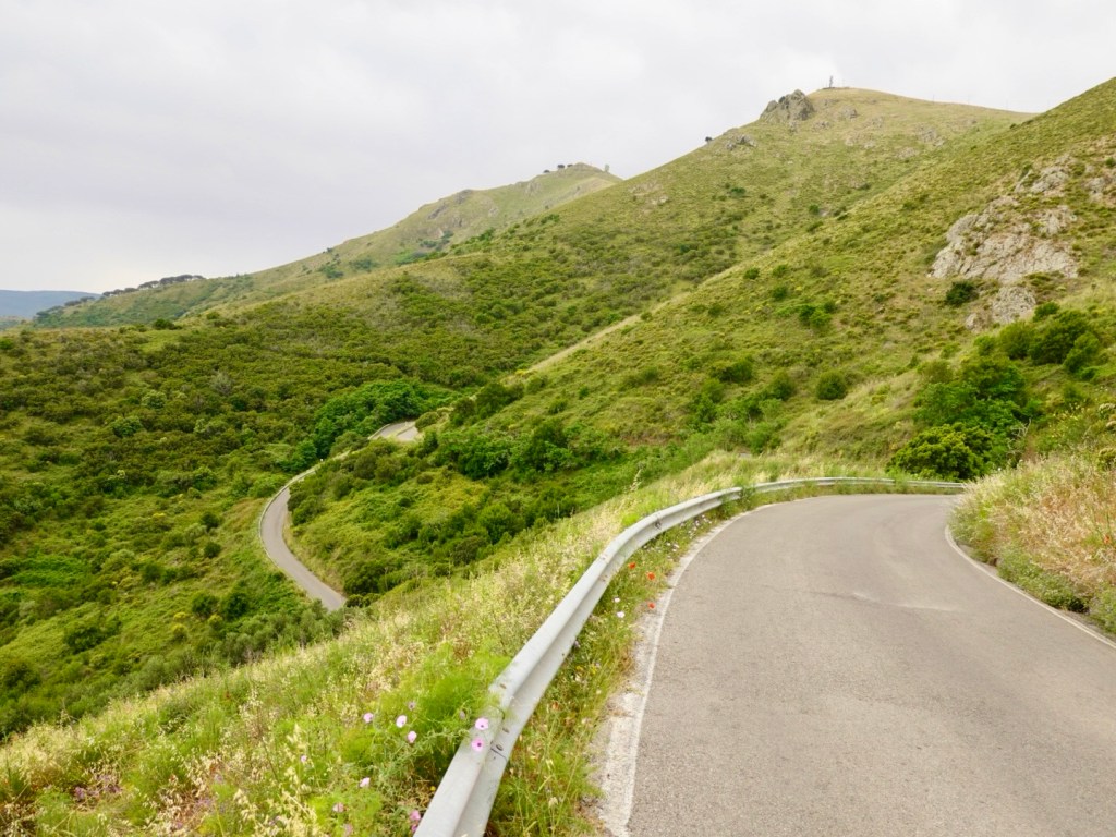
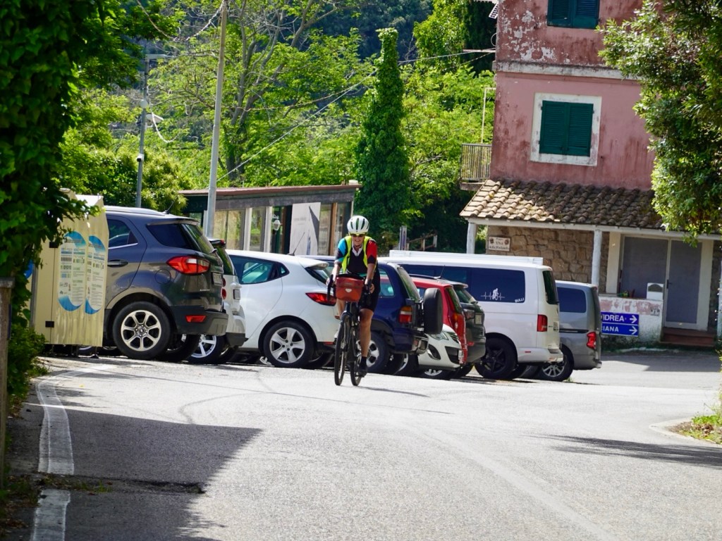
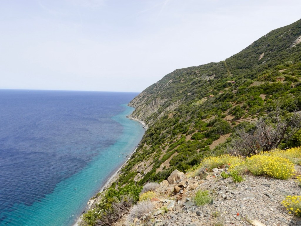
It was back onto gravel roads at Port Puponga, heading in a generally westerly direction. The signpost indicated it was 6 km to a camp ground that also had a coffee shop.
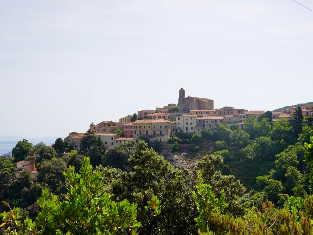
It was also the base for many walks in the area.
There was a consistent flow of tourist traffic heading in, but they drove at a far more considerate pace, and many were 2wd vehicles and a variety of camper vans.
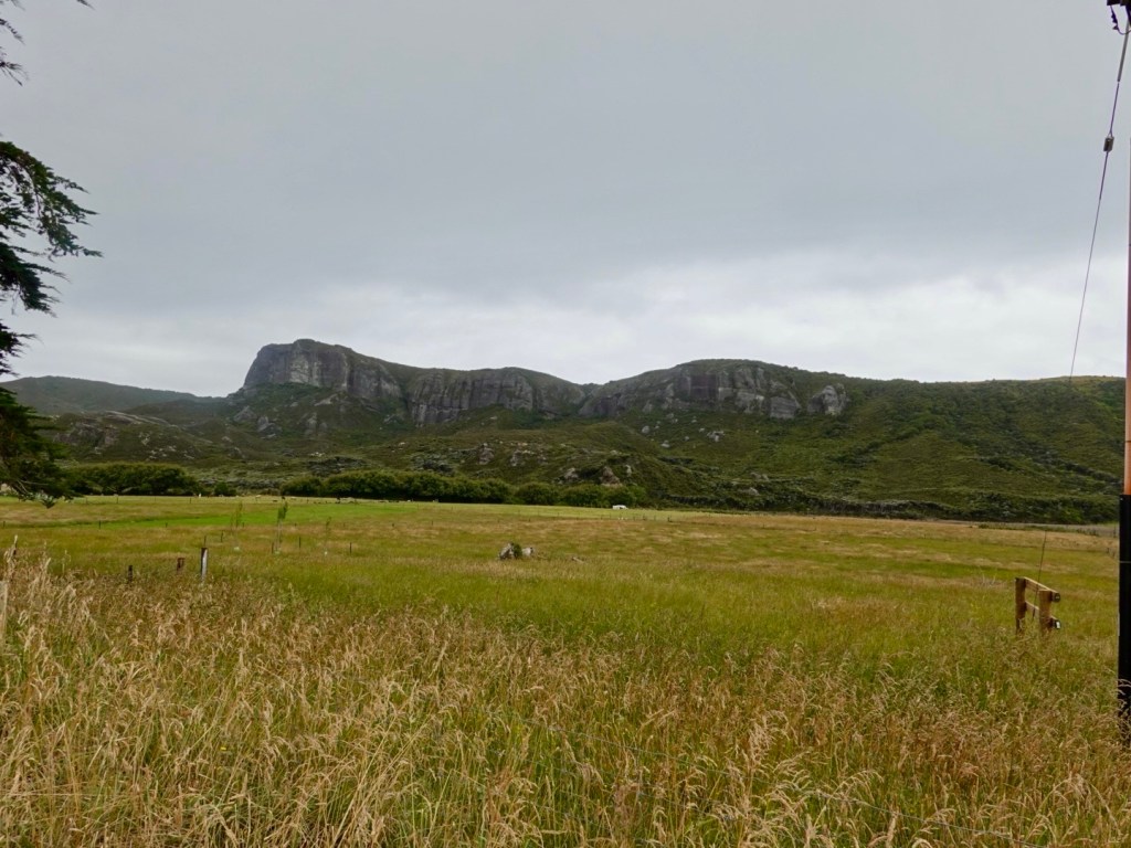
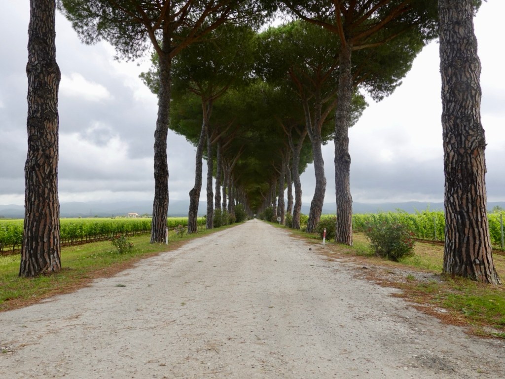
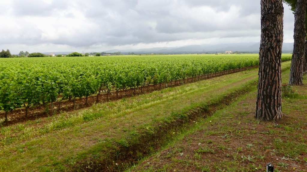
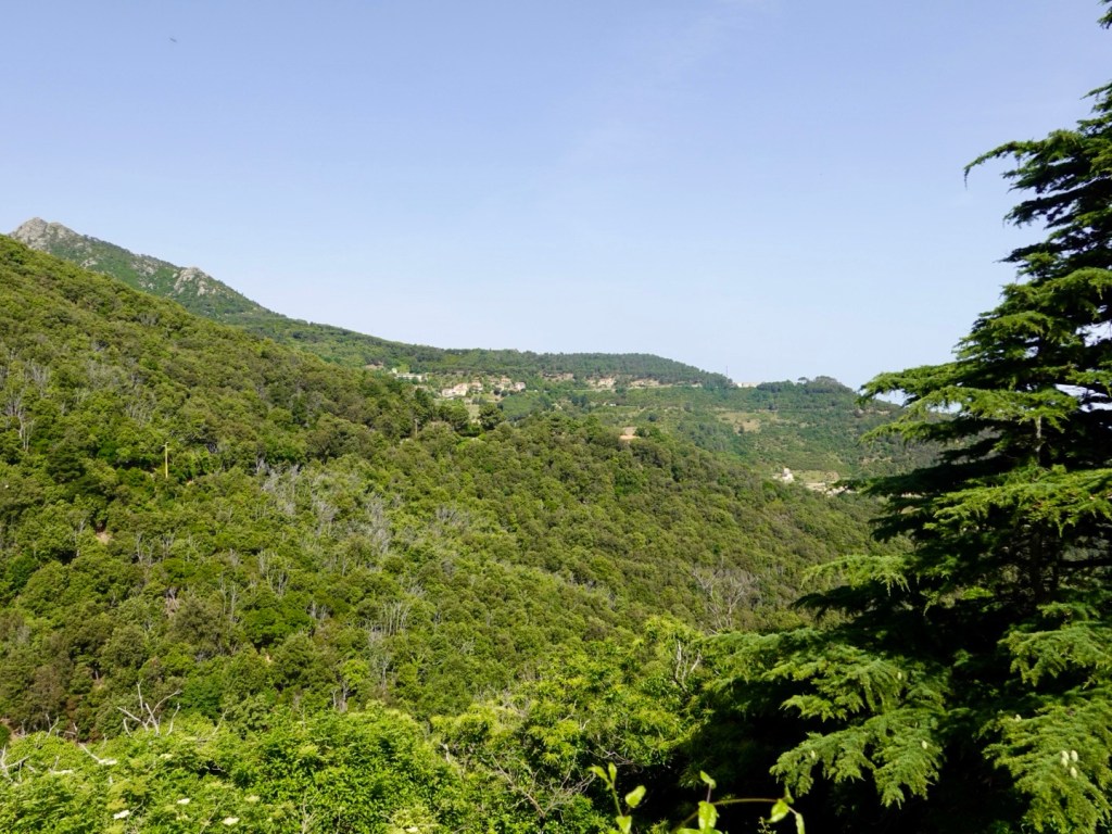
There is some farmland.
The road has two climbs, was a well compacted base with some looser gravel on top.
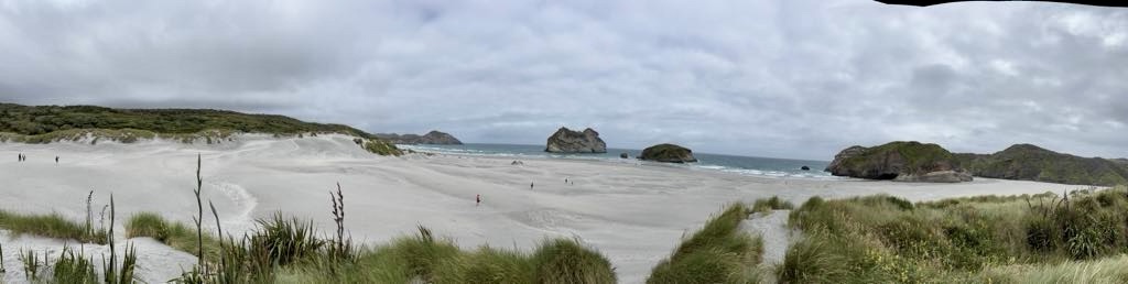
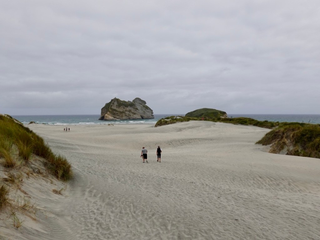
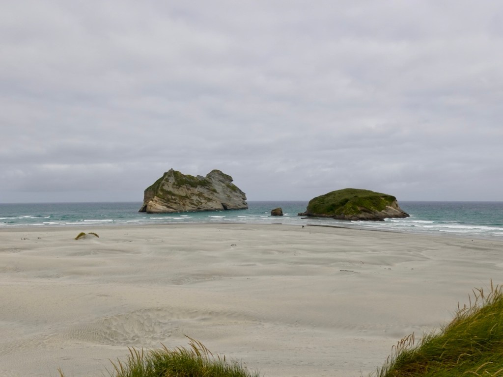
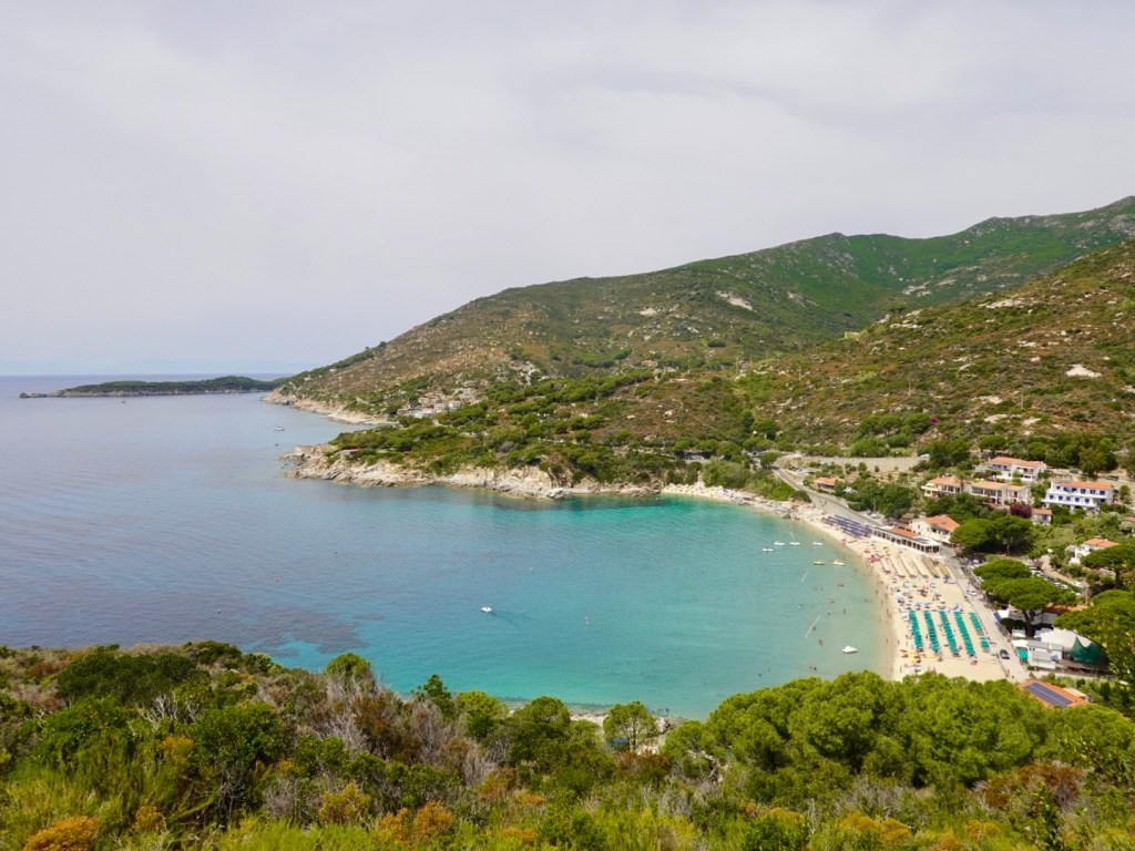
Once we arrived at the end of the road, Tony took the camera and walked in to Whaririki Beach as we deemed it unsuitable for me with my knee and lack of appropriate footwear.
Photos from Whaririki Beach and walk back out.
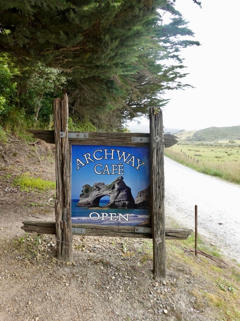
The cafe is a quirky place, well sited for walkers.
We then rode back out the 6 km gravel road, with increasingly heavy inward bound traffic including three 4wd buses.
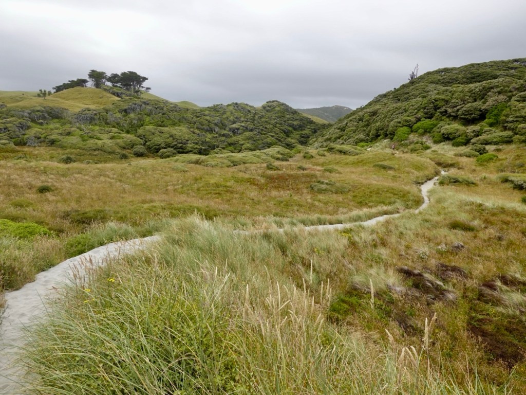
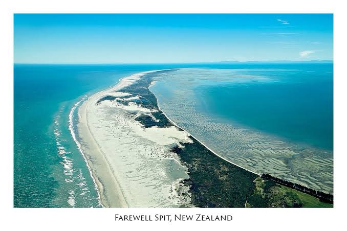
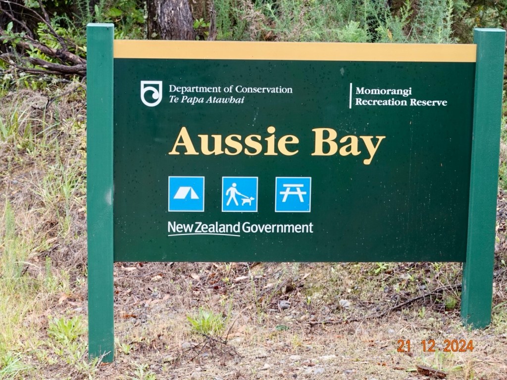
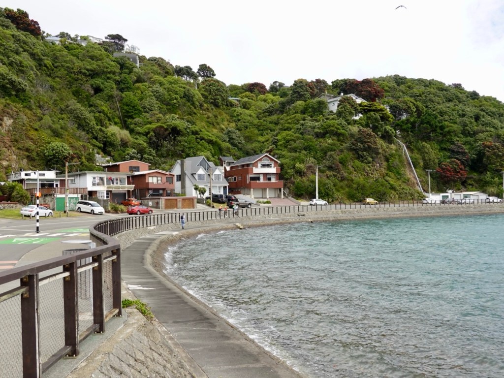
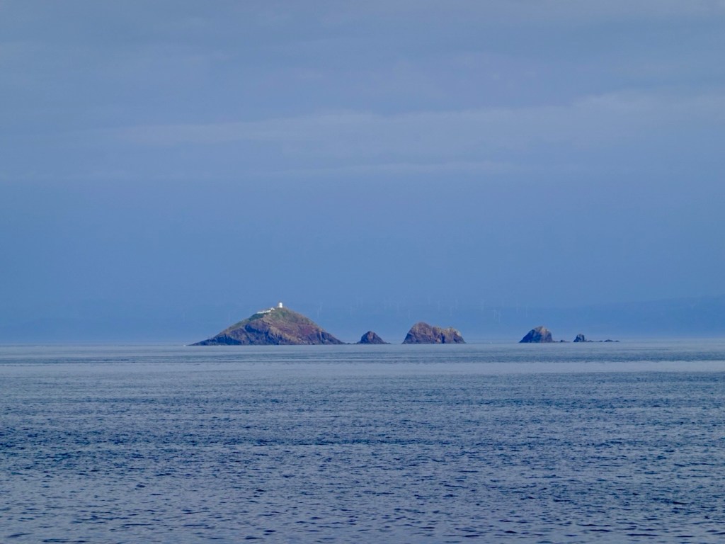
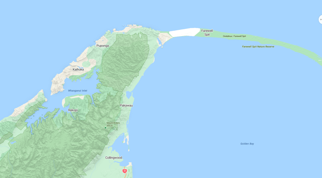
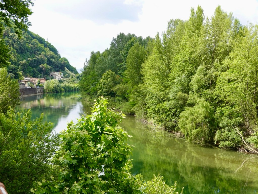
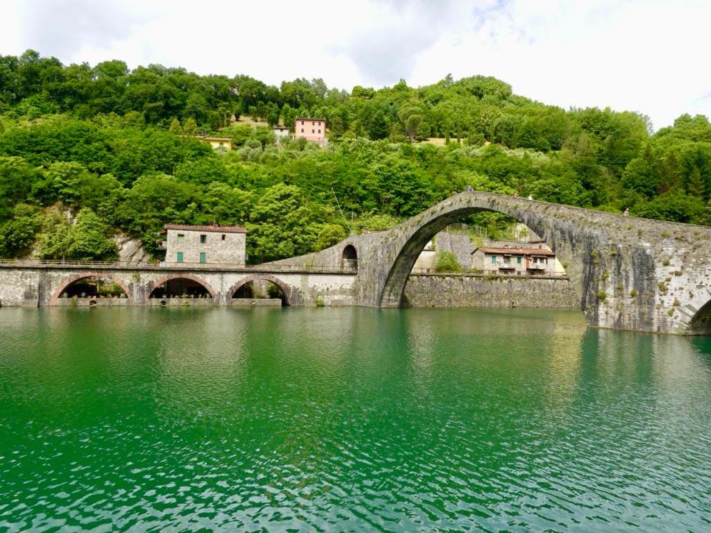
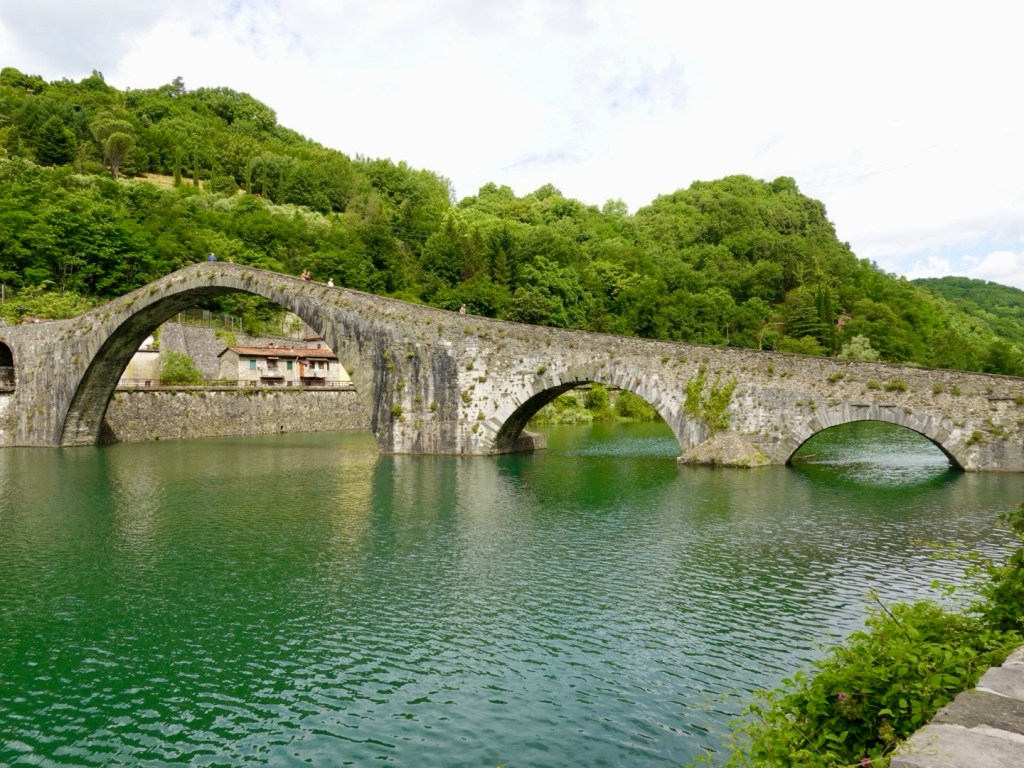
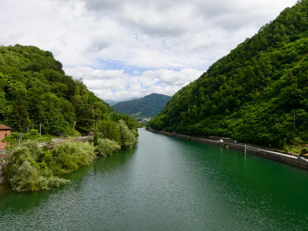
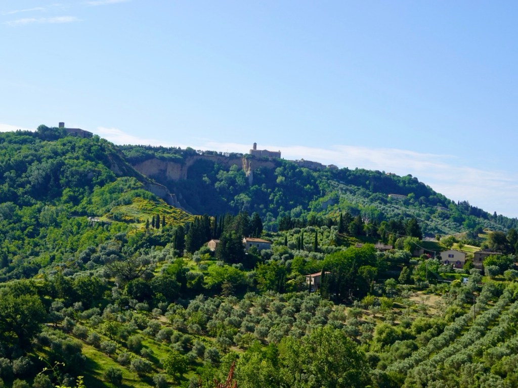
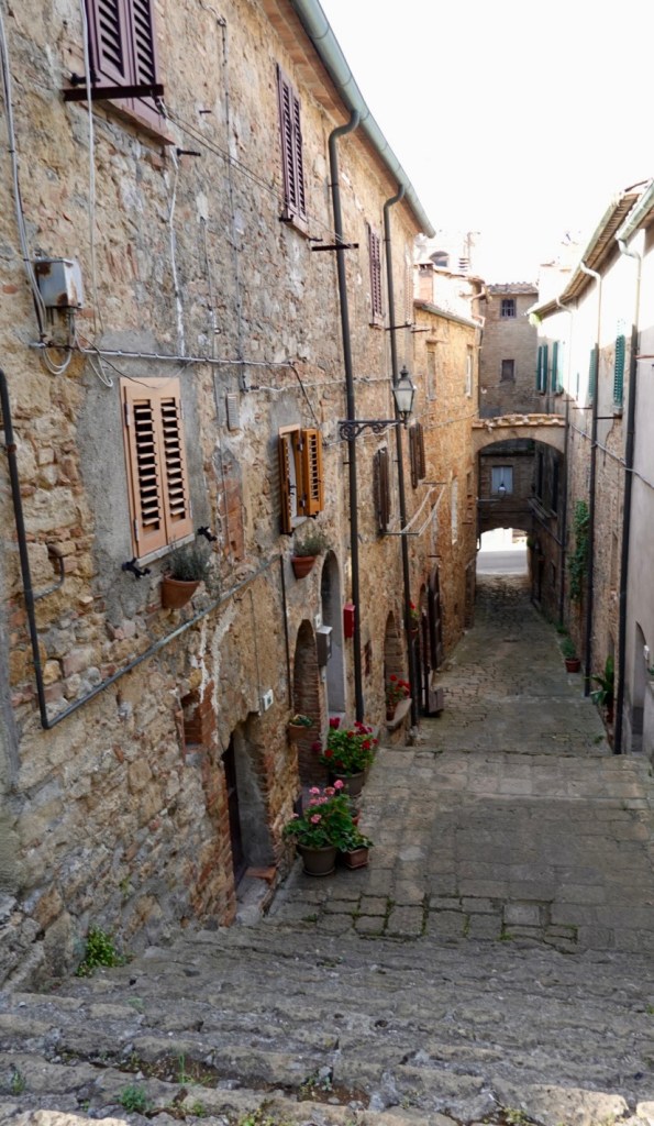
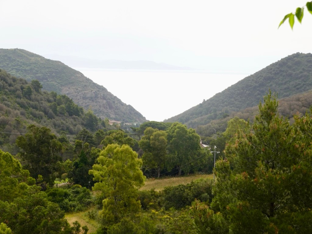
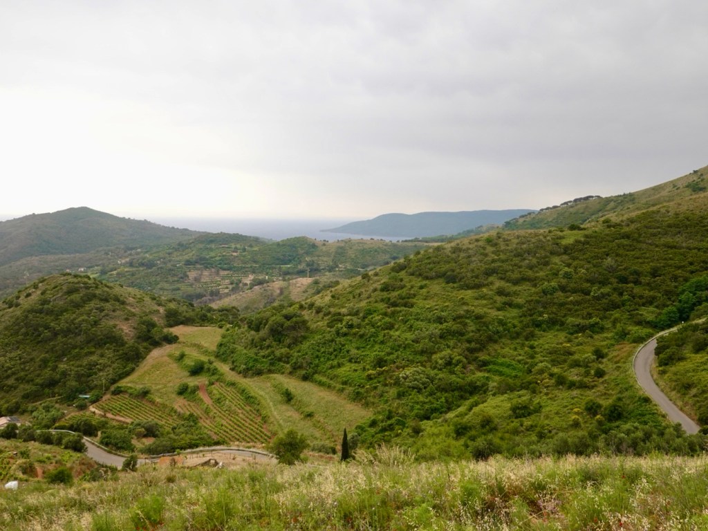
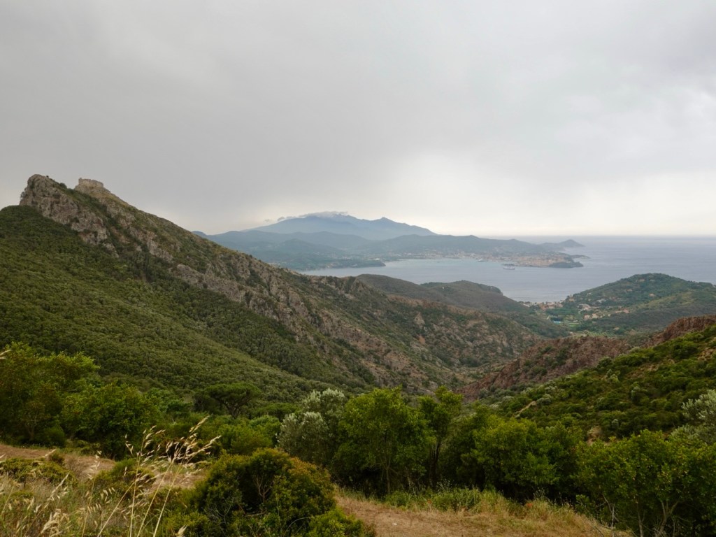
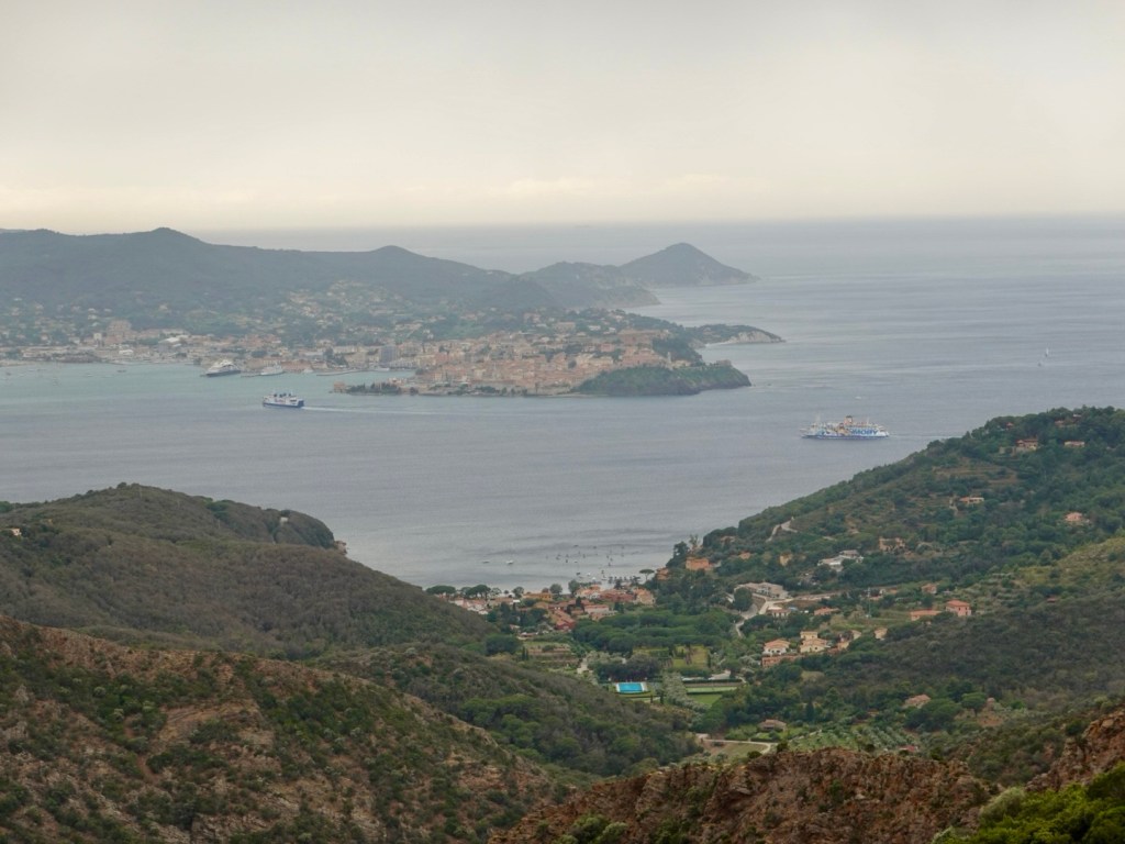
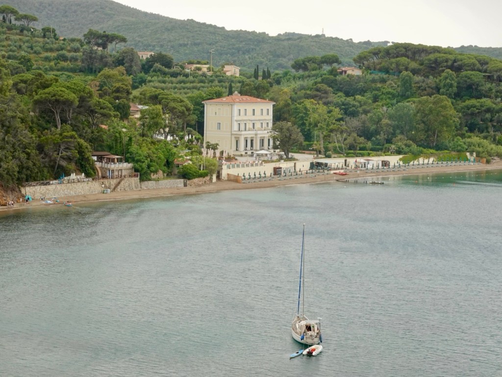
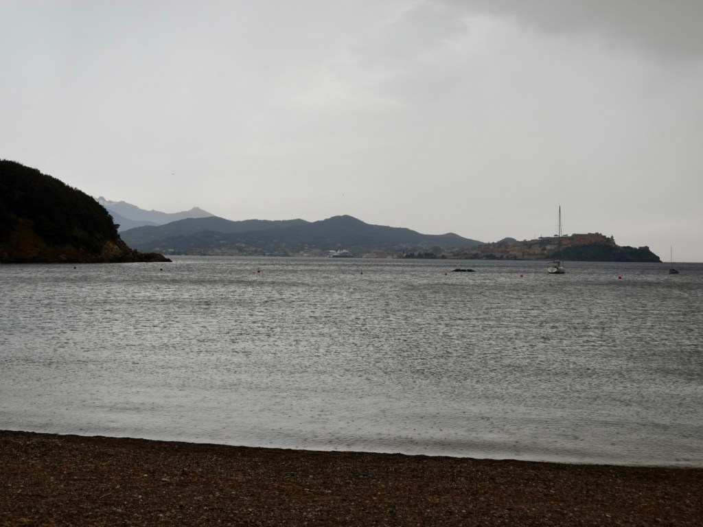
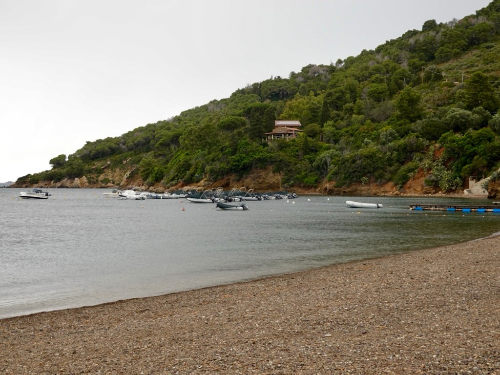
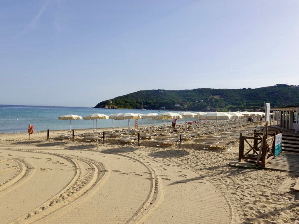
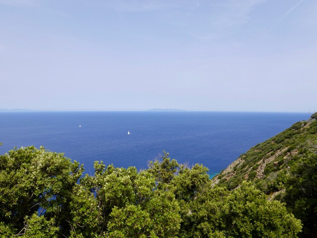
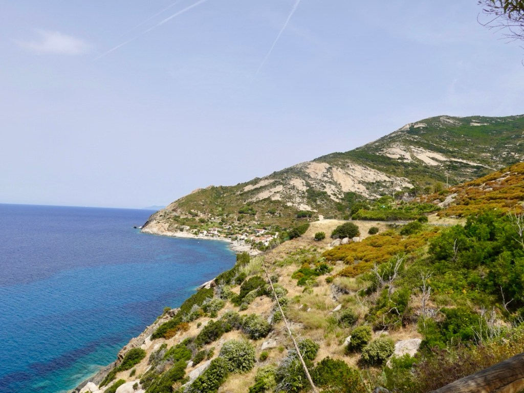
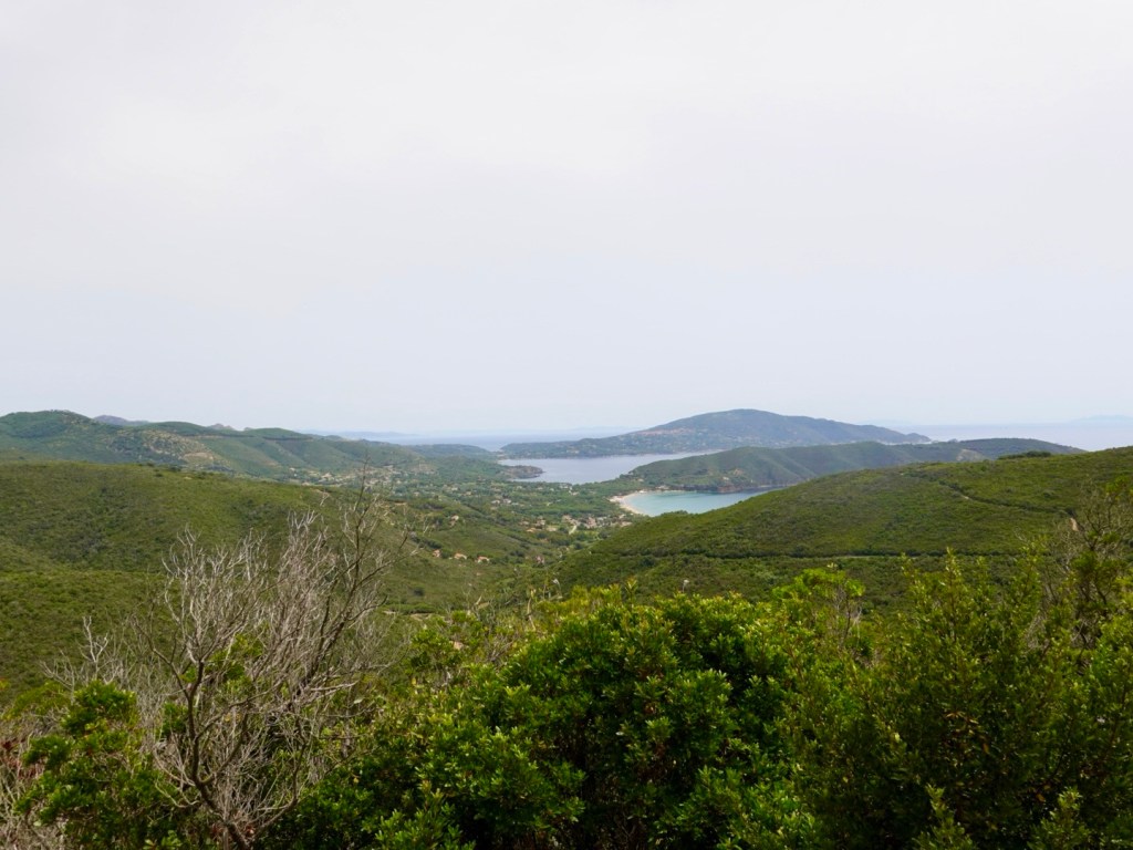
We then took another gravel road to Farewell Spit, which consists of 25 of stable land and 5 km of mobile sand spit. It is the longest sand spit in New Zealand.
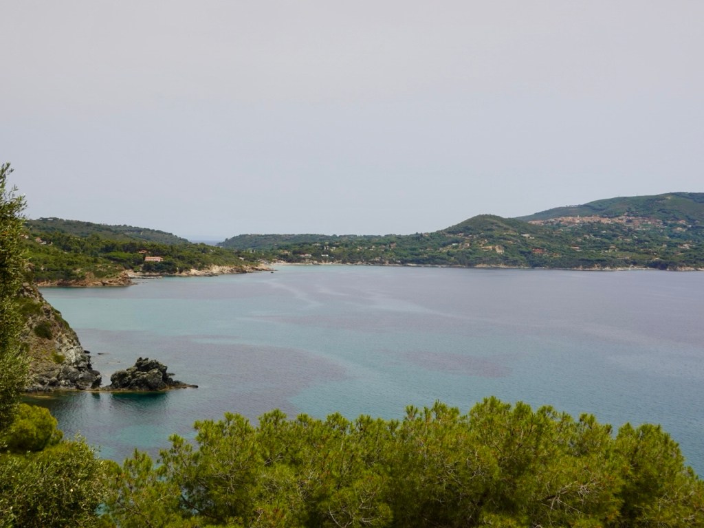
You can walk to the outer spit, facing the Tasman Sea.
A borrowed aerial photo showing the spit extent.
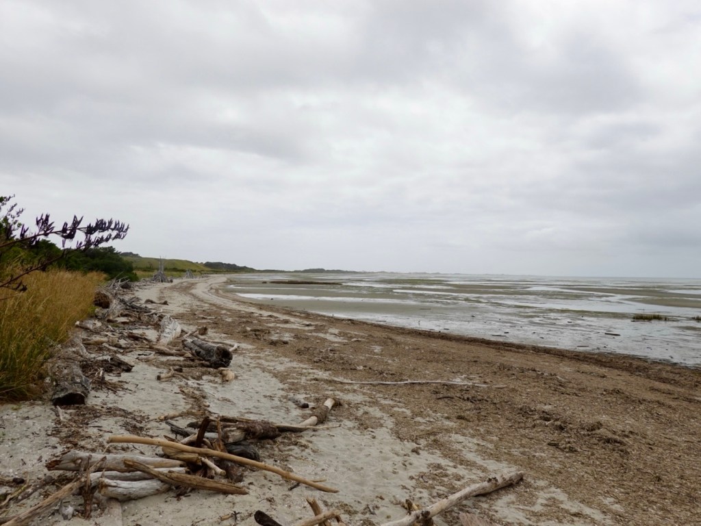
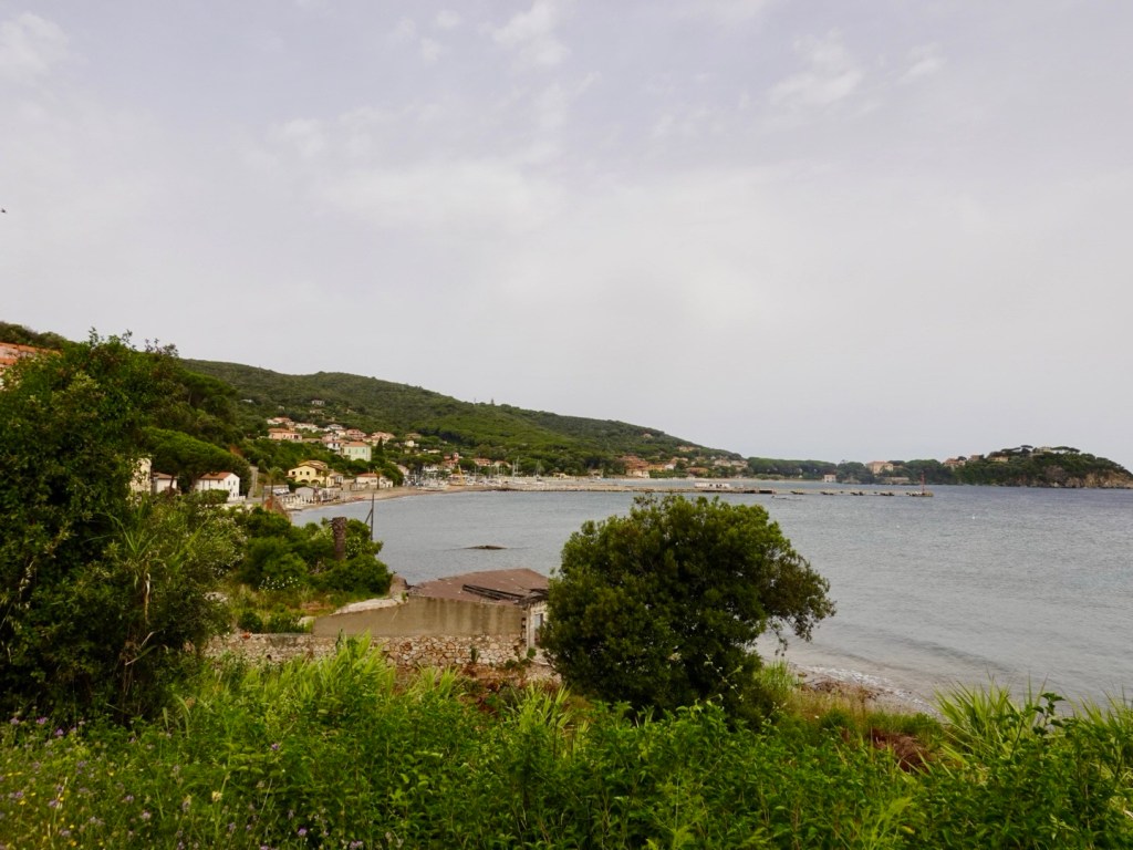
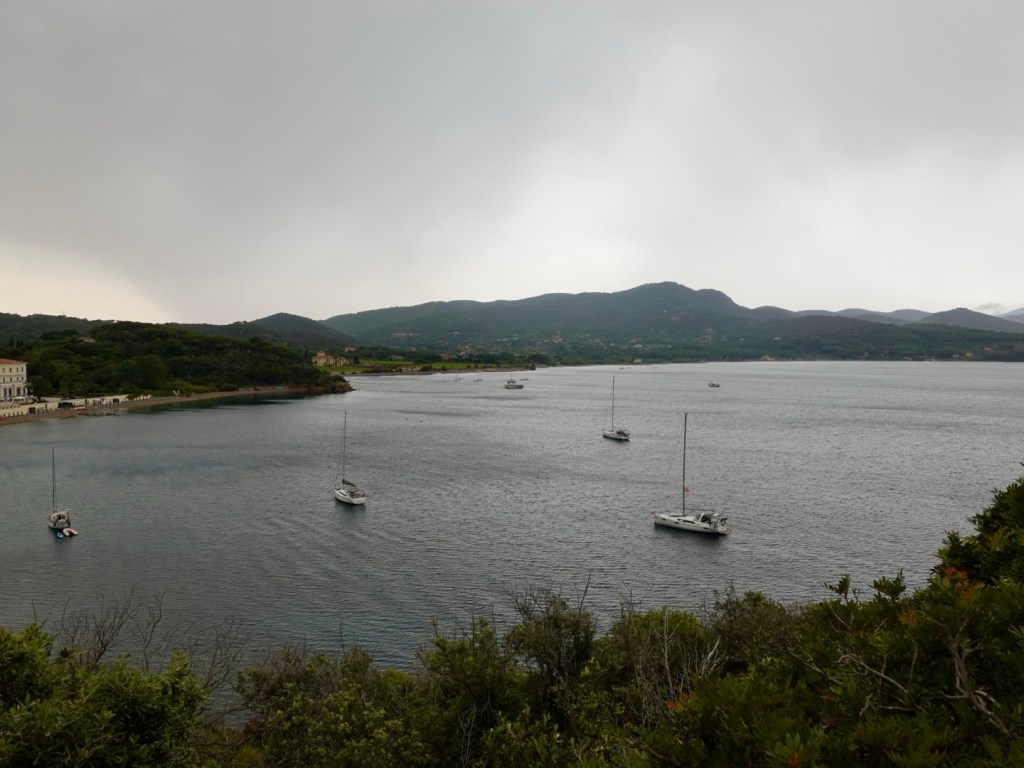
Our view from the inner spit, forming part of Golden Bay. Very shallow waters, lots of drift wood. This is on the stable land part.
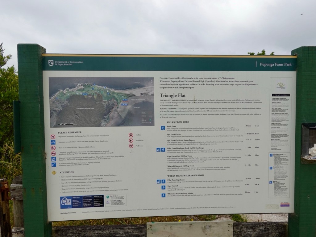
Local board with walks
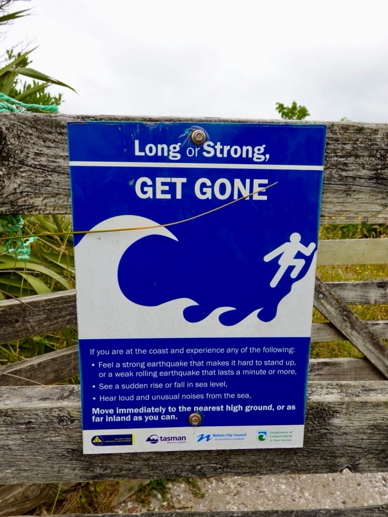
A more alarming sign!
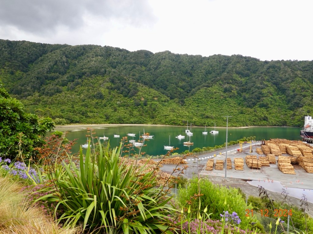
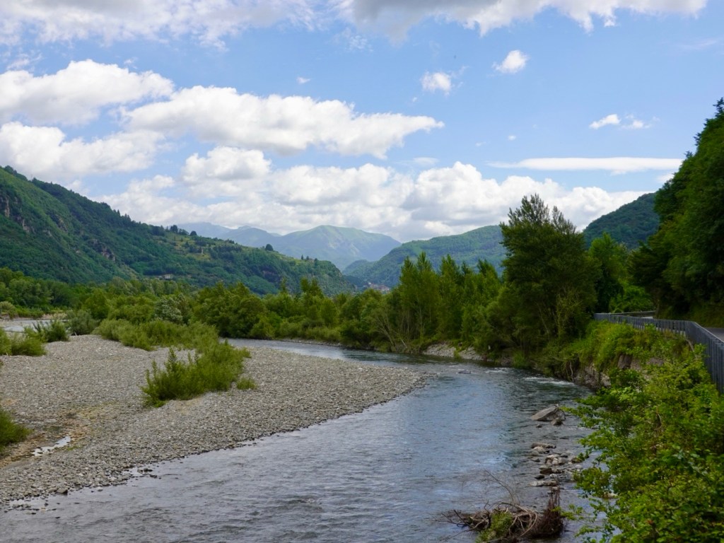
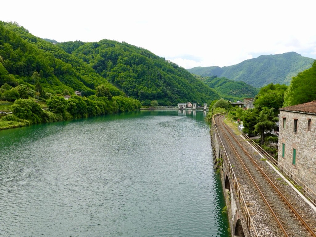
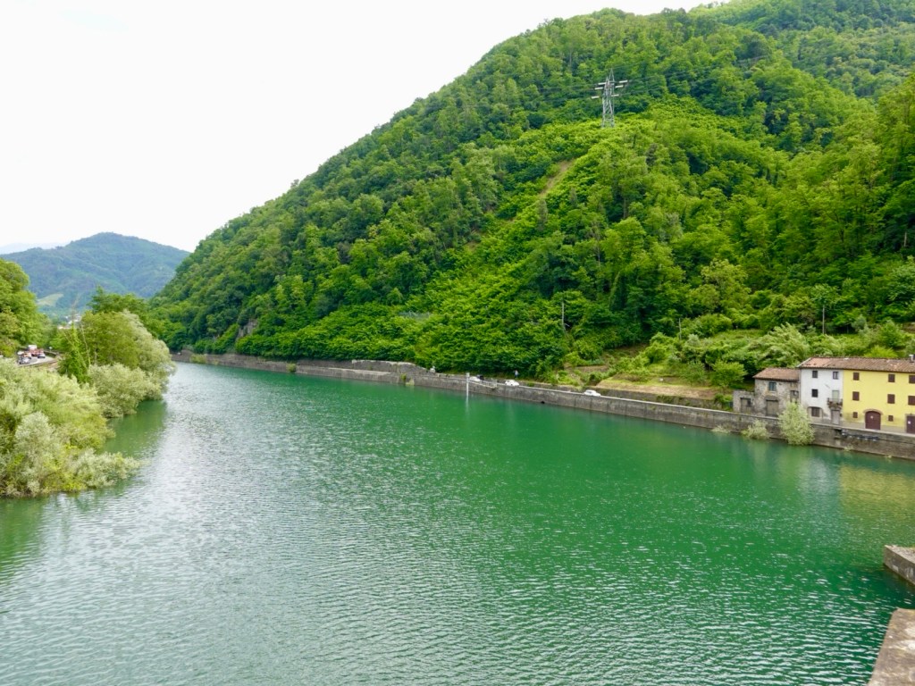
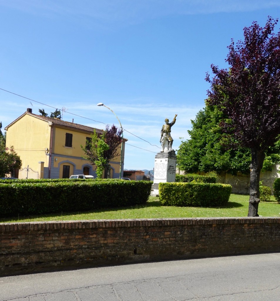
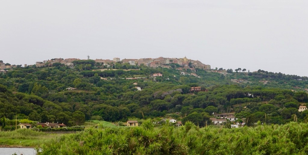
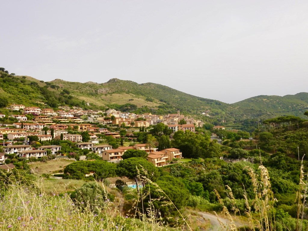
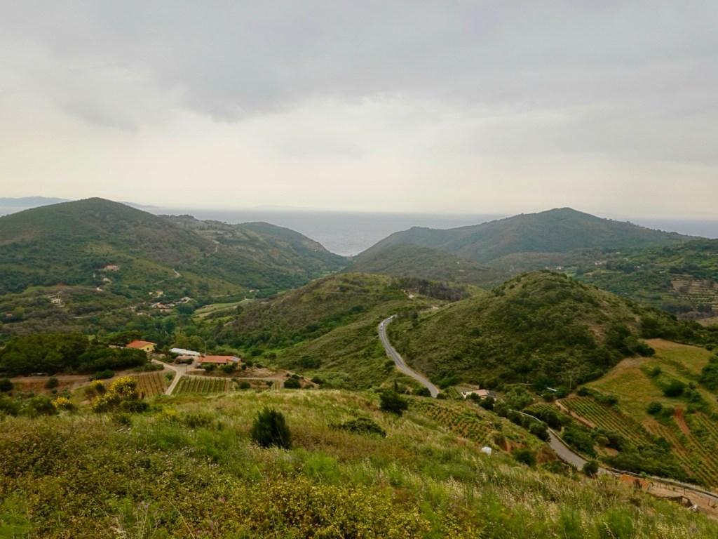
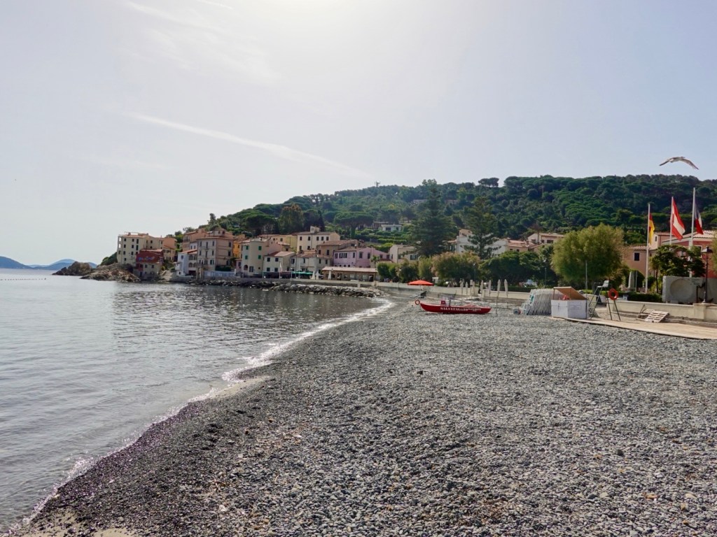
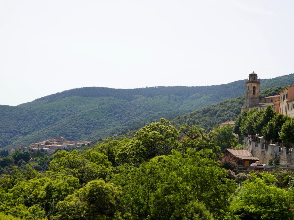
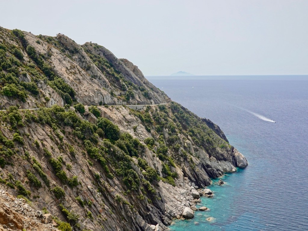
A very pleasant 25 km ride back to Collingwood where we were able to get into a nice groove of around 25-26 km per hour to arrive at our favourite cafe, Collingwood Court House.
I was keen to try the mussel chowder and it was the best chowder I have ever had !
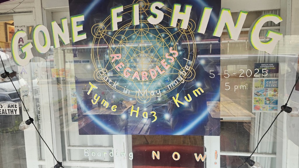
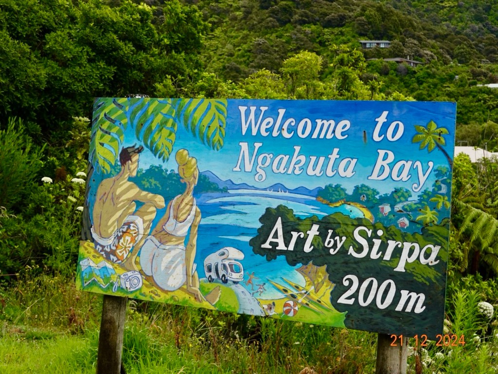
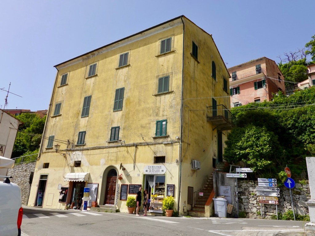
The other cafe? This art work sign appeared on the window the previous day. Doors were shut so I had peered at the art work through the windows. However, as we headed back to shower guess who was standing out the front? NgAngA himself. Fish can’t be biting!
Collingwood is worth visiting! We really like the little village and area. Great waterways, mountains, vistas, cafe, quirkiness and bike rides.
Tomorrow we move onwards on our little cycle tour.
Overnight there was a lot of rain. Each time I woke it had not eased up.
When we finally rose, we had no power. We fumbled around with my little torch packing and having breakfast that had been provided, sans coffee. Sacrilege!
We headed off about 7.30 am keen to start riding before it got too busy.
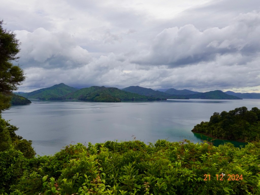
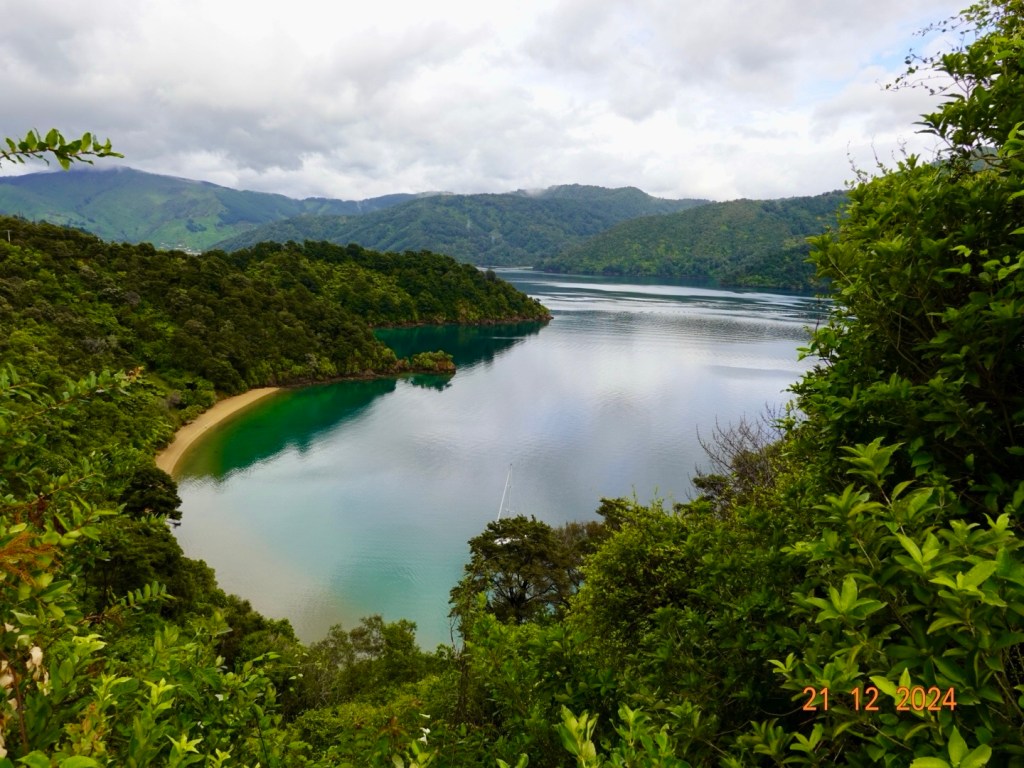
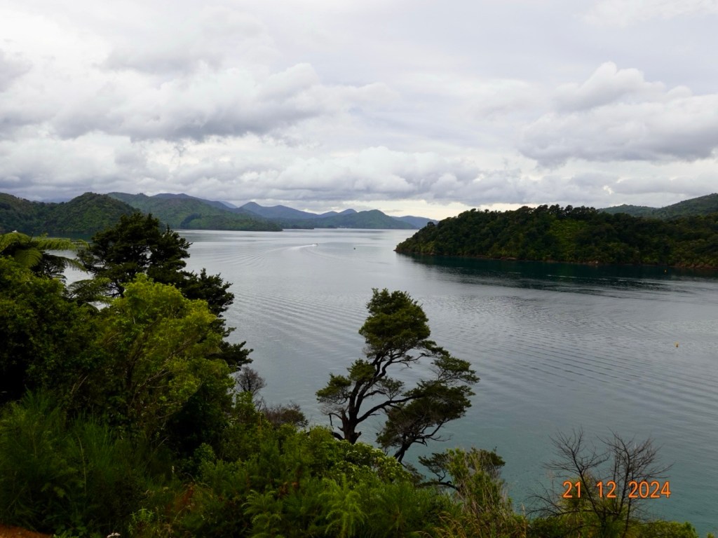
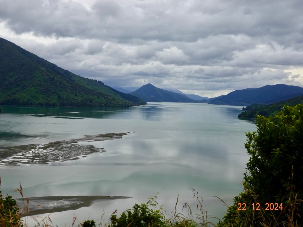
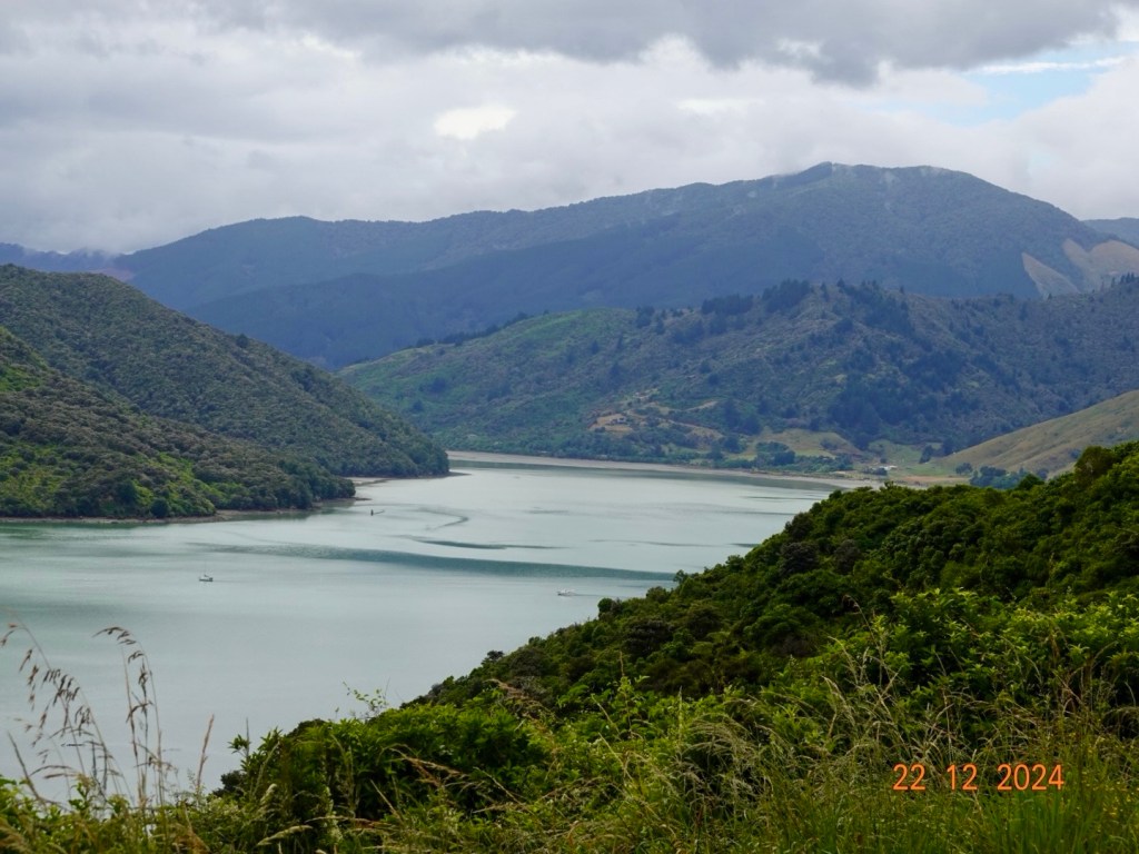
The first 35 km was a super scenic ride from Picton to Havelock on Queen Charlotte Drive. There were some fantastic vistas.
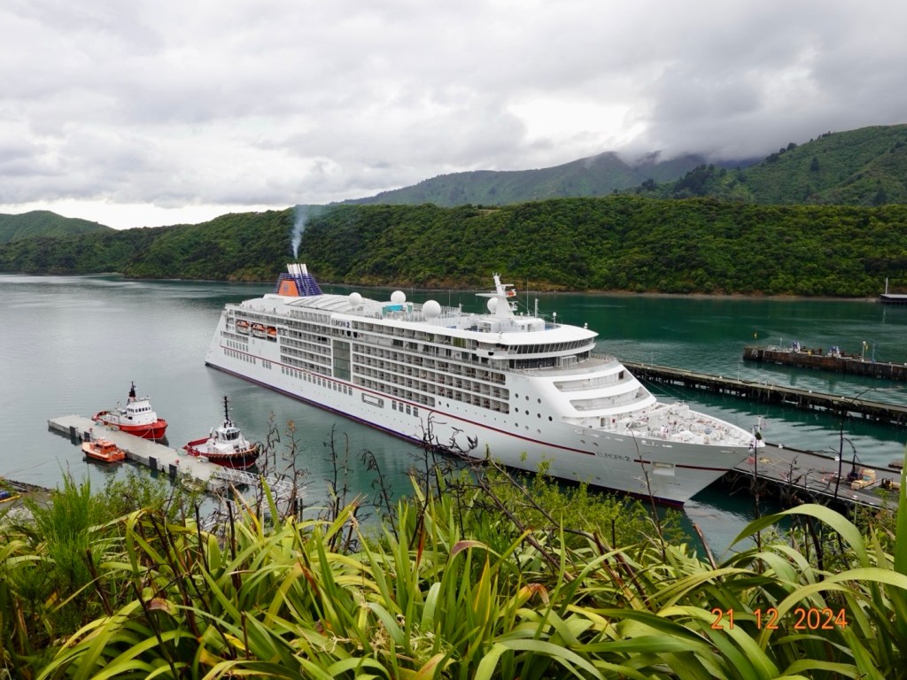
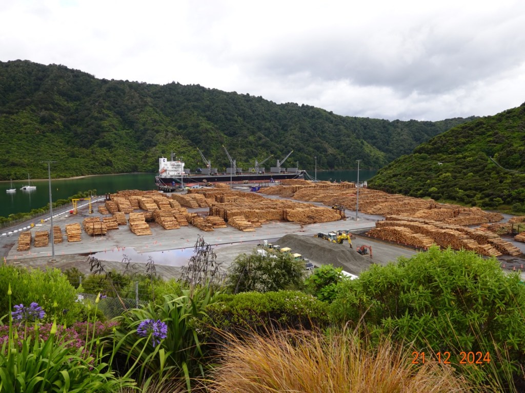
Climbing out of Picton a cruise ship was docked.Further on a port seemingly dedicated to plantation timber.There was a nice bay off to the side of the port.More distant views across Grove ArmBeautiful bayCloser up
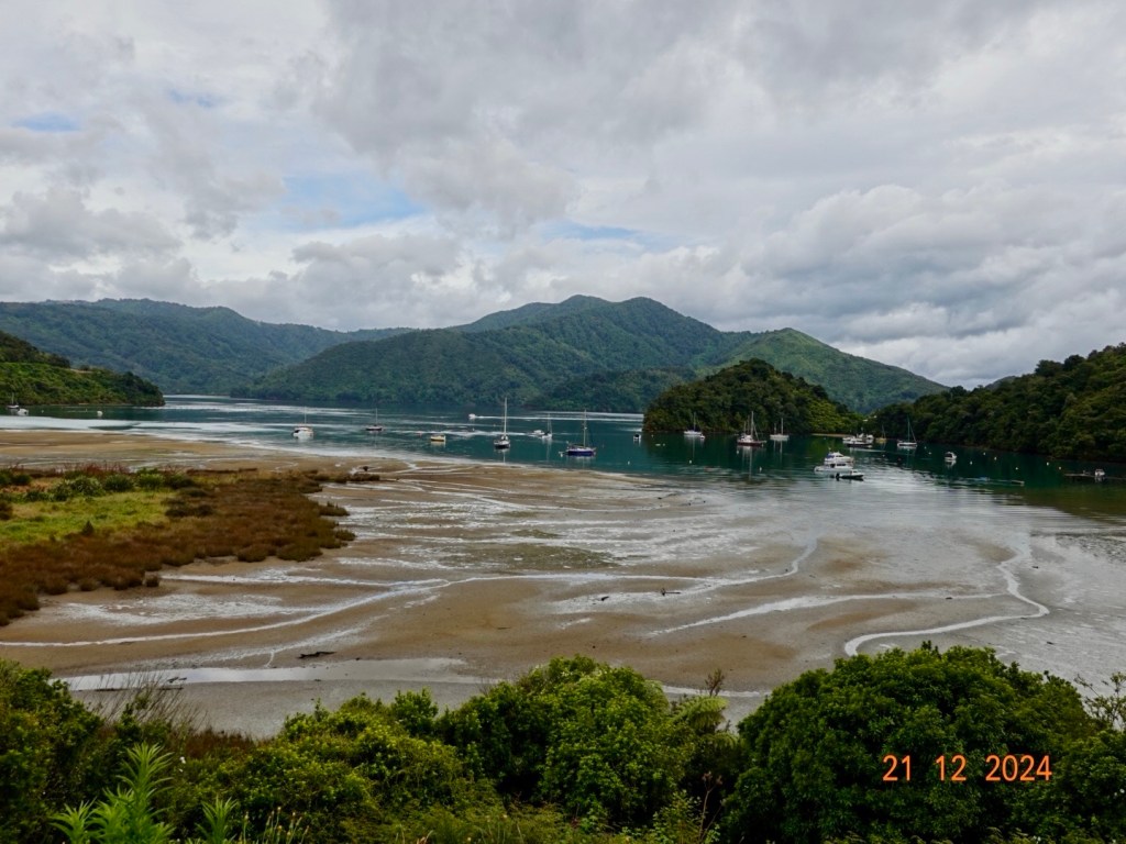
Ngakuta Bay, is small settlement and bay in the Marlborough Sounds.
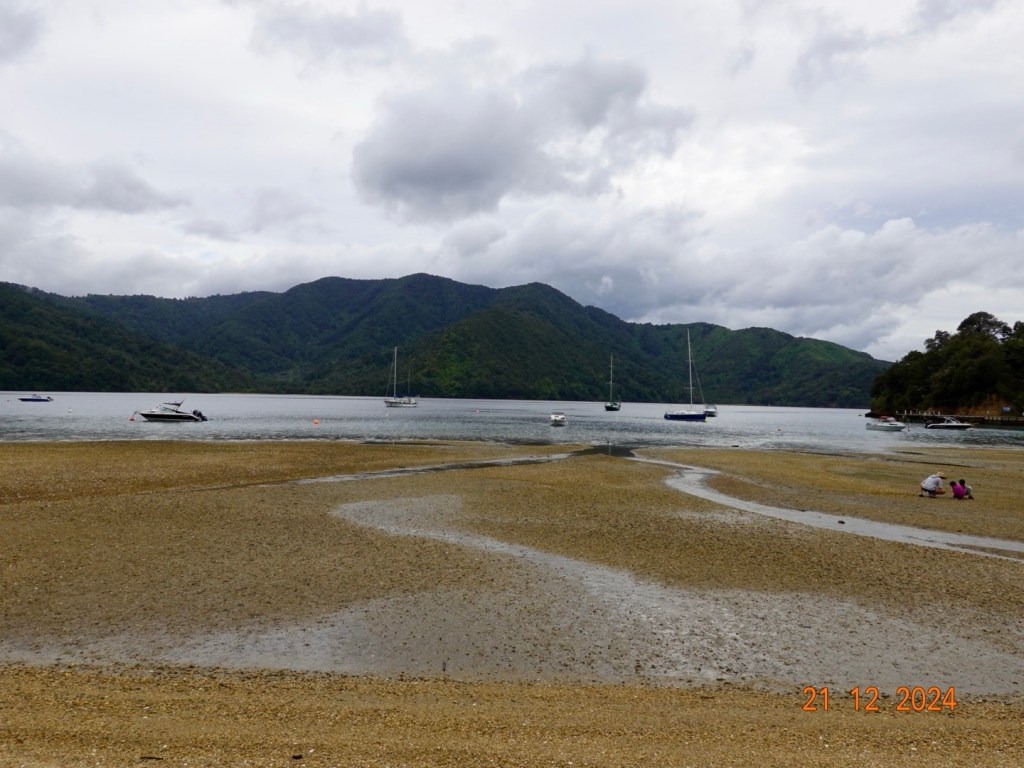
Low tide Local art, we passed numerous artists shops, all closed today.We continued on.Momorangi BayMomorangi Bay at sea level, tide is out We stopped at Momorangi Bay to eat our bananas before they became inedible. Bananas do not survive long in pristine condition touring.I wonder why we snapped this photo?
A few more vistas from Queen Charlotte Drive before arriving in Havelock. This section of our ride was excellent. Wonderful views and no wind! Whilst it was overcast and we started off with our rain jackets, we quite enjoyed the cooler conditions as more like home. Traffic was not too bad, mainly camper vans.
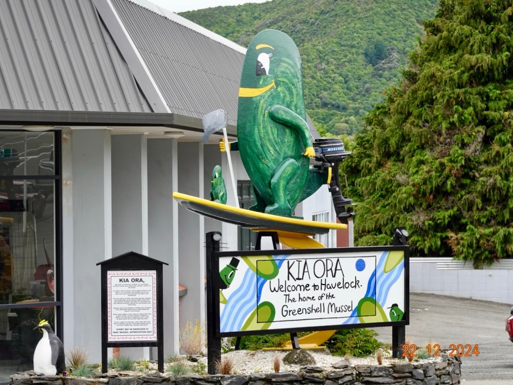
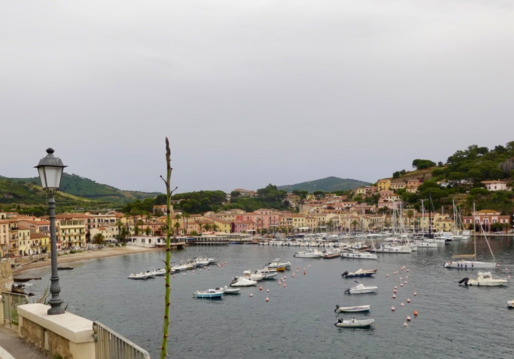
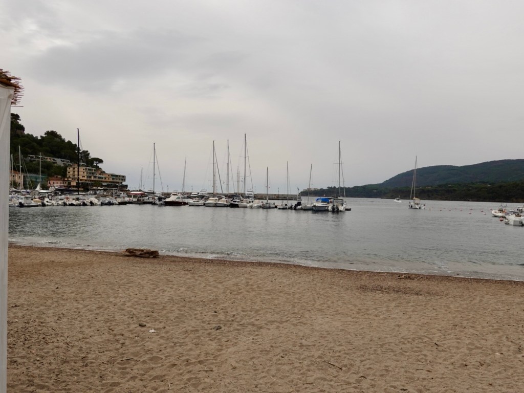
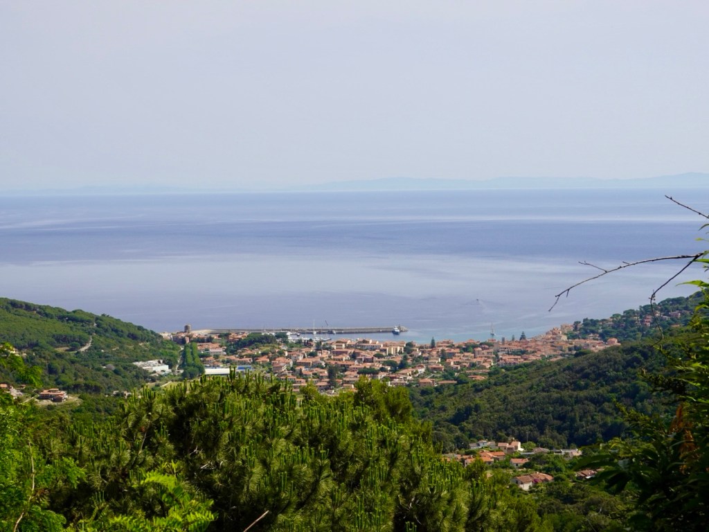
Havelock calls itself the “Greenshell Mussel capital of the world” and is located at the meeting point of the Pelorus and Kaituna Rivers.
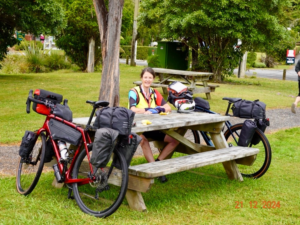
We had a decent break in Havelock, grabbing a much needed coffee and tasty morsels! Some cyclists from Wellington wanted to chat enquiring about our bike radars that were beeping and flashing. They suggested some great dirt tracks. My response? “You’d need a chopper on standby as I would surely break a bone!”
Mussels riding surfboards…think surging the super flat local waters a tad optimistic.
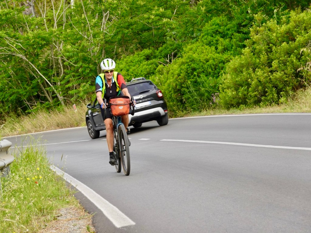
Leaving Havelock our ride quiet road sojourn ended and we were on a state highway. The trucks were back plus caravans, campers, 4WD with trailers, heaps of cars.
It was very windy with a strong headwind challenging us in places.
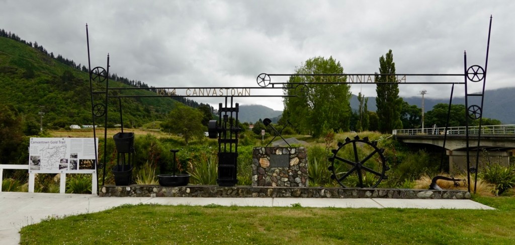
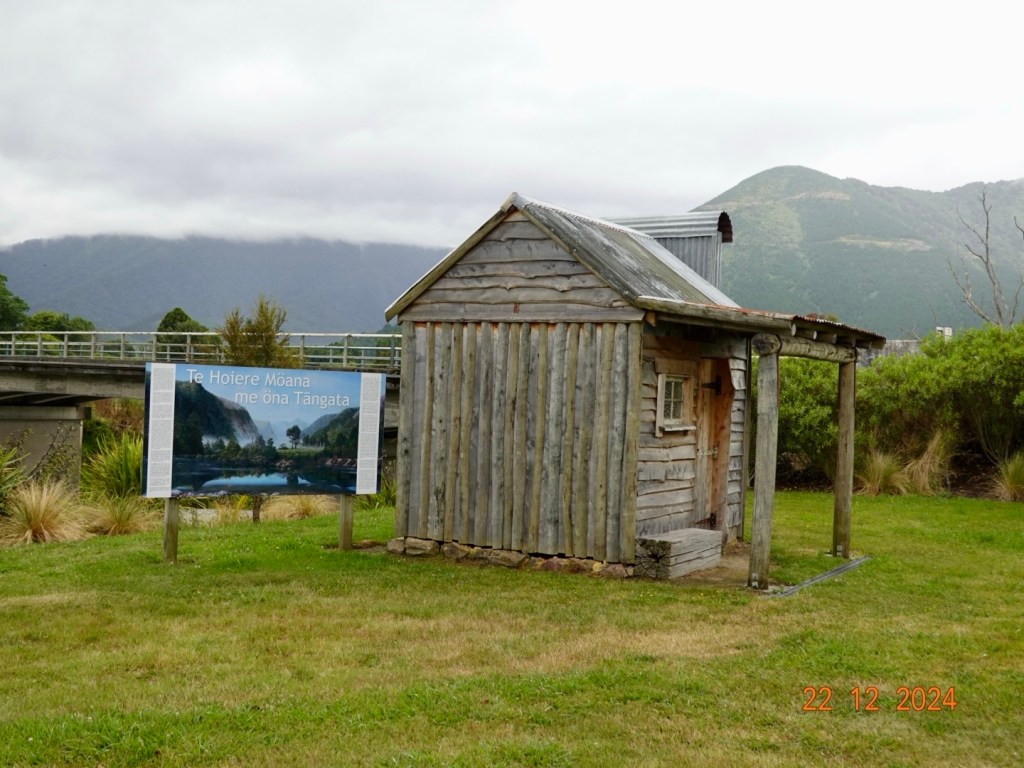
Canvastown is a small village where the Wakamarina River joins the Pelorus River. Once home to gold miners in the 1860’s. We stopped to look at the local historical memories.
Pelorus Bridge featured in The Hobbit – The Desolation of Smaug. Not having watched the movie, apparently there were dwarves filmed floating in barrels down the river! Surely that should be outlawed? Tyrion Lannister would surely say 🤷♀️. ( for non GOT readers, Tyrion is THE best character ever seen on tv, and he is also very height challenged. He was whip and wit smart and one of the ultimate survivors).
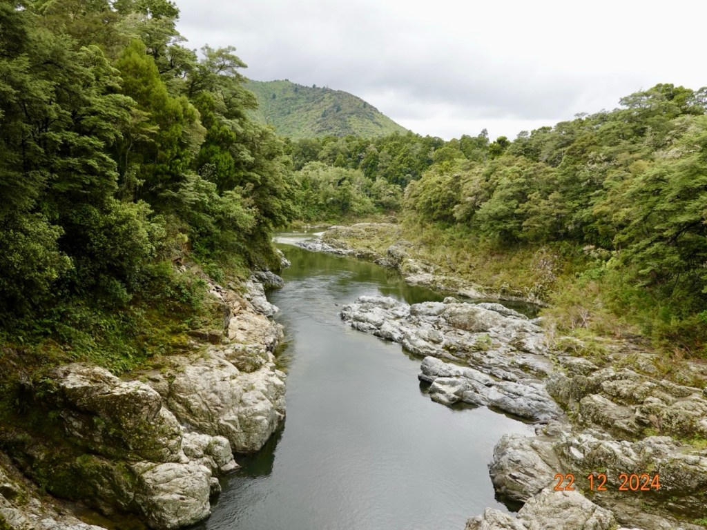
Pelorus Bridge crosses the Pelorus River, and is surrounded by a super nice reserve. There are tracks leading to waterfalls and rock pools, or you can walk along a ride to a viewing peak and walk across a small suspension bridge.
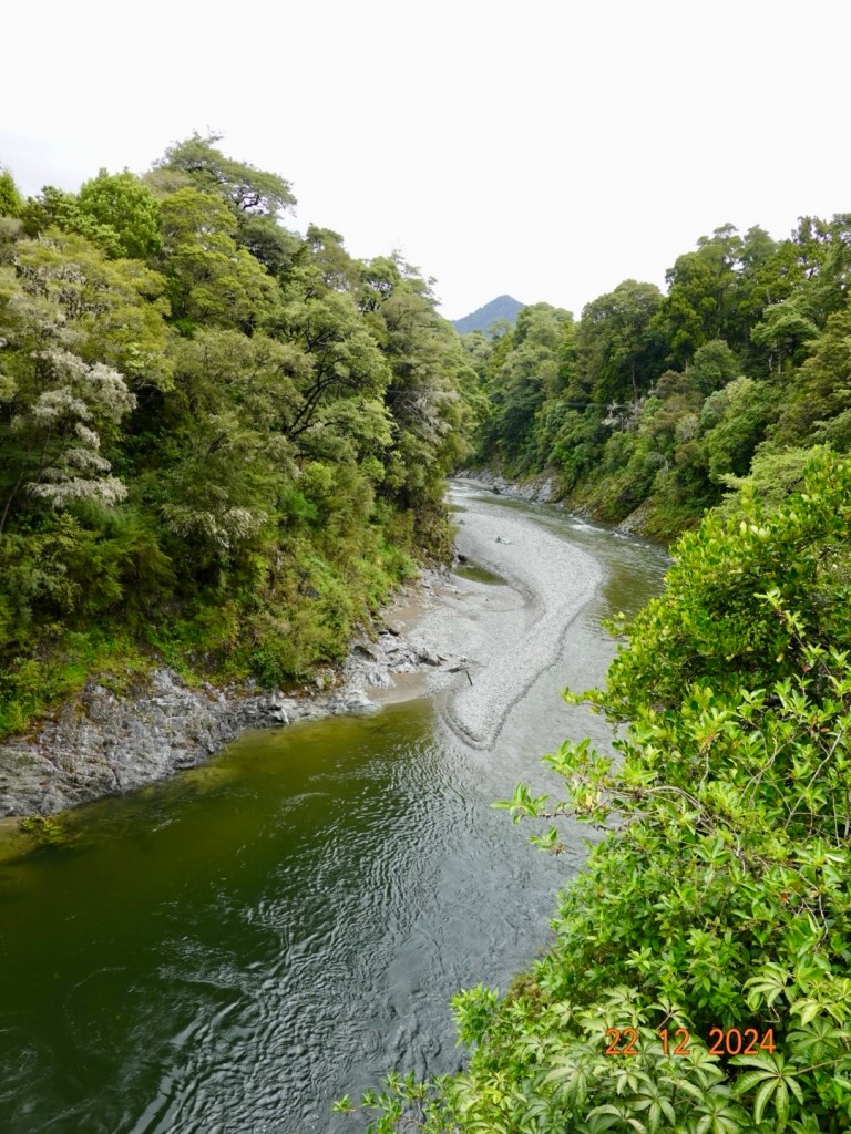
Pelorus bridge view to the eastPelorus bridge view to the west
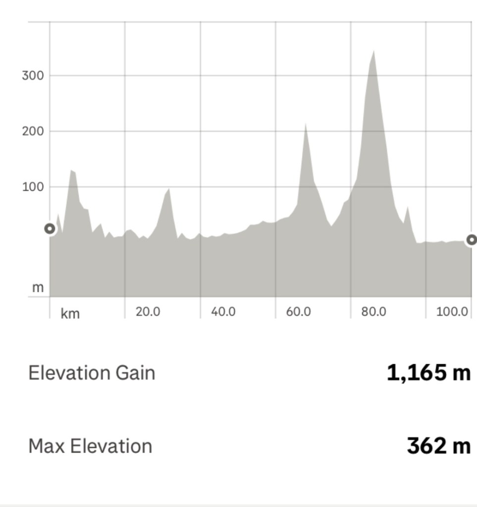
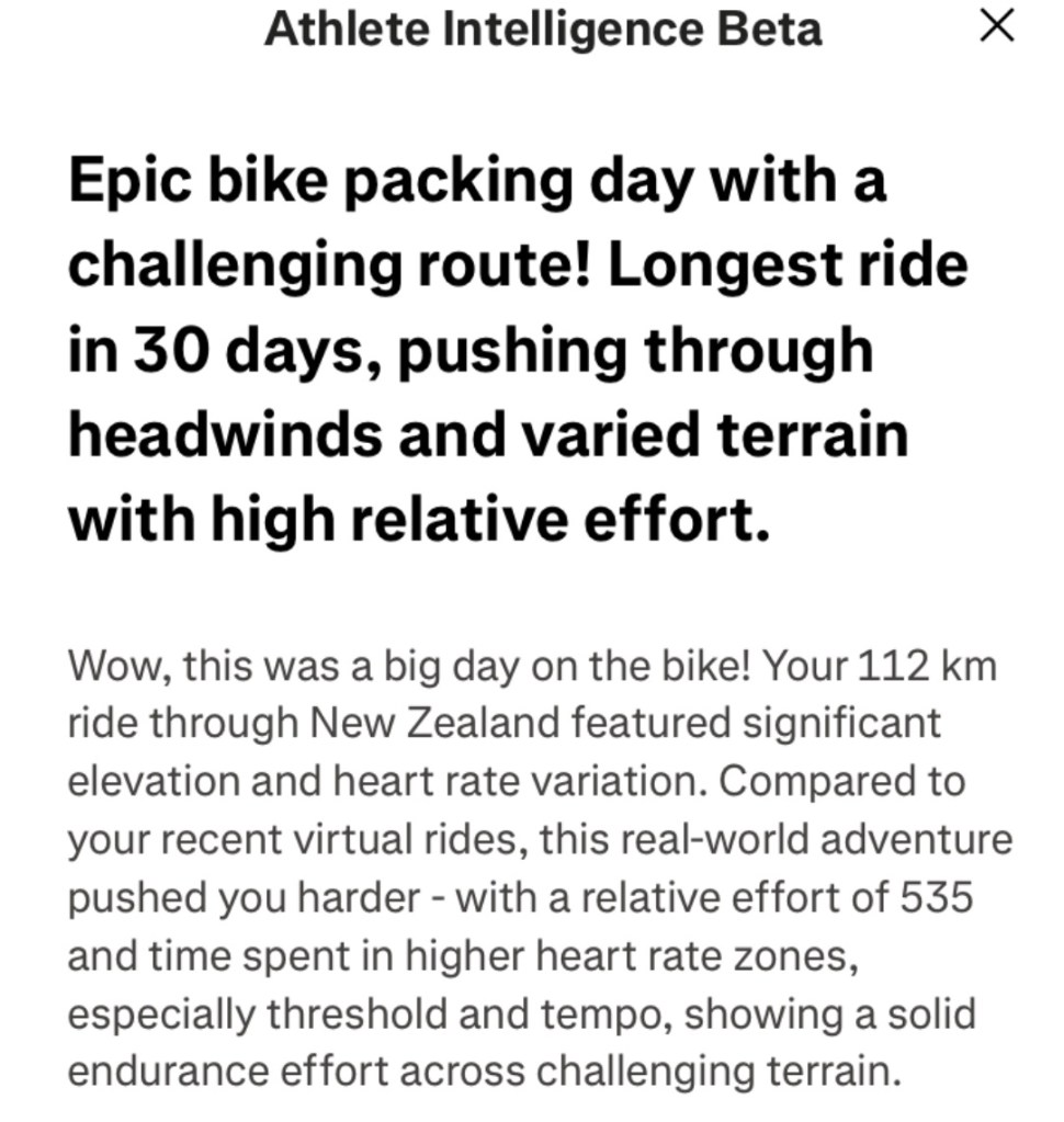
Today was a solid ride of 112 km and 1165 metres climbing. The climb at around 60 km was hard due to an incredibly strong headwind, reminding me of HellFire Pass in Wales where we had awful headwinds.
Descending we then had the longer 5.5 km climb, with section of just over 13%…where I am wondering do I jump off and push? I got through it though. Fortunately we were fairly sheltered wind wise on this climb but it did start raining about 1 km in requiring a stop to throw on our rain jackets.
Glasses were off as they fogged up. About 500 m short of the top the rain stopped .
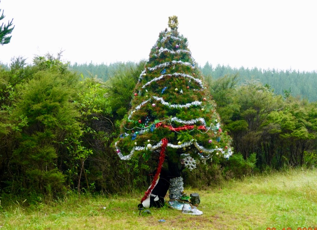
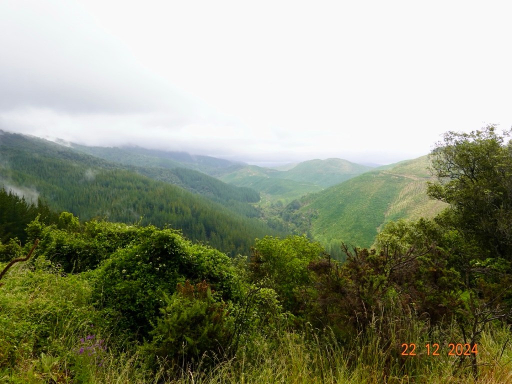
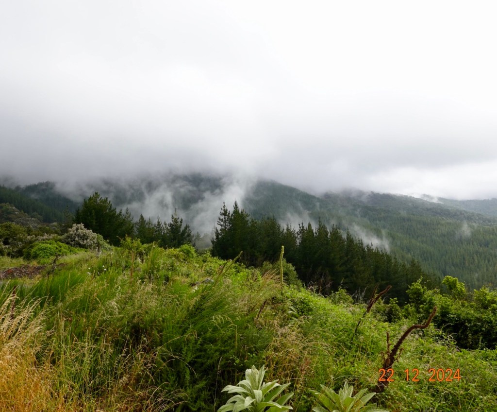
Near the top was this decorated tree. I did not stop as the gradient was 10% here and I cannot reclip my bike shoes in at that gradient. Tony can 😊From the top looking across the valleys still with rain haze Low clouds but lifting
The descent was slow and considered as the roads were wet and therefore potentially slippery particularly if any oil on the road.
Nice tailwind into Nelson along the flats and a shared pathway through parklands.
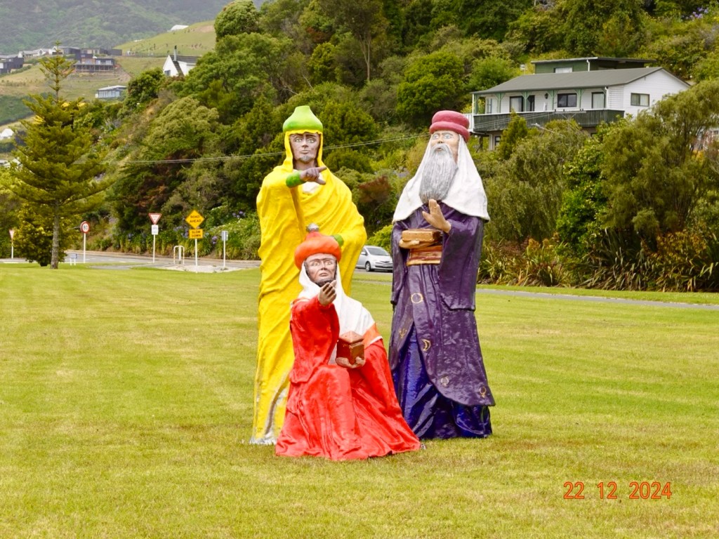
The guy in yellow was telling us our accomodation was another 3 km in the direction he pointed. The guy in red agreed.
Our accomodation was at the top of a seriously steep driveway that I had trouble pushing my loaded bike up! The views are nice.
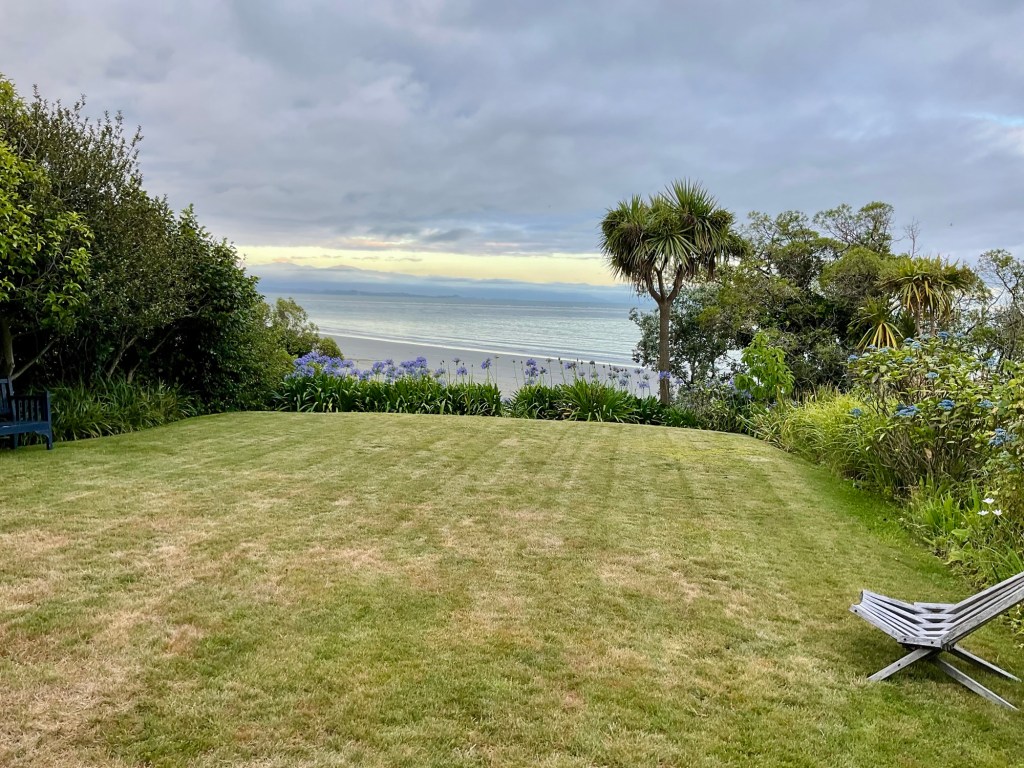
View from our unit.
We wandered down the street in search of food and quickly found Monteith Brewery where we had a nice meal. I did enjoy my lamb shank and vegetables.
Strava now has artificial intelligence summarising rides. This is what it said about today’s ride. It did make me laugh…big brother is watching!
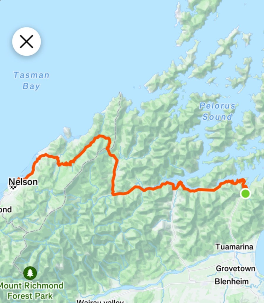
Todays route
So there we have it folks, first full daytime and dusted, and what a start! Usually I map a few easier days before hills but not possible this trip.
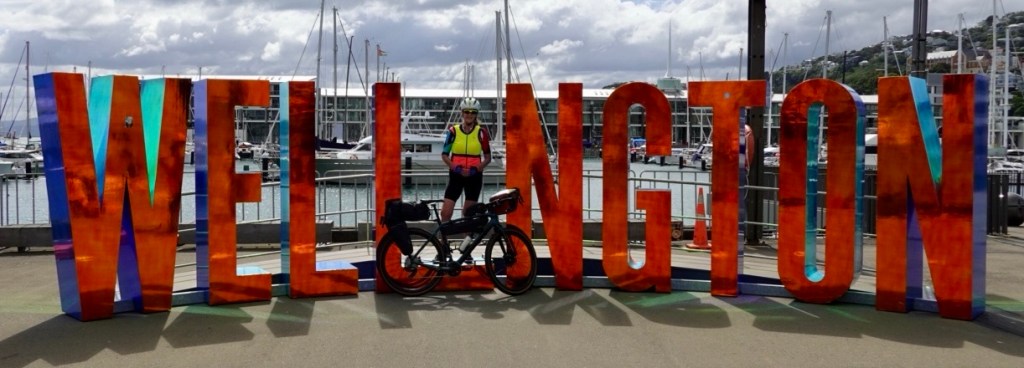
We safely arrived in Wellington and into bed by 1 am.
We were both appreciative of the hotel location, within Wellington Airport. We could see our aircraft from the window, maybe 250 metres away.
Up at 5 am after a fitful sleep, to reassemble the bikes, have breakfast and ride to the ferry.
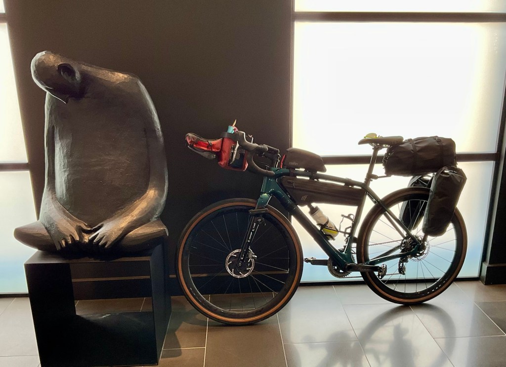
Hotel lobby. I feel a bit like that statue.
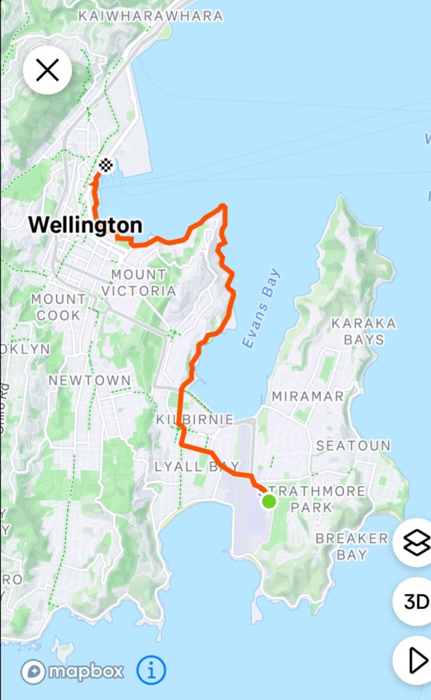
It was a cruisey but super windy ride from the airport initially riding under one of the airport runways.
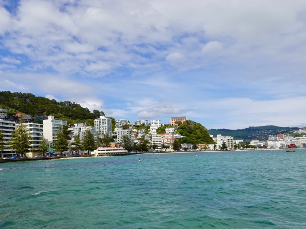
We followed the coast into central Wellington.
We headed directly to the ferry terminal, checked in, then told….there is a delay of a few hours. Groan.
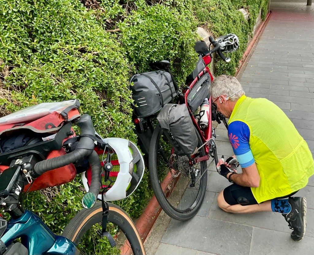
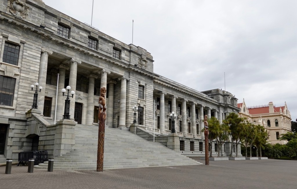
Both feeling tired, neither of us were keen on a ride around Wellington as we didn’t feel super alert enough, so found a spot near New Zealand’s Parliament at The Hive to chill.
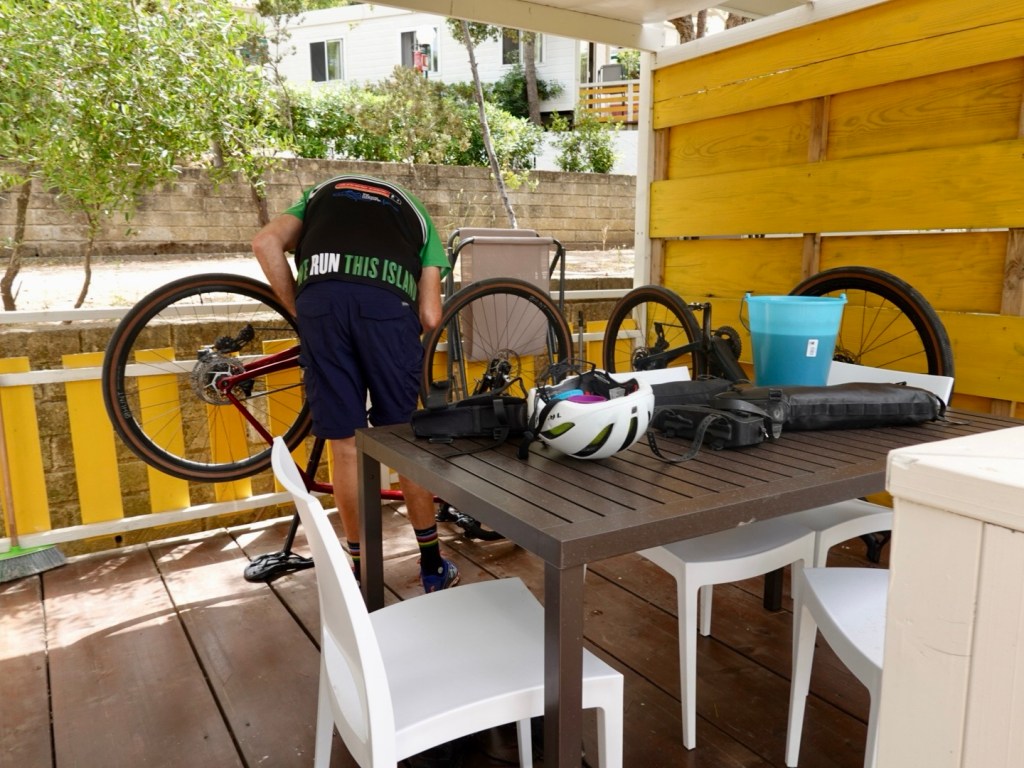
Tony undertaking some additional maintenance whilst killing time
Wellington is the capital city of New Zealand, located on the south western tip of North Island. Its Maori history goes back to the 10th century.
It is the most densely populated city in New Zealand, primarily due to the restricted amount of land between the harbour and the hills.
The area has high seismic activity with a major fault, the Wellington Fault running through the centre of the city.
Whilst New Zealand does not have any deadly animals (no snakes, no deadly spiders) it does have the potential for life threatening earthquakes (remember Christchurch) and of course volcano’s (White Island).
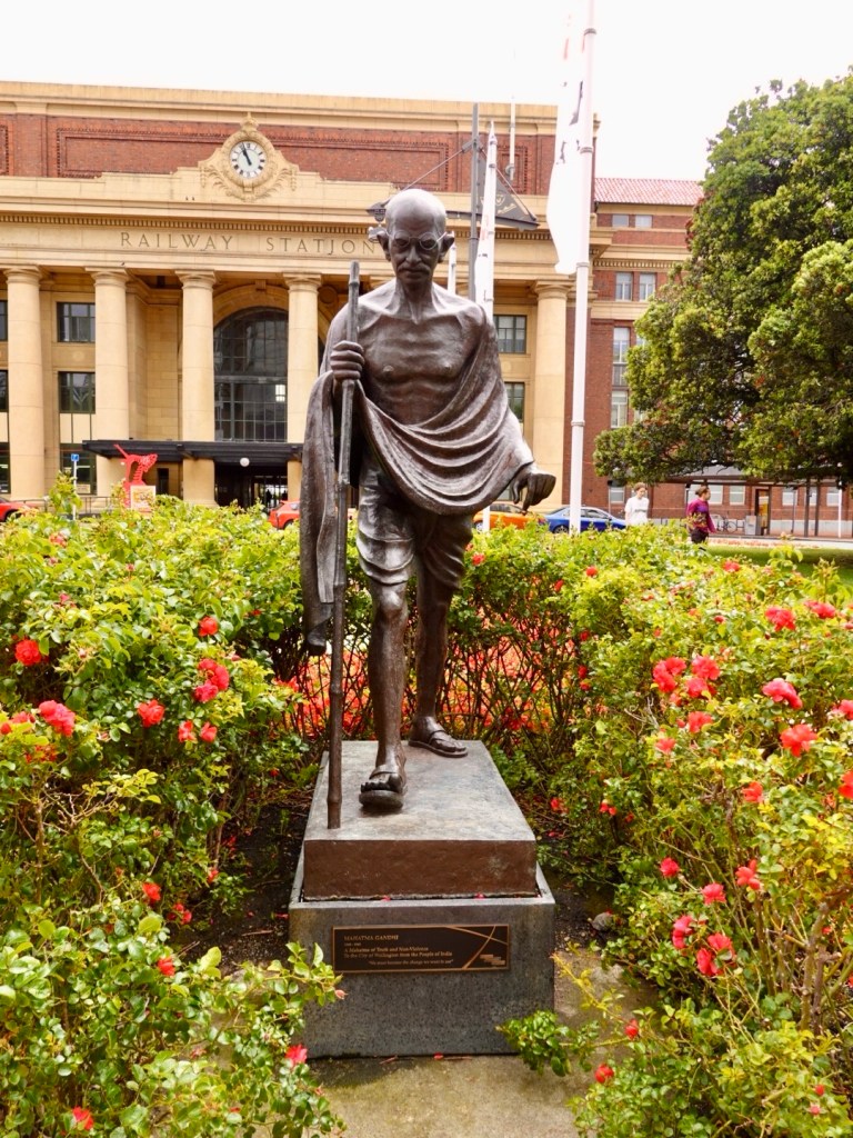
Wandering around the area as I got bored, I took a few photos.
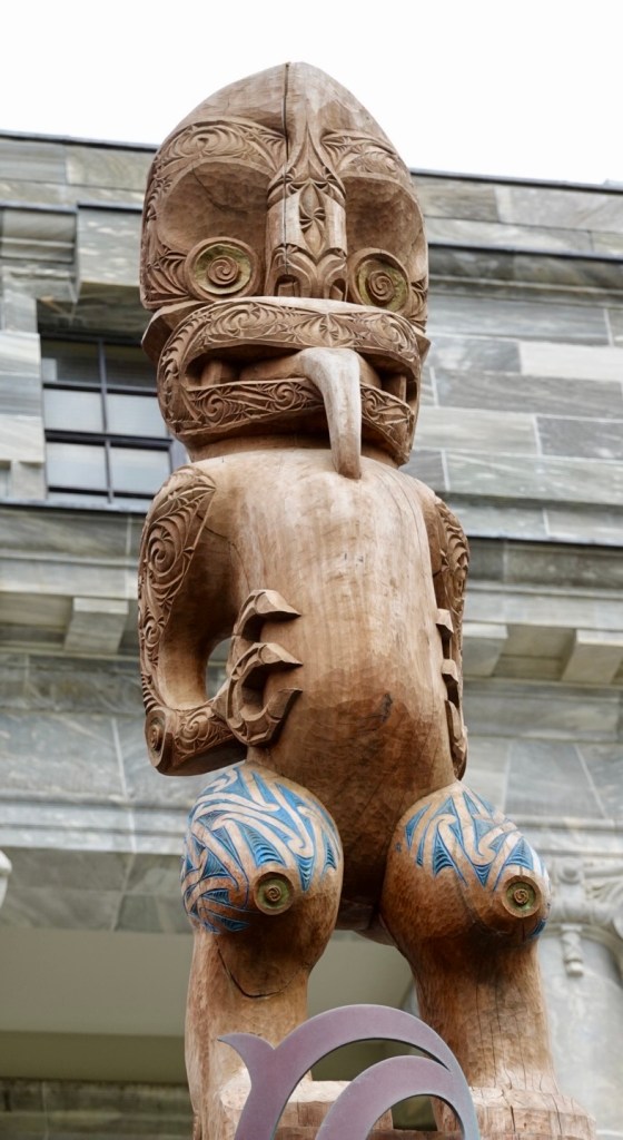
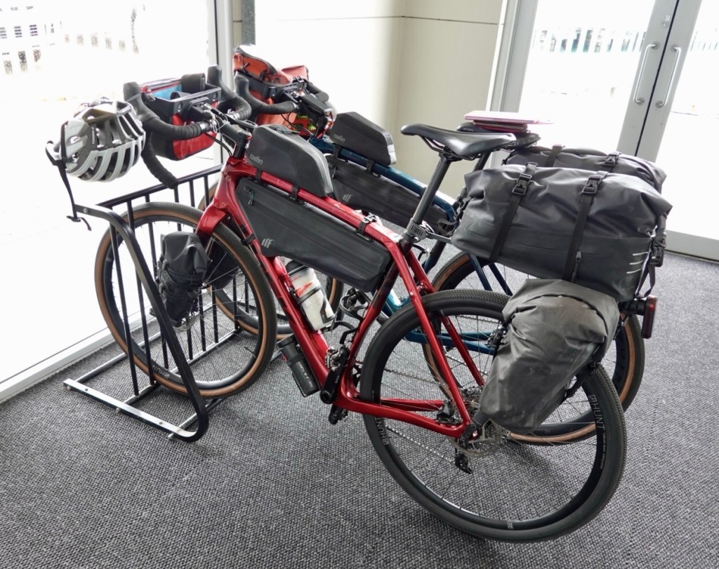
Mahatma Ghandi….not sure of his link to New Zealand but think this was more in recognition of his peace crusader efforts.I quite liked the railway station signagePart of New Zealand’s Parliament buildingThe Hive Close up of this dude sitting on top of a wooden totemBikes waiting more patiently than us at the ferry terminal.
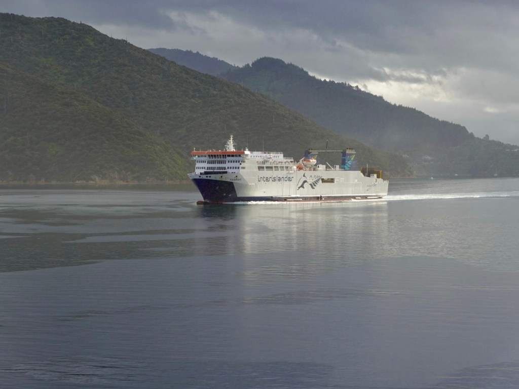
Some 3 hours after the original scheduled departure we were on board. The bikes were stored on the lowest vehicle level.
Our ferry ride takes us across Cook Strait – the section of water separating the North and South Islands of New Zealand. It is considered one of the most dangerous and unpredictable waters in the world! Where are those sea sick tablets??
We were ok though, having paid extra for a cabin. We did both sleep for the first hour of the trip.
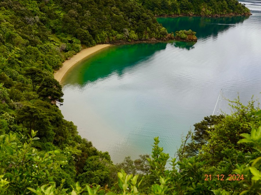
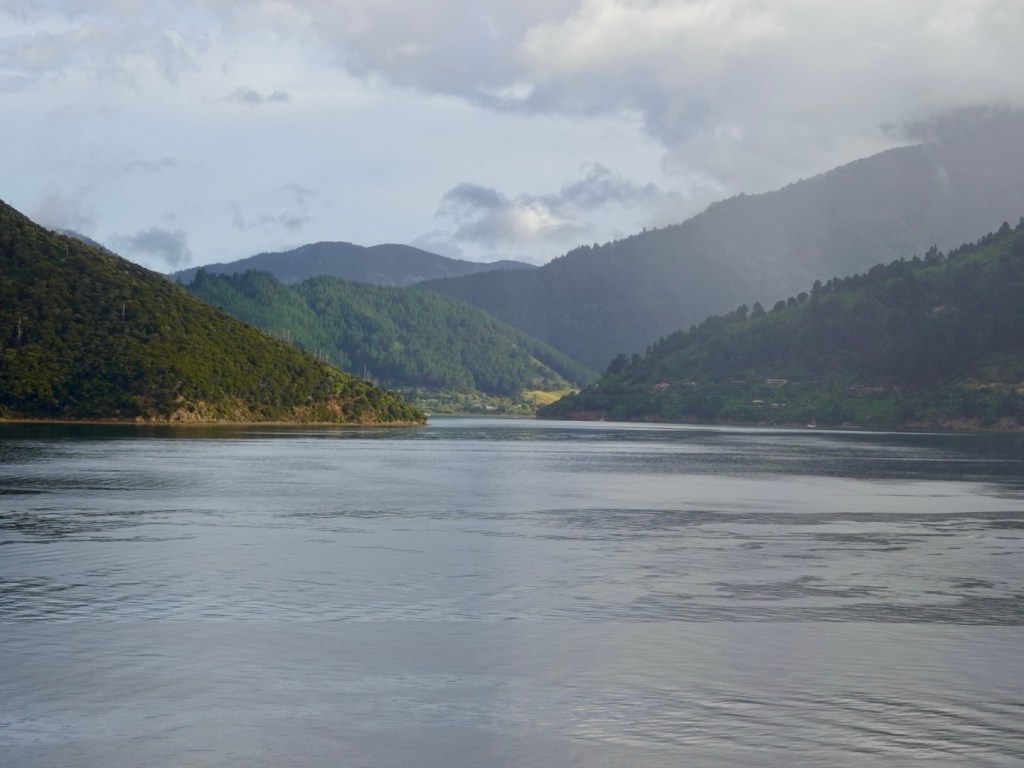
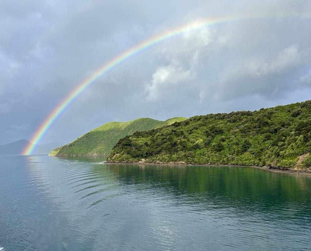
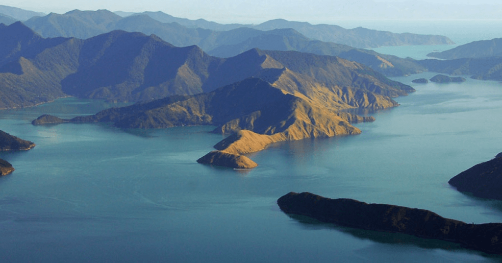
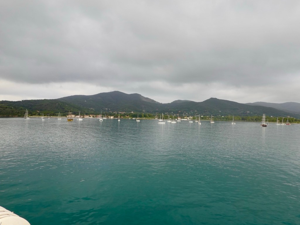
Marlborough Sound is regarded as one of New Zealand’s top areas of outstanding natural beauty and its not hard to see why.
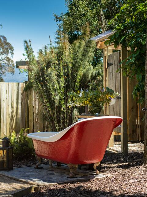
We are staying in a quirky Air BnB. The little wooden cottage with an outside bath.
After grabbing sandwiches for a quick dinner, it’s off to bed we go, listening to the rain pour down.
I have often wondered how many km I have cycled overseas – I have guessed in the past. Today I went through all my Strava data files and did a nice little spreadsheet. I have ridden 27, 762 km internationally in 20 countries.
France is sitting in first place with 6,565 km, followed by Italy on 4,757 km and New Zealand 4,750 km
I cannot believe that we are only 13 sleeps away from returning to New Zealand, our first trip there since 2019. It certainly rates highly for us as a cycling destination.
We will fly into Wellington, arriving late at night. The next morning we will have to move with haste to put the two bikes together, store our travel luggage and head off to the ferry.
We will be on a four-hour ferry trip across Cook Strait to Picton – and hopefully the weather is nice as I think the closer we get to South Island, the better the scenery will be. Queen Charlotte Sound looks spectacular (photo courtesy http://www.newzealandtrails.com)
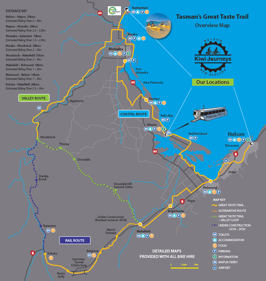
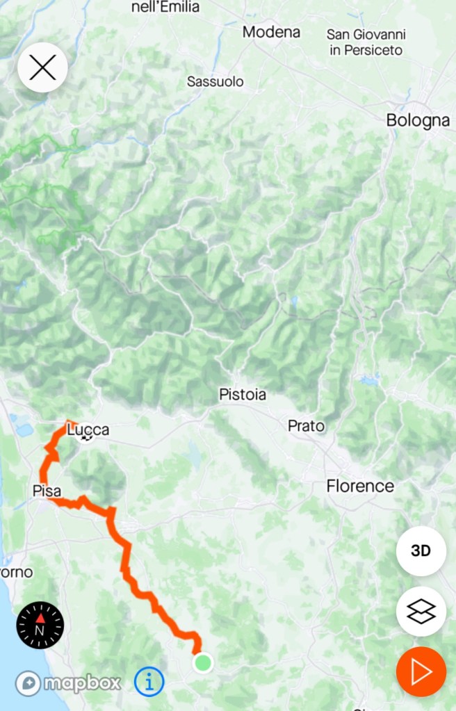
Then off we head the following morning with a 111 km ride, and around 1100 metres climbing. We will spend two nights in Nelson and complete a circuit ride on the second day heading out through Stoke, Richmond to Norris Gully and Kohatu via Spooners Tunnel following the Great Taste Trail.
I have borrowed this map from a cycling company promotion. We are not involved with this company as we are independent riders – I map all of our rides, upload them to our bike computer, and make all necessary accommodation and ferry transfers. For riders new to cycle touring, I do initially recommend using a company – as we did ourselves in the earlier years.
Then we have another tougher day – 108 km and 1078 metres ascent to climb over Takaka Hill to Motupipi, riding along the edge of the Abel Tasman National Park.
There is a degree of trepidation as this road features on a website highlighting dangerous roads. The Pass is described as “very steep and a winding road with 257 corners and some almost 320-degree hairpins”. There is no other route over though and we will leave Nelson as early as we can (there is no breakfast where we are staying so we will likely eat a little before we leave and pick up food along the way).
This day will also be Christmas Eve and I expect traffic will increase exponentially.
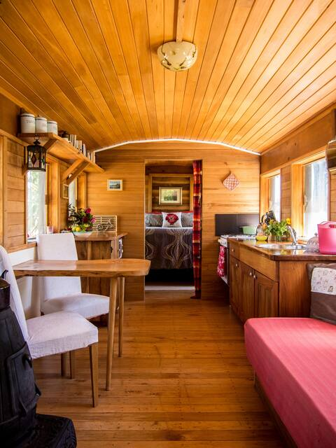
We will be in Motupipi for Christmas, a small village in the middle of nowhere staying in a renovated train carriage. We will aim to buy some food from Takaka so we can eat on Christmas Day!
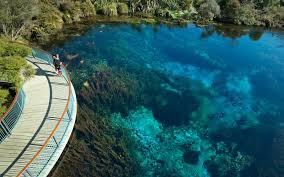
A few things planned include a river swim at a local river spot, visiting Tata Beach and Te Waikoropupu Springs – a beautiful sacred site – no swimming allowed. Maybe a bath?
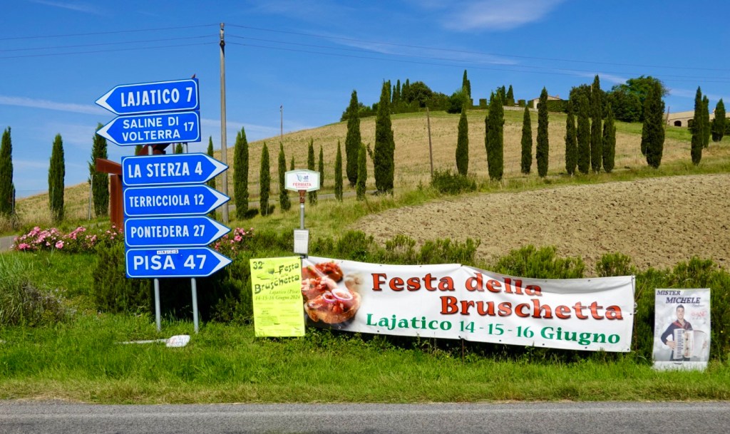
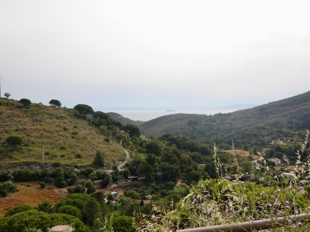
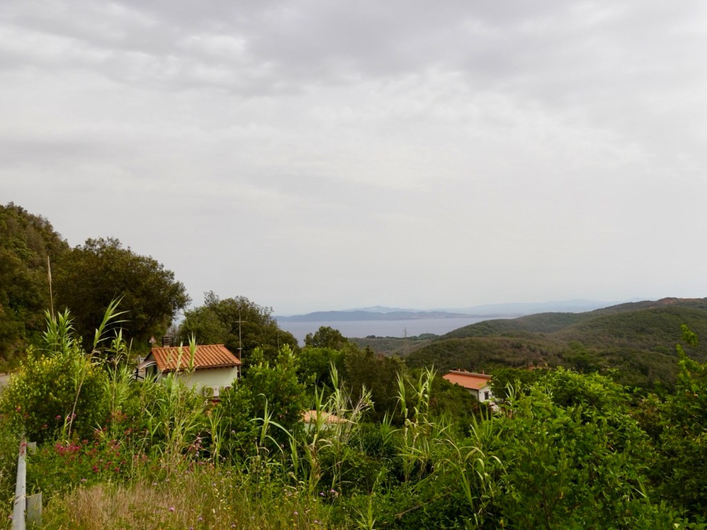
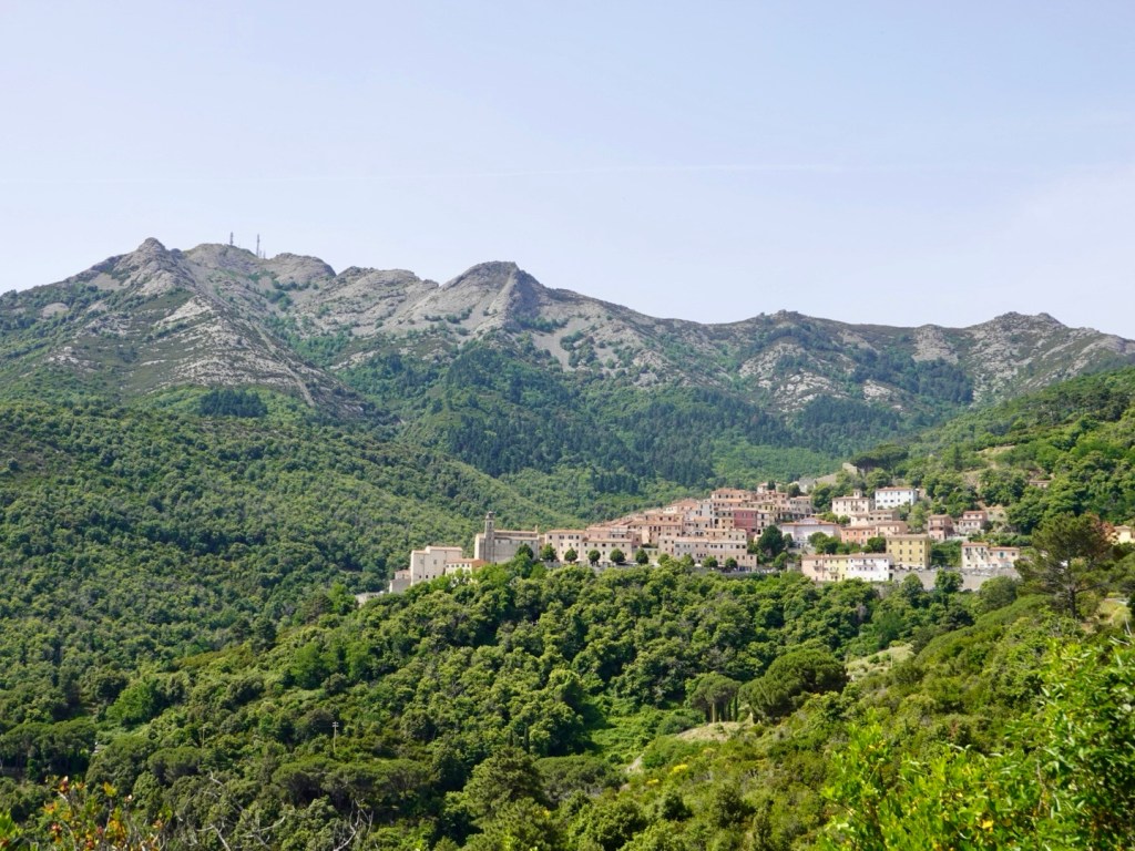
Collingwood is next – yes New Zealand also has a Collingwood – and we have three nights there as we have two-day trips planned including heading towards Cape Farewell and the West Coast.
I have mapped a ride to head in and around the Whanganui Inlet and possibly up towards Puponga. What we end up doing will depend on the weather, how we feel as we may also head to the famous and historic Langford Store at Banhaim – in a totally different direction.
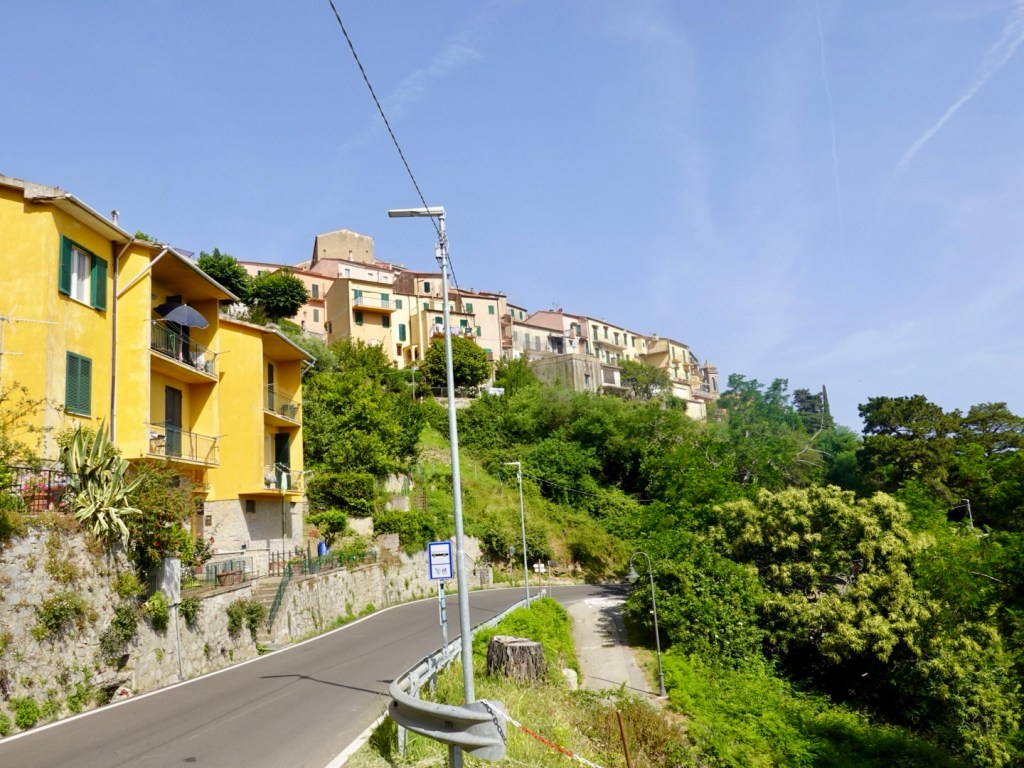
Leaving Collingwood, we weave back and over Takaka Hill (we love climbing hills with a loaded bike – said noone ever).
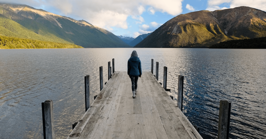
We are going to St Arnaud for two nights, overlooking Lake Rotoiti. We will cycle around to Lake Rotoroa the following day.
Then we have our easiest day riding out to Blenheim following the Wairau River and valley.
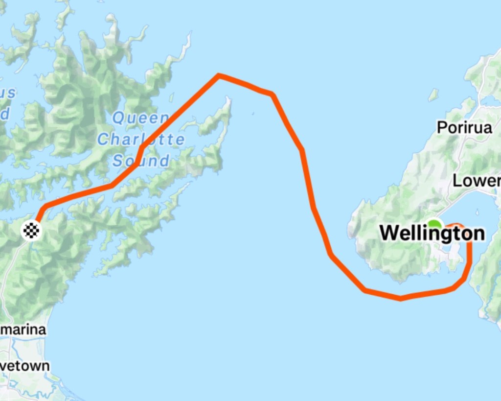
Finally we head back to Picton the following day to return to Wellington on the ferry and a possible short ride before cleaning and packing our bikes up.
We are hoping for nice weather, fair winds, minimal rain, no spills or illness.
New Zealand will then move up to number two on my all-time km list, overtaking Italy!
I will blog each day, assuming wifi is strong enough – with Tony’s photos and my words.
Thankyou for reading, and I look forward to sharing our journey vicariously.
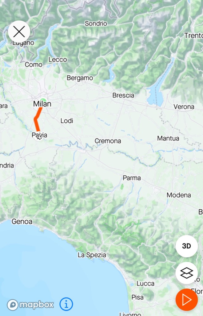
5 am we were up and packing to head off to Lucca train station for the first of two train trips today.
It was only a 22 minute trip to Viareggio, on the Mediterranean coast. I had contemplated us riding the 22 km but given the time of day and connection to Milan, we took the easier option.
There were a flight of stairs involved in getting to our platform, and lucky Tony is strong enough to carry both loaded bikes up.
We had seats allocated in carriage four, and put the bikes there, but two blokes sitting nearby indicated we should move the bikes to carriage three. They had hanging rails there, and Tony removed our heavy rear panniers to protect the front wheels taking all the weight.
The trip followed the Mediterranean coastline via La Spezia to Genoa, lots of scenic coastline and also tunnels through the hills.
The train was packed full from Genoa and a lovely young bloke from Germany who was concluding a solo two month cycle tour sat with us, and we shared our adventures with each other.
Milan train station was super busy. People pushing and shoving to get off the train, pushed passed our bikes impatiently.
Once we escaped the station, the city streets were just as bad.
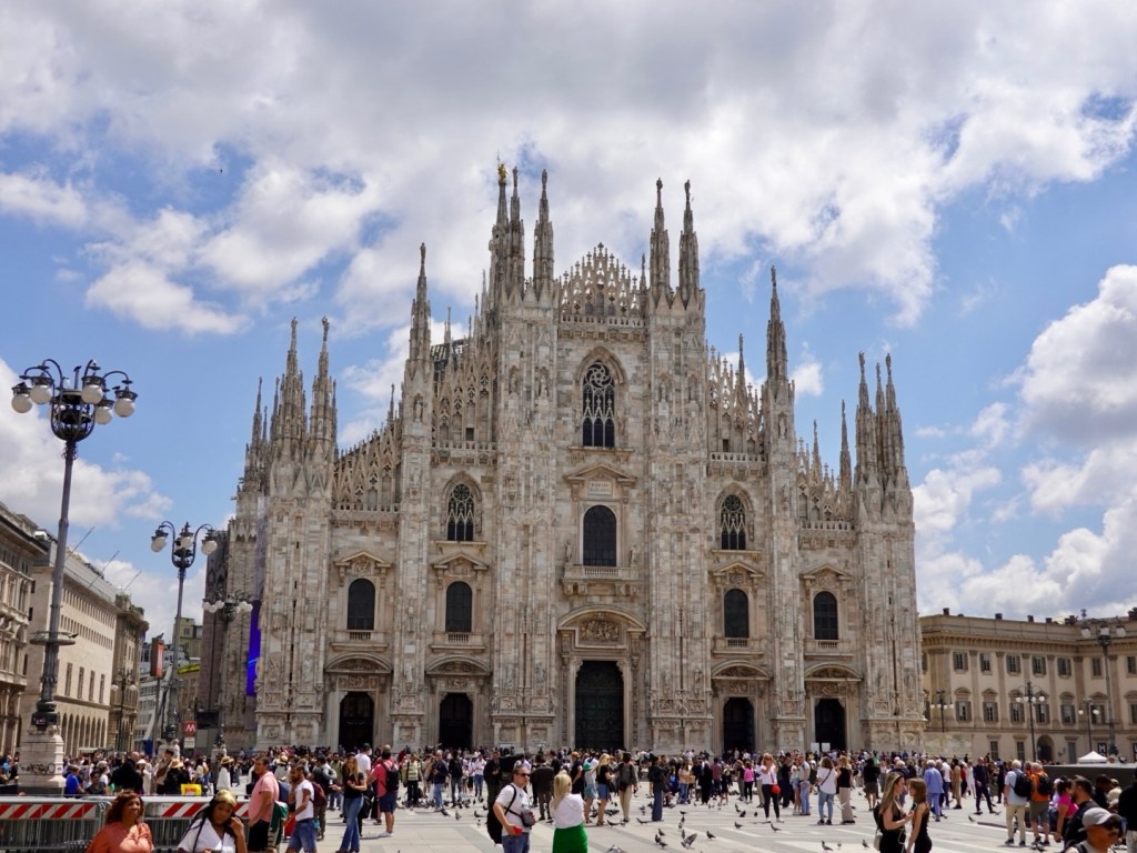
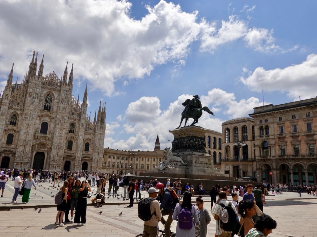
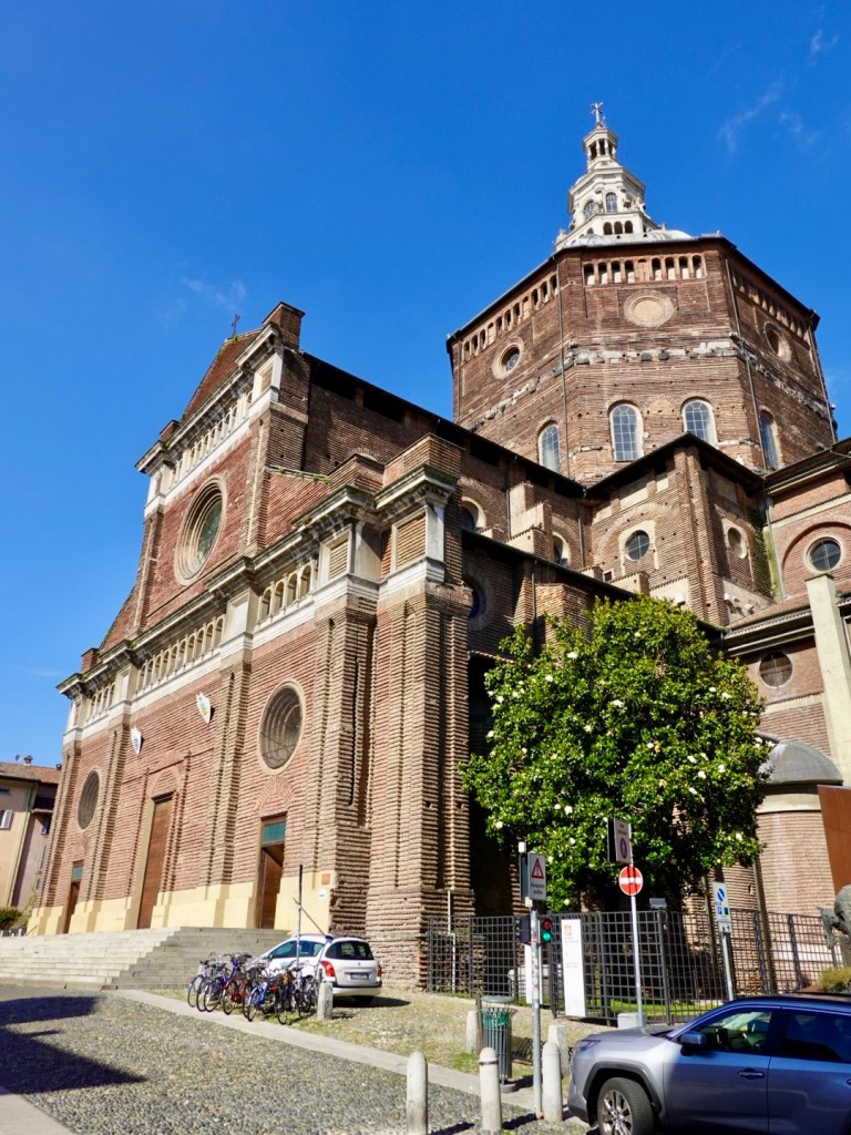
Our route took us to the famous duomo, the third largest church in Europe. How we got there in one piece is pure luck.
Red lights seems to be the new green in Milan. A seriously crazy city to cycle in. We have ridden through London and Paris without anywhere near the same hassles and pressure as Milan.
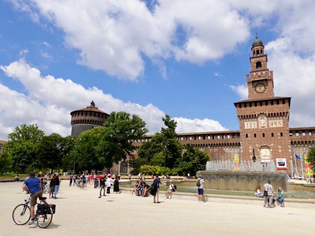
Castello Sforzesco was the first of sight we rode past. Built in the 15th century by the then Duke of Milan on the site of a 14th century fortification. It was one of the largest citadels in Europe after additional renovations and extensions in the 16th and 17th centuries.
Today is a museum.
Finally we made it to the Duomo di Milano, the seat of the Archbishop of Milan.
Taking six centuries to construct, with final details completed in 1965, it is the largest cathedral in Italy ( St Peter’s basilica in Vatican City is larger, but the Vatican is a sovereign state, the smallest country in the world).
I would really like to have gone inside, but the queues were very long. A few days in Milan would be warranted on a hop on, hop off bus I think plus a pre booked tour! Another day.
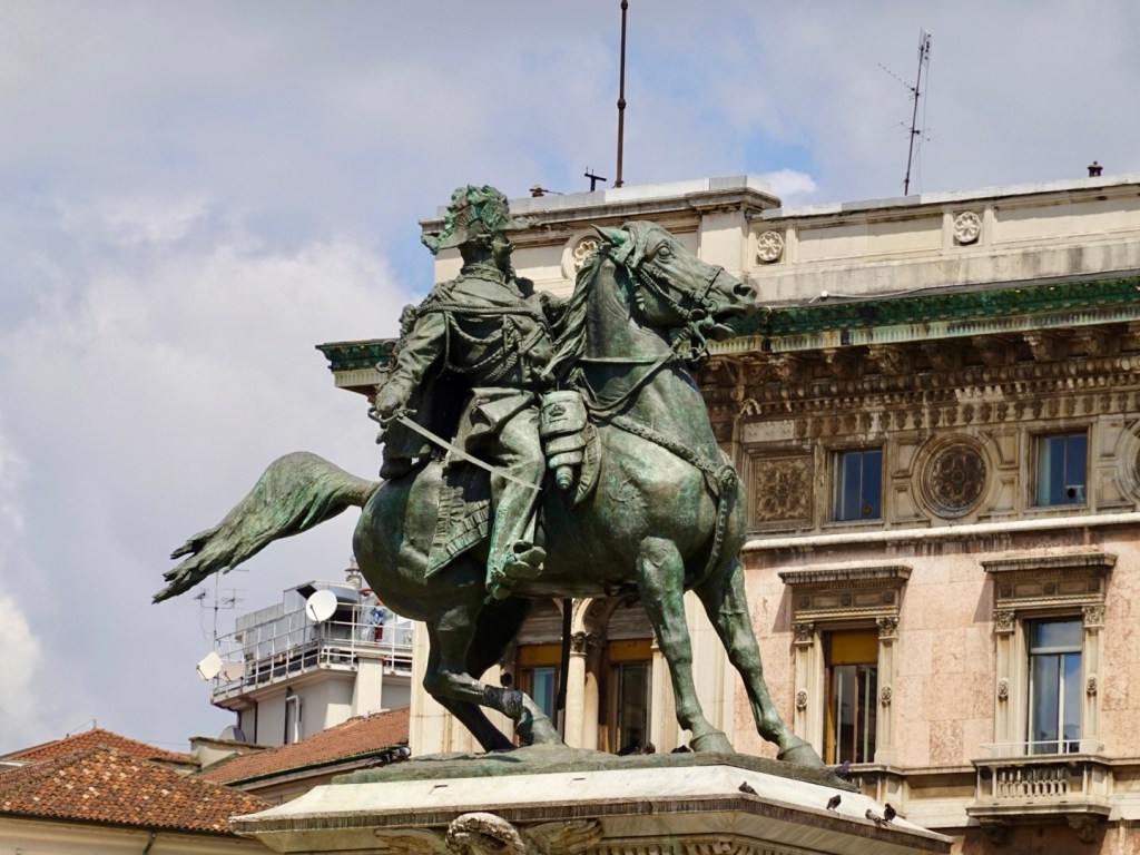
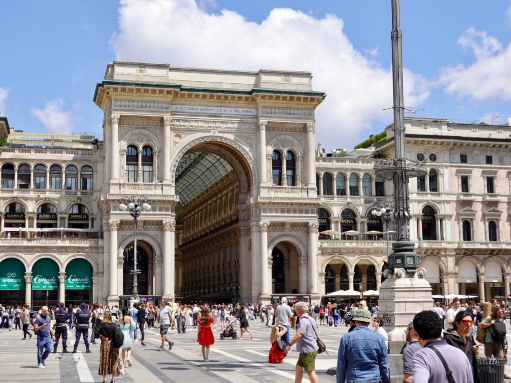
The detail is incredible and I am sure the inside magnificent. Vittorio Emanuele II, King of ItalyThe arch is an entrance to Galleria Vittorio Emanuele II, a huge indoor shopping precinct, Italy’s oldest gallery.
We were very hungry. Very hungry not having consumed any food since about 6 pm the night before. We were up to a 19 hour or so fast!
We presumed we would grab food at the railway station, but nothing available at either bar chocolate bars from a vending machine.
So we were keen to find somewhere a bit quieter to sit down, and about 7 km later we were ‘in the burbs’, and found a Japanese restaurant, with an outdoor area where we could park our bikes next to us.
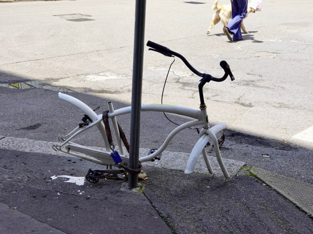
This bike was chained to a post outside the Japanese restaurant. The lock has held, but the bike has been savaged.
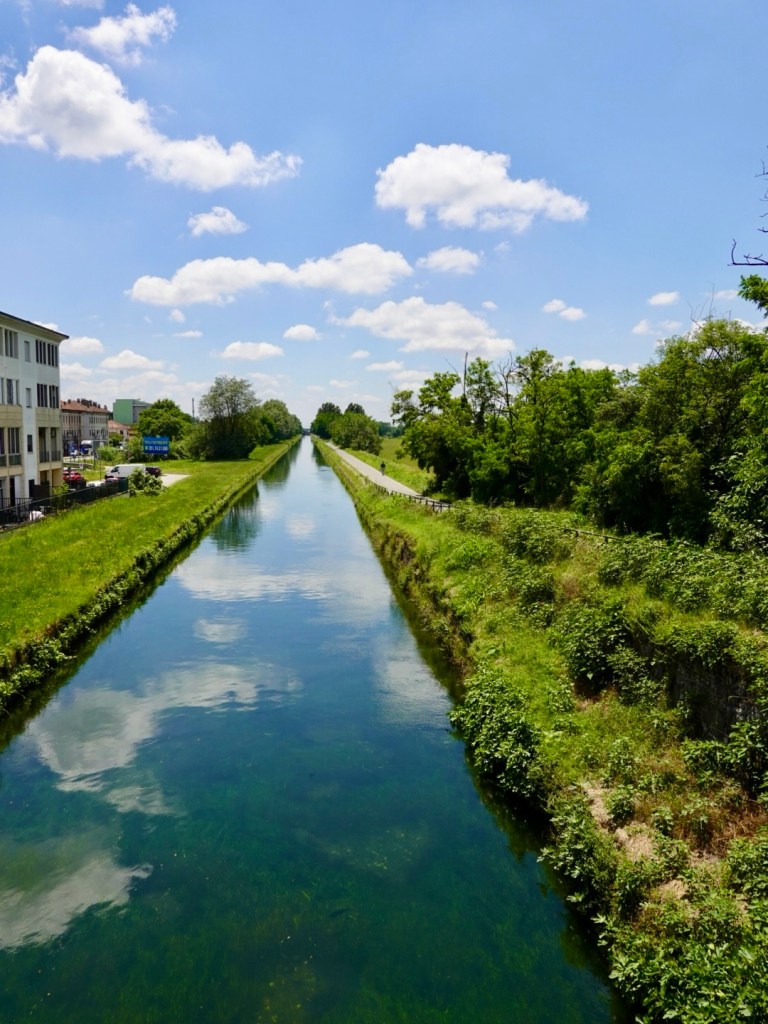
Milan’s canals were first developed in the 12th century to transport goods and defend the town. The canal network was expanded and eventually linked to the Italian lakes and Switzerland, and the Adriatic Sea to the south. Many canals were built over during the 20th century for reasons of hygiene and mobility.
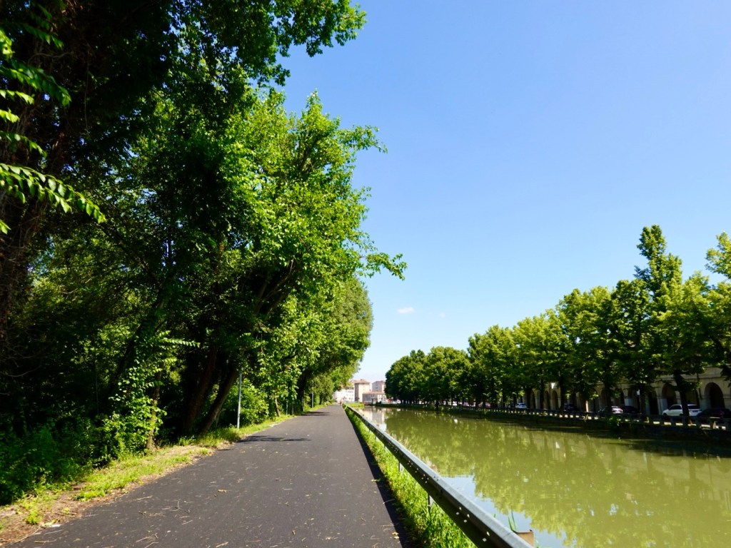
In picking a route to Pavia, I selected one of the canals that went into Pavia, Naviglio Pavese. It started off nicely, well formed pathways.
Despite how it looks, the water was clear when viewing it. There is a green like algae on the canal floor, with the sun, giving it the green look.
We came to a roadblock on the path and it was dang! The nearby road was super busy. We consulted our maps and a lycra clad road cyclist stopped and checked where we were headed, offering to show us a way around the roadblock.
We followed him for a few km and thanked him once we were back on the path and he flew off at circa 30 kmh.
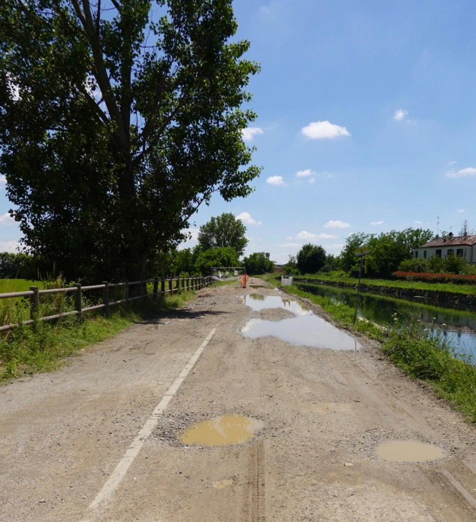
Maybe 10 km further on we came to this mess. At this point, we agreed to give it a crack as that is not so bad. However we regretted our decision. About one km on and we were walking our bikes around huge puddles that consumed the entire width.
Then we arrived at the excavator, totally blocking the way, plus huge excavations. Annoyingly we had to retrace our steps through the mud, back to the road.
By this time our shoe cleats were mud clogged necessitating a solid shoe cleaning exercise.
Down the busy road for maybe 5-7 km we were eventually able to rejoin the quieter canal pathway. They are upgrading the path and resealing and we benefited from a nice surface.
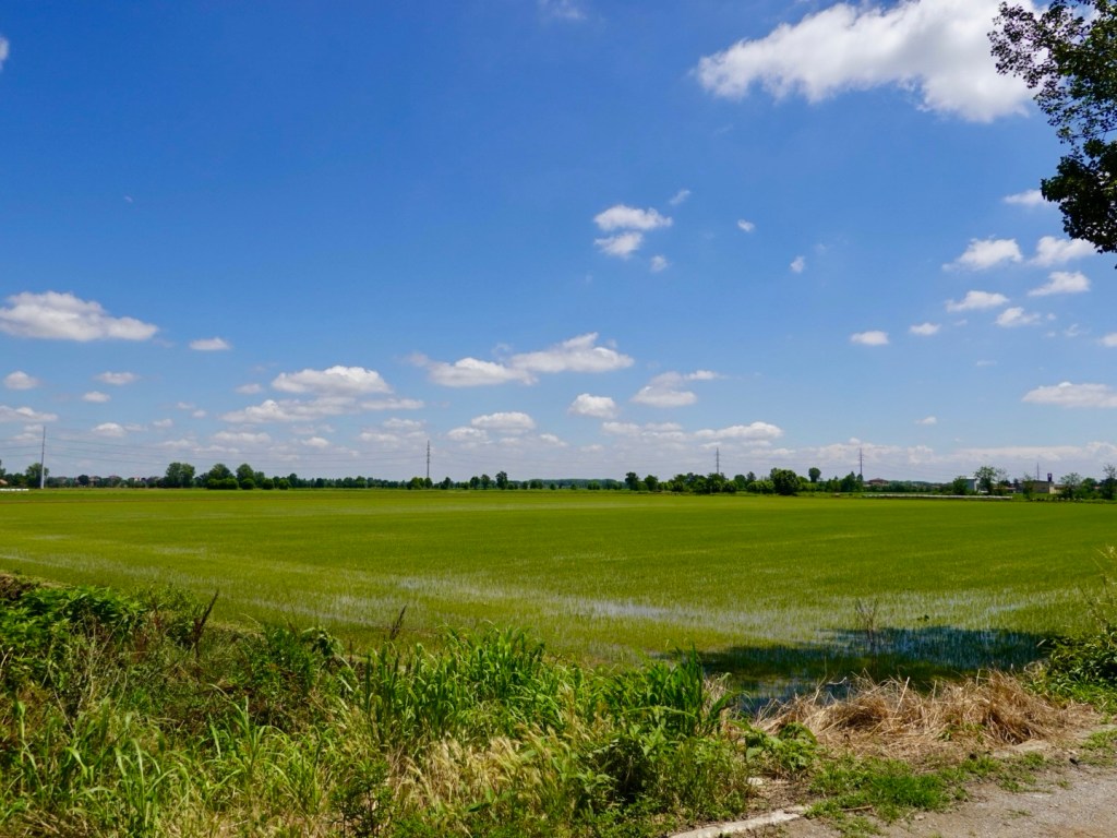
Agricultural landsLook at that nice smooth surface.
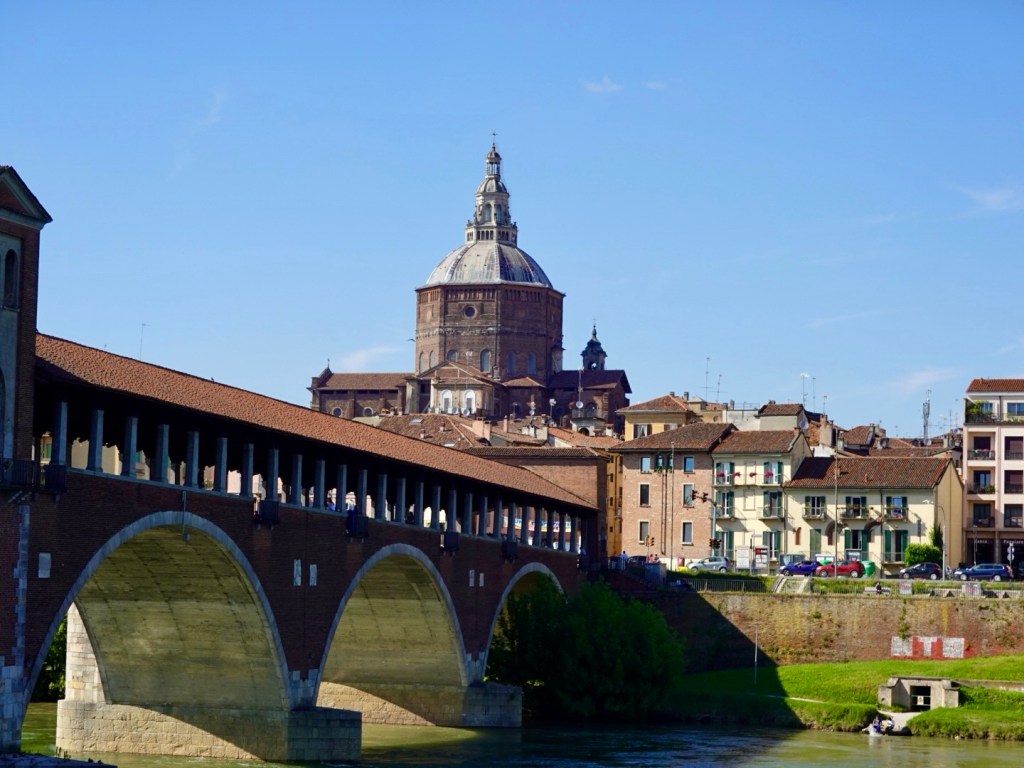
We arrived in Pavia, our overnight destination. A short and flat ride of 48 km.
Pavia is build on the banks of the Ticino River, near its confluence with the Po (we rode through the Po delta some ten days ago). It has a population of around 75,000, with a significant ancient history. There is a University that was established in 1361 and still runs today.
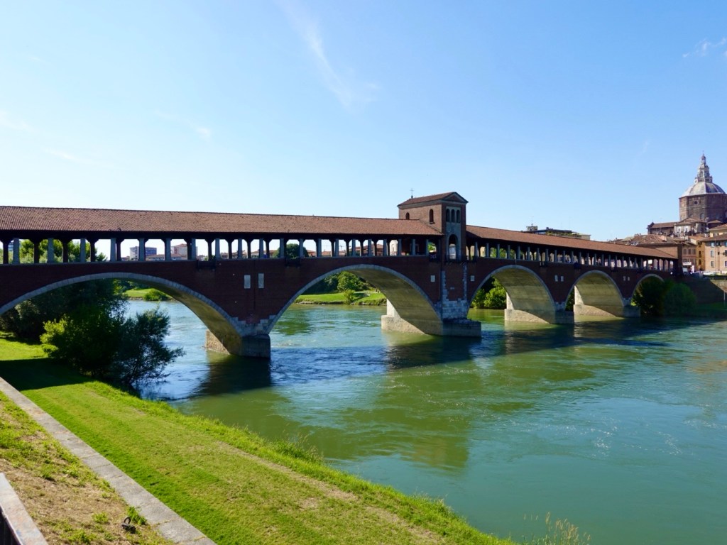
View of the Ponte Coperto and Pavia duomo
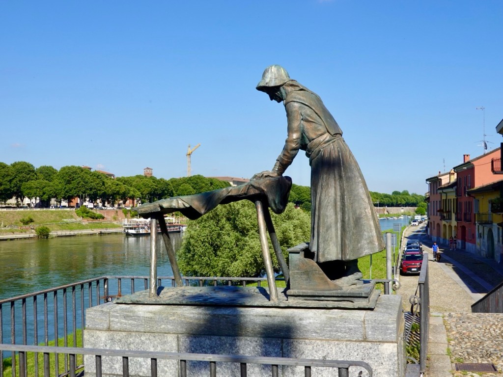
After settling into our accomodation on the southern side of the bridge, we headed back across the bridge on foot to check out the old sites, and find more food!
The statue of the laundress represents the history where the laundresses once used to wash their clothes in the river.
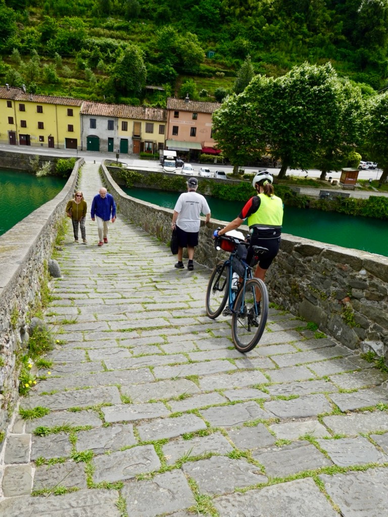
Ponte Coperto
The streets are quite wide, and well paved.
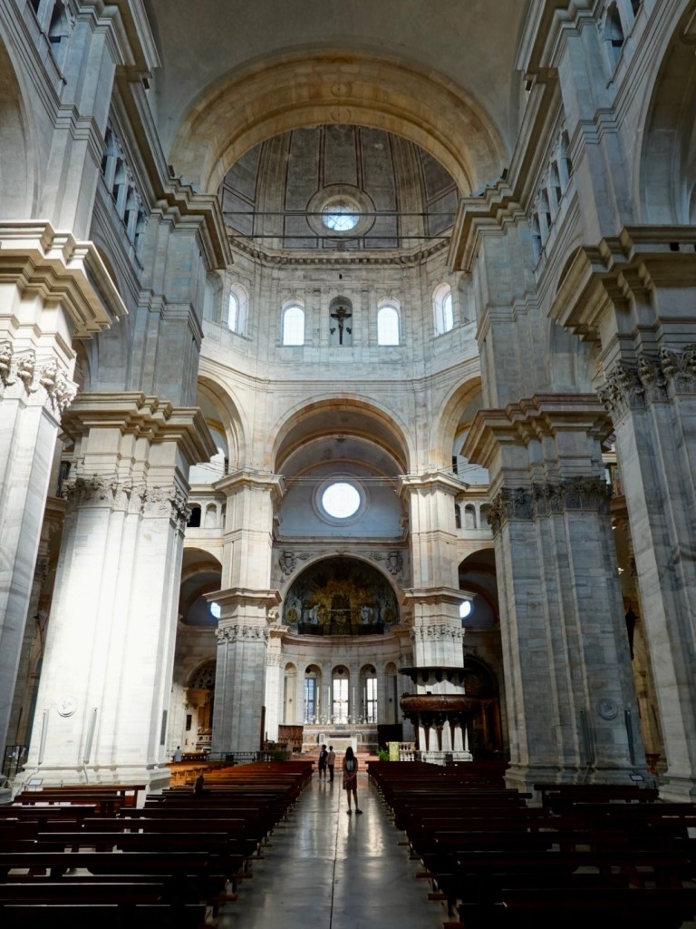
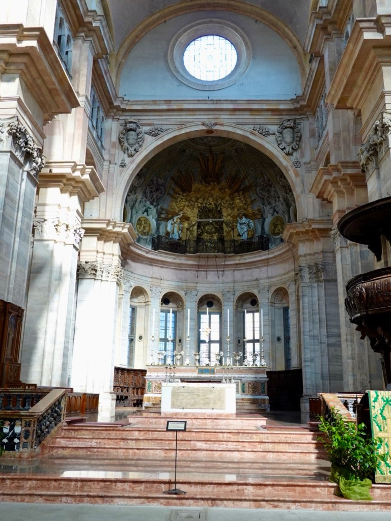
We headed to yet another duomo, the obvious sights as they are usually the tallest structures in each town, with a significant history and extraordinary architecture.
Construction commenced in 1488, on the site of two medieval churches.
The central dome has an octagonal plan and is 97m high, weighing 20,000 tonnes. It is the third largest dome in Italy.
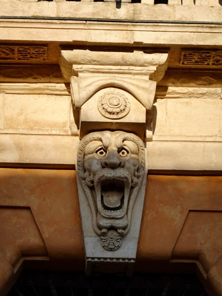
Statue outside the cathedral. Mischief makes have added blue and red paint on the genital section of what is a male horse. Old ruins and walls adjacent to the duomoAnother old church A few of the former many torres, only a few still existMunicipal buildingGargoyle, I am a fan of gargoyles, they amuse me Later in the day view of the Ponte Coperto as we walked back to our accommodation
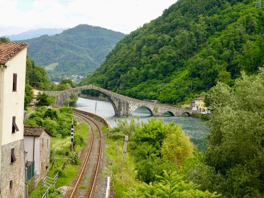
North of Lucca is the Serchio River valley, features the Apuan Alps to the east, the Gargagnana Mountains to the west. The devil lingers nearby.
Ponte del Diavolo bridge – legend has it that the Devil constructed the bridge in exchange for the first soul to cross it. The villagers sent a dog.
We decided to do a ride out to Devil’s bridge on an active recovery day.
But firstly we needed to solve a travel issue I had not been able to do from home with trip planning.
With airfares booked we had time parameters. In deciding to ride to Elba Island and spend three nights there, that effectively meant we could not do a perfect loop ride.
So we needed a train to join the dots from Lucca to Milan.
I have caught Italian trains before, with a bike. Roma to Orvieto and Orbotello to Roma. No issues.
Online I just could not book this required train trip. Some trains do not take bikes also eliminating the high speed route via Florence.
Anyhow, nice young lady at the Lucca station tried seven different combinations to get us on a train, with bikes, and failed.
My stress levels were getting pretty high, feeling quite anxious by now.
She described it as “weird” and did a system shut down and reboot. Voila!
She was able to book us on the one I had originally wanted to Viareggio then Milan! Only one train station change.
I realised I was shaking so we went and found some colazione (breakfast) and espresso.
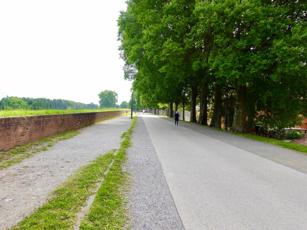
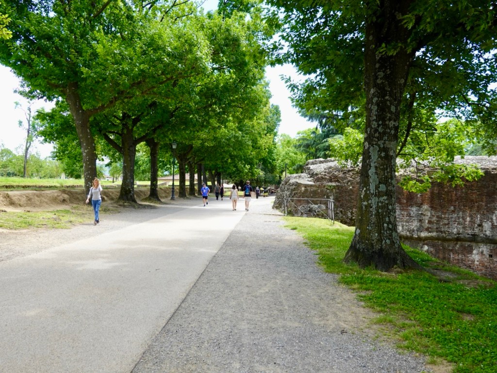
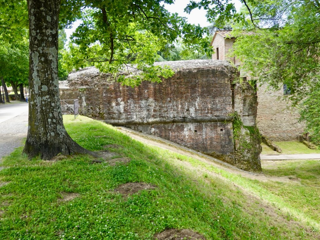
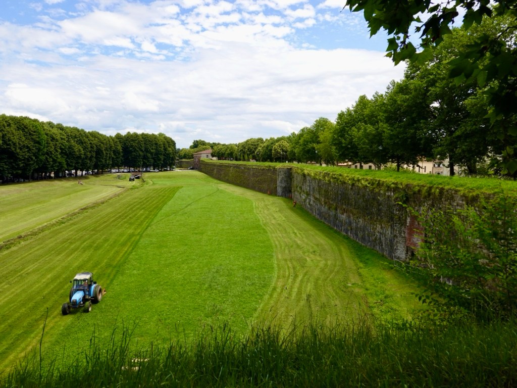
We then headed off via the walls, 5at are so wide you can ride along them on perfectly sealed pathways.
Wall pathway
Some view from the wall before we exited from a northern porte.
The pathway we followed for about 10 km was gravel of various compaction levels. Nice to be away from cars. We then ended up on road for the rest of the ride to the bridge.
A rail bridgeWe followed this river Then we followed this river..beautiful backdrop
There is the first sight of the Devil’s bridge. There is no way you can ride up it. As I pushed my bike, the angle peaked at 19.8%. The cobbles were particularly difficult to walk on.
Ponte della Maddalena was a vital river crossing on the Via Francigena, an early medieval road to Rome, an important medieval pilgrimage route.
It was constructed around 1080.
Looking down the riverLooking up the river Walking down the bridge
We had refreshments nearby then headed off back to Lucca where we did some more riding on the wall.
1548 if I’m reading my Roman numerals correctly , one of the old portes into the old town through the wall.I like the trees growing at the top of the tower. I gather that was a deliberate thing.At lunch we stopped to eat in this piazza, nice tiling.Closer up,of the vibrant mosaics Rear view of the same church.
Back on the wall, this is a good example of where other wall structures crossed.
Below the wall, plenty of grass to be cut.
One of my favourite views today summing up Lucca, history and Tuscan hills.
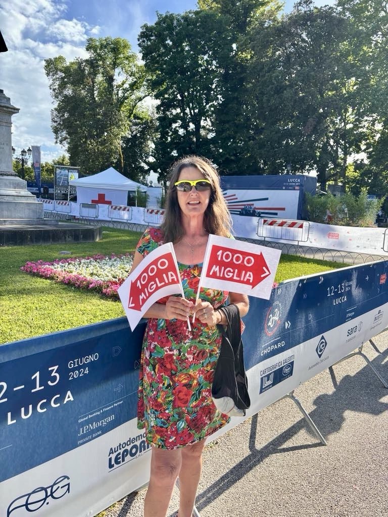
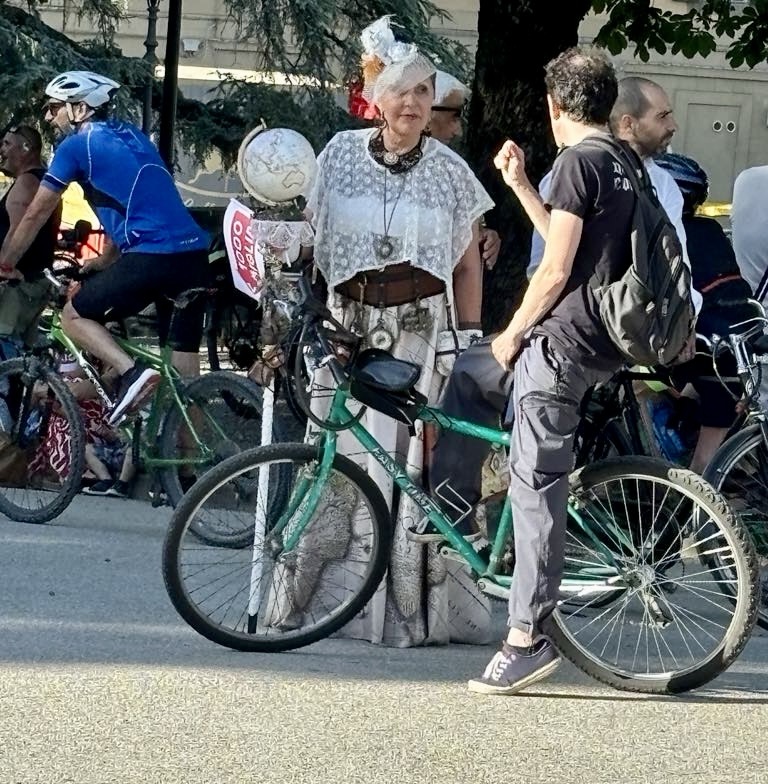
After grabbing an earlier dinner, we came across crowds of people, police, barriers and banners. We had no idea what was happening but Miglia 1000 was featuring everywhere, so we googled it.
It is billed as the world’s most beautiful car event, and Lucca was about to be inundated with 110 Ferrari’s that were participating.
I think it is a bit like Tasmania’s Targa event but with a lot more Ferrari’s. Tony loved it, saying there were car models passing by he’d never seen before.
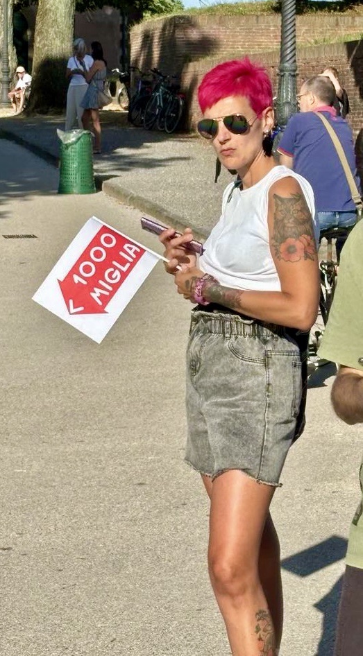
However before the cars arrived, there was lots of time to kill. I think we waited close on two hours.
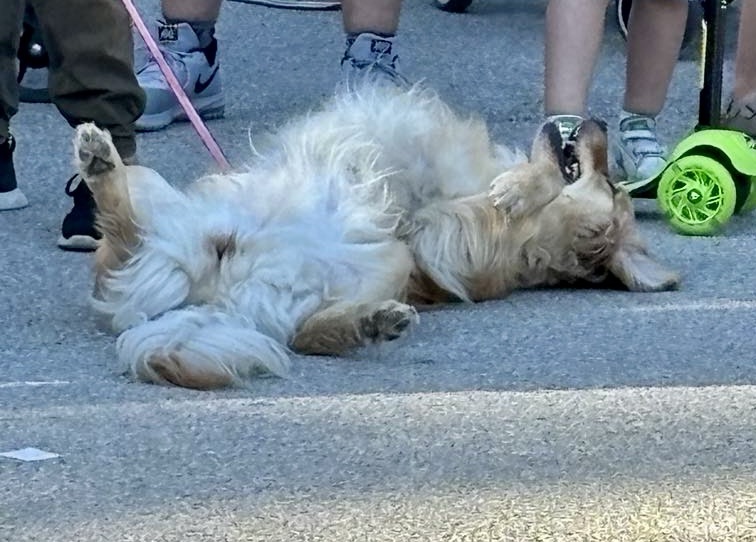
We were given banners to waveWe watched as six young ladies argued strongly with police and the event organiser to not have to turn their wheeled contraption around. The girls lost the battle but put up a mighty defence.The lady with the orb wandered around in her hooped dress, also carrying a little leather suitcase.This lady was getting pretty antsy and fidgety waiting, but I admired her boldness with hair colour choice. This dog was just sick of the whole proceedings and lay like that despite the owners protestations.
Waiting for the cars, we walked further down the road, away from the crowds, closer to our exit porte through the wall. It was better as there were less people, and shade available.
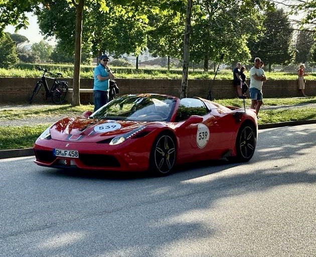
Finally the cars started arriving, crossing a number of checkpoints. Tony picked these two out for the blog.
Quite the car show Lucca, Enzo Ferrari would have been very happy with 110 Ferrari’s in one place.
Another day done, only a few days ride left before we commence our long journey home.
Blue skies, an amazing breakfast spread and we were ready to roll and head to Lucca for two nights, 96 km away.
Our accomodation is a building over four levels, meanders around and has another area that then climbs up to a roof top cafe, another level up to a back yard exit and where our bikes were stored.
You can imagine what Tony said when the key we were given did not fit the padlock and he needed to go to reception….on the ground floor.
Whilst waiting for Tony I took this looking over our accomodation rooftop towards the city hall tower. Tony was back and his watch said he’d already done more than 10 flights of stairs for the day. The bikes were in the box on the right. The doors open and the lid also slides forward. There is a video camera just above it, and the rear fence has high stone walls and locked gate.
On our way I had to walk two sections to get out, up steep cobbles, and down steep cobbles. Eventually after a km we were free riding, downhill.
Some views as we headed down the slopes.
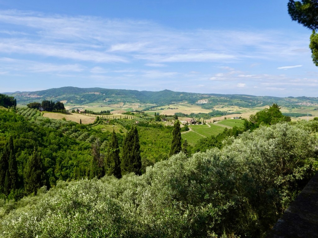
Looking back at Volterra, mainly vineyards
Once on the valley floor, our route took lots of turns. At one corner this was advertised. Looks like an interesting theatre.
This is the same corner, just further to the right. Bottom right promotion may be more your thing. Quite the offering 😊
Quite a pleasant ride, roads were busy at times, particularly in towns. Other times, we rode through, or skirted around quiet villages. The temperature was getting hot, and there was a headwind present, providing cooling effect.
10 km or so before Pisa we rode sections of this cycle way. It started off ok, this section well compacted white gravel. That is as good as it got though. Most of it was single track on a poorly maintained variety of surfaces. However, it was quiet and free of traffic.
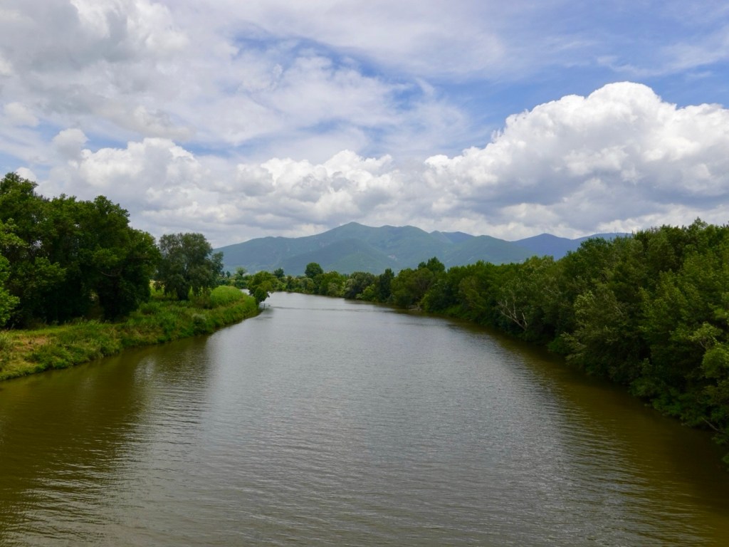
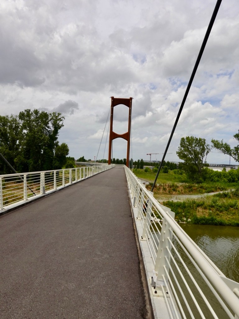
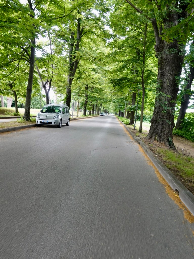
Crossing the Arno River that passes through PisaOutskirts of Pisa is this shared pathway bridge Back on the road, this tree lined street provided lots of shade
Pisa, an interesting city. The waterside buildings all have wooden frame structures attached around windows to accentuate features. Looks like a fairly recent addition. You can see in the photos if you expand them. The frames are all white and varying shapes and sizes.
Santa Maria della Spina, erected around 1230, on the banks of the Arno. It was rebuilt at a later date at a higher level due to fear of flooding.
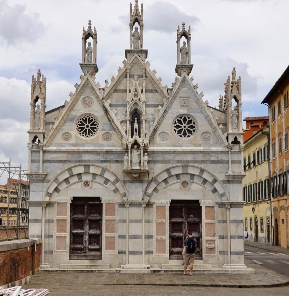
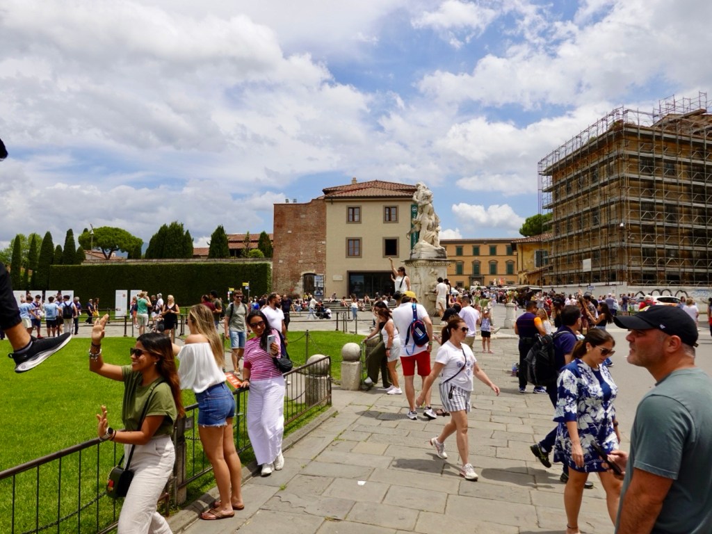
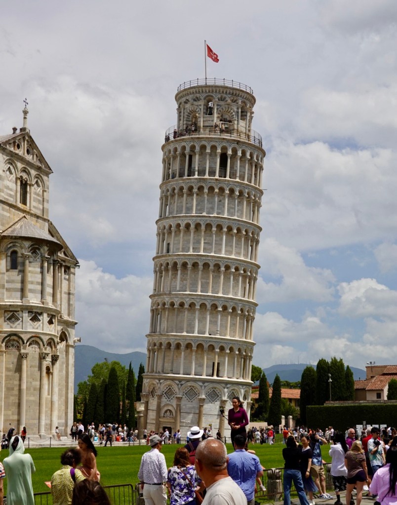
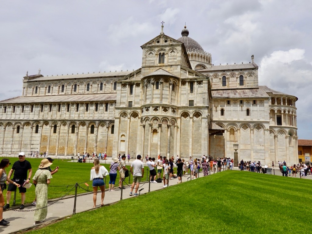
Arriving at the spot where all the tourists flock in Pisa we were amused by the tourists and the various poses they aim for with the famous leaning tower, Torre pendente as it is locally known, with all the direction signs labelled as such.
Torre pendente, the carrara marble used is particularly clean looking. Not sure if it needs treatment to stay that way, but it is ‘crisp’.
Torre pendente is the bell tower for Pisa Cathedral, located close by. The angle of the lean is quite significant and disturbing really. If it was our house it would likely be condemned, but this has had extra engineering works and safe for tourists to enter, so they say.
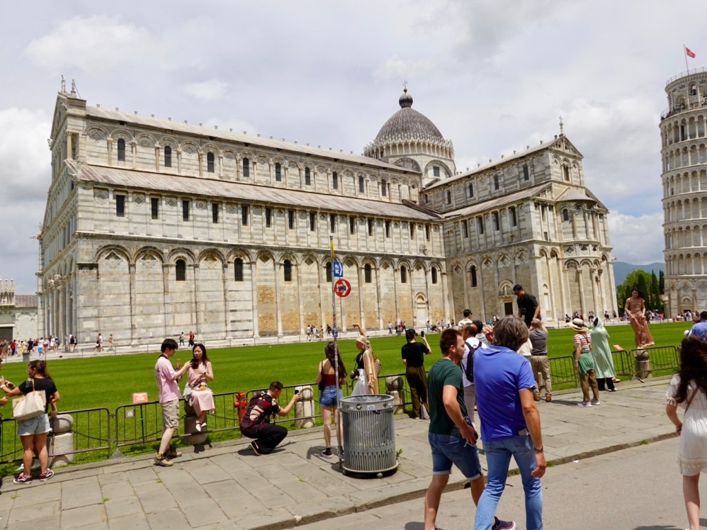
Pisa duomo (cathedral), construction began 1063, consecrated 1118Another view Pisa Baptistery, commenced construction in 1152, completed 1363.
We did not hang around very long in this part of Pisa, pushing our bikes through the crowds, we were keen to keep moving.
There was the usual assortment of junky souvenirs to be purchased, plus those blokes who sell ‘genuine’ well known brand watches!
Surviving Pisa intact, we were back on the open road, and some five km or so down the road found refreshment and shade at a petrol station that had a cafe/bar and umbrellas!
We headed onto another bike path, this one named Puccini. It was also rough and rugged and slower going but we enjoyed the no car element.
Some of the sights from the path.
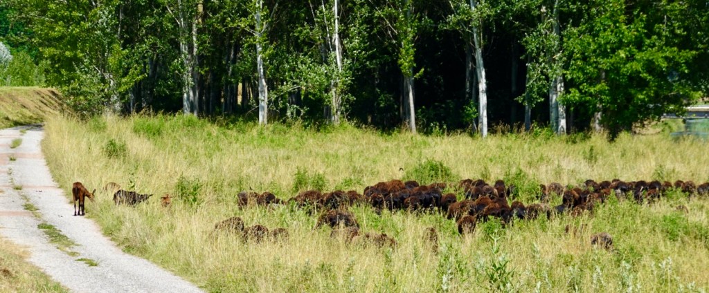
Group of sheep with a few deer joining them crossed our path. They were not overly perturbed by us.
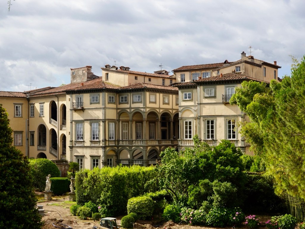
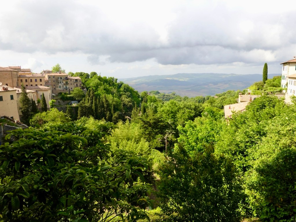
Our accomodation in Lucca is just outside the stone walls. After our usual showering and laundering we wandered through Porta san Pietro to the old town.
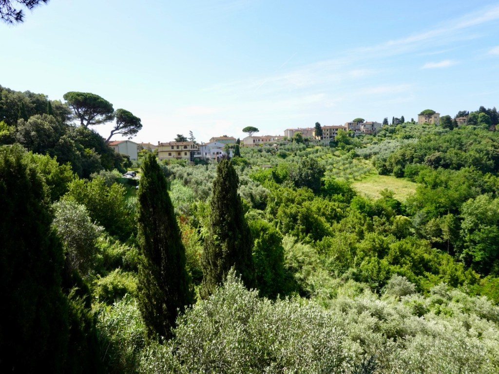
Initial impressions are the the town has more space than say Siena or Volterra, which are very compact.
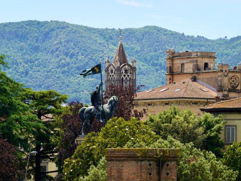
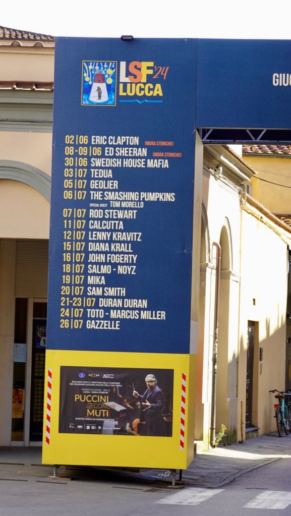
There are a nice range of older buildings but around them was much construction activity. There is an area with a huge stage and this is why. There are a few concerts there I would have been interested in and looks like Ed was recently in town.
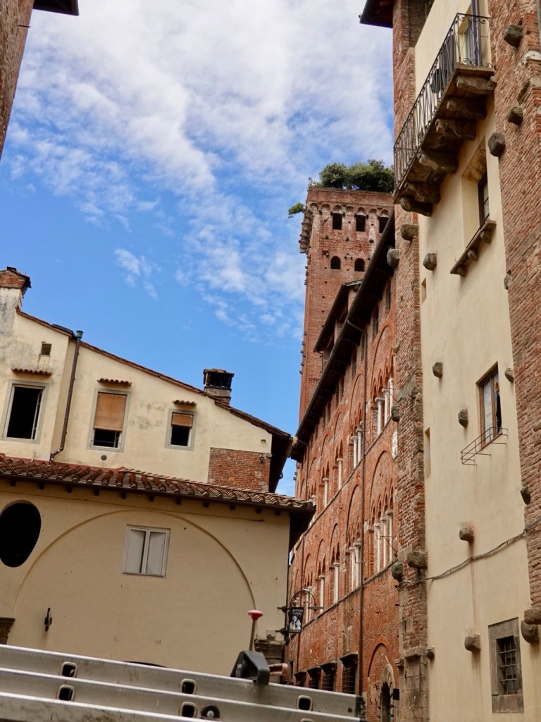
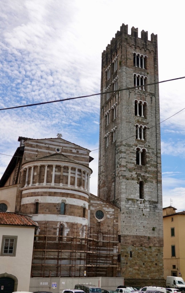
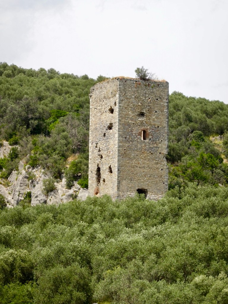
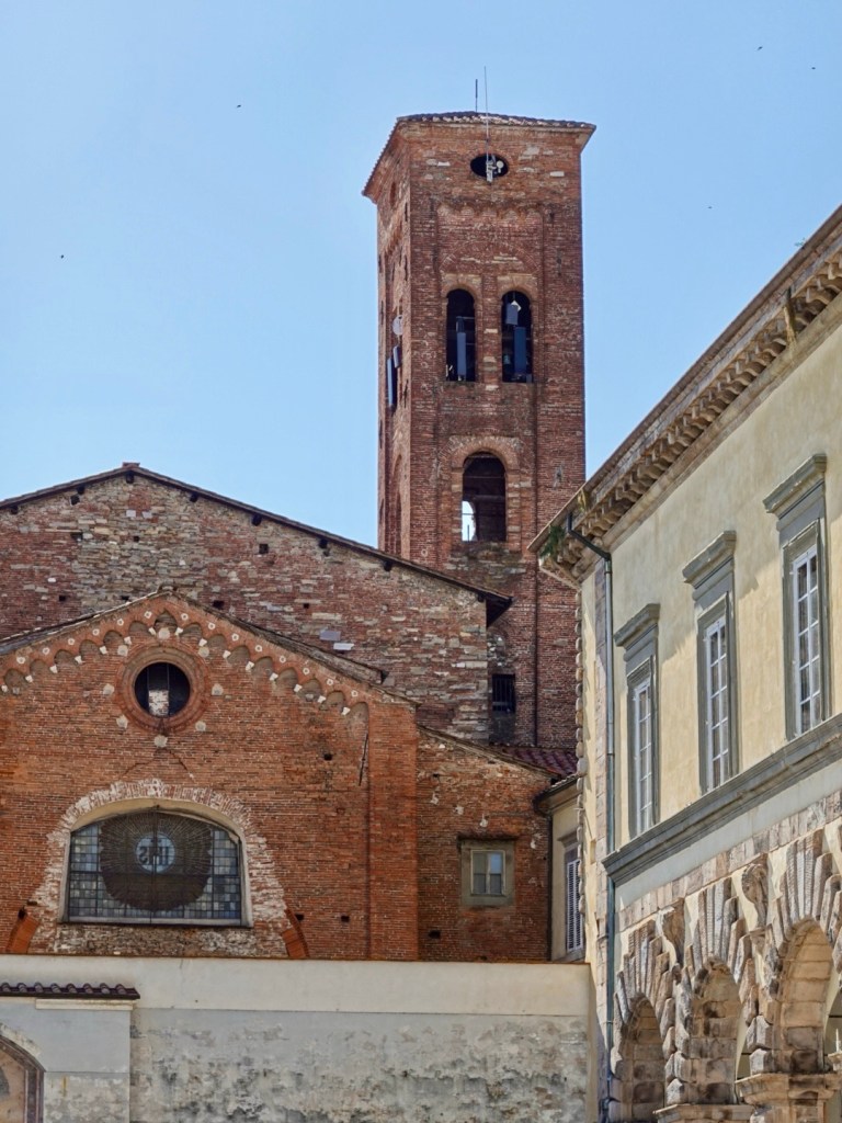
Towers are very popular.
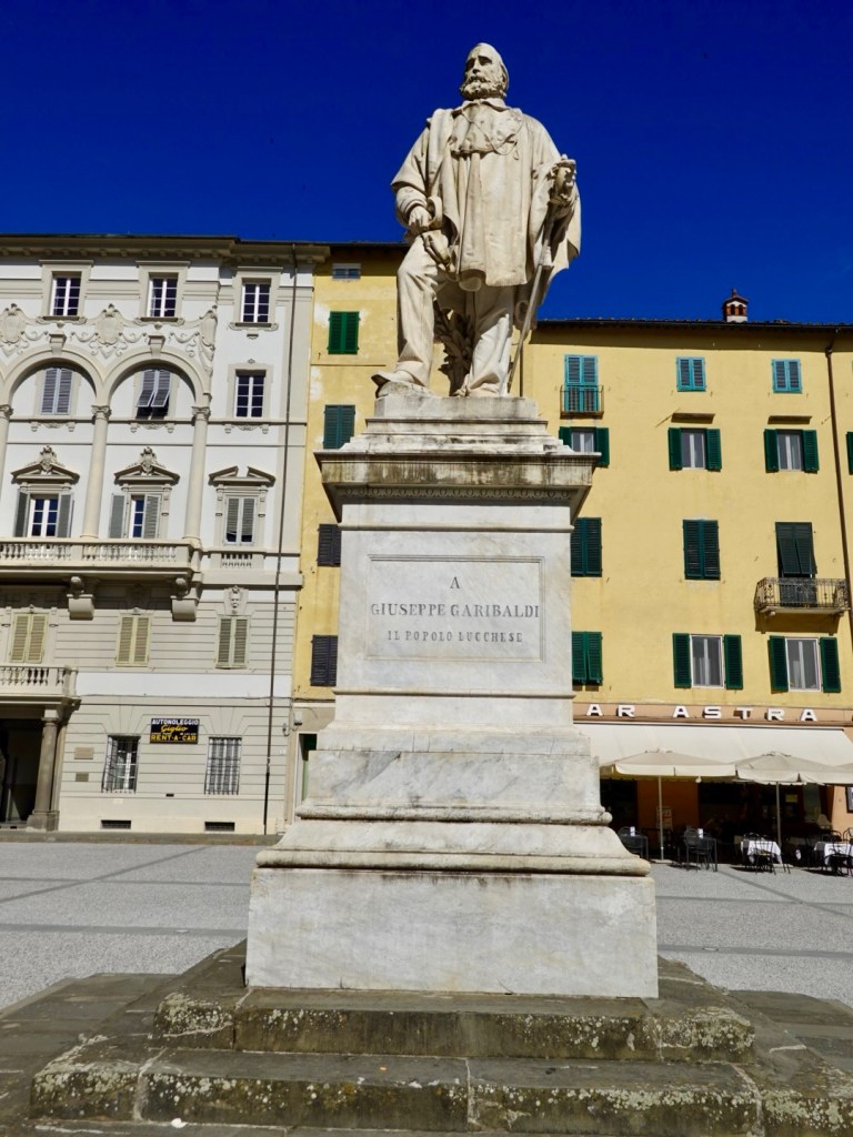
Garibaldi, an Italian general, patriot, revolutionary and republican. In his spare time he collected butterflies…maybe
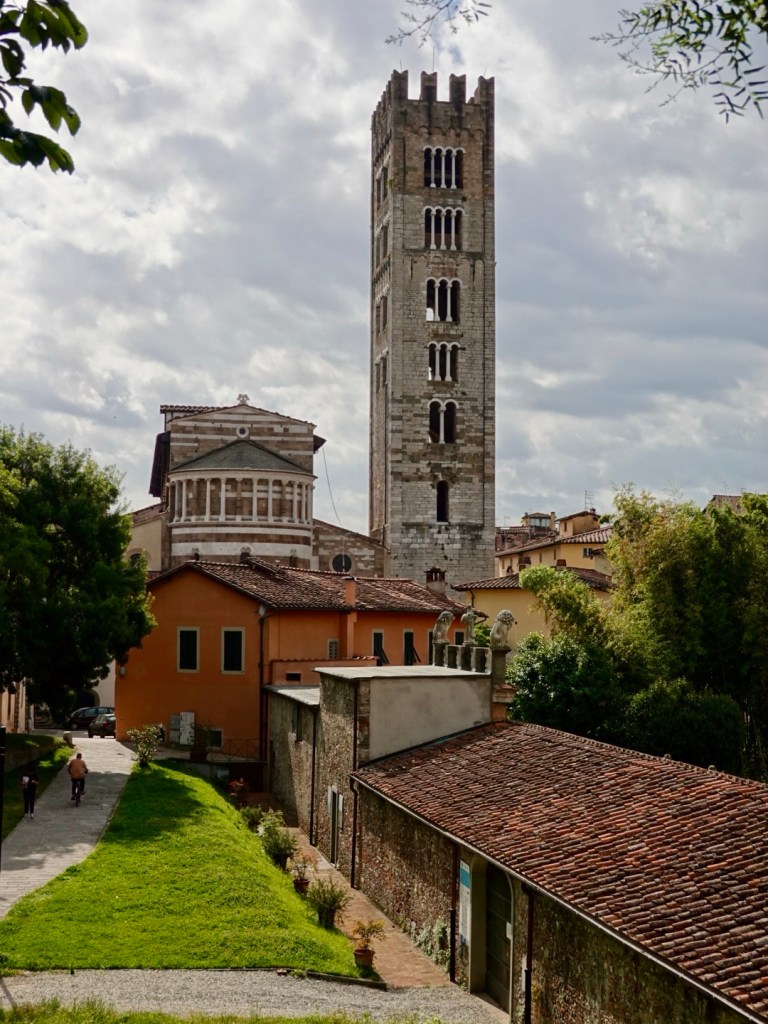
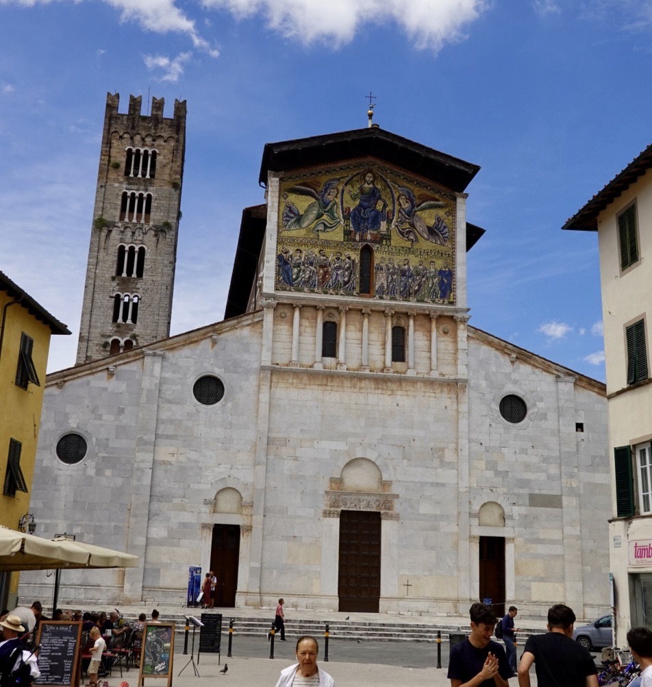
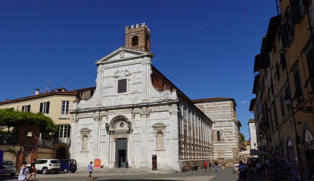
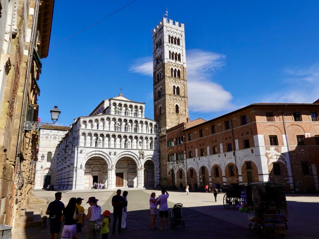
We headed towards the duomo.
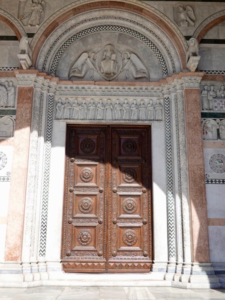
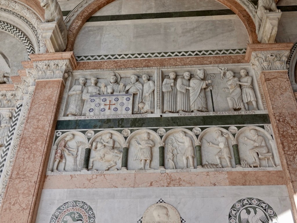
Construction commenced on the duomo in 1063. The great apse with the tall columns remain, with the nave and transepts rebuilt in the 14th century.
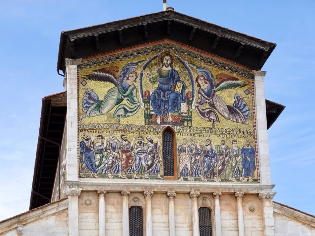
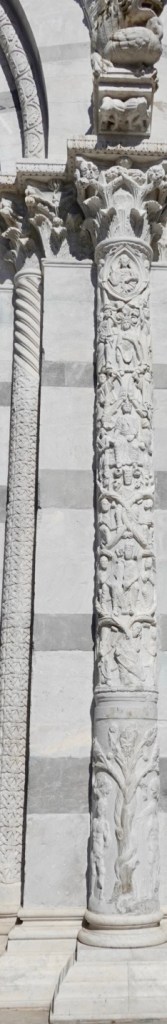
The front facade was from 1203 and has incredible detail Close up of one columnI do love these doors and carvings, so beautiful Incredible detail
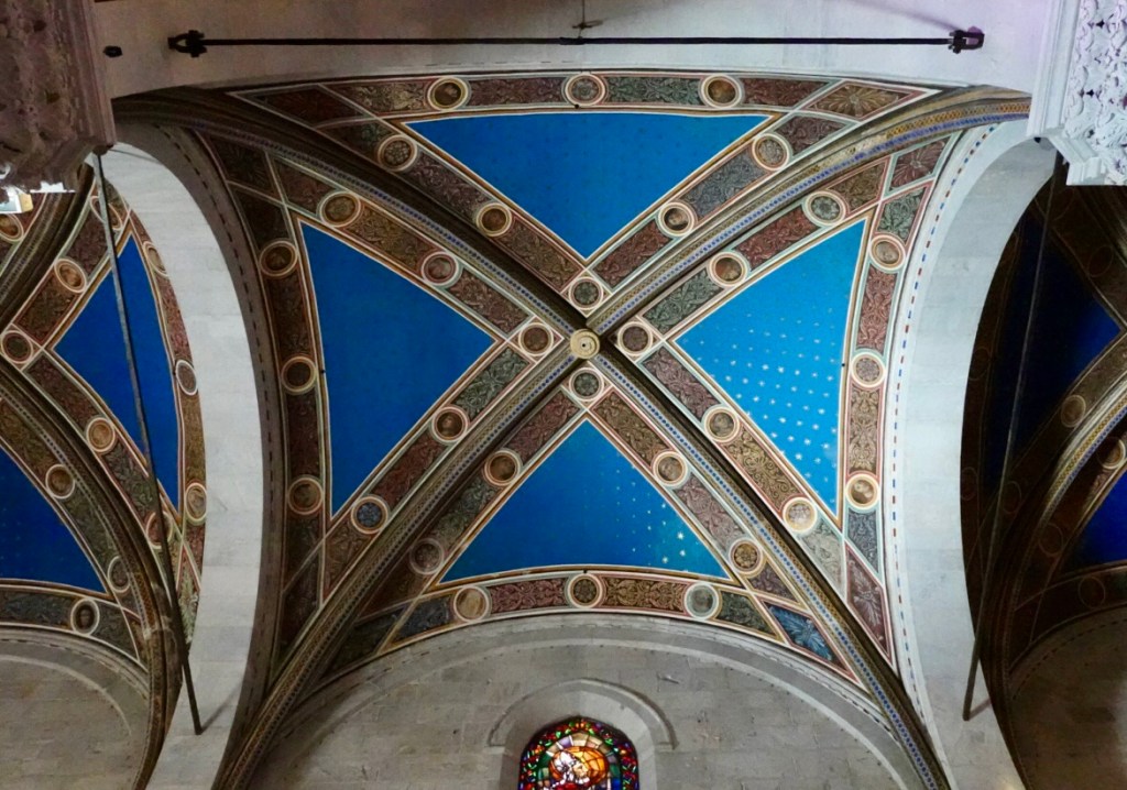
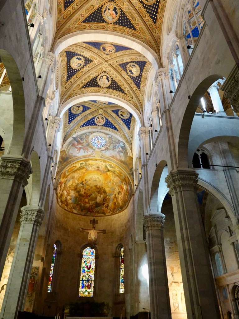
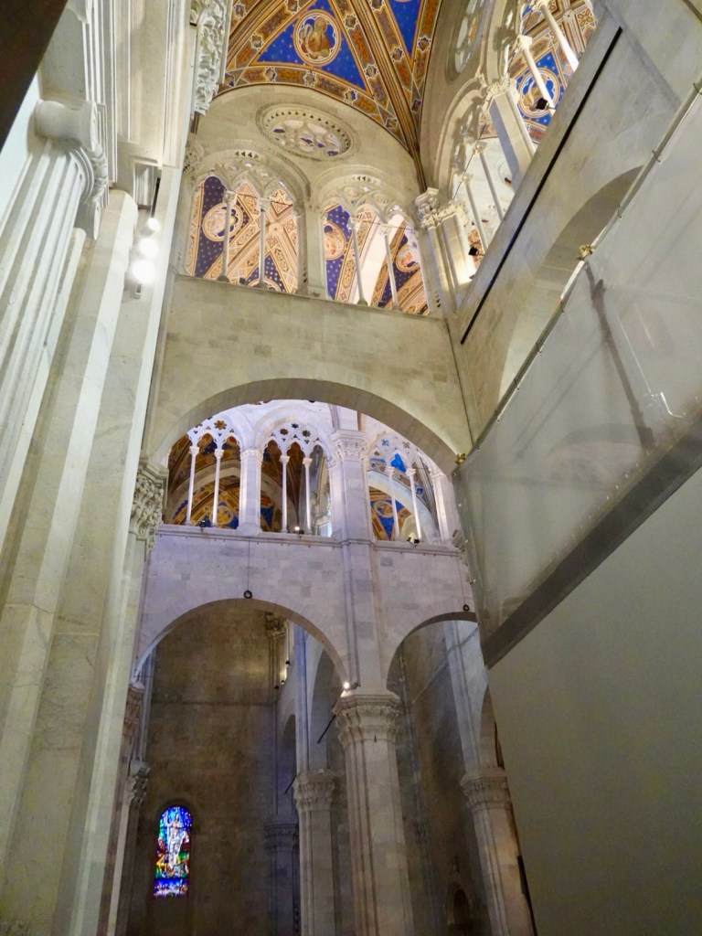
My interest inside these very old churches are the ceilings. The duomo has incredibly high ceilings and gothic arches. How on earth did they manage that back then, let alone the magnificent art work so very high up.
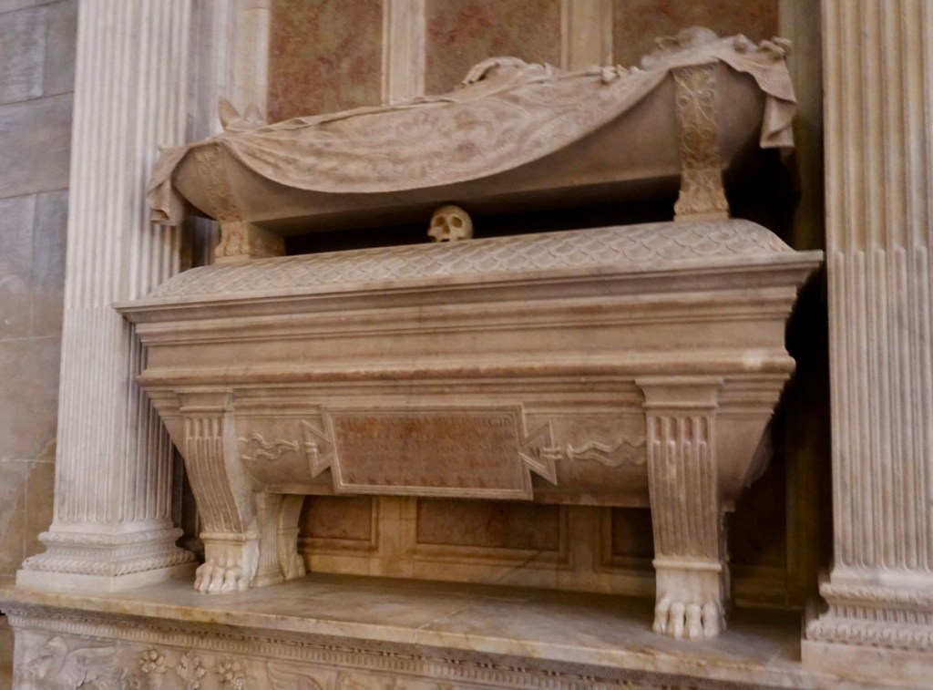
Looking up Looking up Looking up and along Just incredible constructionHard to get into one photo, but a floor mosaicThis intrigued me. Beautifully carved tomb, with what appears to be a skull wedged in there.
We had a lovely dinner in the town before retiring and contemplating tomorrow.
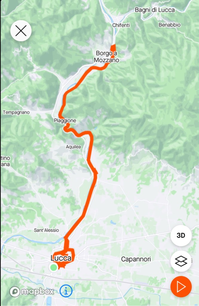
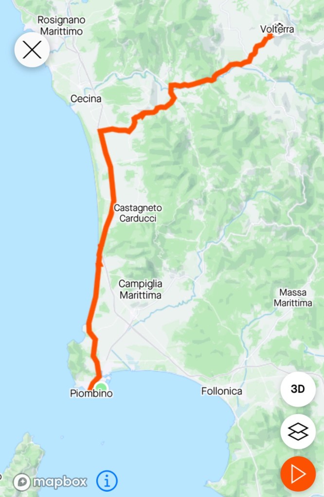
Today’s route and fairly flat day, bar one 2 km 5.7% climb.
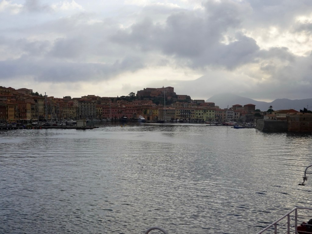
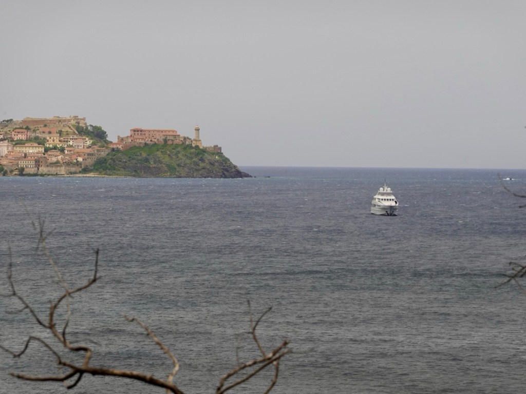
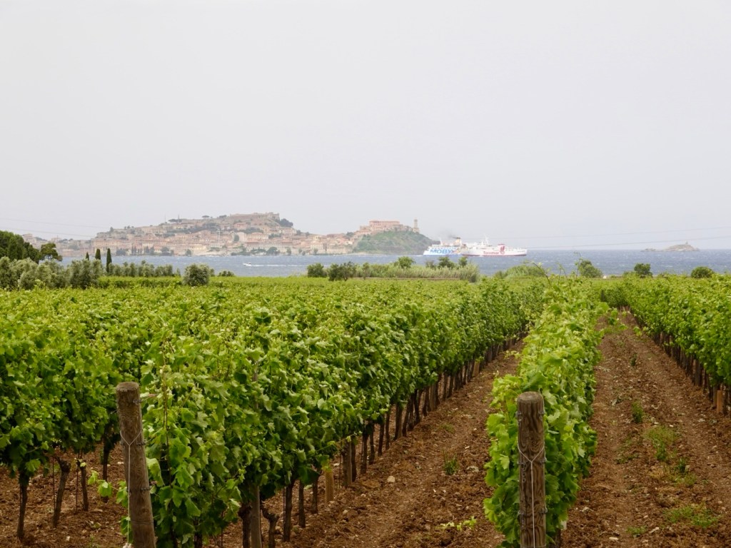
Up early to finalise our packing, dressing, and ride to Portoferraio for an 8 am ferry. Only a 10 km ride, and the road was fairly quiet until we hit the capital.
Nice view on the outskirts, looking up at Fortezza dell Volterraio.
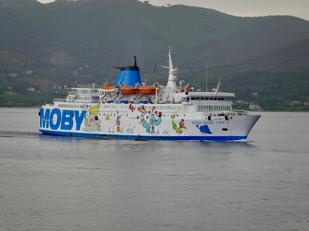
Arriving at the port and having our tickets checked, the guy offered us the opportunity of hopping on an earlier ferry that was just docking. Absolutely, as that would give us an extra hour in Volterra, today’s destination.
The ferry was fairly quiet, with less than a third of the vehicle deck used. Massive trucks were on board, dwarfing me as I stood there tying my bike up to the side rails.
We headed up to the top deck which was fairly cool once the ferry got moving.
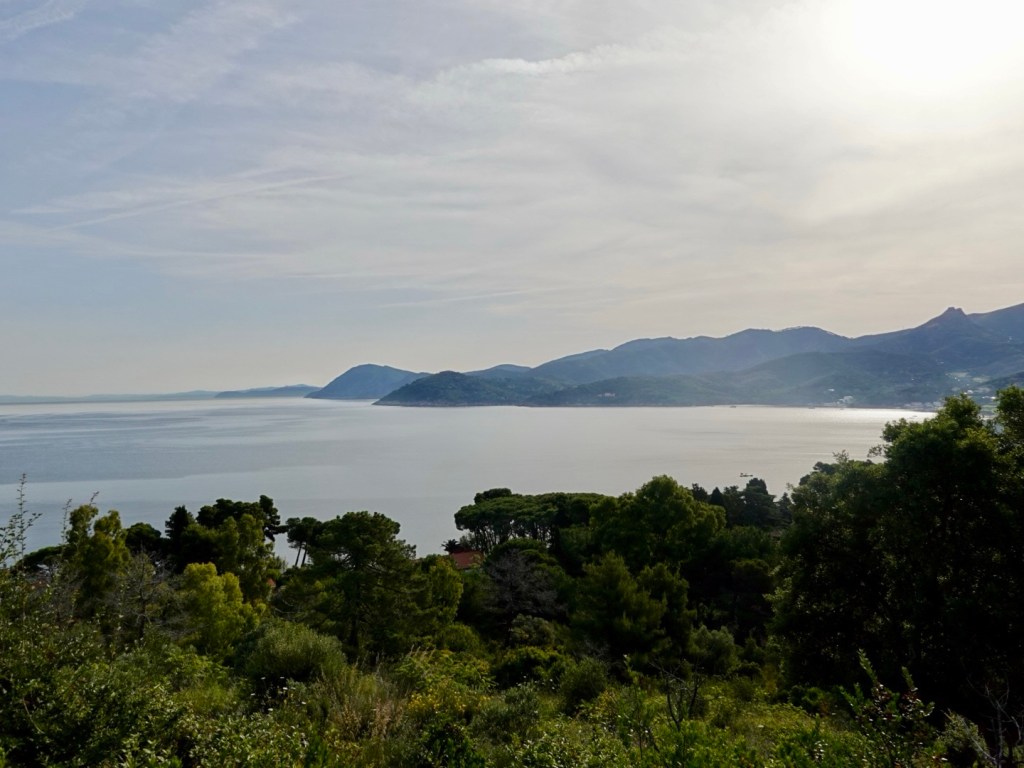
Some last views of Elba, an absolute gem of this trip.
Moby is another ferry company. All their ferries are brightly decorated.
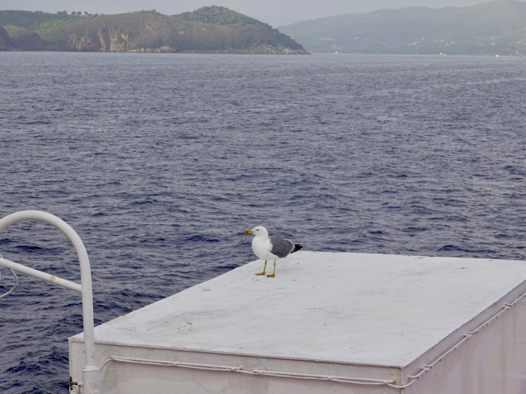
We watched this seagull hop on board and it sat there for 2/3 of the crossing and then flew off back towards Elba.
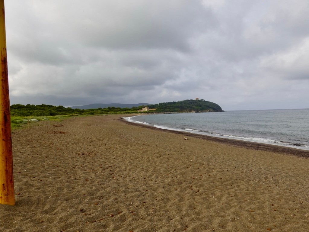
From our route map below you can see there was a longer straight stretch adjacent to the Mediterranean. Riding you could not see the sea as there is a strip of vegetation maintained with plenty of parking.
Interestingly EasyPark is all over Italy and you need a ticket here, despite no towns or villages for many km.
Did cross the vegetation to look at this section of beach though.
Looking southLooking north
A nice vineyard entrance gave us a reprieve for a short break.
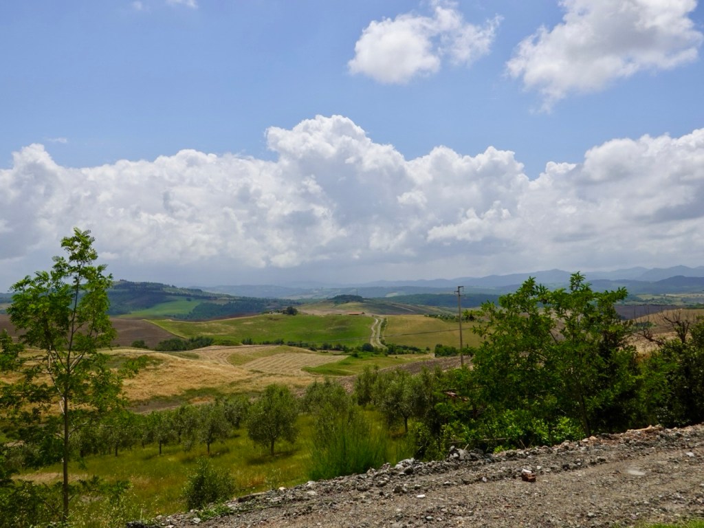
After 40 km of flat, headwind riding we turned to the north east. Hills grew closer.
The day was still overcast but becoming humid as there had been a little rain. Only sprinkles for us, but the rain had obviously been through before us as the road was wet in many places.
We had a few shorter climbs and up the heat was turning up as we started sweating more. The sun still had not quite managed to poke its head out.
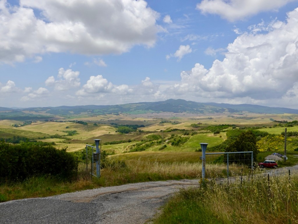
Hilltop town we rode below, Casale Marittimo On one of the shorter climbsNice Tuscan view
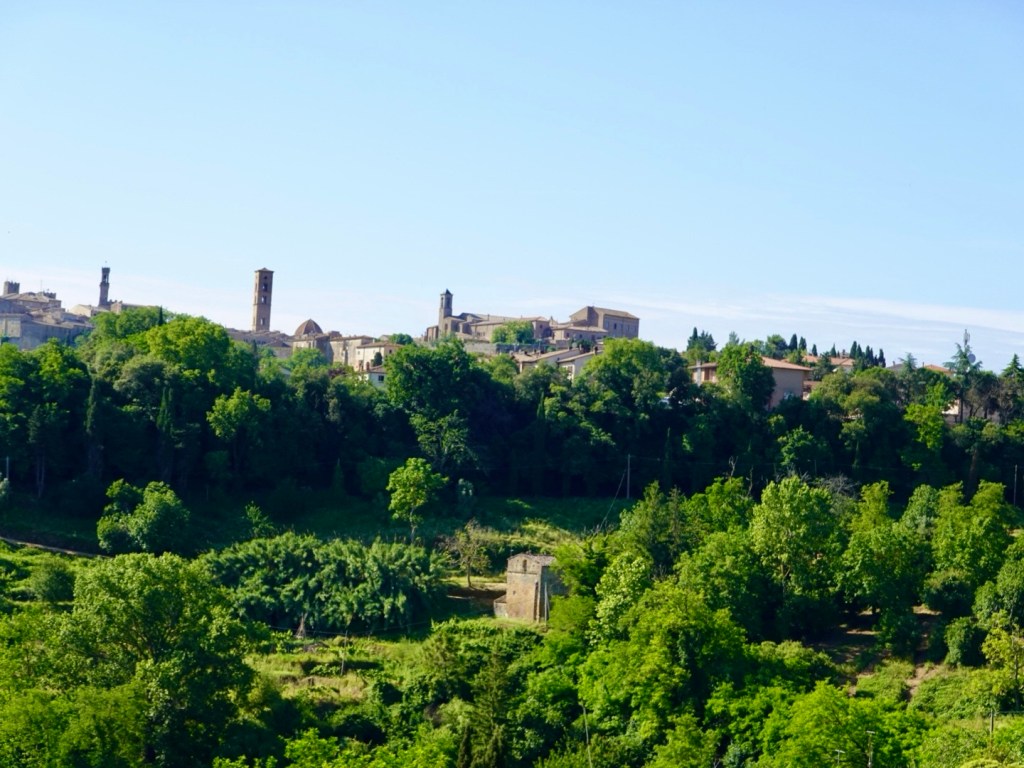
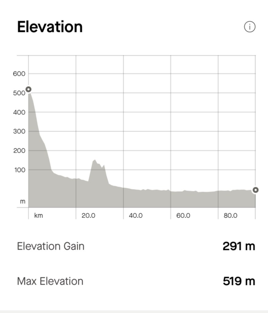
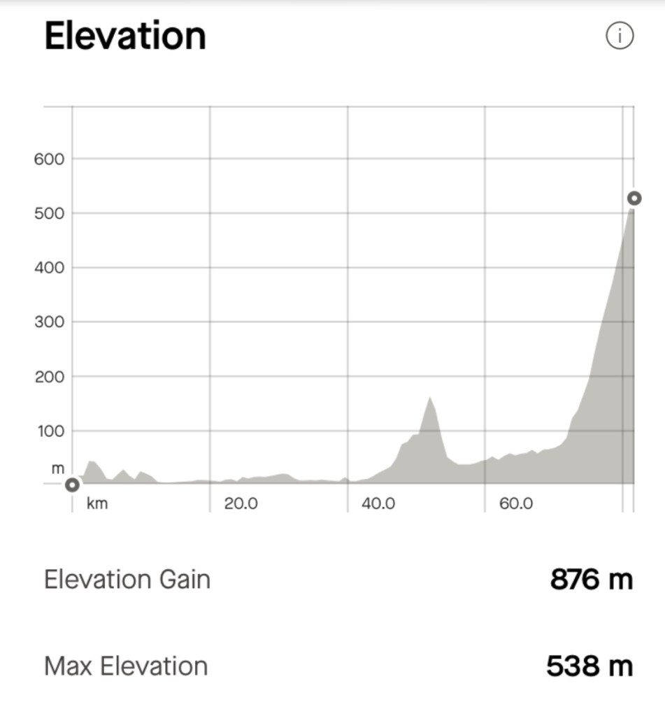
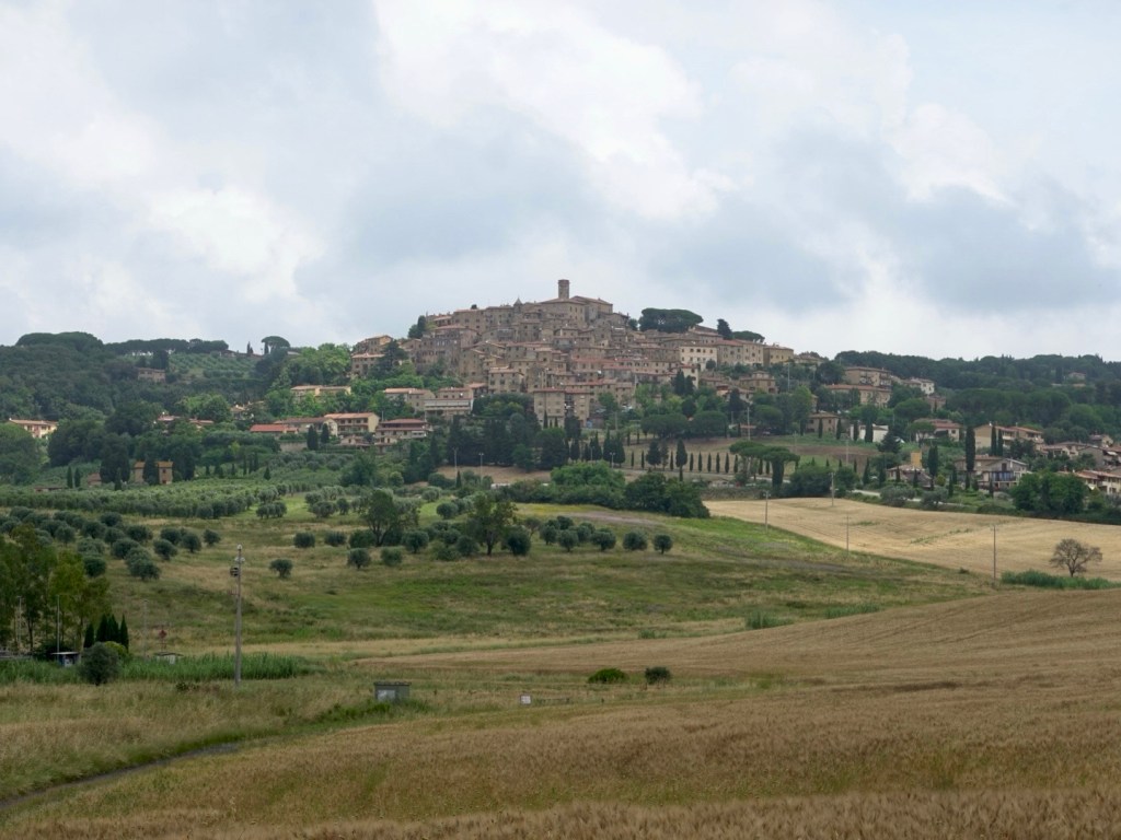
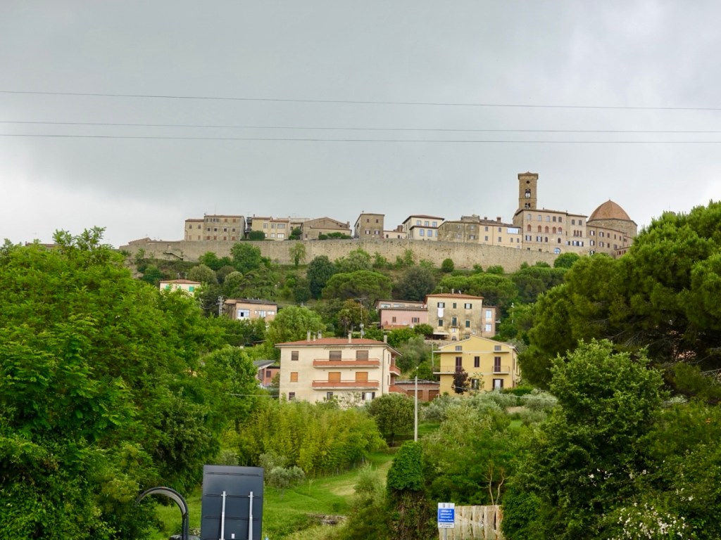
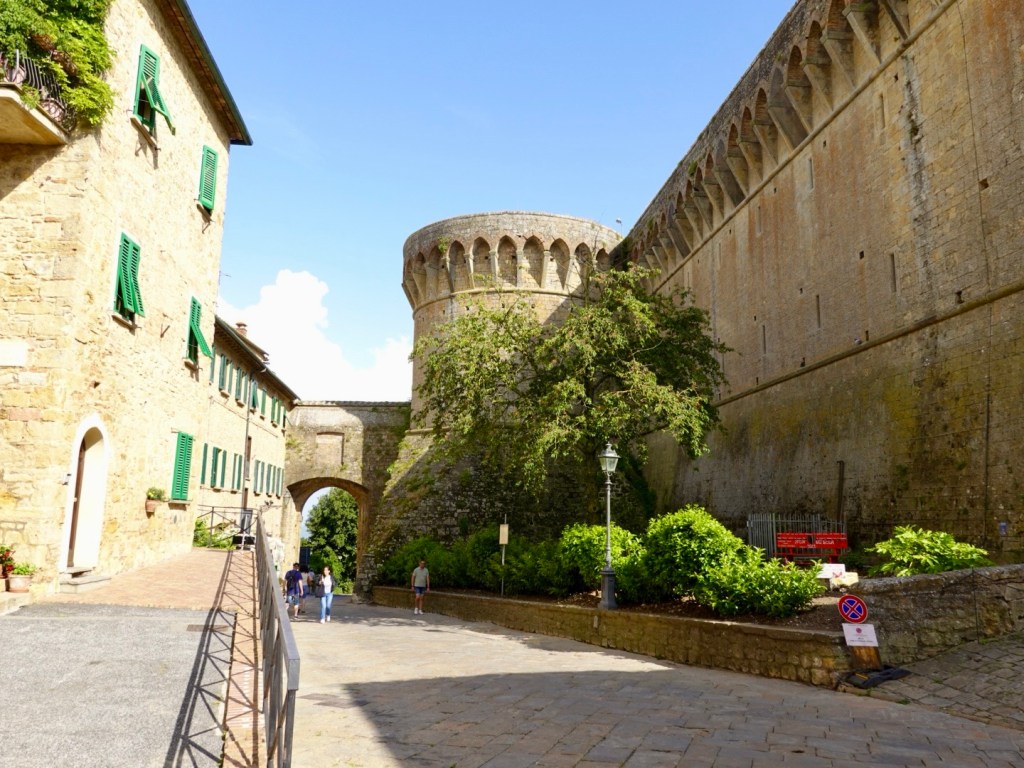
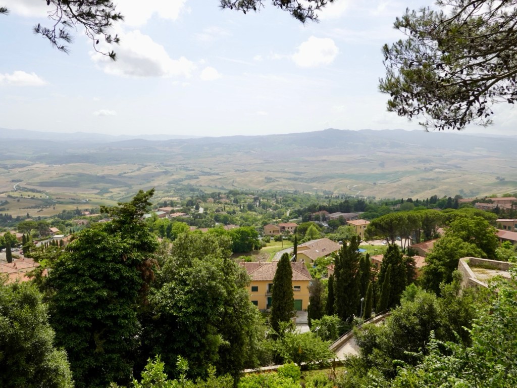
Finally our destination was in view. Volterra. Accomodation always seems to be at the top of a hill. In this case, a 10 km climb, 450 metres ascent. The first few km were very gentle, pushing the final 7 km to around 5.5% average.
It looked so far away at this point.
The climbing graph. The climb shows obviously.
A few photos during the climb. By now the sun was out, it was 32C, humid as we were drinking water frequently to try and stay hydrated.
The road was busy and you could guarantee the car behind you would want to pass on the right hand, steeper bend meaning you could not go out wider to a less steep incline.
Shade was non existent as it was very open. The best relief came when one of the big buses descended, generating a breeze as it passed.
Getting closer And closer…
The actual town starts about 2 km before the top of the climb. The last 500 metres was difficult as there was a tricky junction to give way, cross and climb steeply.
It was a huge relief to make the fairly flat, cobbled main street and I had indicated I wanted to stop at the very first gelato sign.
We both had two scoops of limone gelati! It was soooo nice.
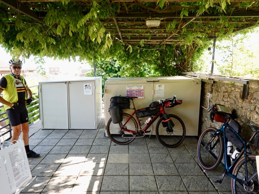
We found our accomodation easily but were quite surprised. It is a family run albergo and as we took luggage off the bike it disappeared and was immediately transported to our room, up three flights of stairs!
We took our bikes up the street, around the corner, up a very steep cobbled climb to the allotted spot where they said someone would meet us. It was their backyard and here was a young lad offering to take our bikes the last 10 metres, then an older man taking control of our bikes. We were like….what the heck? Who are these people? No one has that kind of interest in our bikes at accomodation!
The older man is the family patriarch, he has proudly built an amazing bike box with retractable roof, lockable doors, adjacent to their rooftop cafe.
We have never had any accomodation do this for our bike luggage or bikes before and we walked down about three flights of stairs empty handed to our room.
If in Volterra, come to Albergo Etruria, run by the Moretti family.
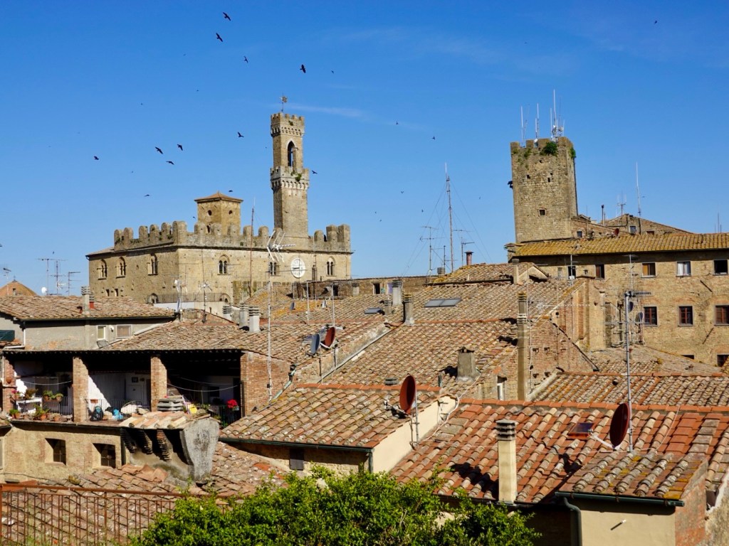
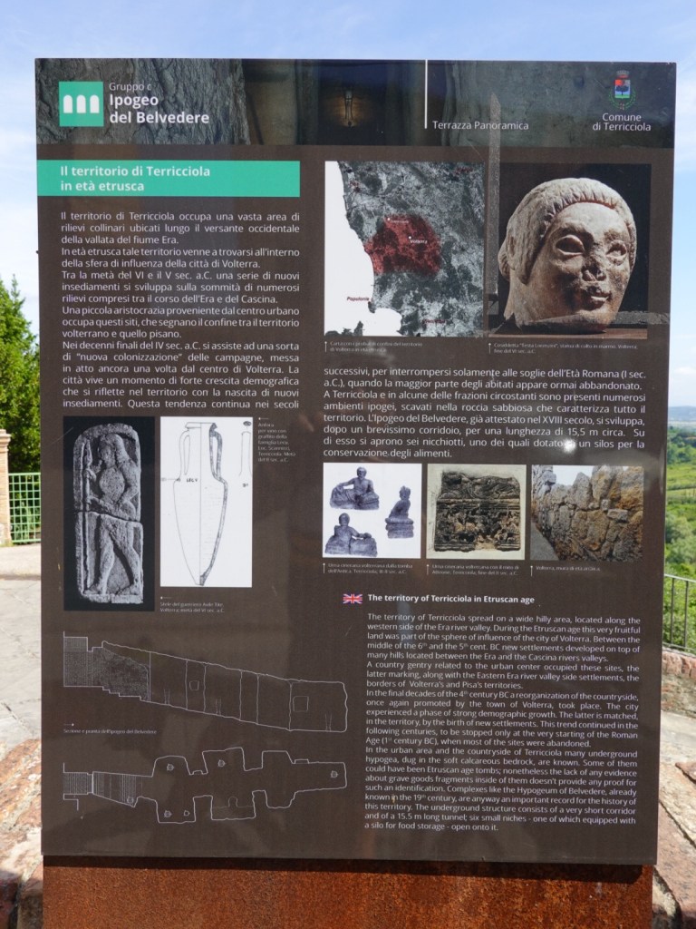
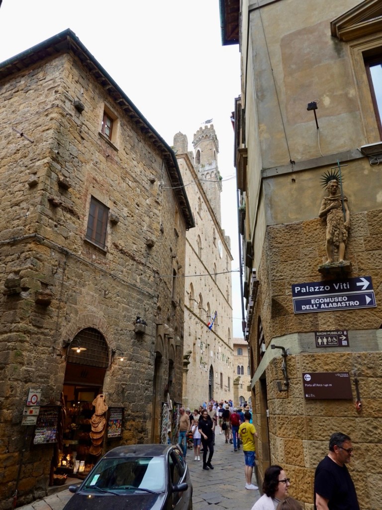
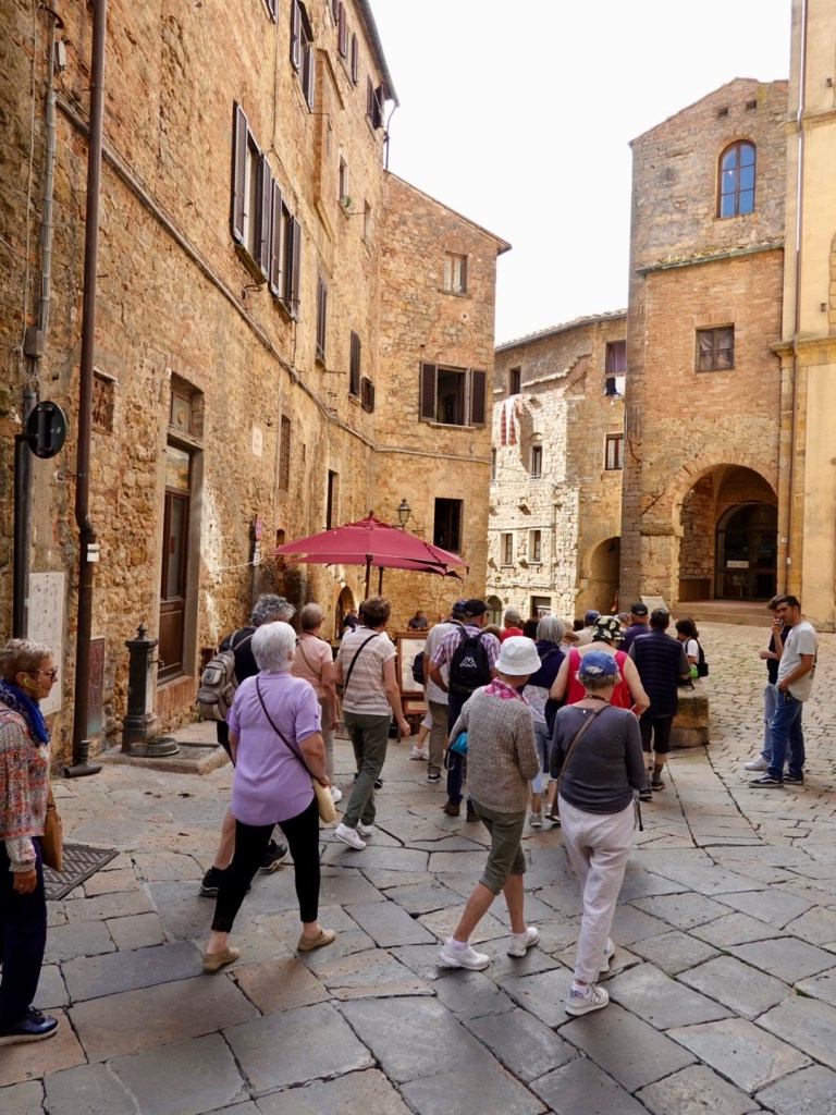
We spent a few hours walking around the town inside the old walls. The centre was transformed by the Etruscan’s in the 9th century.
Many current buildings seem to be from the 12-14th century.
Alabaster shops are frequent, as it is a local speciality. I watched one guy carving alabaster, no protection over his mouth or nose and wonder about alabaster dust and the lungs,
Photos from our meanderings.
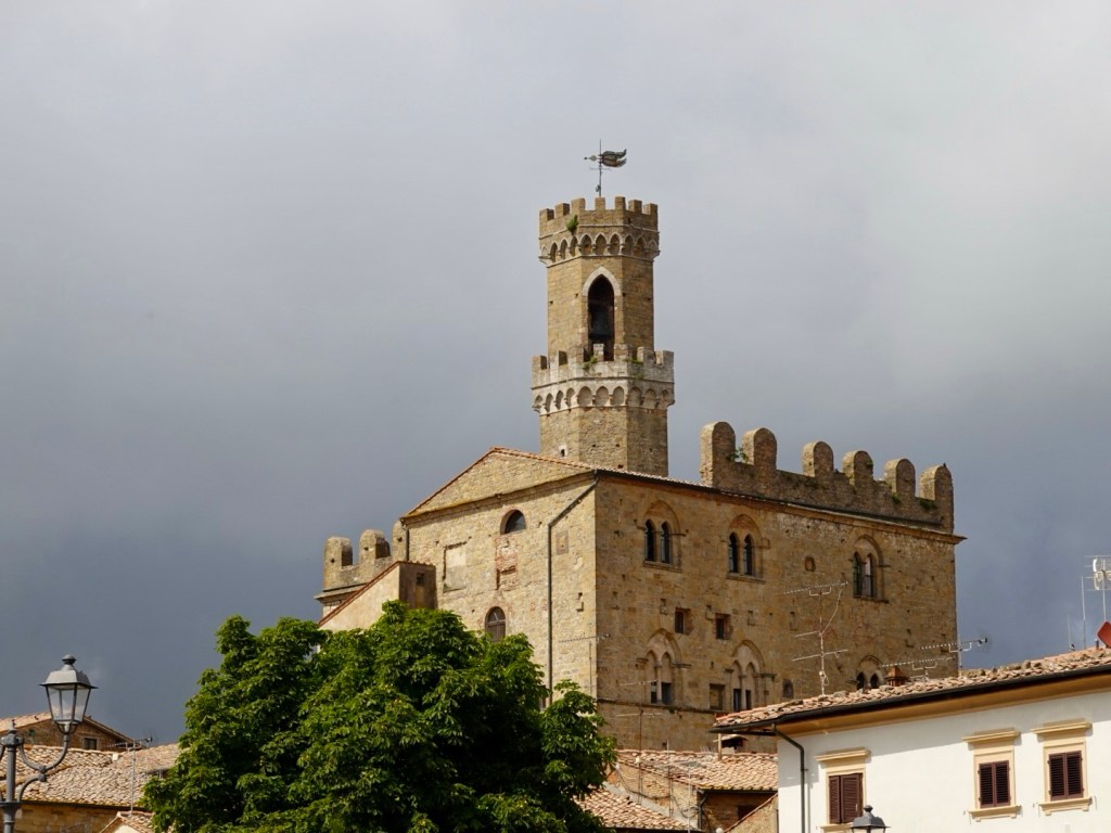
Palazzo dei Priori, commenced construction in 1208. It is the earliest Tuscan city hall, and still used for the same purpose today. The tower was rebuilt in 1848 after earthquake damage.One of the many alabaster shops.
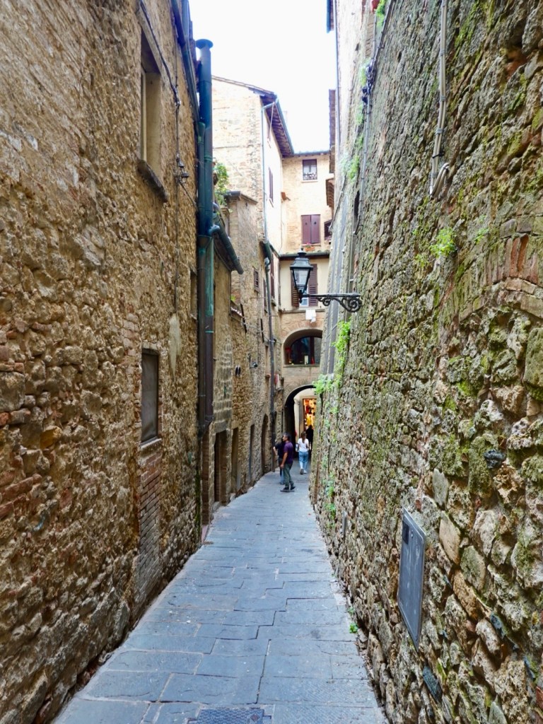
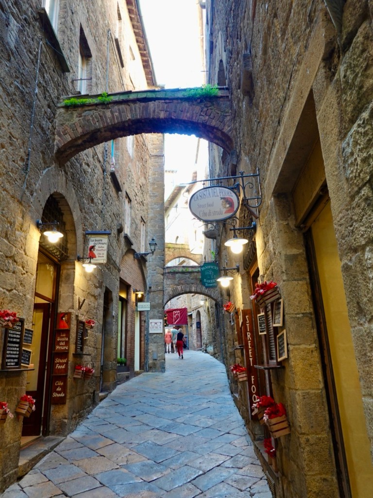
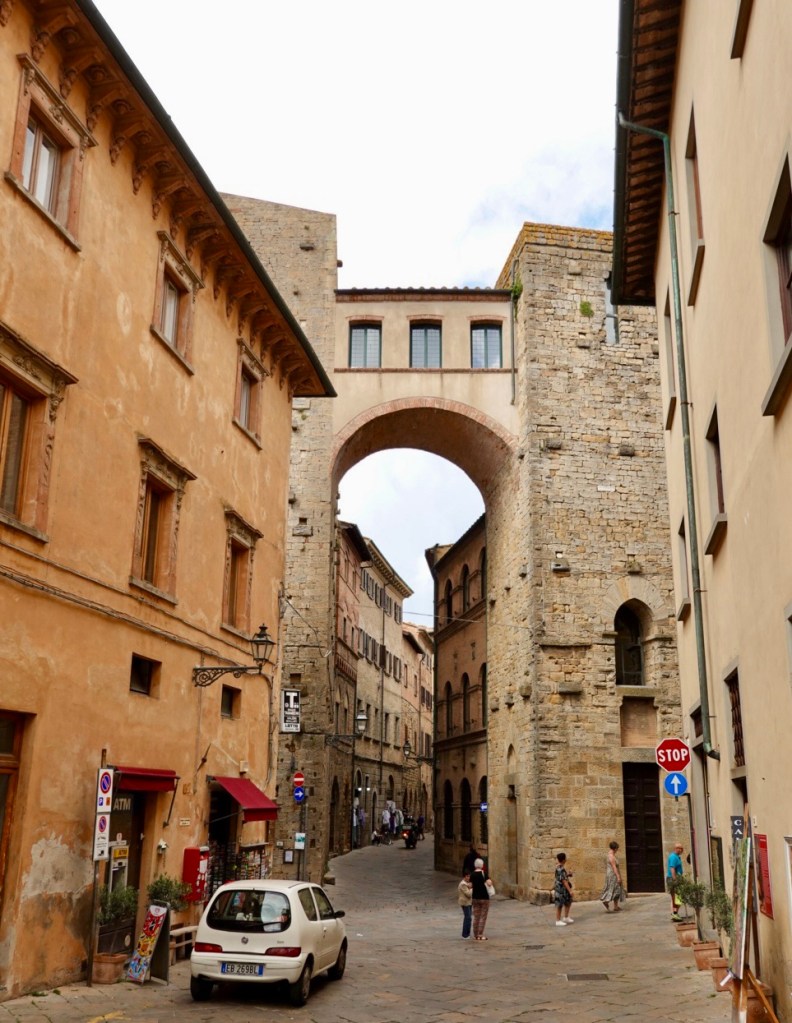
There are many narrow laneways.
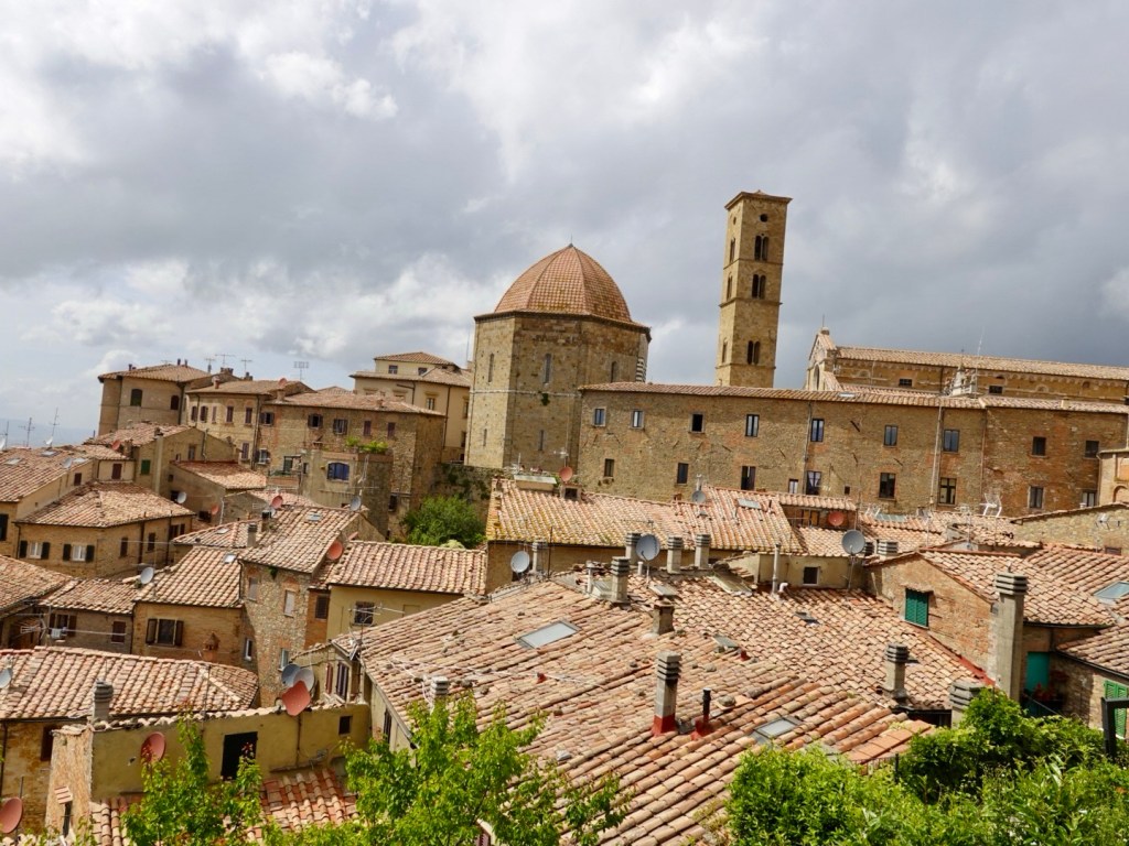
Wonderful old buildings and churches.
City hall from another angle
Colourful flags
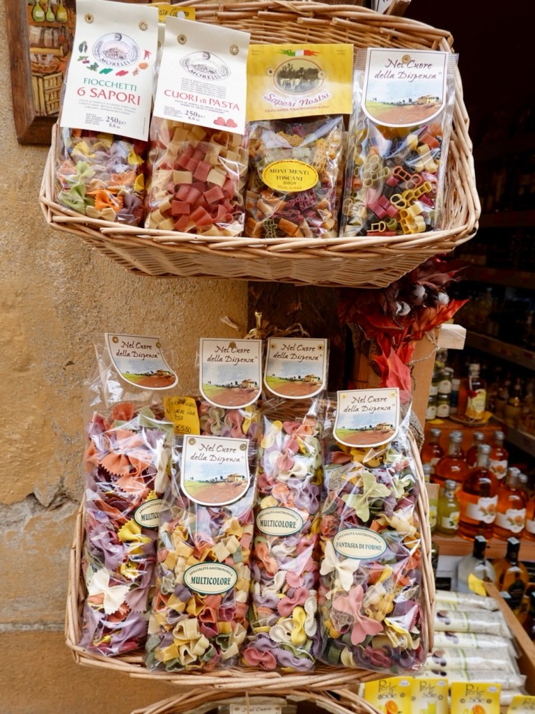
Colourful pasta
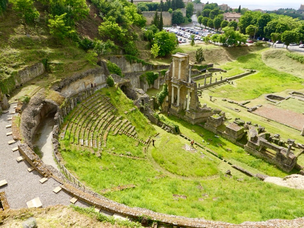
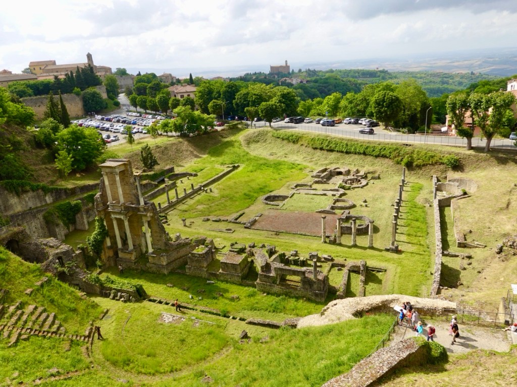
The old Roman theatre and baths were rediscovered in the 1950’s when excavations started for a sports field. There was not enough money available for an archaeological excavation so patients were used from a local psychiatric hospital to uncover the 3,500 seat auditorium and baths.
Originally constructed in the late first century, the theatre is regarded as one of the best remaining in Italy. There were three men busy with slashers working and I think when finished, the definition will be greater again.
Walking through the archeological parkEtruscan Roman acropolis remains, only seen today behind a wire fence.
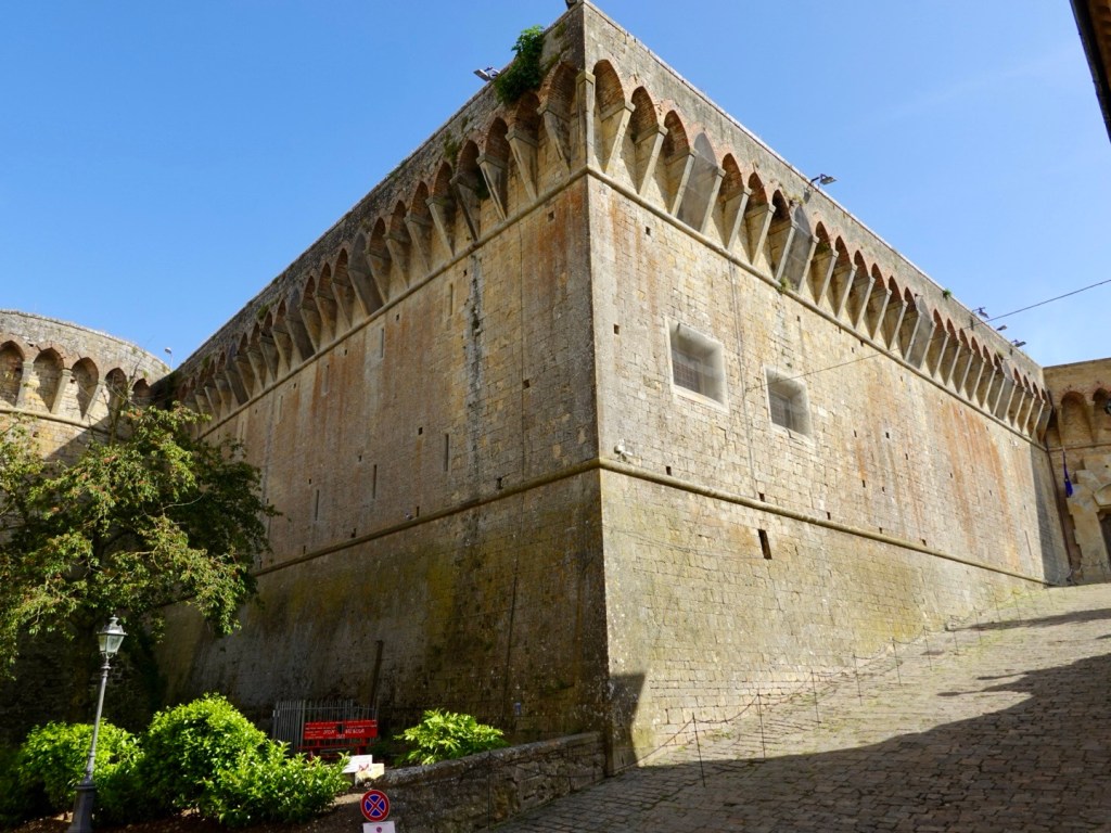
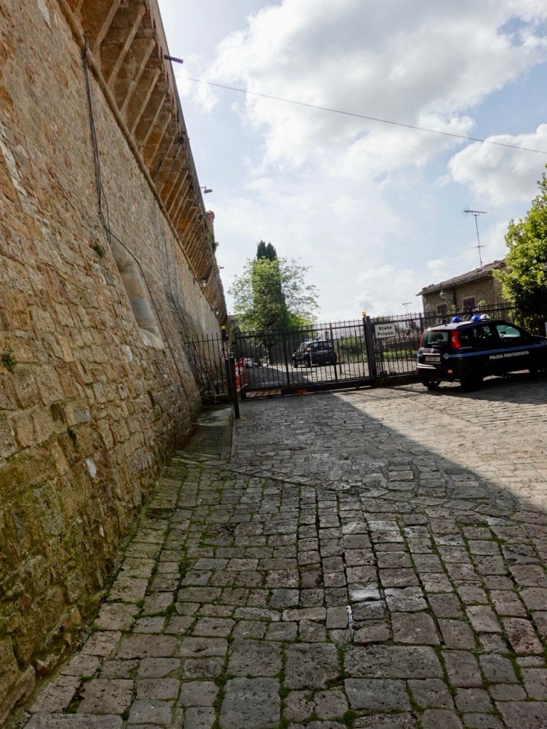
Walking up and around the old Medici fortress, we only got so far…
It is now a prison! I imagine the walls are super thick and impenetrable.
Some distant views from the walls.
Dinner time
Some restaurants have the ubiquitous bread basket in a brown paper bag. No plates, you just seem to drip olive oil over the bread and use your paper serviette for mess.
Ciao ciao, thanks for reading, another day in our adventures. 93 km and over 900 metres climbing. 😊❣️
We have not checked the weather forecast for days as it’s been the same, hot, hot, hot.
When we awoke today it was very cloudy hiding the sun, and the trees were blowing strongly. Strong winds of up to 37 kmh SW were forecast.
Whatever we thought! She’ll be right!
Today was to be another hilly ride, sporting climbs plus one super tough one in the wind.
Keep on spinning
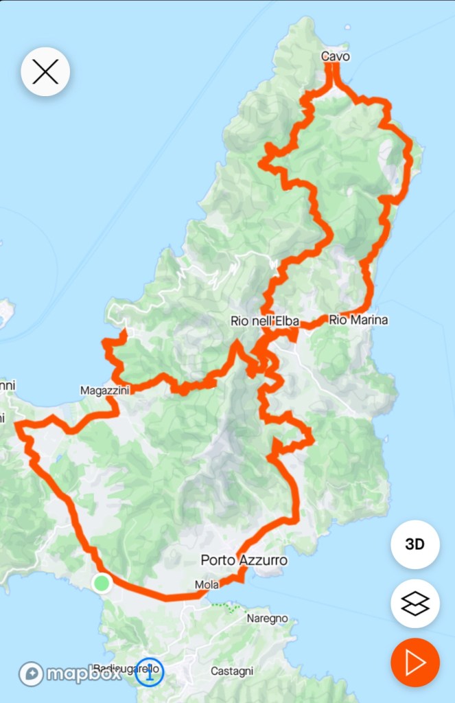
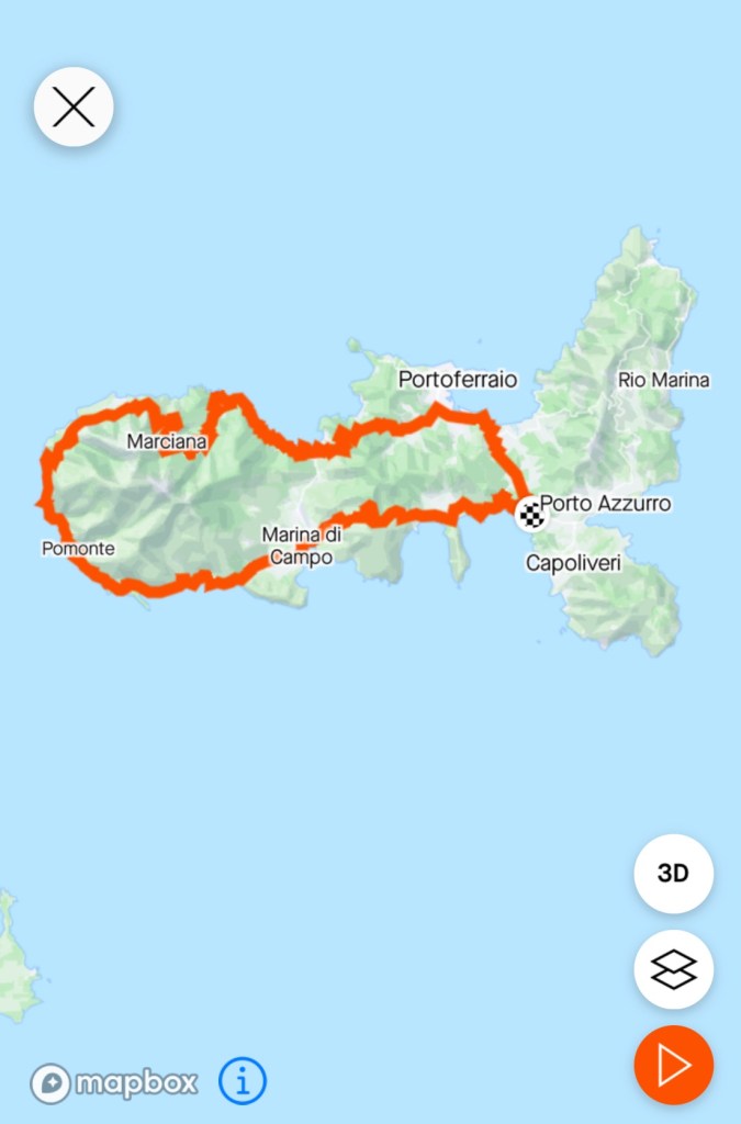
Today’s route was exploring the eastern aspect of the islands starting and finishing at the green dot in Lido. Basically a figure of 8, heading towards Port Azzuro, Rio nell Elba, Rio Marina, Cavo, back to Rio nell Elba, Magazzini, and back to Lido.
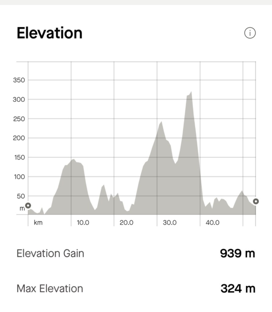
A total of 53 km, 939 m climbing. Back home by lunchtime, despite stopping for lunch and morning tea.
Port Azzurro is only 3.5 km from Lido so we reached that town first.
Resort pool along the way Looking up at CapoliveriPort AzzurroPort Azzurro
Climbing and descending was the order of the day. Given the lack of sun, the brilliant blue azure seas were not revealed.
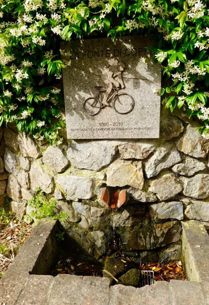
Hazy towards the sea gap. Mainland Italy in the background Hill villages Rio nell Elba where we would pass through twice, but at differing height levels.Quite dry landscapes in rocky soils Memorial to Fausto Coppi, the dominant international cyclist post WW2, rated second best Italian sportsman of the 20th century. Amongst many highlight wins, he won the Giro d’Italia five times and the Tour de France twice. He died in 1960 aged 40 from malaria.
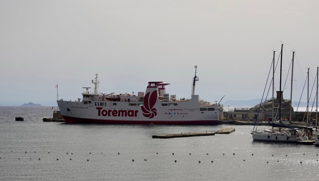
We stopped for a coffee break in the port town of Rio Marina, a port originally to transport iron from the island but today, a hub for ferries from mainland Italy.
Toremar, the company we used to cross to ElbaClock on the edge of the port RioMarina Starting the climb out of Rio MarinaStill climbing, looking back at Rio MarinaLooking east towards the Italian mainlandClear road on a Sunday morning, bonus.Heading towards Cavo
Leaving Cavo we had the longest climb of the morning at around 7 km. It was a nice climb, with the wind interfering only minimally climbing, usually on an exposed right hand bend.
Some photos from the climb. Not as many as Tony went into a competitive mode, catching three riders ahead and staying ahead, ha ha. I too managed to pass them, not that it was a race!
What goes up, must come down, and we descended back into the cross point of our figure eight at Rio nell Elba, heading back up for a nastier climb.
This climb was shorter at around 4 km, but more evil with 13-14% sections, very narrow road, with cars going both ways at times. You could guarantee a car at a right hand bend!
Right hand bends are the hardest as they are steep into the turn, and no option of heading left in case a car is descending on the narrow road. In addition the fierce winds hit us at those bends (side on often) pushing you towards the right hand edge.
The evil ascentGetting higher And higher…The Toremar ferry we saw at Rio Marina heading back to Piombino on the Italian mainland.Rio nell Elba, again!Great views up here An old castle, Fortezza del Volterraio, Etruscan origin, expanded by the Pisans in 1200’s, strengthened over the centuries as a defence base. One of its claims to fame, is that it is one of the only places on Elba not to have been raided by Turkish pirates. Having ridden on the nearby road, seriously think there may have been easier pickings for the Turks!
The descent was hairy! The wind was extraordinarily awful, it started to spit with rain, the road very narrow and steeper than what we had just climbed.
A very slow and controlled descent by me particularly given the number of bends and barely one car wide. I think I could smell my brakes!
Looking towards the capital Portoferraio, numerous ferries on the move.
Once we’d completed the shaky descent we decided to go to the nearest local village to sit out the spitty rain. We headed to Bagnaia,where not much was happening, I guess due to the crappy weather.
Nice chateau Looking over the bay
Bagnaio is a pebble beach offering a range of aquatic activities. Today, most were sitting in the local cafe. We stopped and had a light lunch, watching a sand storm gust through that left our bikes filthy!
Bagnaia bayPebble beachColourful roundabout
Feeling replenished, we left the village and immediately went into a short climb that had a 13% pinch. The cold legs did protest much!!
Portoferraio Portoferraio
The afternoon we decided to chill. Tony got to work cleaning our bikes.
Washing is done and is out drying in the wind. It is still warm despite the wind and has been in the mid 20’s.
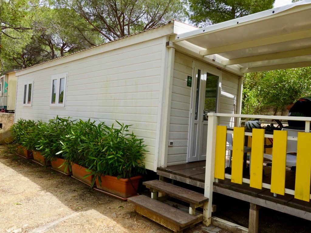
Our unit. The view from our deck, including eucalypts over the lower unit.
So tomorrow we head off early. We will be on the road by 6 am to ensure we are at the ferry with time to spare, or enough time to cover a contingency such as a puncture.
Hard to believe that this time next week we will be well on the way home.
With two full riding days available on Elba Island, we had two routes mapped. One covering the western section, the other the eastern section.
Today we tackled the western section totalling 77 km, 1291 m climbing.
This ride is possibly our favourite ride ever…possibly….there is a fair bit of competition, but it is certainly right up there.
What made this ride rate so highly? Was it easy? No way, it is a tough sporting ride, with punchy ups and downs and a couple of tough climbs.
The temperature was hot, for us, around 30c and quite humid. We melted.
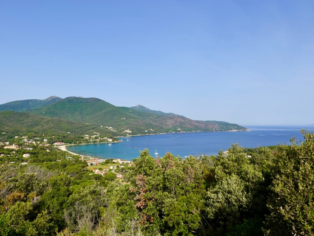
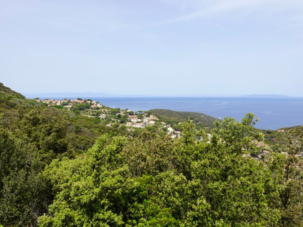
This ride is amazingly beautiful and challenging gaining heights that provided extraordinary vistas, the most incredible blue azure seas, views over the distant Corsica (France) and old villages.
The vegetation was typical Tuscan scrub, with patches of green in gullies, otherwise quite dry. Very rocky outcrops.
We rode in an anti clockwise direction, meaning the sea views were closest to us (remembering Italians drive on the right hand side of the road).
We started by heading back towards Portoferraio on a road we are not particularly fond of as it is busy, but there was this nice vista looking towards the eastern section we will head to tomorrow.
Elba has over 80 beaches and it is not possible to check them all out. Many are down very steep roads, people parking up higher and walking down. I think a small boat would be wonderful for such a reconnaissance.
We did ride into Procchio though. It was only about 9 am there were few beach goers with the temperature already being in the high 20’s.
On we continued, up and down and around the coast.
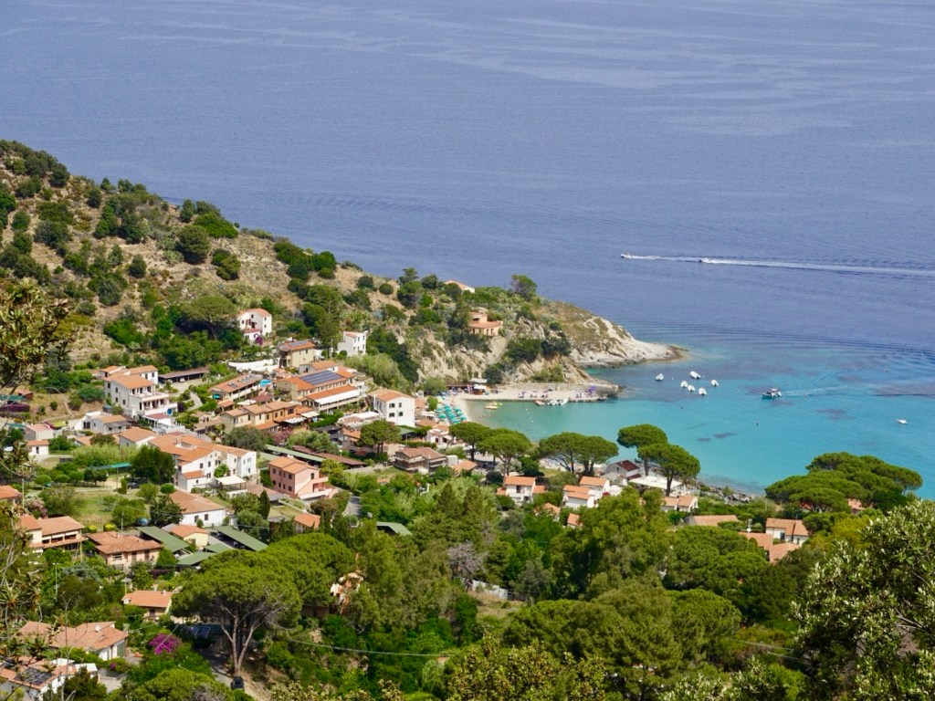
Easterly vistaIsland off Spaggia della Paolina Marciana Marina is the name of this village, it does also have a marina.A Napoleon remembrance outlook as we descended into Marciana MarinaPredominantly a pebble beach, there is a small section of sand beach to the west
There were 13 registered climbs per our Hammerhead bike computer. We were now at the point of one of the longer ones. The tallest climb below. It was 5.7 km in length with some steep pinches over 10%, but doable despite the over bearing heat.
Looking back down at Marciana Marina on the way up.Poggio, a hill top village, on the way through, the top of the climb being a few hair pin bends above the village, so we did not stop.
There is another shorter climb after Poggio to take you to a higher village, Marciana.
The view from Marciana looking back again at Marciana MarinaNearly at the top of the climb at Poggio
Some of the views.
Looking towards MarcianaWe stopped at this little shop for some food and drink in MarcianaMonte Capenne, the highest peak on Elba at just over 1000 m. You can walk up or take the cable car.Poggio
We then rounded the cape to ride along the north west section of the island, heading south along the western section.
The land was increasingly barren and windy, with distant views to the island of Corsica (France).
Diving
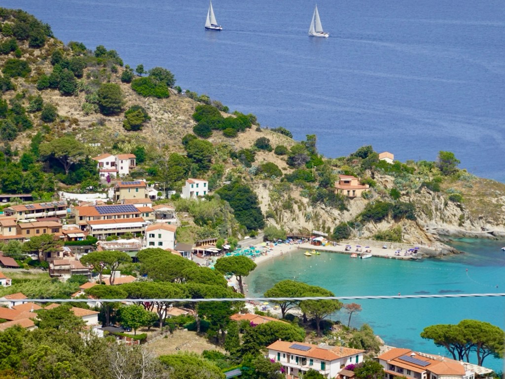
An area we liked was Fetovaia, regarded as one of Elba’s most exotic beaches, sheltered from most winds.
FetovaiaFetovaia
On the home run now along the southern coast, numerous more beaches, and one nasty 3.5 km climb that we found tougher than the longer, earlier one.
This climb had multiple sections well known excess of 10% for extended periods. I was regretting not having found an early lunch.
With our home beach of Lido in the far distance the remaining challenges were two small hill climbs, one of which was on gravel.
We were very satisfied with this ride as tough as it was. Truly a sporting loop for self powered road cyclists.
A chill for e-bikes many who were dressed for a picnic, no helmets, and the rent a mopeds, wearing no shoes, hair flowing.
An interesting note on helmet use with bikes. I think 100% of road cyclists ( Lycra clad wearers) used helmets. E-bikes, some did, some had strapped to,the front of their bike ( super useful if they crash…not) or had no helmet.
In Australia they are compulsory and I am all for them as my fractured stapes and subsequent conductive hearing loss and epilepsy both believed to be from a head knock I had with a fall on a busy road when I was 20 from a bike, pre helmet days (per my neurologist and ENT).
We demolished the food in our fridge on our return, had a shower and a nanna nap! Later we made it to the beach for an earlier dinner.
I highly recommend Elba Island to anyone wanting to visit Italy!