Hanging out on dirt roads.

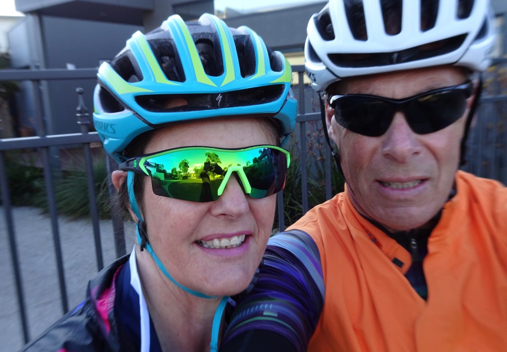
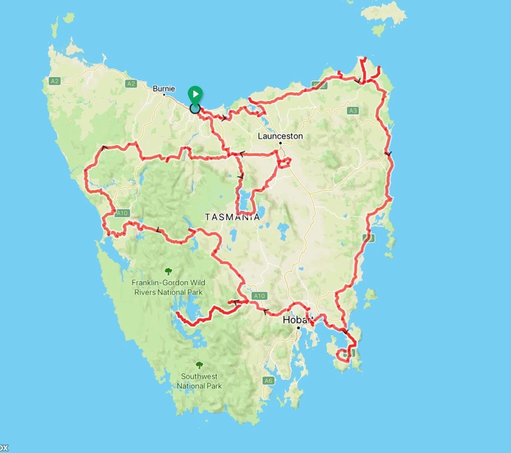
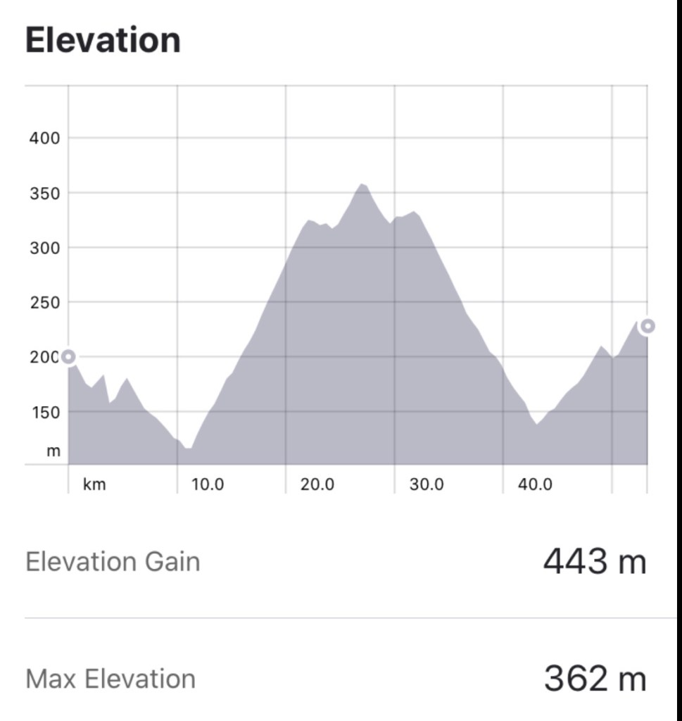
We awoke early, had breakfast, packed and were in the road by 6.40 am.

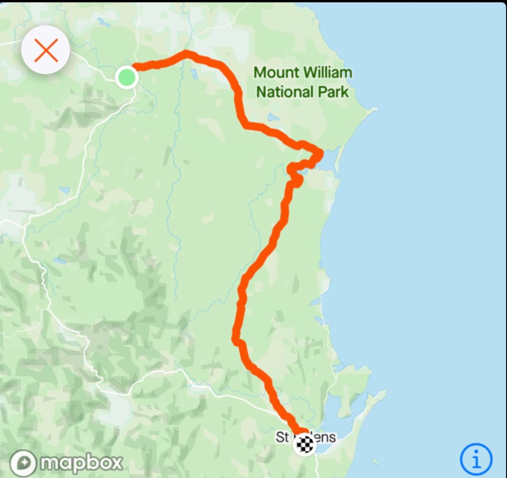
We had discussed various routes with Angela, one of the pub owners the night before and had decided to take the dirt road option to St Helens. Why? Well certainly not due to my β€˜ love’ of dirt roads, as you would all know now that dirt is not my favourite option.

We chose it simply to minimise traffic.

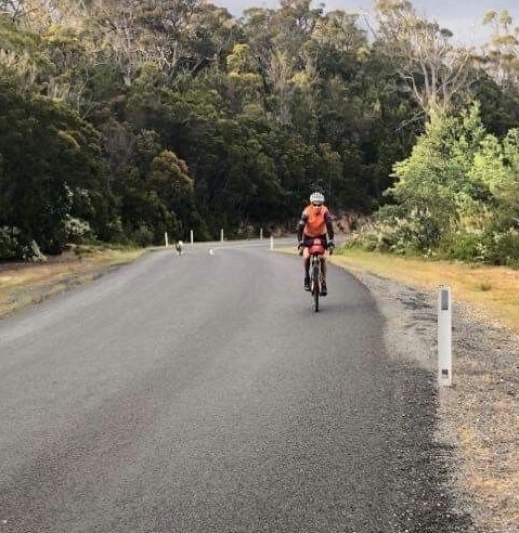
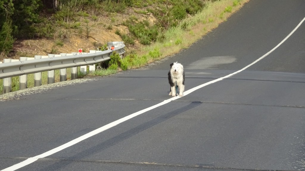
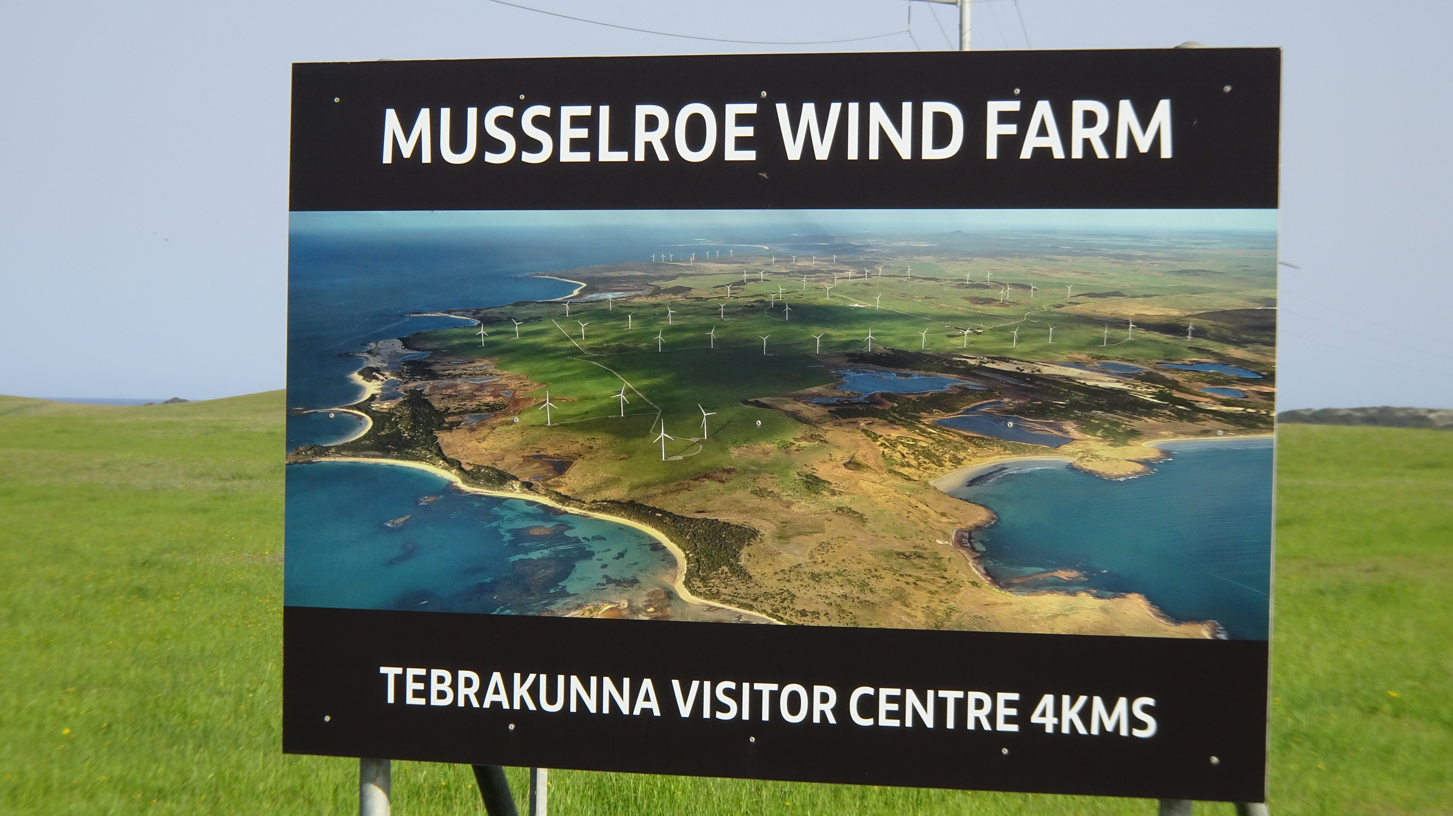
Heading off on the same route as the previous day to head to the Cape Portland wind farm, we descended and crossed the Ringarooma river and today the dog was not present.

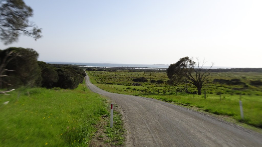
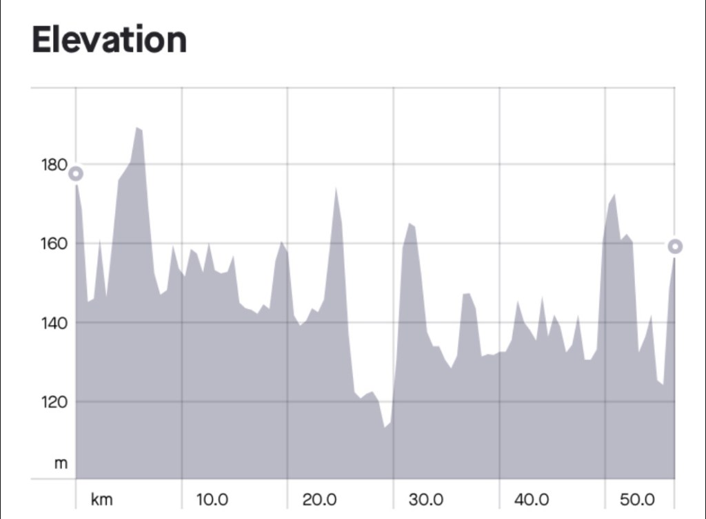
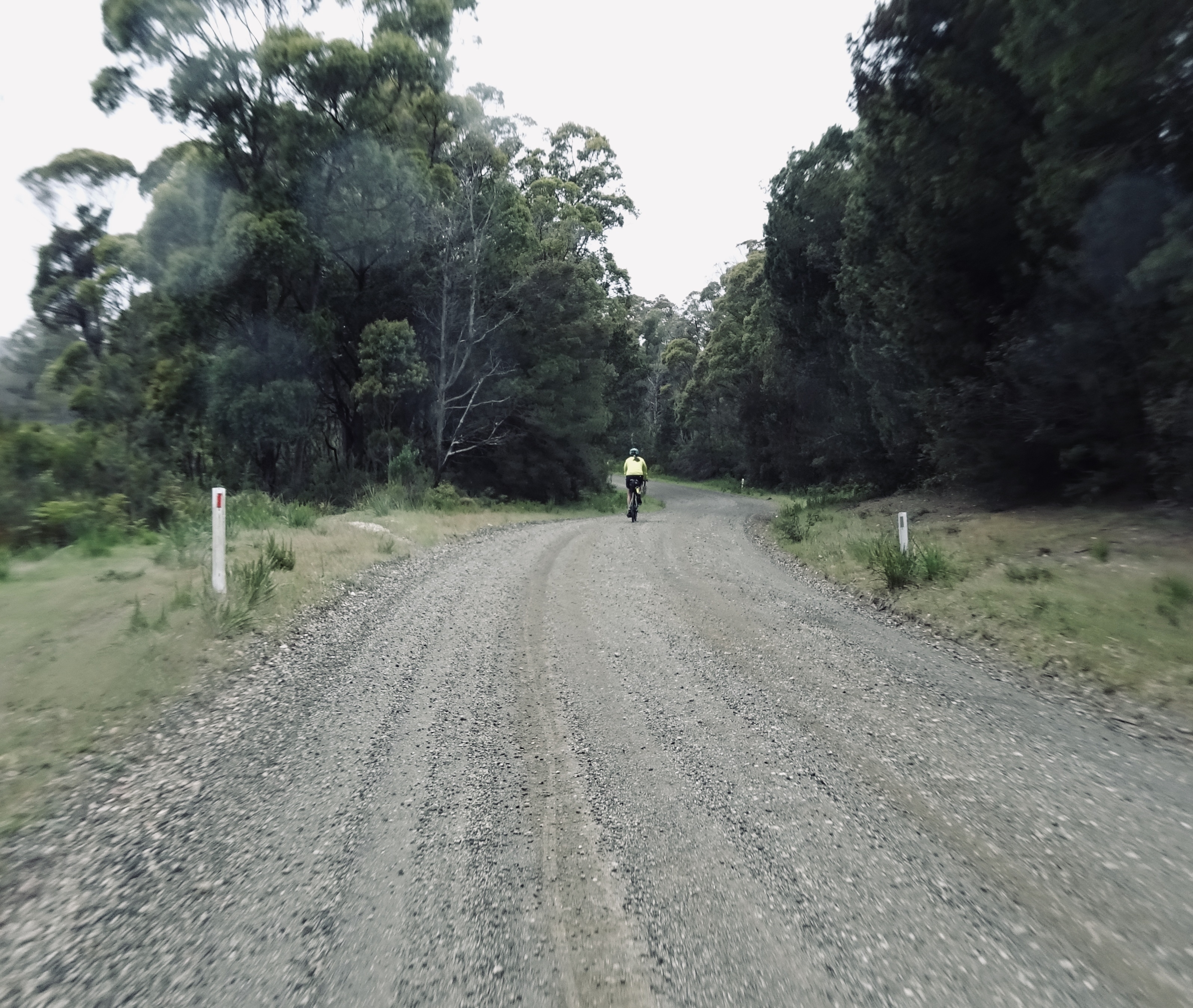
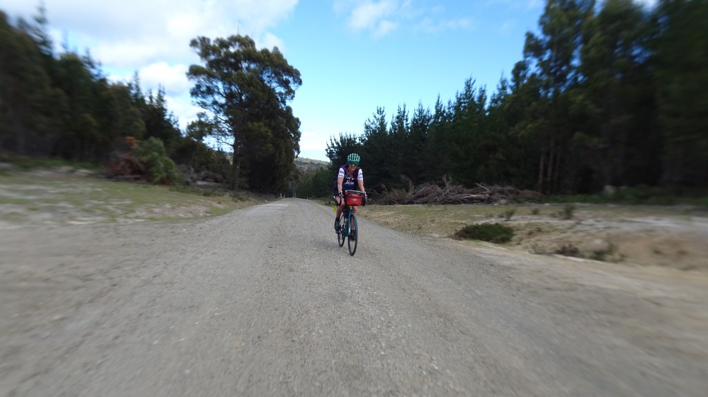
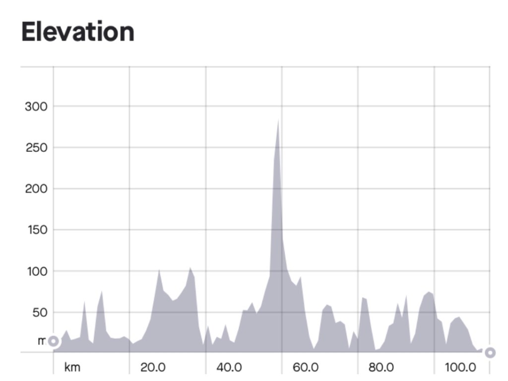
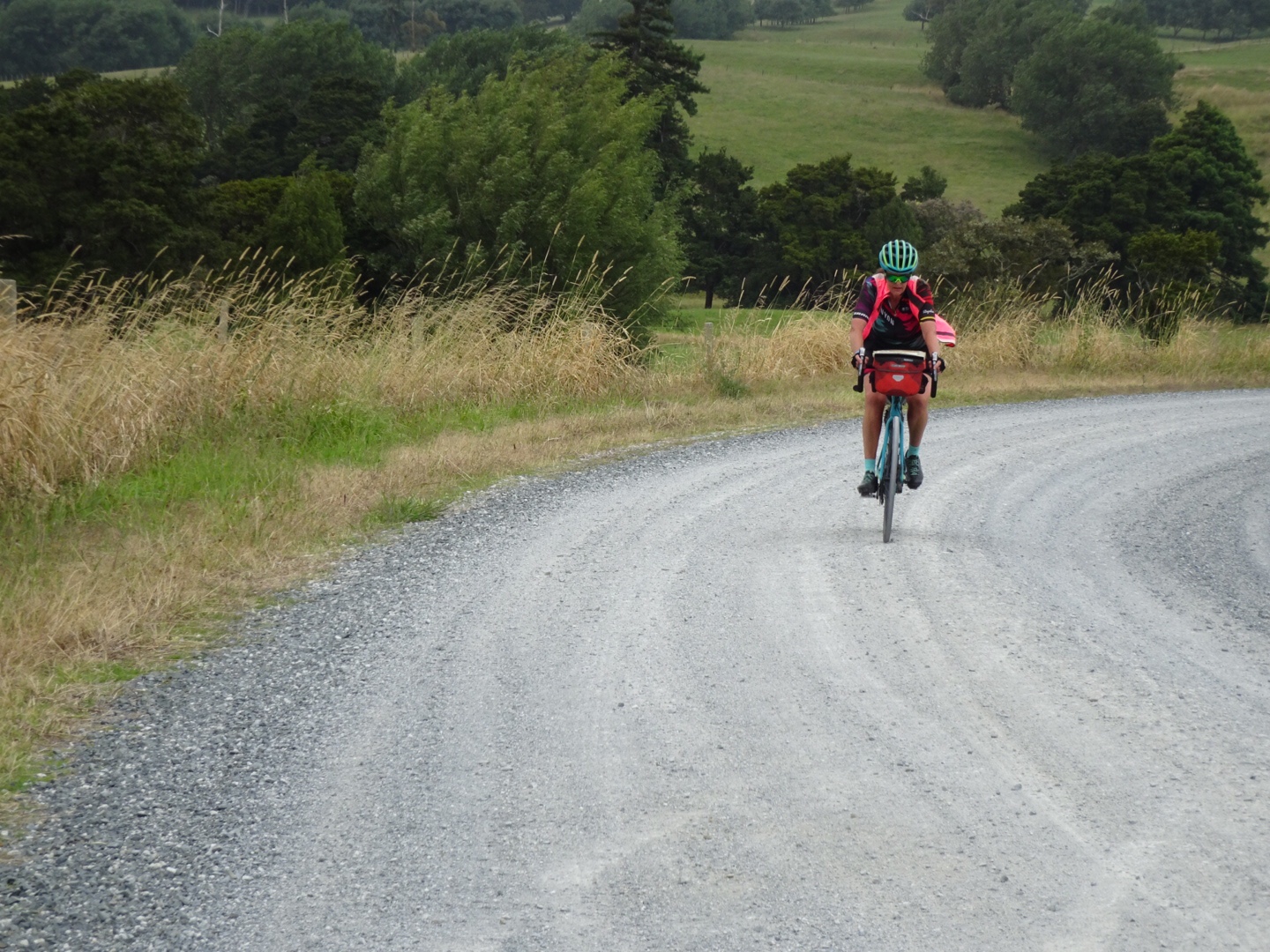
At the two km point we veered right to start our dirt adventure. We were heading to Anson Bay some 25 km away and despite the dirt, it was a pretty well maintained road, even by my highly judgmental gravel index.

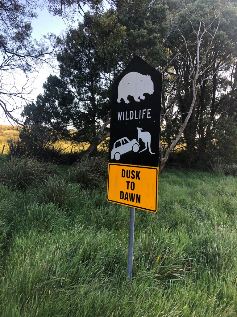
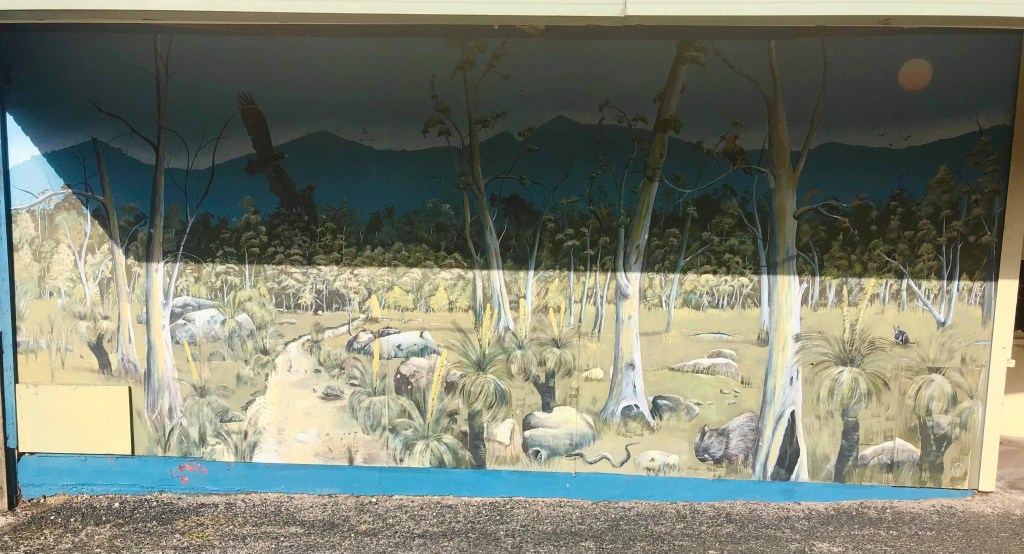
I love these signs. Our kangaroos are super strength, able to lift the front of cars up. They are also bigger than cars it seems. International tourists must be shocked when they see the local wallabies. The wombat is relatively larger again. Mind you, both animals can render significant damage to a car.

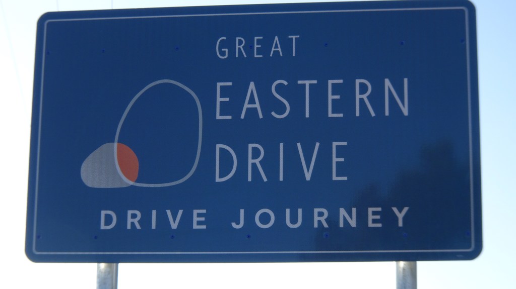
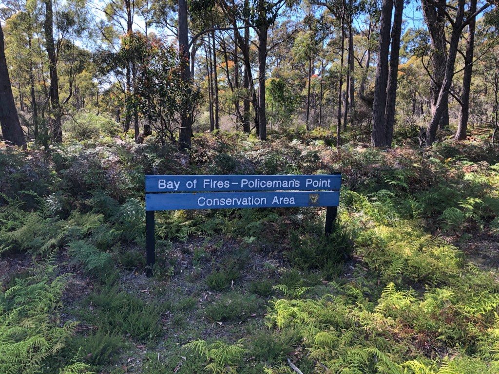
Our route formed part of the Great Eastern Drive promoted by local tourism authorities.

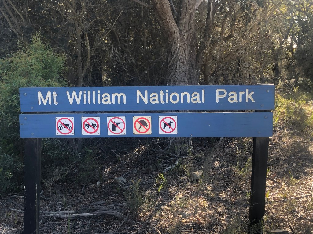
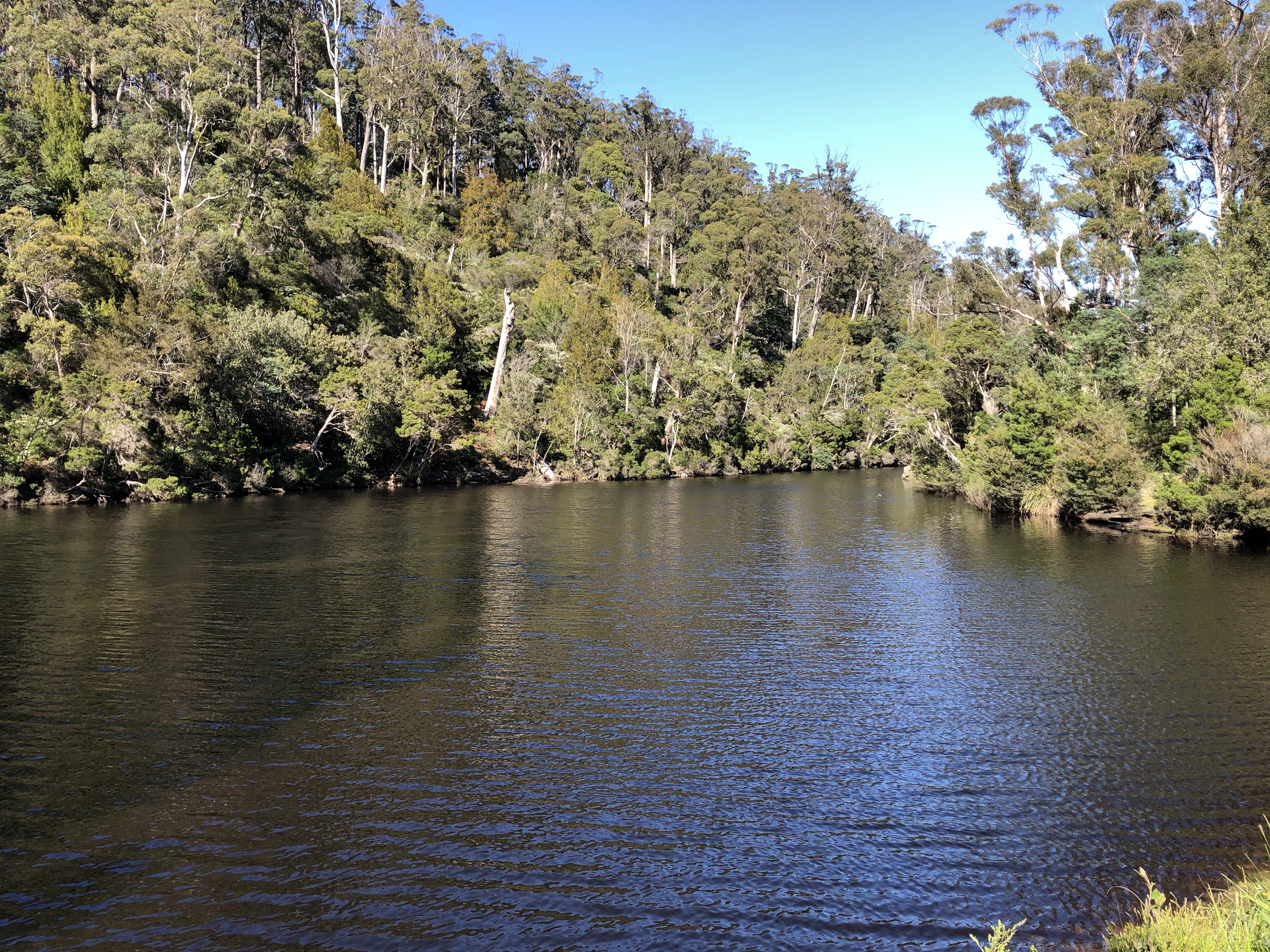
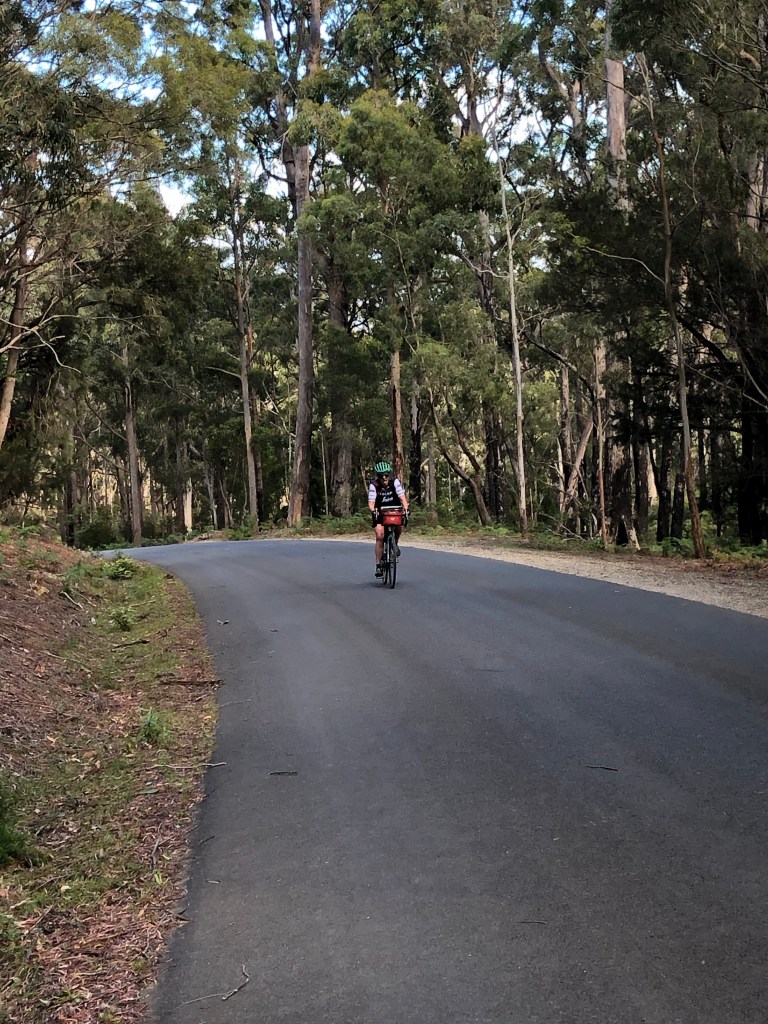
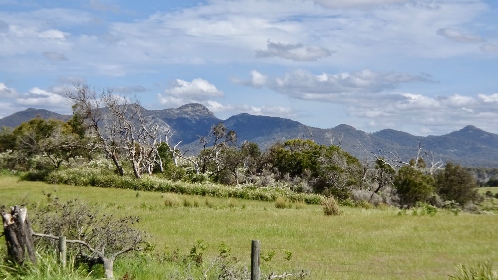
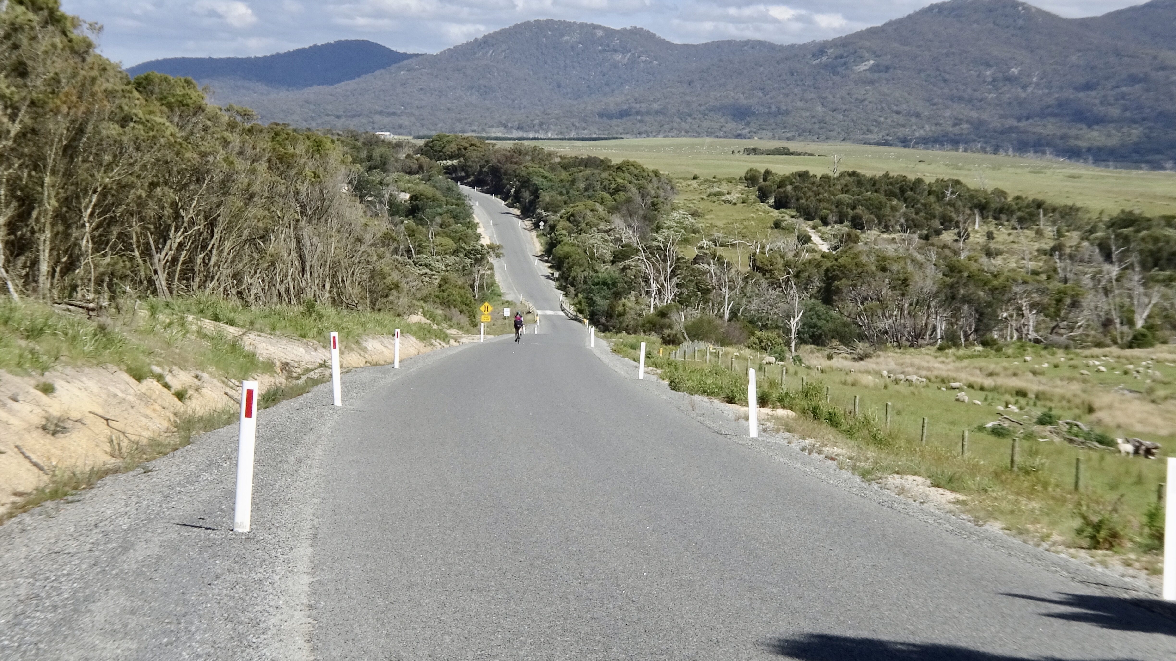
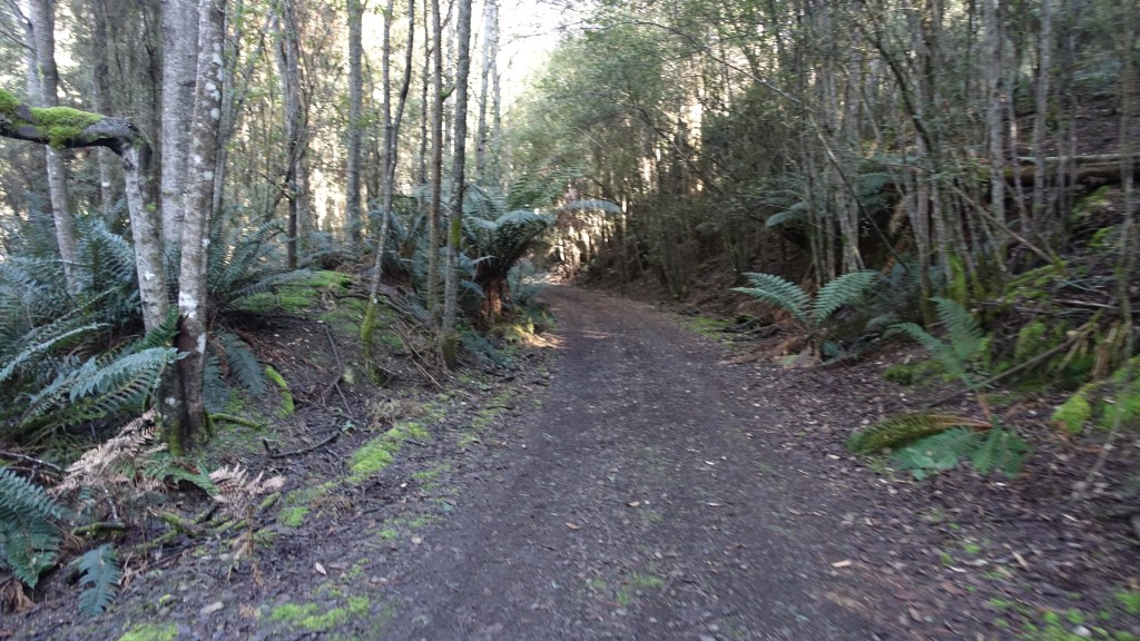
We enjoyed this section, the weather was cool but pleasant, we were protected from the winds and the scenery was pleasant. The road dissected the Mt William National Park. Neither of us had been before and made a note to return and head up to Eddystone Point.

Some limitations, all seem reasonable.

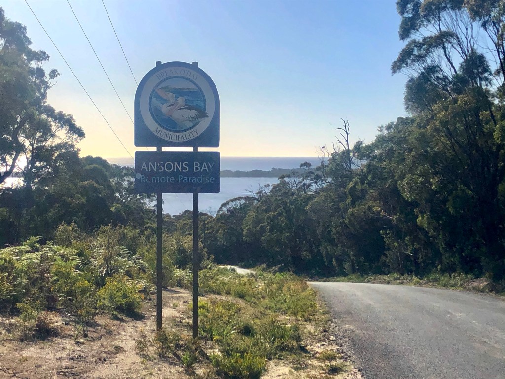
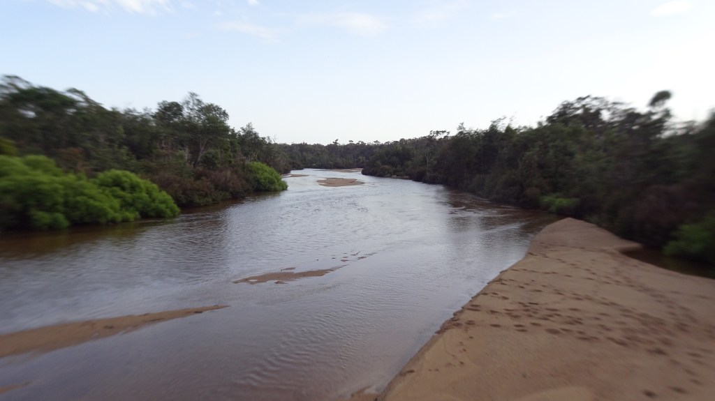
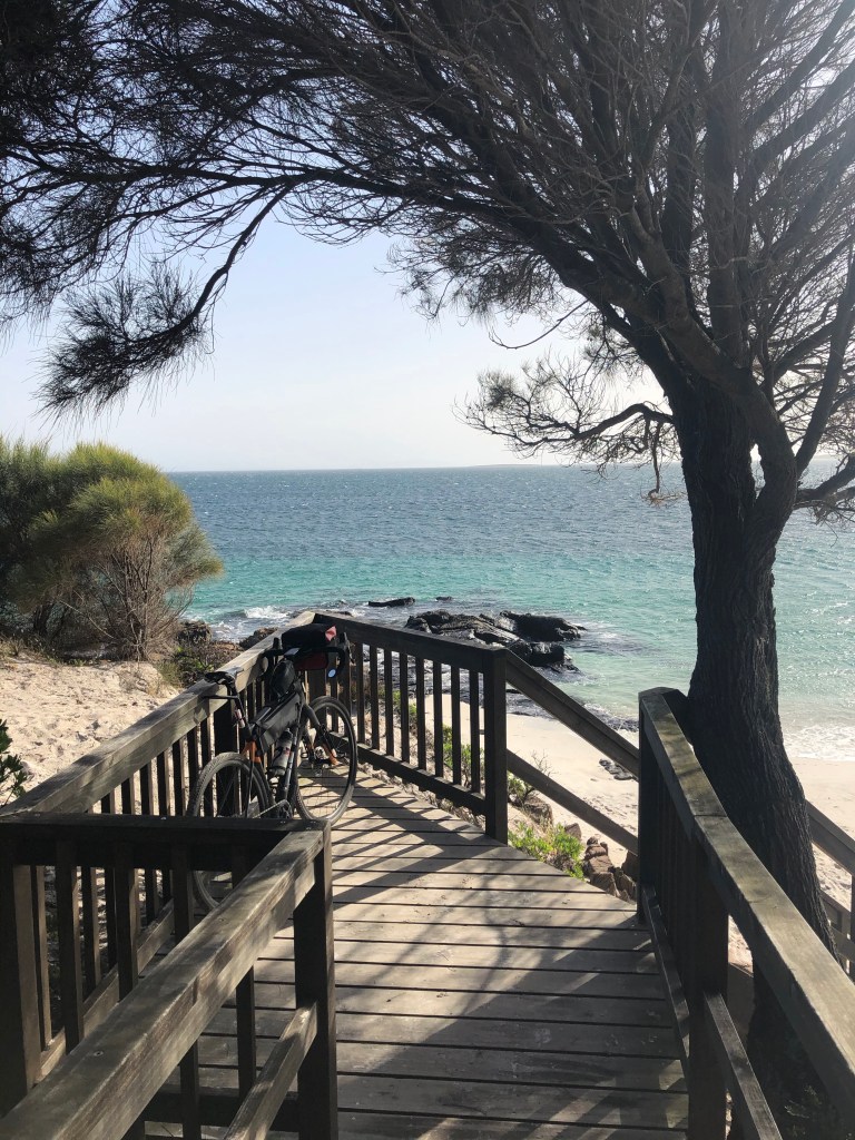
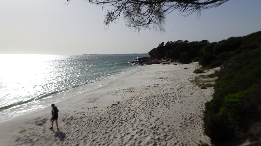
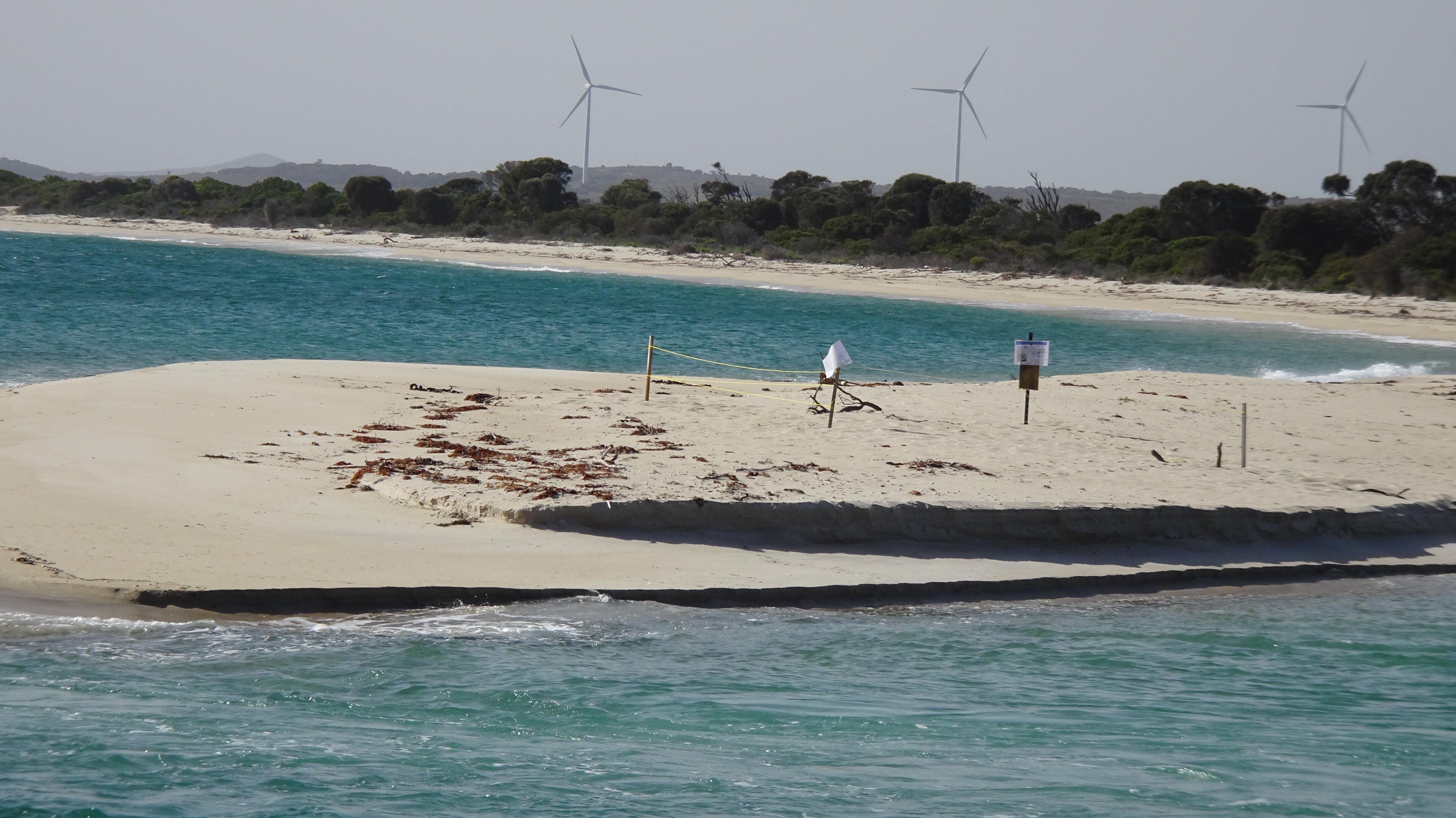
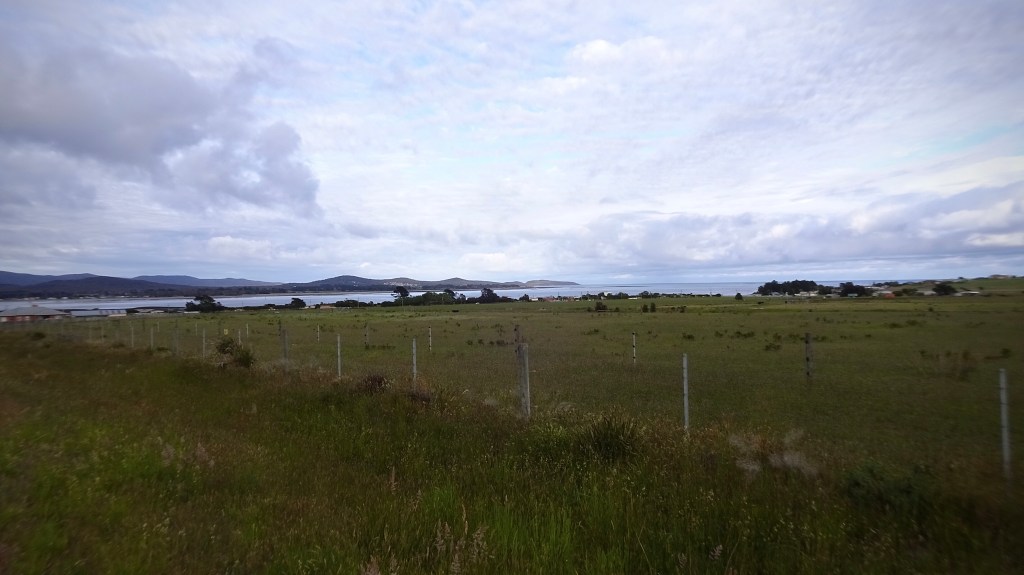
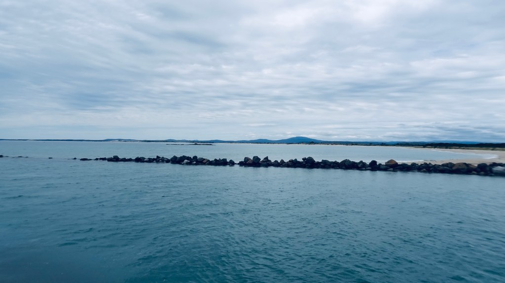
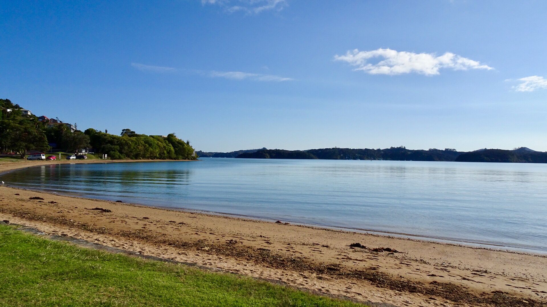
As we entered Ansons Bay the road thankfully was bitumen as it was a steep descent, to the so named remote paradise. What a pretty bay.

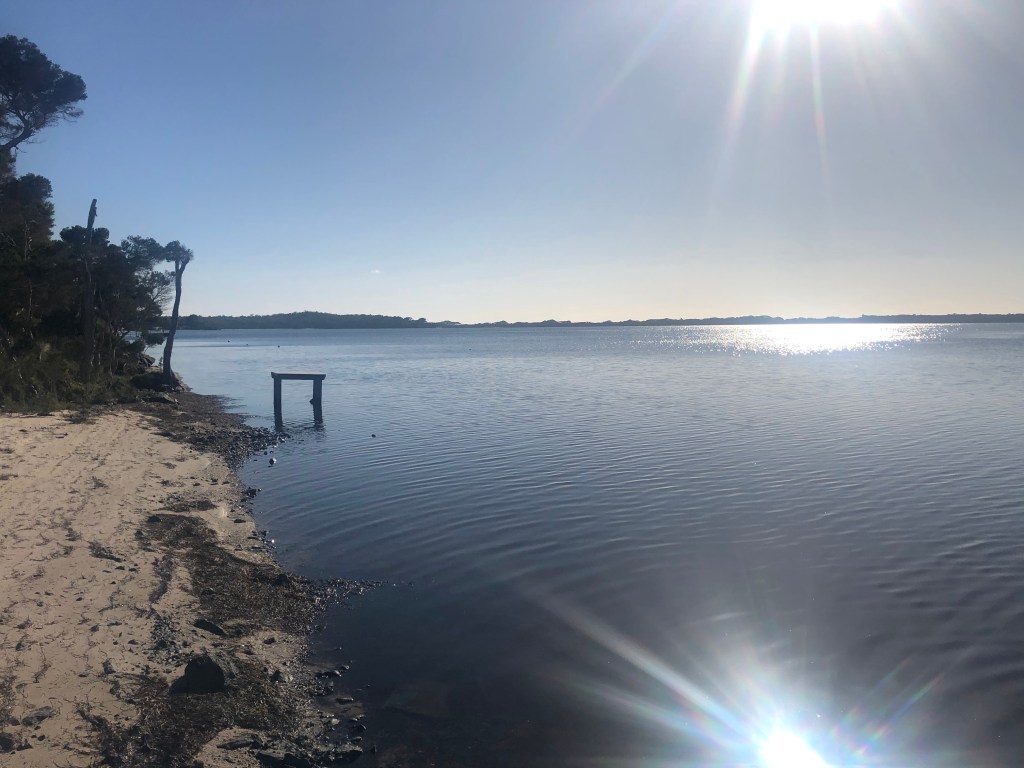
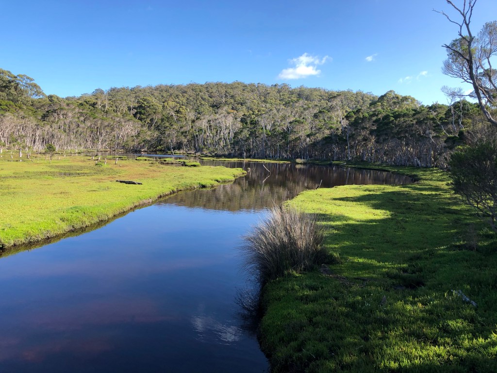
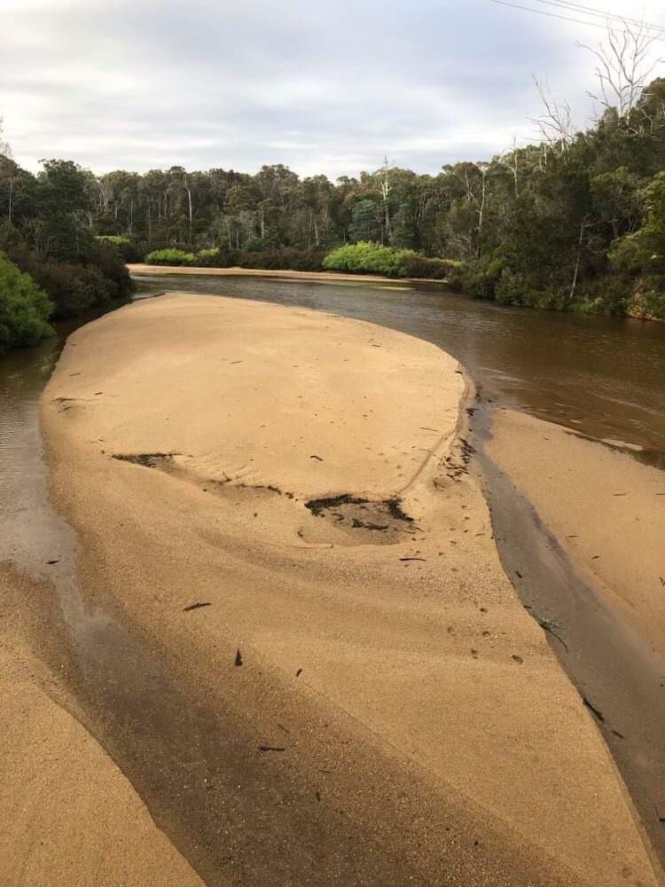
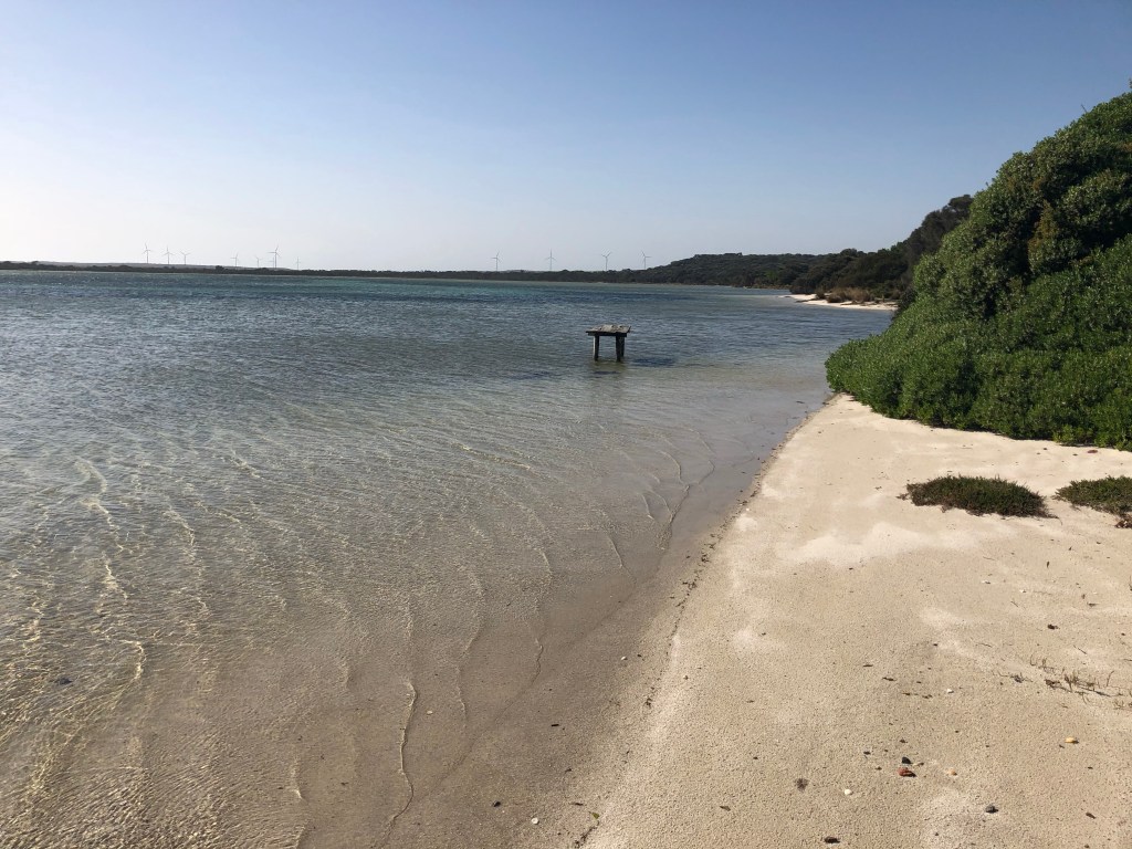
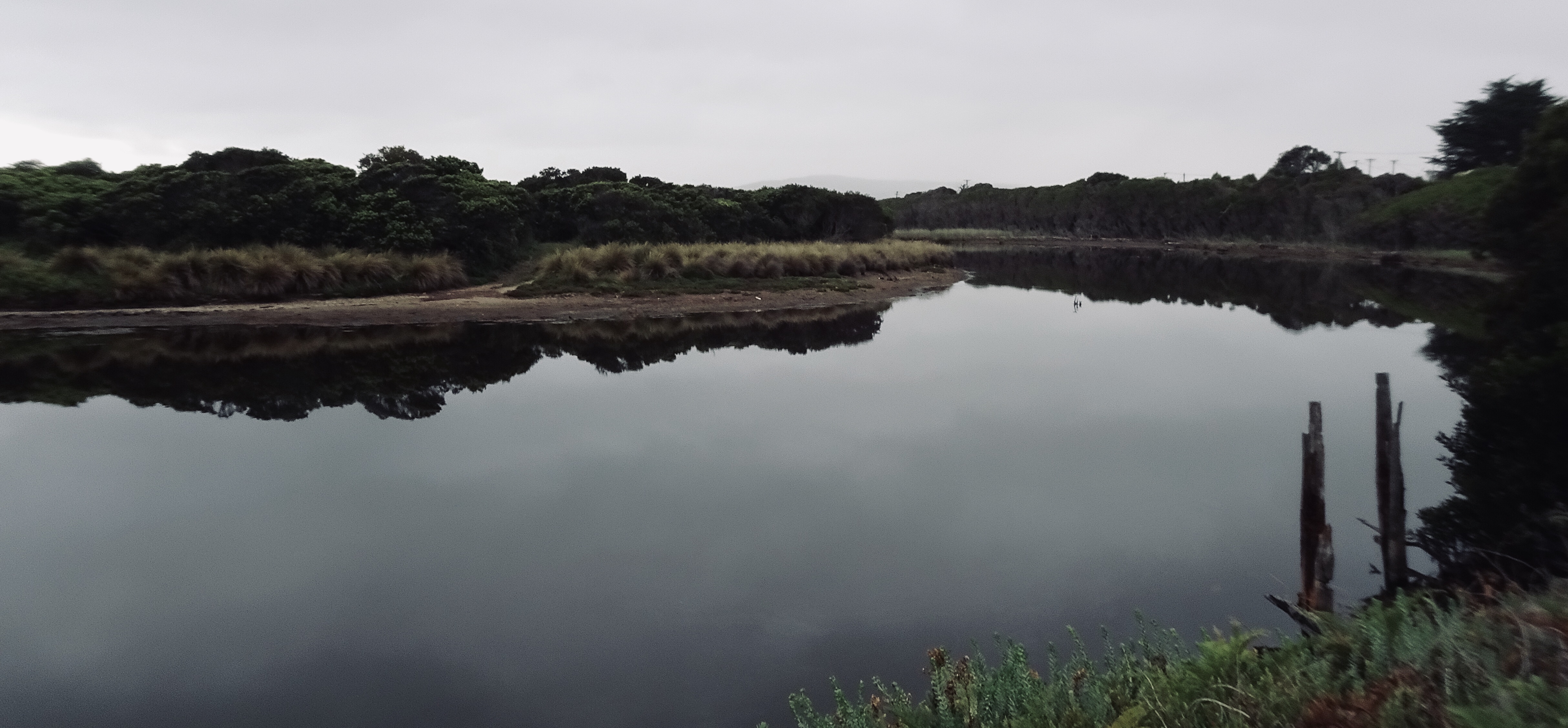
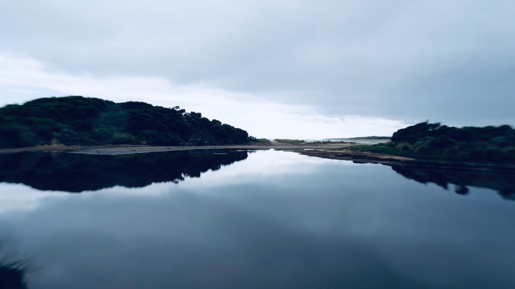
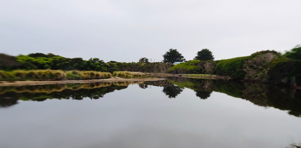
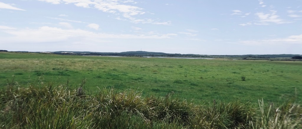
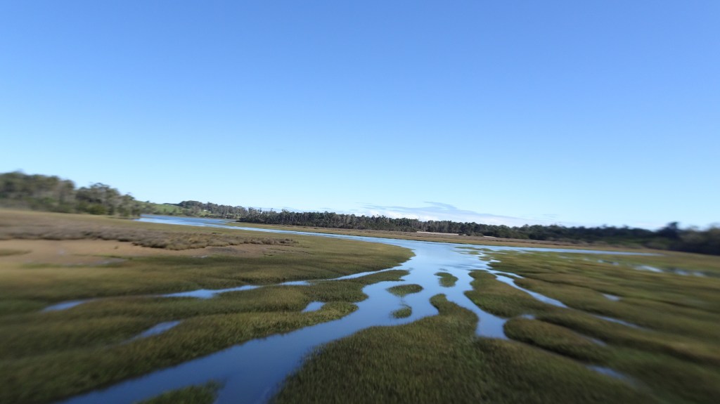
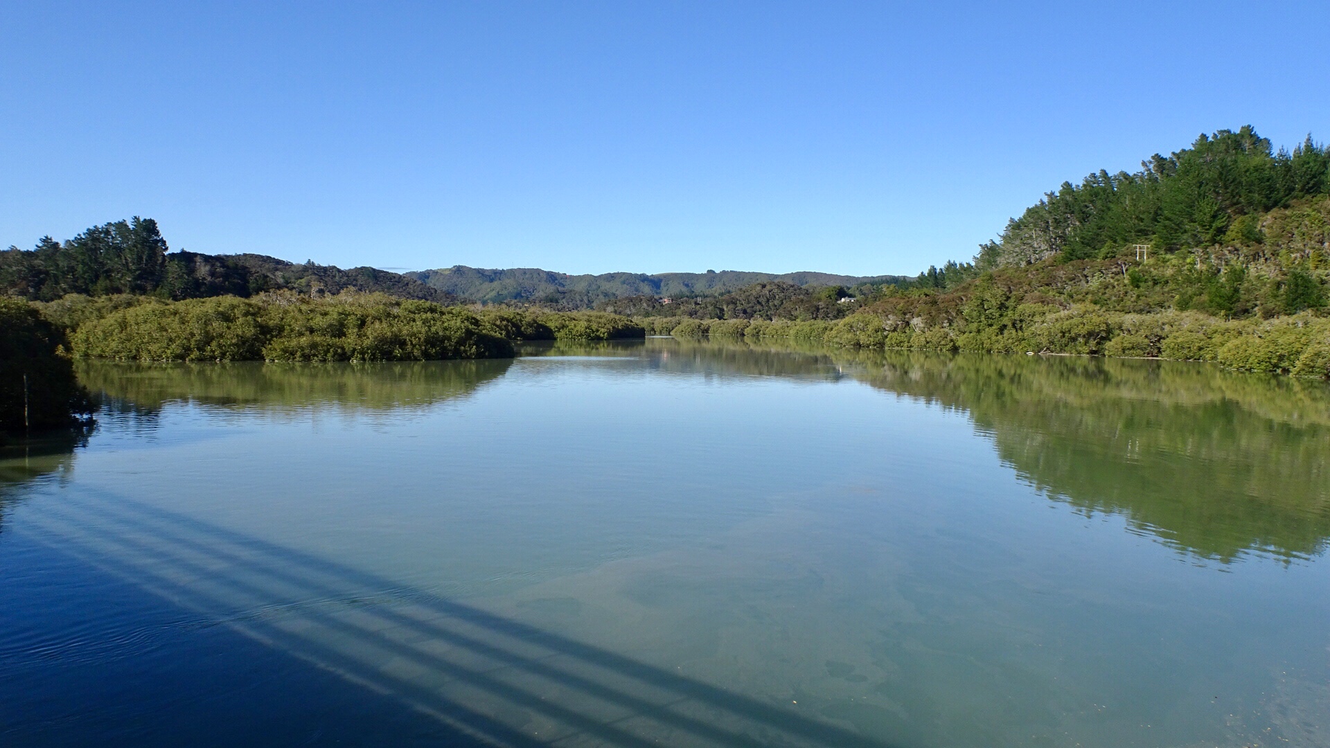
Just behind the bay was this lagoon.

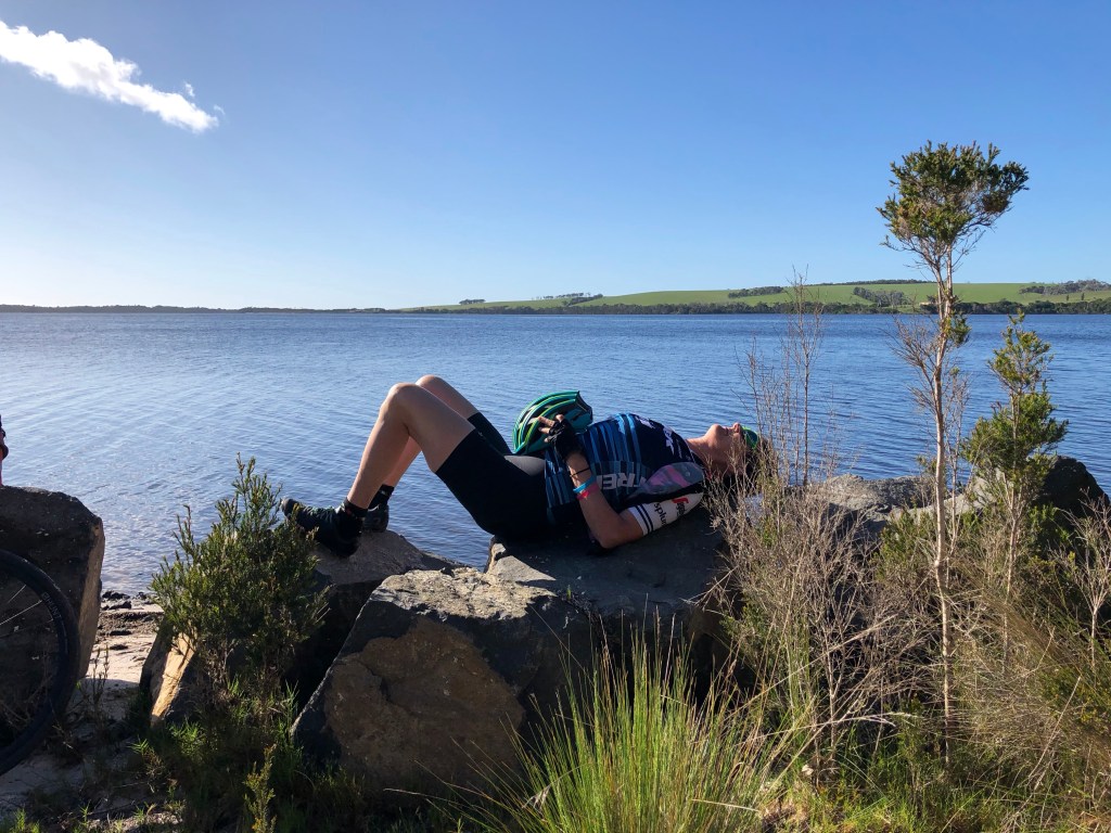
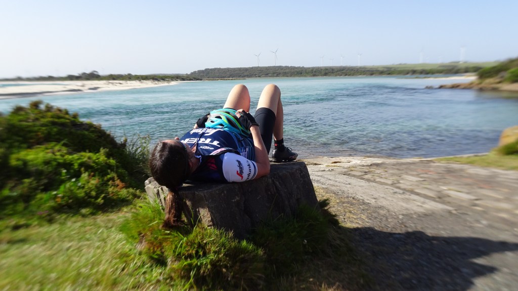
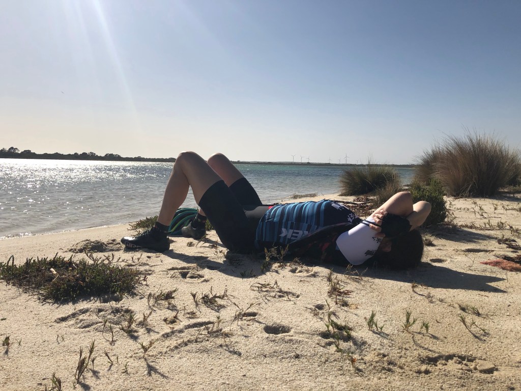
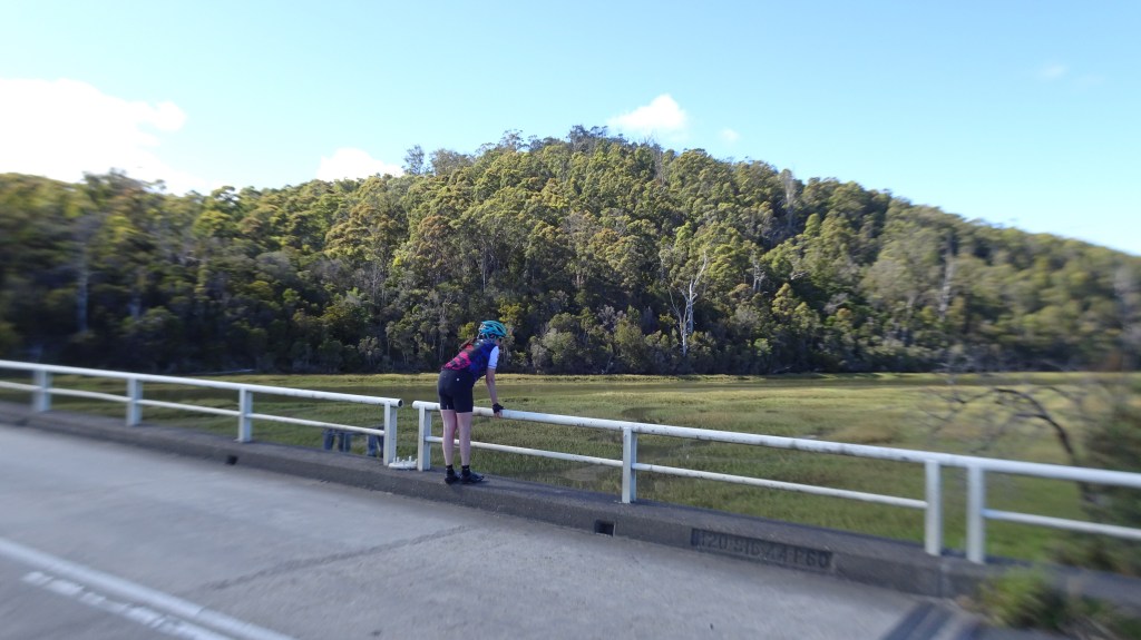
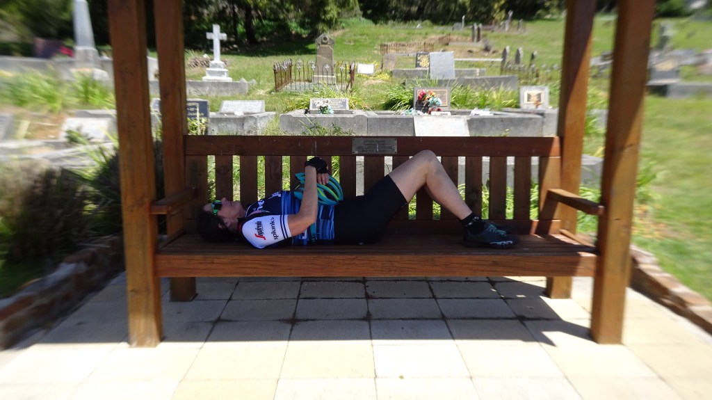
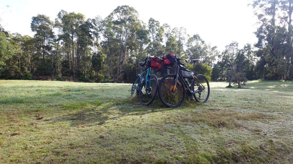
Back at the bay one needs to maximise opportunities to rest. This was one of my least comfortable choices.

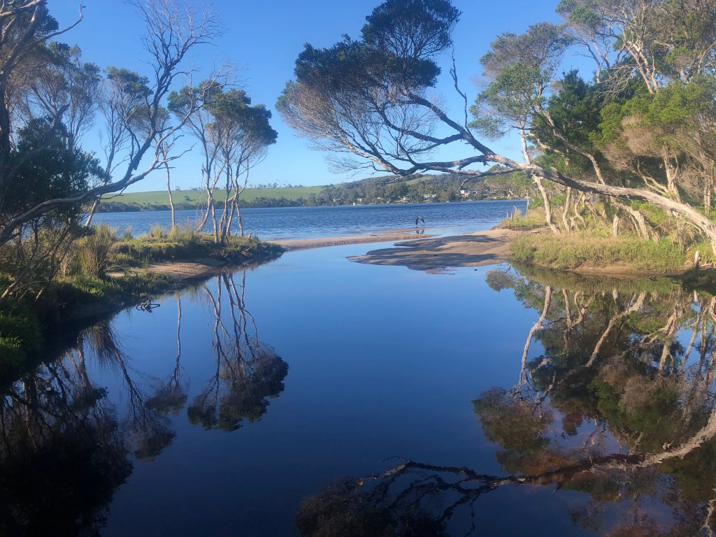
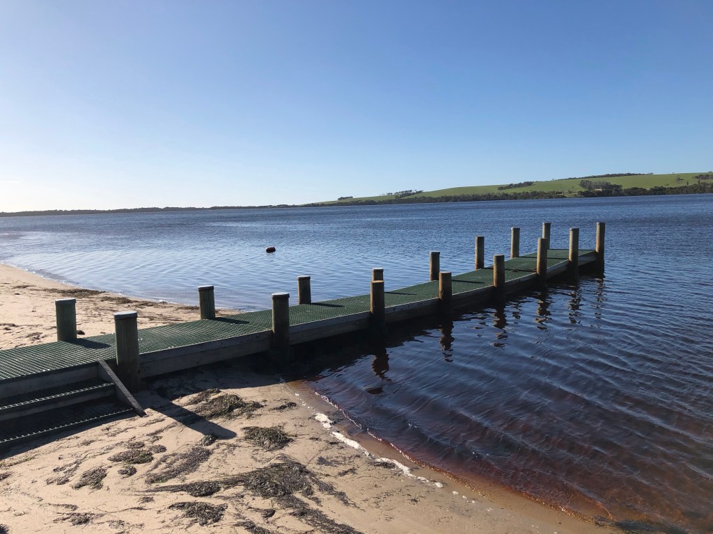
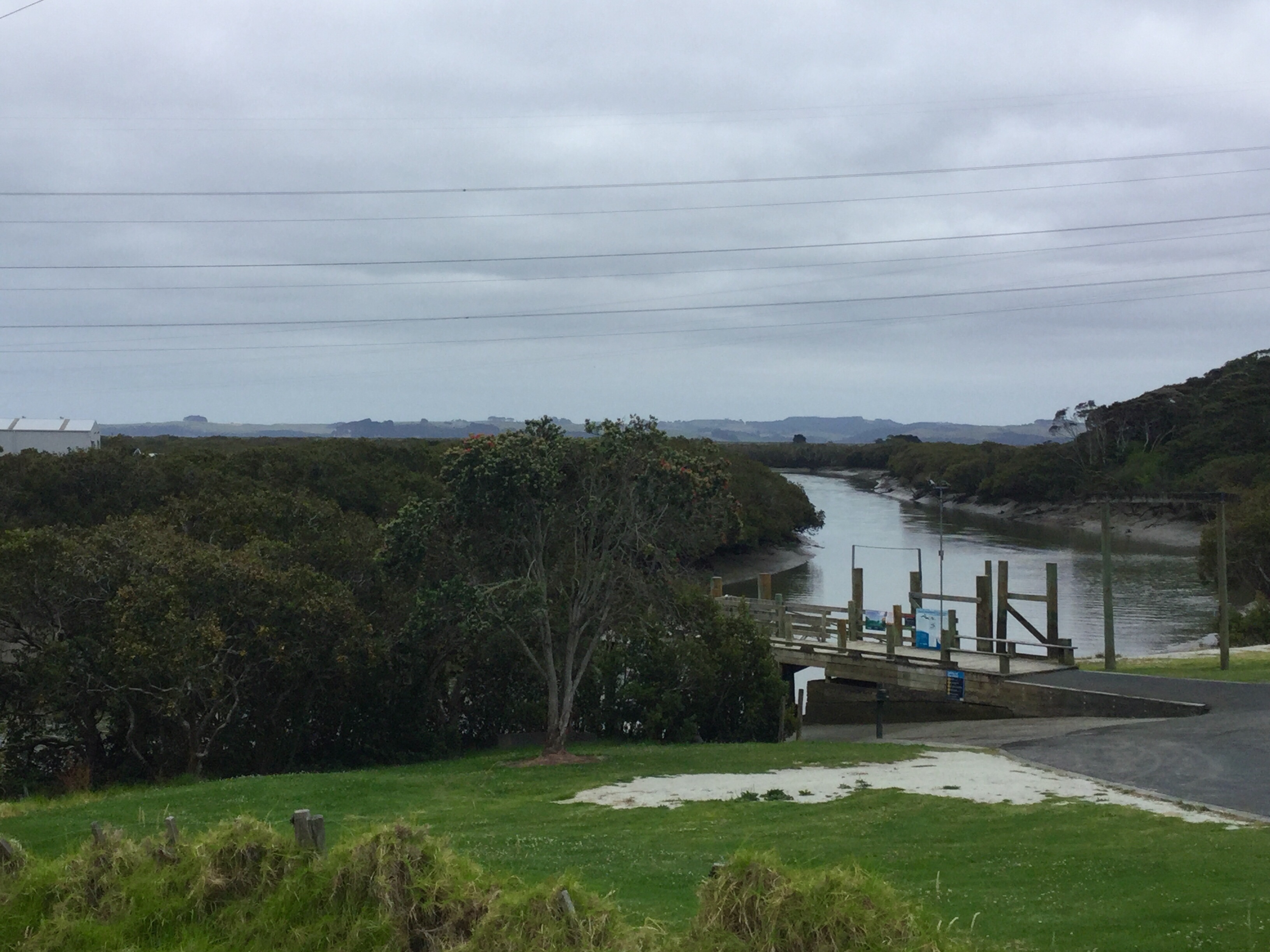
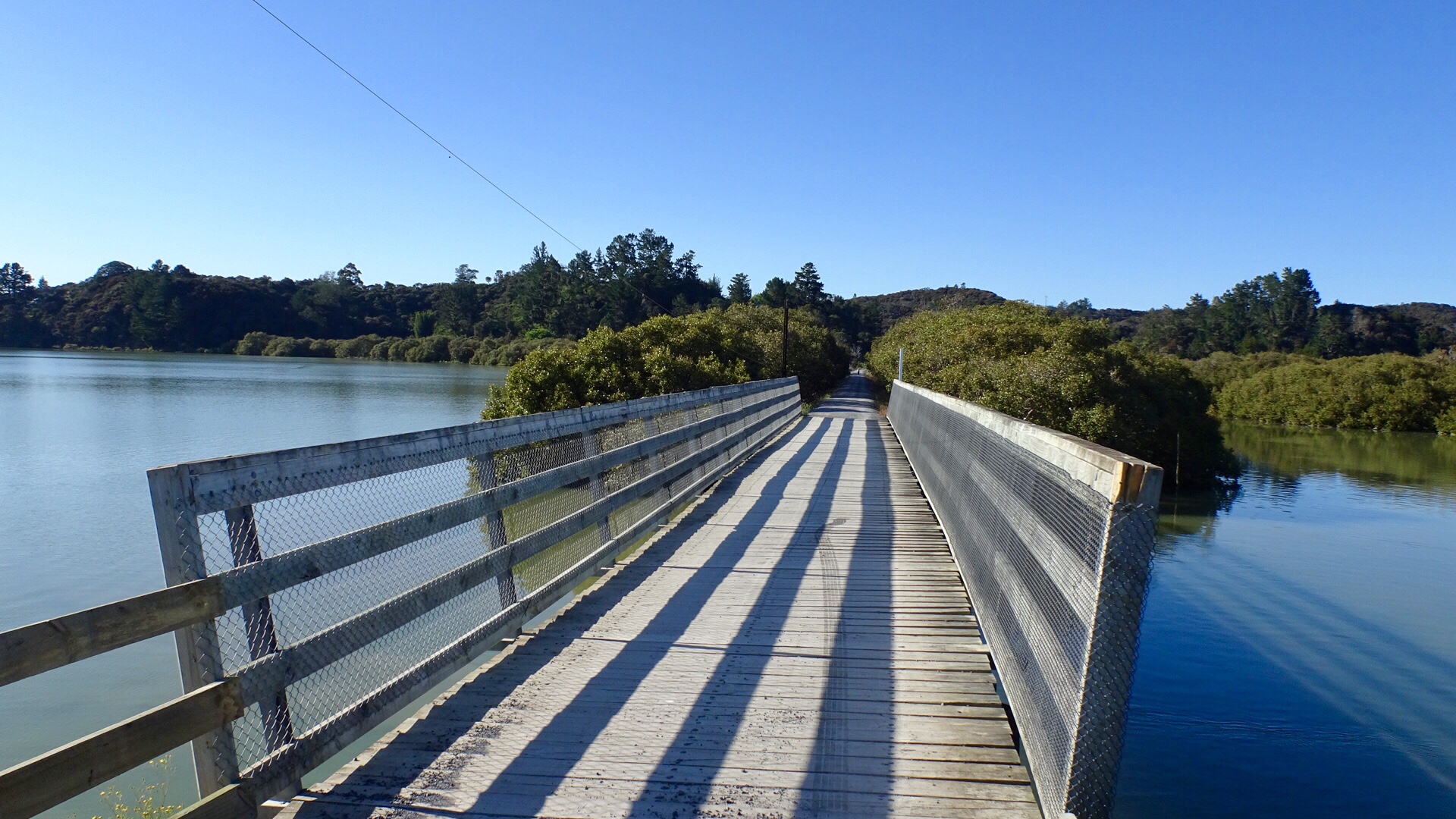
Further along the bay was a boat ramp and jetty.

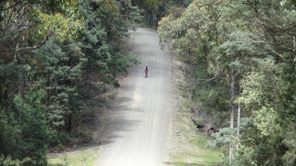
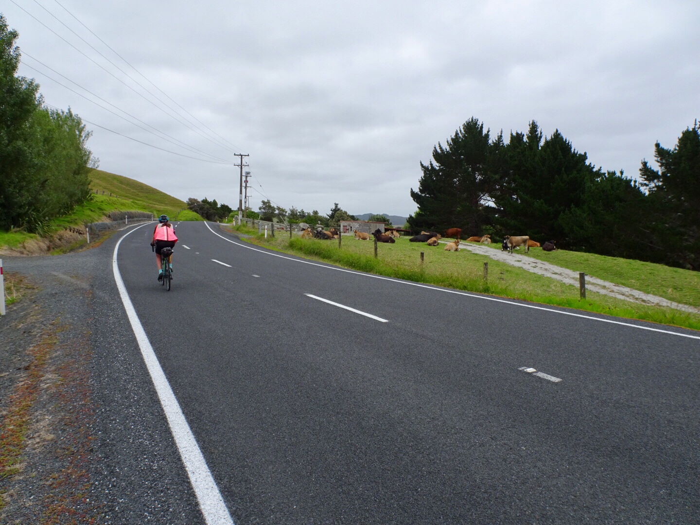
After the steep descent into Ansons Bay we figured there would be a climb out. Dirt climb through lovely virgin bush.

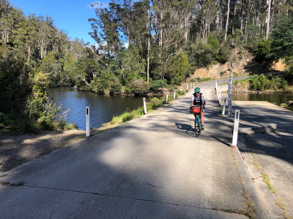
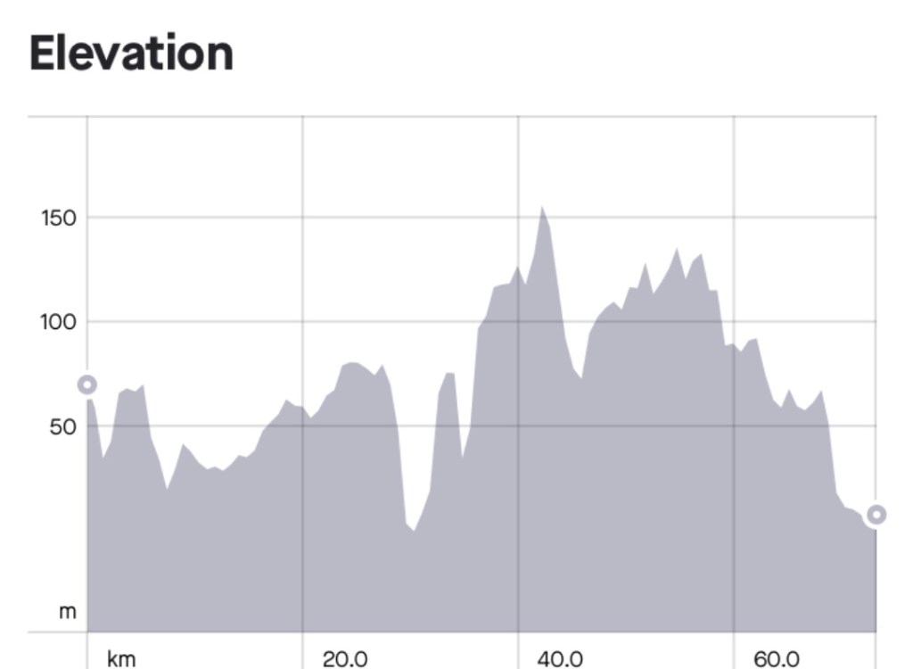
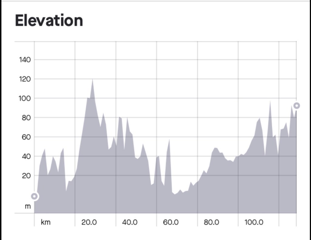
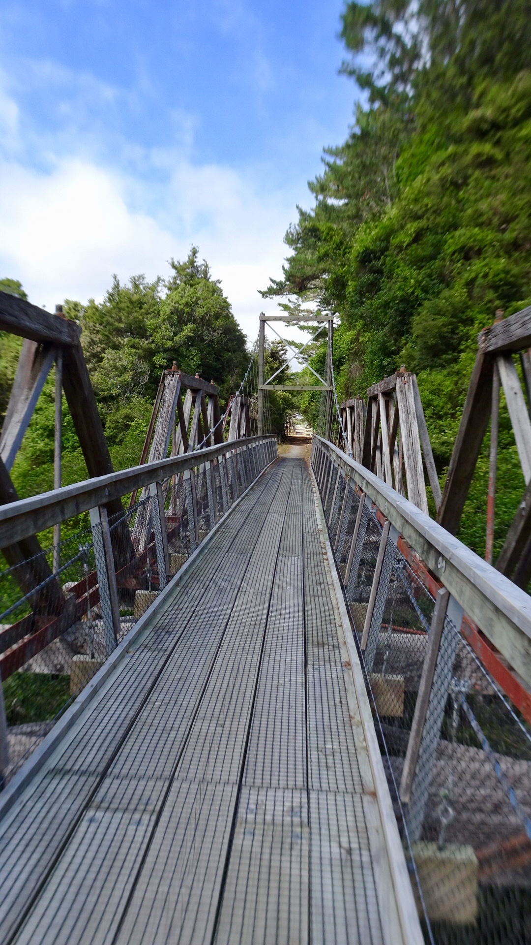
We rejoined the main dirt road and another very steep descent to this flood crossing, reminding me of Spellman’s Rd, near home. Tony has the route in his Garmin and could see what was ahead, reminding me to drop into my granny gears.

Oh my goodness….17 percent climb out and it was a bit much with the bike weight for my knee and I bailed about half way up, walking a few hundred metres before riding at a mere 11 percent. I was astounded that I actually recleated my bike shoes back onto the pedals, but riding was easier than walking!

Just starting the climb

Just finishing the climb

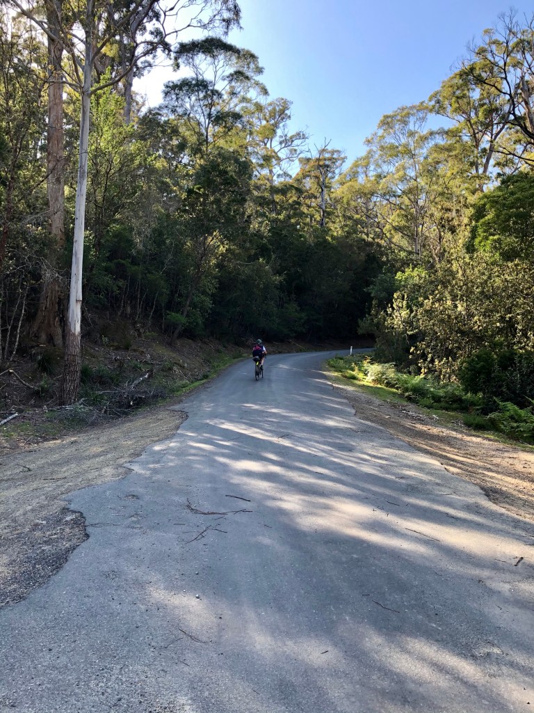
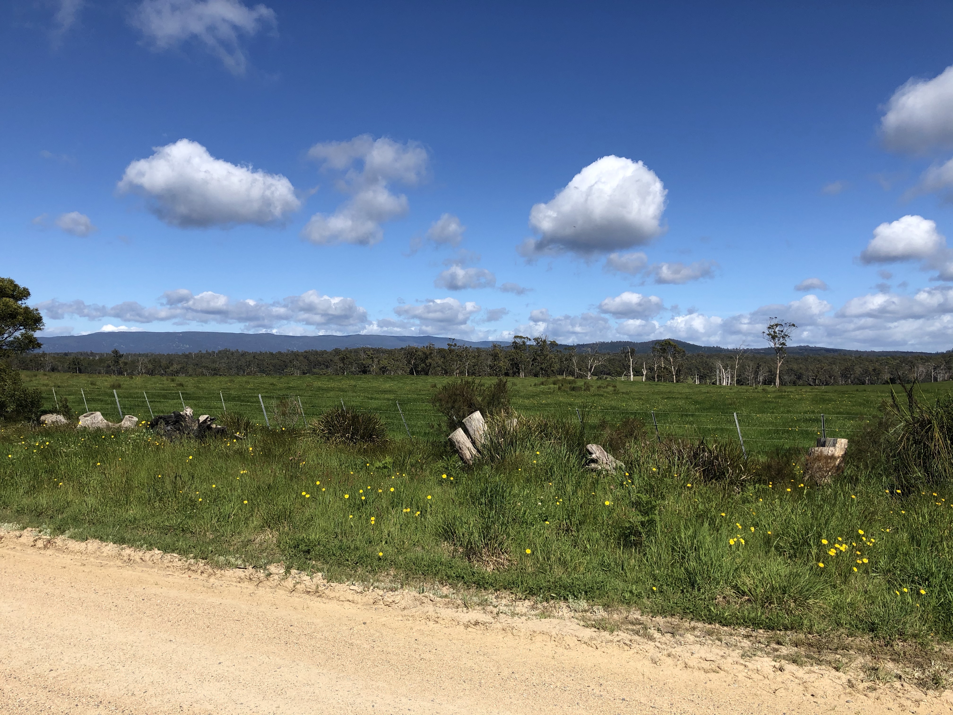
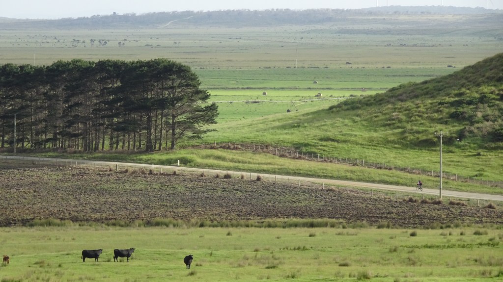
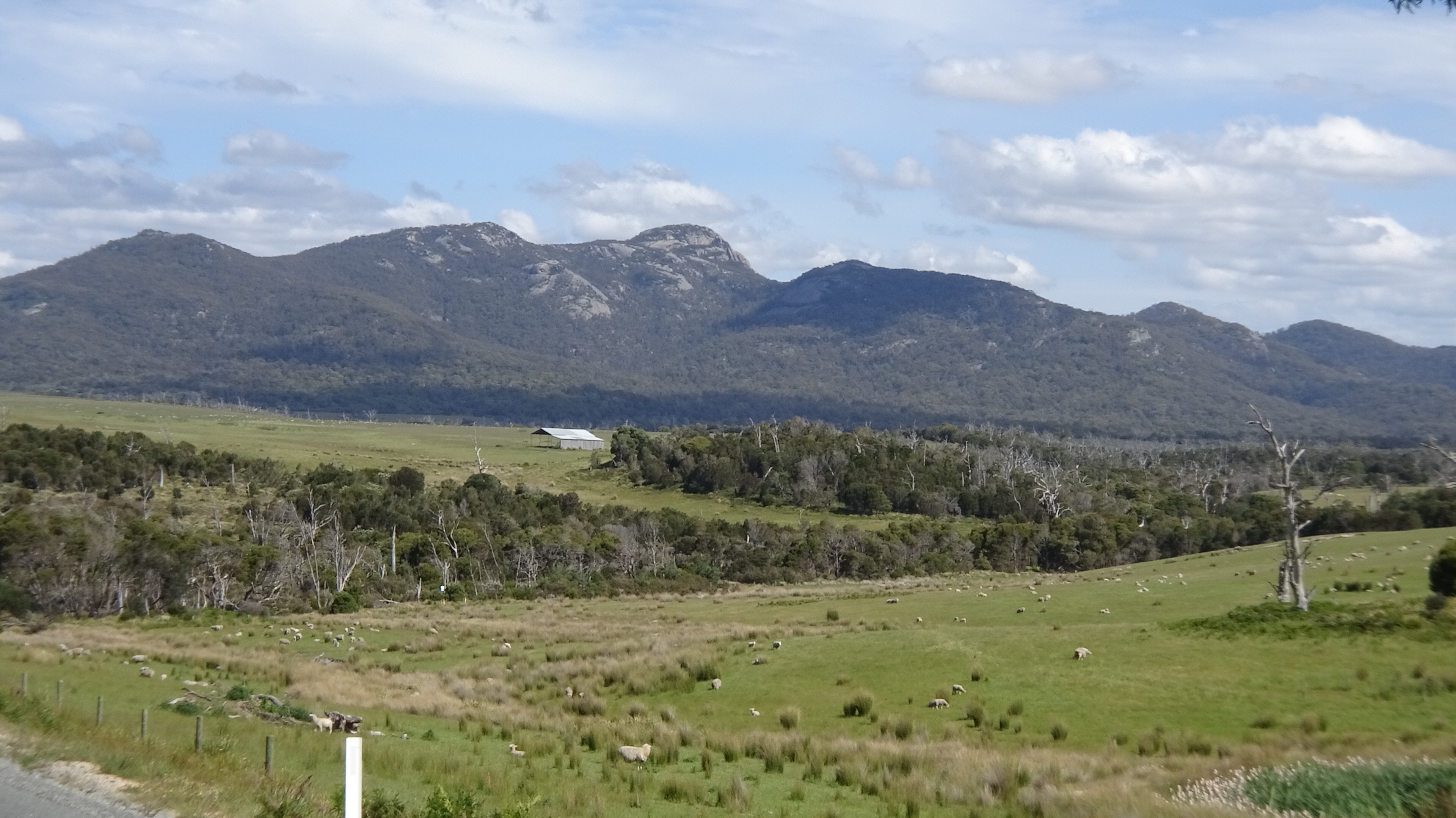
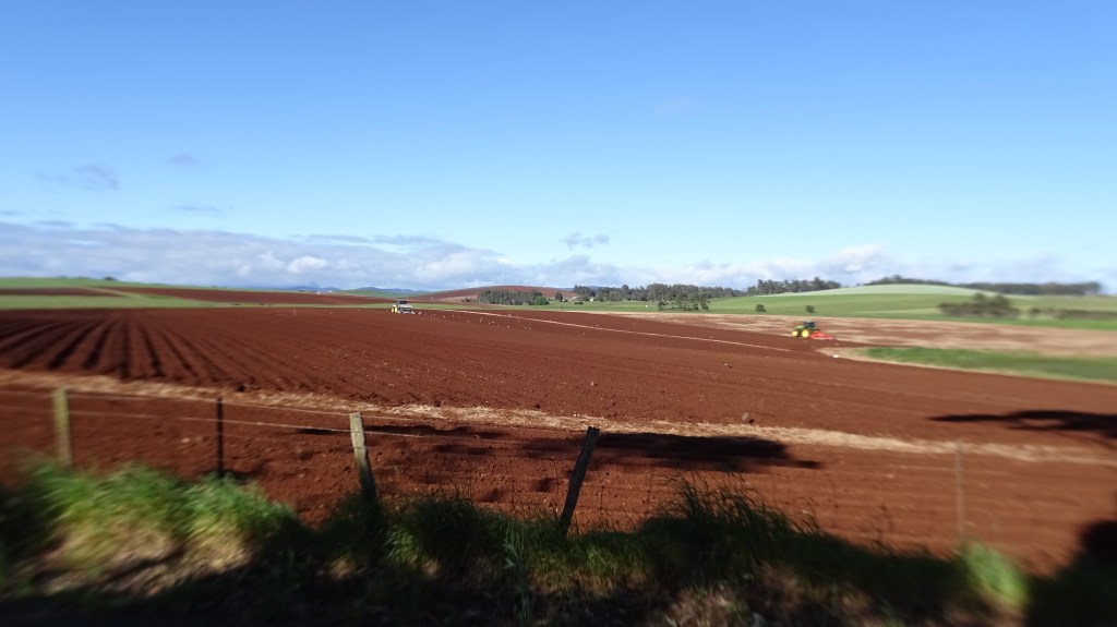
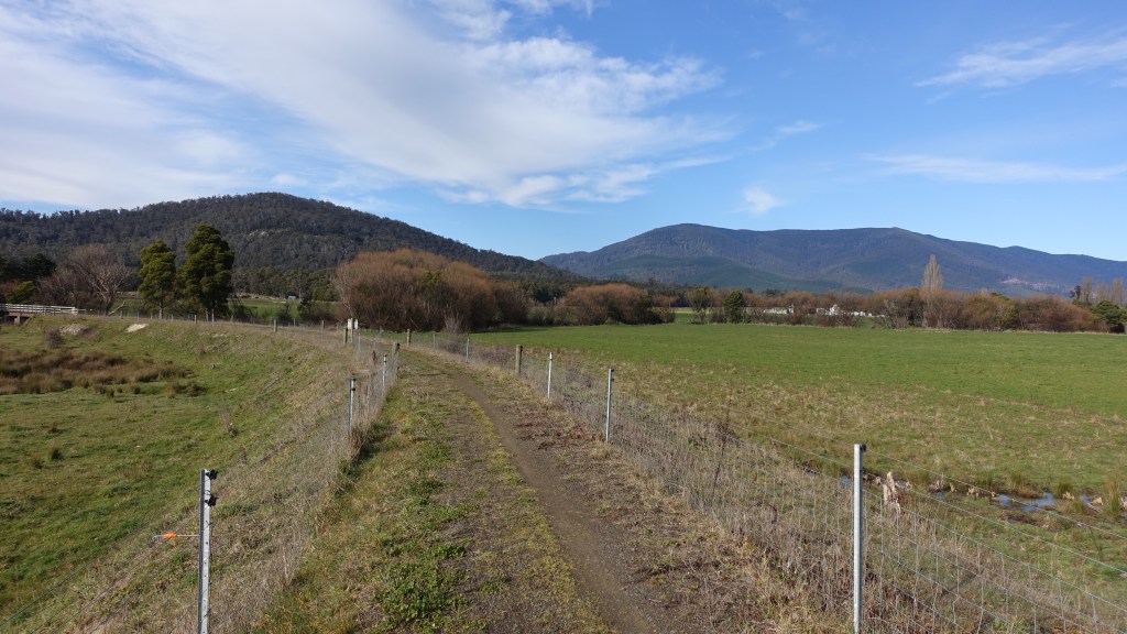
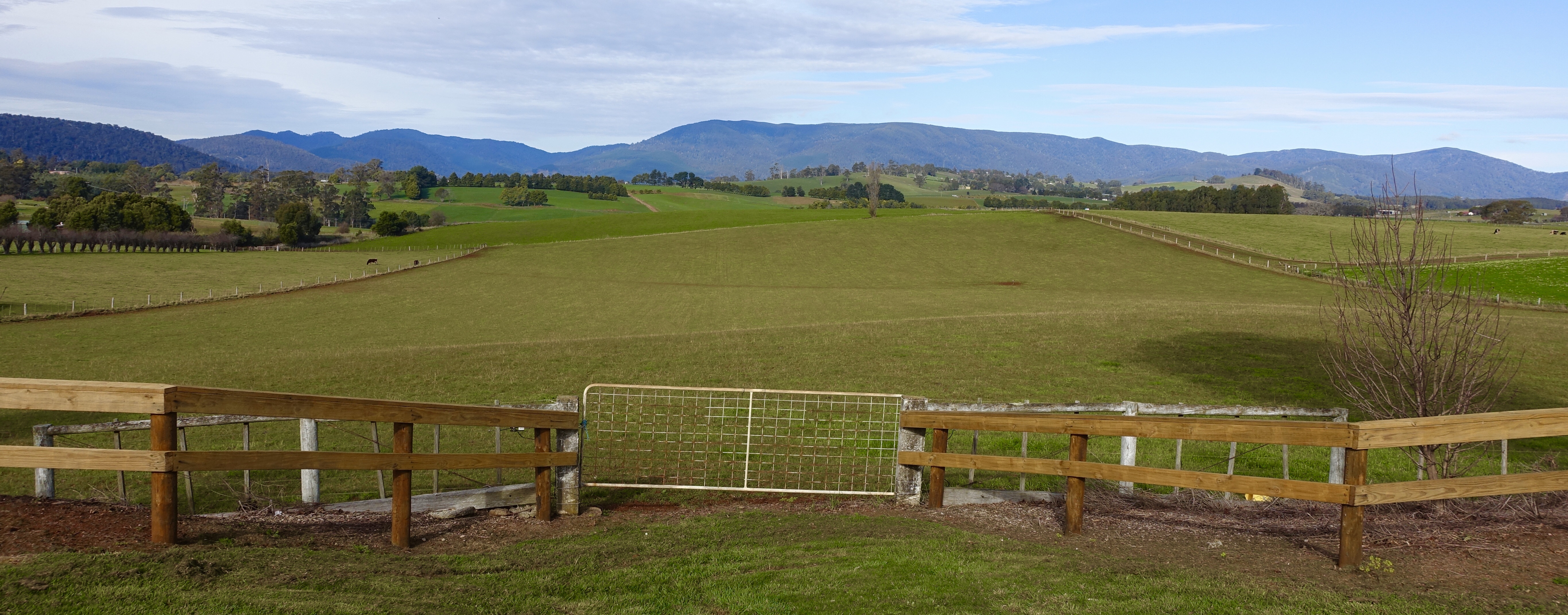
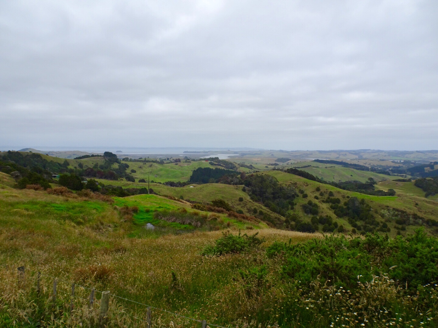
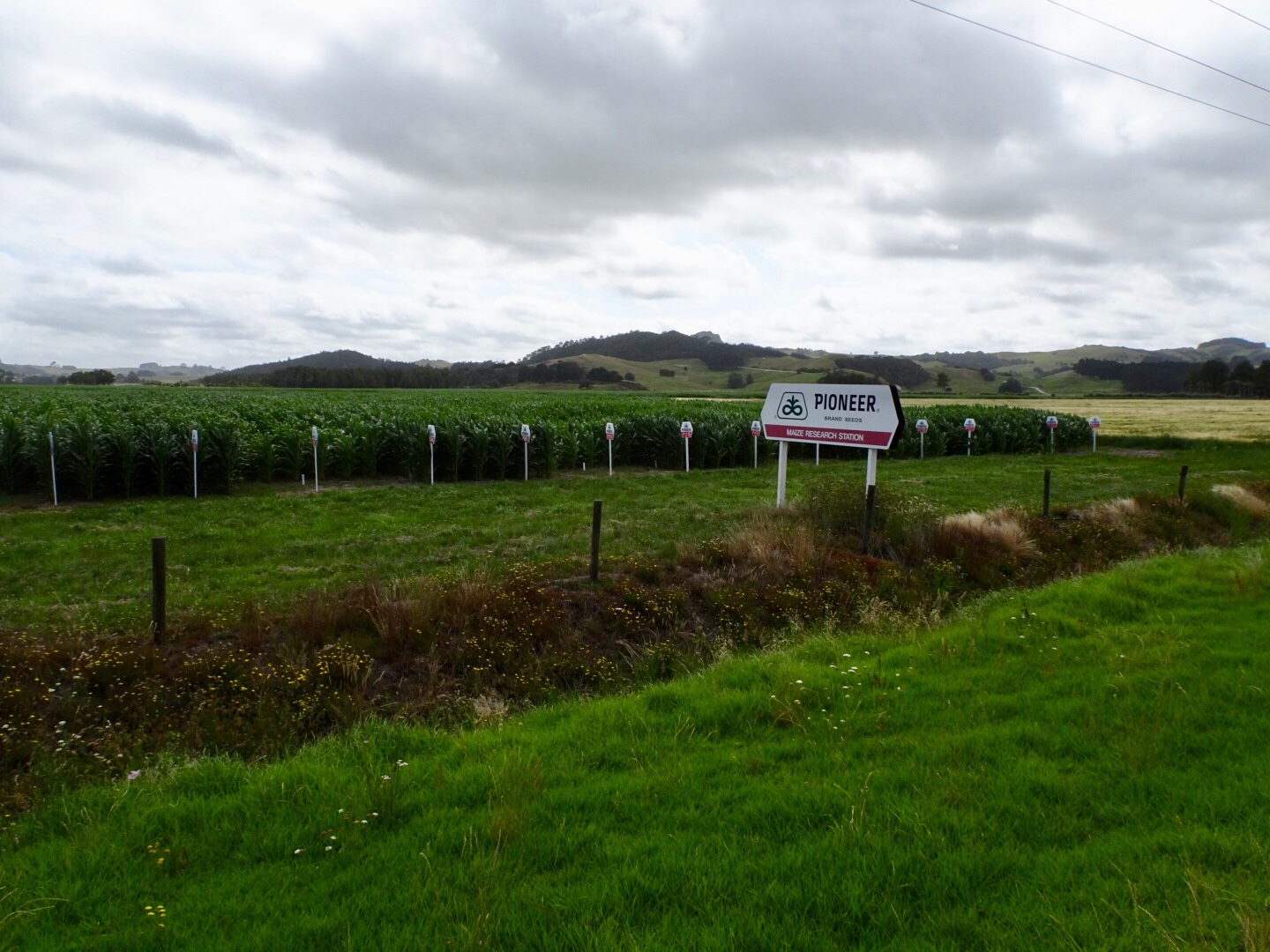
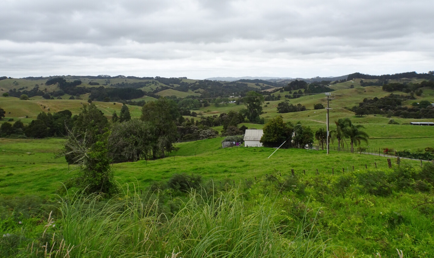
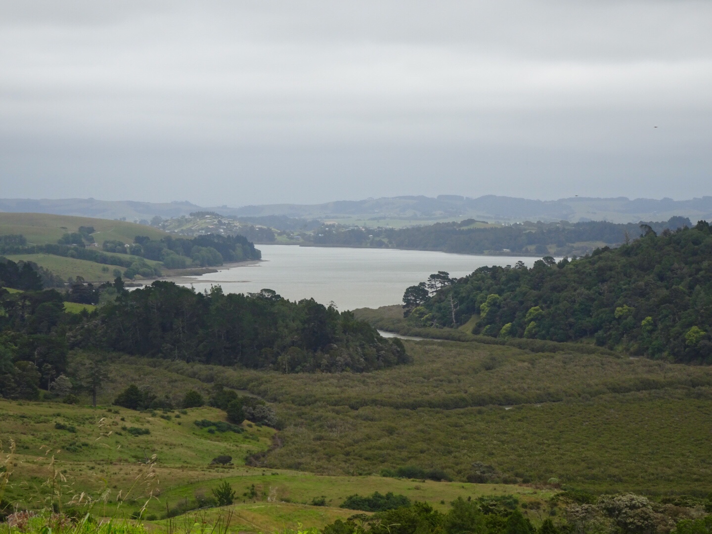
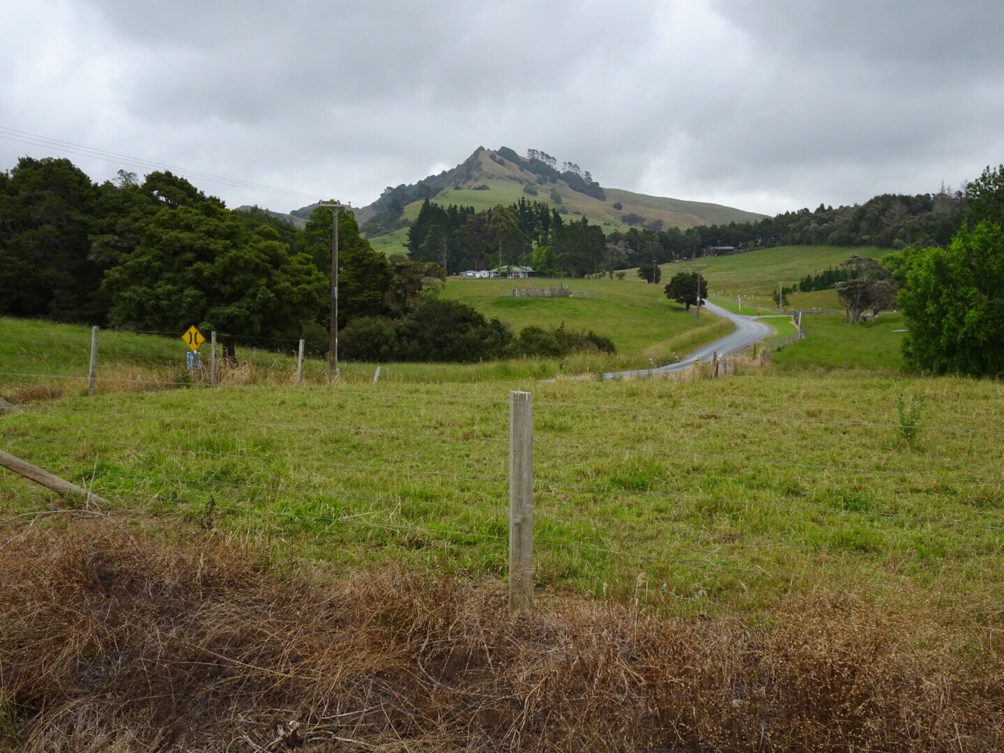
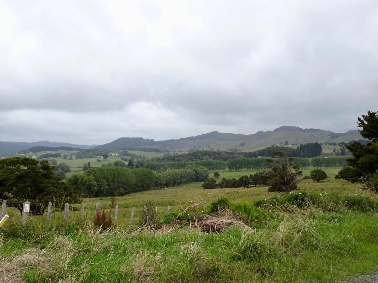
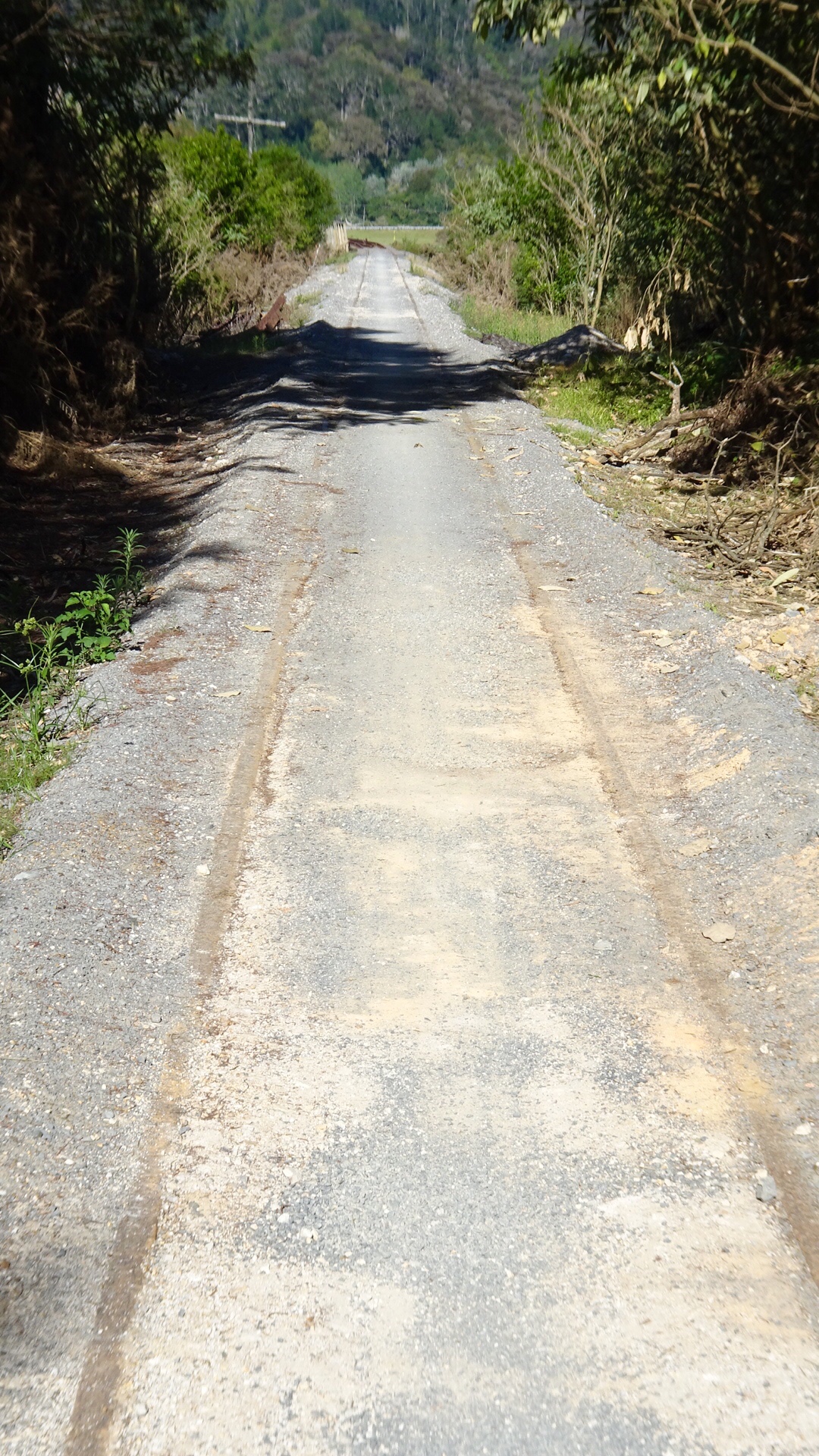
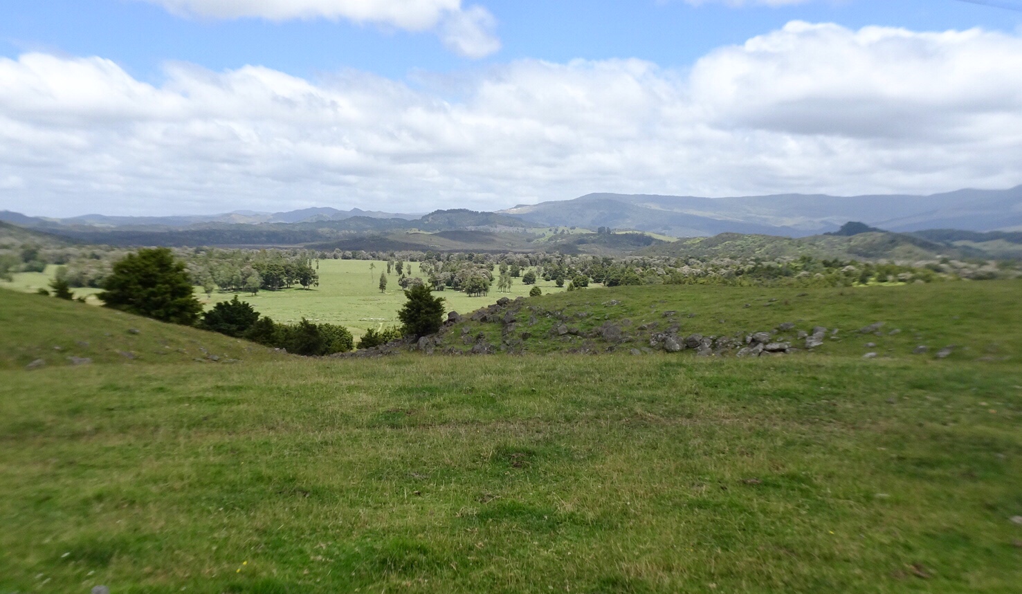
Some interesting areas passed including conservation and farming land.

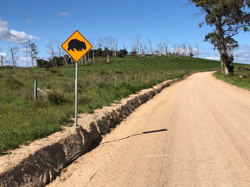
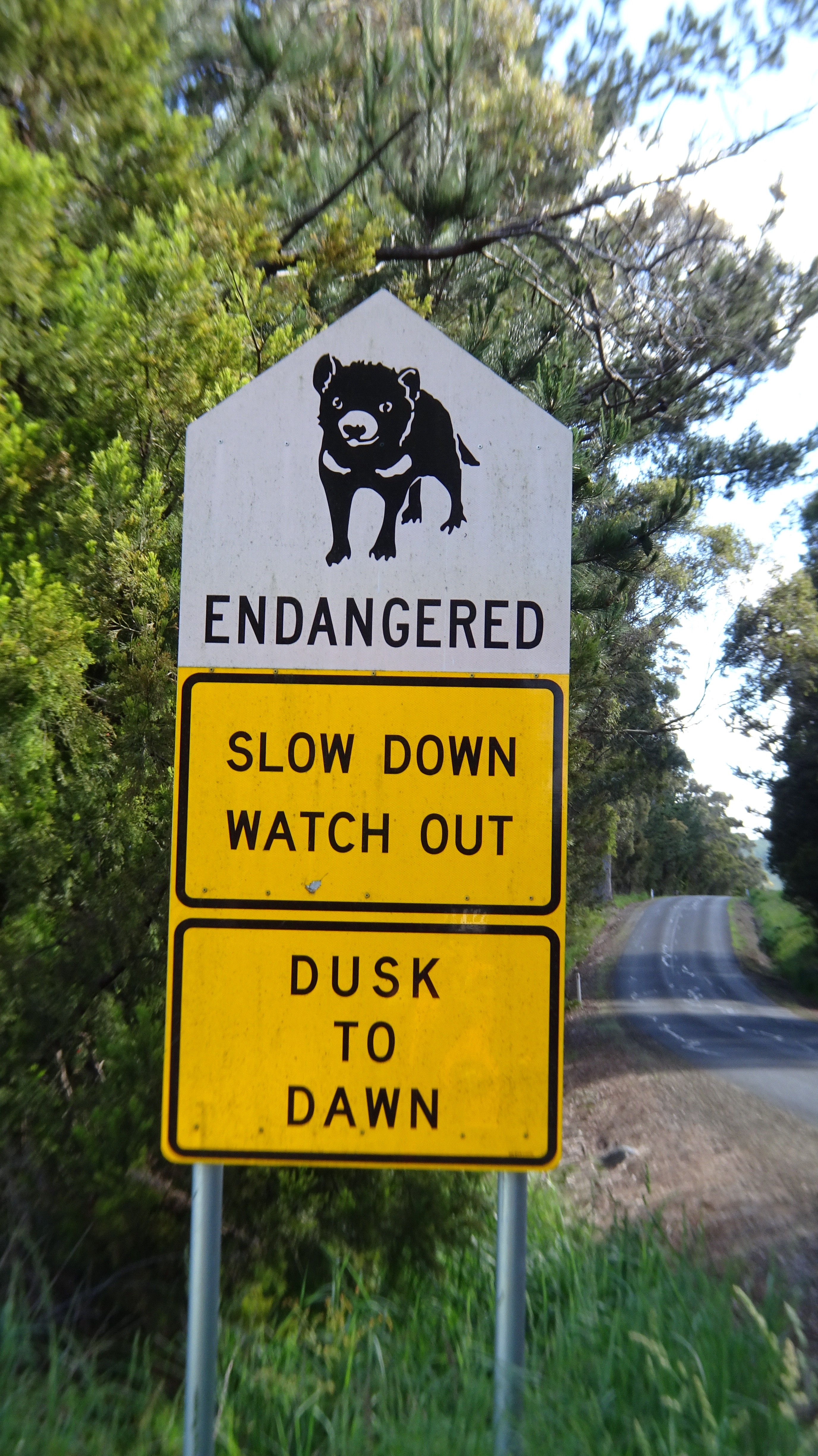
A lone wombat sign. So far we’ve not seen any live wombats but sadly have found 3 dead roadkill.

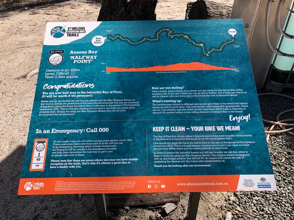
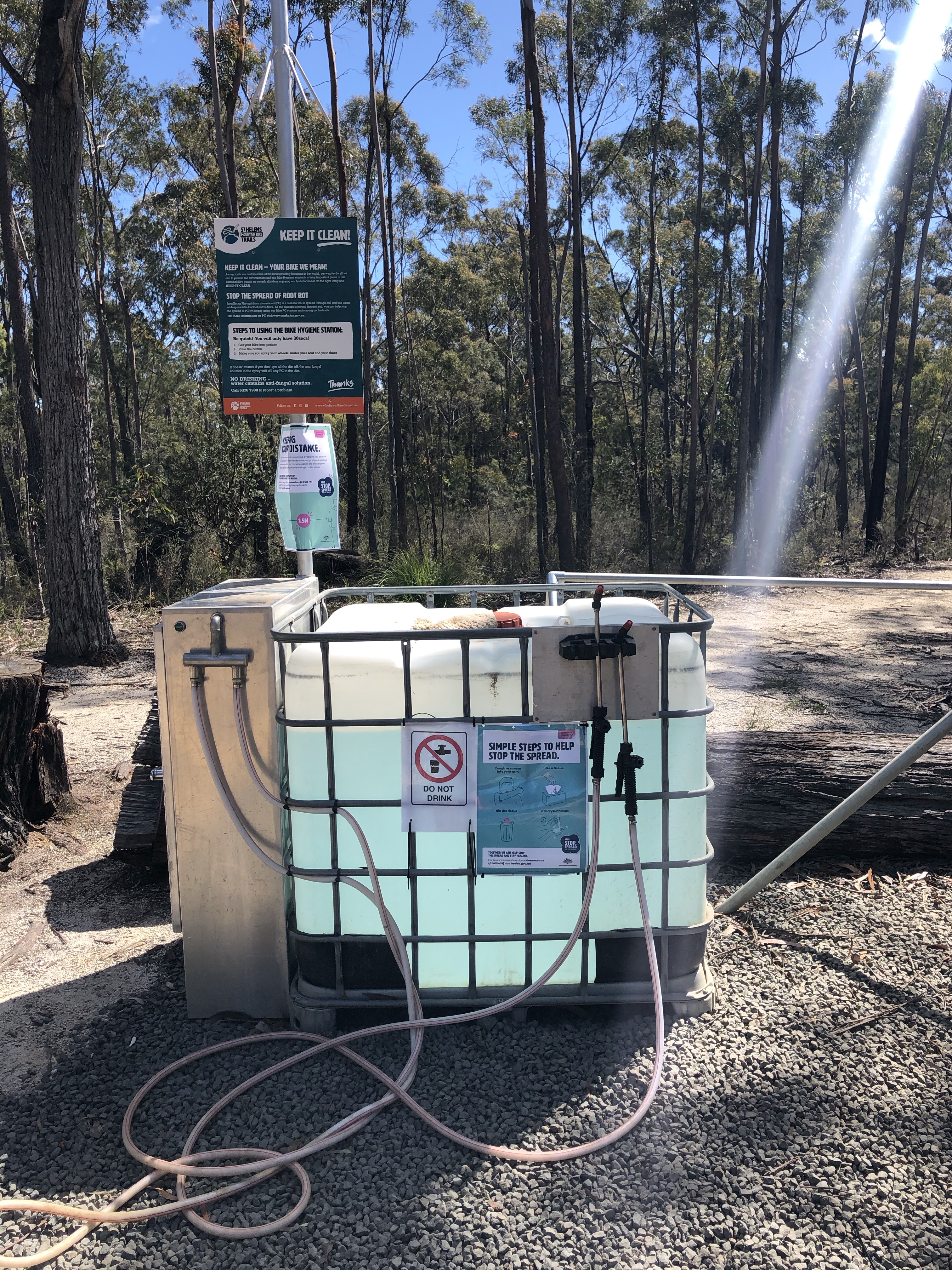
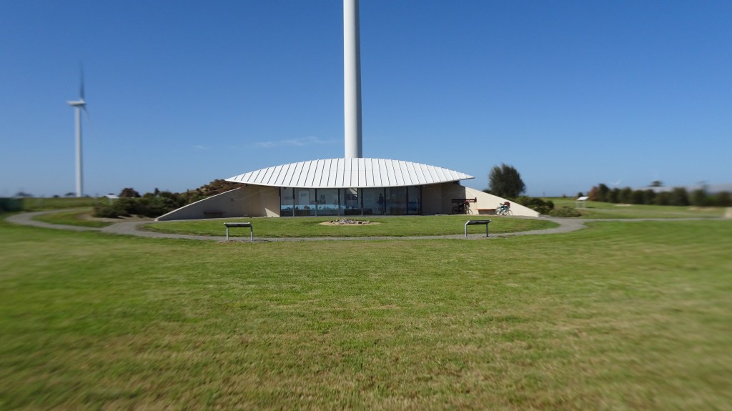
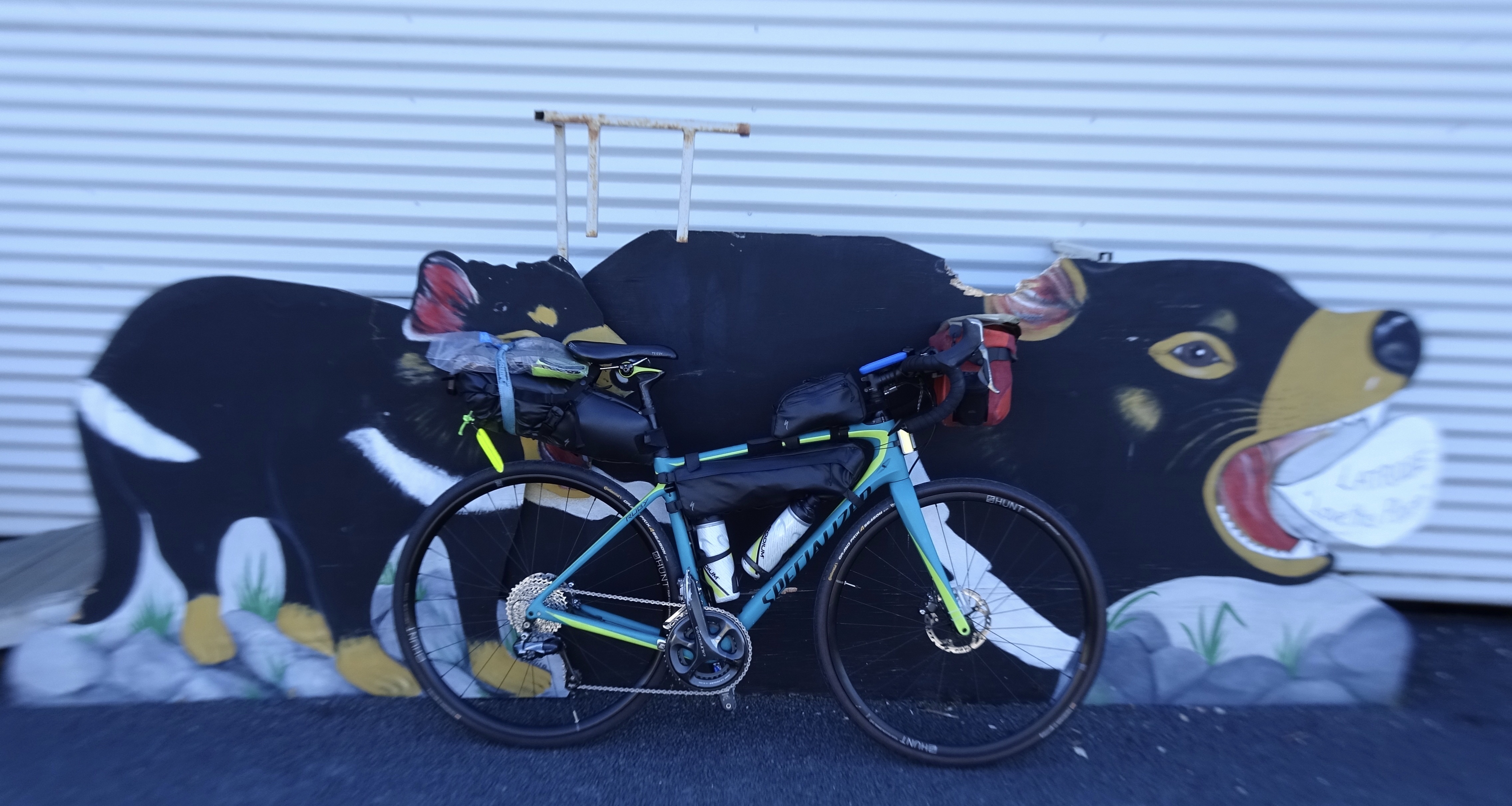
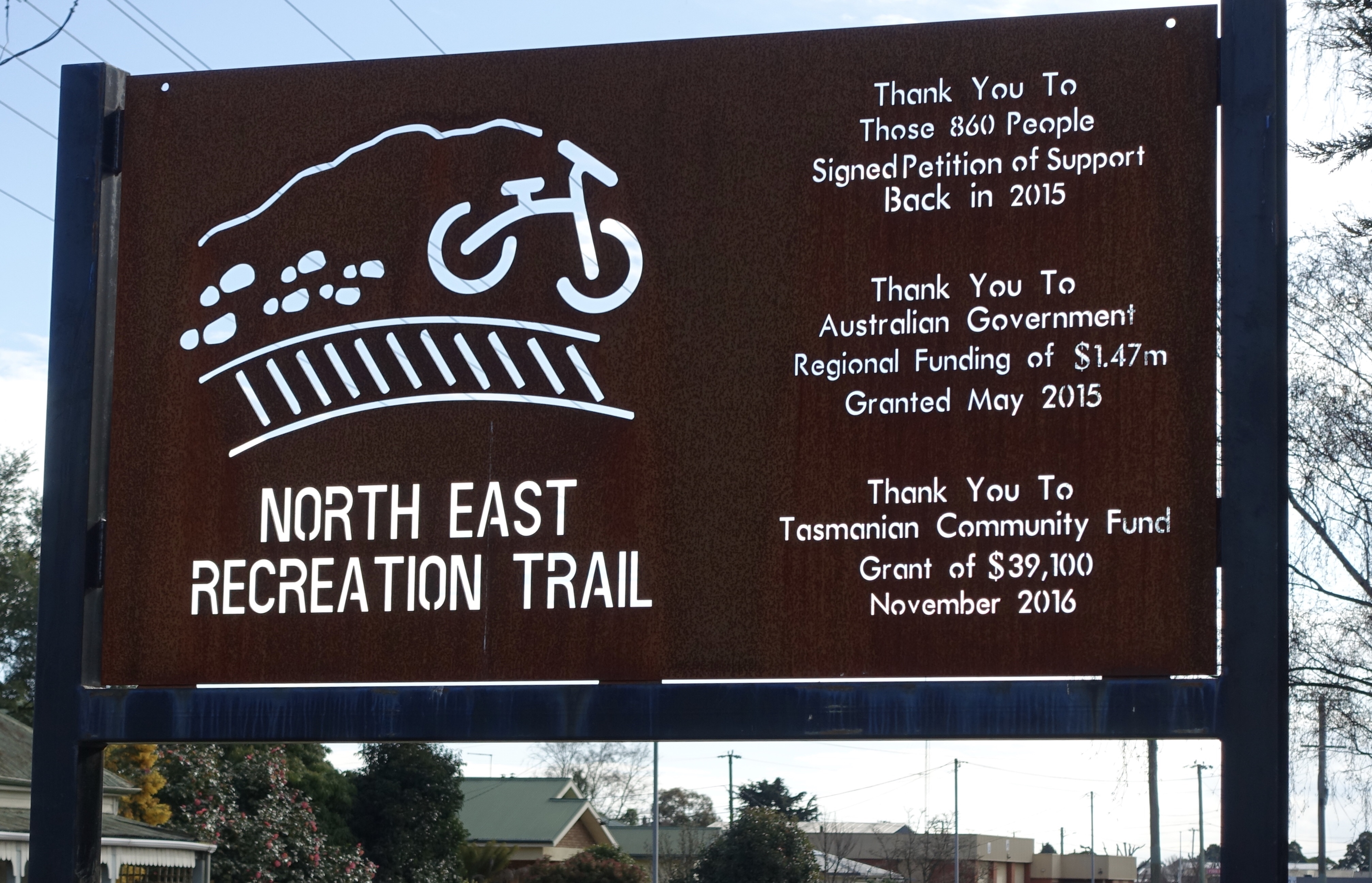
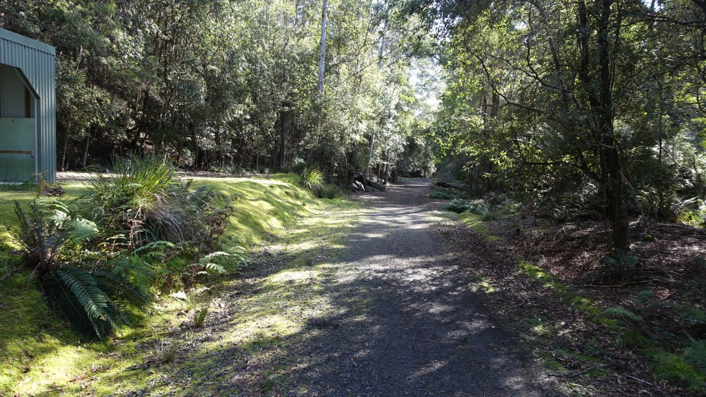
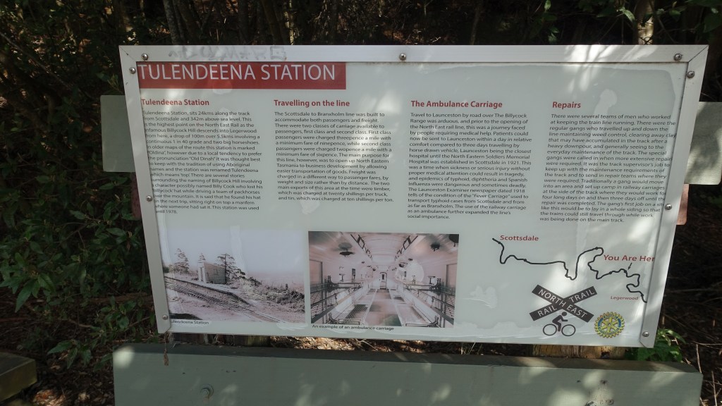
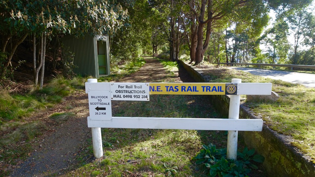
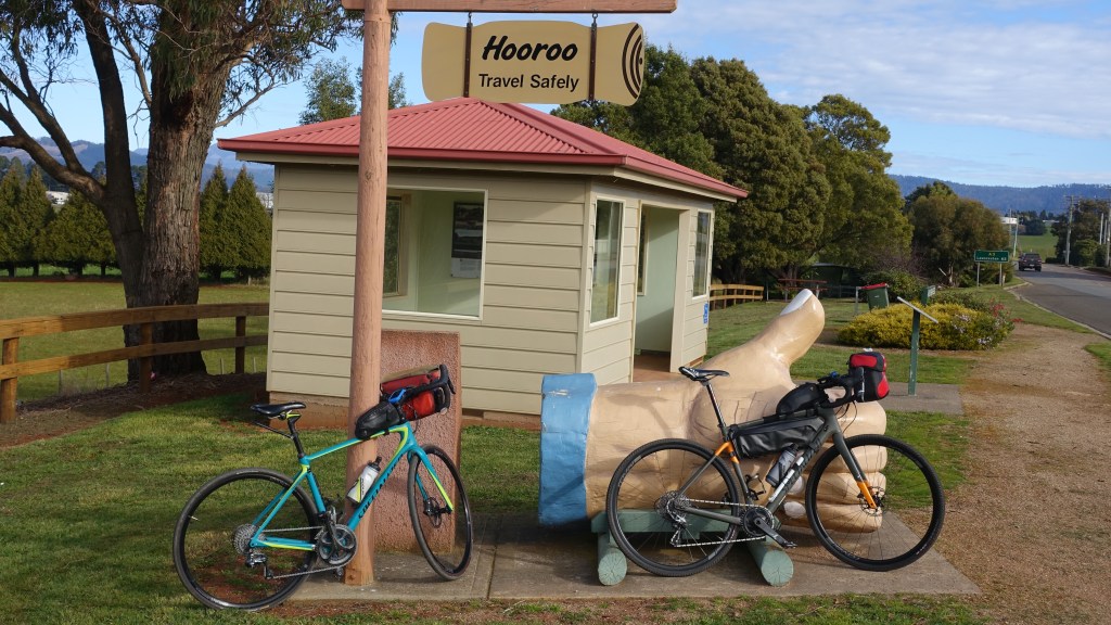
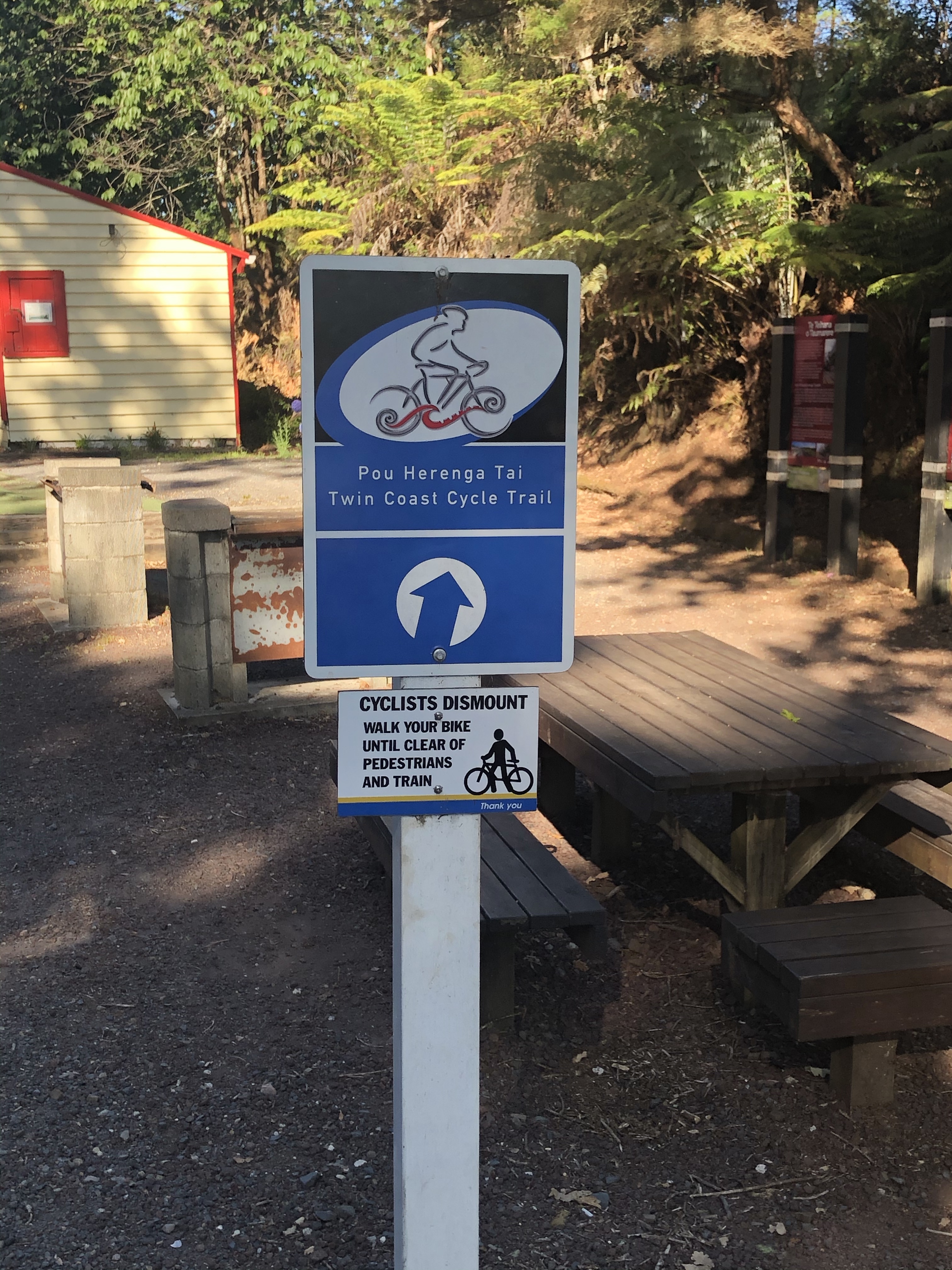
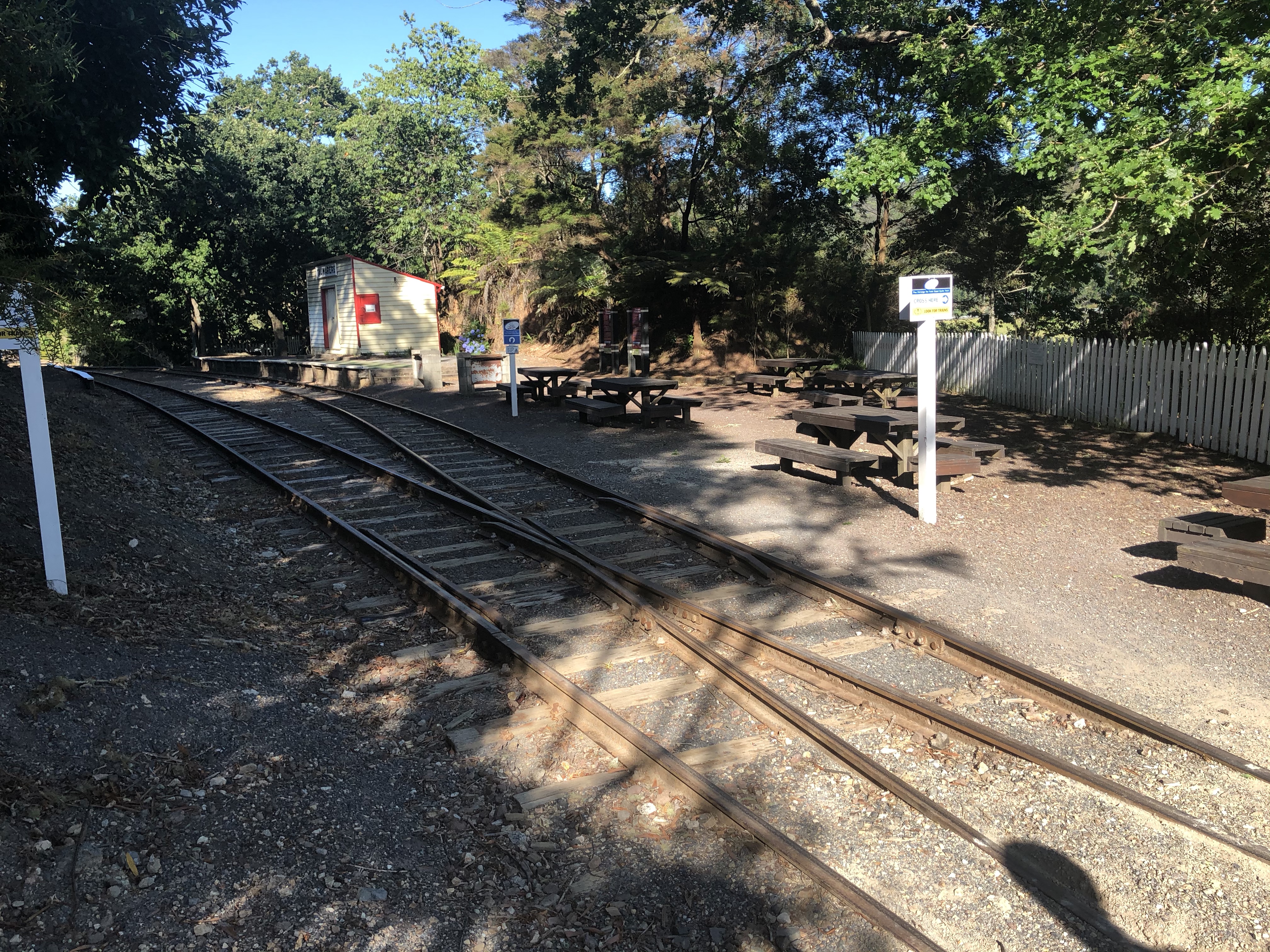
We ventured upon the newly opened Derby to Bay of Fires MTB track half way point. Plenty of bike racks, two tables (you cannot sit as nothing to sit on) and a wash station.

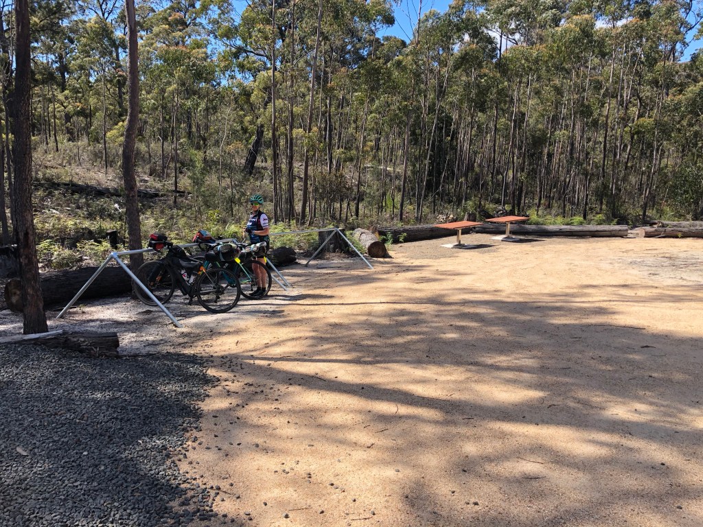
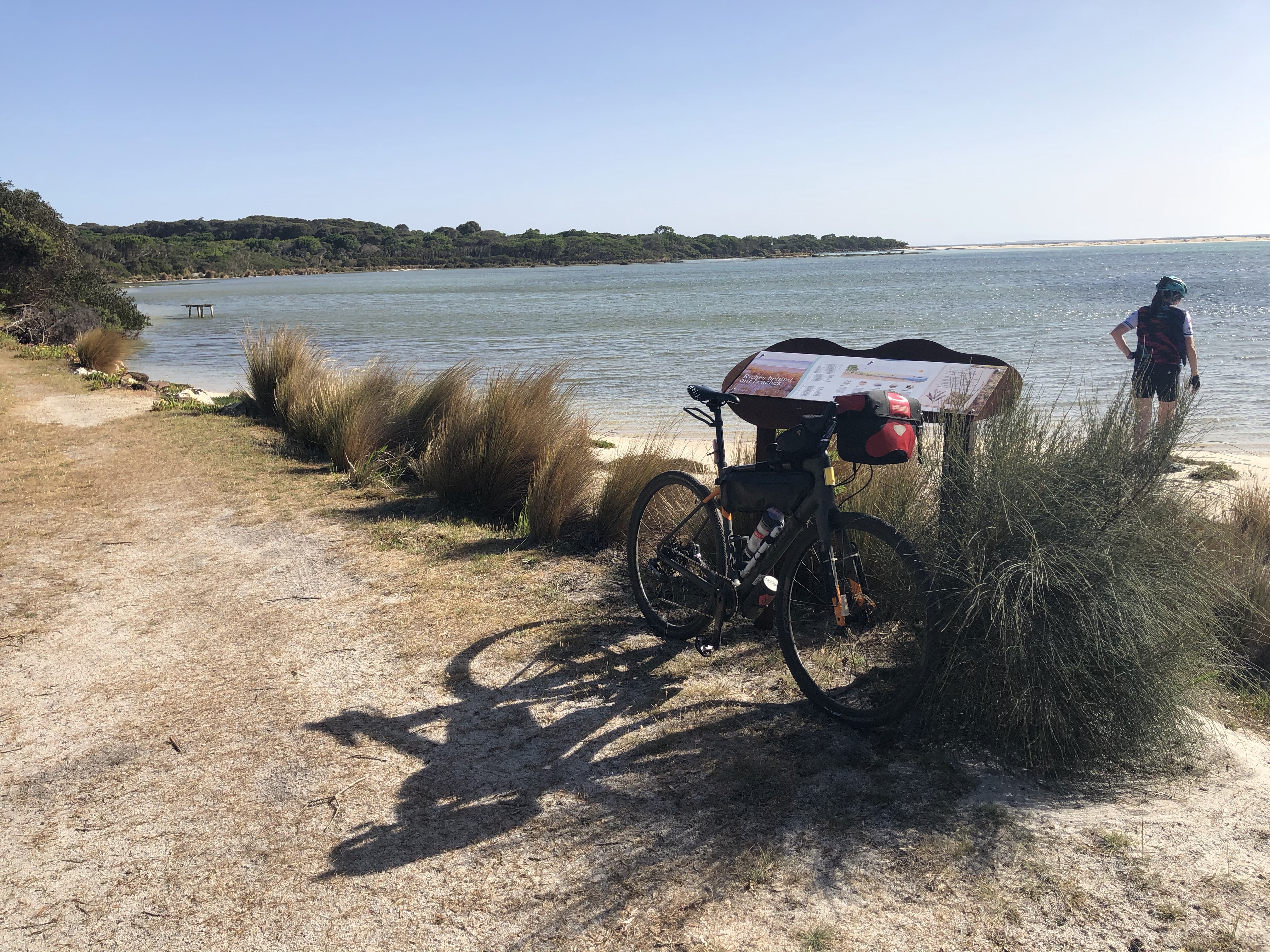
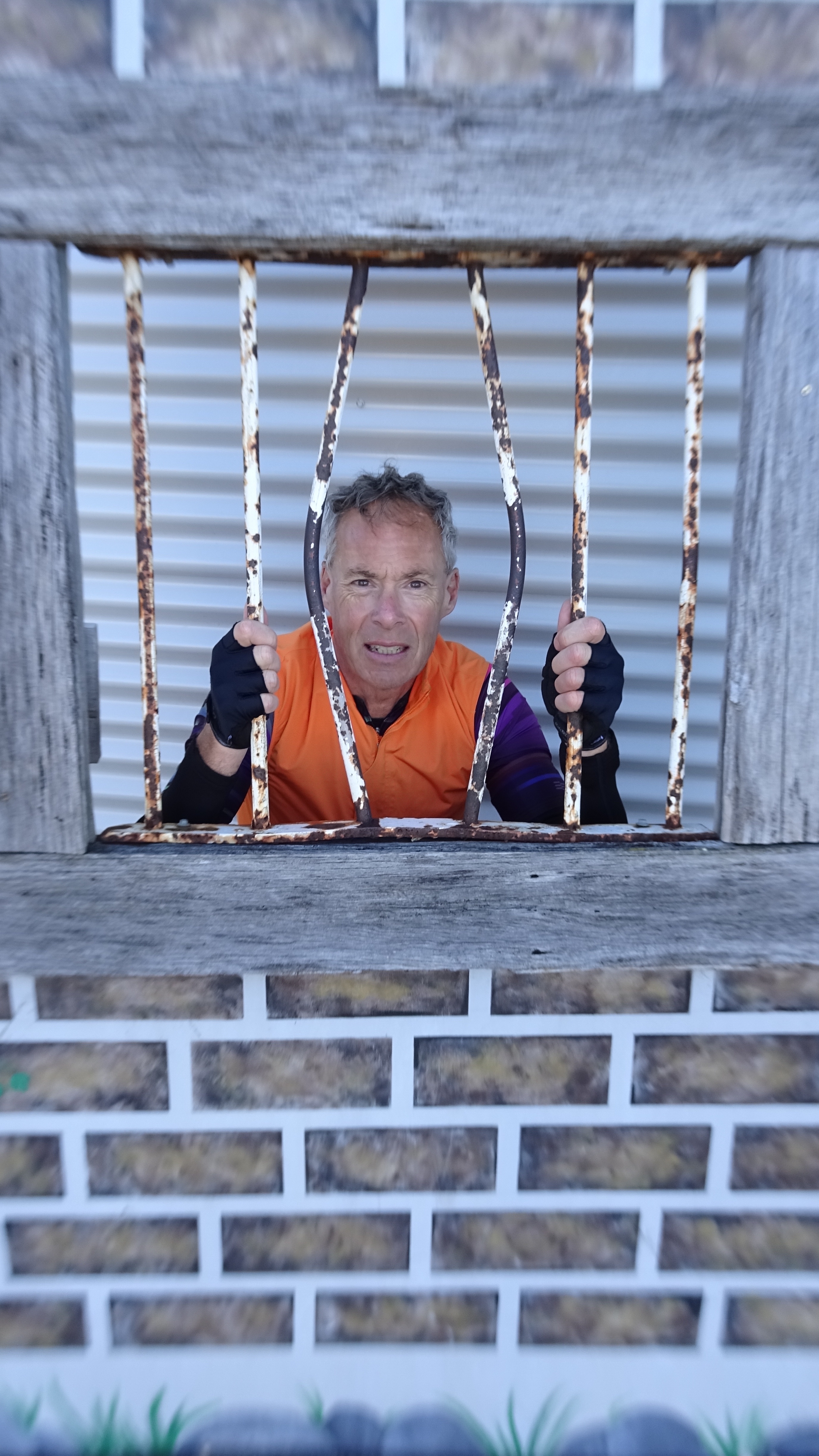
Given you can’t sit and chill at the table, I might as well rest.

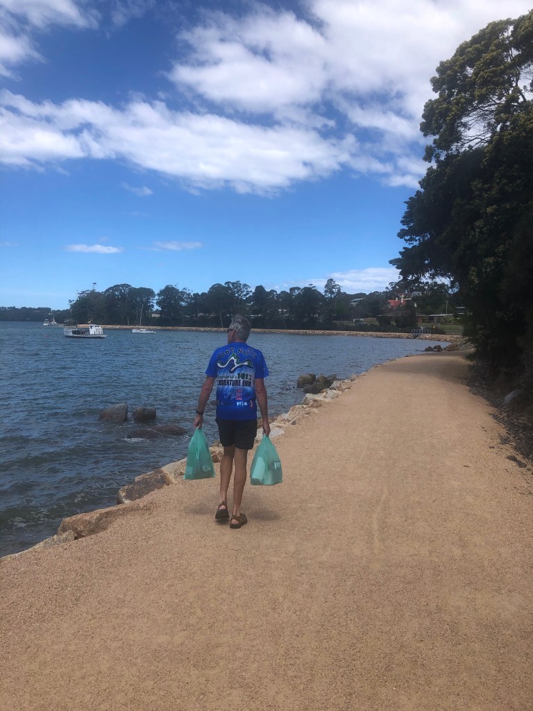
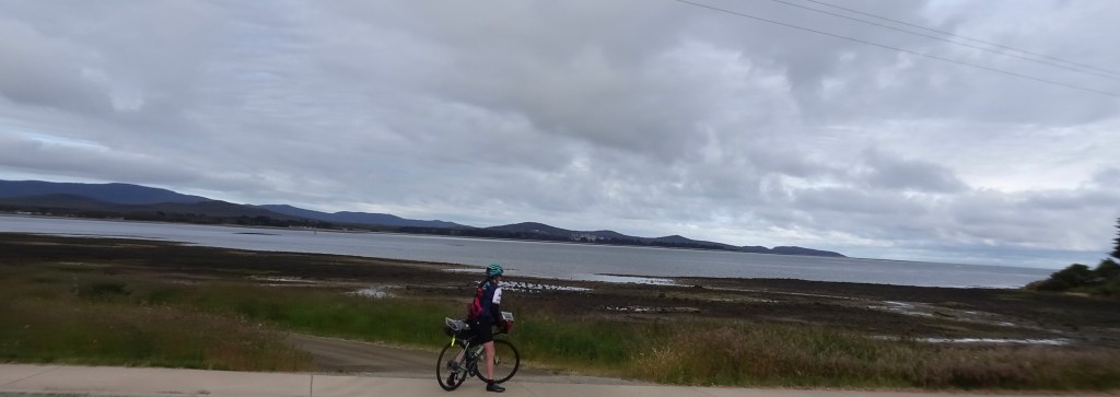
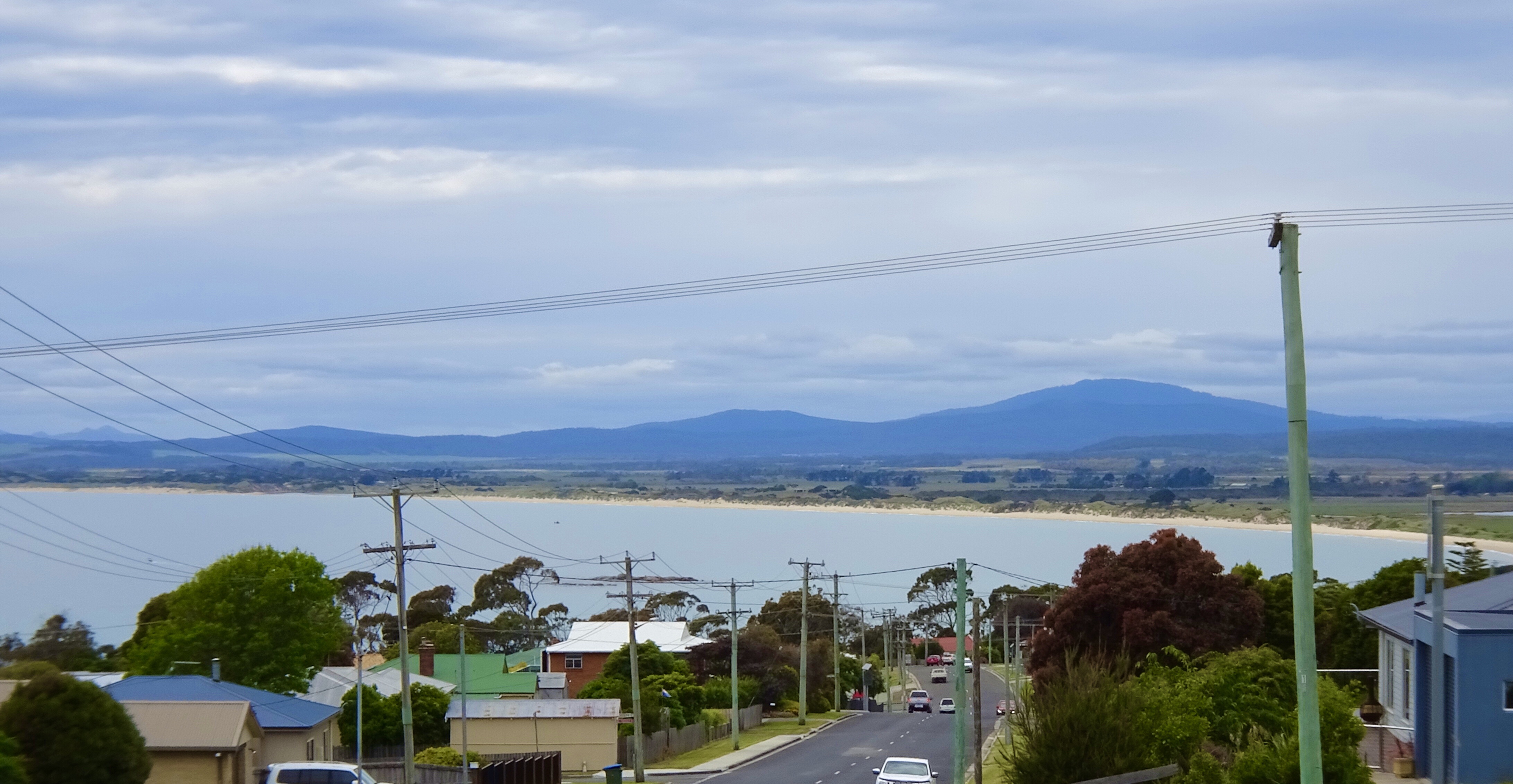
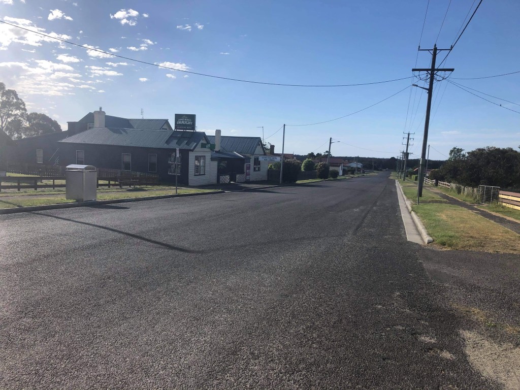
We arrived in St Helens around 11 am, plenty of time to chill, starting with a nice coffee. After checking into our accomodation we headed to the local supermarket to grab dinner and breakfast supplies, walking along the new foreshore path.

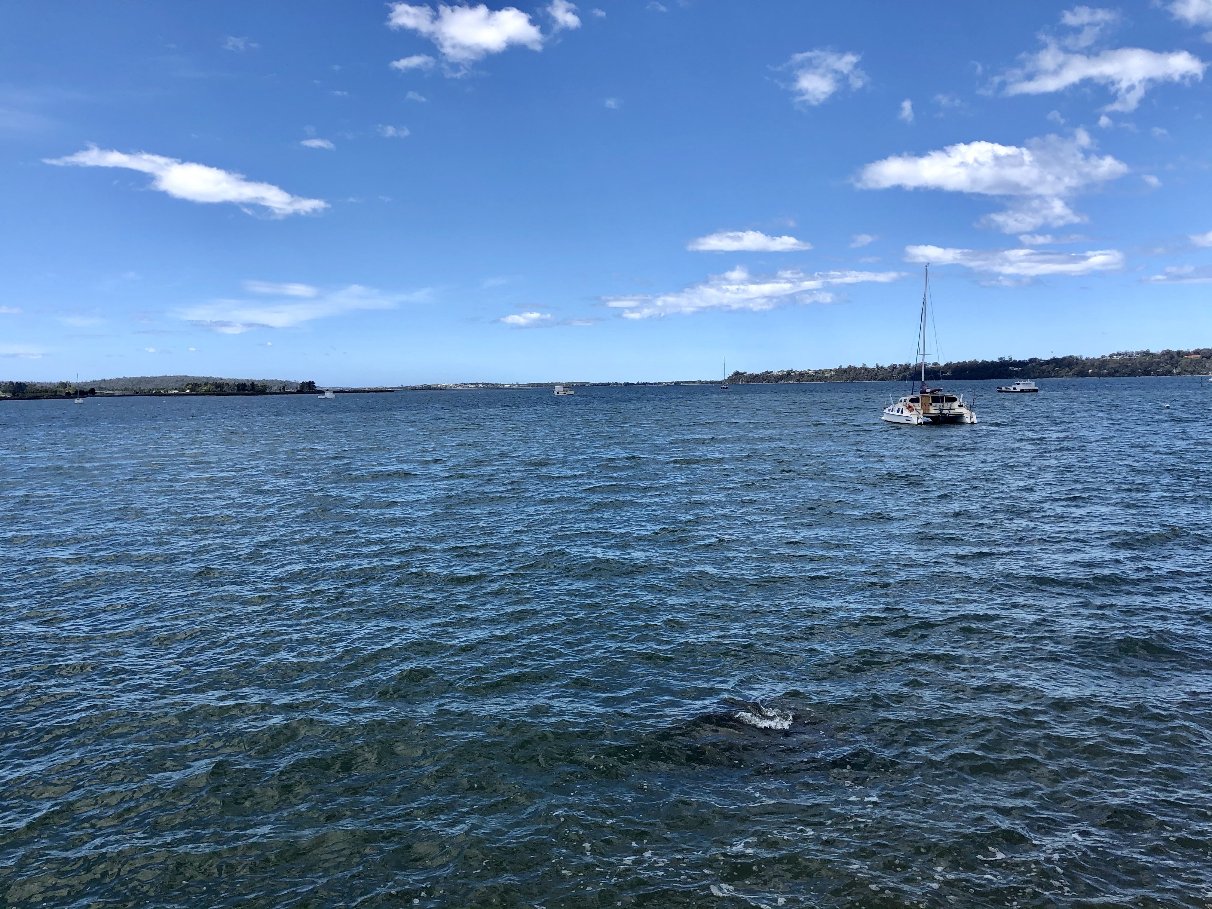
So this photograph is really for one person, who will laugh. Leon White! We found your stolen donut trailer!

Day 4 done and dusted. Tomorrow we head down the East coast to Swansea, overlooking Freycinet and the Hazards.

Thanks for reading, Ooroo.

Gnarly

What a unique bed head, made by the pub owner from wood acquired from the Portland wind farm. Appropriate as that is where we were planning to ride, and that is Tony checking out the wind forecasts.

Not looking great. Better get moving!

Leaving Gladstone we descended to the Ringarooma River. Looks like a great place for a dip on a hot day.

What goes down must go up when cycling, and I laughed as I noticed Tony being chased up the hill by this dog. The dog was barking, and when it stopped, started howling. Not sure if it was seeing Tony off, or wanted to join us.

Note the dog back left running up the road.
Not a bad runner but we out cycled him.

Looking ahead towards her coastline.

A great photo as Tony took this from the top of a hill watching me further ahead

We had a pretty good ride up until the last 5 km before the wind farm. Then we had a northerly headwind, confirmed by the turbine blade positions. The picture below shows a good aerial shot providing perspective.

We rode to the very end of the gravel road, and found this walkway and great little beach.

Heading back along the road we turned off to Little Musselroe Bay. The shots below are from the boat ramp (fairly rugged construction) with some delightfully located β€˜rustic’ shacks.

Further along the same road, we rode into the campground, and that was really nice.

There are two shacks off the campground and position, position, position. Tony went past the β€˜do not enter’ sign and took these two photos.

The Tebrakunna Visitor Centre was to be the next stop a few km past the campground, up a hill with extraordinary wind exposure! The centre was excellent and well worth visiting. It was a welcome respite from the winds (inside the centre).

Mannalargenna was born c1780. His clan was the pairebenna and his homeland tebrakunna ( Cape Portland). Mannalargenna was a revered bungunna, formidable warrior, and in his older age, considered a seer.

Before the arrival of the white colonists, he and his people had lived an uninterrupted cultural life world. Throughout the 1820’s mannalargenna led his warriors in a war of resistance. Ultimately the story is shocking, with the decimation of his people too sad to write about. They were hunted and killed and their clan of over 10,000 reduced to 300 and then they were shipped off to Flinders Island.

Some wonderful examples of aboriginal arts see on display.

The wind farm has 56 turbines, 80 metres in height. Each turbine blade is 44 metres long and each turbine has 3 blades weighing 7 tonne each. Each turbine can generate 3 megawatts.

The average wind speed at the wind farm is 9.1 metres per second, or approximately 33 km/h, so hardly surprising the farm is very windy and is regarded as a world class wind resource. The turbine blades feather and stop turning at 90 km/h ( 50 knots) but are designed to withstand wind gusts of more than 250 km/h.

We later checked to see how strong the winds were that we were experiencing on our ride out and found out that it was 48 km/h gusting to 67 km/h. Close to non rideable, and questionable safety wise.

We continued to battle staying upright and the gusts continued throwing us around. We rode in the middle of the road, as we had good visibility both ways and it provided us with a few extra metres from the left gutter margins.

A welcome reprieve was a necessary stoppage to allow this herd through.

No more pictures were taking heading back to Gladstone as we really struggled, and put our head down and counted the km down . We had intended to visit Little Blue Lake, but keen to get the bikes, and us, off the roads. It was scary riding in this wind and I did my best to control the bike and stay on it. Progress was slow.

We are the only guests at the pub, and the pub is closed on Mondays. The owners were at a private appointment in Bridport, and would not return for another two hours. Once we arrived back we killed time sheltering from the wind out the front, with a direct view of this renovators delight across the road.

This old church is for sale a few doors down. Not well maintained externally but internally quite nice and only $130,000.

Tomorrow we head to the East coast. We are hoping the forecast winds are a bit less…and intend to set off early. Most of the ride will be gravel, so it will be a slower ride, regardless of the wind possibilities. We have chosen it as the main road is quite narrow and windy.

Thanks for reading, Ooroo!

No we are not dodgy…

Up and about at the crack of dawn and not having any breakfast supplies we ate one of our emergency protein bars and drink. We had intended to head into George Town as the supermarket opened at 7 am but we could not be stuffed….as our route turned east before the town and we would have to double back.

Over the road from our accomodation we had a final look at the Tamar River.

Well we thought it was our last view but we had to climb a hill and there was another final view.

Our choice of route was great. Literally car free at such an early hour Sunday morning. We arrived at Beechford, where there is a nature reserve.

A smaller section of dirt road before our route brought out onto the main arterial road servicing the north east. No avoiding it.

We stopped for some food at the Pipers River store, and were amazed at how busy it was. Most drivers seemed to have dual cab utes.

Certainly the road was much busier but we made good use of our Garmin radar notifying us when cars were approaching well before we could hear them or see them in our bar end mirrors. We soldiered on to Bridport where we planned a longer break.

First views of Bridport from the top of the hill.

As we ate our lunch, we both discovered people we knew but not seen for a long time. For me, it was Cathy C, a swimming mum who I had not seen for around 12 years. Her husband Marcus and I had managed a Tasmanian swimming team one year at national championships.

Tony…..well, a mob of motorbikes pulled in adjacent to where we were sitting. I could see Tony checking them out (as he used to sell motorbikes many many moons ago). He went to pop something into his bike bag and next thing a motor bike guy starts talking to him about bicycles. I knew it would not be long before the topic changed to the other two wheelers. Some 20 minutes later I took this photo…I got sprung πŸ˜‚

Leaving Bridport a snap of the Bridport River and across the bay to where we were heading.

The surrounding land as we rode towards Waterhouse was very open grazing land

The biggest laugh of the day happened just past Waterhouse as we hit 100 km for the day. We wanted to stop and have a break and snack and finally found a lovely spot just off the road with nicely mowed lawn and shade.

We leaned our bikes against a tree and about 5 minutes later the local farmer arrived with support. He (Barry) had seen our red flashing rear lights and thought he’d better check us out, in case we were dodgy. Apparently they do get the occasional dodgy! We passed the test and had a lovely chat.

Barry, Casie and Cameron…Tillie and Thomas turned up to see what was going on a bit after this photo.

The farm is predominantly beef, lamb and cropping and quite large, with frontage into the beach. Sounds idyllic until I asked about snakes. Yes heaps of them including some huge tiger snakes. Eeeeek.

So this must have jinxed us. Great we were not dodgy but not that far up the road (about 10 km) was a very brilliant coloured copper head snake. It was a metre or so away from the bike as I screamed past. I decided I should scan the road more carefully, as it was quite warm and the last thing I wanted was to run my wheels over a snake and get it caught in my wheels or chain!!

Not our photo but this is a lowland copperhead…one of 3 venomous snake varieties in Tasmania. Deadly poisonous and protected.

For some distance we had been viewing Mt Cameron.

After a nasty climb to finish the day we arrived in Gladstone. Not a busy town but once upon a time it boasted 2 pubs, a bakery and 2 butchers, but these days you could sit down in the middle of this main road.

That is where we are staying, Gladstone Pub. We are the only guests.

A quick walk around town we found what looks like an old jail? Must remember to ask the pub owners.

An abandoned building has an interesting mural.

Our day is done and dusted. 128 km and 1050 metres climbing in what was lovely riding conditions. We had some mizzle and had our raincoats on and off a few times, but overall the day was great.

Thanks for reading……Ooroo.

Batman – na na nana

The view from our back deck as we ate breakfast at home

We were up early. Tony had forgotten to turn the weekday alarm off, so at 4.45 am some random song blasts out of the radio.

We got up, as we were wide awake.

We took our time and had a solid breakfast including mushrooms, bacon and eggs.

A few last minute checks and we were ready, rolling out the gate at 7 am. A note here about the photos…later in the day when uploading the photos we discovered an issue with the camera using automatic, it has applied macro, hence the blurring. Tony has subsequently found a way to override it….fingers crossed.

3 weeks worth of gear on each bike
Selfie

Our plan took us straight out onto the Bass Highway, through Don and skirting around Devonport to Spreyton and then Latrobe. There was no wind and we knew that would not last as the forecast predicted NW winds of 30 kmh plus. Westerly would be ok for a bit, but the northerly could become an issue later.

Lillico…looking along the penguin rookery area. This is only a few km from home.
Local scarecrow as we turned off the Bass Hwy

Made use of the public toilets in Latrobe and liked the following….well I am descended from about 18 convicts I have traced so far, including a First Fleeter.

I have no explanations though for this guy as he has a distinct lack of convicts in his ancestry.

From Latrobe we started climbing up towards Moriarty and Harford, rich agricultural land.

Wonderfully rich soil colours

We crossed the rice grass infested Rubicon River as we edged our way towards Narawnaptu National Park.

Before we turned onto the dirt road we came across this sign, not an unfamiliar one to most Tasmanians. The Tasmanian Devil survival is threatened due to a facial tumour disease that is a contagious cancer.

In this particular area, many undiseased devils have been released, and sadly killed by cars. The devils feed on carrion ( rotting flesh) and many native animals are killed by cars around dusk and dawn. The devils come out to feed on them ( in the middle of the road) and sadly they too get hit.

We had decided to take a dirt road option near the National Park boundary as it would get us off the narrow and winding Frankford Highway. The downside was that it was quite steep in places.

There were pinches of up to 12 percent with loose slippery gravel that also featured some delightful corrugation. Part way up an older couple stopped and told us β€˜it gets worse’ and to be careful.

They were not wrong. I found it very challenging with my bike wanting to take a different line to the lower level, slippery camber.

Worse was the descent. You could walk faster!! The descent was up to 15 percent so I was thankful that we did it the other way.

What did amaze us was that we crossed Municipalities into West Tamar, and the road improved out of sight. It was better compacted and far less corrugation.

At the end of the dirt road is Yorktown, the site of the first permanent settlement in northernTasmania. The site was selected as fresh water was available and a town set out. however, it was an failure and did not proceed.

The history cairn. There is a short walk nearby.

We were hungry by now, and Beaconsfield was about 5 km away. We check into a local bakery adjacent to the old Beaconsfield Gold Mine. Well know to Tasmanians as it has had a fairly checkered past, including the more recent disaster that will live on in many Australians memories.

The famous spot where the world first saw the two survivors.

Are you looking for a unique Christmas present for someone special? The gift shop in the Heritage Museum had some unusual choices.

Moving right along…..we headed towards Kayena and Sidmouth

From Sidmouth boat ramp….Batman Bridge. At work the pronunciation discussion-debate has ensued for many years. Mike B, a Kiwi insists that it is Bat Man ….yes like the famous Batman character. However, he is wrong! We do like to tell him that.

This Batman is named after John, who founded Melbourne. Before that though, he lived in Van Diemans Land ( Tasmania) in the 1820’s rising to prominence hunting bush rangers and sadly through his participation in the Black War ( Colonists vs Tasmanian aborigines).

His name is pronounced Batmn.

The Batman Bridge is 432 metres in length and 91 metres in height. It was opened in May 1968.

I visited the bridge during construction with my step granddad. He was a Tasmanian Minister in Parliament having held numerous portfolios. He married my nan in 1967 and he passed away a few days short of their first wedding anniversary, also May 1968.

Therefore, my visit with Tom would be late 1967 or early 1968, aged 5. I still remember it though. In latter years, I did numerous cross country running events over the bridge.

We needed to cross the bridge but chose to follow a dirt road around the Tamar River to visit the Auld Kirk church.

Time for a rest.

We crossed the Batman Bridge and the wind was really picking up now. Very gusty NW and we knew this was going to become a slog soon. Turning left onto the East Tamar Hwy we battled very strong head and side winds. Very slow as we climbed and just ticked the kilometres over.

We were relieved to arrive in George Town.

We did a quick reccy to check out food options noting lots of food shops closed. We then headed towards Low Head and checked in to our accomodation. Feeling a bit wind battered ( we checked the current weather reports and it confirmed the wind was 39 kmh NNW).

We were only 3.5 km from the Low Head lighthouse and initially just could not be stuffed as it meant headwind. Being out and back, tail wind home. Off we went.

First stop was the old Pilots station. You can rent accomodation here, have a meal and there is also a museum. It was established in 1805 and is Australia’s oldest continuously used pilot station.

The lighthouse was established in 1833 and was Australia’s third and Tasmania’s second.

The lighthouse sits at the mouth of the Tamar River overlooking Bass Strait. It is a particularly rough piece of water.

Big first day. 127 km and around 1400 metres climbing, too much dirt and crappy headwinds to finish off.

Tomorrow another big day so better get some shut eye. Thanks for reading. Climbing details and maps below.

That nasty climb in the middle was the loose gravel.πŸ™ˆ

Never say never.

2020 has been a year like no other. We all know that, we have all been affected in various ways.

The sad reality of cancelling our Italian, French, Swiss cycle holiday in May plus our cycle tour of Taiwan hit home. The saddest part is knowing I won’t see one of my kids (Ben) for what literally could be years (as he lives in Switzerland).

I have always needed goals, and with two being removed, saddled with another reality check of Tony being made redundant after 25.5 loyal years with Caterpillar (and that was via Skype) new goals seemed difficult to find. We always knew that one day this would occur, but we had a plan…I would take 6 months off and we would travel. I never did factor in a global pandemic. The timing was a bit sucky.

My travel guide reading started to resemble the picture below….

My work had changed. I’d been pulled off my usual activities and was establishing and administering a grant program for business continuity. I was also assessing a sustainability grant and loan applications. Daily my job involved reading multiple stories of financial and personal distress particularly in the hospitality and tourism sector.

Much coffee was consumed…reminding me again of the cycle tours where it was cafe to cafe to cafe…..reminiscing of wonderful trips of years gone past.

Trek ambassador these days…complete look with socks and coffee. 😊

We had never contemplated doing a cycle tour in Tasmania. Whilst the roads are superior to Europe we do not have the same cycling mentality/acceptance with our car drivers. Frankly they can be pretty scary here…and it only takes one careless driver to snuff your life out…in a split second.

As I sipped that coffee it hit me…no, not the car….but C19 presented a unique opportunity as there were no tourists (at that time). Our roads, in theory, should be quieter. Hopefully quieter would equate to safer.

Since that realisation, our borders have opened to most states of Australia, but not international tourists.

I also have not had one day off work on annual leave since last Christmas. There was one period where I worked 7 days a week for over a month, under a lot of pressure. It has been a tougher work year and a bit of time off would be good for the mind, body and soul.

So we started mapping and came up with a plan.

This route is just over 2100 km. Far too much climbing, and some gravel sections. But this is touring and we will chillax as much as possible, trying to get on the roads a bit earlier (as most places here do not provide breakfast options like Europe) to try to minimise traffic as much as possible.

Our first port of call is Low Head. Other overnight stops include Gladstone, St Helens, Swansea, Orford, Port Arthur, Acton Park, New Norfolk, Strathgordon, Mt Field NP, Lake St Clair NP, Strahan, Corinna, Waratah, Cradle Mt NP, Deloraine, Poatina, maybe Deloraine again, then home.

I have certainly got a serious amount of km in my legs…41,000 km this calendar year…that is more than the worlds circumference. The legs are tired, having just finished a massive October raising $ for kids cancer charity. I rode in excess of 5,000 km, and raised $16,800. Full recovery won’t be possible before this tour starts, but we will be taking it easy. This ride is not about speed but safety and enjoyment.

Covid presented other opportunities this year including being the first female Zwifter, globally, to ride 100,000 km. That occurred in April. I am now at 129,500 km. In addition, this assisted me in becoming a Trek ambassador in Australia….so look for the opportunities in difficult times.

Door to door cycling has its advantages…no packing your bike up. We will roll out our driveway maybe 7 am ish…..this coming Saturday. Cycle touring is all about β€˜ish’. So stay tuned for the latest adventures.

Ooroo

North Eastern Rail Trail

This ride has been on the bucket list for some time, and the opportunity presented itself last week. The weather forecast was good, if a tad chilly.

The big decisions – what bike? The obvious choice was to take my (Specialised Rockhopper Pro) MTB bike given the trail is all gravel and we would be doing over 50 km of gravel.

However, I do not generally do obvious! I chose to dust off my touring bike (Specialized Roubaix) as I had not ridden it since our last cycle tour in New Zealand at Christmas time, and I missed her!

The drive to Scottsdale took a couple of hours, and crossing the Sidling I was feeling decidedly seedy (as I do suffer from car sickness at times). I was most relieved when we pulled into the old Scottsdale railway station site.

The Scottsdale to Branxholm line was built to accommodate both passengers and freight. In addition, there was an ambulance carriage to allow patients requiring medical help in Launceston to travel easier. Typhoid patients in 1918 resulted in the carriage being known as the Fever Carriage.

Leaving Scottsdale, the track gently descends passing by some homes and then farmland.

We saw a sign indicating toilets some 700 metres away at a camp ground and went to pay a visit – we did not find them, and went bush, then necessitating a short 16% gravel climb back to the main track!

Looking for the toilets. How hard could it be?

Scottsdale’s strong heritage with forestry is undeniable as we pass by business involved in forestry and then forest coups. This warning sign ensured we did not stray off the track.

Effective signage.

This sign brought back memories from Europe – one of when we were riding through France and entered a French armoured tank training ground, another when riding in Italy when leaving a rough path there was a warning sign advising the use of a Glock with trespassers…then there were the land mine signs in Croatia!

The track was well formed with lovely vistas.

Peaceful views

There were a few highway crossings, plus some well designed minor crossings.

At the old Tonganah Clay Mine we left the rail trail and followed a dirt road for maybe a km or so. The mine pits, now full of water, were over the former rail area.

The mine produced kaolinite, a layered silicate clay mineral, a product that had been in high demand in pottery, refractory and rubber production.

The mine opened in 1975 and closed in 1999 – post the closure the area was rehabilitated and now forms part of the Tasmanian Forest estate.

Perhaps the most impressive area of the former rail line is the section where massive cuts were made into granite. The construction of this section of railway posed many problems for engineers.

Teams of men were set the task of cutting through sections of solid granite and building bridges and embankments through ravines. It was also necessary to wind the track up and down the mountains to accommodate the maximum incline permissible on Tasmanian railways of 1 in 40.

Along 7 kilometres of track 5 cuttings were made, with depths of 10,17,11,14 and 12 metres respectively.

Trewalla Station lies 15 km from the Scottsdale station, and 204 m above seas level. The station was built to service the small farming area of Maryvale, a settlement that has since disappeared. Trewalla is a Tasmanian aborigine word meaning mountain.

Riding through wet and dry sclerophyll forest, we reached a spot where the sign stated it is possible to view the Furneaux Group on a clear day – it was a clear day, but the horizon showed little ocean given the height of the forest. The Furneaux Group consists of 52 islands, and was the base for the sealing industry, but fortunately the last sealing permit was issued in 1828.

Kamona Station – an aboriginal word for venom, lies 5 km from the Trewalla Station towards Legerwood and is situated 311 m above sea level. This is 107 m higher than Trewalla station, making it the steepest section of the rail on this side of “Billy-Cock” with an average rise of 1 in 46.

The station closed in the 1950’s and none of the original buildings remain. However, there is an excellent shelter for picnics on the site now.

Tulendeena Station sits 24 km along the track from Scottsdale and 342m above sea level – making it the highest point on the North East Rail Trail, as the infamous Billycock Hill descends into Legerwood further on.

Tulandeena Station is the end of the trail, at the junction with the Tasman Highway. Time for a snack before retracing our steps.

We zipped back as it was a gradual downhill for about 15 km, then slightly undulating for the balance. No stopping. Very pleasant and enjoyable.

Back in Scottsdale we came across this amazing thumb with an interesting story.

Joshie Janoschka was a local resident (formerly from Germany) and he had a tree fall across his gate after a fierce storm. Instead of cutting it into firewood, he opted to carve a Big Thumb, such was his sense of humour, and his gift to the district. Joshie passed away in 2004.

The final view is from Scottsdale looking back over the area we had ridden.

Is this trail good? Yes, 54 km return, well made, scenic, safe for families.

Well done Dorset Council and Scottsdale Rotary for their vision and hard work in establishing such a wonderful trail for the benefit of multiple users.

The area and incline data

Ooroo

Sharron

2019 done and dusted

Just like that our current cycle tour finishes, and it is 2020 with the blink of an eye.

Leaving Barry and Kerry early (to minimise NYE traffic) we headed out on 5 km of gravel road, climbing 100 metres. I stayed upright. Miracle number 1.

The traffic was minimal on the State Highway and only 18 degrees, nice climbing weather. The first climb was only a few km after leaving the gravel.

It was very overcast making sombre photos.

Refuelling with a shared lasagne at DD’s and it was outer Auckland and our North Shore destination arriving back at 1.30 pm.

It was straight into cleaning and stripping down the bikes ready to transport them home to Tasmania.

Another great tour concluded. A short one at over 800 km and over 9000 metres climbing, but we are both due back at work Jan 2nd.

A phenomenal cycling year that saw me amass over 43,000 km for 2019 alone, moving into 8th position overall out of over one million zwifters globally, leading female and scheduled to be the first female to attain 100,000 km globally ( June if all goes well).

I also broke the Zwift world record for 24 hours riding (women) with an 836.1 km ride in August.

I continue to be a passionate advocate for ‘older’ riders, in the face of being told I am ‘too old’. Zwift management has lost its marbles politically speaking with so called leaders/ambassadors in Australia who are more interested in their take home dollars than true advocacy and ambassadorship, engagement and motivation.

On the road we achieved a huge 3,300 km and 8 countries touring in May, facing challenges including central Europe’s wettest spring in 30 years.

2020 will be huge. Aside my 100,000 km goal I have been appointed as a ride leader and ambassador for Italy Bike Tours which will see me at the Giro d’Italia supporting riders, as best I can. This is a huge acknowledgement for what I do in encouraging others to challenge themselves, and supporting riders achieve their goals.

I have made so many wonderful friends through cycling around the world, and this year caught up with them in the Czech Republic and New Zealand.

Last night we were with a few of them in Auckland. Suzanne, Deb and Gervase are in the first photo, John, Vic and Tony in the second.

I am forever thankful for my cycling extended family, those who accept me as I am, encourage and support. You all know who you are….but in particular Gervase for being my sage and Mirek for being my little brother.

To Tony for his boots and all attitude to my crazy ideas, love and hugs.

So 2019 – behind me now!

Sweet and sour

Second last day of this cycle tour…boo,hoo…but being down the business end means needing to navigate traffic into larger cities, and in our case, peak holiday period.

Our day started off pleasantly enough at Baylys Beach. This is the view we could see from our breakfast table. The rolling hills remind me of King Island, where links golf courses have been established in two coastal areas.

As breakfast was not until 8 am, we left later than usual. Not ideal as we knew we had about 118 km and 1150 metres climbing, and the latter half on New Zealand’s busiest Highway SH1. No options really.

Today’s route. Essentially east, then south, east and south.

After rejoining SH12 first town was Dargaville. Not a particularly inspiring town, and in overcast weather looked a bit dreary. The toilets were nice and bright. We also crossed that long bridge, over the Wairoa River, which has no verge so we zipped across as fast as we could.

Then the road was very straight for quite a long time. Agricultural region boasting kumara and plenty of maize including trial crops.

There were interesting geological features that stood out in otherwise flat farmland. The first is Maungaraho Rock, an extinct volcano plug that has eroded over time.

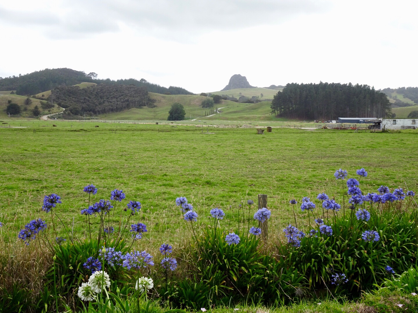
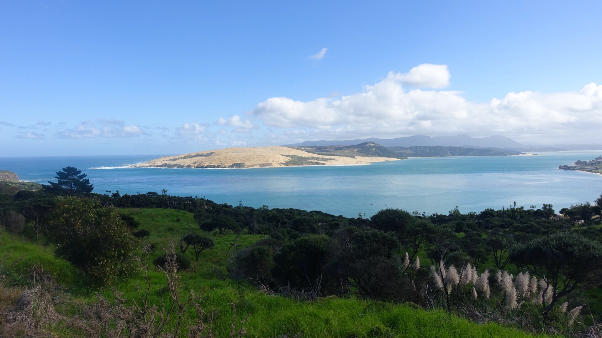
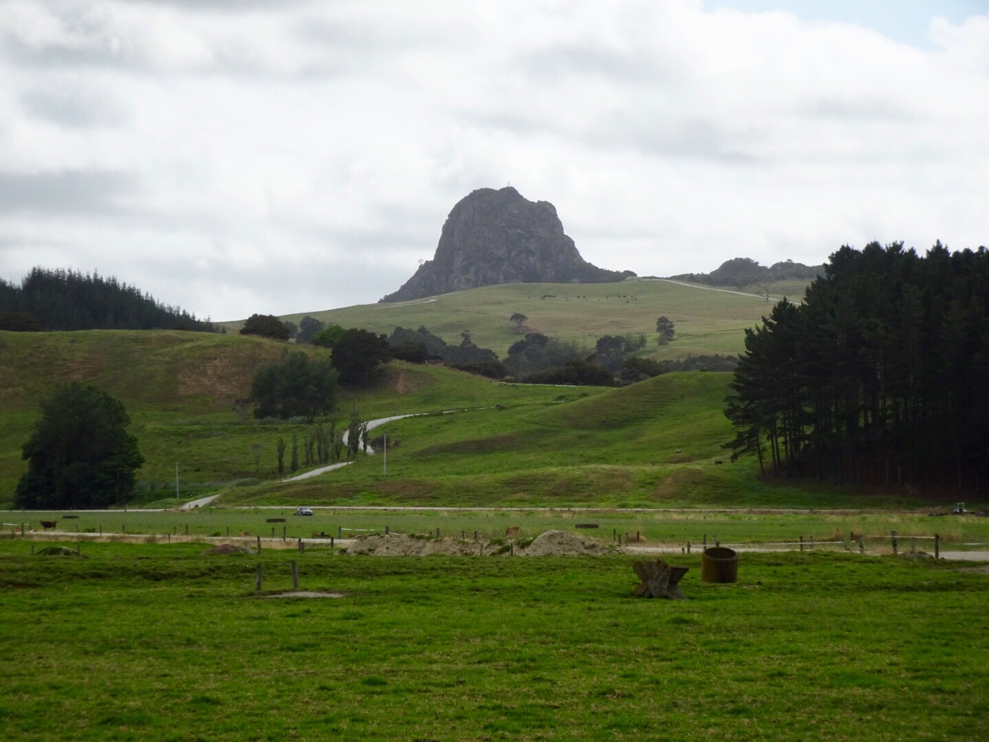
The peak below is Tokatoka Peak. It is a rare phenomenon as it is the plug of an ancient volcano. The material around the plug has also eroded over time, leaving only the hardened lava core.

in the pioneering days, the river pilot lived at the base of Totatoka and would climb the peak to watch for sailing ships in Kaipara Harbour.

Wairoa River continuing its journey out to Kaipara Harbour.

In the small town of Ruawai we stopped for refreshments. I recalled stopping here last year on my solo trip, and also recall the same scooter. Must be a local hangout for the elderly gentlemen.

Moving on nice rural scenery.

Before you know it, we have clocked up 75 km and decide to grab some lunch in Maungaturoto.

We were having to work a bit harder now as the hills became more regular. We climbed up to Brynderwyn and where else do you park your bike at the junction with SH1 to take a photo?

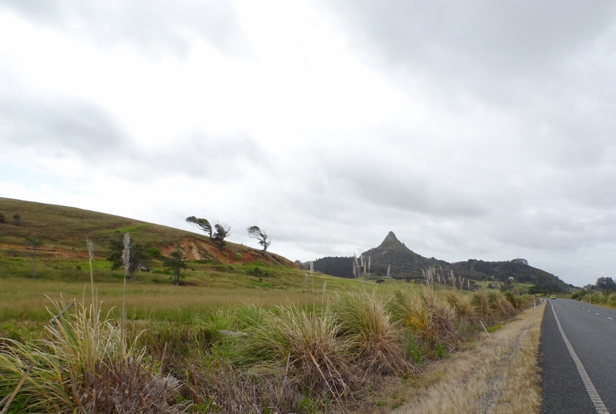
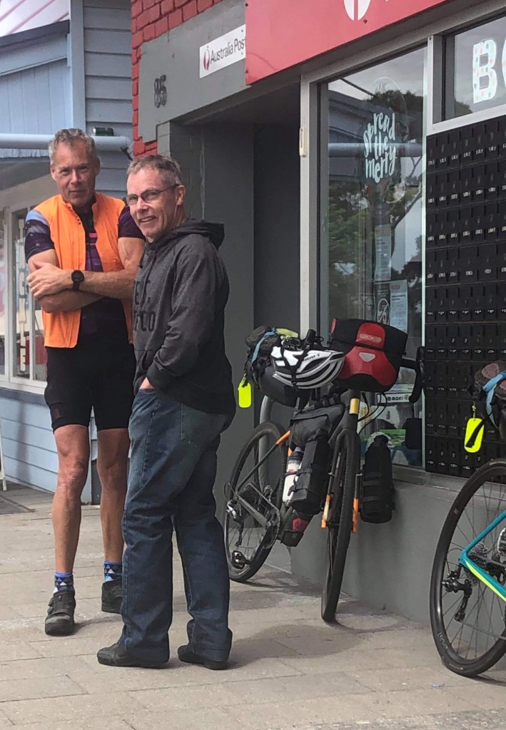
The local shop has a collection of bikes. Lost yours? Might be here!

I needed more water and purchased the very last bottle from the staff member who seemed to be having a bad day. Very grumpy. When assistants are like that, I am extra nice, wishing her a fantastic afternoon. She just looked at me……
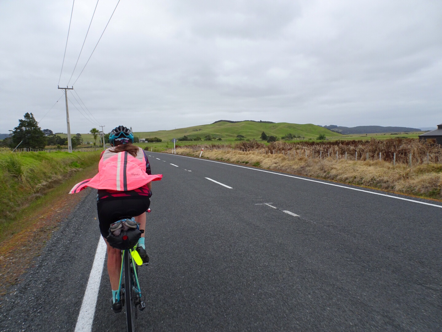
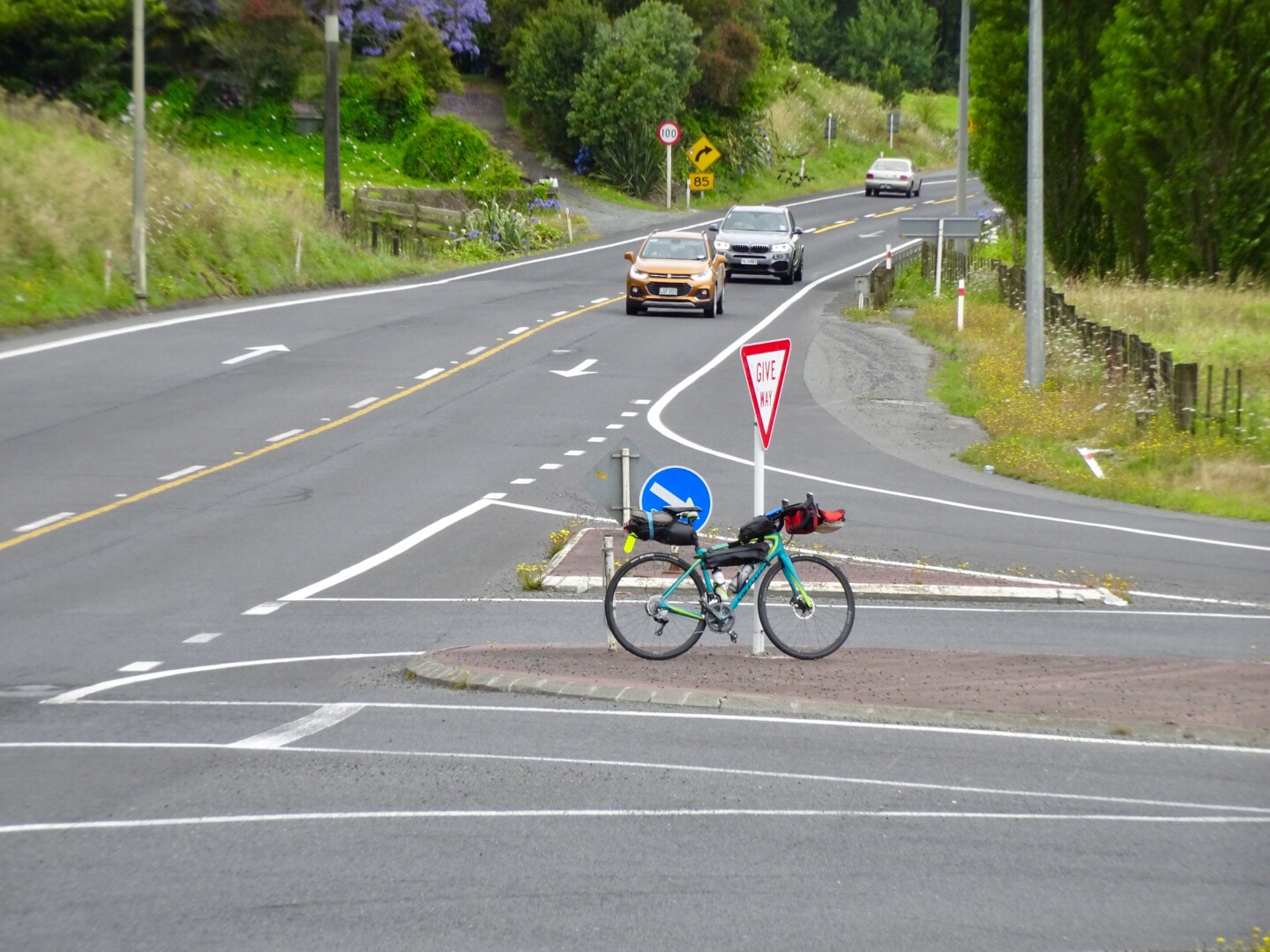
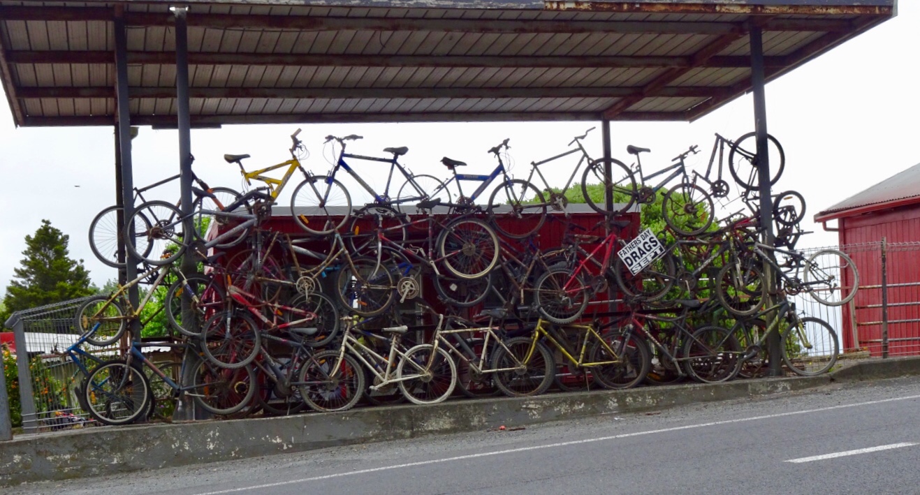
This is when our ride today got ugly. It was pretty horrid really as we were on a major highway, with verge ranging from zero to reasonable. It was incredibly busy and to make it more interesting (as if more challenges were required) it was drizzling lightly. Just nuisance value whereby your glasses end up with water on them to reduce visibility.

Utmost concentration was required. As can be seen from the elevation graph, it was hillier now too.

Lighter moments in the town of Kaiwaka. What this place is I am not sure…maybe a cafe?

This building? No idea….

This cheese shop amused me. You can see on the left that it is a Dutch Deli…..but….they have the Welsh flag flying.

It was such a relief to arrive in Wellsford, despite the last climb. Curiously, traffic was crawling up the hill slower than us!

We picked up some food for dinner, as we are staying some 7 km south of Wellsford with no local food options.

Aagh it was gravel….not again! πŸ™ˆ A picture of concentration as I climb up this gravel road.

It is a lovely area though.

We are staying at Barry’s Air BnB. I stayed here last year on my solo journey, final night.

Barry is an interesting guy, currently working on set design for the next Lord of the Ring movie. He hand draws all set designs.

He constructed his house and is into recycling parts where possible.

Since I visited last, he has constructed an external kitchen. We prepared and ate our dinner here. Useful for storing bikes too! If you look carefully you can see my cycle clothing hanging out to dry in the wind.

So here we are on the eve of our final day. We intend to get cracking early for a few reasons. Traffic for one and we want to be back at Gervase and Deb’s house by mid afternoon to start cleaning and packing our bikes up. Thats the worst bit…no time to celebrate!

Anyway that is tomorrow and we rest on our laurels for surviving today!

Thanks for reading,

Ooroo!!!

Tane Mahuta

A beautiful morning, fabulous breakfast, great company….hard to get moving! Enjoying our breakfast on Blair’s deck. This is my second visit to Blair, who lives in Rawene, a village on the shores of Hokianga Harbour.

He’s one of those guys you just get on with! You do not have to to watch what you say…as there are no pretentious airs, but a down to earth good fun guy. We had some quite numerous conversations over dinner on topics that the politically correct would rue.

The view across the back yard is very peaceful and serene.

Yummy breakfast cooked on Blair’s bbq and fresh food including bananas from his neighbours garden.

But farewell we had to bid, as today was all about hills.

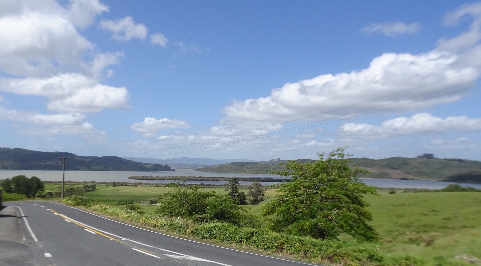
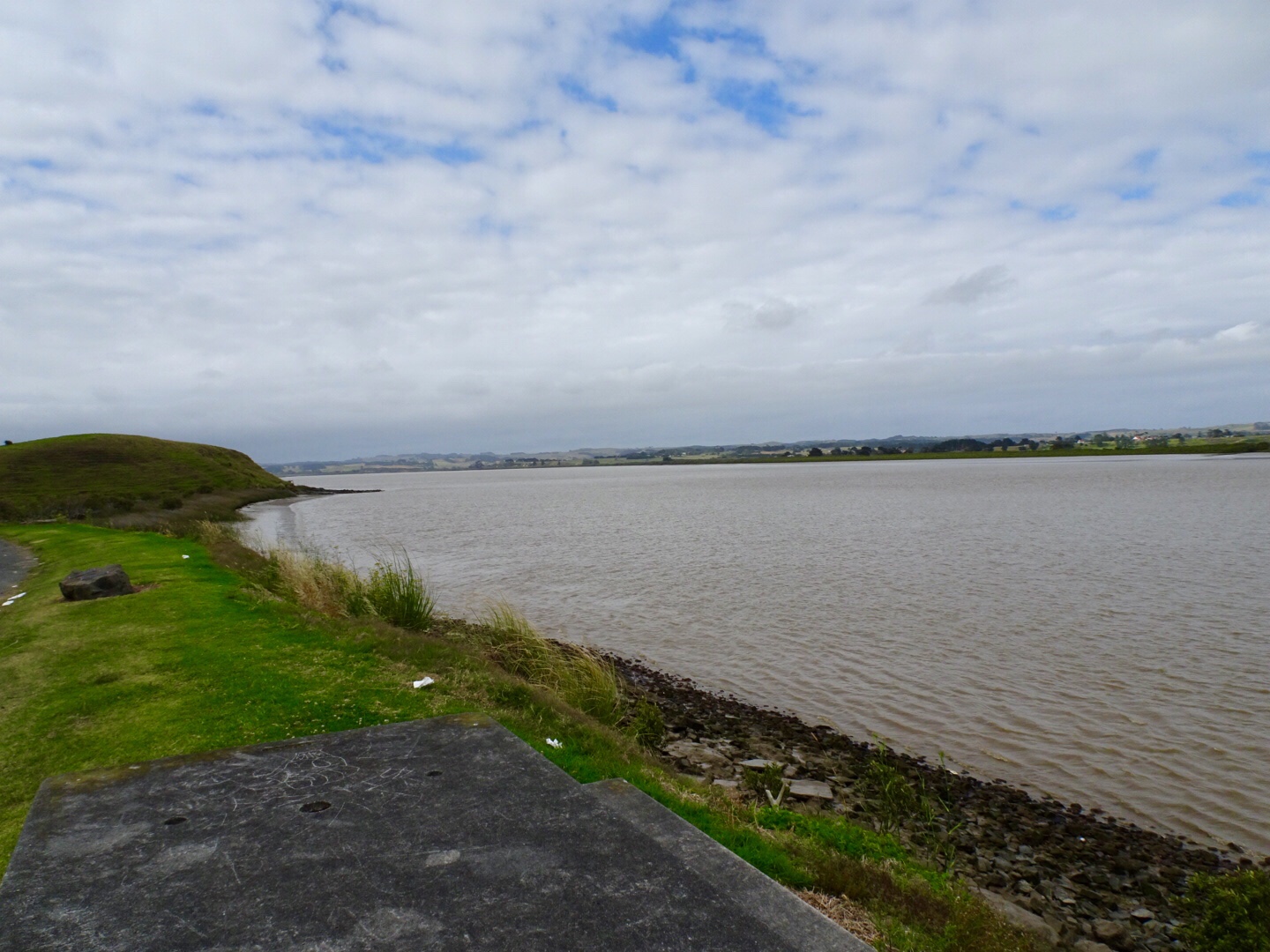
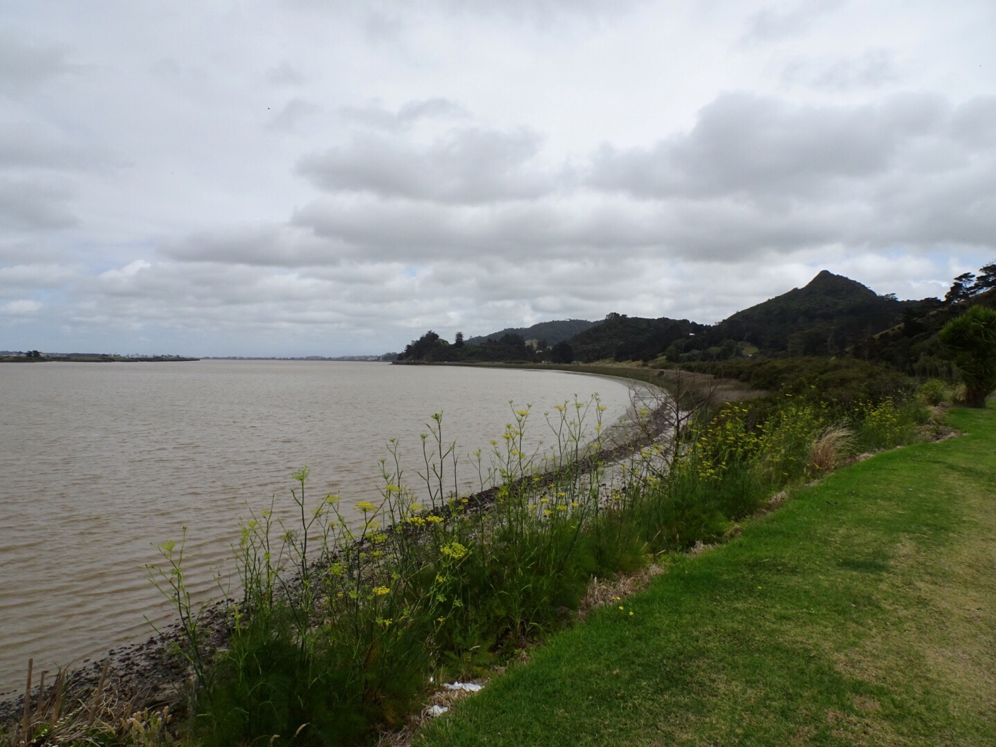
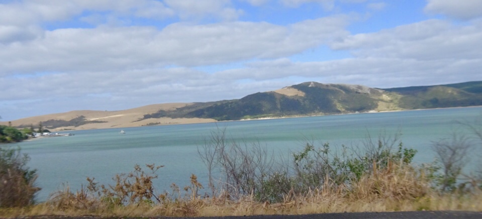
Leaving Rawene views of Hokianga Harbour. Unfortunately our camera has developed an issue we cannot resolve, hence blurred edges.

Out to greet the roosters at the intersection , we turned right onto SH12. Fortunately it was fairly quiet still being early Sunday morning.

Opononi was awake and we grabbed some items from the 4 Square store for the day. I like Opononi. The waterway here is still Hokianga Harbour, but close to the mouth where it enters the Tasman Sea.

After Omapere, the hills kicked in, but nice views again. I think a house on this land where the cows graze would be really nice!

The road turned south after the climb, and we hit a headwind that was to become a real pain in the butt later in the day.

I’m going to throw the climbing graph in now. You can see that there are a couple of descent climbs. Carrying luggage makes these climbs tougher…slower…anything over 10% with luggage is hard work. We’ve had heaps of 15% climbs.

The longest climb today though was the one up through Waipoua Forest. It is an enjoyable climb though as it has a steady gradient. It provided relief from the wind, shelter from the sun and is scenic. Hawkers not welcome either!

After you peak the first climb, you descend about 75 metres in altitude and arrive at Tane Mahuta.

Tane Mahuta is reputed to be over 2,000 years old. The tree is also called Lord of the Forest and is a Kauri. It is named for the Maori god or forests and of birds.

In 2002 measurements were taken of the tree dimensions. The tree girth is 15.44 metres. The trunk height is 17.8 metres. The tree height is 45.2 metres. It is reputed to be one of the oldest and largest trees in the world, but is under threat from Kauri dieback that is decimating many of the native trees.

Some refreshments from the well located van.

Onwards we rolled up and down.

We visited a Kauri shop on top of a hill. An old piece of what we assume is Kauri decorated with….garden gnomes…..once upon a time, in my younger years, a friend and I were known for selective gnome relocations!

In the shop, the little old bespectacled lady with bucked teeth and gold fillings asked where we were riding to. She advised one small hill and down hill the whole way.

My memory of having ridden this section last year was foggy but looking at the surrounds it seemed a little impossible. It also made me recall similar advice Sue and I received on a stinking hot day en route Auckland to Wellington. That time a little old lady told us all the hills were done.

Both were wrong, both need new glasses, and I suspect both drove automatic cars! I stopped counting after 10 climbs of varying length. Never trust little old ladies assessment of what constitutes a hill on a bicycle!

The last few hours we really battled strong winds…not behind us either, making tough work of the easier sections! The west coast of North Island is in view, and we rode reasonably parallel south to it.

Our route map.

The traffic on SH12 really built up during the afternoon. We had a few dickhead drivers (my term for those drivers who deliberately buzz us and take no action to be anything other than selfish road hogs).

On the other hand, we had an awesome milk tanker driver…

On the back of Tony’s bike is his rear red flashing light ( I ride with my rear light flashing too) but his has an inbuilt radar. It notes cars before we can hear them. It sends a message to both of our Garmins (bike computers mounted on our front stem) with a beep and a dot that moves up the screen the closer the car gets to us.

When I hear the beep I then check my Italian cycle mirror, mounted off the right hand handlebar, look to see if I can move off the road anymore than I am, to provide the greatest margin I can between myself and vehicle. (These mirrors are excellent, and were recommended to me by a Kiwi riding friend Greg. When we ride in Europe, we swap the mirrors over to the left hand side).

In the case of the milk tanker, Tony was a bit further ahead and the radar had unsynched, but as I climbed I could head a truck well back changing down through his gears, but seemed a bit too low. Checking my mirror I realised he was moving slower than he was capable of to protect me as he had a few cars behind him.

So I got up out of the saddle and put in a bigger effort to get to the top of the climb, where Tony was, and off the verge.

He gave us a huge wave, as we did back. He was a great example of someone looking after us!!

Approaching the outskirts of Dargaville reminded us of what this town is famous for.

The last 8 km was a real slog. Again, I had inadvertently found accomodation that required climbing to get to. The wind was very strong and we had tired and at the 110 km point, having climbed nearly 1700 m with our gear on board, we were pleased to arrive in Baily’s Beach.

Nice view from our bedroom.

The local shop is the dairy, takeaway and restaurant so off we headed for a steak, starting with garlic bread. As we finished, I was amused to note the paper lining the base of the garlic bread plate.

Here we are in New Zealand, where they do a fantastic job of promoting their products. But sometimes, you just cannot get away from home…..

Thanks for reading,

Ooroo

The good, the bad and the ugly…not necessarily in that order.

After I finished my blog last night, I jumped into bed. As I lay there I was aware of something touching my upper legs (and it was not Tony!). I reached my hand down and grabbed what I assumed to be a moth, and threw it out across the bed, towards Tony as I expected it to fly.

The room was still quite light and when I checked to see if maybe I had inadvertently killed the moth, I was alarmed to see a reasonably large spider on Tony!

I jumped out of bed, as did he as he was alarmed at the sound I made.

The spider having been flicked off by Tony then tried to hide between the mattress and tucked in sheet…we ultimately won the battle and New Zealand has one spider less.

I have since identified it as a Tunnelweb spider..described as a very fast New Zealand spider and somewhat shy!

Shy or not, it was not sharing my bed and crawling over my body! This creeped me out! I do not think this has ever happened to me (knowingly) before.

Despite that, we both slept very soundly in lovely accomodation at an Air BnB.

We were on the road by 8 am and look what had already arrived in the harbour…yes, 3,500 Aussies. We beat a retreat and headed out of town!

Looking in the opposite direction provided a nicer vista.

We climbed a few hills and had one final view back towards Russell and the Aussie’s.

Following the harbour shores….

We hopped onto the Twin Coast cycle trail.

The first few km were excellent quality. Compacted gravel on top of existing railway infrastructure. At the bridge, an additional deck had been constructed on one side.

We entered at our own risk, but could not see what the issue was.

We arrived at the old Taumarere Railway Station, now used as a tourist railway from Kawakawa, but formerly supporting a thriving town of 1,500 people with industry and tourism benefits.

Our first stop was Kawakawa. Originally we were going to head further north to KeriKeri, as it is a lovely old colonial town, well preserved but after having been in Whangarei we learned of Freidensreich Hundertwasser, an Austrian born architect who spent the latter years of his life living in New Zealand.

His designs feature all around the world, and Kawakawa has a toilet block he designed that is regarded as an international work of art.

The style is typical Hundertwasser with wavy lines, irregular ceramic tiles, integrated small sculptures, coloured glass and a live tree incorporated into the architecture.

Hundertwasser requested that any vegetation removed for construction should be replanted on the buildings green roof.

The toilets are Kawakawa’s main tourist attraction, and the most visited toilet in New Zealand, with tourists buses arriving to photograph the toilets.

The toilets are fully functioning.

Back on the rail trail we crossed the Kawiti Truss Bridge that passes through the Ngapipto River Valley, where the descendants of the great Ngati Hine leader Kawiti live to this day.

Although Kawiti cautioned his people never to sell their land, it was confiscated for the North Auckland railway line in 1913.

This impressive truss bridge took 500 men to build and is 74 metres long.

I like this photo showing some of the truss work and the river below.

On the track we found an alive hedgehog. In the five previous trips to New Zealand we had only witnessed flattened dead ones!

I think it is cute, but apparently they pose a significant threat to many New Zealand native species due to their voracious appetites.

Hedgehogs are not endemic, having been first brought here by ‘acclimatisation societies’ to remind settlers of their homelands. They were later introduced in greater numbers to control garden pests such as slugs, snails and grass grubs.

We thought he was cute!

Further along the cycle trail, which certainly was not as well constructed as the first few km, and in many parts, was just a single true track, we found this sign. Interesting.

Kaihoke was the town we hoped to grab some refreshments, apparently a thriving town in its history. When the train line opened in 1914, 1000 people came out to celebrate. The town peaked as a trading centre in the 1950’s before falling on harder times.

Heading into the local Countdown supermarket for a cold, large bottle of water proved a futile exercise. Despite two laps of the supermarket I could not locate any large bottles. I asked and was told not available, but proudly showed me their extensive range of cold alcohol! πŸ˜‚πŸ˜‚πŸ™ˆ

So in desperation I headed into McDonalds to buy iced coffee and fill our water bottles up in their bathrooms!!

Back onto the road for the last 40 plus km to Rawene, with minimal verge. Groan. Nice countryside though.

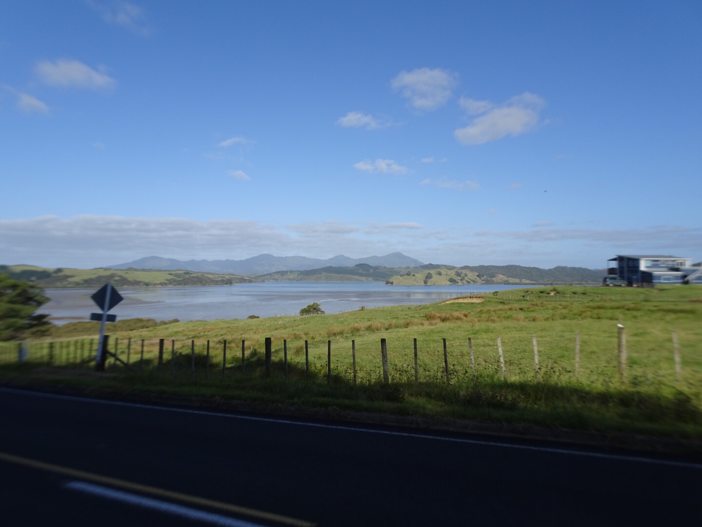
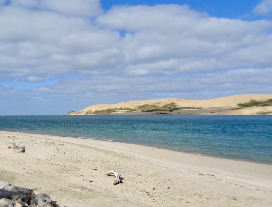
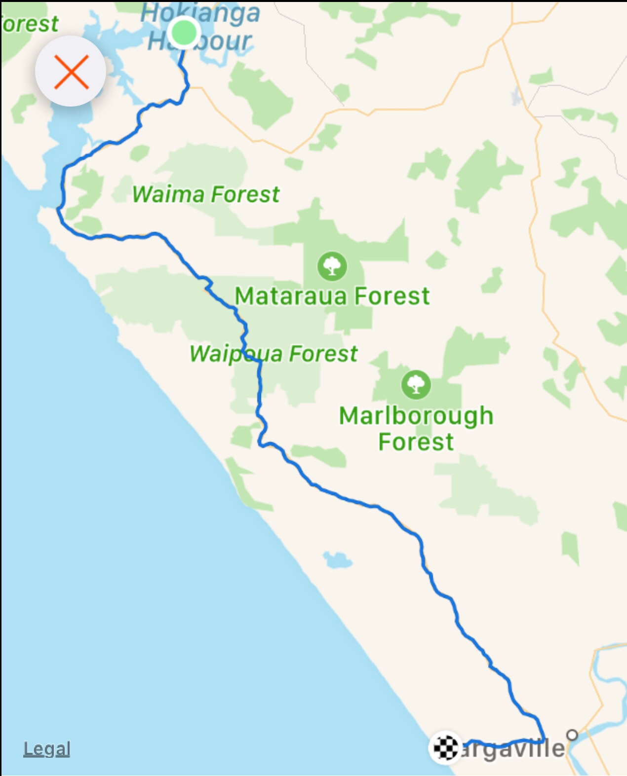
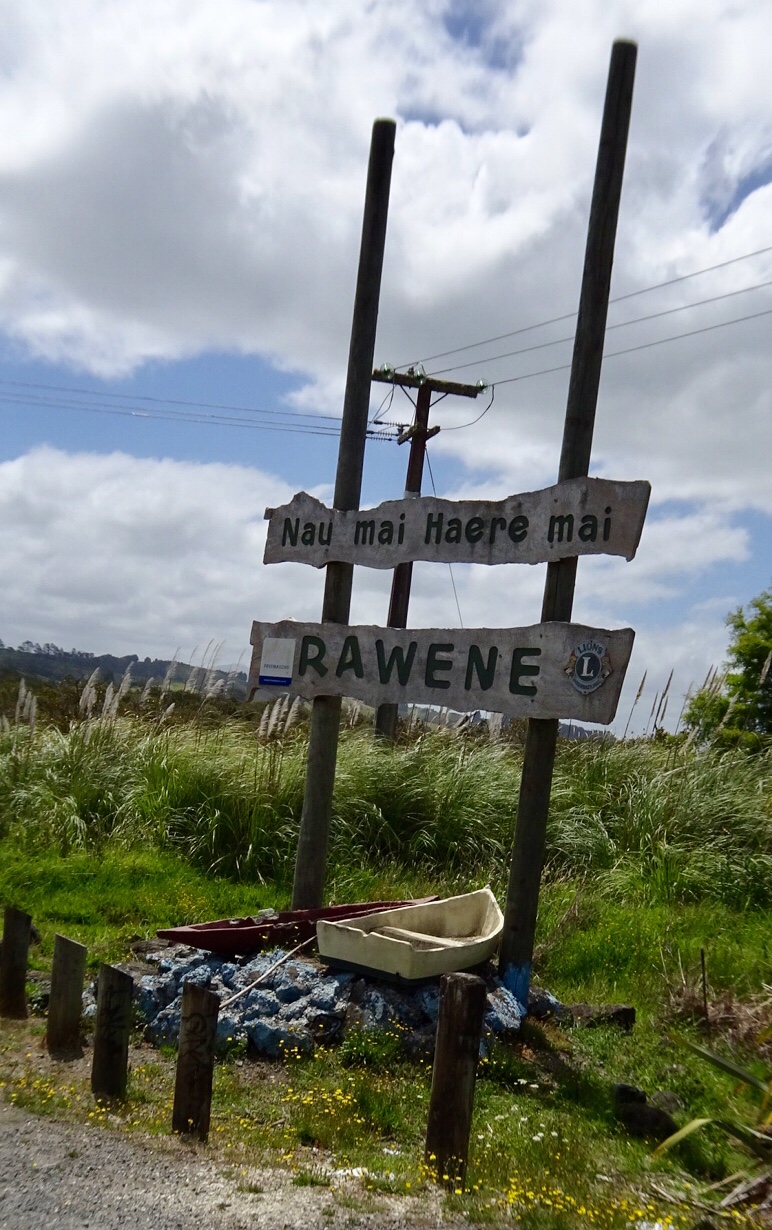
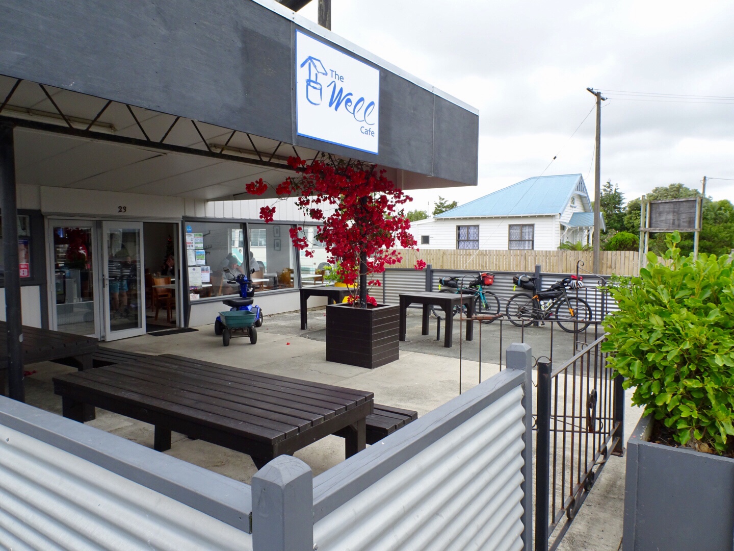
We were very glad to turn off to Rawene.

These critters seemed pleased to see us too. We later learned that this is the local dump point for roosters!

Quick trip to Rawene, as it is only 6 km in from SH12.

Down to the ferry at the road end….I caught this ferry last year on my return journey from Cape Reinga, arriving into Rawene to stay with Blair, an Air BNB guy that I have kept in contact with since on Facebook.

Great to see Blair again. Blair is a professional chef, and we have just finished an awesome meal that he cooked. Vegetables and greens all from his garden. We sat on his deck looking out to the harbour.

Todays route and elevation that has taken us from the east to west coast of New Zealand.

Tomorrow is another day…more climbing and over 100 km ride as we head south towards Auckland.

Thanks for reading, I need my beauty sleep…first I’ll check for spiders!!

Ooroo