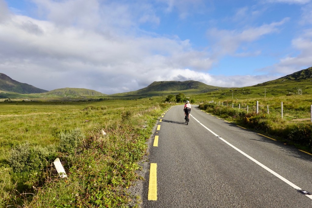
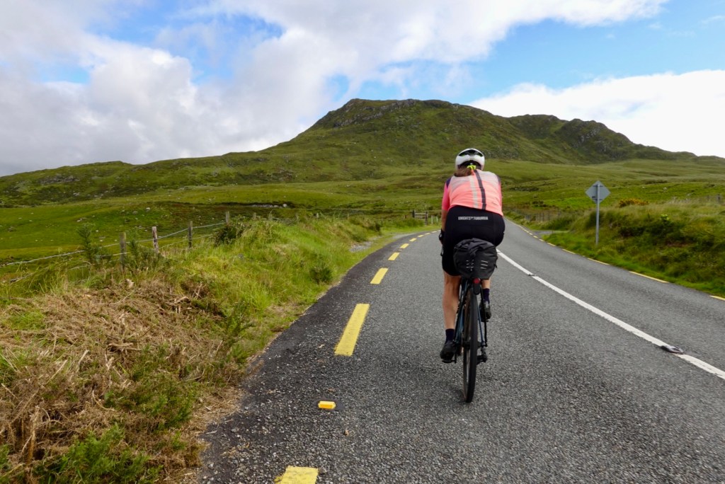
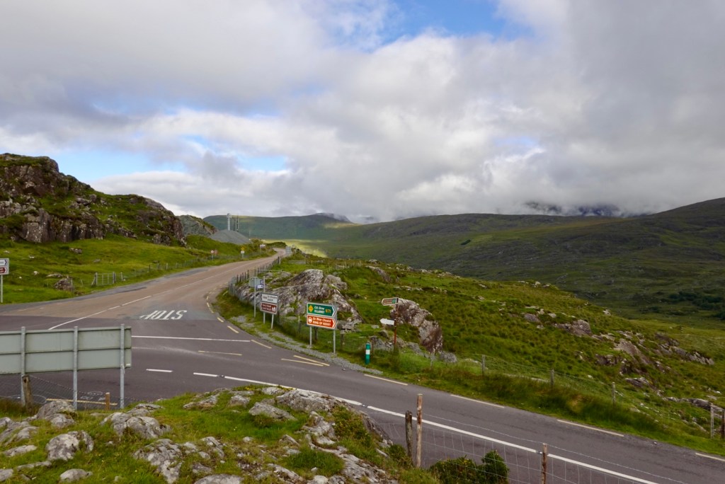
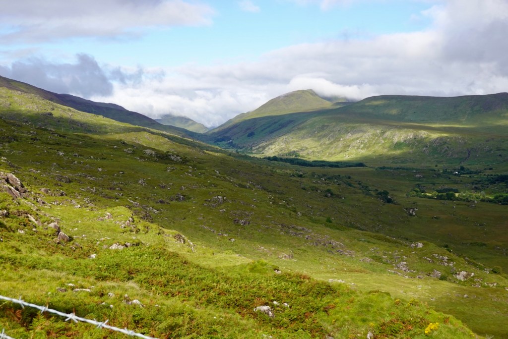
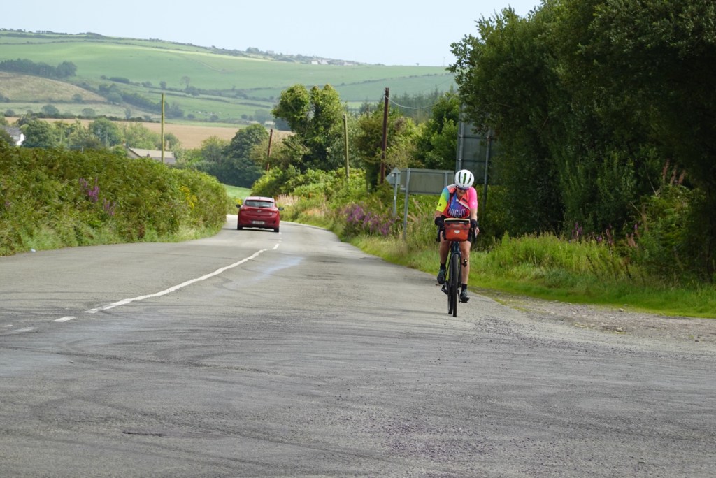
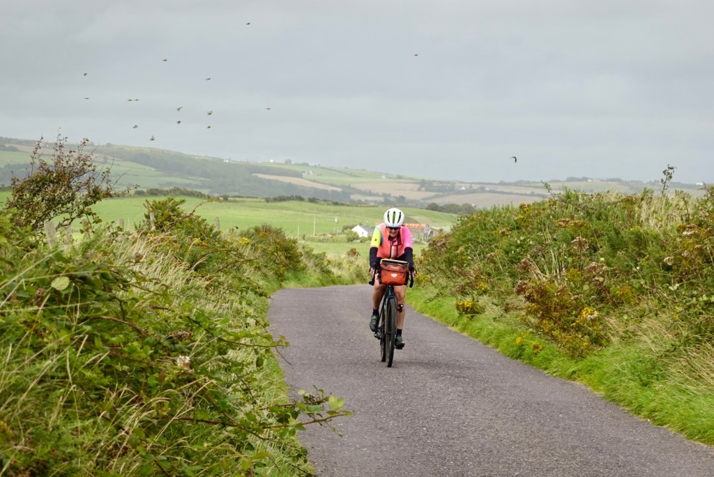
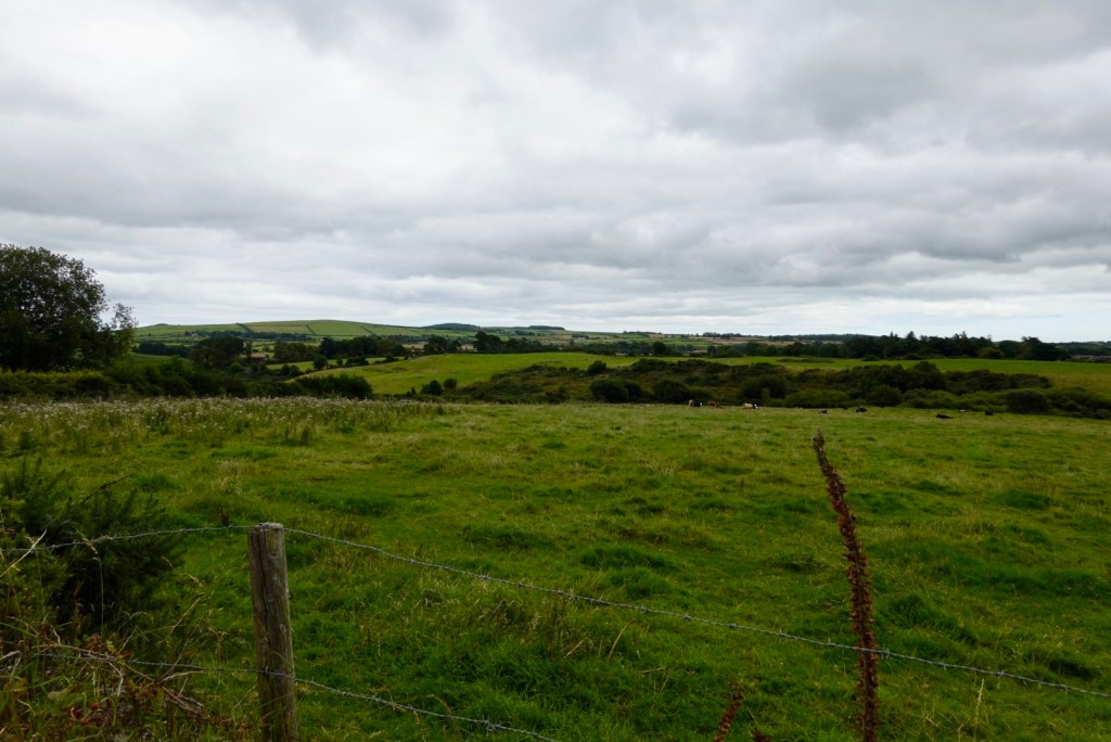
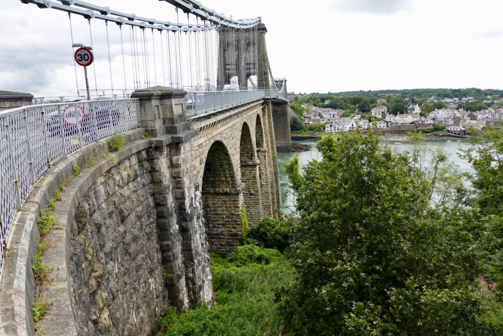
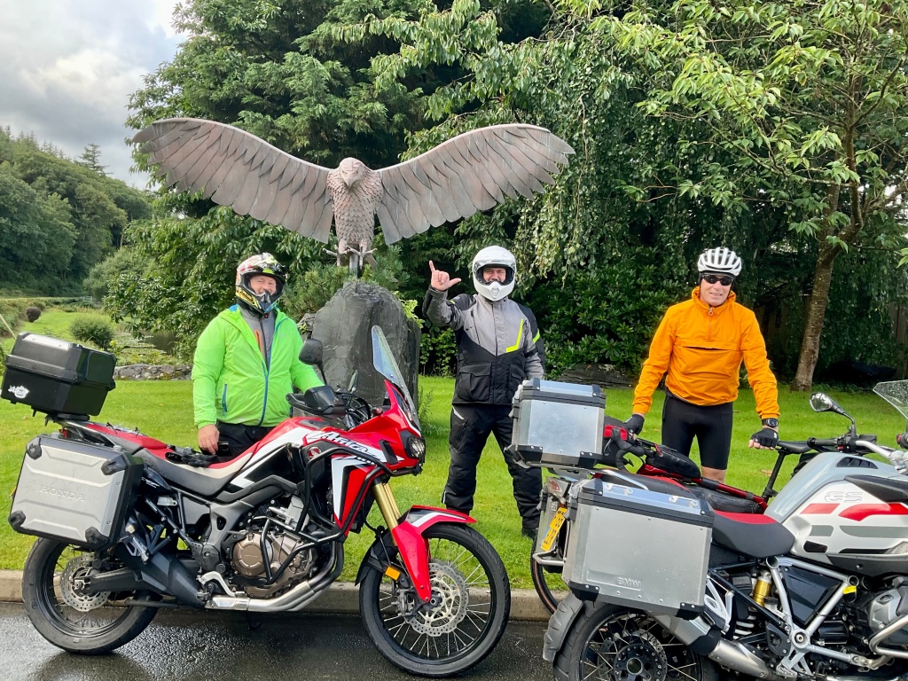
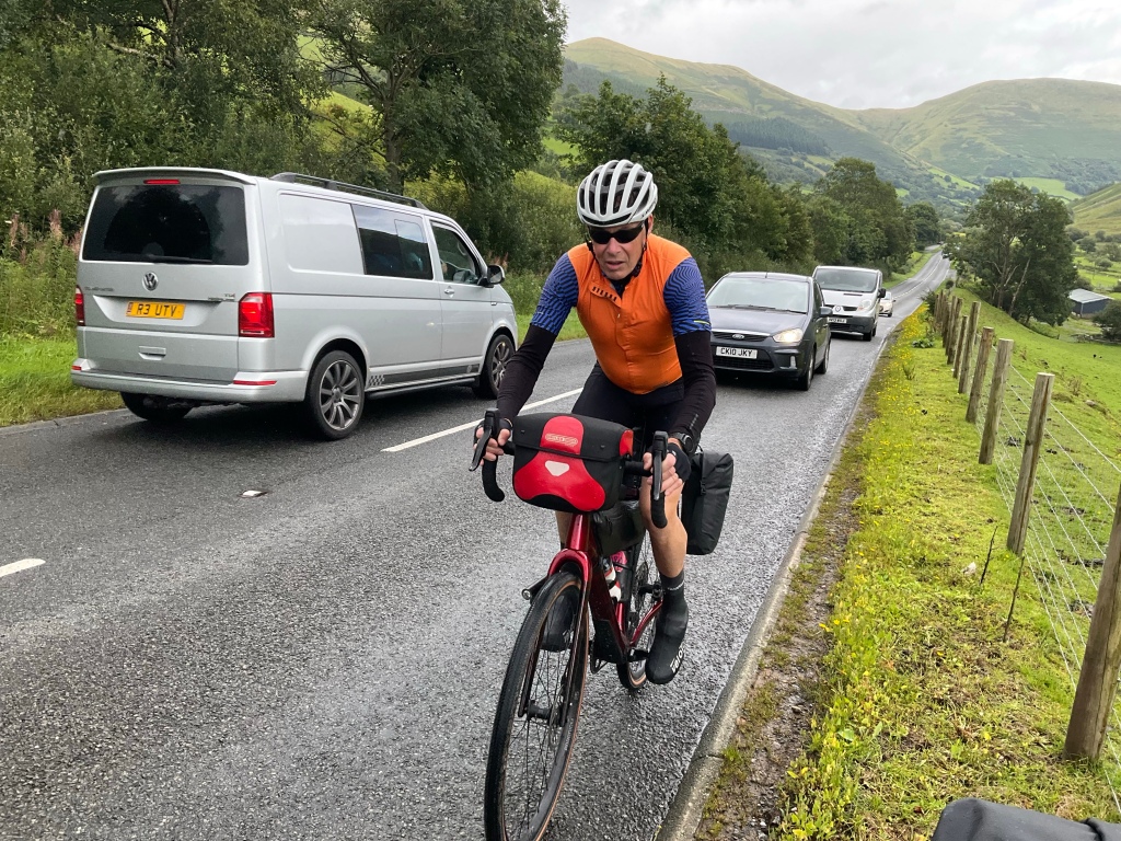
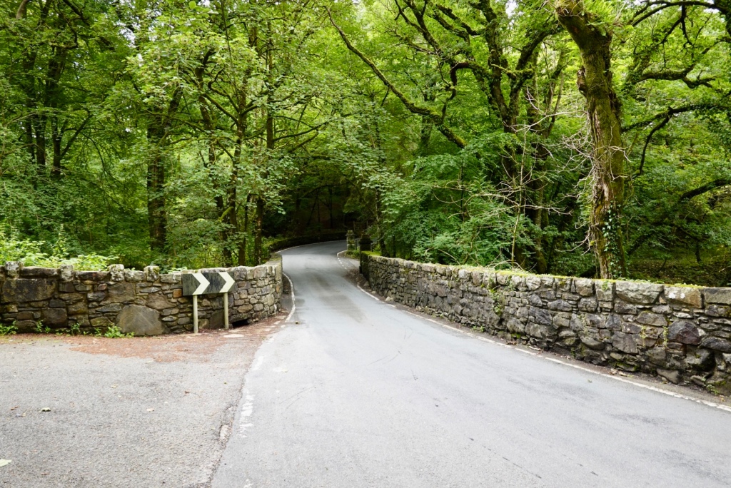
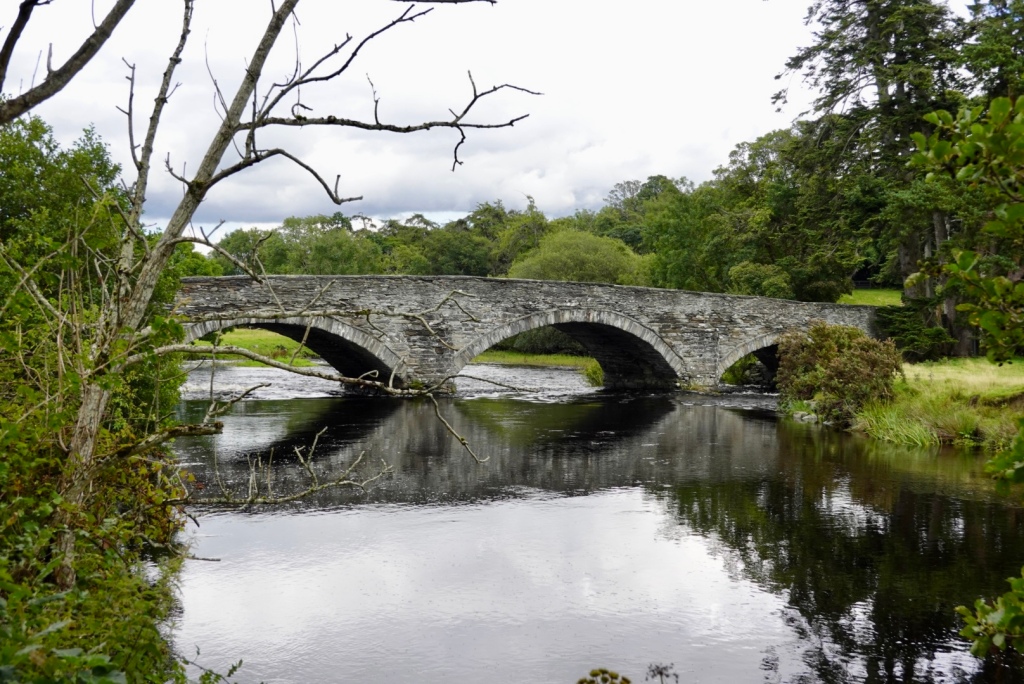
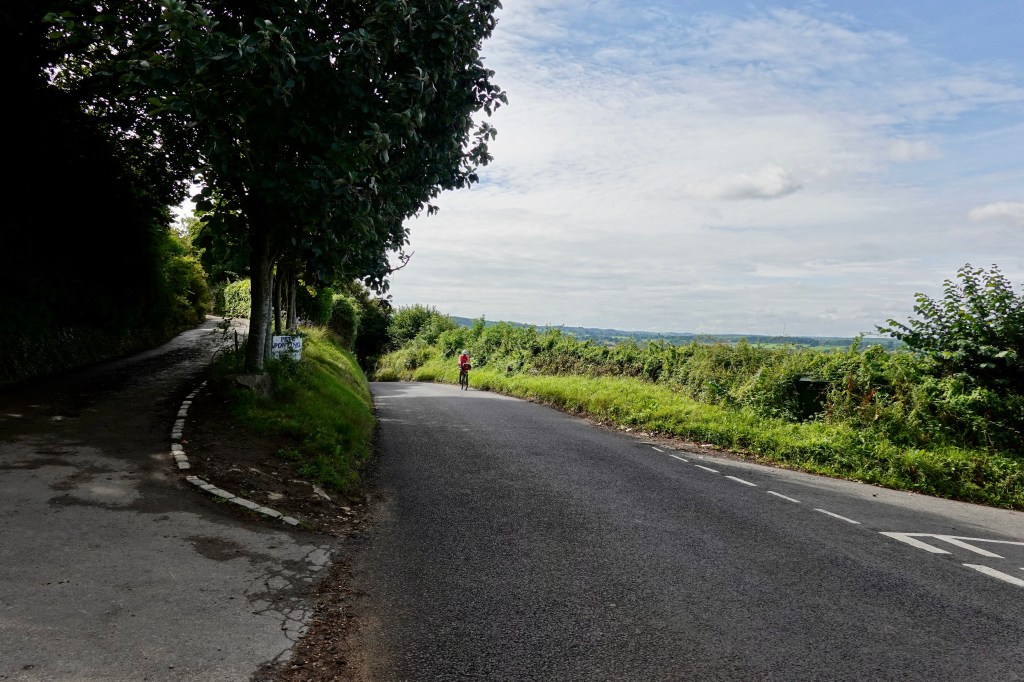
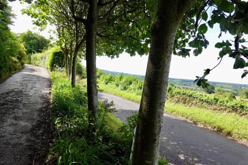
Leaving Kenmare we turned left and started climbing for the next 9.5 km, our first goal was Moll’s Gap
Molls Gap is a mountain pass on the road from Kenmare to Killarney, offering views of the MacGillycuddy’s Reek mountains.
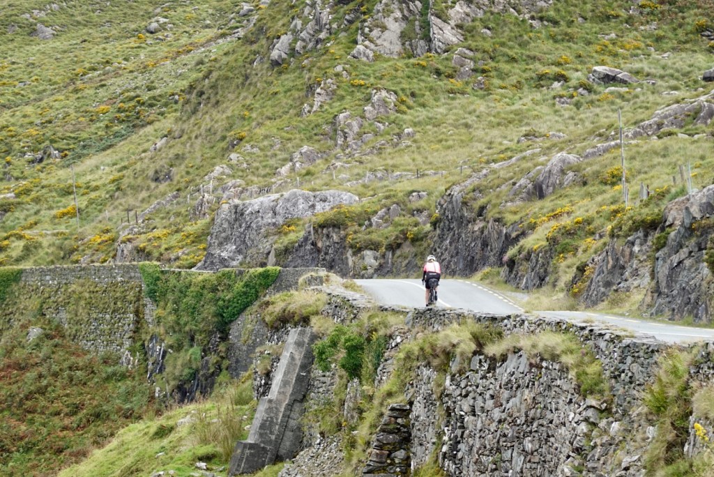
Just about to reach the top, turn right then….
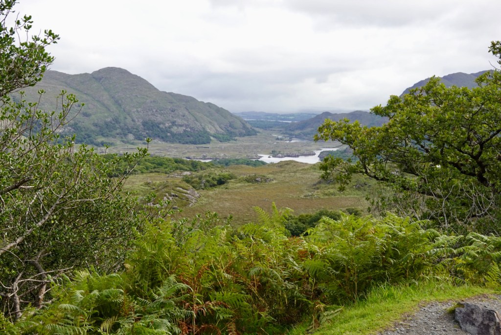
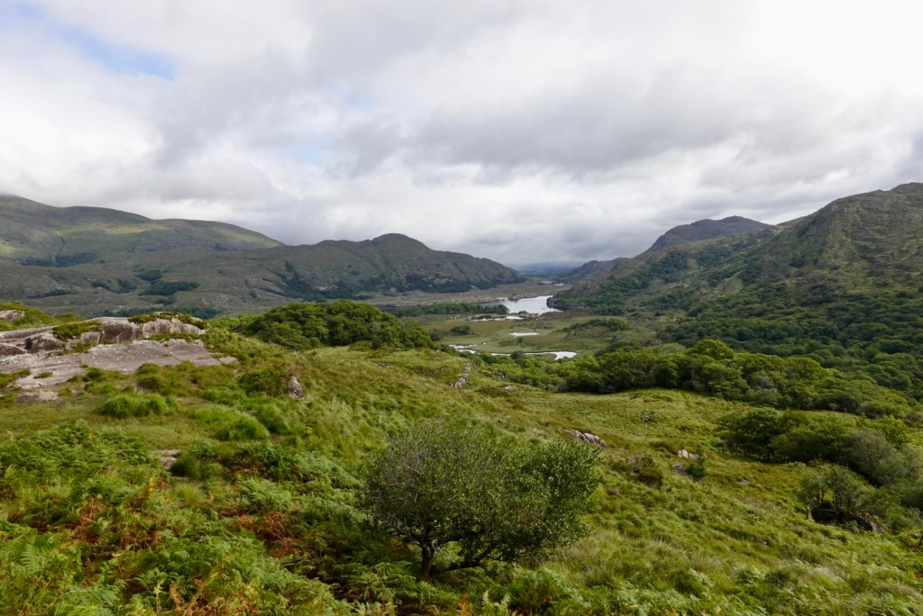
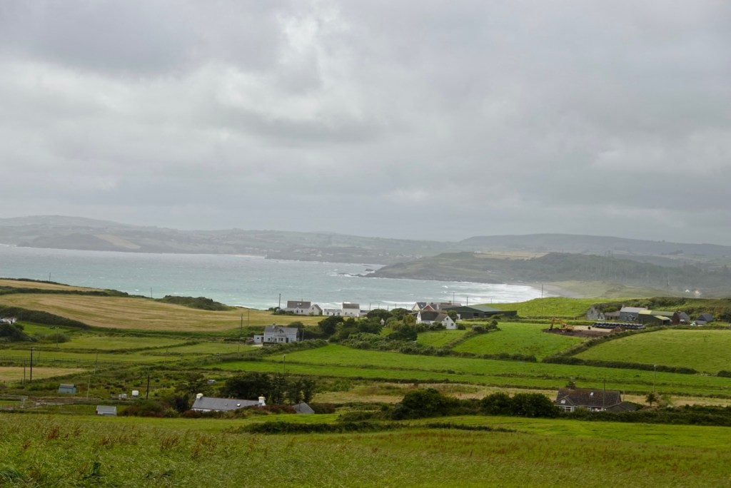
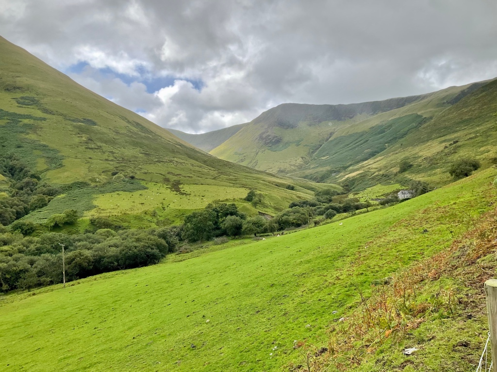
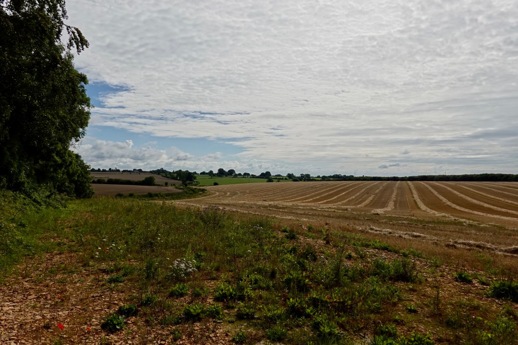
Ahead is Killarney National ParkThis is looking back About to head off down this roadThe first big peak is the climb to Moll’s Gap
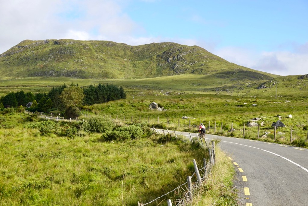
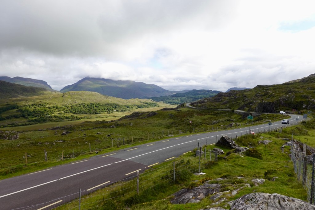
We then start descending.
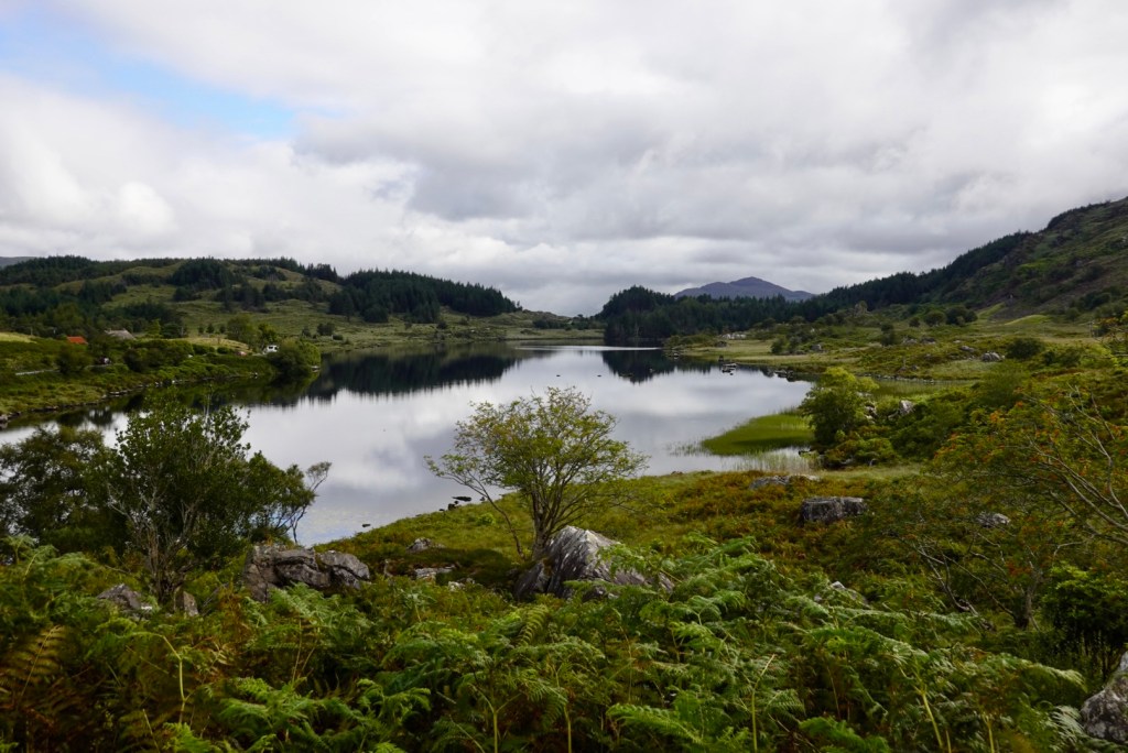
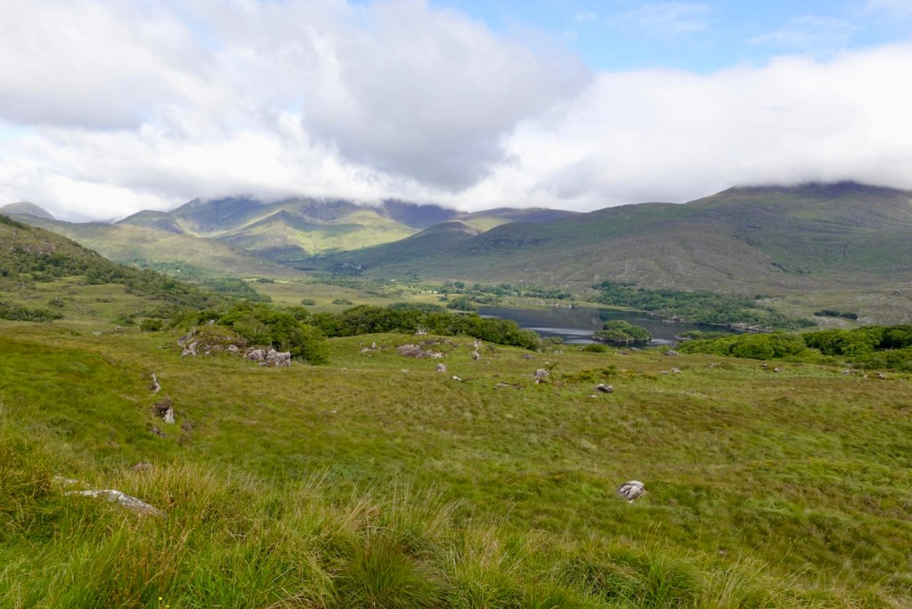
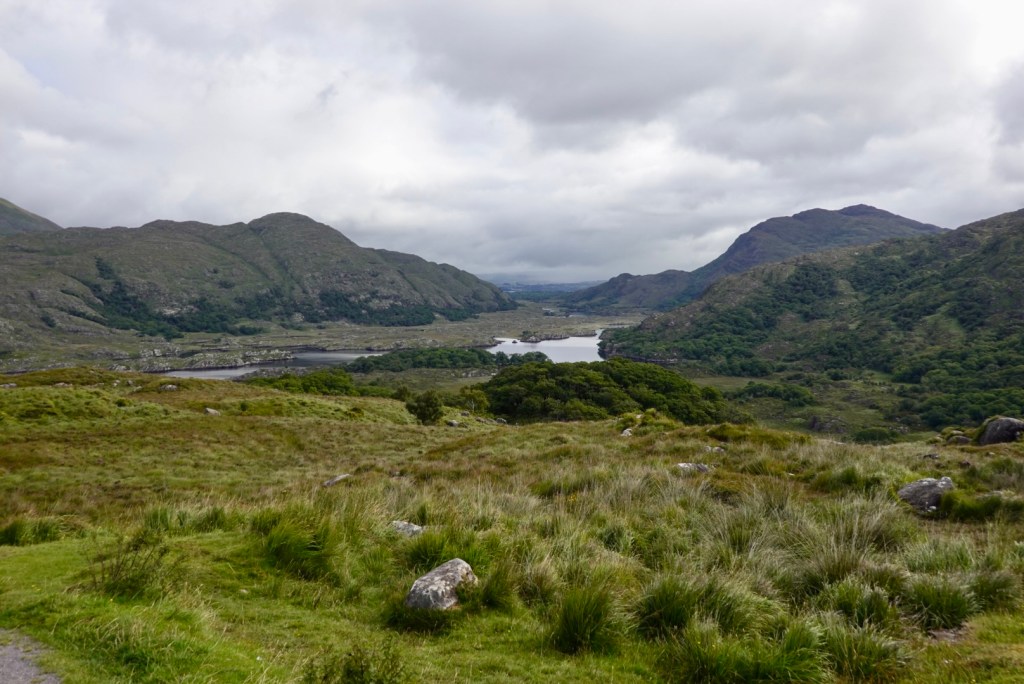
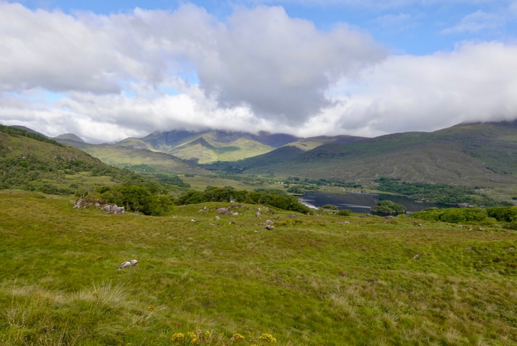
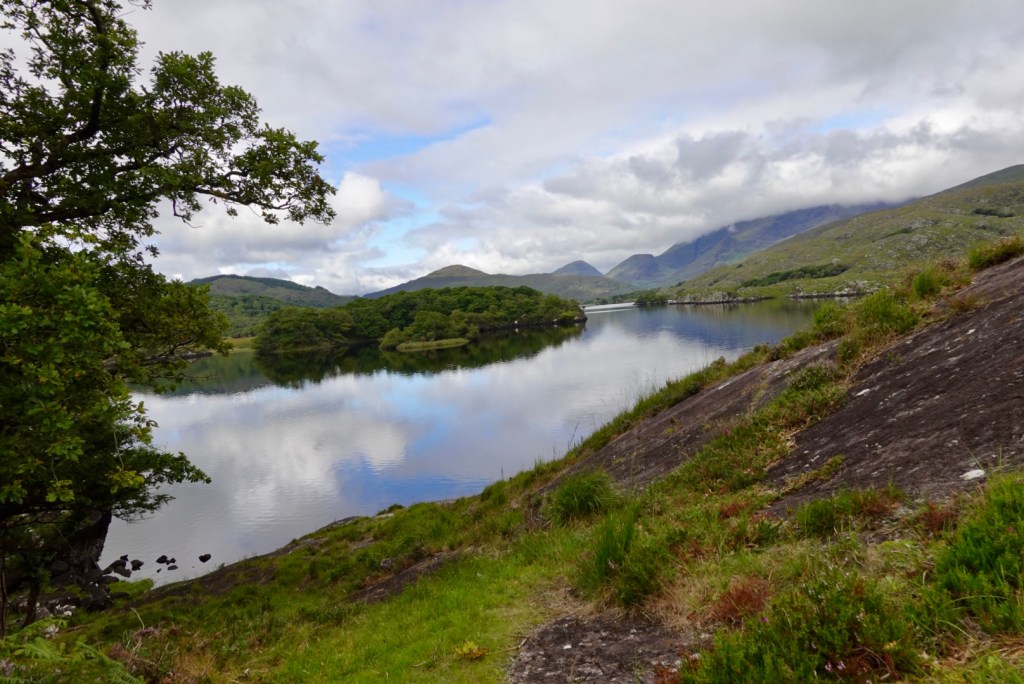
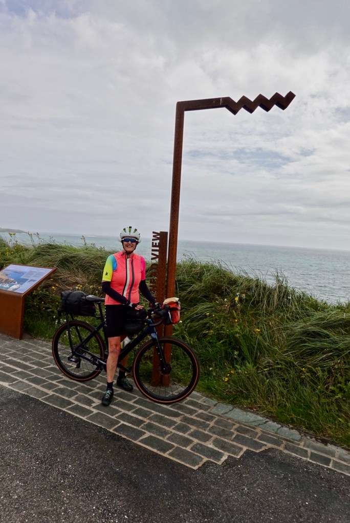
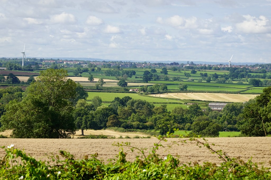
The Ladies View is a great vantage point overlooking all of Killarney Park (in good weather). The view is so beautiful that Queen Victoria is said to have allowed her ladies-in-waiting to admire the landscape with her, which was regarded as a rare privilege – hence how it earned the site name of Ladies View.
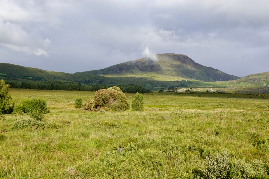
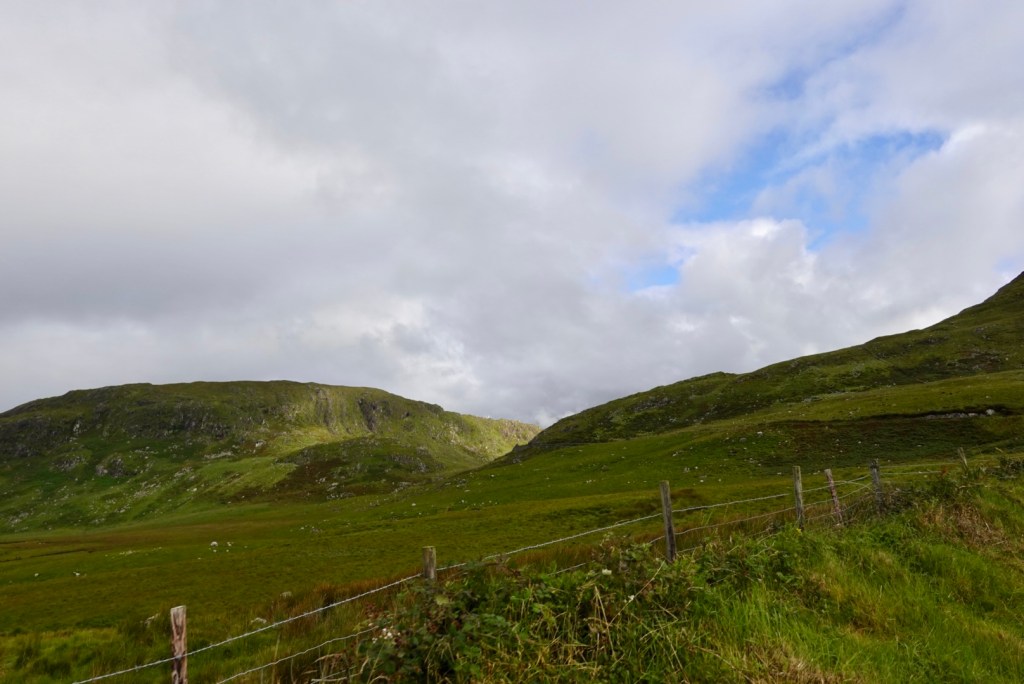
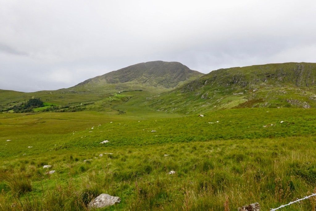
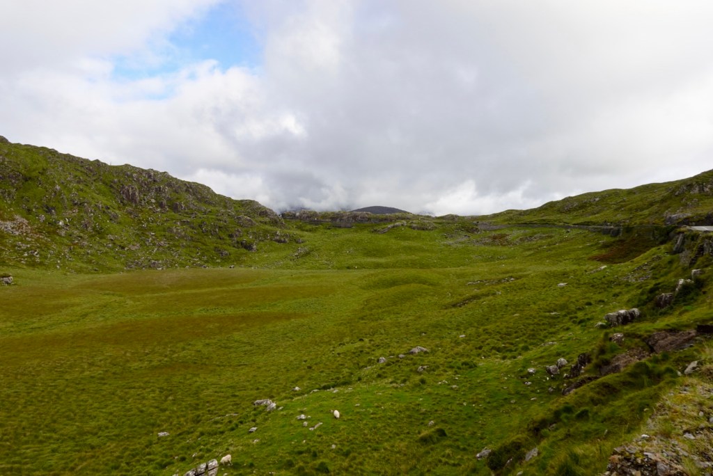
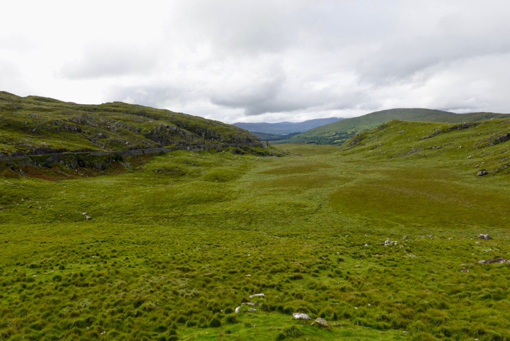
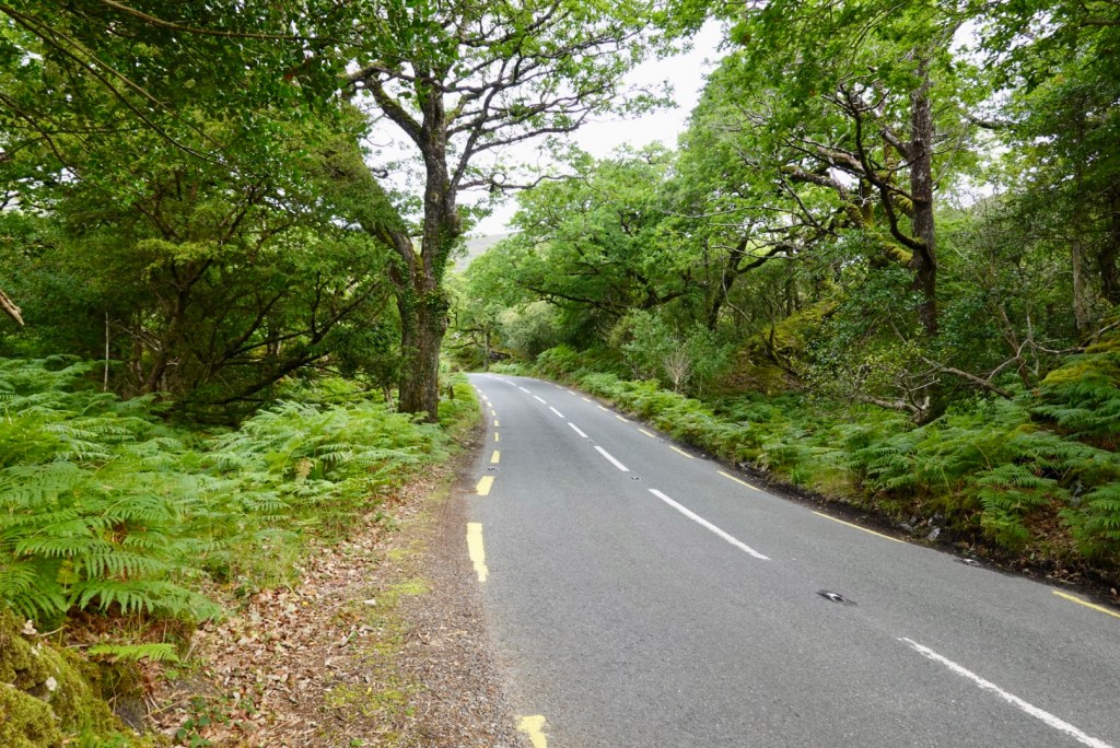
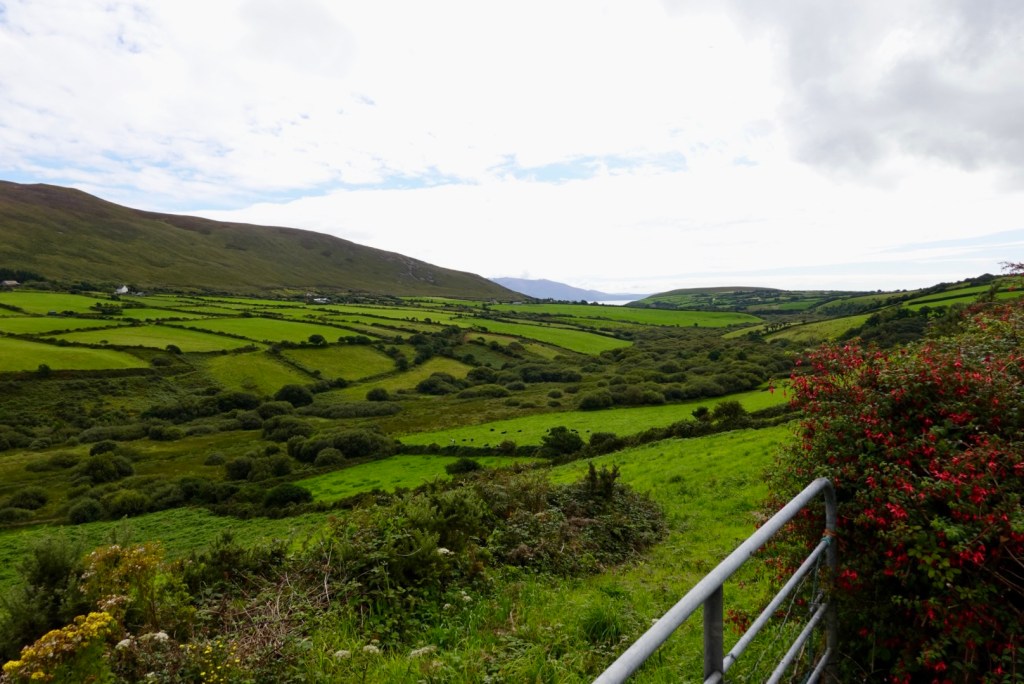
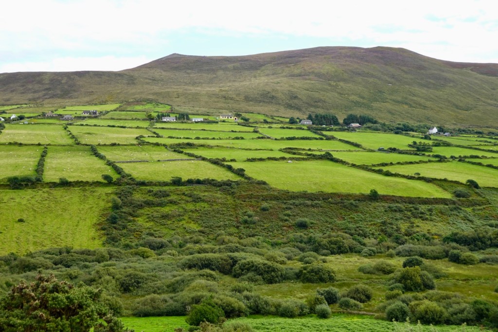
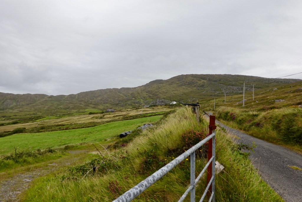
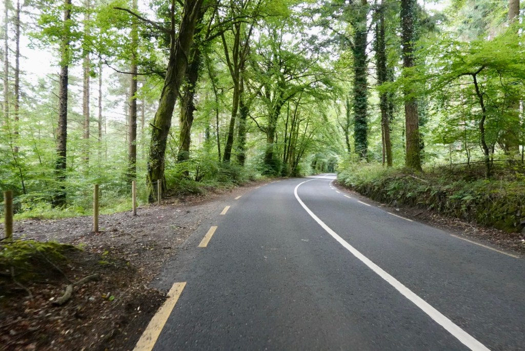
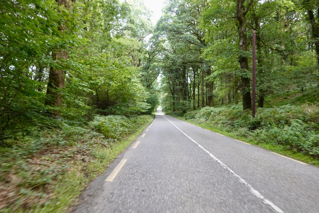
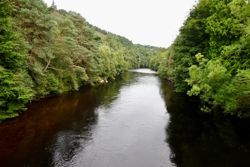
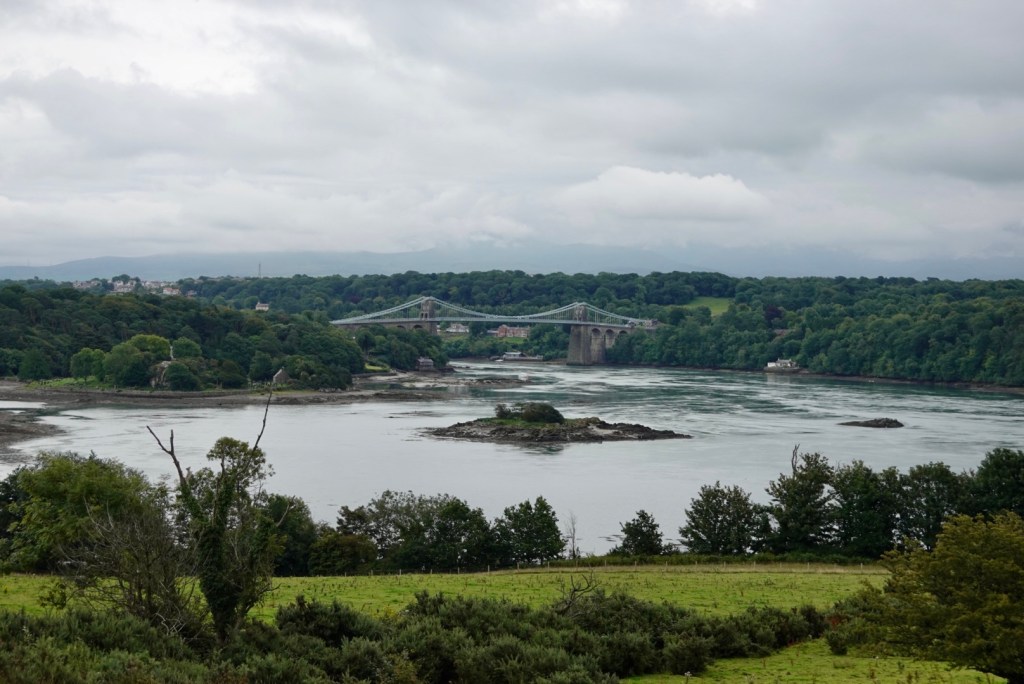
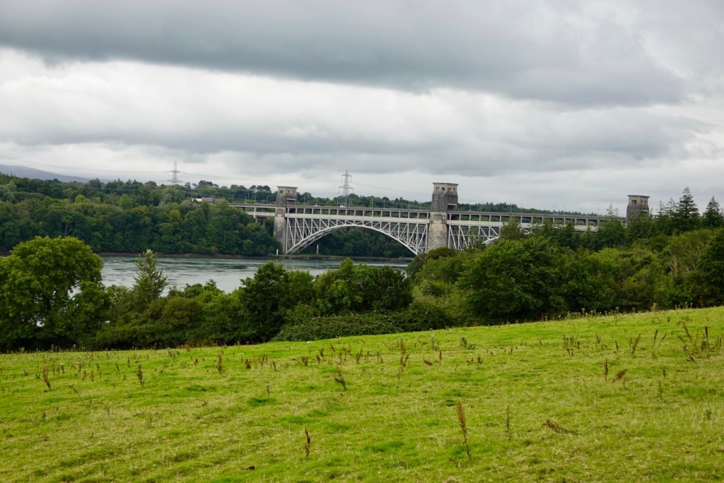
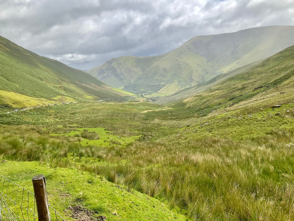
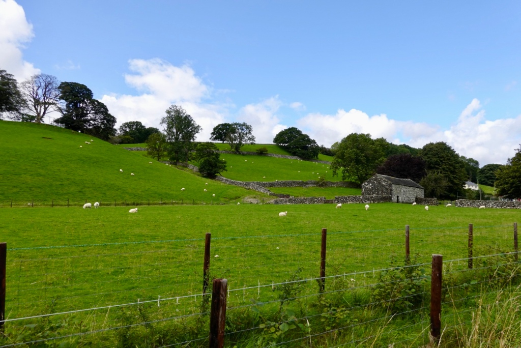
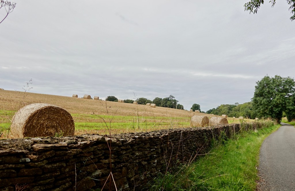
We kept descending through the Killarney National Park.
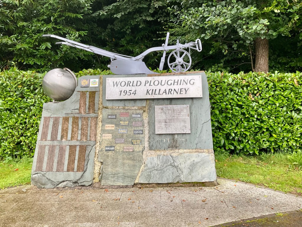
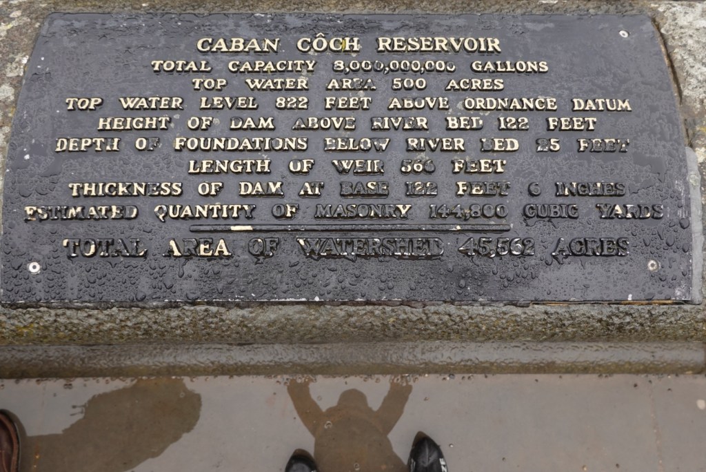
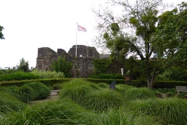
Killarney National Park was the first national park in Ireland in 1932 but humans have lived in the area since at least the Bronze Age, 4000 years ago.
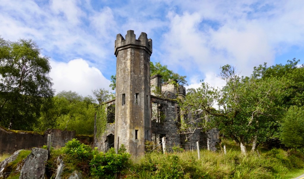
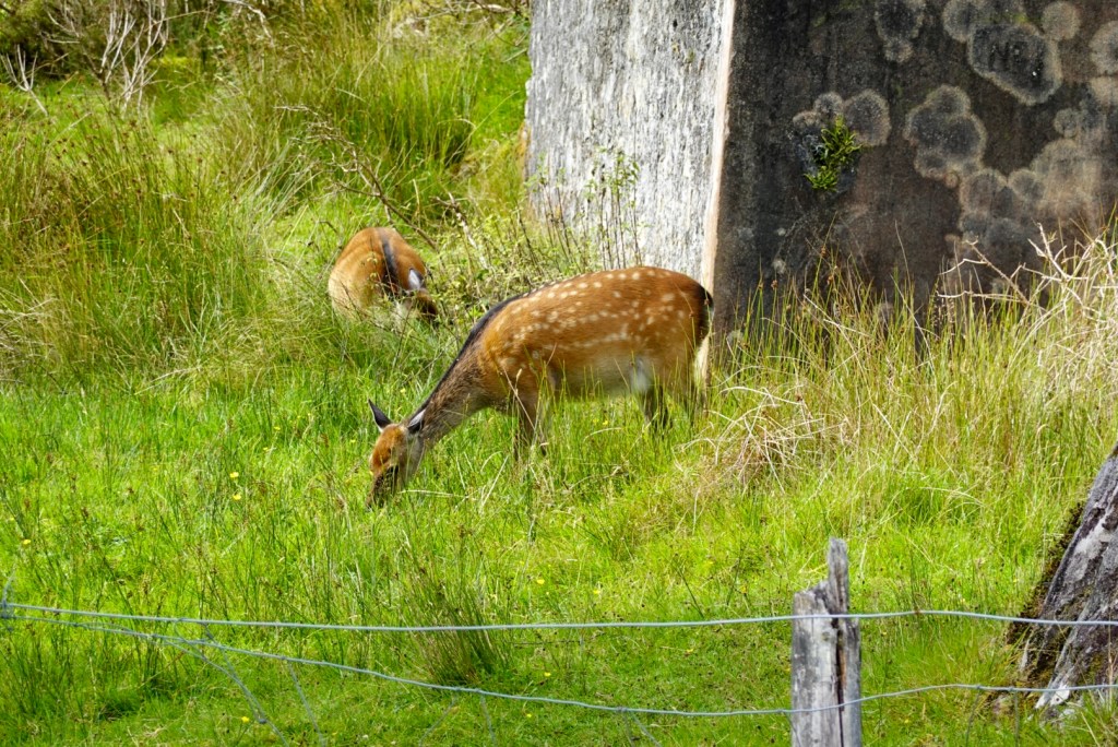
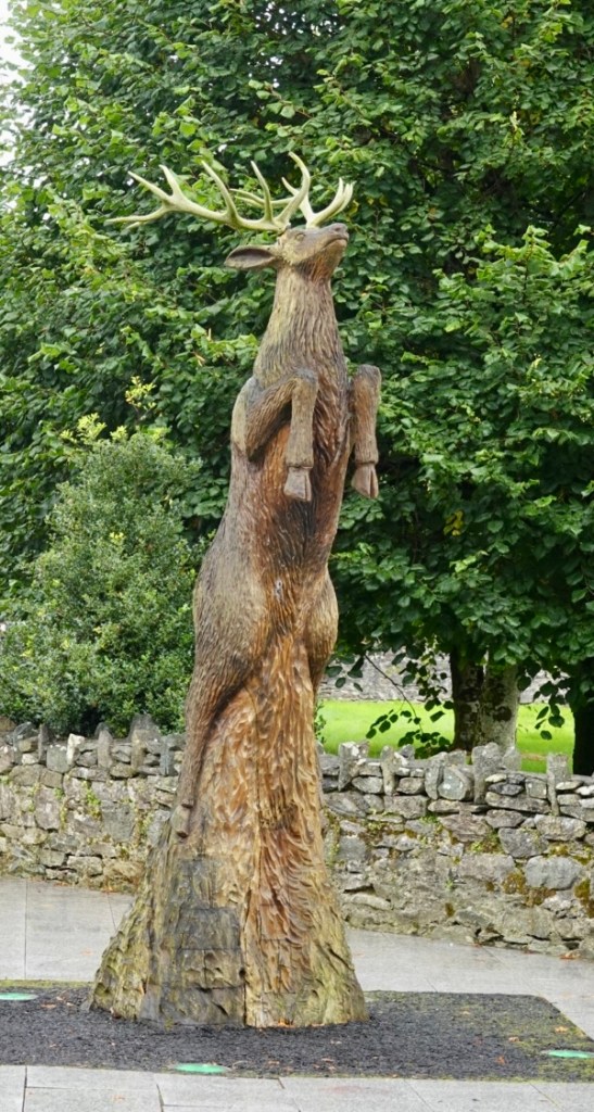
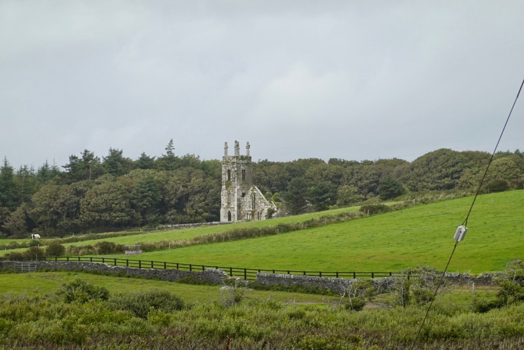
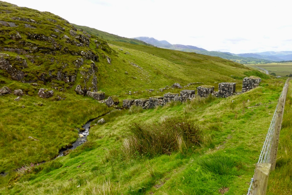
An old abandoned structure with a nice turret and wild deer. There had been warning signs on the road re wild deer. A wild goat had run out onto the road a little earlier reinforcing the need to descend with care.
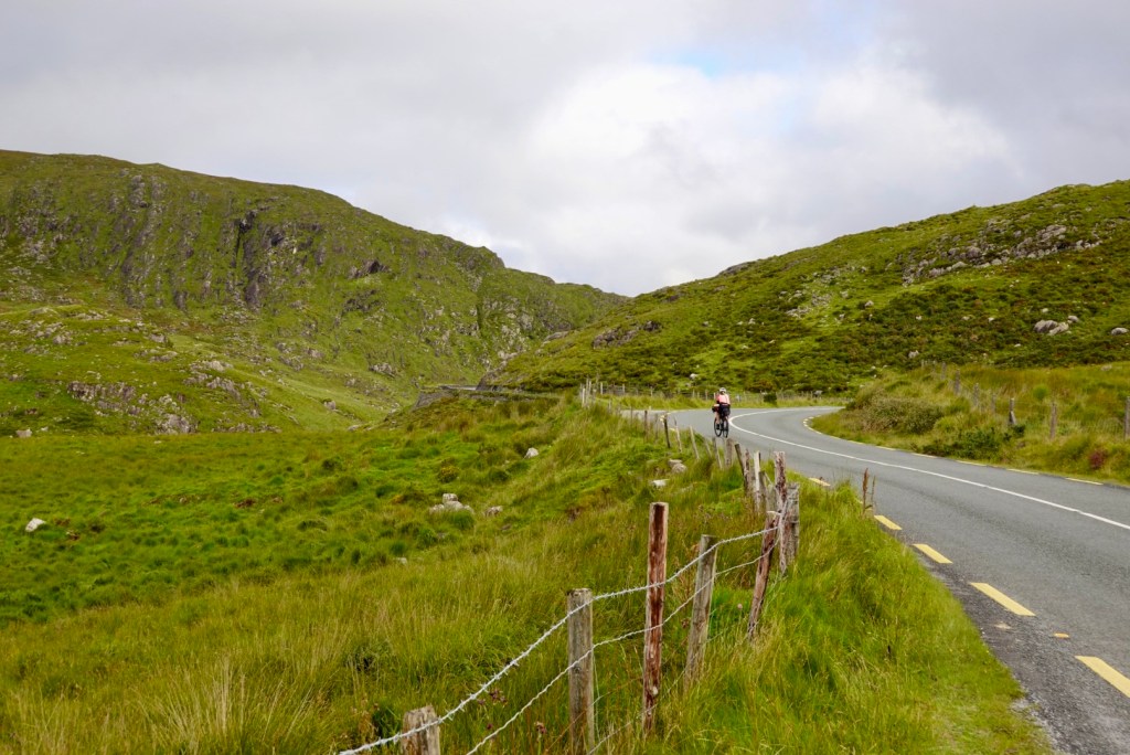
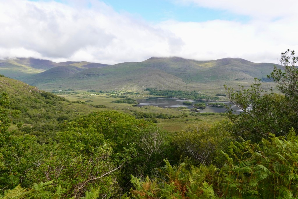
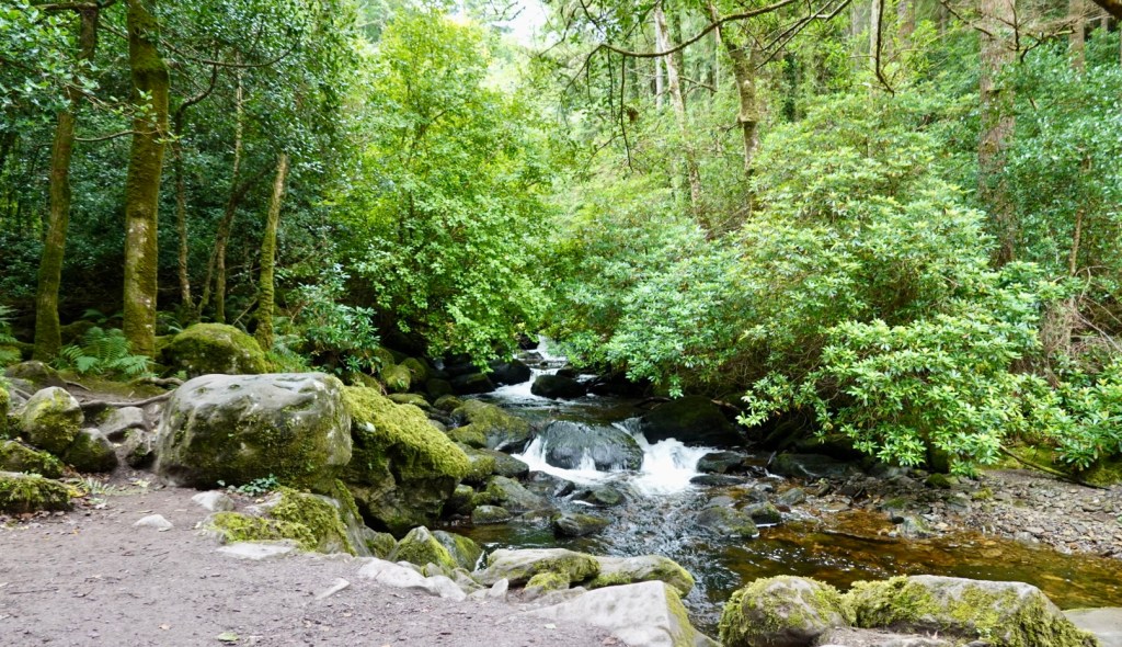
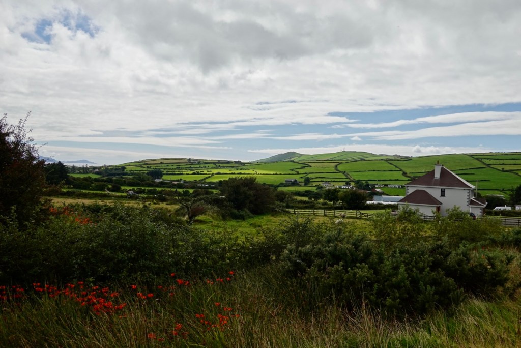
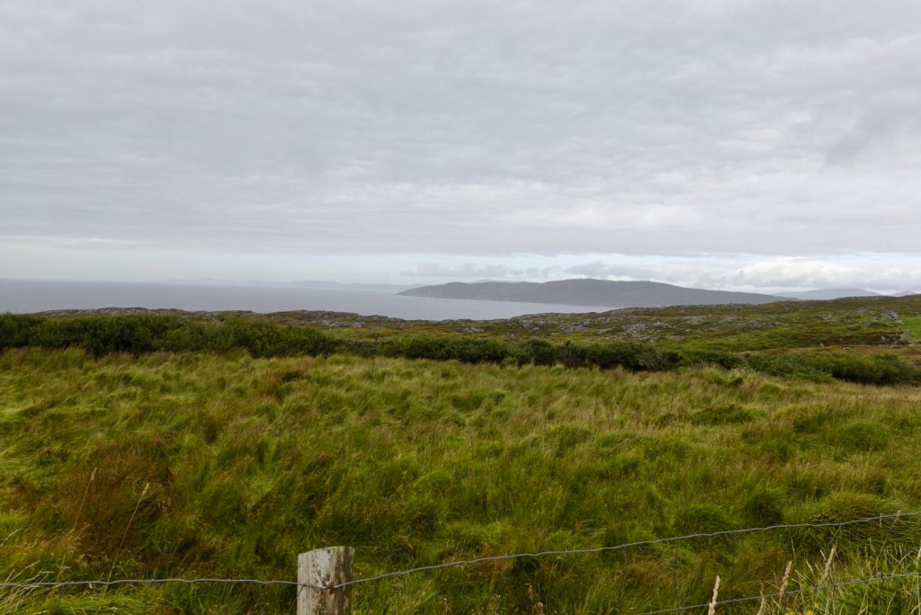
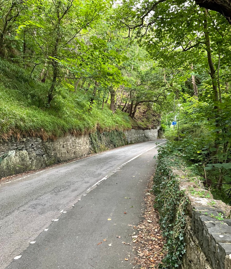
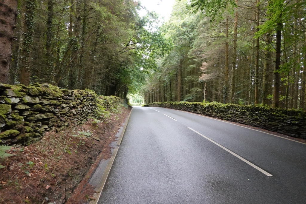
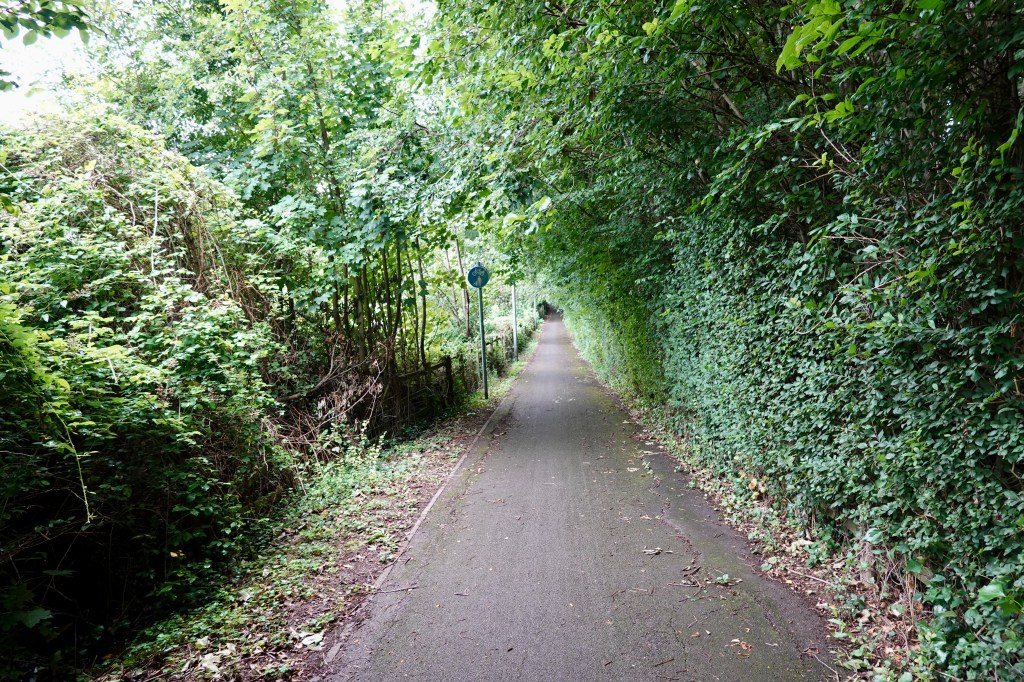
The vegetation changed as we got lower. It became more lush.
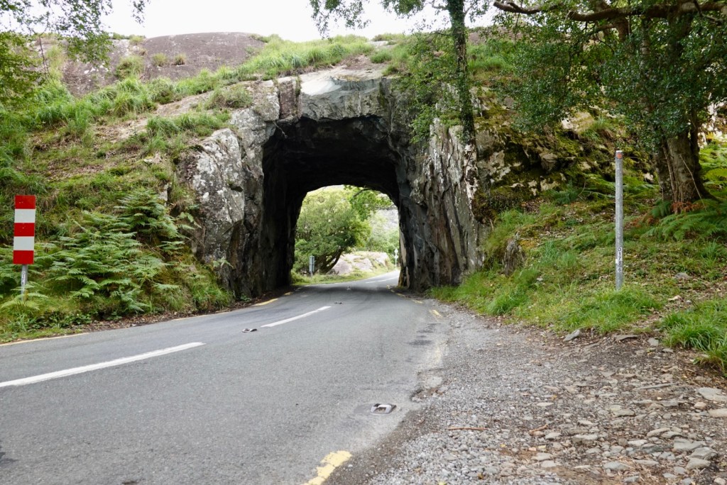
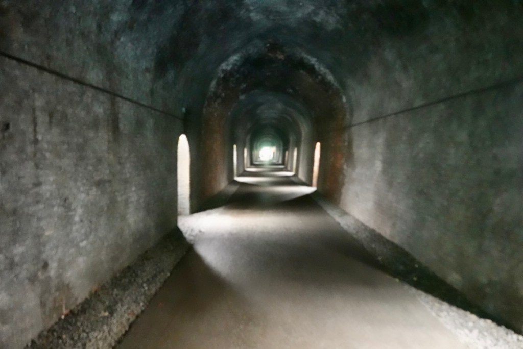
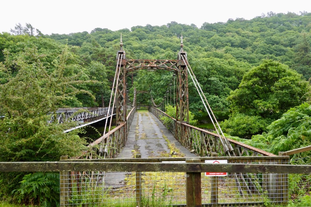
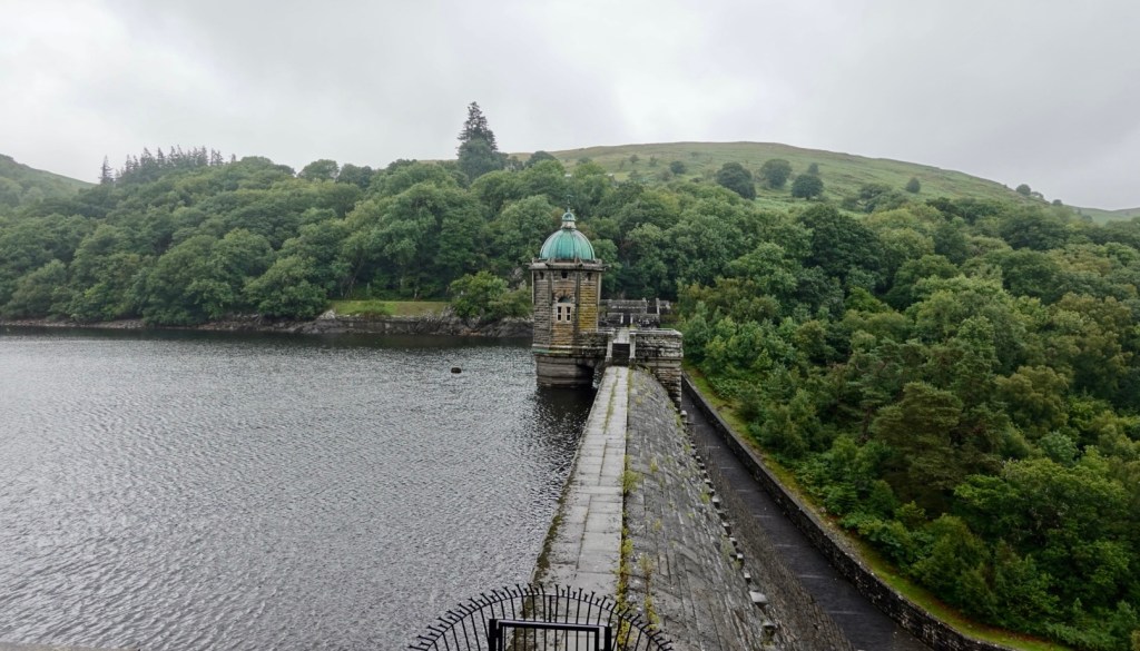
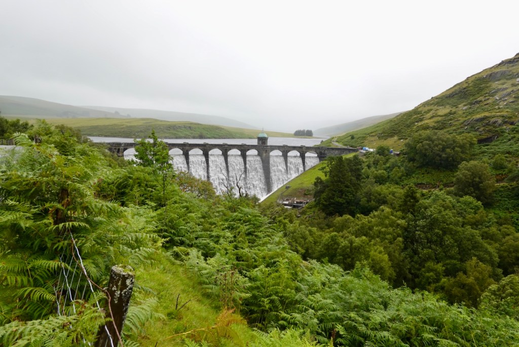
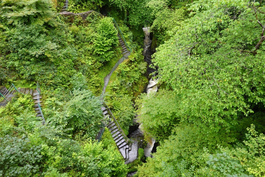
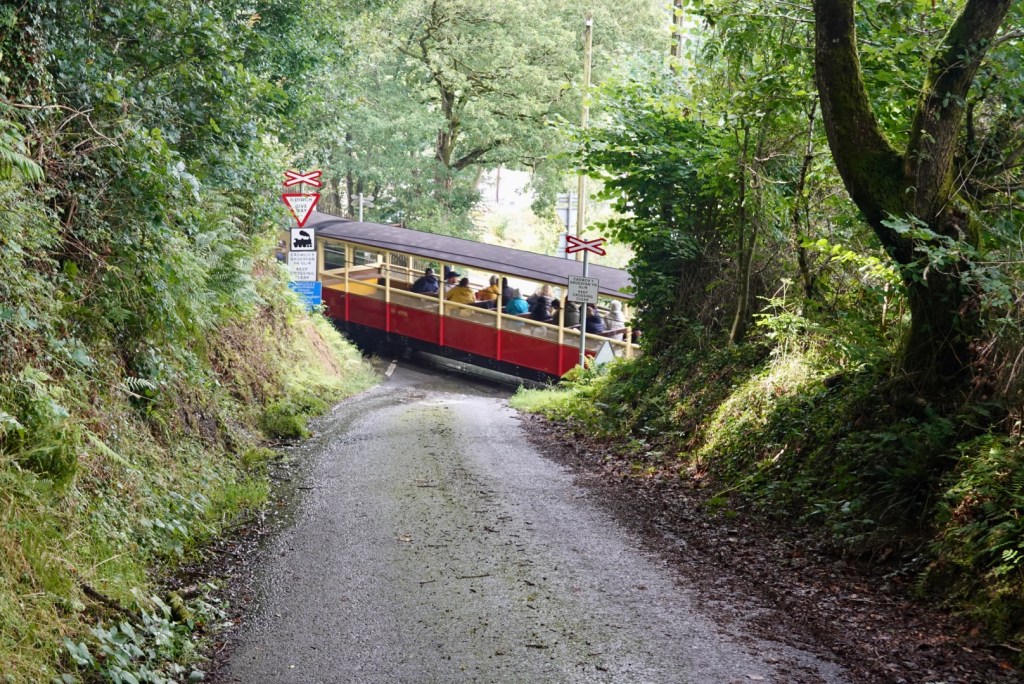
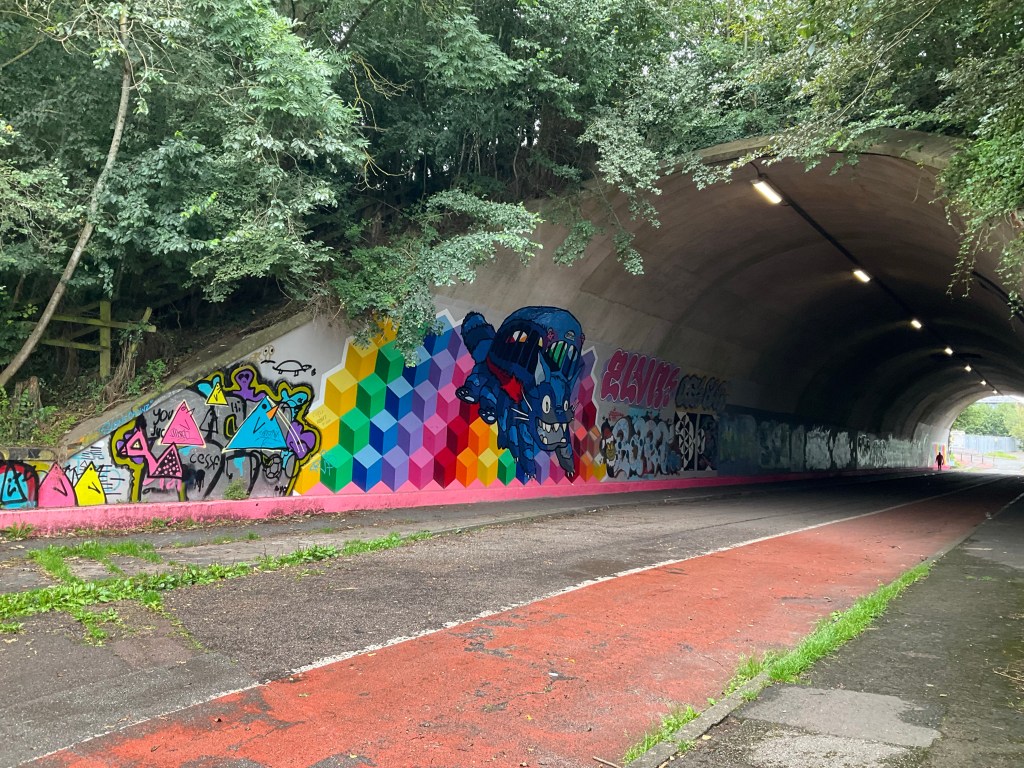
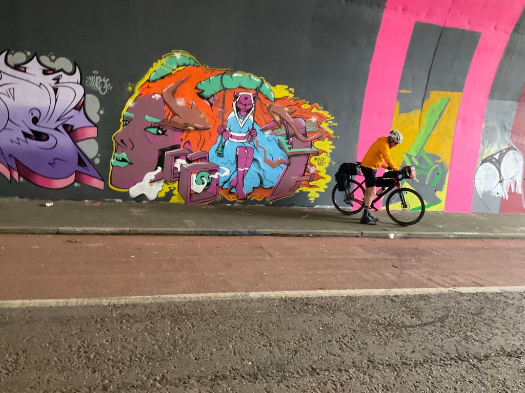
This tunnel is carved through rock. it has a height limit of 4 metres. A tour pass had passed us earlier. I would like to see how slowly it passes through here.
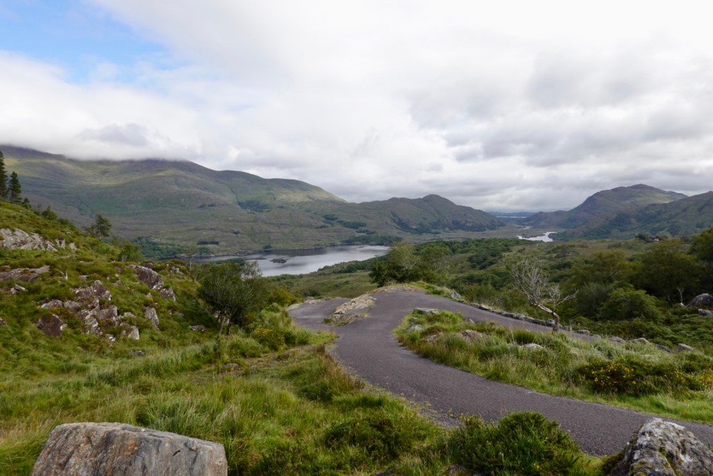
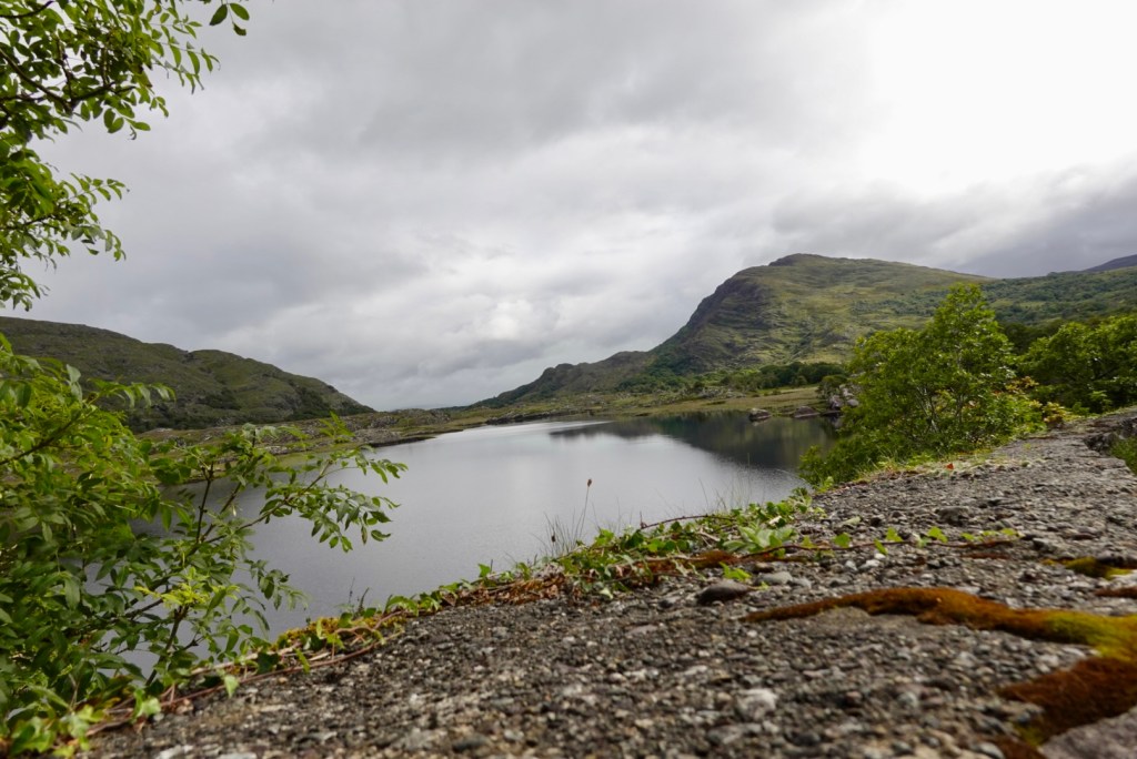
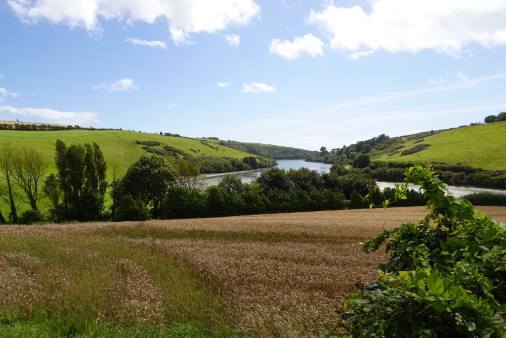
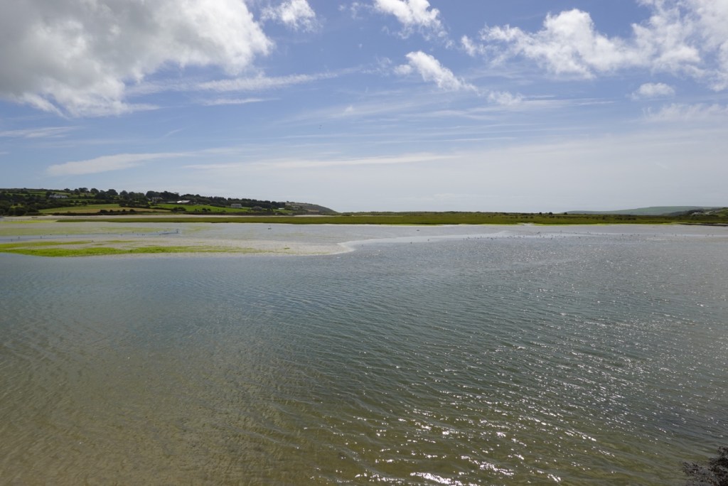
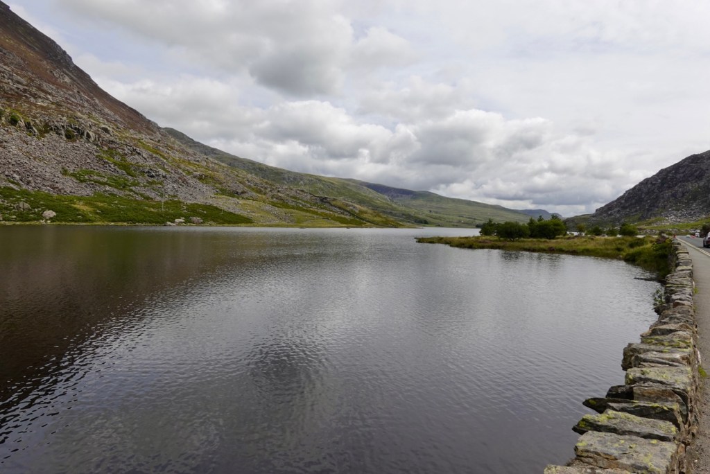
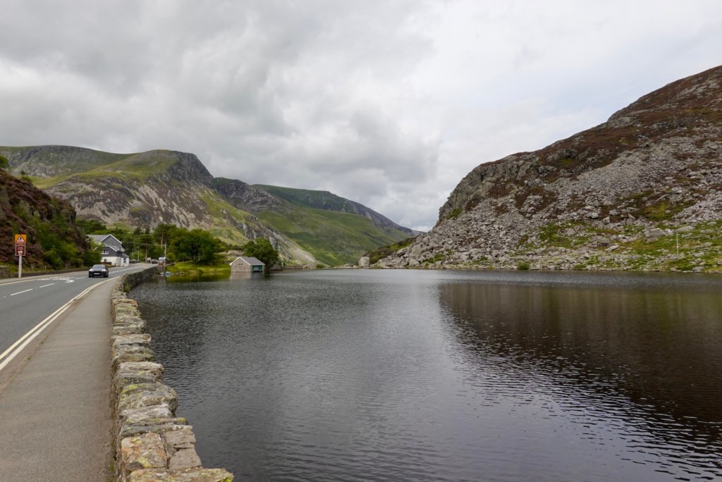
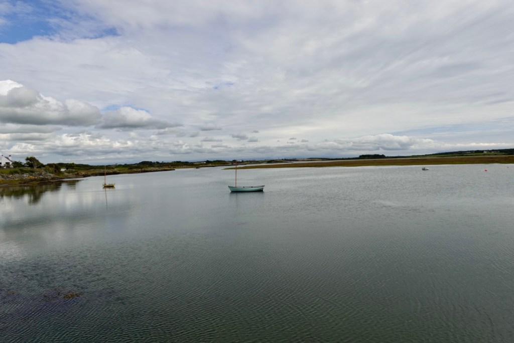
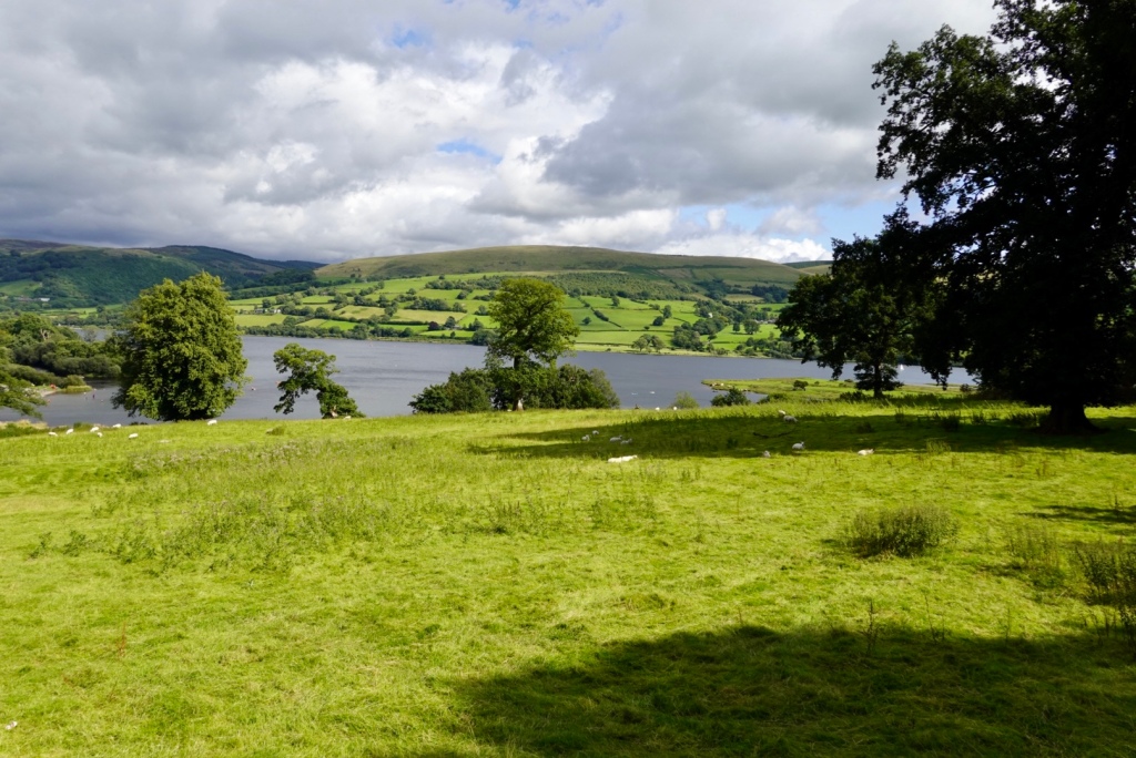
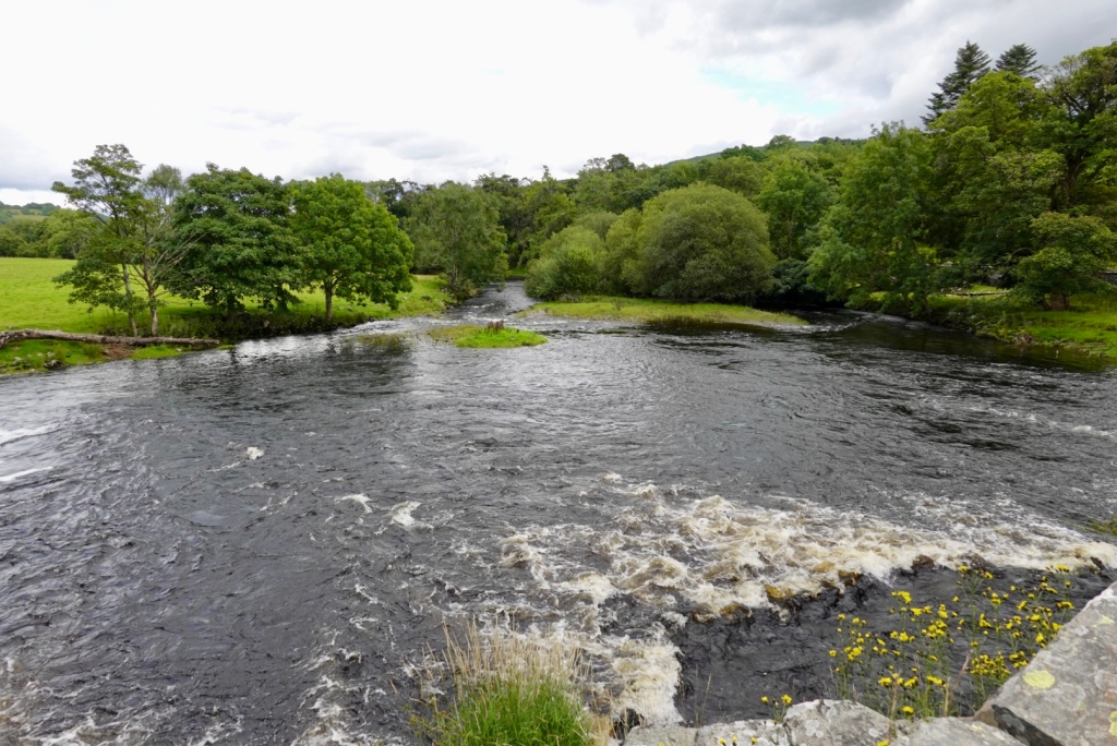
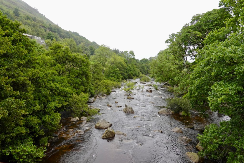
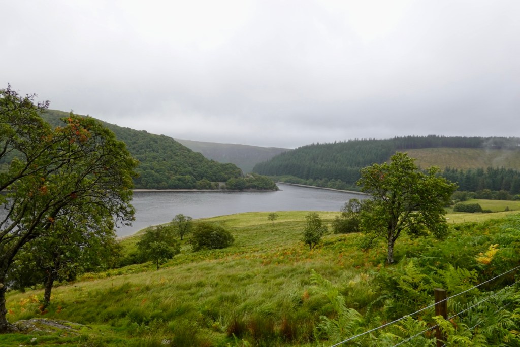
A section of Upper Lake.
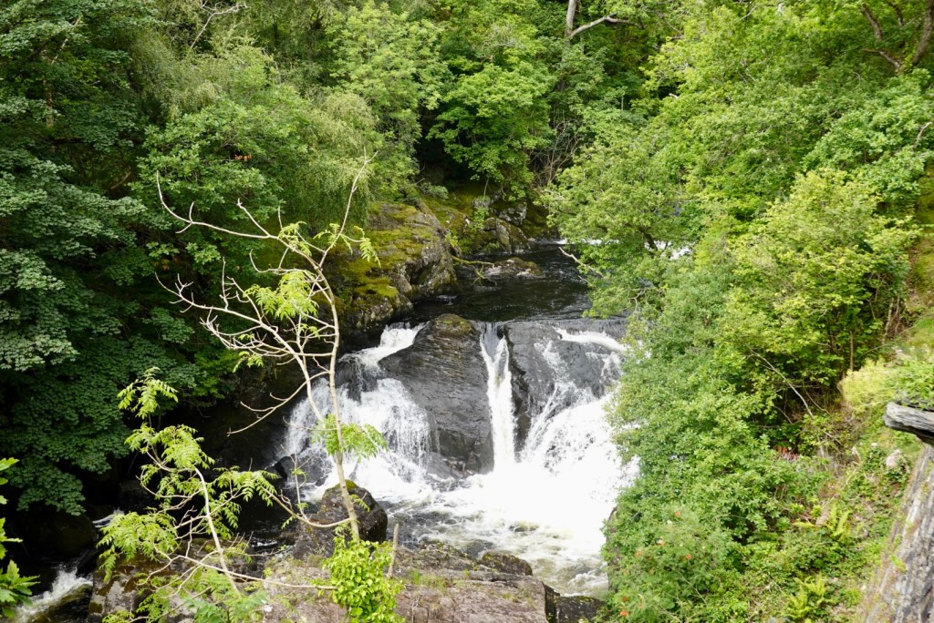
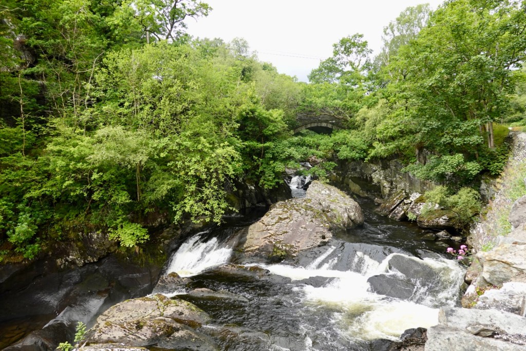
Torc waterfall flows into Muckross Lake.
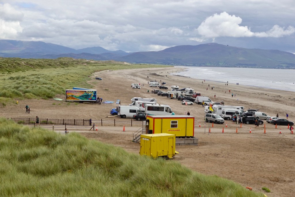
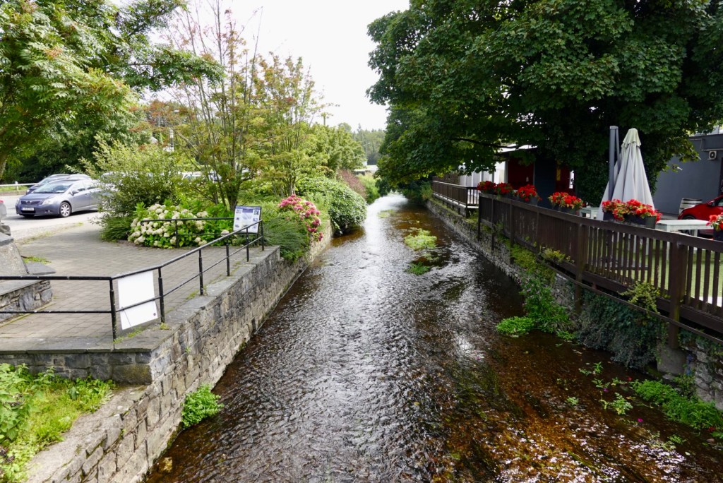
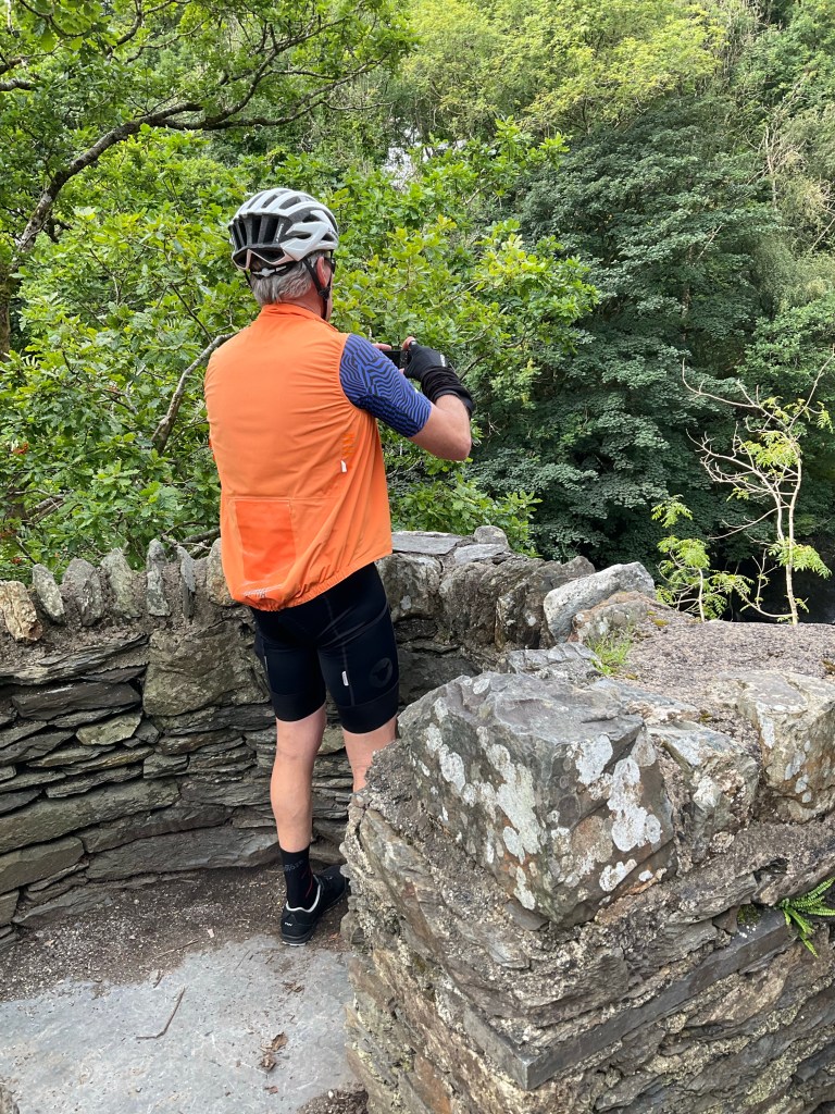
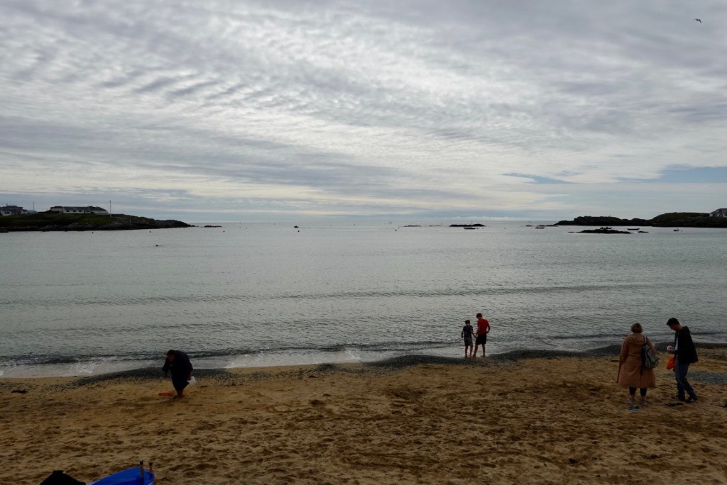
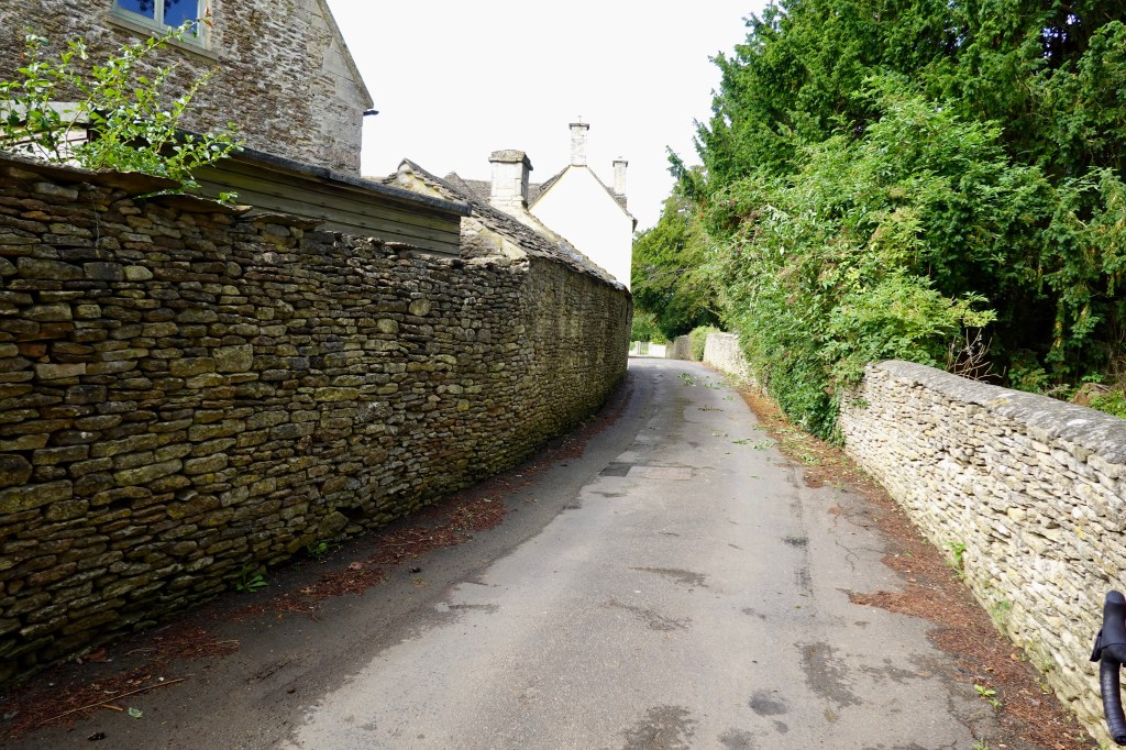
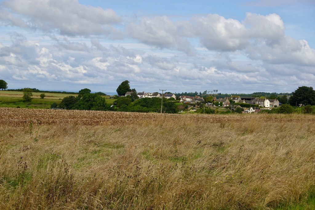
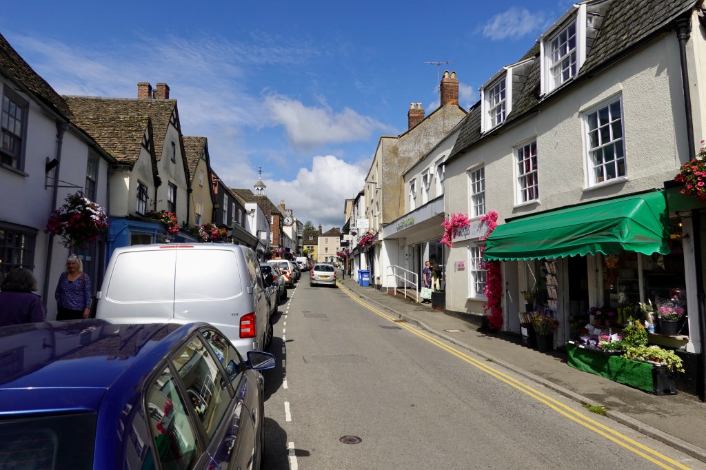
Killarney town is super busy, lined with large and small accomodation. Very busy with tourists and locals, you can sit in a horse carriage and travel up to the Torc Falls and sights in between.
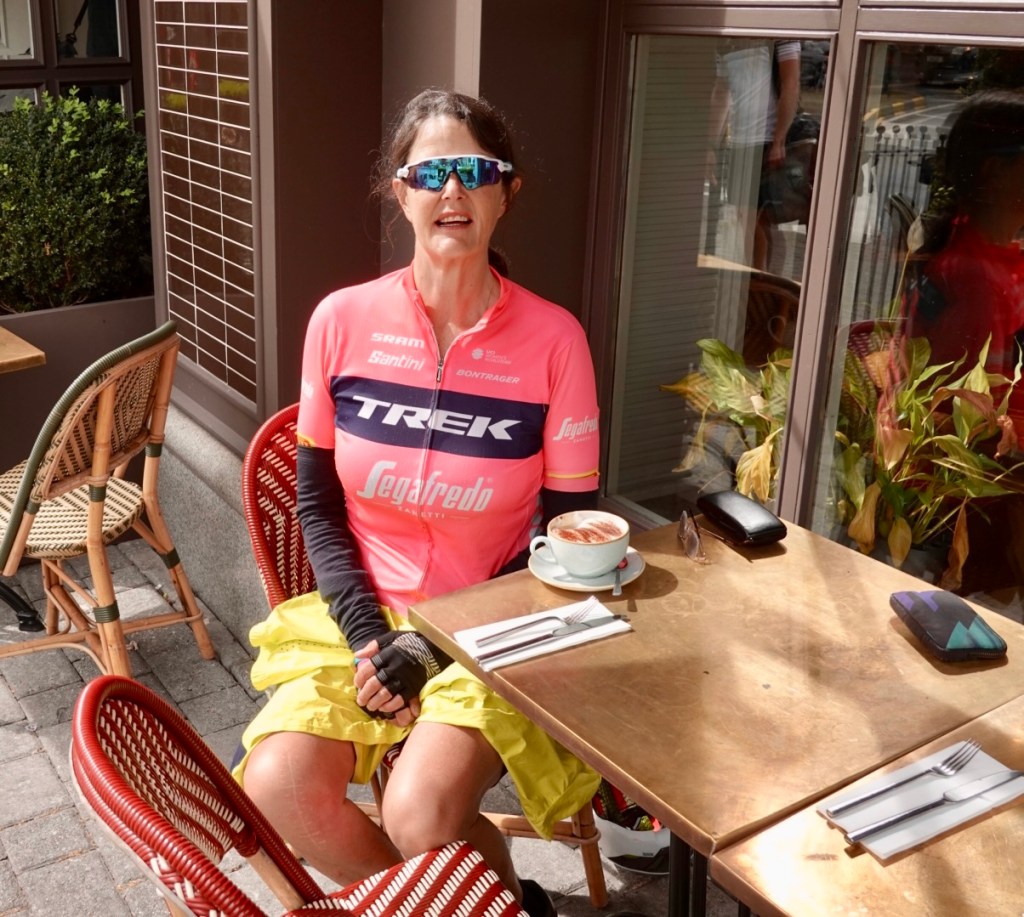
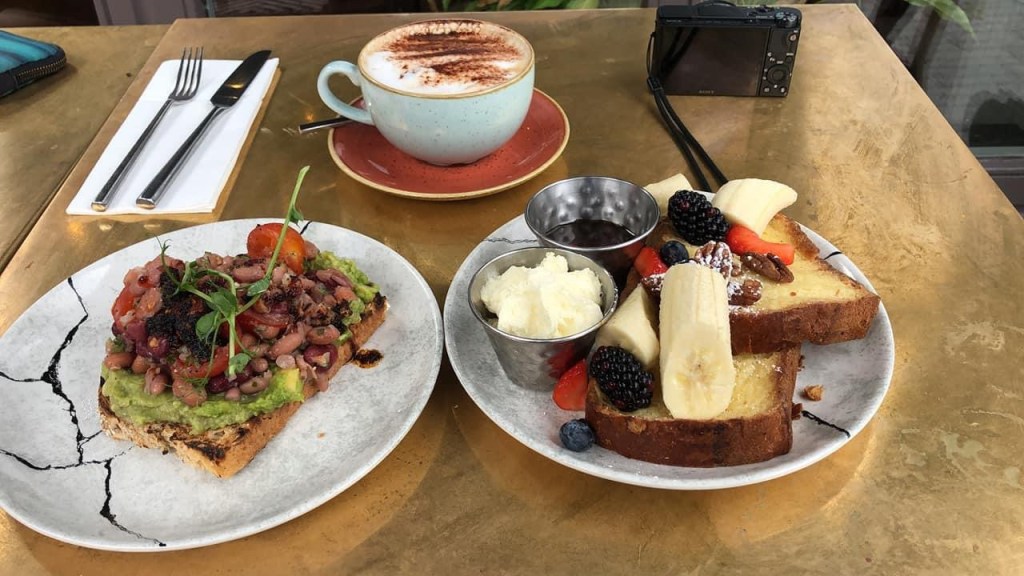
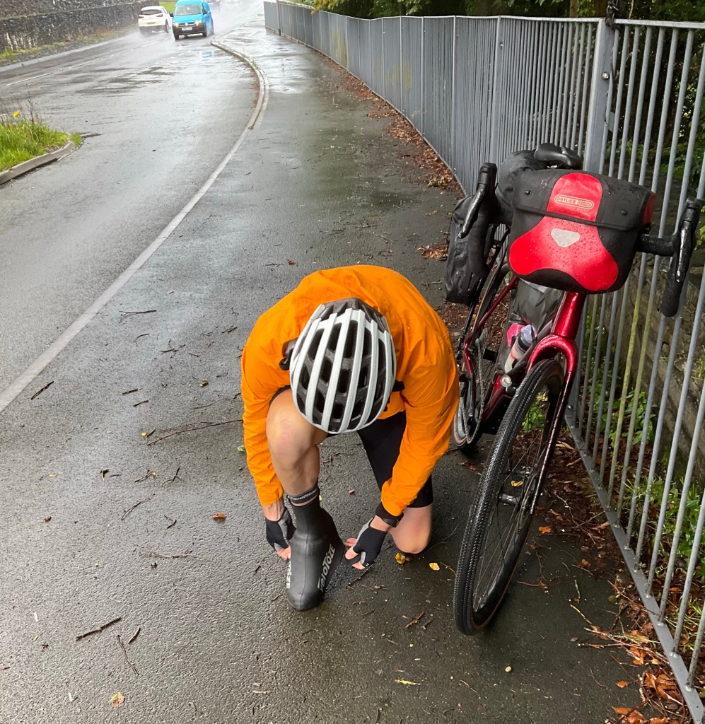
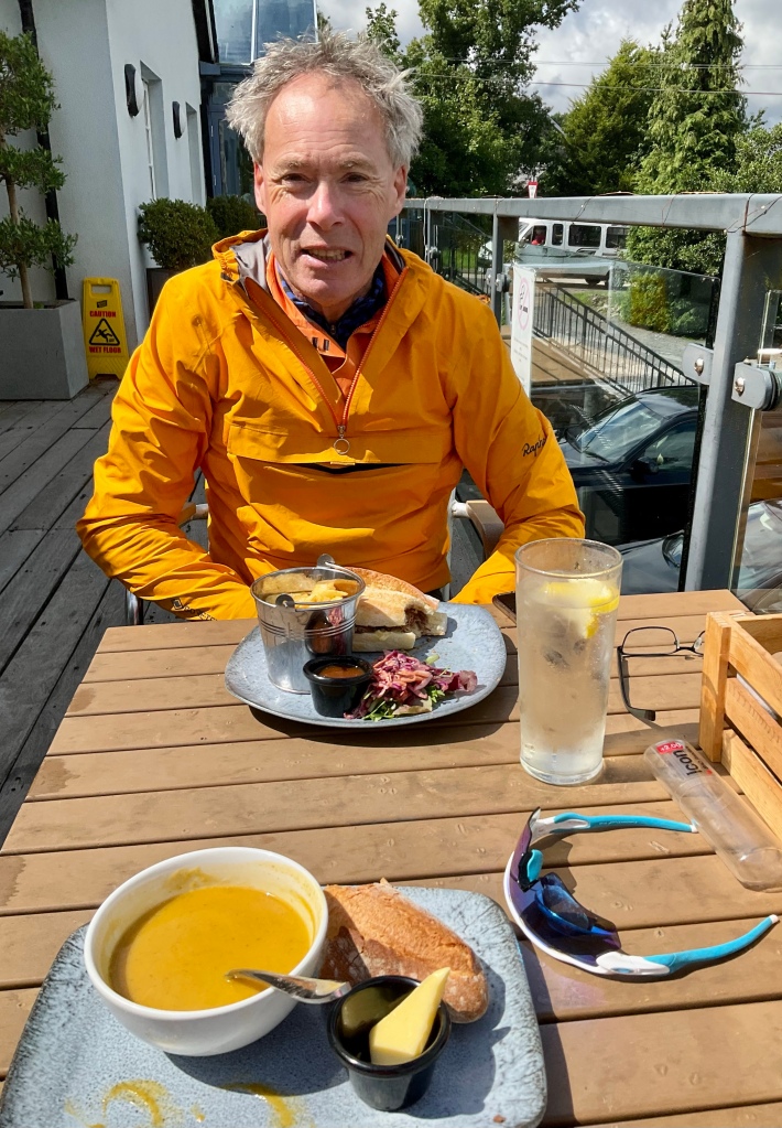
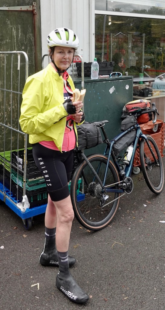
It had started to rain as we left Torc Falls, so went into this cafe for an earlier lunch, and popped our booties on (of course, it did not rain after that!).
Me eating healthy had envy of Tony’s choice.
A few local sights as we left Killarney.
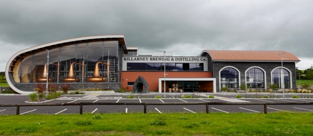
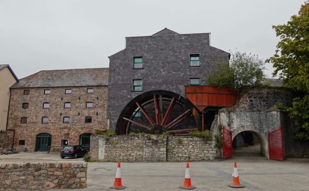
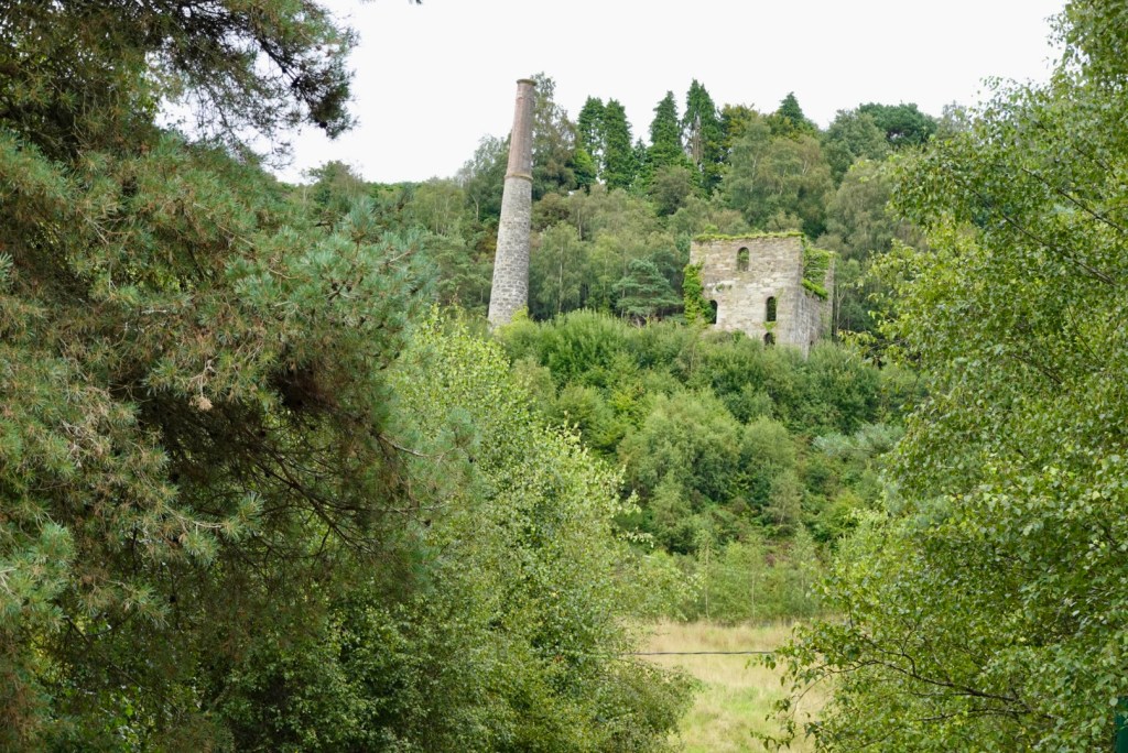
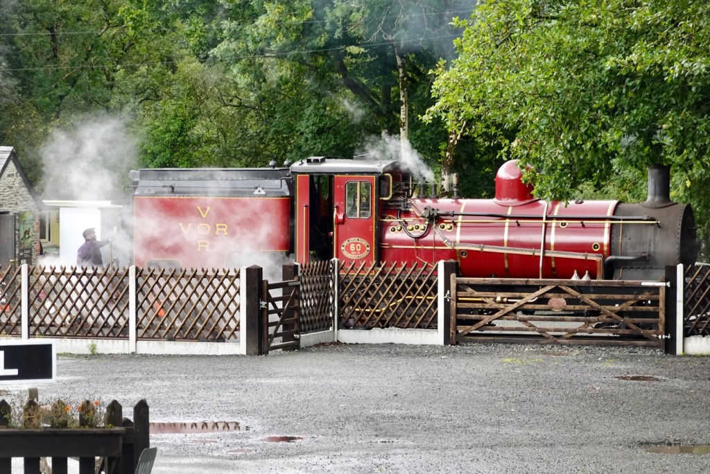
A lot of copper in these stills.
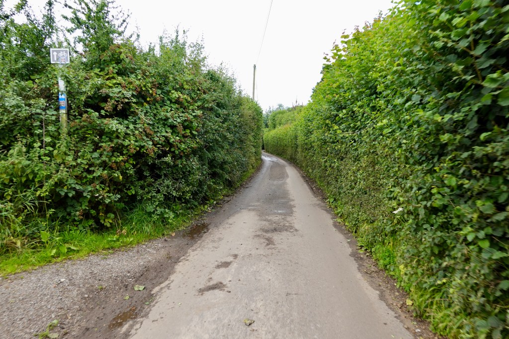
Back into the countryside!
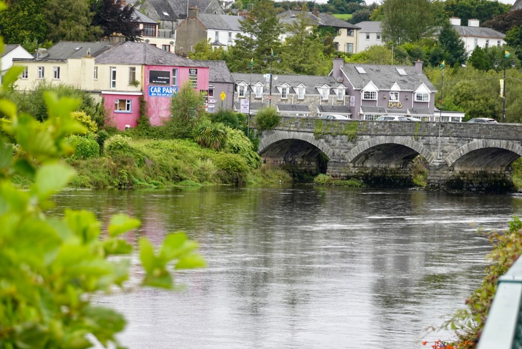
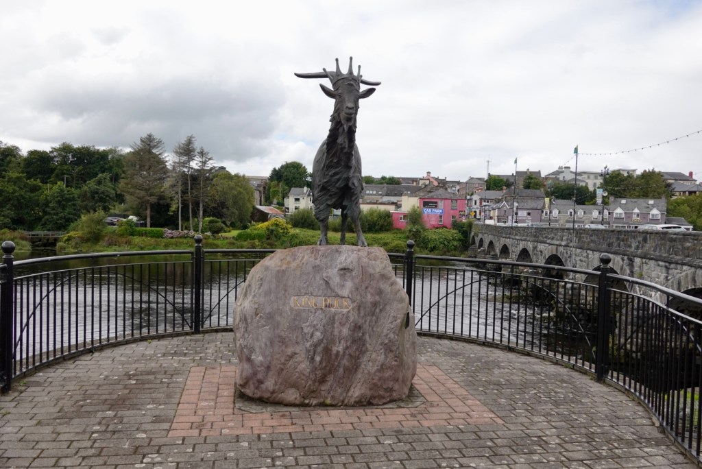
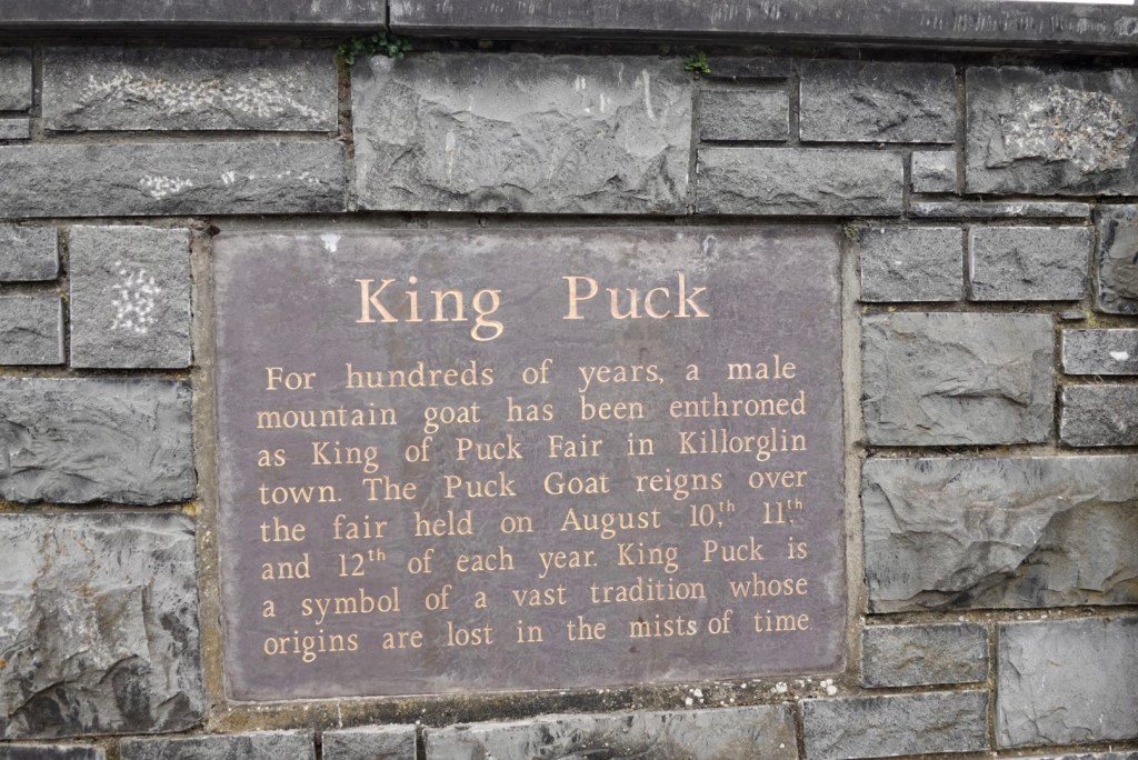
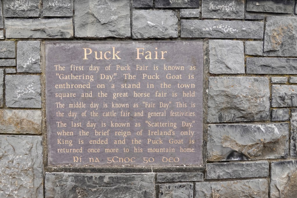
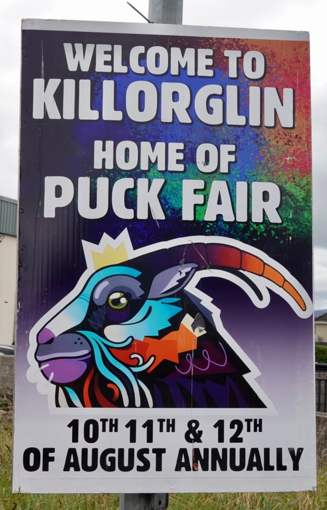
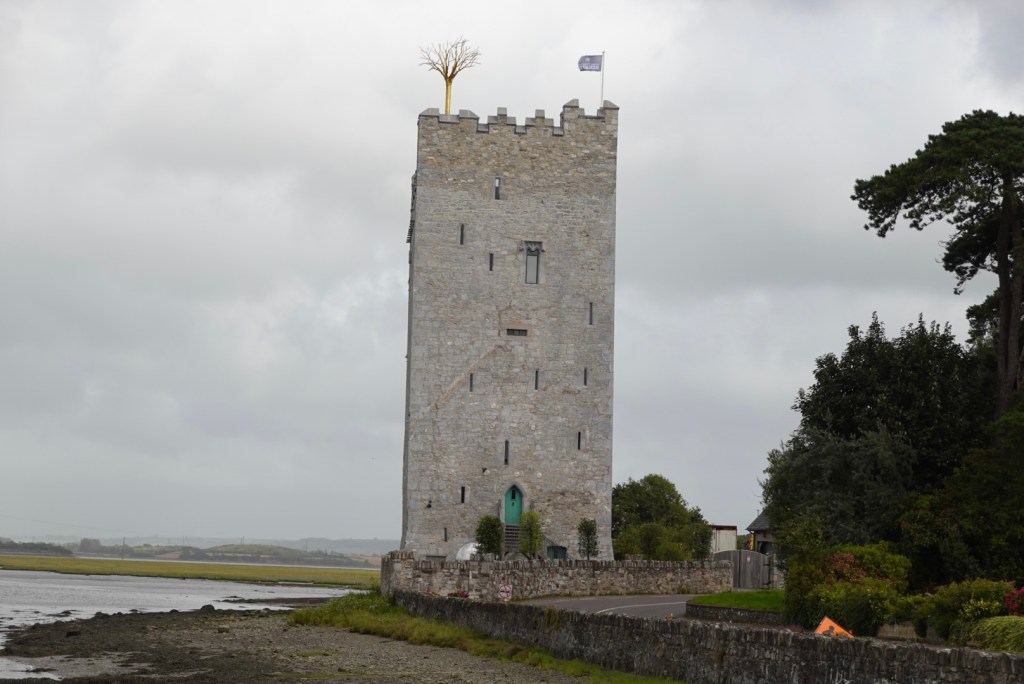
Killorglin is known for the annual Puck Fair festival, which traditionally starts with the crowning of a ‘king goat’. There is a large bronze King Puck statue on the edge of town, close to the bridge.
We just missed out on the Puck Fair….it is the 15th August.
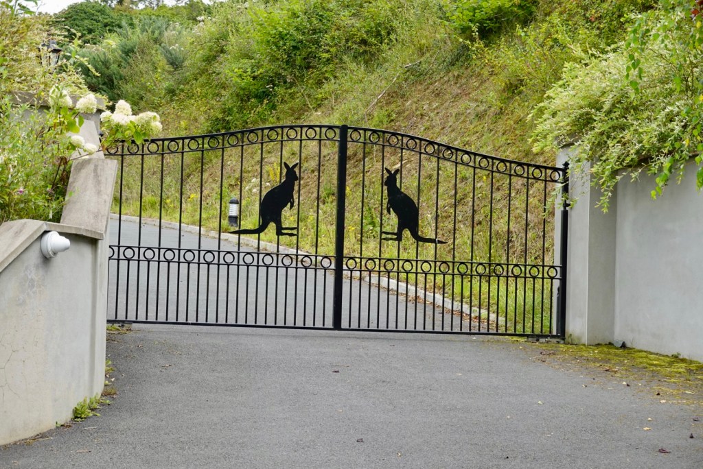
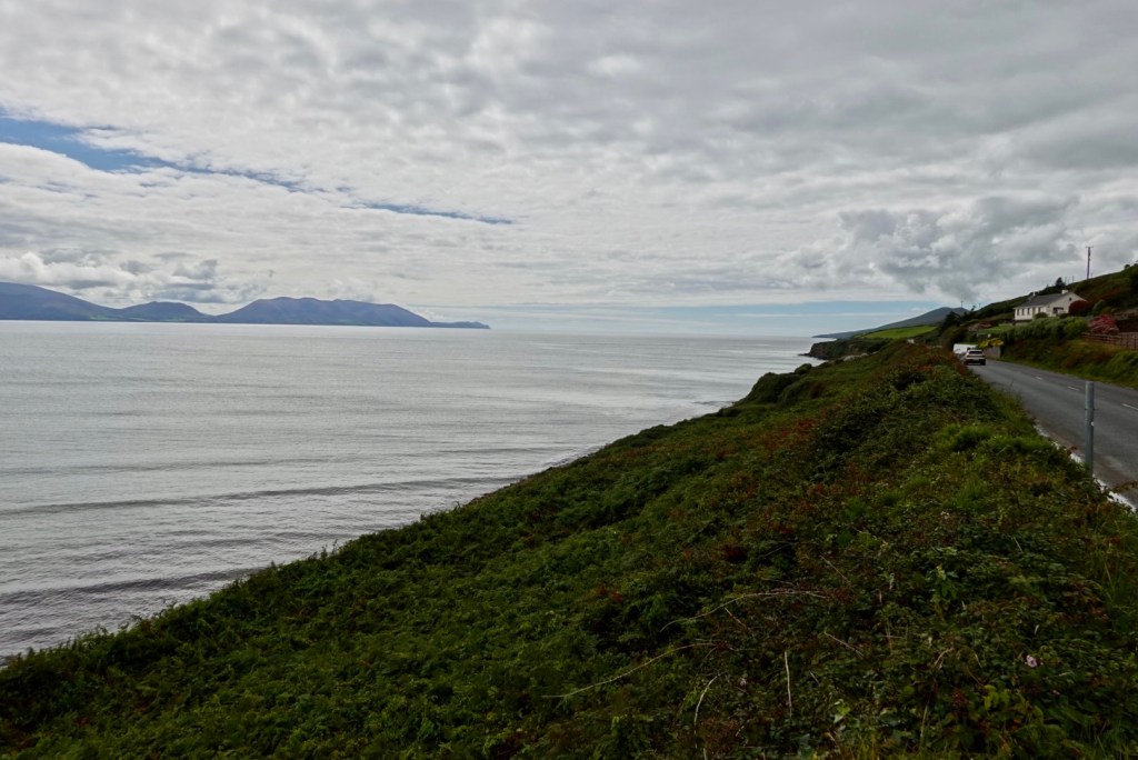
A bit of Australiana in the next section as we crossed towards the Dingle Peninsula.
I wonder if the owners are Australian?Long range view towards Dingle Peninsula, looking a bit claggy.
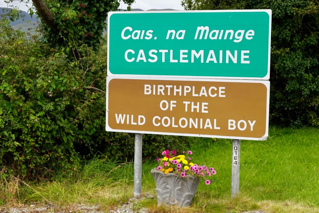
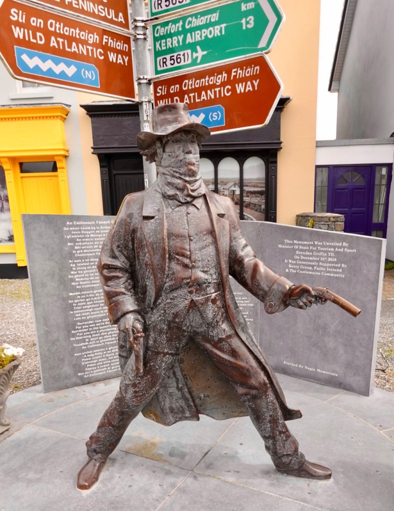
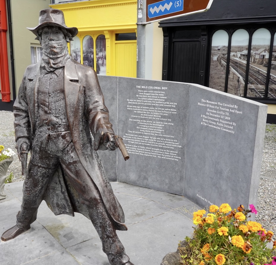
This sign got us talking. The Wild Colonial Boy was a song we both sung at primary school. One and the same?
Yes, one and the same….there was a wild colonial boy, Jack Duggan was his name….
The words to the song
Post ride research indicates it is likely that Jack Duggan was fictitious, but a great song and surprise find today.
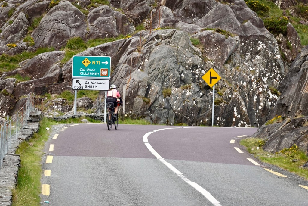
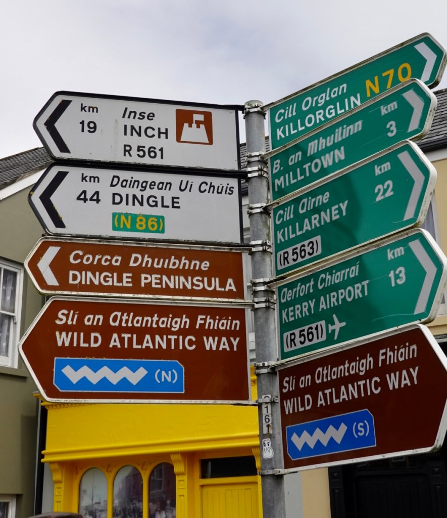
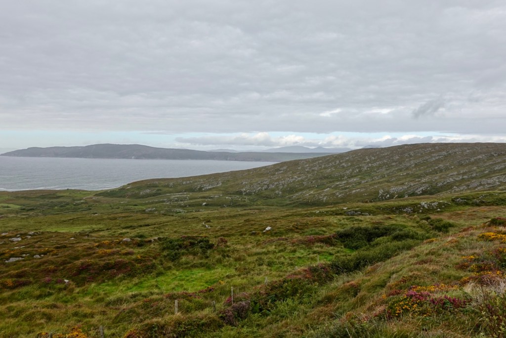
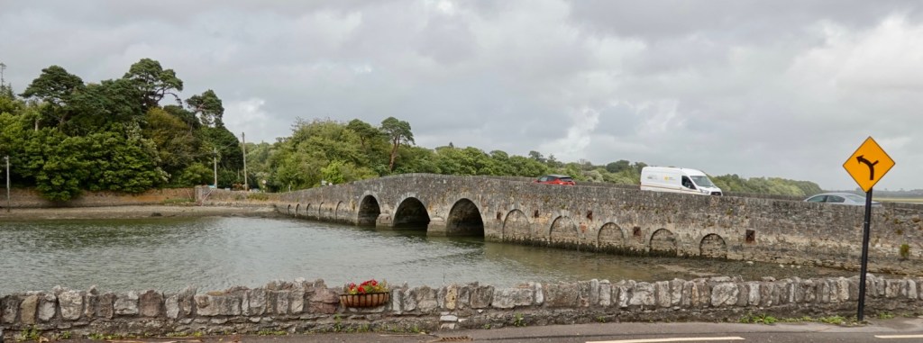
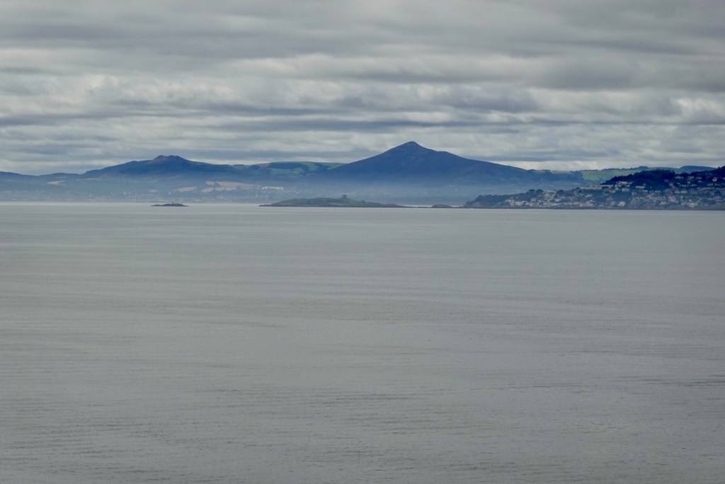
Castlemaine is a turning point to many places. You can see where we have come from, and where we are heading to, still on the Wild Atlantic Way, but no longer on the Ring of Kerry.
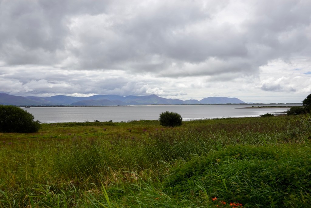
Now on the Dingle Peninsula looking towards Iveragh Peninsula.
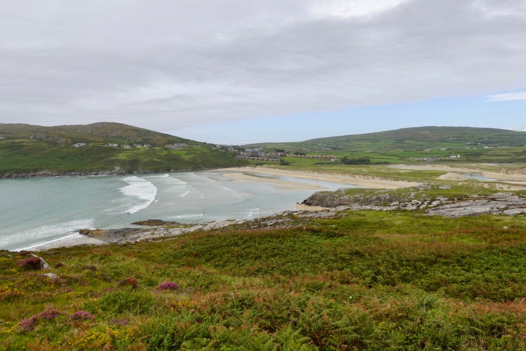
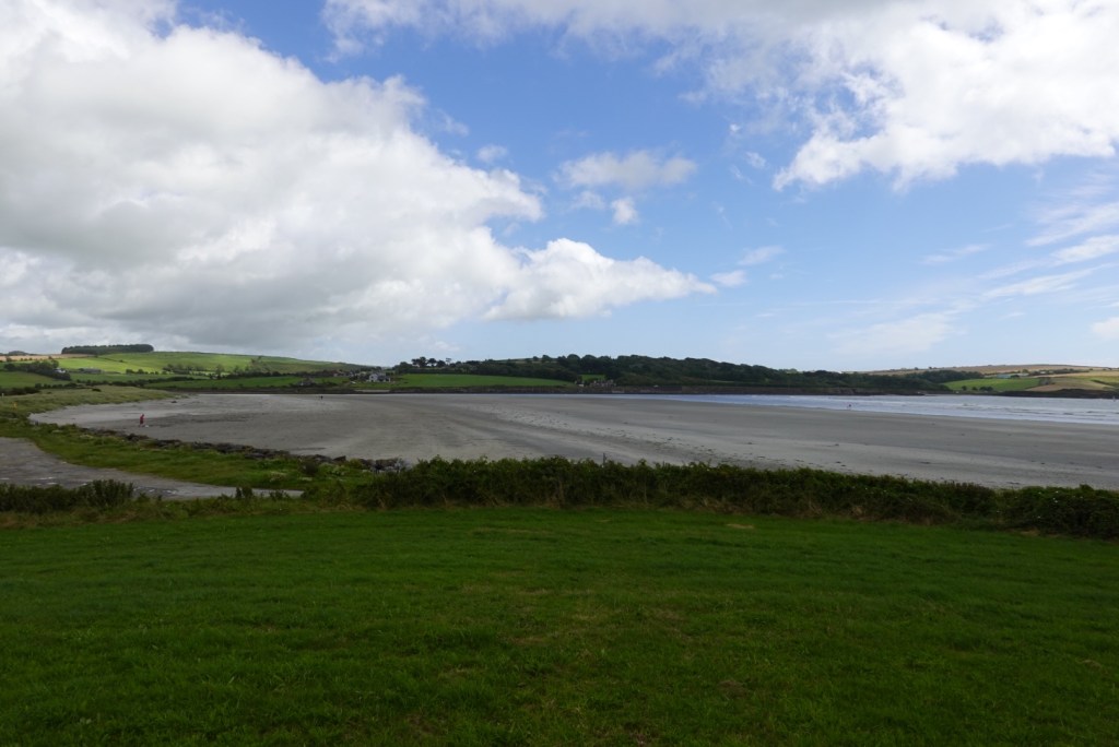
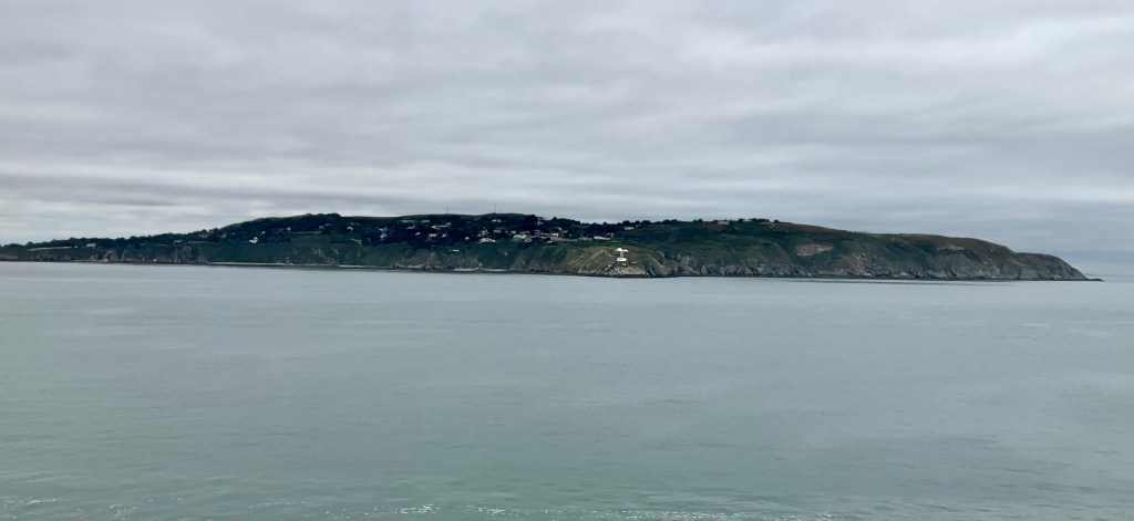
Inches Beach is famous for a few reasons. It is the only place where an inch is actually three miles long! The movie Ryan’s Daughter was also filmed here.
You can see how it just out into Castlemaine Harbour and Dingle Bay.
There was a sign up reminding drivers of high tide times and to ensure all cars are removed from the beach.
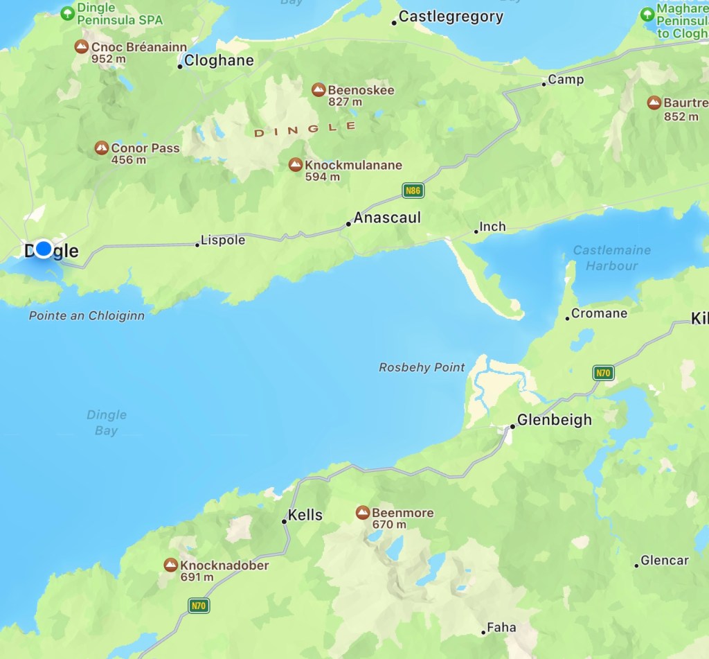
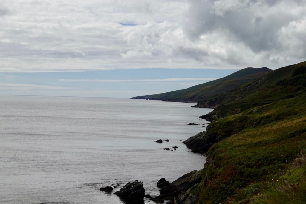
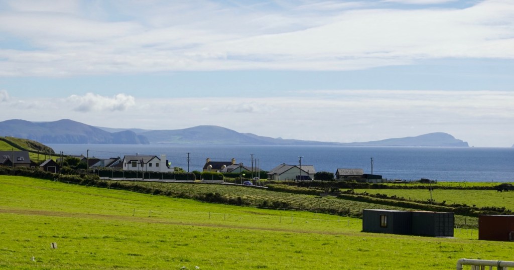
The last stint into Dingle predominately following the coast, but also heading inland for a section.
Back to the coast, then Dingle.
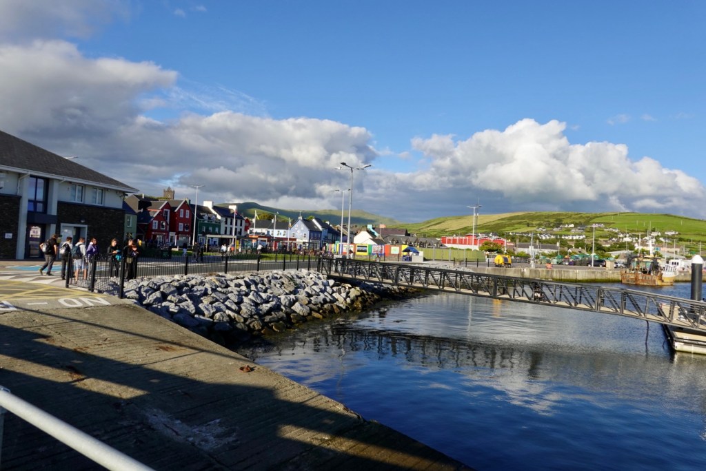
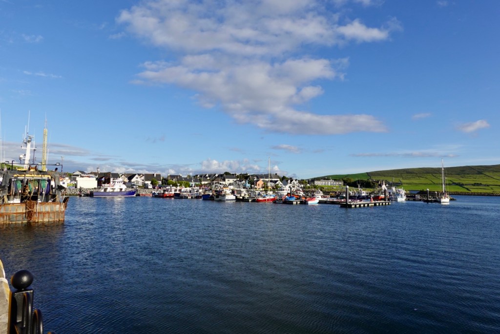
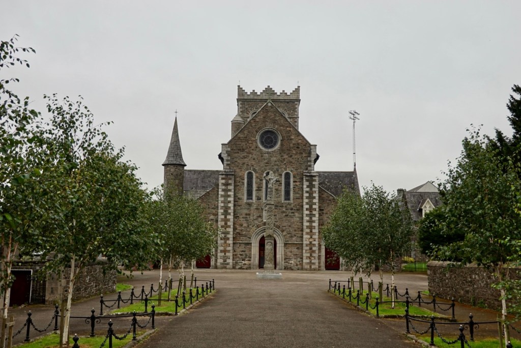
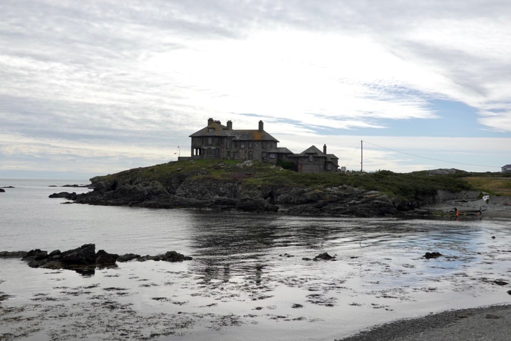
Dingle sits on the Atlantic coast and was developed following the Norman invasion of Ireland. It is a super busy town with tourists, fishing and agricultural pursuits.
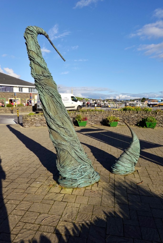
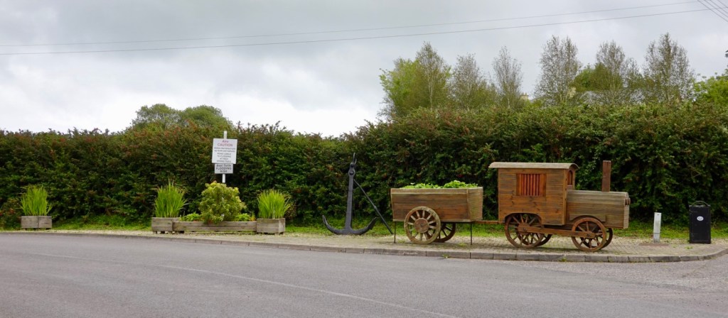
Use your imagination….no interpretive panel…I thought a stylised anchor?
The end of another day, and this is the half way point of our holiday. We have now ridden for 14 days, with numerous consecutive days over 100 km per day.
We are holding up ok. Our butts felt it a bit yesterday as some of the roads around Killarney and Dingle were very uneven, patched, pot holes so lots of bouncing around and trying to avoid hitting holes.
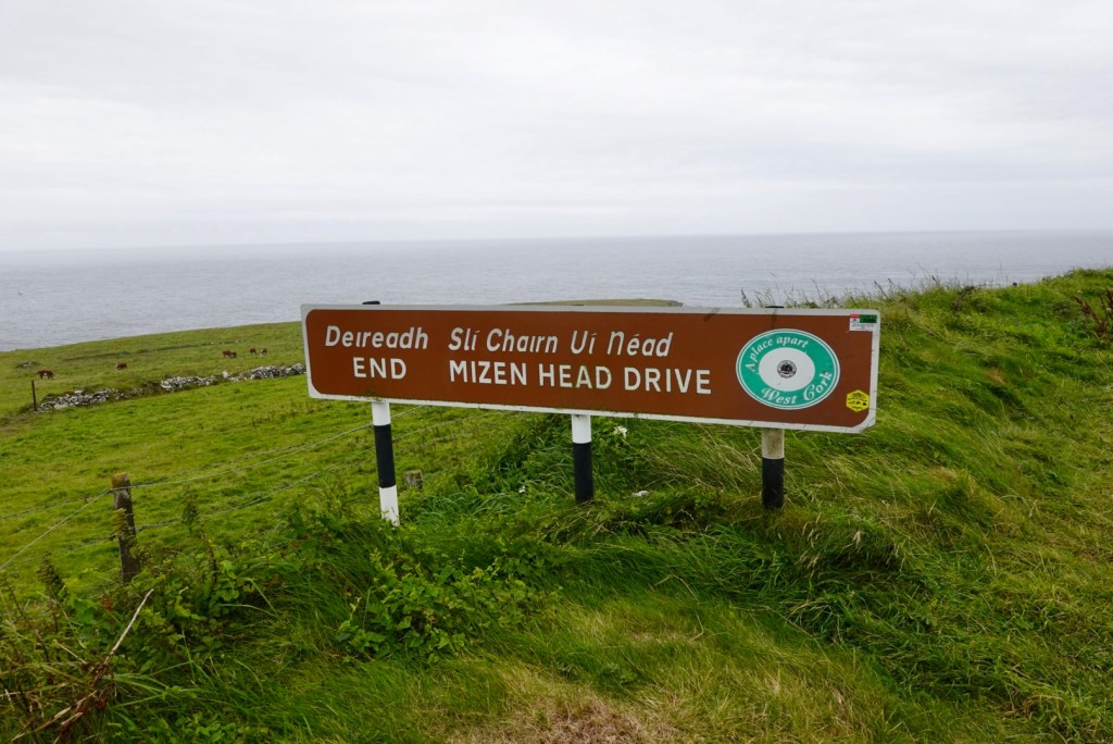
A big day planned tomorrow with the Slea Head Drive, a very popular circuit. We hope to leave early enough to avoid heavy traffic. We then come back to Dingle to refuel before the challenging Conor Pass.
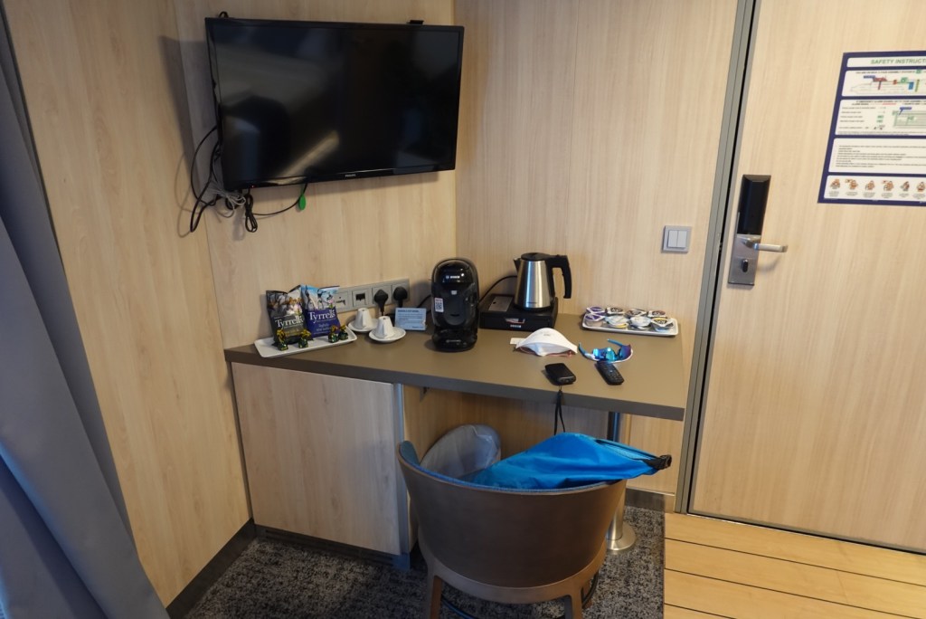
Our hotel room is the smallest in living history. It is 3 m x 3 m. The shower is in a cupboard. The toilet is in another cupboard. The bed is about 6 inches short.
You cannot shut the toilet door if sitting on the loo. The hand basin is tiny and to clean your teeth you need to be able to be a contortionist. 🤣🤣🤣 Fortunately the bikes are in the rear courtyard!
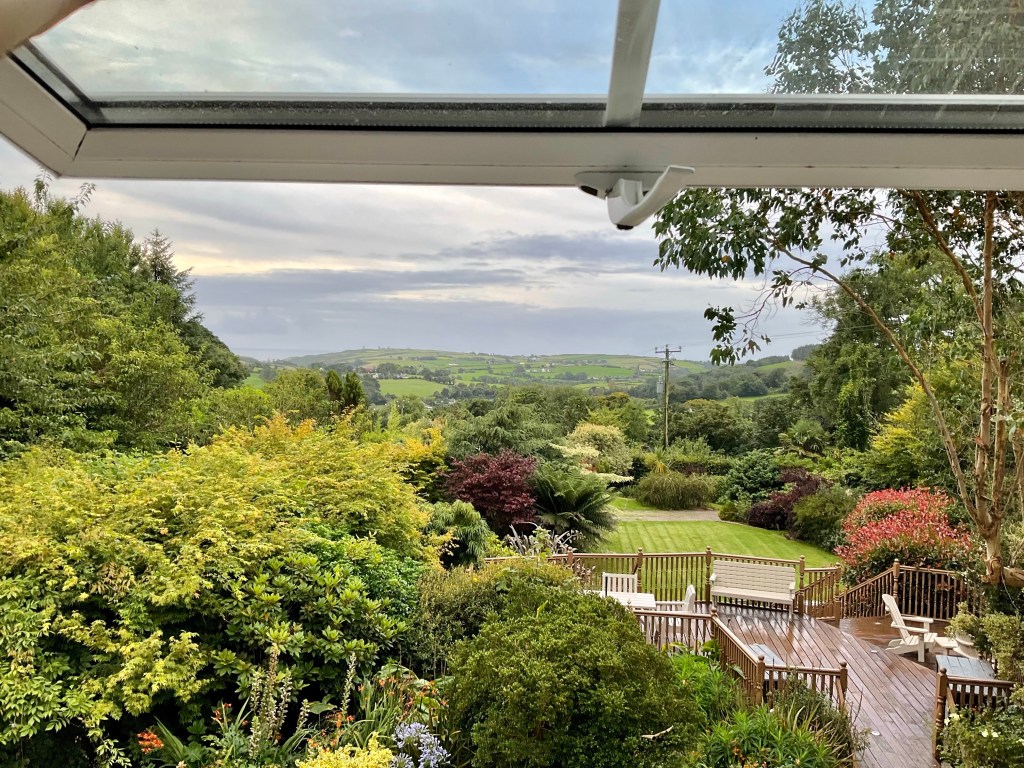
A beautiful view from our bedroom window enjoying the distant panoramic views. The forecast was ok, with lighter winds, and light rain around 3 pm.
We enjoyed a lovely breakfast prepared by our hosts Jim and Carol and got underway soon thereafter.
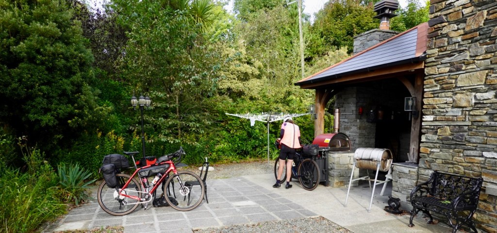
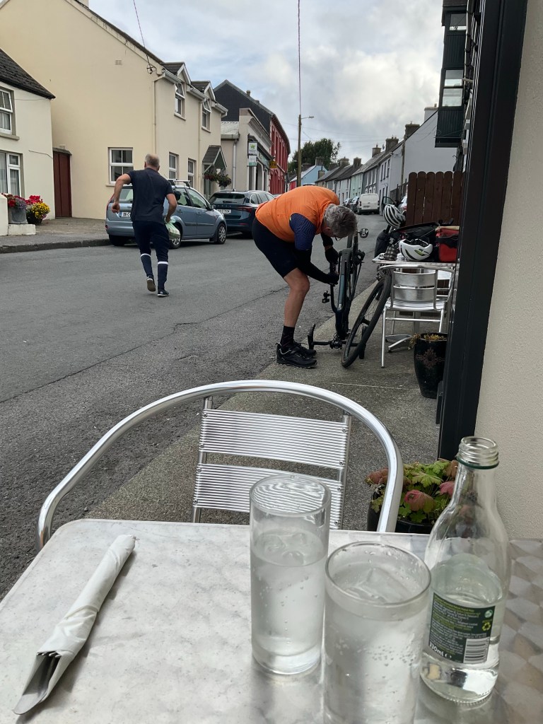
Finalising the bike packing before leaving our accomodation.
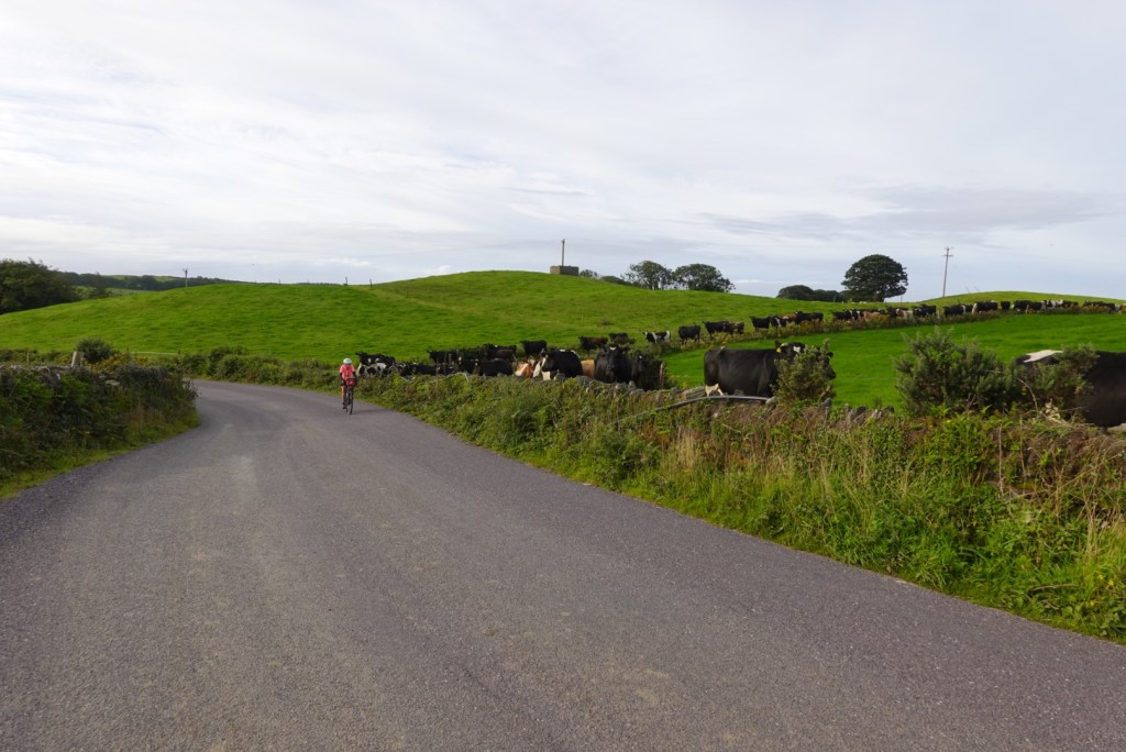
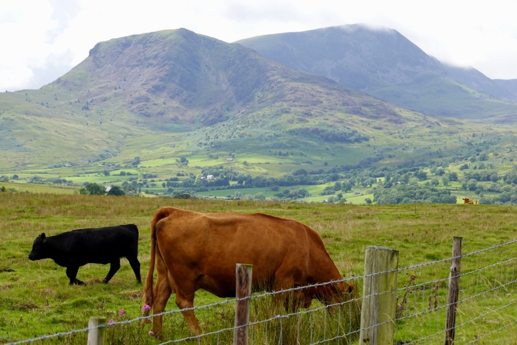
It was straight up to the top of the hills down to the conga line of curious cows.
The first town was Skibbereen, the capital of West Cork. It was fairly quiet being a Sunday morning.
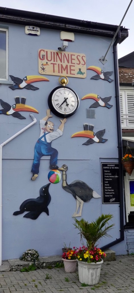
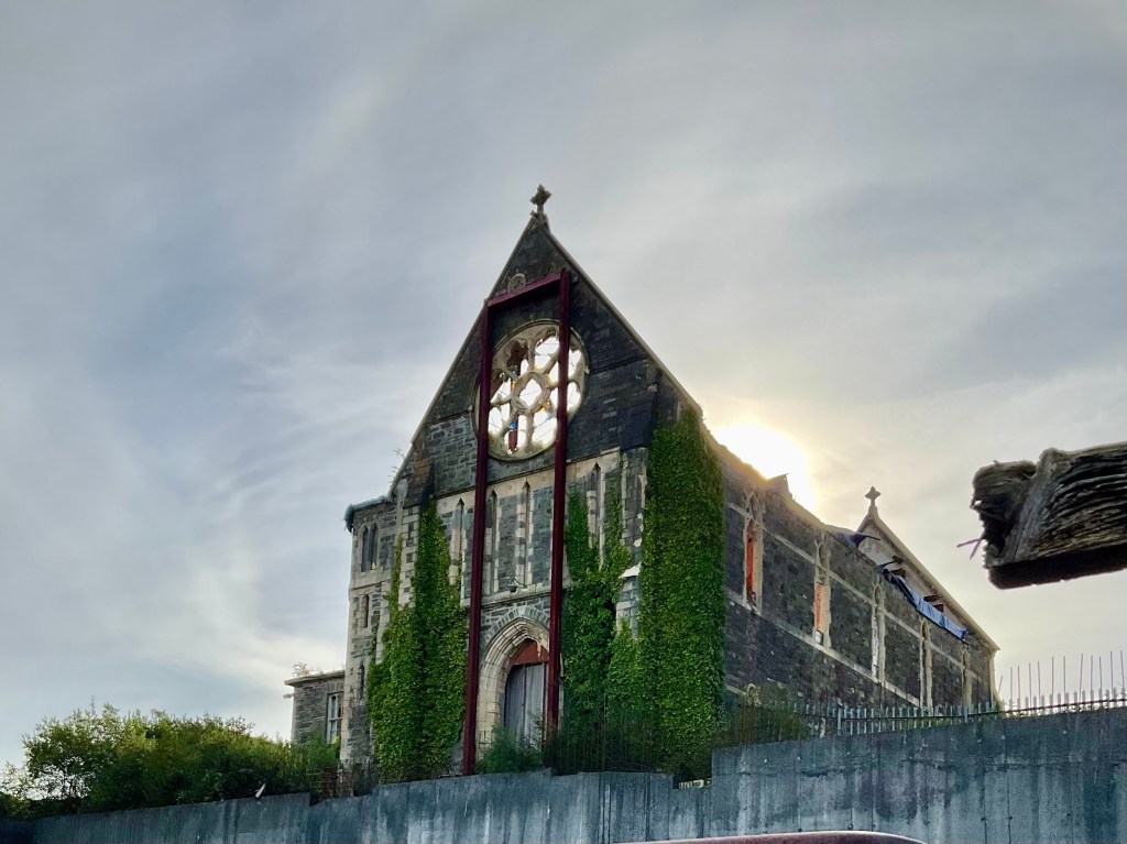
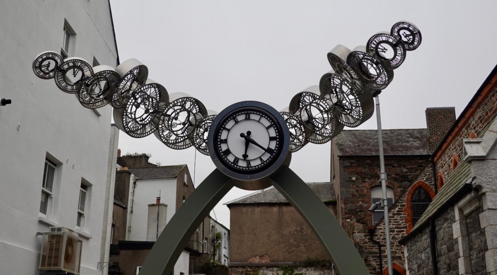
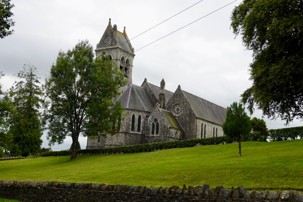
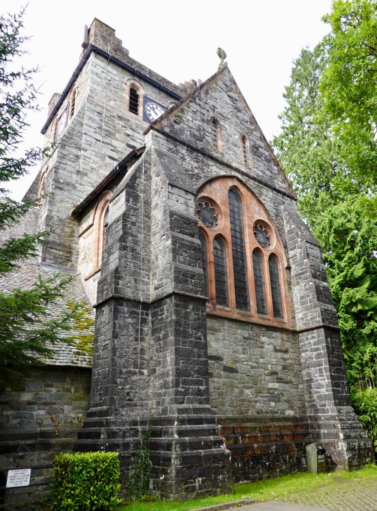
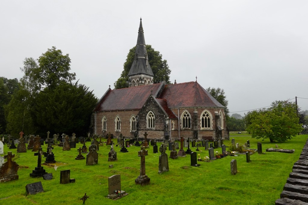
Not quite Guinness time as this pub was likely shut. The clock is not correct.An old church that has seen better days, having some work done to it.
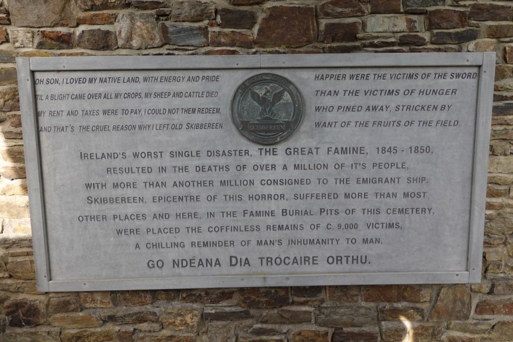
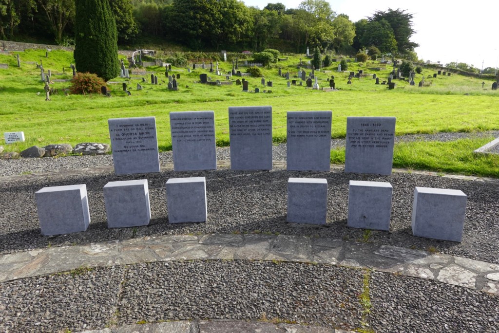
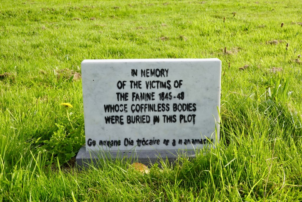
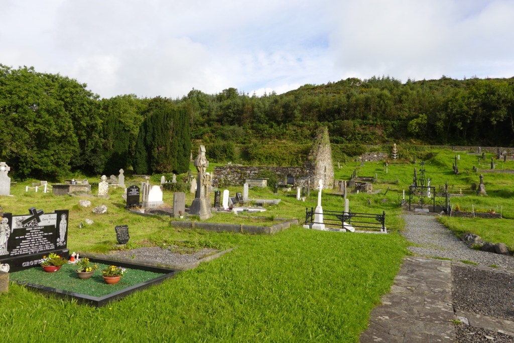
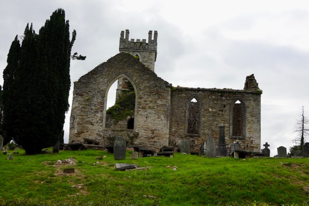
Not far from Skibbereen is the Abbeystrowry burial ground, a totally sobering experience. It is the site of what is regarded as one of the most poignant and significant Famine memorials in Ireland.
This is the location of the infamous ‘pits’ or mass graves where possibly 8,000 to 10,000 Famine victims were buried in 7 years.
The dead were thrown in the pits coffin-less and nameless, by the hundreds, daily without mourning or ceremony. A few inches of dirt would be added waiting for the next batch.
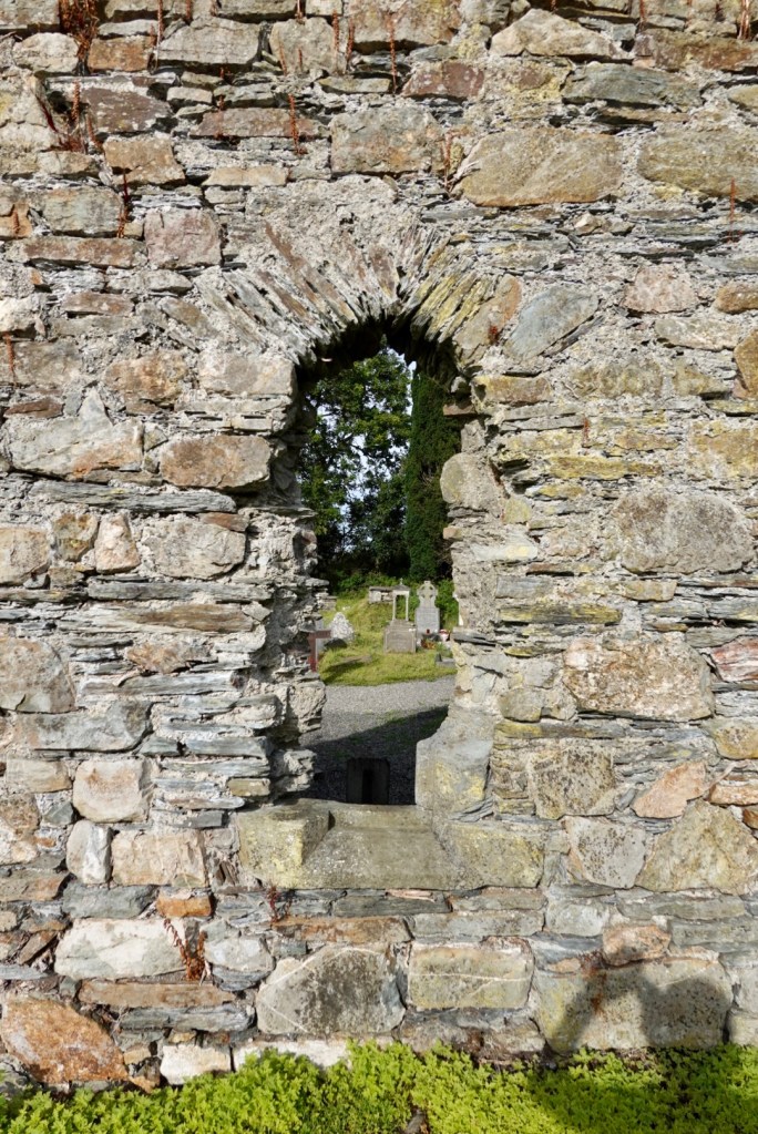
At the entrance gateThe green grass without markers is the top of the Famine pits. This is the main memorial.A smaller memorial A broader view of those whose names are remembered from better times.Window into the stone wall looking into the graveyard.
We moved on, but you had to feel compassion for the dreadful times experience here in Ireland where they lost 25% of their population to the Famine and subsequent emigration.
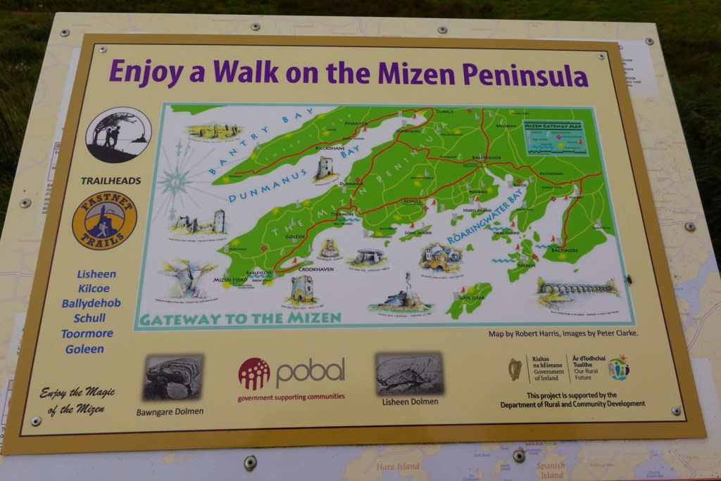
A short climb had a lay by we stopped at. There was a plaque promoting walks on the Mizen Peninsula.
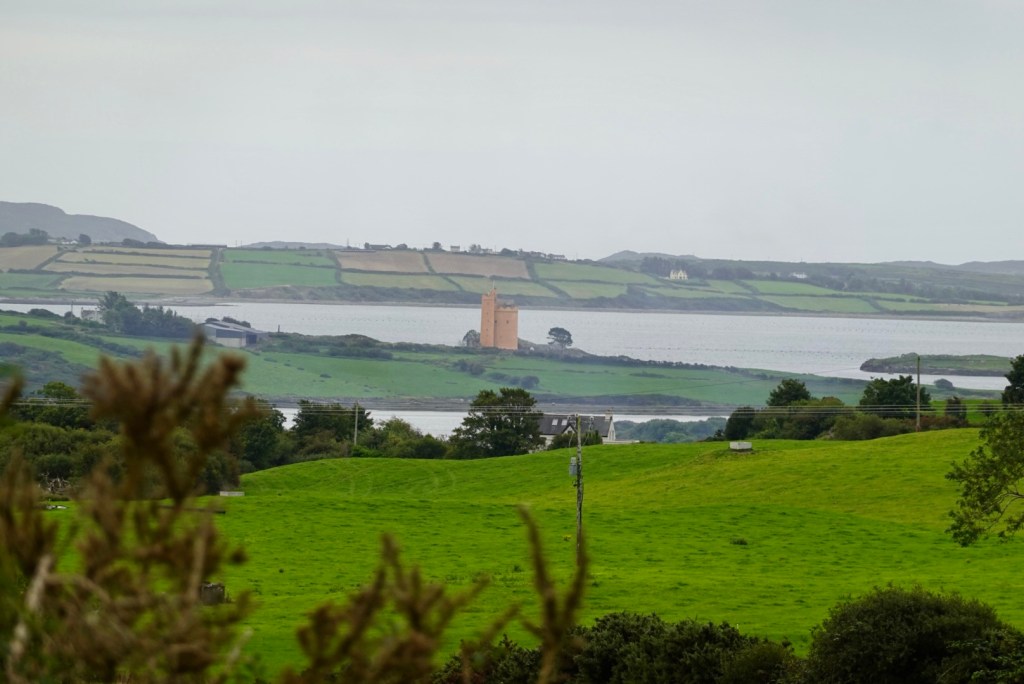
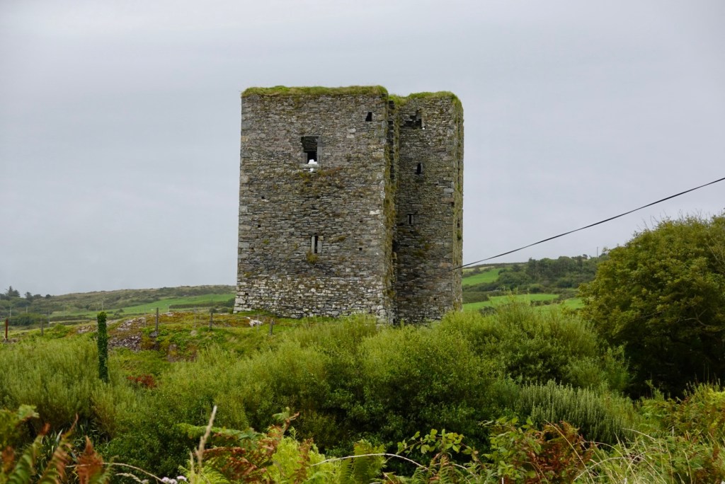
We are between Aghadown and Ballydehob looking down towards KilcoeThe castle at Kilcoe
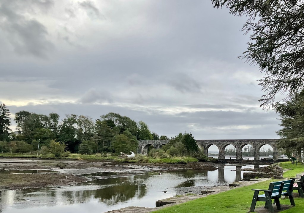
Ballydehob was the next town, and it has an impressive 12 arch viaduct that was used by West Cork Rail in the last century
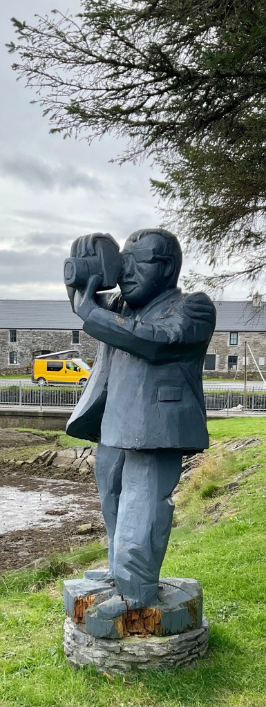
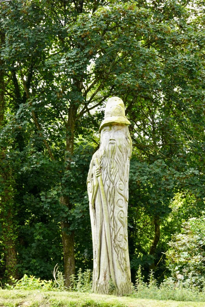
Low tide view from the westEasterly viewWooden carved statue looking towards the viaduct
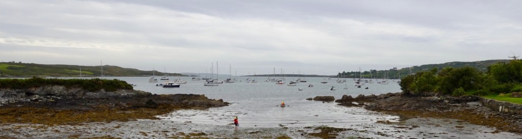
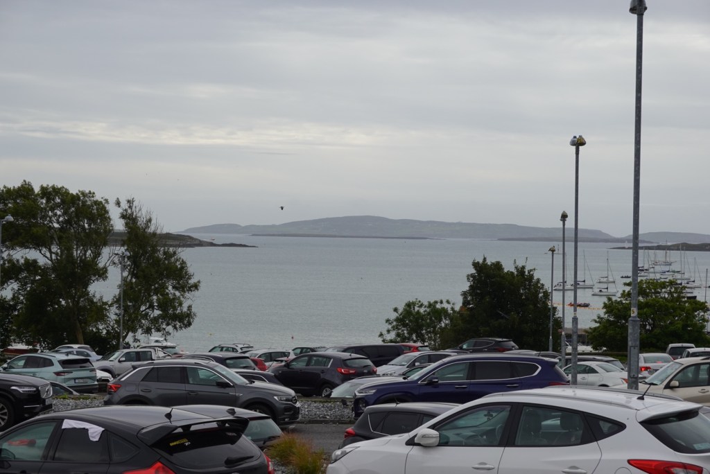
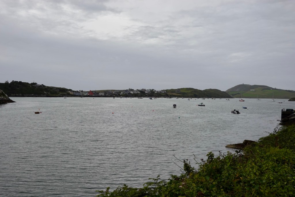
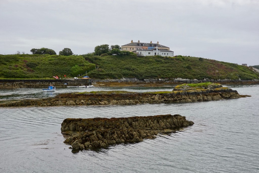
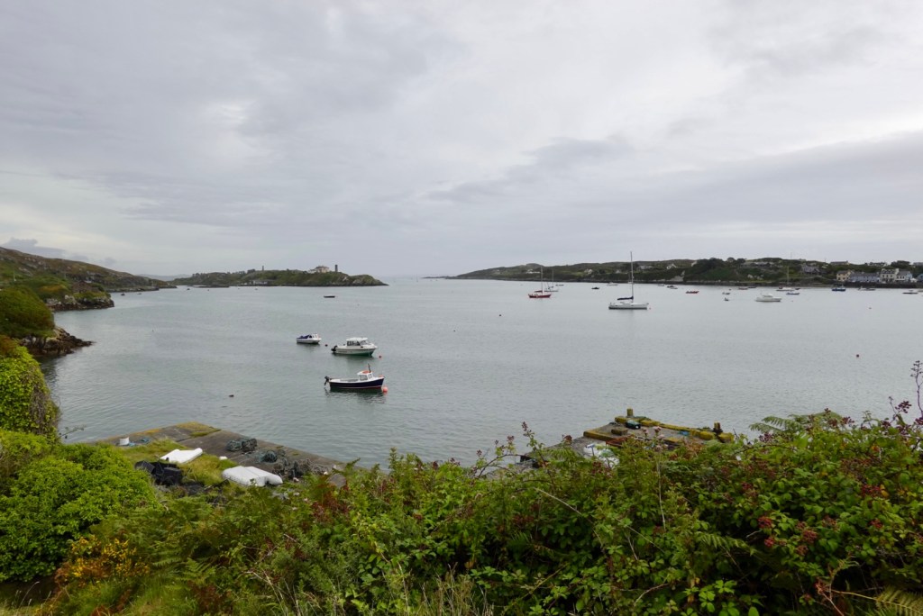
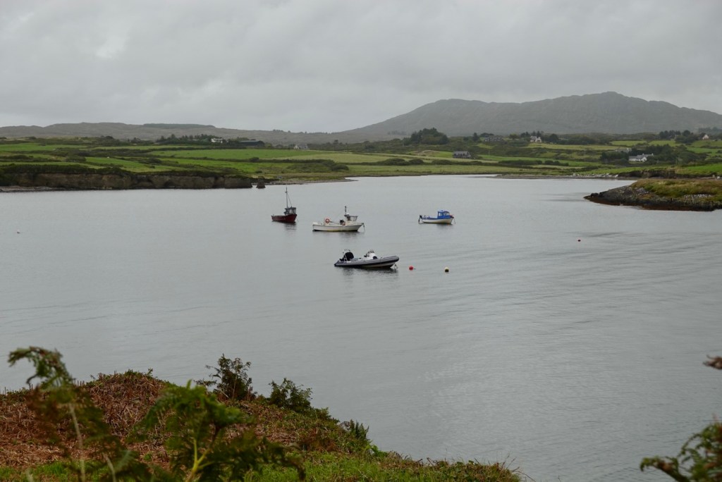
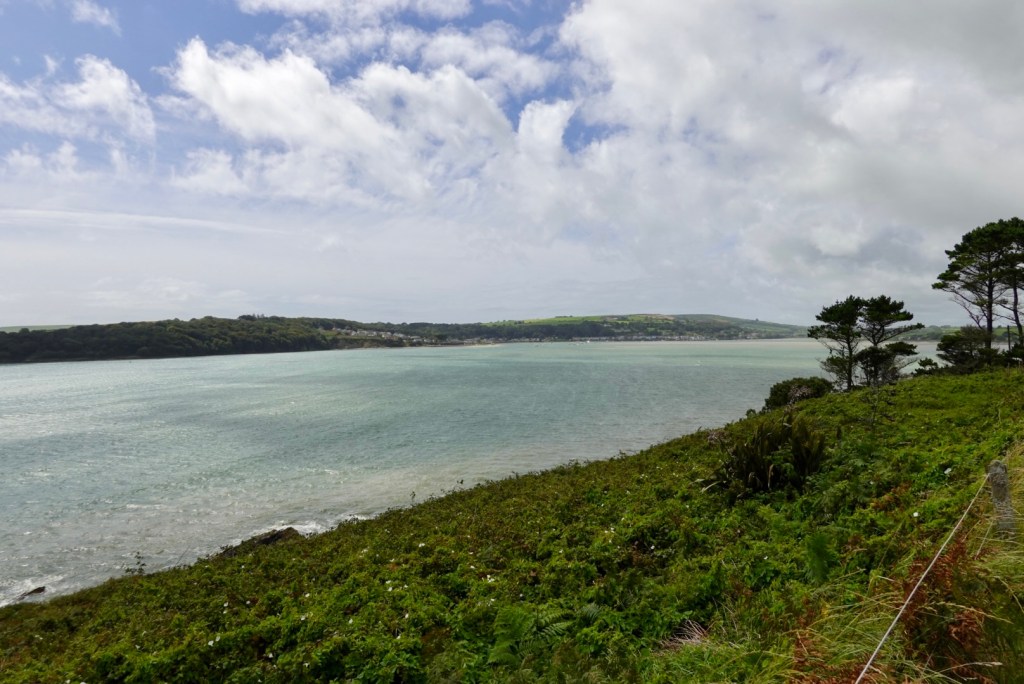
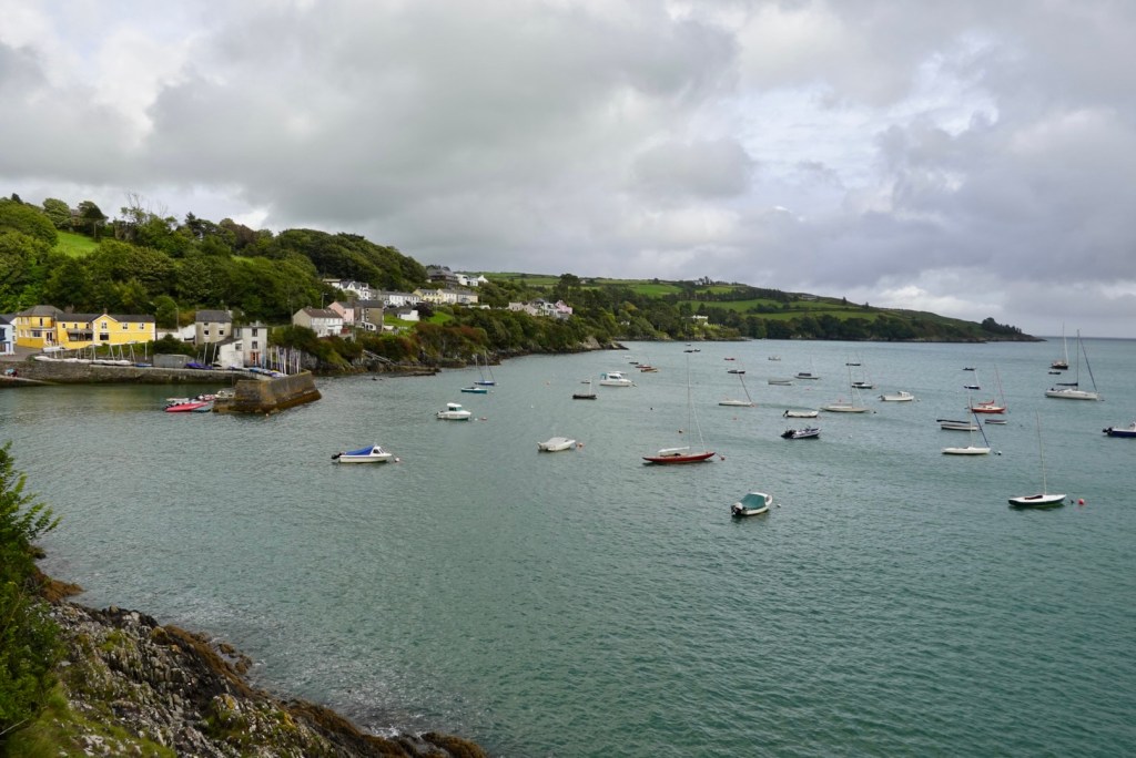
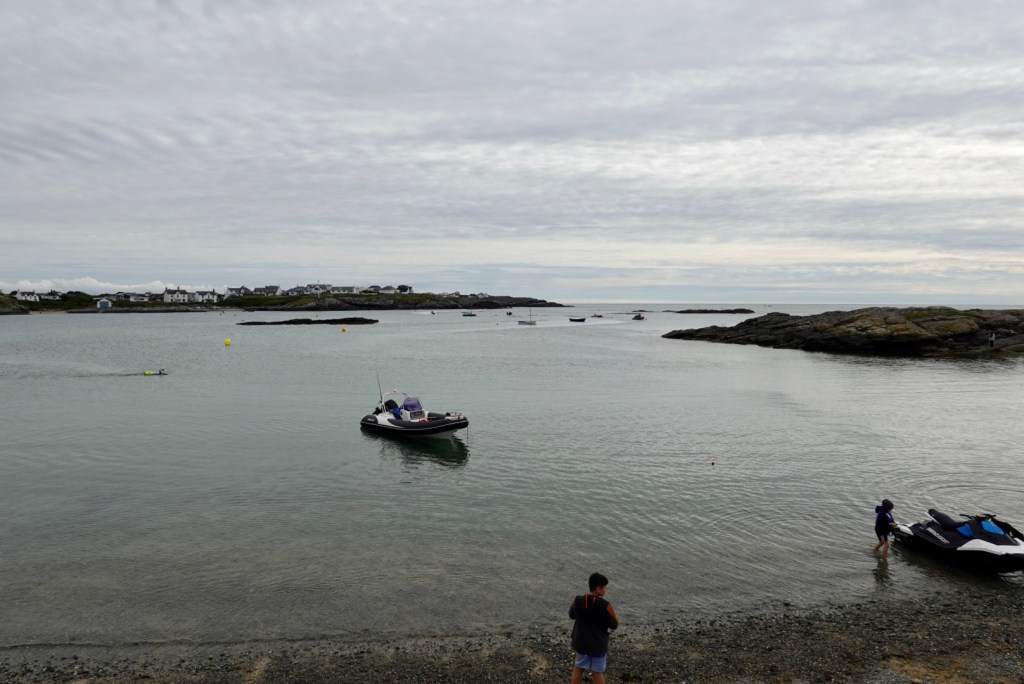
Schull lies at the foothills of Mount Gabriel and Schull Harbour. Very popular with yachtsmen.
Part of Schull Harbour
We stopped for a coffee at a small cafe that was super busy, and drank our coffee next to the doggy minus a leg, overlooking the harbour.
Getting out of town down the narrow busy Main Street was like riding a scooter, crawling pace if lucky, ready to jump off at short notice. A steep but short climb out had us moving again, fairly clear of traffic. Where does it all go?
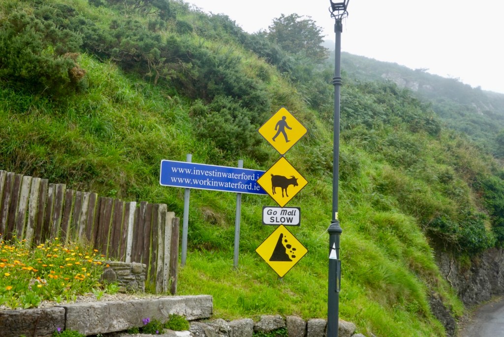
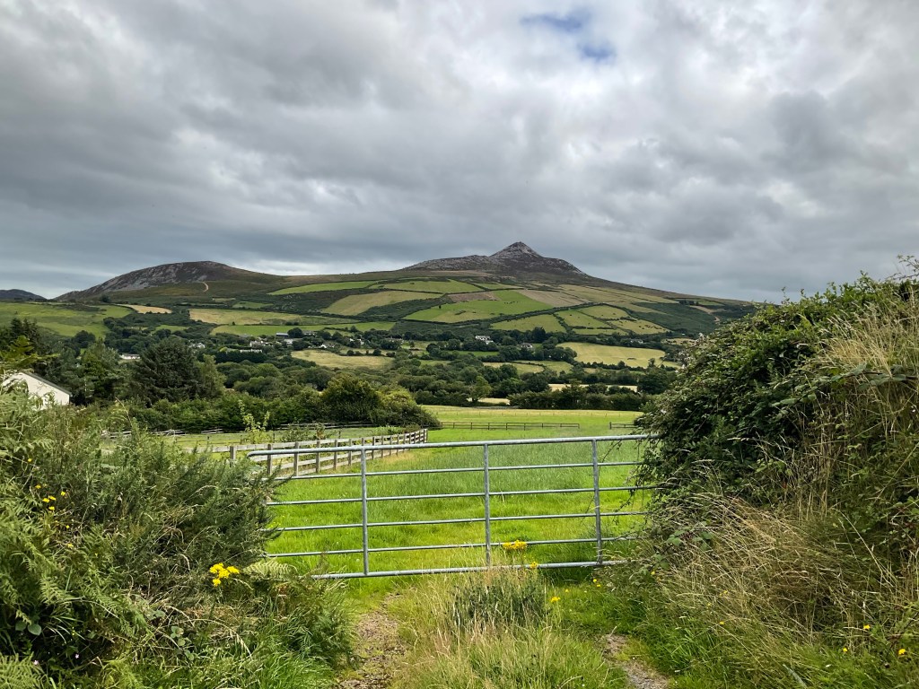
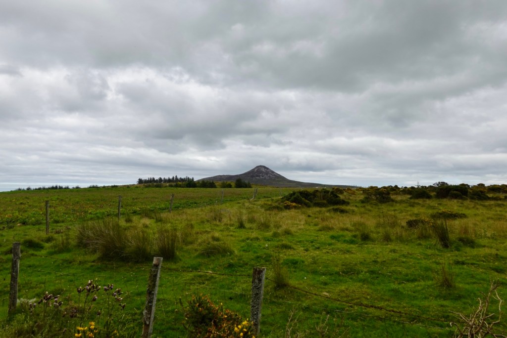
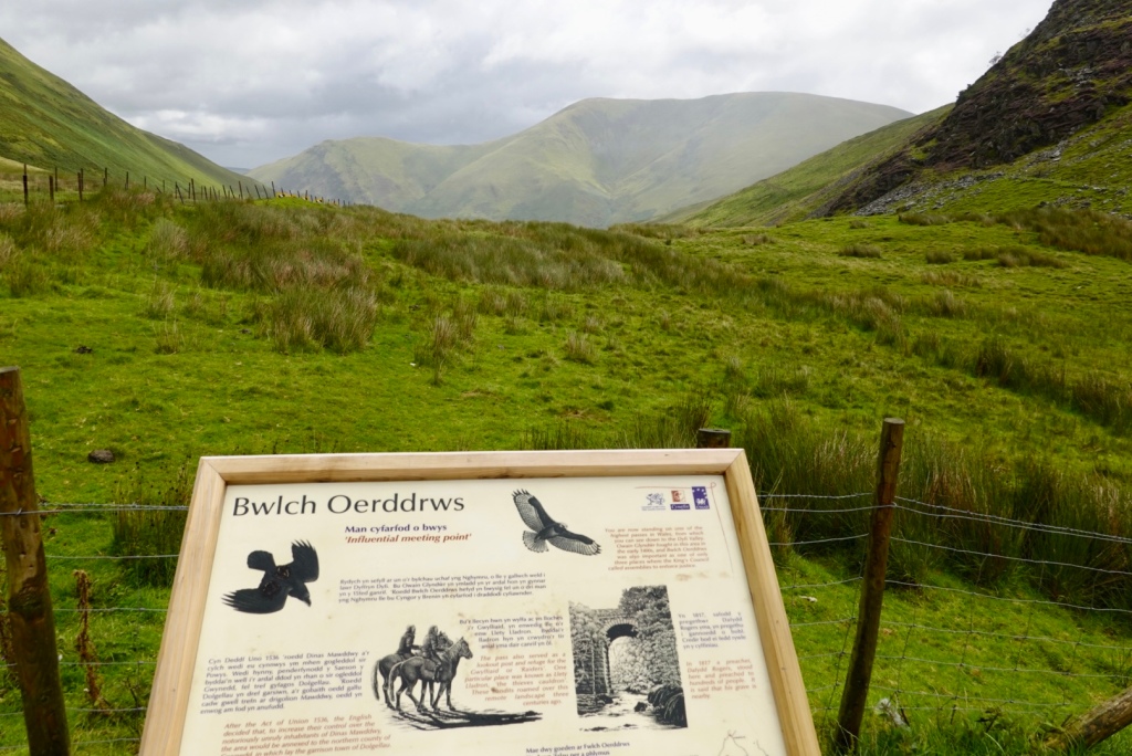
We were on the main route to Mizen Head and to our right was Knockaphuca. I just wanted to type the word, even in Irish is Cnoc an Phuca!
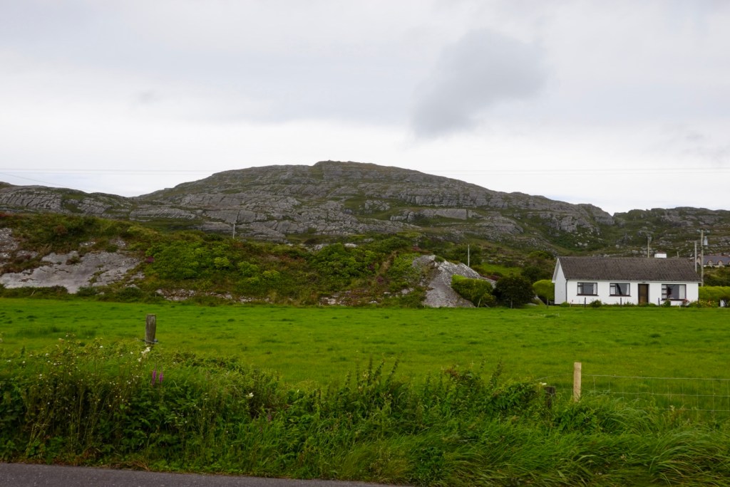
It is a mountain summit in Cork and a popular walking trail. Our route took us to the eastern and western flanks today.
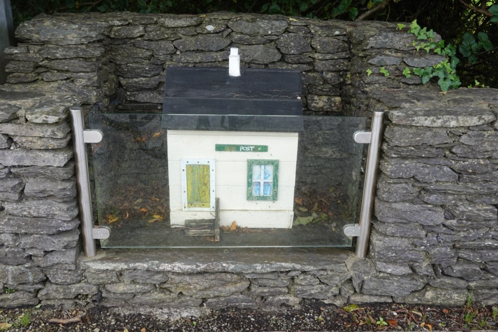
Lowertown had seemingly seen better days. There were multiple commemorative plaques recognising what was on this site before. As an example, the little post office niche is where the Macleain post office once stood. It was closed in the late 1920’s.
It also memorialises,the former owners son who was killed by British forces in 1919 as part of the so called Troubles during the War for Irish Independence.
On a brighter note is this dancing platform. The dancing platform was a traditional meeting place where courtships and social gatherings built local community relationships.
Lowertown had a dancing platform, Locals would come and listen to Irish music, trade stories, watch and often dance themselves.
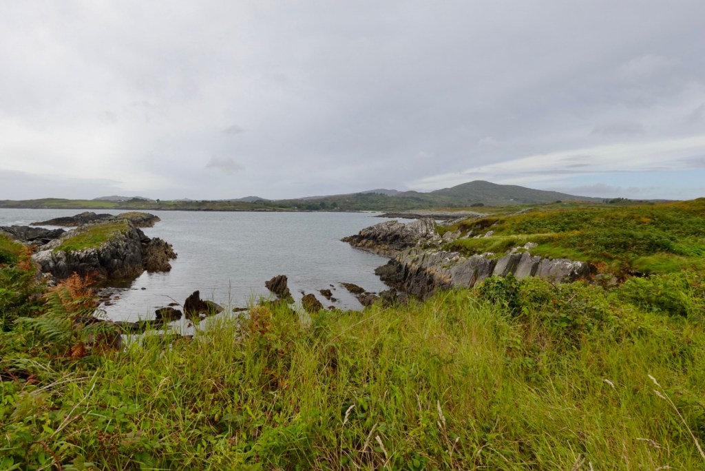
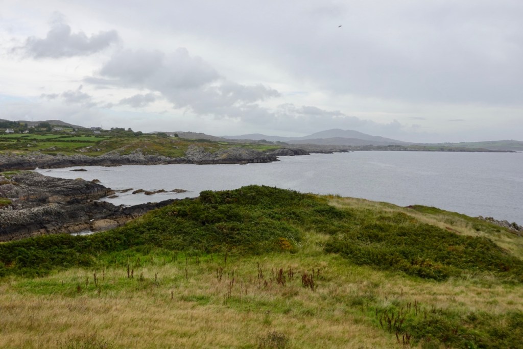
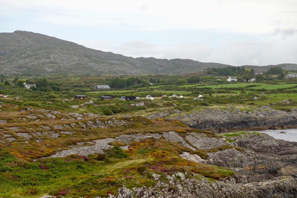
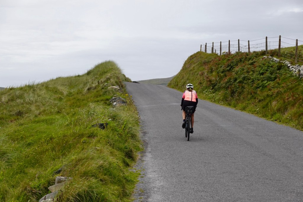
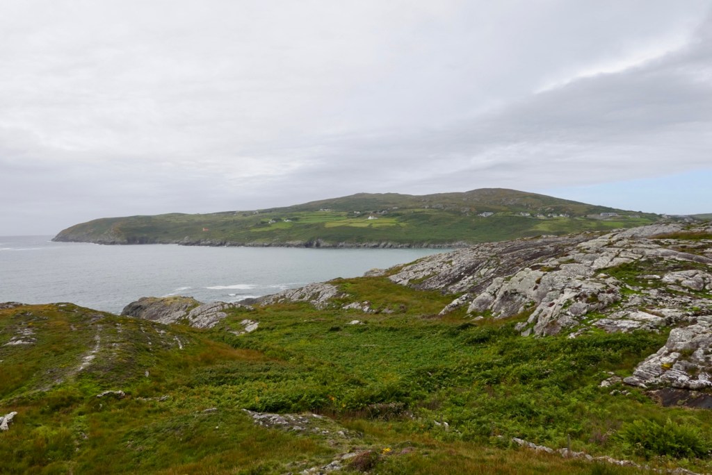
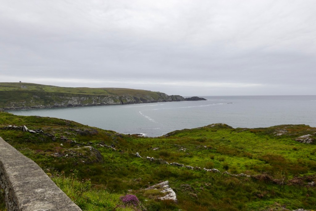
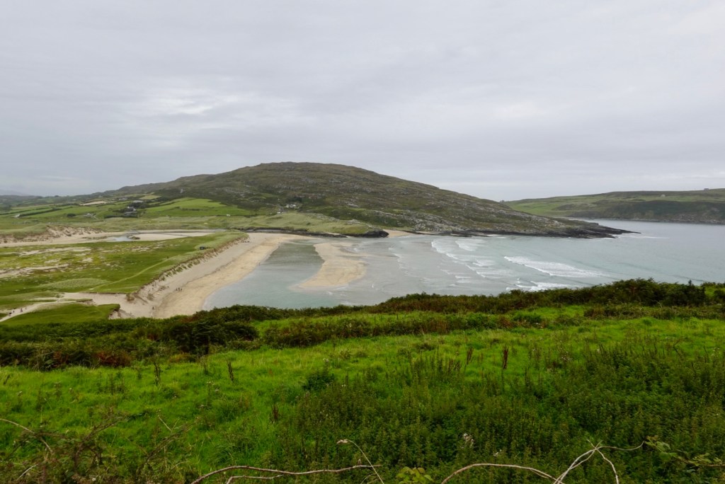
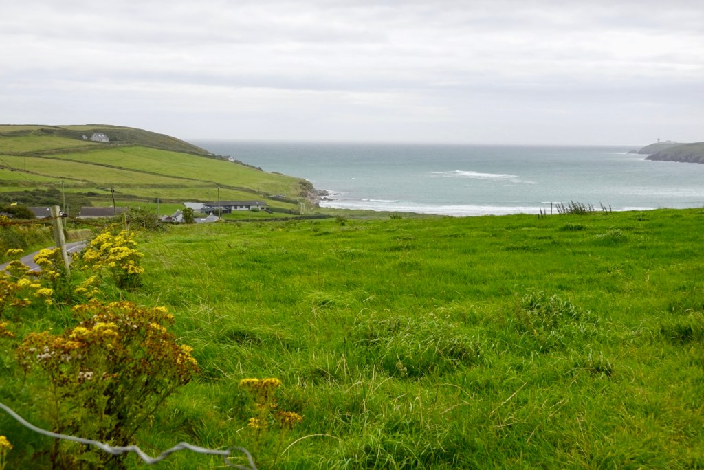
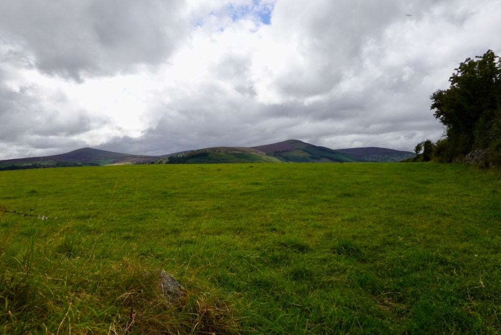
The coast was to be a constant companion for much of the rest of the ride. The scenery was outstanding along the Mizen Peninsula.
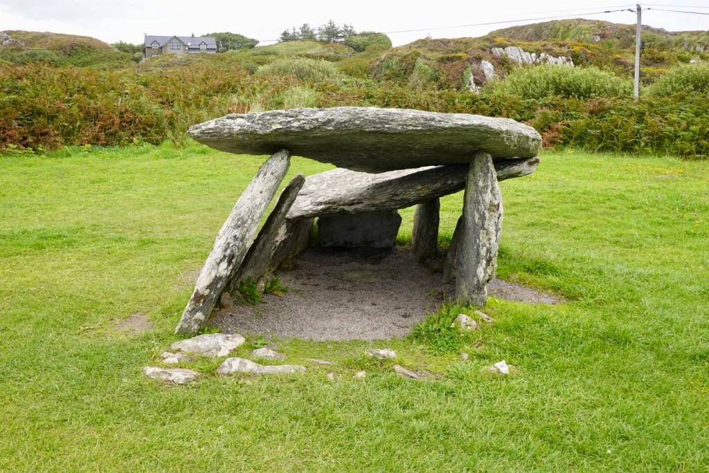
We stopped off to view The Altar. It has existed for over 4,000 with scientific research finding ancient bone fragments buried deep within. It is believed that these were the ashes of loved family from the Bronze Age.
In the 18th century, priests used the site to conduct services when it was illegal to say Catholic mass.
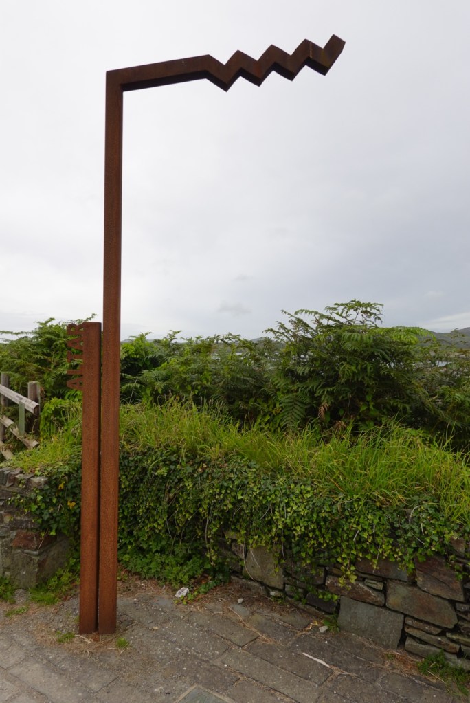
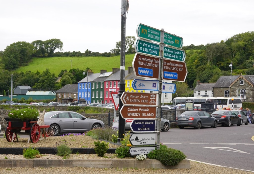
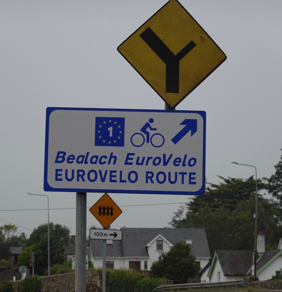
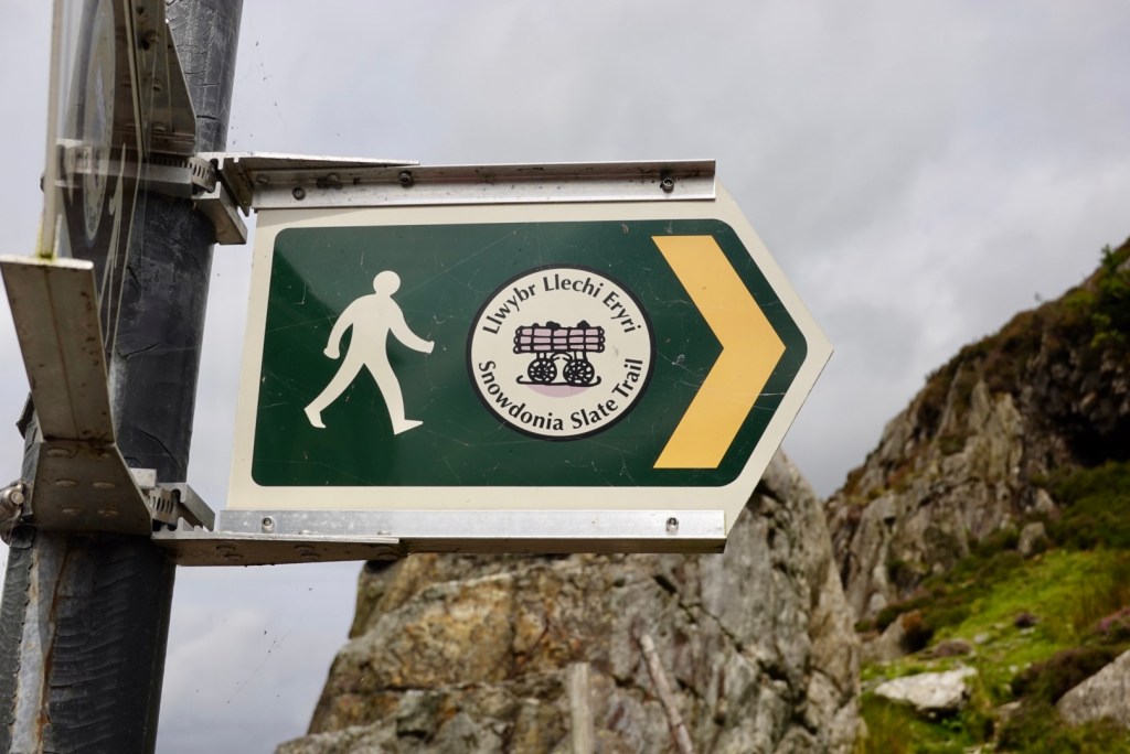
Wild Atlantic Way signage with the name of the site in the left.
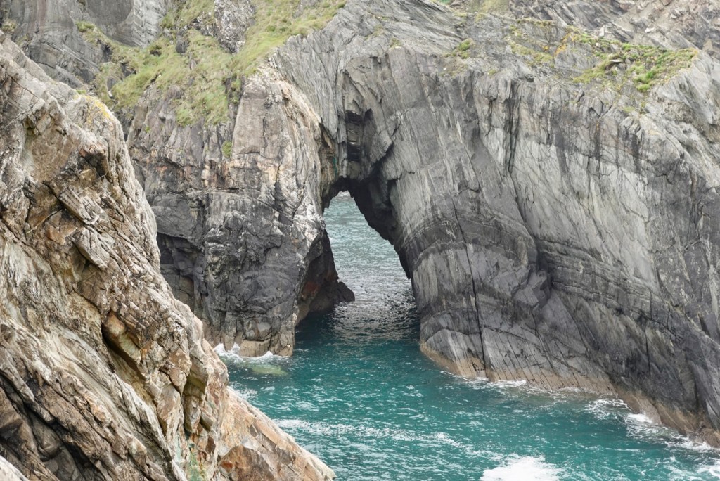
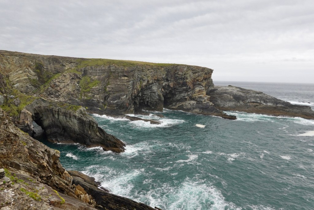
Magnificent coastal views as we headed to Mizen Head.
We crossed down to the right hand side of this beach, climbing up past the string of buildings you can see on the left hill.
Then looking back towards where we had ridden and the previous photo stop point.
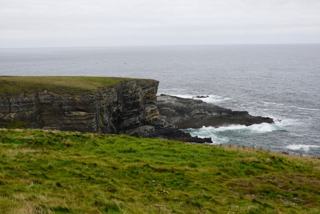
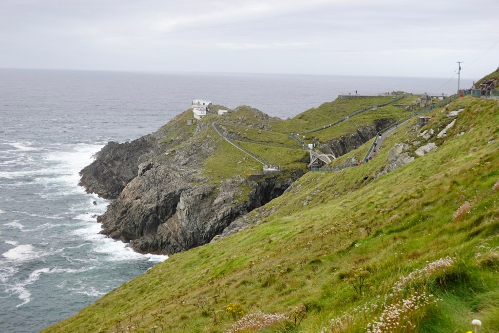
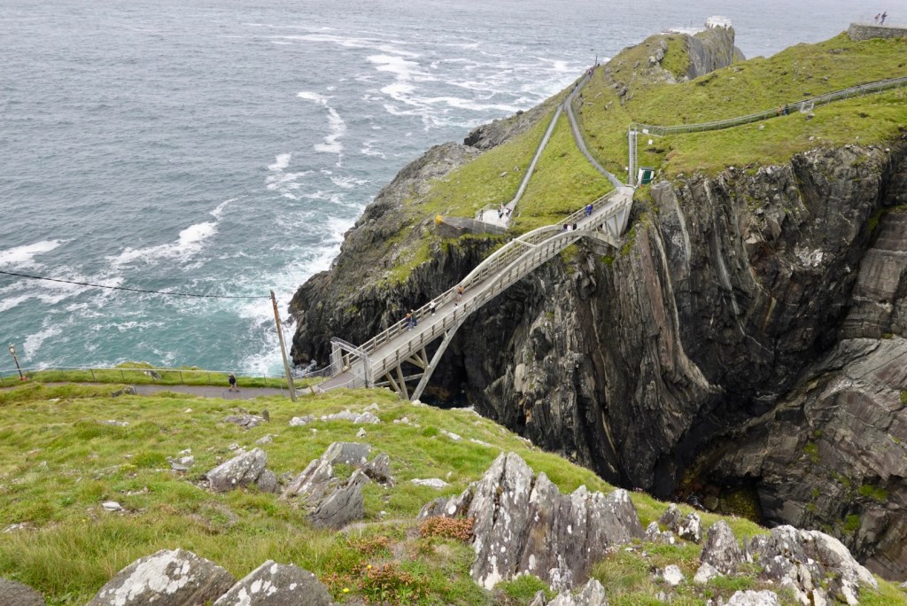
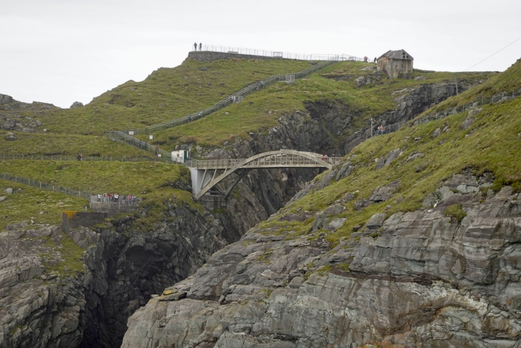
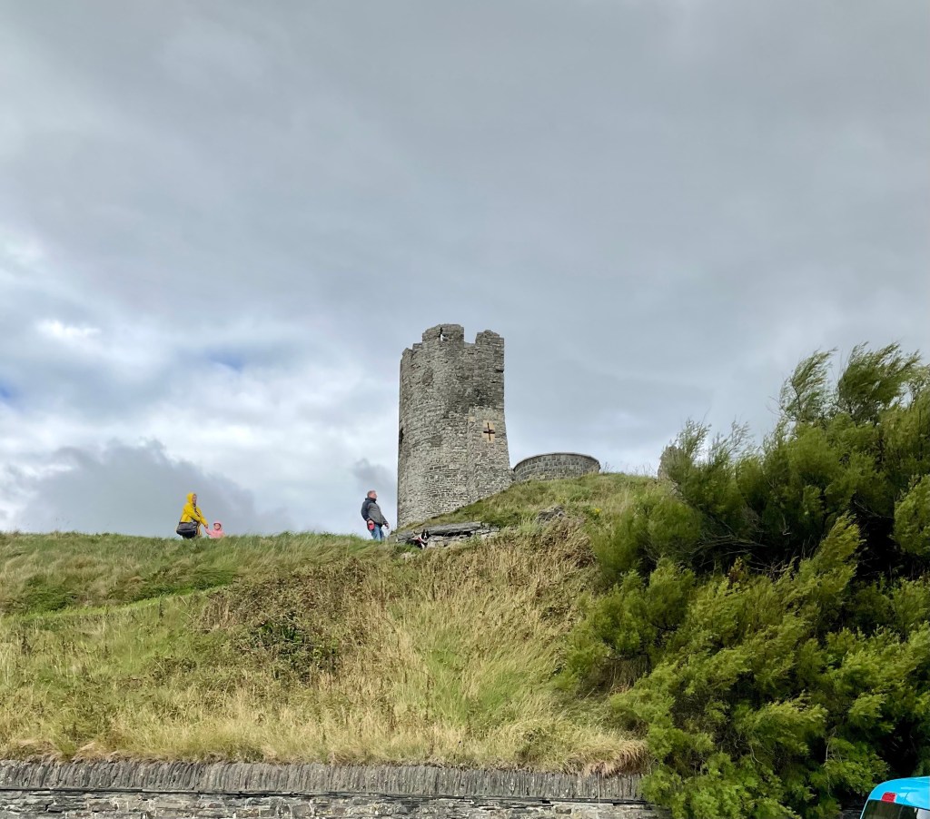
Mizen Head is Irelands most South Westerly point. The site is operated by a tourism cooperative and costs 7.5 euro to enter. It has long been reported as the most southerly point of Ireland, but another head nearby is about two metres further south (but inaccessible?).
In earlier years we had contemplated a supported ride from Mizen Head to Malin Head ( far Northern Ireland), but changed our minds after that company kept 3,000 pounds ($6,000 aud) of a deposit six months out from a trip. That was the motivator for us doing our own thing. Look at us now, having our own solo bike adventures 😊❣️
Tony paid the fee and walked around the site, whilst I watched our bikes and got bailed up by curious, but well intentioned USA tourists. The place was crawling with tourists. The parking area was full of tour buses, campers and cars.
Tony found on the walk conga lines of slow moving tourists on the steep steps in various areas. We try to avoid conga lines! Here are some of the photos from his walk as he cut it short to return and not join the long lines.
The bridge connecting to the last jut of land
We decided not to lunch here to get away from the crowds, and had noted a pub and pop up food van as we climbed the 4 km climb towards Mizen Head.
We scooted back to the food van, sat at an outdoor table and enjoyed a Belgian waffle with Nutella and banana, and a fruit smoothie.
The next section of ride was our favourite. The western flank of the Mizen Peninsula for 20 km or so, along a road that buses cannot enter, and large cars and caravans would find difficult. We encountered only four vehicles in 20 km, and one of those was the Garda (police).
Some of the photos of this blissful and beautiful section.
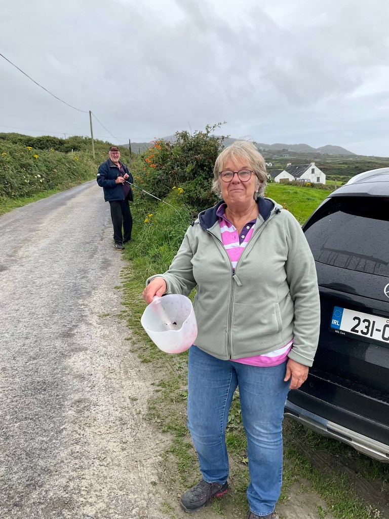
As we scooted along we last this couple blackberry picking. They both shouted at us, and the only word I recognised was “Aussie”. I’m like WT.??? Who could know we are Aussie, so we stopped and went back.
To our surprise and disbelief, it was Jim and Carol who cooked our breakfast, owning the lovely overnight accomodation in Union Hall. They had picked buckets of blackberries already.
Jim and Carol, from Union Hall
We moved on to finish this lovely section of ride.
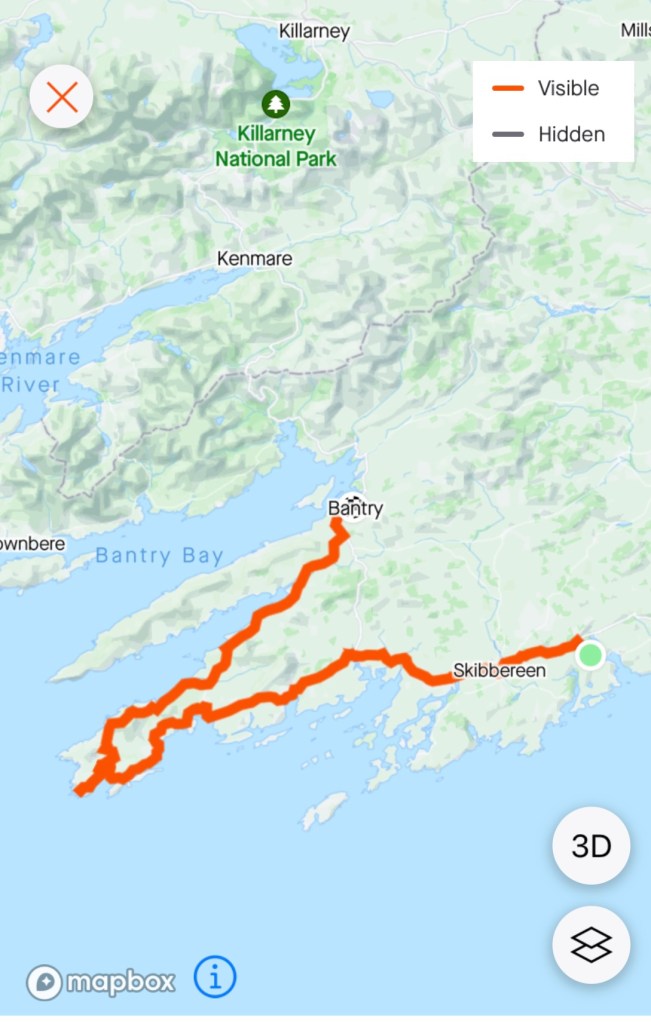
All good things must come to an end, and that quieter section of road ultimately joined the main road to Bantry, our overnight stay. Traffic was busy but for most there was a small verge.
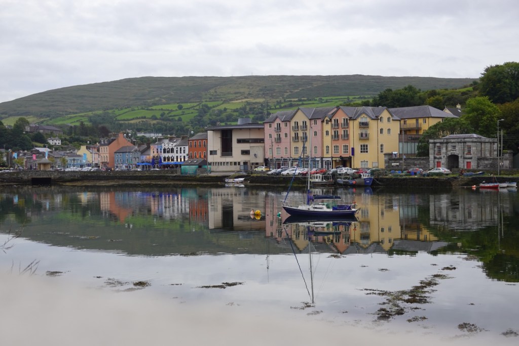
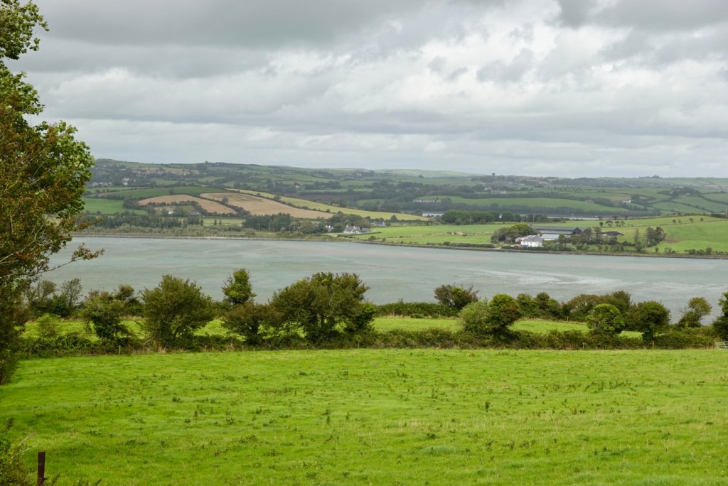
Bantry is located at the mouth of Bantry Bay, twice entered by French fleets in 1689 to support James II against William of Orange.
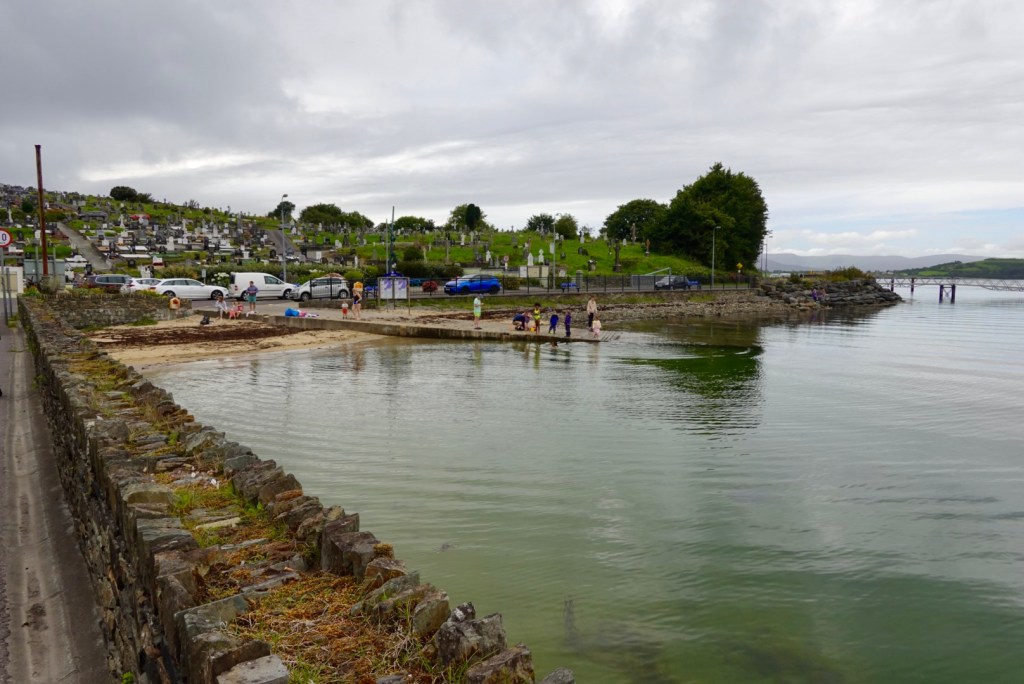
As we entered we noted the children playing in the water, adjacent to the cemetery.
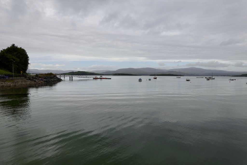
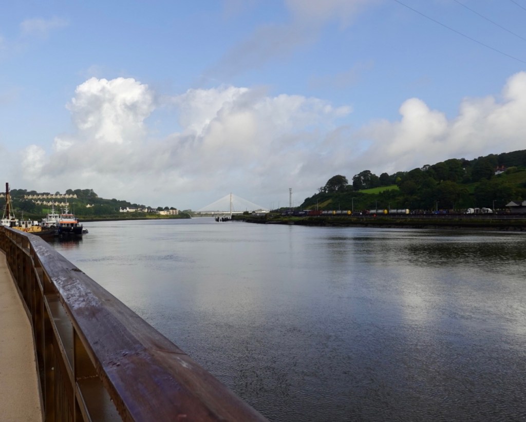
The bay is peaceful.
We checked into our accomodation, showered and crossed the road to check out dinner options.
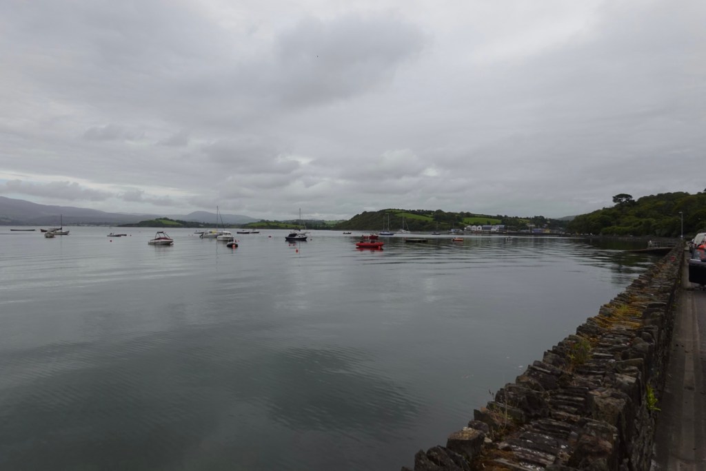
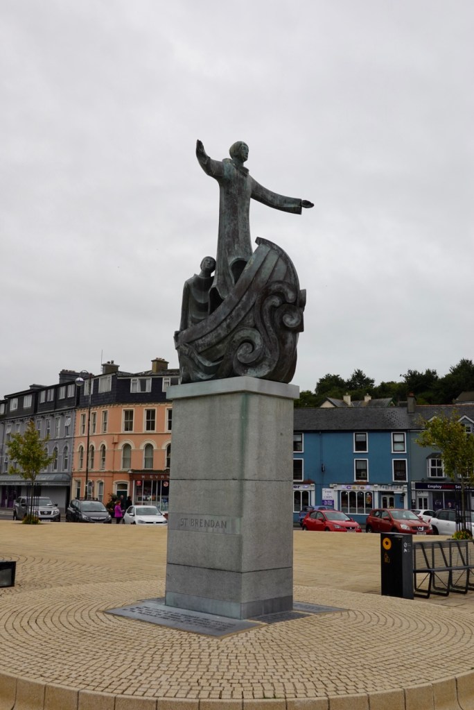
St Brendan statue Looking from our side of the river to the Main Street Lots of signs, and our accomodation is the green house in the string of four colourful buildings.
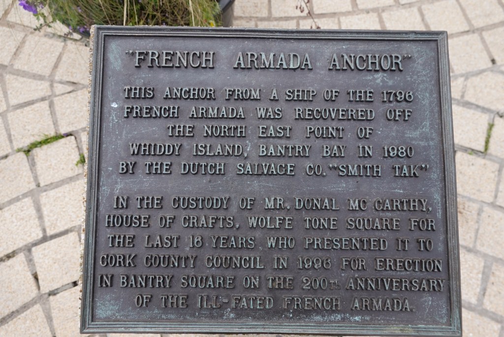
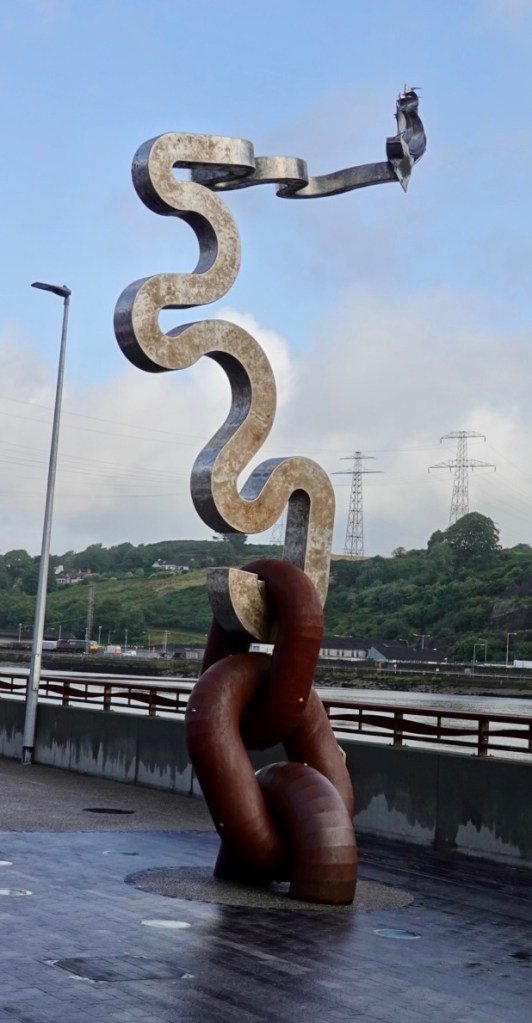
A famous anchor.
We enjoyed our meal. Not cheap, as we had a main course each and a non alcoholic drink each, and it was $99 aud.( Seafood linguini and a lasagna, lemonade and a sparkling water).
The Australian dollar is not strong on the Euro or Sterling. making our dollar low helps our exporters be more competitive, but makes Aussies having international holidays pay more for the privilege.
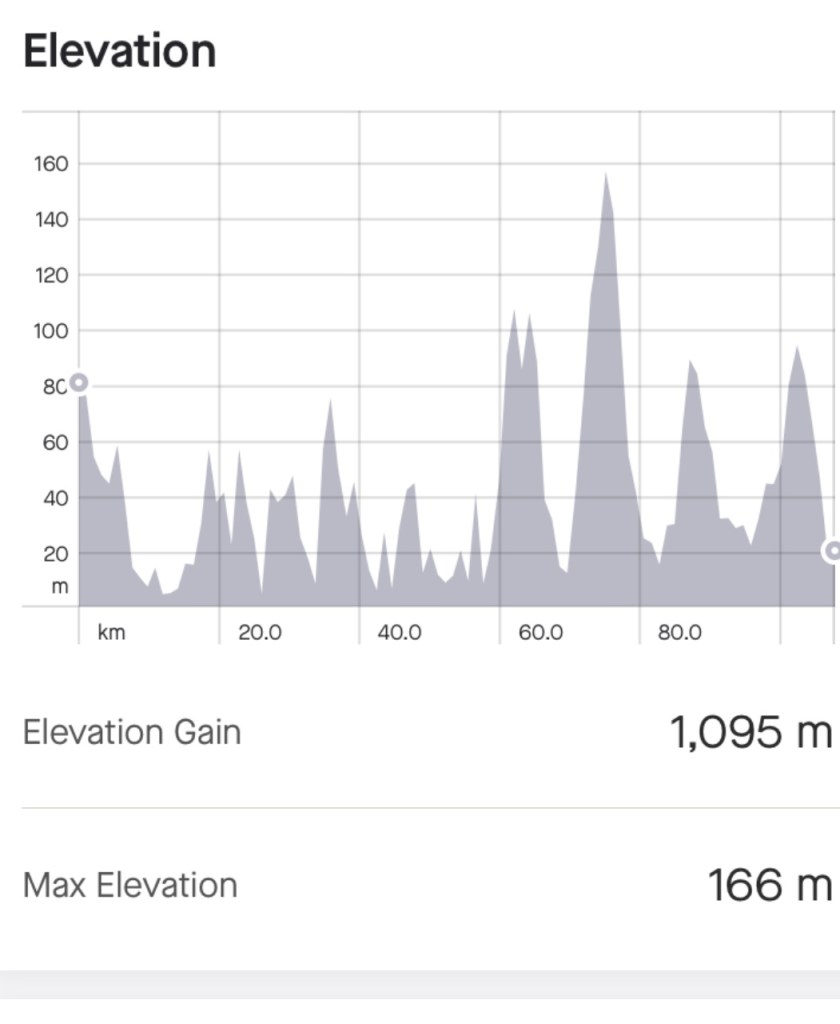
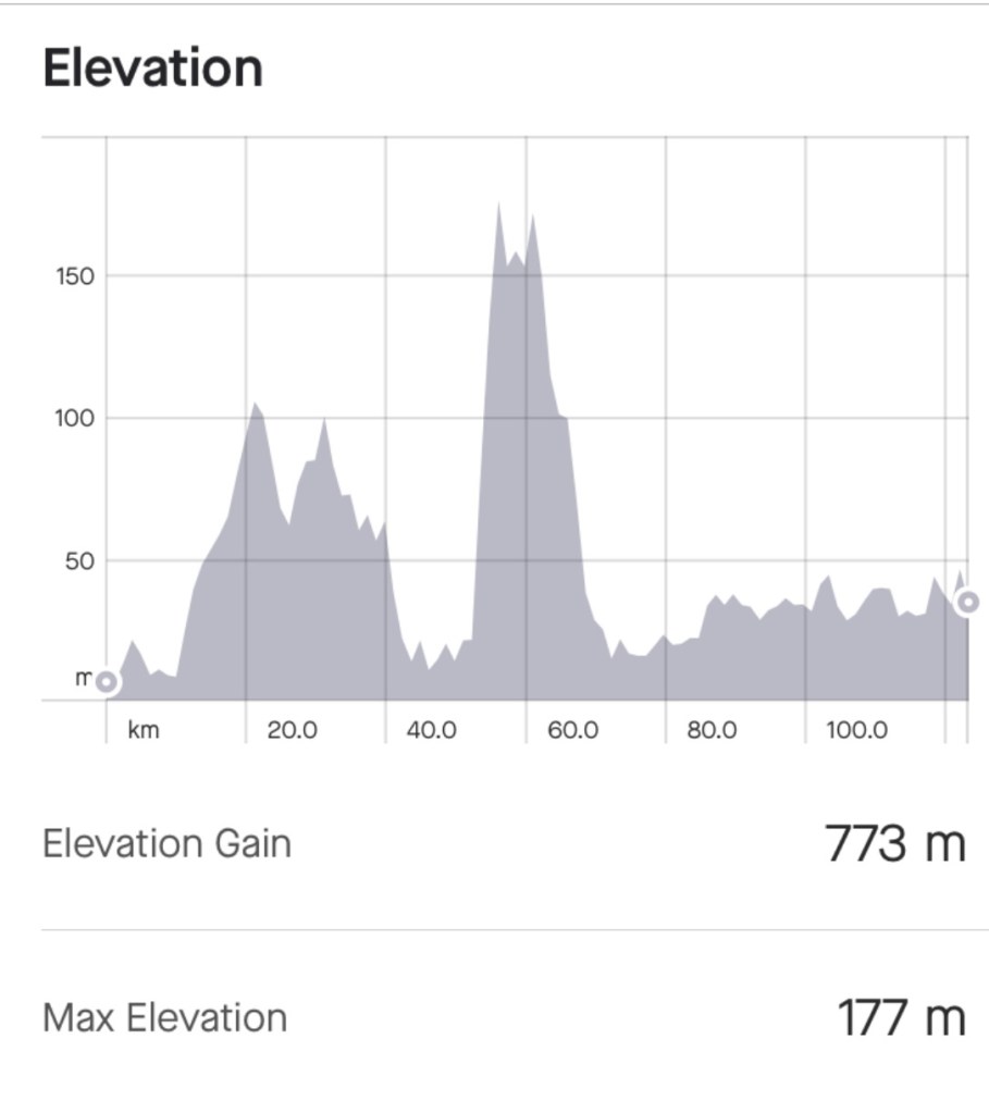
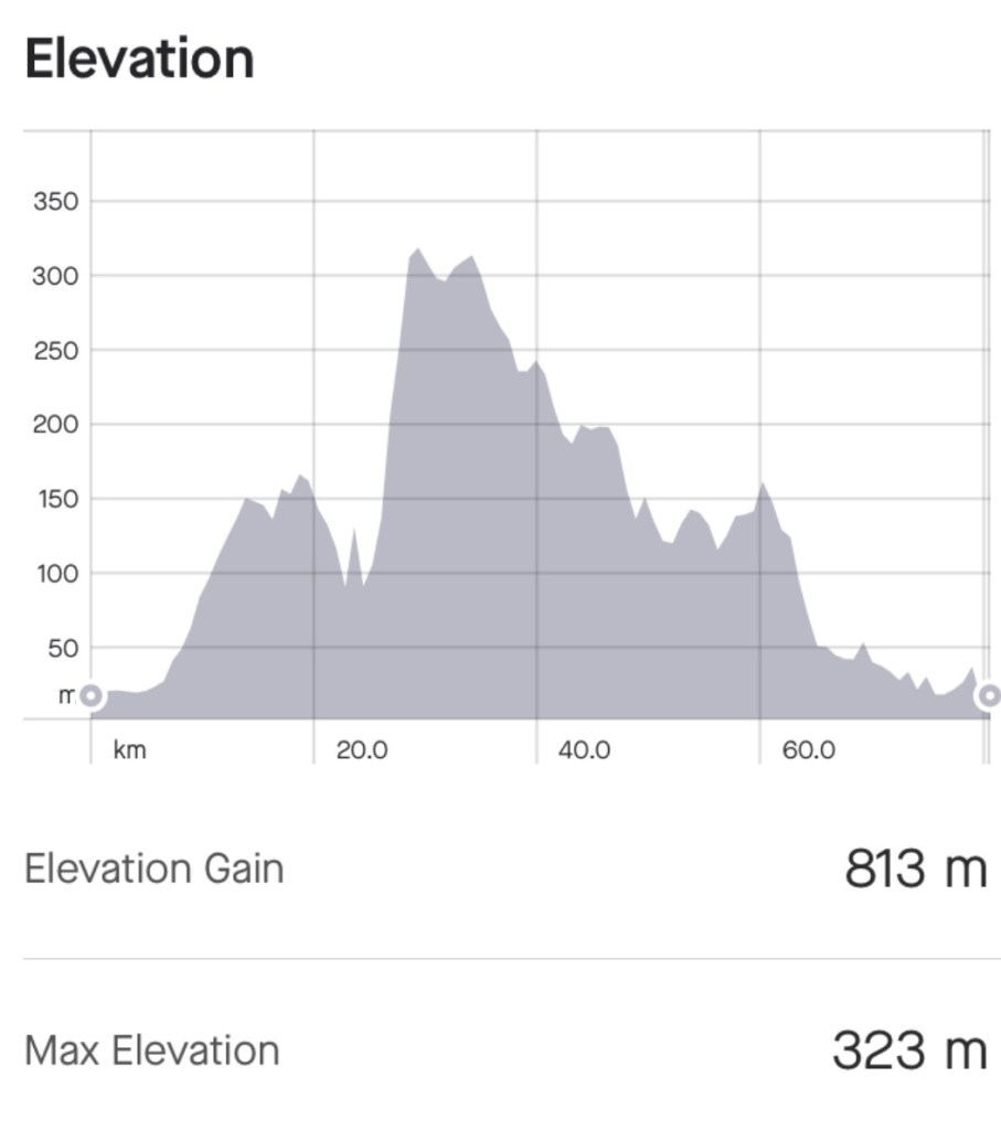
The end of another day. It was a brilliant day. The winds were not an issue, the scenery and route was magnificent. 108 km and 1100 metres of climbing. A solid day.
Our accomodation in Waterford was …a bit of a a dive really. Breakfast would be at 8.30 so we decided to pass as we needed to be on the road earlier for a longer day ahead exacerbated by forecast high winds.
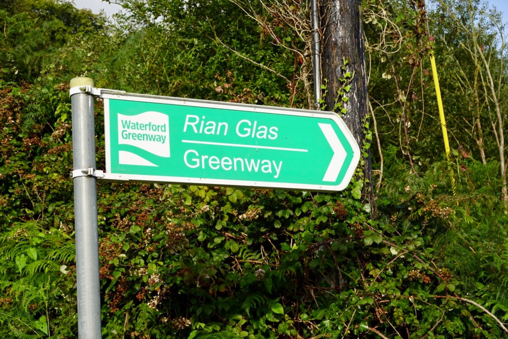
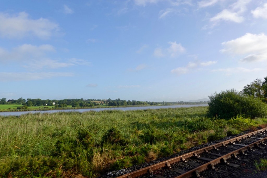
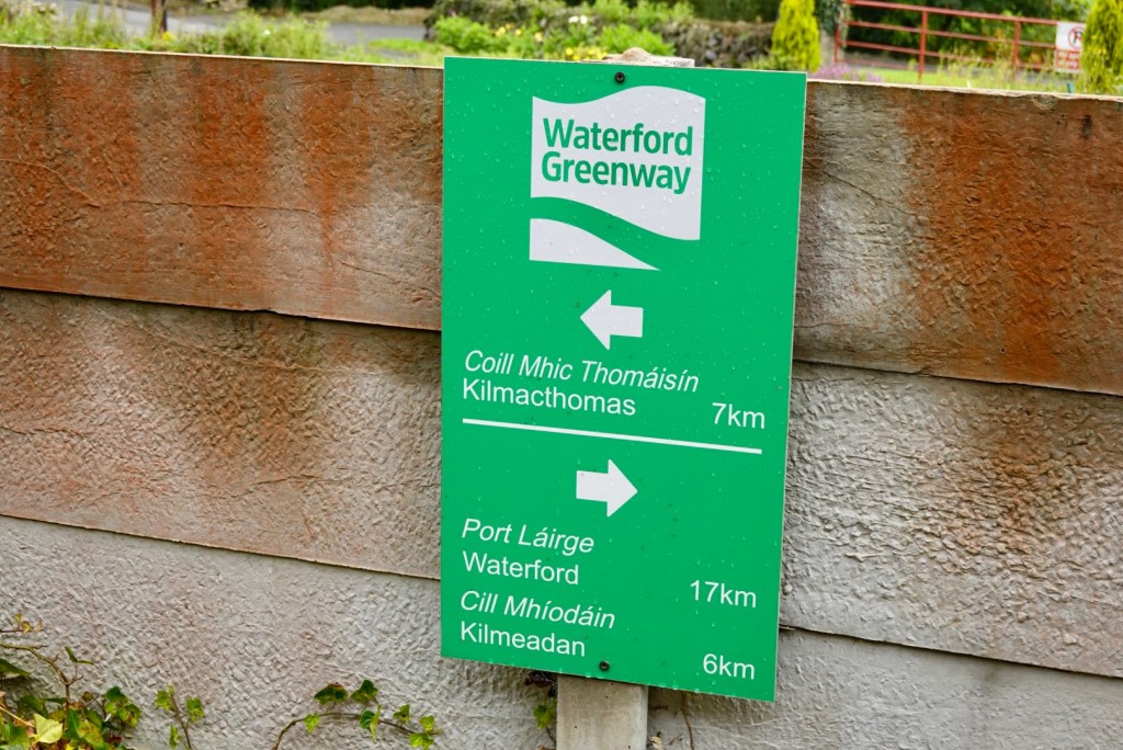
Finding food at the local convenience store we headed off towards the Waterford Greenway.
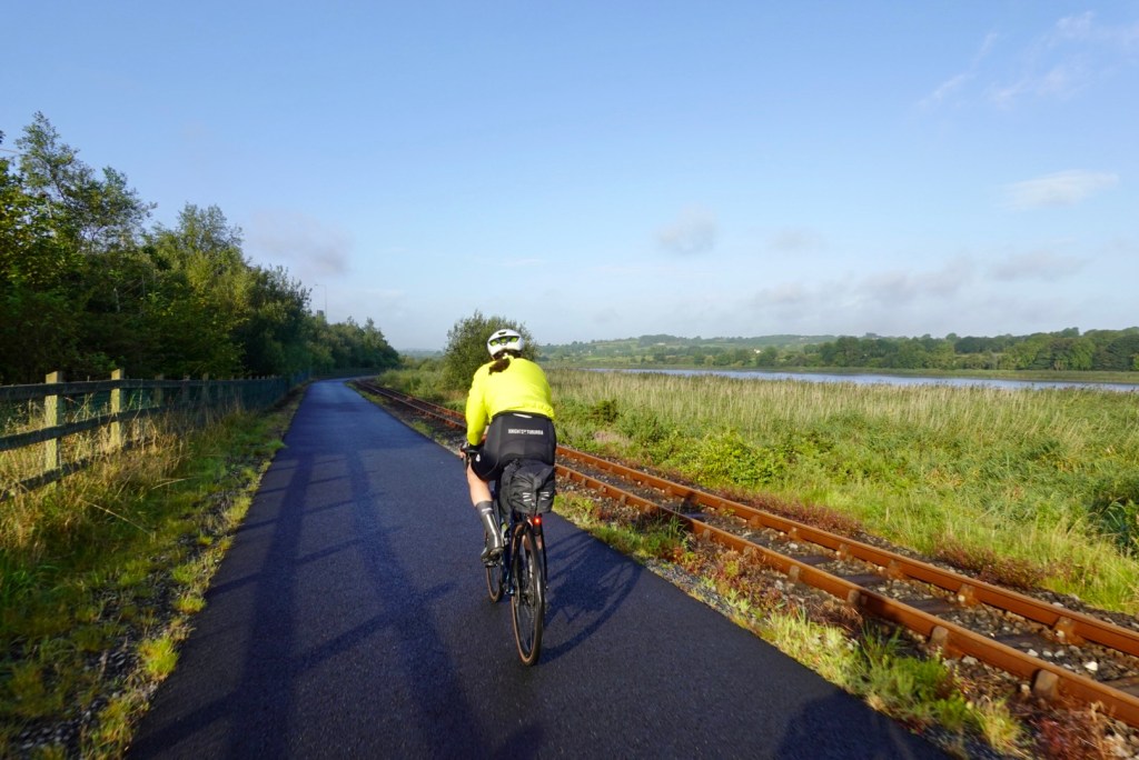
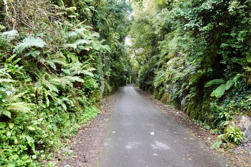
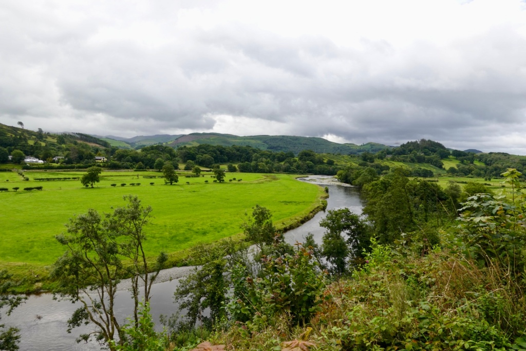
Waterford Greenway is a 46 km shared off road trail, running from Waterford City to Dungarvan along an old railway line. The cycle and walking paths follow the gently flowing River Suir beside the rugged Comeragh Mountains.
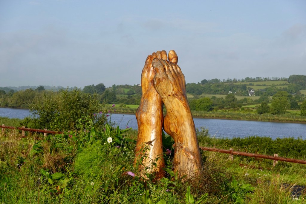
I really like this photo. The weather looks great (you can’t see wind 🤣), and something about those feet.
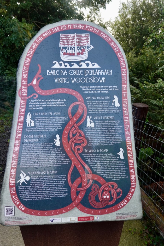
At this site they found significant Viking settlement remnants as they excavated for a major road. As a result, the road was diverted.
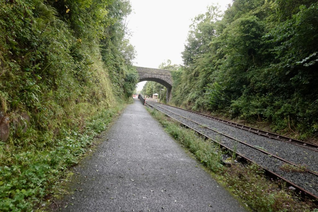
Quite a few of these road overpasses. This one is just before the end of the rail line.
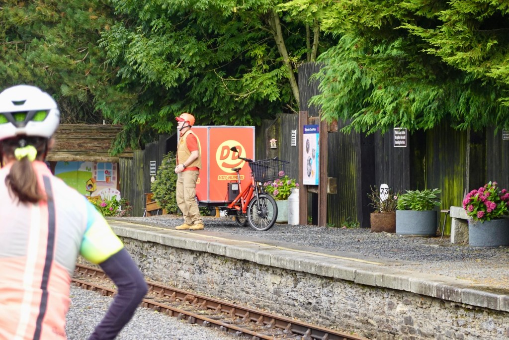
As we went around a bend there was a commotion with this guy. He rode that cycle with the Dizzy Deliveries trailer over the rail line, jumped off, and carried on a treat in ultra dramatic style. We were halted in our ride. There was a film crew there filming his antics.
Dizzy Deliveries is an Irish tv show. Lamh is a manual sign system of communication used by children and adults with intellectual disabilities and communication needs in Ireland.
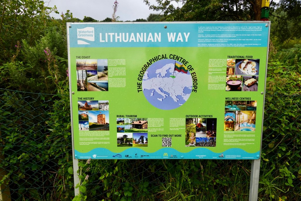
Moving on from that excitement we stopped to discover what the Lithuanian Way was. In essence, a cross country promotion.
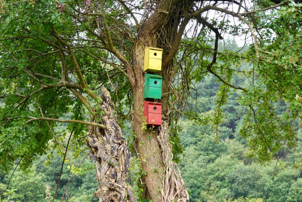
It did feature colourful nesting boxes.
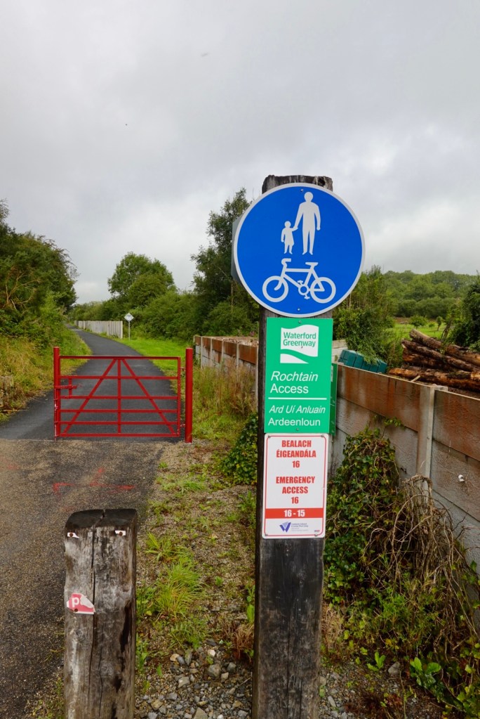
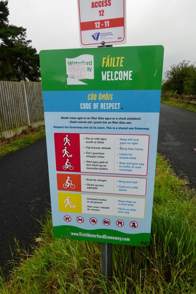
The signage on the Greenway was excellent. Some examples.
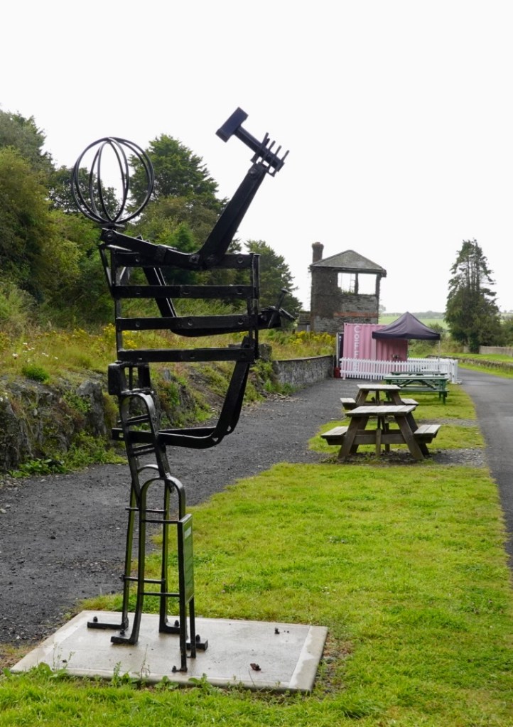
An interesting art work built from old railway metal, installed at an old railway station, now featuring a small portable coffee shop and badly maintained portaloos.
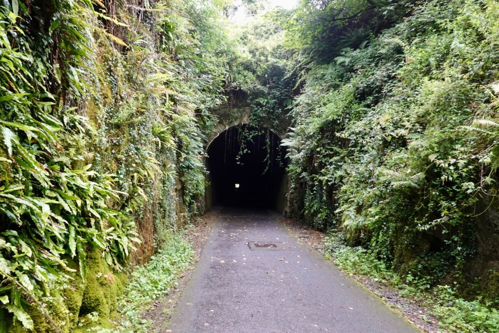
Just ahead was a lengthy tunnel.
The other end of the tunnel came out into a pretty, ferny cutting.
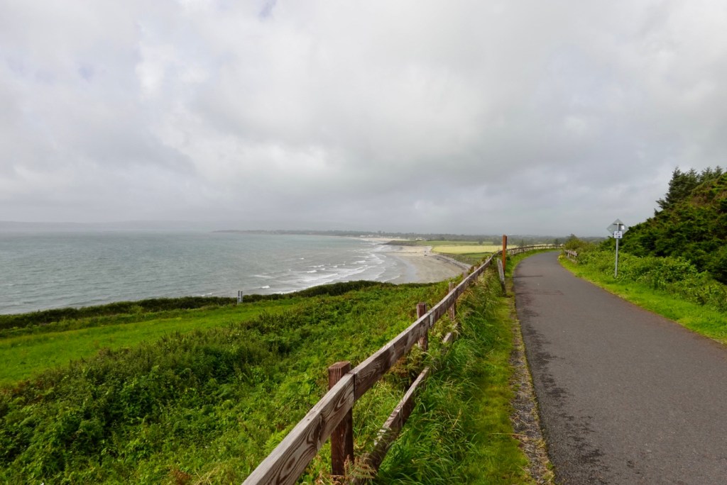
Overlooking Dungarvan on this windswept day.
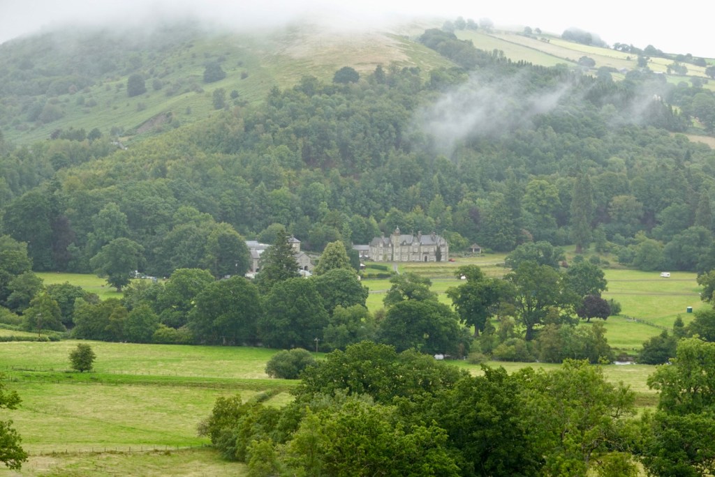
At this point we detoured, heading up a solid hill to find Catherine. She is a family member of Tony’s cousin Melissa, having more recently returned from where she was living in France, now running a B&B (with a wonderful view), supported by son Ben who makes a mean chocolate brownie.
Catherine was a fun delight to meet and although our visit was short, we shared quite a few laughs. 😊
Thankyou to Tony’s Aunty Kay for the introduction, and cousin Melissa for helping to make the connection with comms. Aunty Kay has provided me with lots of personal support and encouragement, both with this blog and my open heart journey, sending me positive messages and encouragement regularly. I am truly thankful ❣️💐xx.
Leaving Catherine’s it was downhill back to the Greenway that finishes a few km ahead in Dungarvan. A pretty town. Water is lower tide at this point.
Eu flag flyingLooking towards the old castle, note the hills behind. We’re heading that way.
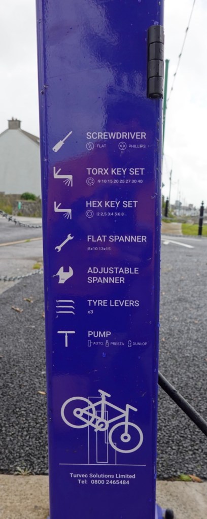
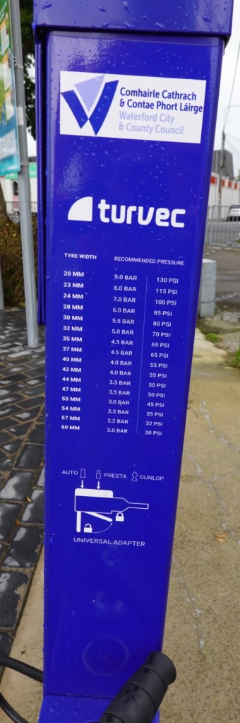
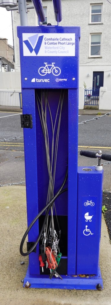
At the end of the track, Tony was interested in all the information on the tyre pump.
Next goal was Youghal. It was a fairly busy road once we left Dungarvan, but for the most had a good verge. We had the longest climb of the day at 3.9 km, and the first half were fortunately protected from the wind, but second half was blown away.
In an area with little verge I was passed very closely by a truck with portaloos on it. Must have heard my earlier negative comment 🙈😳. Near the top of the climb was a lay by, and here was the snoozer of a driver having a sleep.
He had 20 portaloos on his 2 trailers, and his vehicle was named “bear”. My luck in life to be taken out by a full portaloo…hopefully not. I felt like tapping on his window! So if you’re riding in Ireland, keep an eye out for this 💩 of a driver.
Youghal, is a former military and economic centre, located on the edge of a steep riverbank. Viking settlements date back to the 11th century.
Sir Walter Raleigh’s home “Myrtle Grove” is in the town. Tradition has it that it was here that he smoked the first cigarette and planted the first potatoes – true story?
We stopped in town for refreshments, at the supermarket. We sat in an area protected from the wind, enjoying the warm sun. But, we needed to keep moving and get back into the headwind, not before finding some toilets at the local Information Centre.
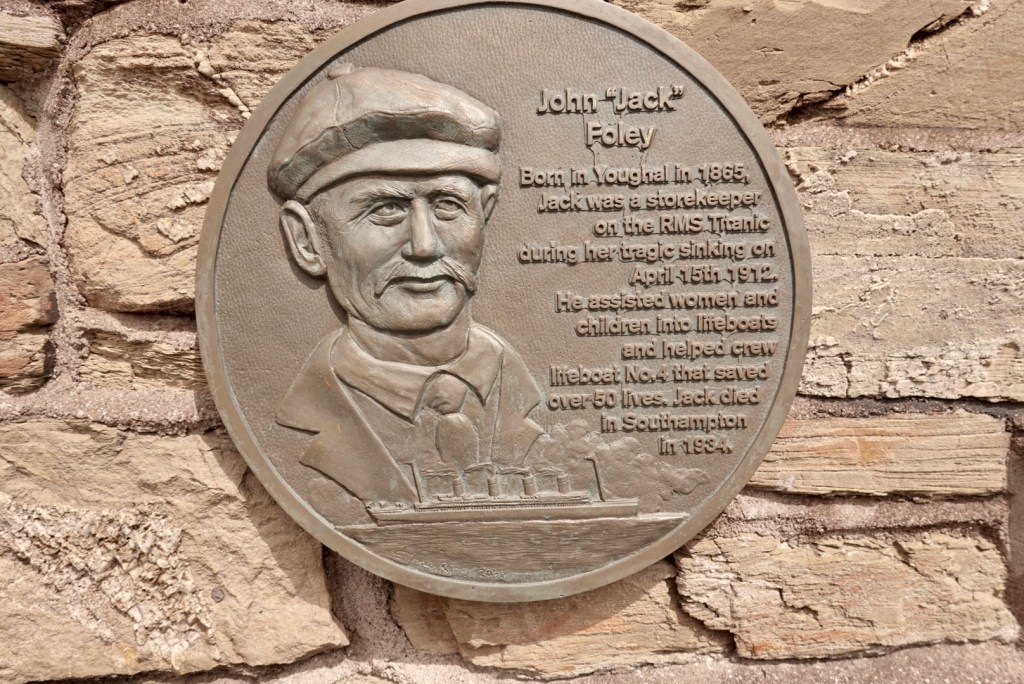
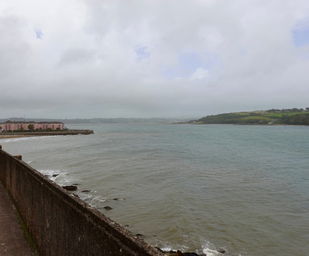
Distant views across choppy watersInteresting story about Jack on the walls of the Information CentreCalmer waters this side, protected by the hill and bluff
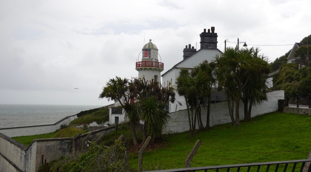
The local lighthouse, was built on this site after great local consternation and arguments. A lighthouse had existed on this site for 800 years but locals wanted it elsewhere on Capel Island. Construction was commenced, then locals changed their mind and wanted it where it us today.
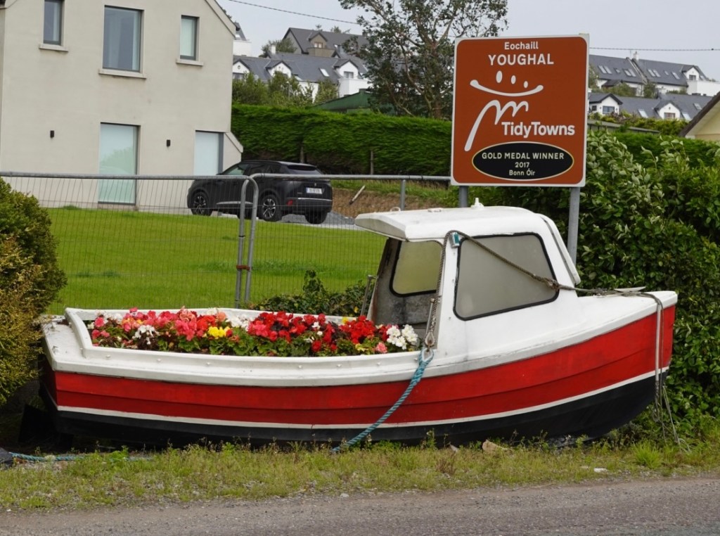
Leaving town, the old boat high and dry full of colourful flowers.
Castle martyr had a pretty little Kiltha River, adjacent was a great named pub.
The wind was hard work. Wind you cannot control. It slows you down heaps (unless a tailwind 😊), and we knew it was strong. In Dungarvan it was reported as 32-50 kmh. It had freshened even more.
We stopped regularly just to stretch and were not unhappy to leave the busier road and head down towards Great Island and our overnight destination Cobh.
Great Island, roads were narrow and busy as we were approaching late afternoon on a Friday. These are some of the sites around Great Island.
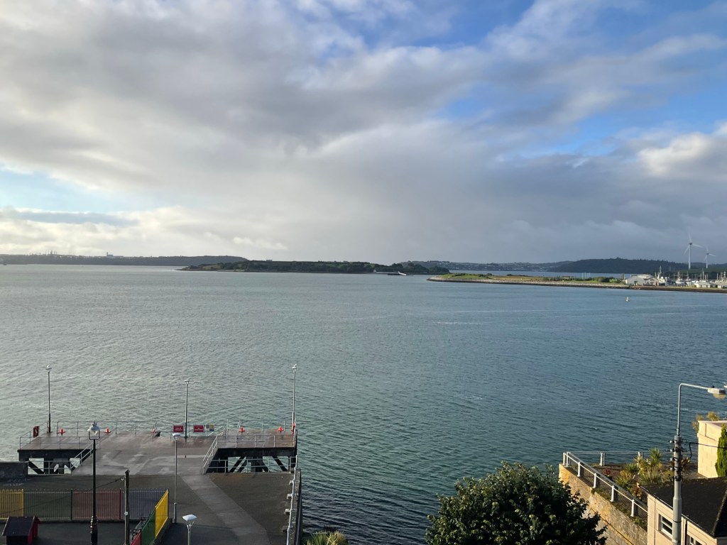
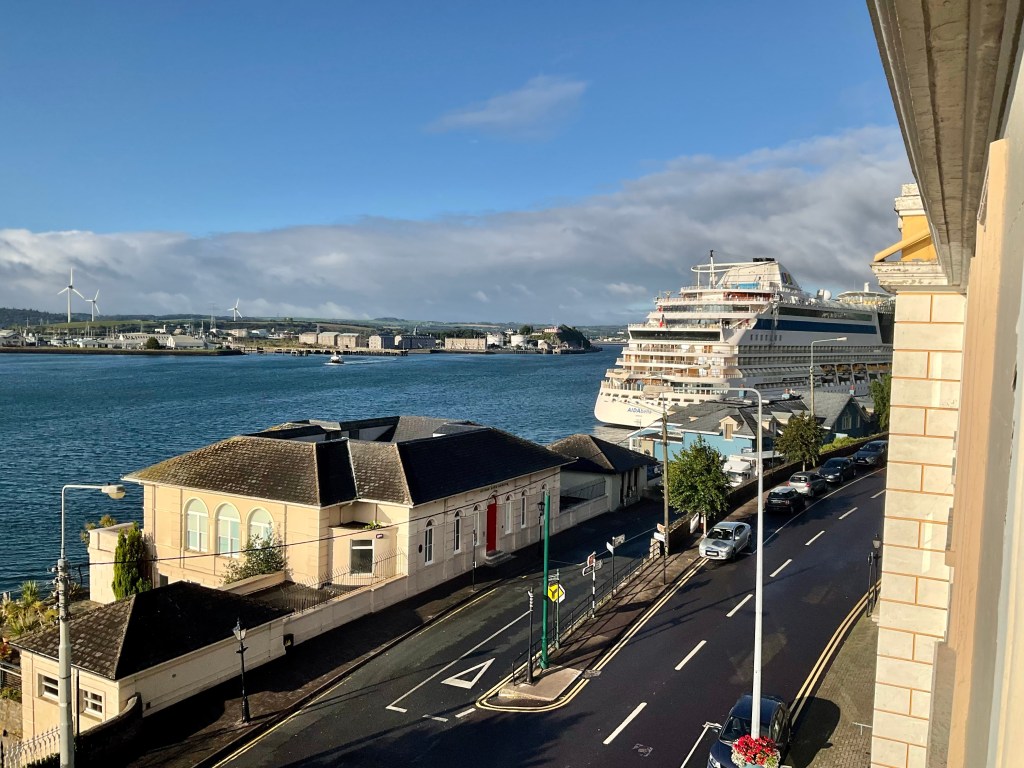
Cobh was a major transatlantic Irish port, and the departure point for 2.5 million Irish who emigrated to North America between 1848 and 1950. It is located on Great Island, one of the three large islands in Cork Harbour.
Our accomodation is in a skinny 6 storey house that was instructed for the US Defence when they lived in town. An elderly man eventually opened the door and spent 30 minutes explaining everything in great detail including the macerating toilet.
We have a great sea view room on the top floor, and I must count the steps. He took me up via lift the first time, but that lift goes to his bedroom, a floor below. I am sure it is a one person lift as we were far too close for strangers 🤣. Then he coughed 😳😳😳
He does have a wife ,but not yet seen her, but she will leave us croissants at 8.15 am, we are told. Later than we want but I dared not say anything out of the script. We will just start later to keep harmony.
We headed off to a local pub for dinner and had huge servings. After dinner we needed to walk. Our puffer jackets were worn for the first time this trip.
Can you notice something different here? Look at the cutlery settings…all tables were set this way. Irish thing or dyslexic staff?
Cobh was the final port of call for the Titanic before it headed off on the last leg of her maiden voyage. There is an pay upon entry exhibition on the waterfront that was closed plus memorial gardens.
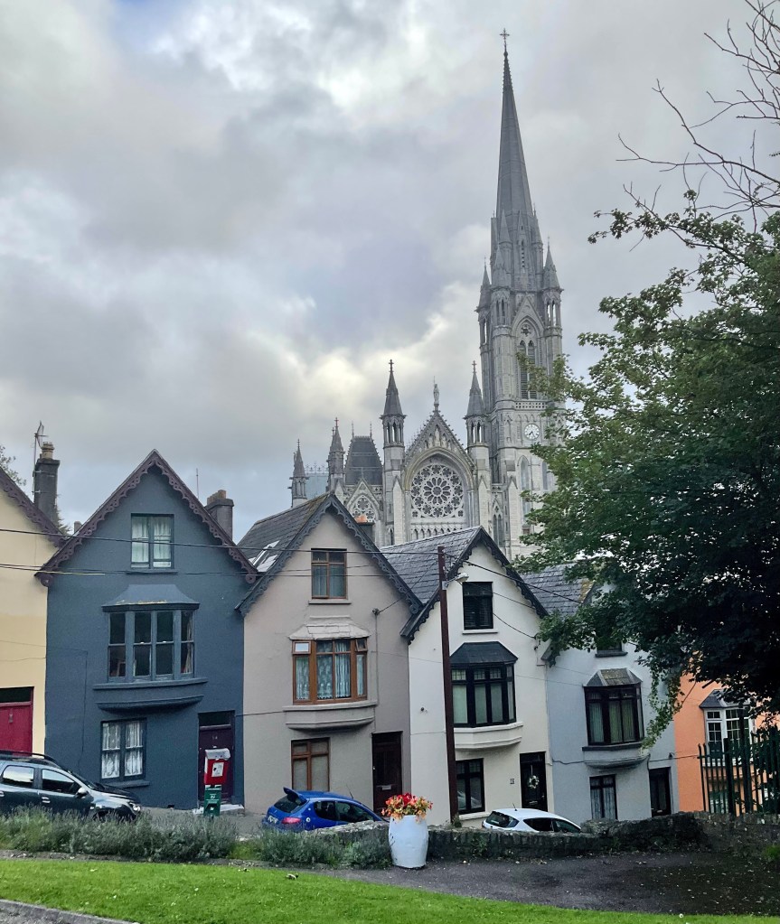
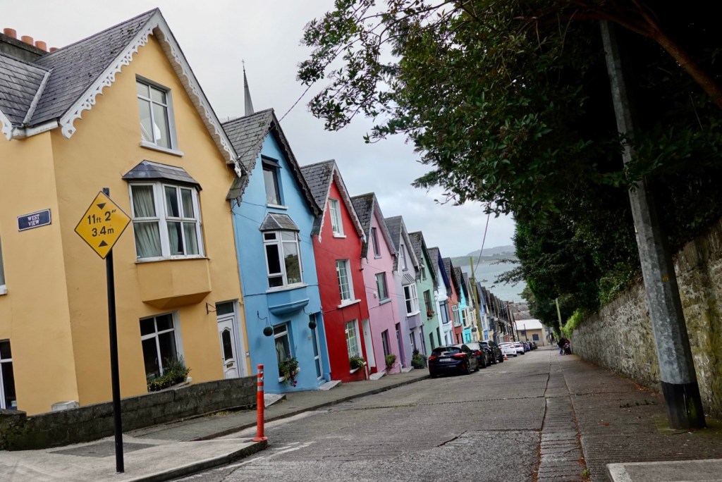
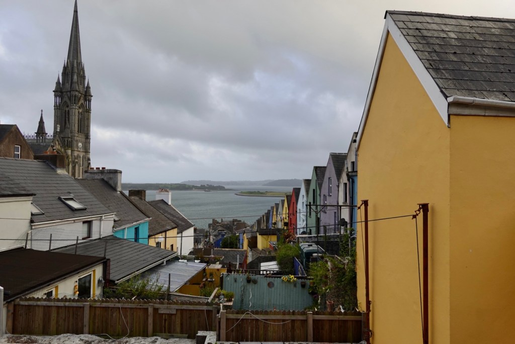
The town has some really pretty sites. There are steep hills and we walked up this one with the colourful houses to reach the cathedral at the top.
Looking up the hill from a park Looking down to the harbour. Back of colourful houses looking towards Spike Island. Tours go there daily from the JFK Wharf.
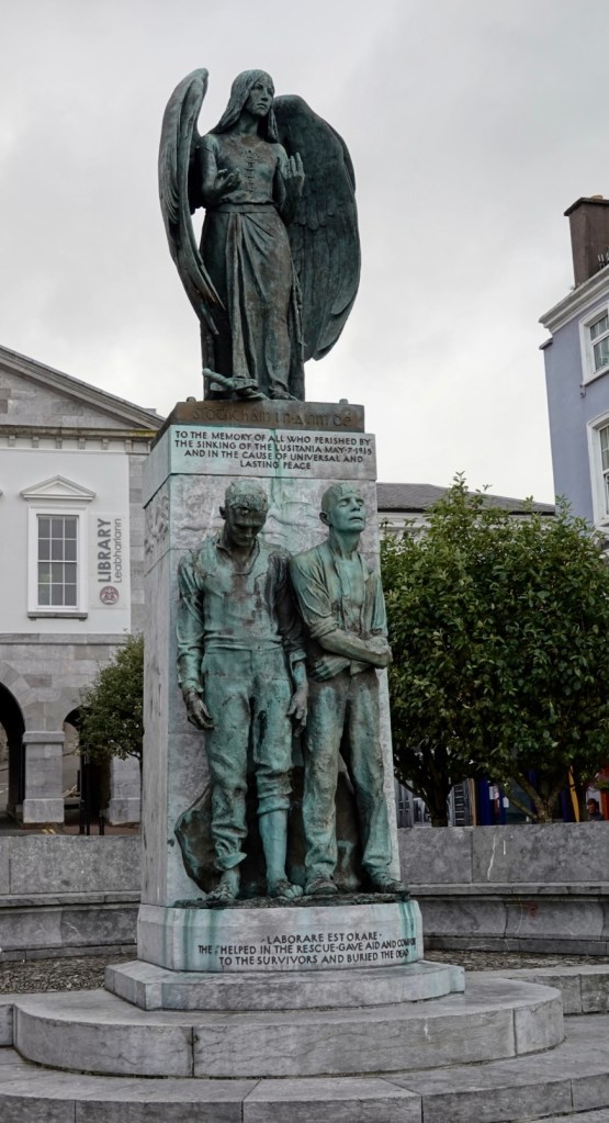
There is a memorial to the victims of the Lusitania, many of whom are buried in Cobh’s Old Church Cemetry. The ship was sunk off the coast in 1915 by a German submarine, an action which was responsible for bringing the USA into WWI.
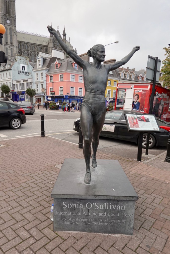
This I did not know. Sonia O’Sullivan was born here. A great female athlete regarded as Ireland’s greatest. She went to four Olympics, won three world titles and still holds world records.
Thousands of teenagers filled the streets. I reckon the ratio if teenagers to adults was about 80/20. It was the place to be. On the waterfront were sideshow carnivals and loud music.
Back in our room we wanted to keep our window open as the headwind blew in to dry our clothes hanging off the curtain rails. On the other hand the music was very loud.
9 pm, it all switched off and the town drained itself of teenagers. Like the pied piper led them away.
The end of another day and our longest for this trip at 123 km. We have now ridden in excess of 1,000 km. The forecast tomorrow is for more wind of over 32 kmh. The rain radar looks favourable.
I did something today that I do not recall happening before. The house we stayed in is very old. The floors are not even. I felt that the bed was on a slope.
During the night, sound asleep, I must have rolled over, and I fell out of bed, hitting my face on the bedside table as I crashed onto the timber floor from the high bed. It woke me up 😳🤣
I did get back to sleep but it took a while.
Looking out the window in the morning this was the view.
Looking straight ahead towards Spike IslandLooking hard right, a large cruise ship had arrived in town. Many of the larger towns today had cruise ship, bus tour people just wandering around. We did not hang around. Anything you tried to photograph, they were sitting on! Give us the quietness and genuineness of the little villages
The allotted croissants had not arrived per the male owner’s time slot. We were super keen to pack the bikes and get cracking so I took a few pieces of our luggage down to the front door, with reason, as the kitchen is adjacent.
I found Mary busy chatting to other guests, and as they left, took our croissants outside to where our bikes were safe in the courtyard. We smashed the croissants down, packed our bikes and headed off.
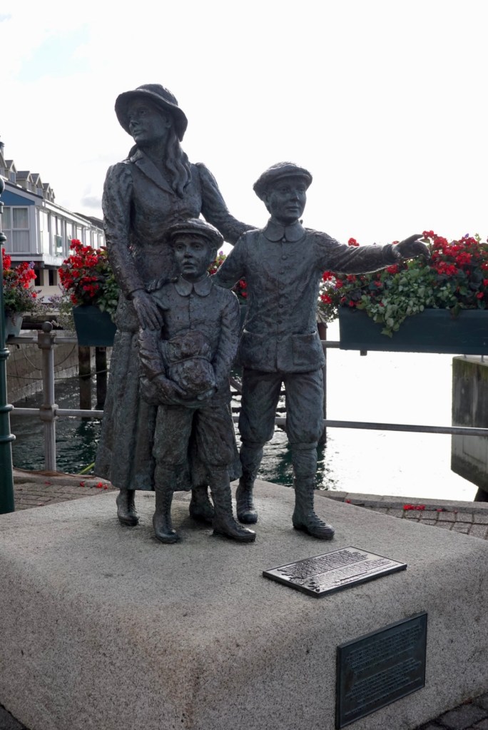
Soon enough we were in our way, and first stop was this statue celebrating Annie Moore and her two brothers who emigrated to New York from Cobh. They were the first immigrants to be processed at Ellis Island. A similar statue is on display at Ellis Island.
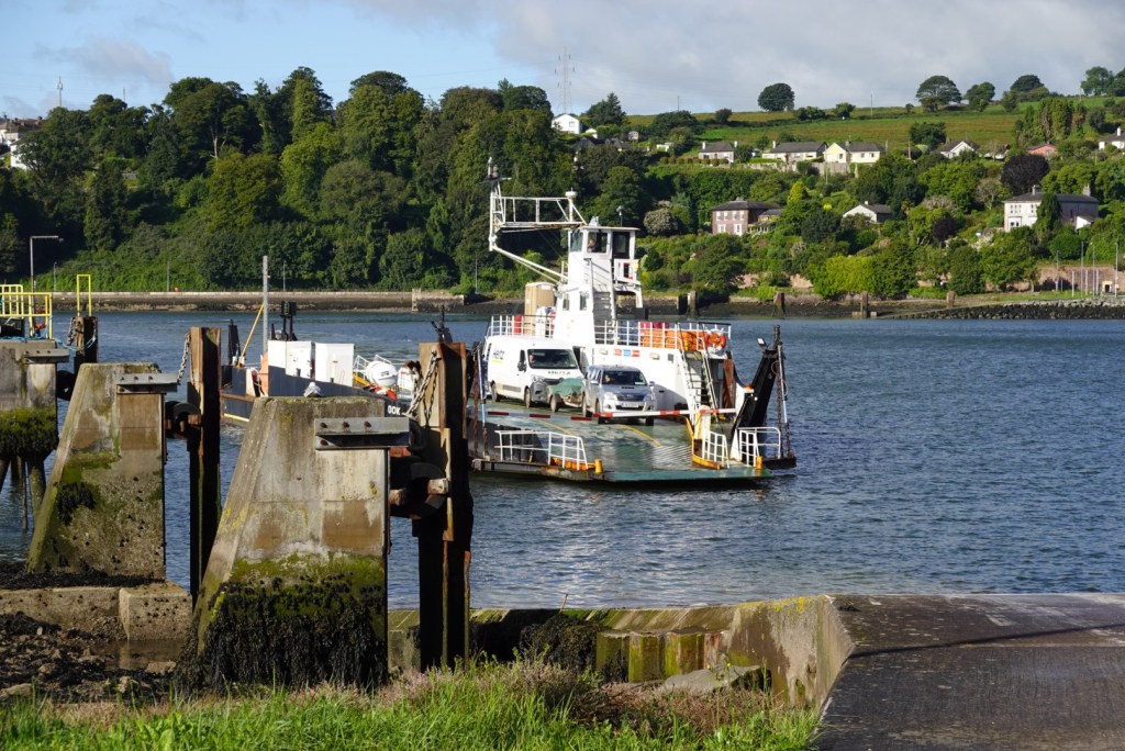
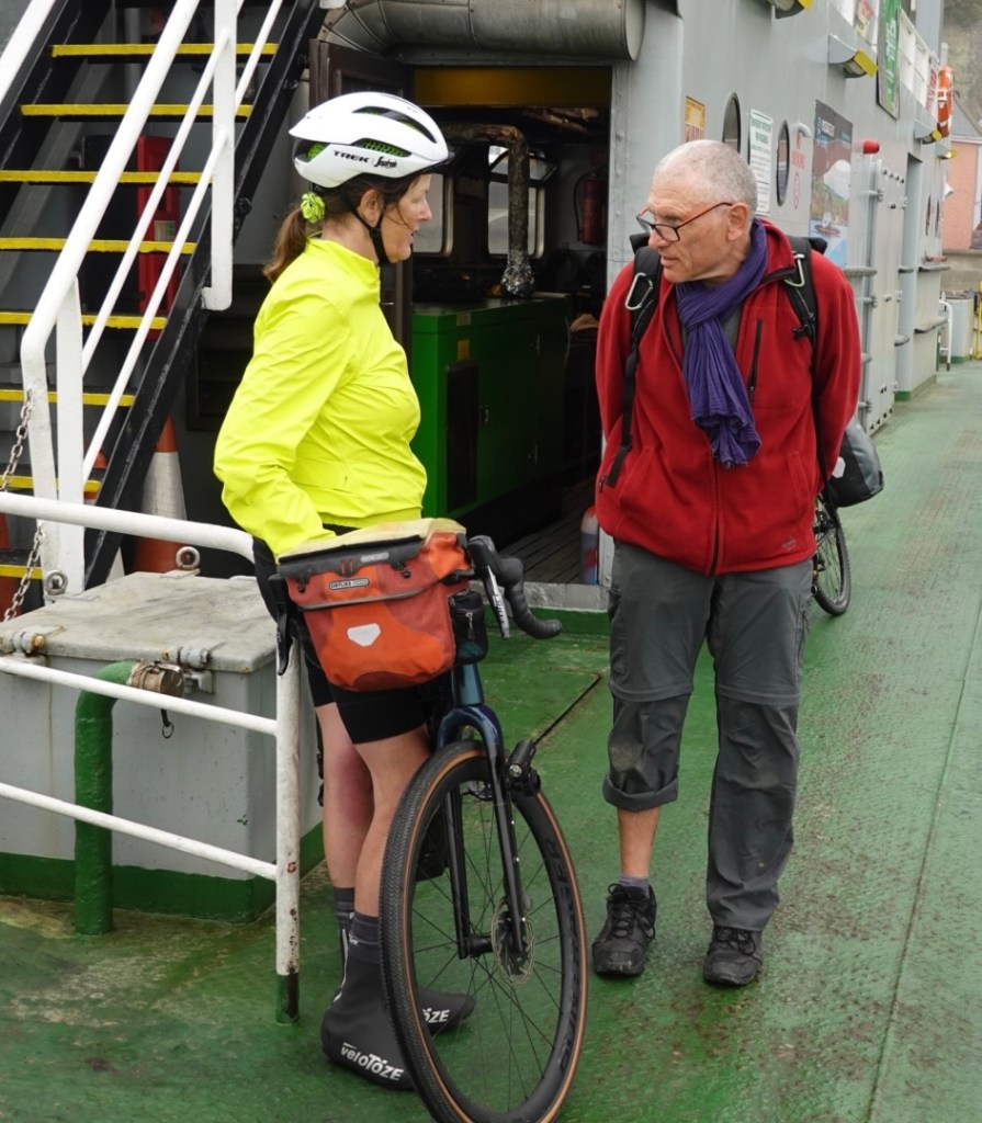
Then it was a 3.5 km ride to the ferry. We waited for it to arrive, walked the bikes on, and then it waited maybe 10 minutes for anyone else to board.
It costs about 3 euro each way and only takes about 5 minutes to cross.
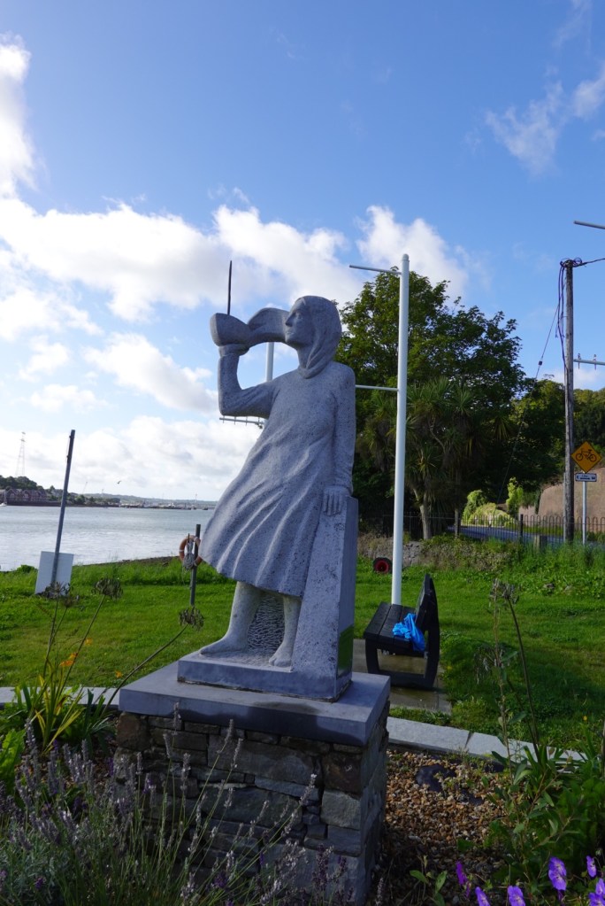
On the Glenbrook (southern) side is another statue of a young woman holding a boat looking towards where the Sirius left to emigrate to America. the Sirius was the first steamship to make the trans Atlantic crossing with immigrants.
Up to 2 million Irish immigrated after the Great Famine. Death from the famine and immigration saw a loss of 25% of the population.
Water was to be a feature today as we crossed rivers, inlets and saw the coastline as we headed in a south west trajectory. Wind was the other feature. The forecast was for a WSW wind of 32 kmh. It was very tough.
At times, on the flat, we struggled to push 12 kmh into the headwind. At other times, the road might deviate to a different angle and we would welcome a short reprieve. Out of the wind when we rested, it was quite warm and we enjoyed the sun.
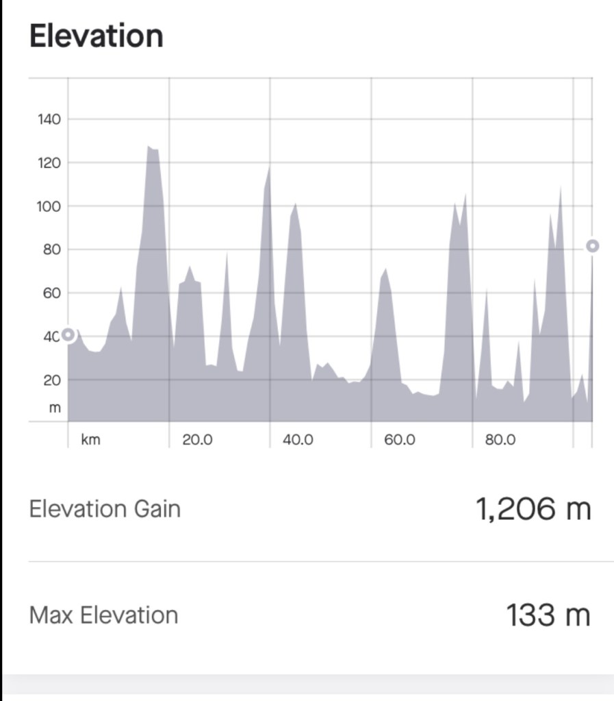
Lovely rural sceneDisengaged bus tourists sitting on what I wanted to photographNear the top of a climb. We climbed over 1200 metres today.Lovely sea inlet. The tides were fairly low.Very flat beach, low tide.An inletQuirky roadside feature Looking towards the ocean An old derelict church A newer church
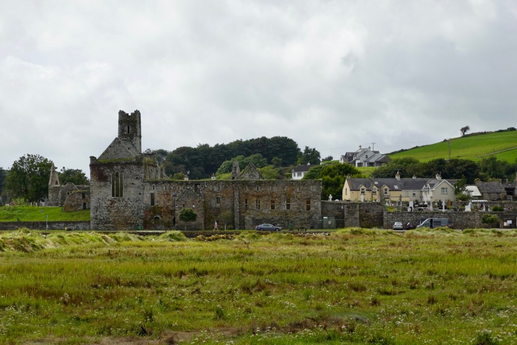
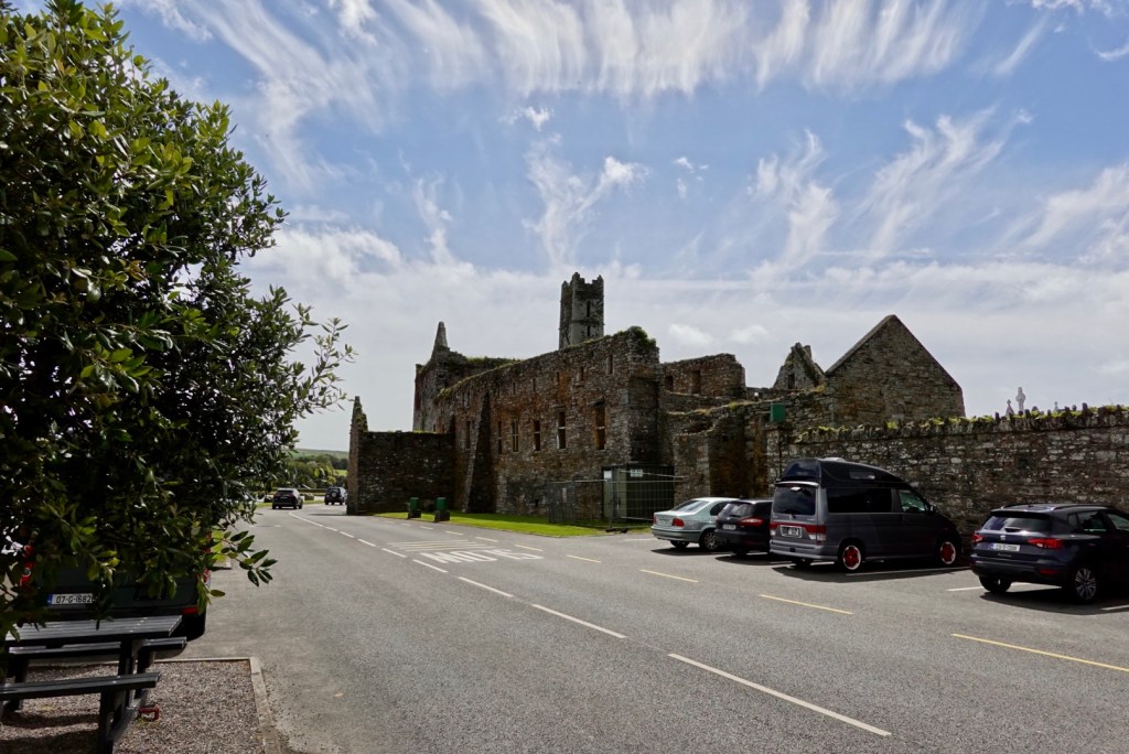
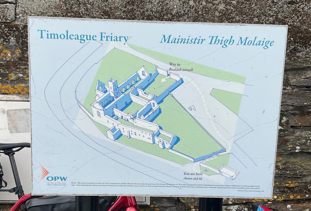
Timoleague Abbey is the main focal point in Timoleague standing picturesquely at the water’s edge at the head of a long sea inlet. In its day it was one of the largest and most important religious house in Ireland. It was founded in 1240 by the Franciscans.
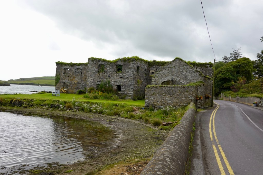
A little further on was the old Arundel Grain store built in the 16th century to store grain for a nearby flour mill. Later it stored potatoes and coal. In 1837 the local port of Ring exported 5,000 bushels of wheat, 1,000 tons of potatoes and large qua titles of ‘superior’ slate.
We stopped at this intersection. Our route was heading left, but we noted EuroVelo went straight ahead. We changed plans and took EV1, as Tony said ‘it surely won’t have a nasty hill’. But it did 🤣
As we crossed the top the sea views came into focus.
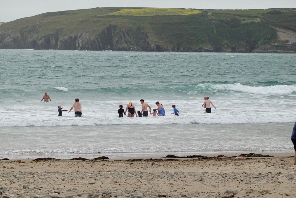
Castlefreke Beach at Warren Bay was the place to be. These swimmers have a seriously strong headwind smacking into them and it is only 17c. The beach also had a portable barrel shaped sauna that people were hopping into after the beach.
The scenes as we headed south were delightful. Remote housing, green pastures, wind blown, like a rural tv show with mystery.
I quite like this one as I finish yet another climb. Note the birds to my right.
What a gorgeous vista these houses have.
Desolate isolation of an old church.
Another beach with the waves smashing in.
After climbing up the hill, there was a lay by we pulled into.
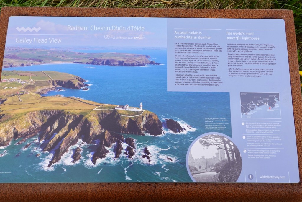
Looking south Information board on the area and the worlds most powerful lighthouse
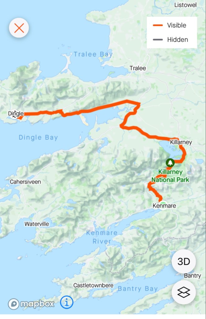
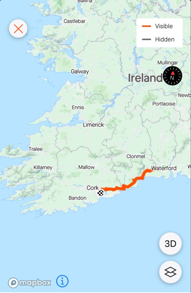
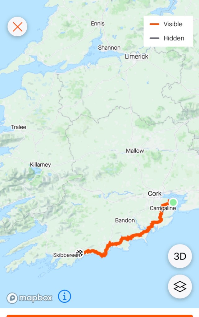
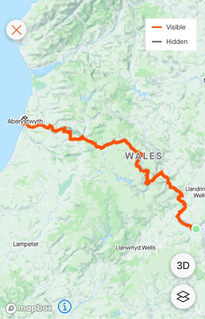
The Wild Atlantic Way is a 2,600 km route (road) and one of the longest defined routes in the world. We are only riding a section of the route from south of Cork around to Limerick, before we cut back to Cork to catch the ferry to France.
There is signage along the way. Route signs plus metal art, all with the same waves,
Dromberg Stone Circle, the Druid’s Alter, is a small axial stone circle, and one of the most visited megalithic sites in Ireland.
It originally consisted of 17 closely spaced stones, of which 13 survive. Radiocarbon dating of samples indicate it was constructed around 1100-800 BC.
The only other people there when we visited were these three French siblings enjoying a touring ride together. Michael, Laura and David live in Grenoble. They will be heading to Australia in a few months, and if visiting Tasmania, have offered them beds at our house.
It was refreshing to see their closeness and joy in their touring endeavours. Tres Bon!
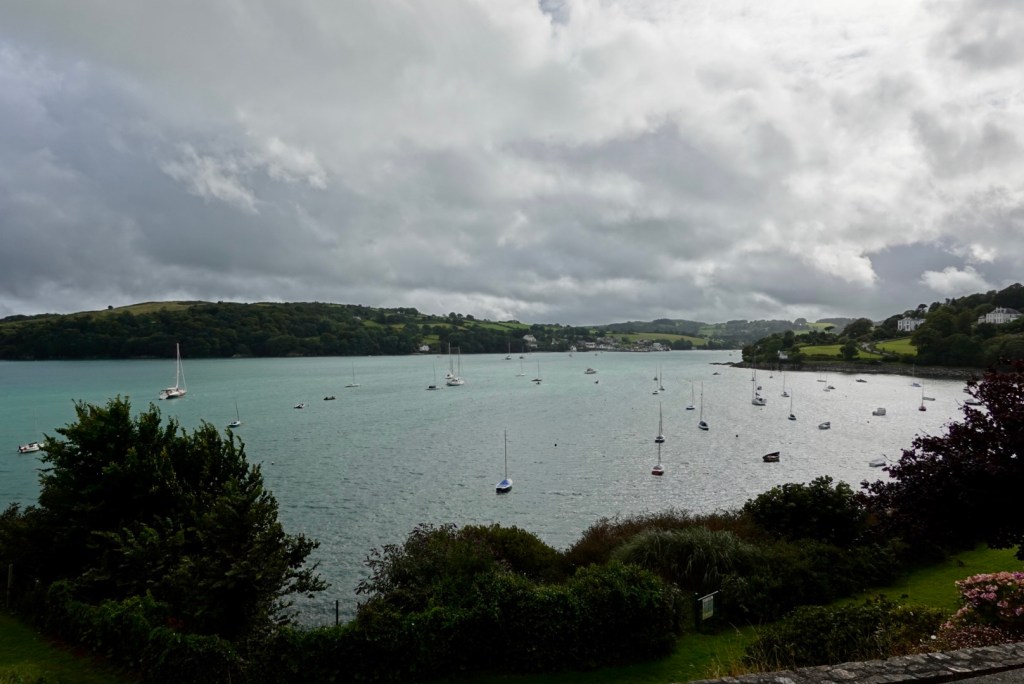
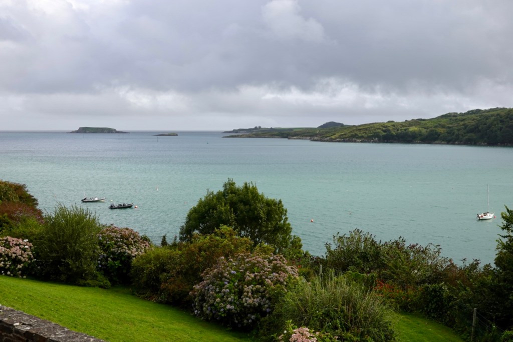
Closing in on tonight’s destination, the waters were calm and protected! Finally some reprieve.
Glandore is known locally as Cuan Dor – Harbour of the Oaks. It was one of the earliest settlements in West Cork, with the Normans building two castles here in 1215.
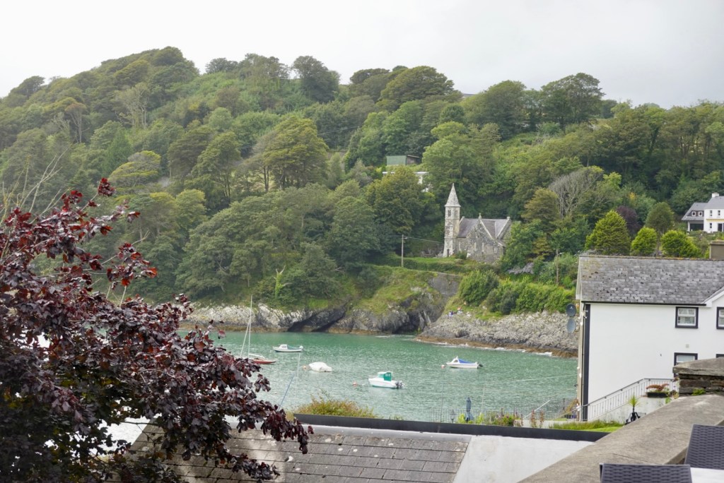
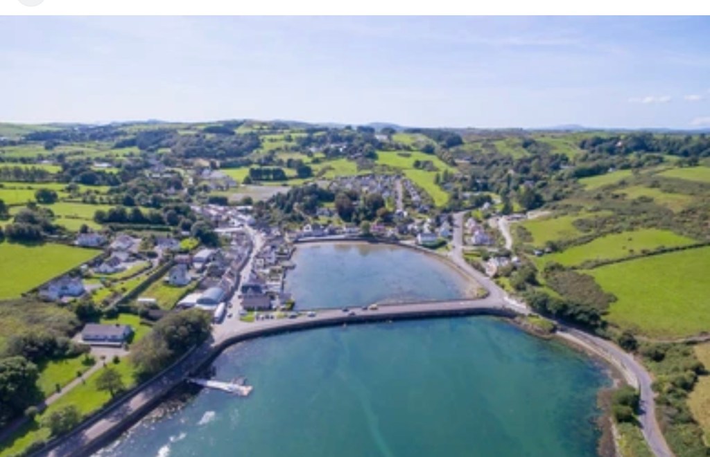
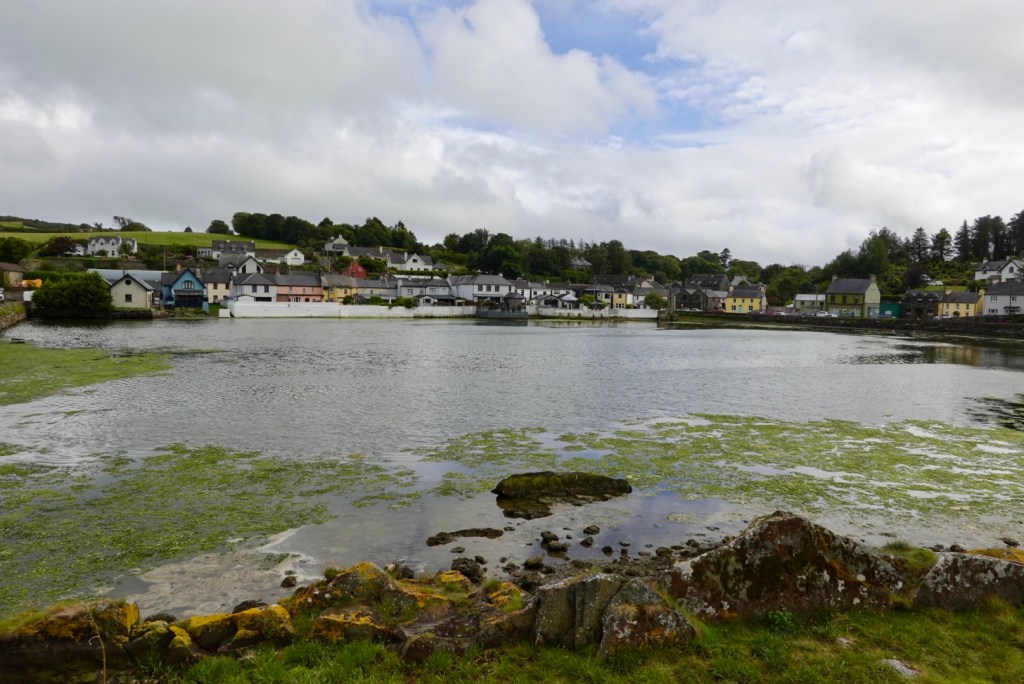
Union Hall is a small fishing village, with its own ice plant and fish processing factory.
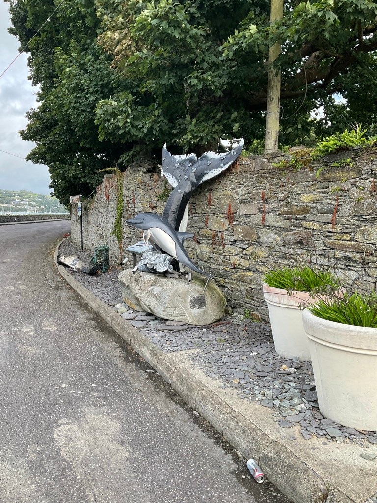
A borrowed photo aerial view of Union Hall. Our accomodation is at the top of the hill in the background.In town the inner harbourLocal roadside art
As time was getting on, and the accomodation was up a hill, we decided to grab dinner first. We ordered at this pub as there were seats outside, so we could keep an eye on our bikes.
Whilst we waited for our dinner, Tony changed my brake pads as I’ve worn a set out already! That’s probably a record for me at 1,000 km and indicates how hilly it has been. Thankful Tony can do it for me too.
After dinner getting up to our accomodation was hard. Cold legs, full tummy, steep hill are not great partners.
Our room here is amazing. It is very large and spacious with beautiful views.
We were given options of 7.30 am or 9 am for breakfast 😳🤣 I said 7.30 am please. She responded “that was quick, you didn’t have to think about it?” No….
Another day (105 km, 1200 m climbing) and that’s a wrap. Thanks for reading. 😊❣️
After a solid breakfast, including tucking away a few spare items for morning tea we left Arklow.
We had weird weather today. It drizzled and mizzled but did not really rain. We had a very low mist for much of the day.
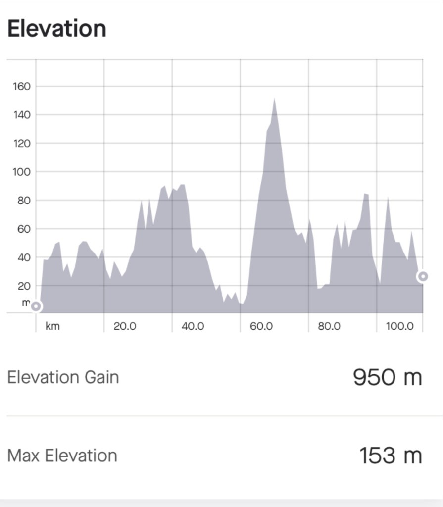
The ride today was 114 km with 950m climbing. The climbs were all ok, nothing too onerous. The roads varied, some were very busy, some had no verge, others had a verge of even a cycle path.
A series of one off sights to start with. Leaving Arklow at this roundabout was the honey hive.
Pity we are not around for this event. Lock away your treasured oldies!
A nice church and house.
Beautiful gardens with nice security detail.
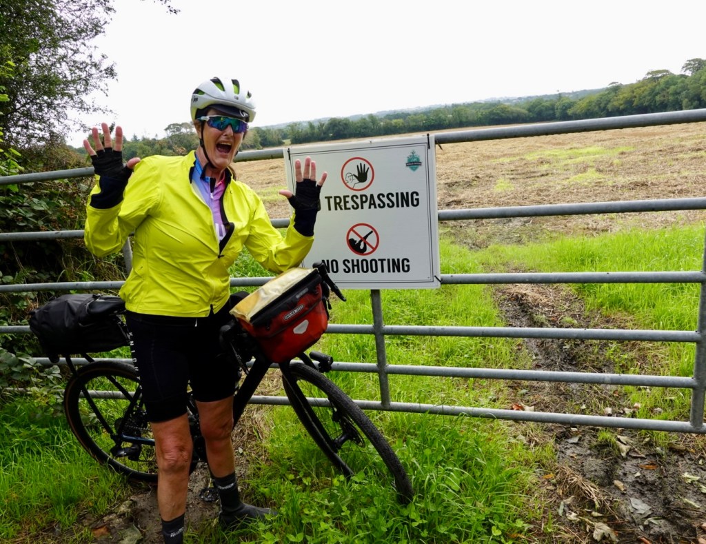
Don’t shoot me!
Dang, another event we are missing out on 🤣🤣.
Really new signage, but some drivers today did not get that particular memo.
An old flour mill.
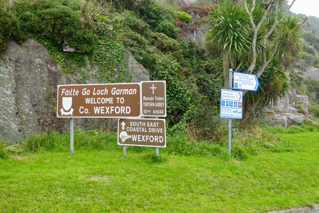
Wexford another town founded by the Vikings around 800 AD. Nearby is Rosslare Harbour, a ferry terminal with ferries travelling to Wales, France and Spain.
Lunch was planned for Wexford. We crossed the bridge, and I fancied sitting outside in a cafe along the river. Not to be, as we could not find one. We went to Tesco supermarket up the hill instead and sat in the carpark. Food was good!
A statue dedicated to John Barry, the father of the USA Navy, who was born in a nearby village.
Lots of pretty flowers along the waterfront.
Leaving Wexford, this sign had me off the bike to photograph. My four children have an Irish heritage, and their surname is Geelan. Their great grandfather emigrated to Australia from Ireland. However, he was from Co. Leitrim, further north, closer to Northern Ireland.
We started to see some of the EuroVelo 1 signs. We will criss cross, and follow EV1 on our continuing journey.
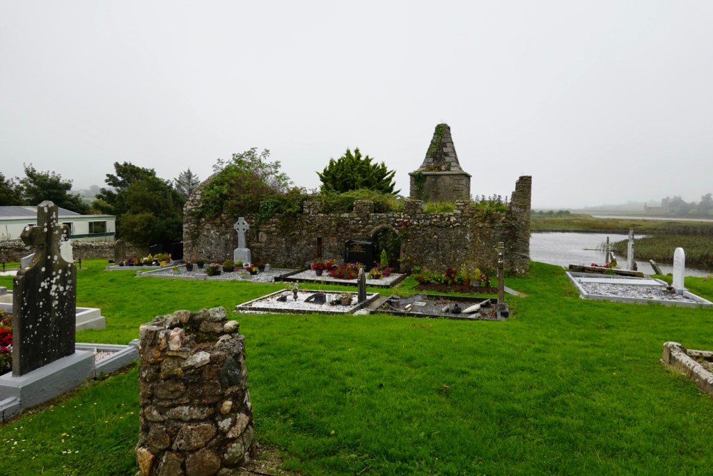
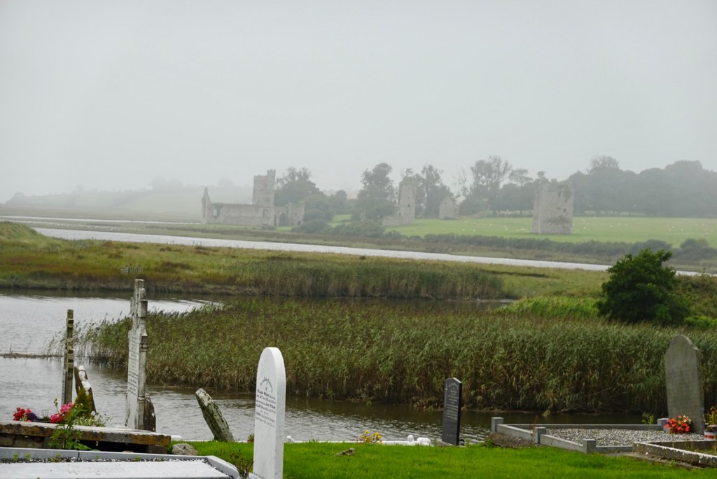
We stopped at this ruined church, then noted something else across the water, per the following photo.
The ruins across the water look interesting, and very eerie in the mist.
Post ride research indicates that this site is known as Clonmines Abbey. It is on private land. It is a deserted medieval borough dating back to the 13th century.
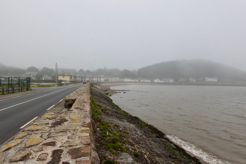
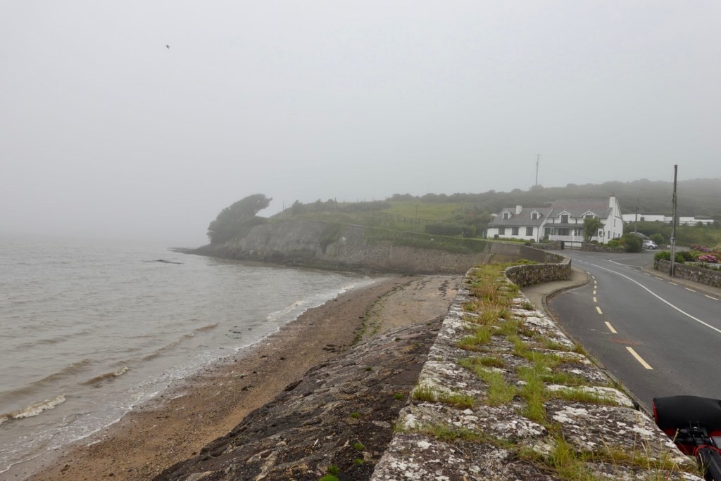
Arthurstown looked eerie too.
We rode up to the left and around this headland
Up the hill, and around the corner from Arthurstown is Ballyhack.
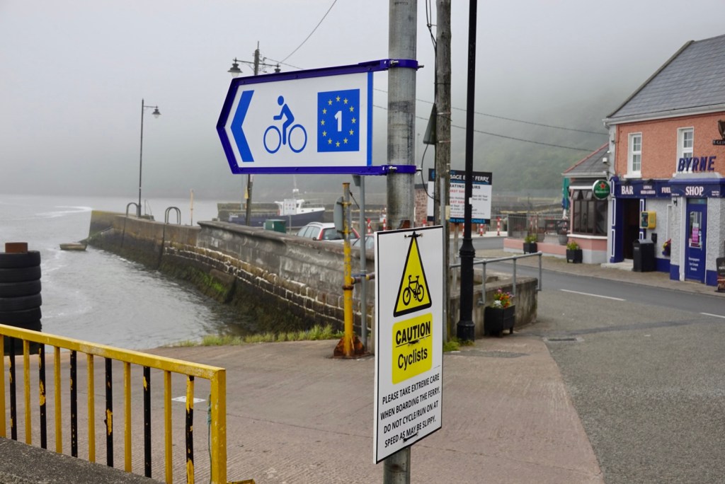
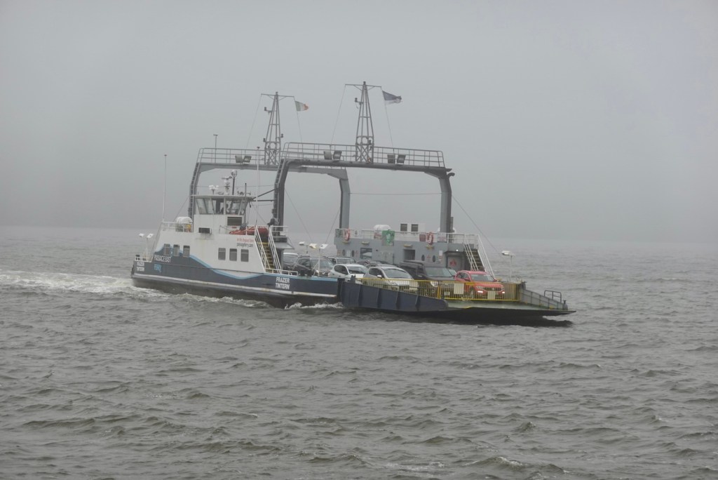
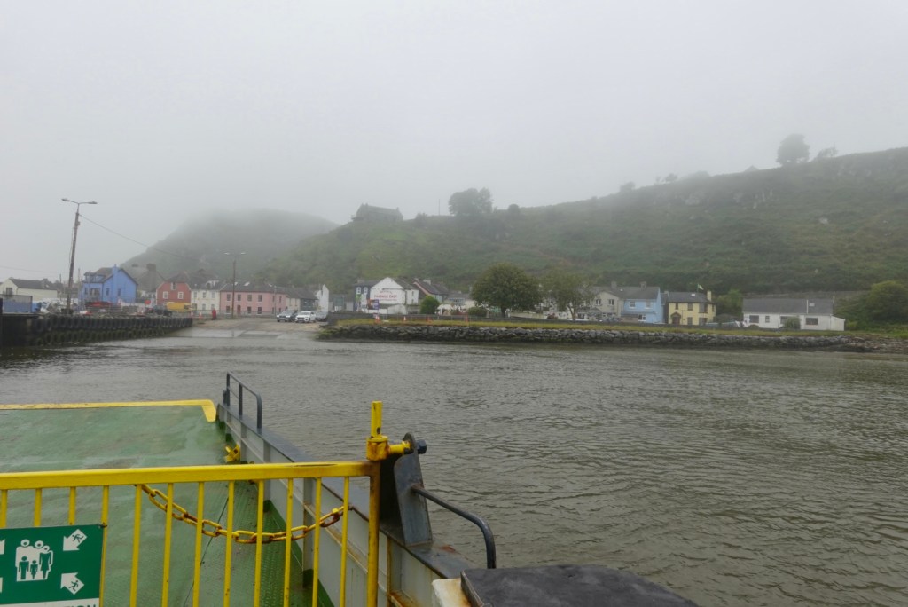
Ballyhack contains a 15th century Norman castle that has been partially restored. Features include its dungeon and a murder hole! It was from this village that we hopped onto the ferry, that crosses the broad estuary of The Three Sisters, to Passage East. Using the ferry saves around 55 km cycling.
Over the road from the ferry The ferry arriving
I chatted with another cyclist. He is from France, living near the Swiss border. He is on a three week cycle ride and following a similar route to us.
In earnest conversation
Passage East is a small fishing village on the west bank of Waterford Harbour. The Norman invasion of Ireland began here in 1170.
Up the hill and around, was very pleasant. After about 8 km we were on the outskirts of Waterford, in super busy traffic again.
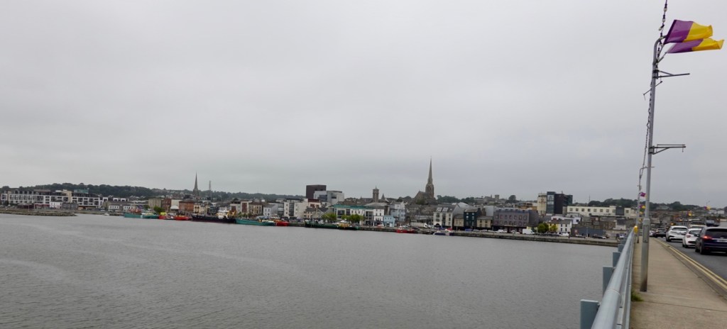
Waterford is the fifth largest city in the Republic of Ireland famous these days for Waterford Crystal (although sadly was shut down in 2009 after the falling into receivership).
Again, it was the Viking raiders who first established a settlement nearby in 853.
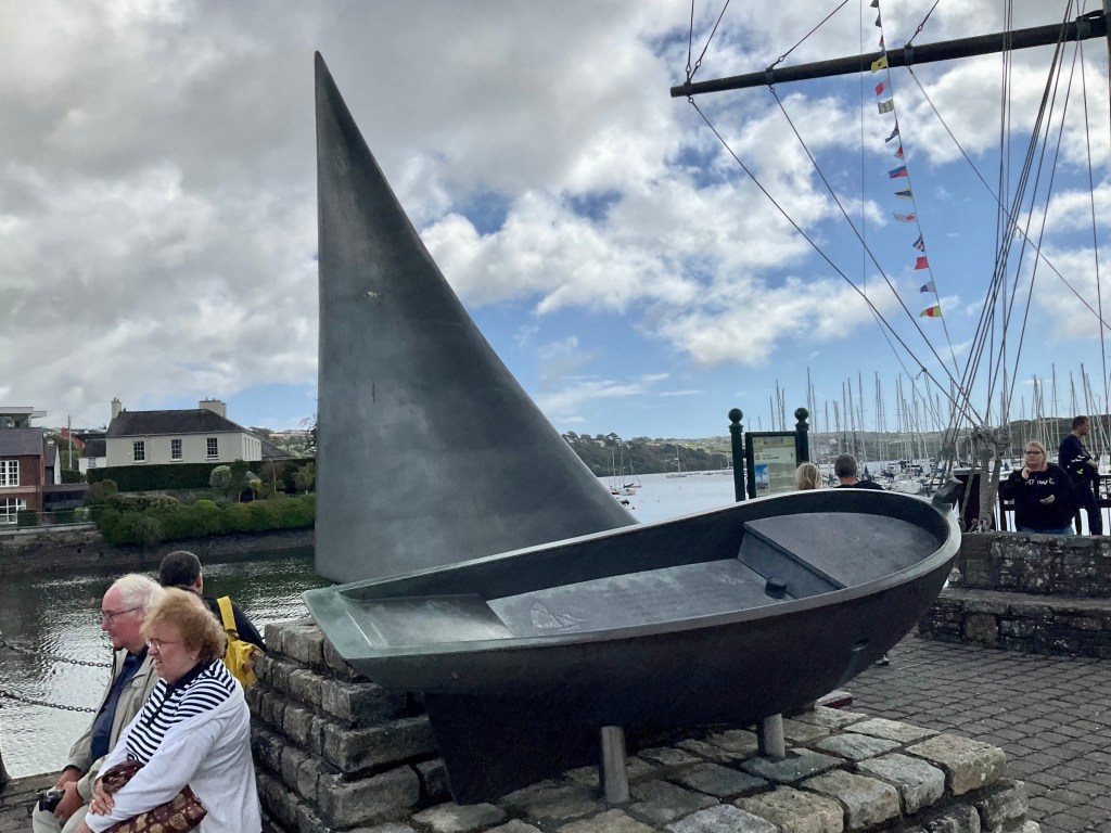
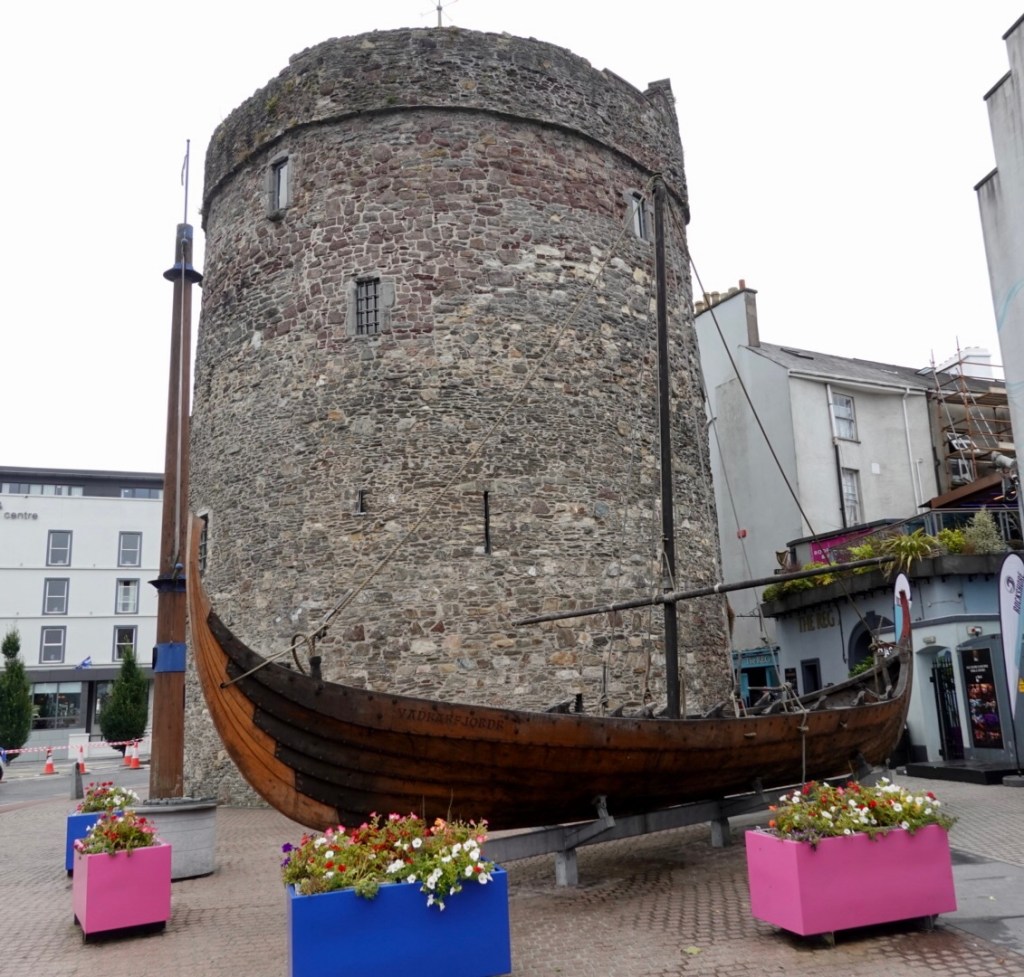
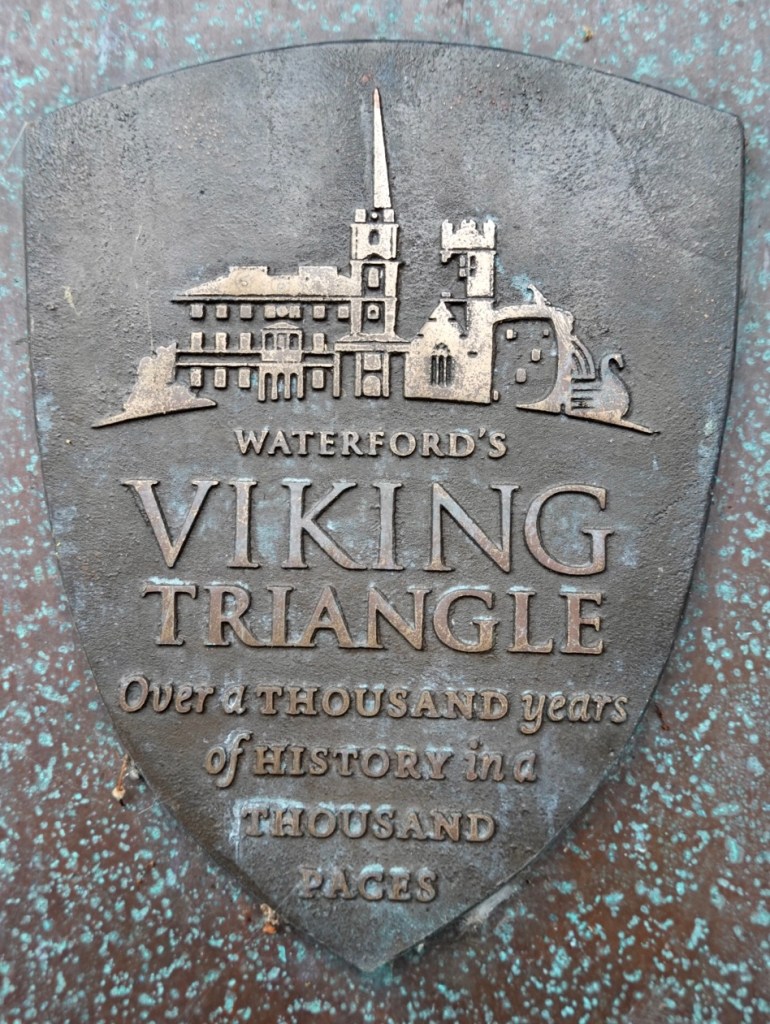
Reginalds Tower is the oldest building in Ireland and believed to be the first in Ireland to use mortar. It is located in the area known as the Viking Triangle. A replica Viking longship, 12 metres in length is on display outside the Tower.
The tower has a long and interesting history.
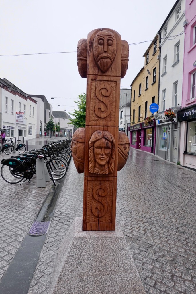
Waterford has an interesting series of buildings relating to their history, within an area known as the Viking triangle. Everywhere you walk, there are Viking references. Even the wifi password at our accomodation is ‘Viking city’.
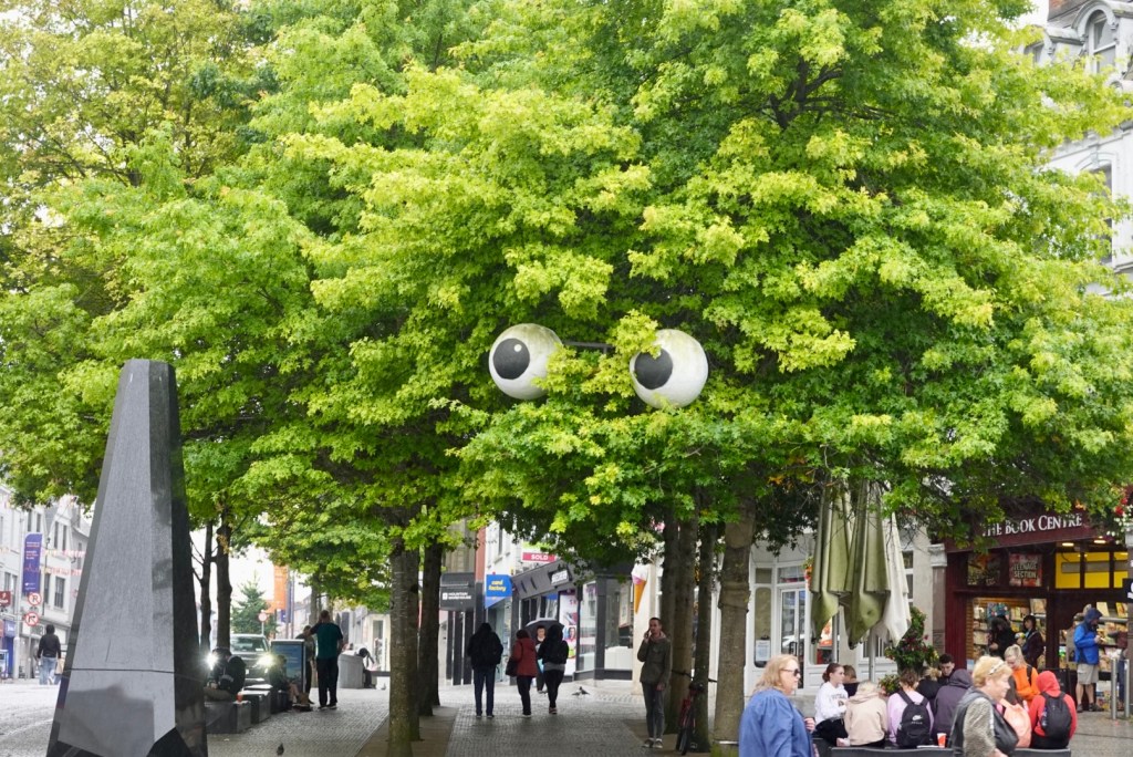
Eyes are watching you
This is a memorial to the youngest British soldier killed in Word War 1, John Condon, aged 14. His war grave is one of the most visited in Belgium. John was born in Waterford in 1900.
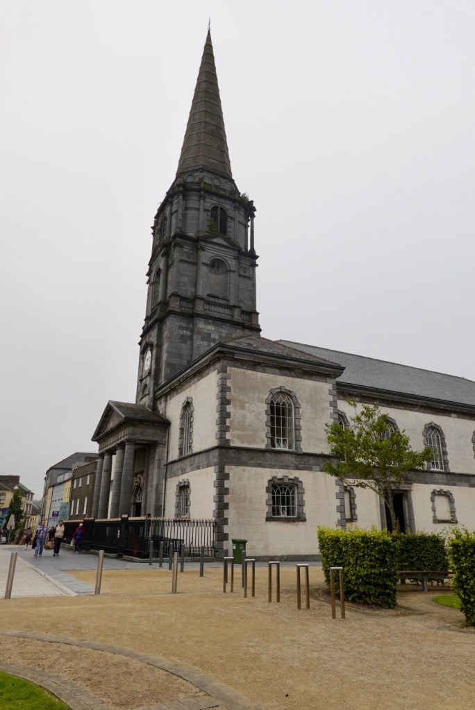
A cathedral has stood on this site since 1096 when Malchus, the first bishop was consecrated by the Archbishop of Canterbury. With an extensive history, the medieval cathedral was demolished in 1773 and Rep,aced by this current cathedral.
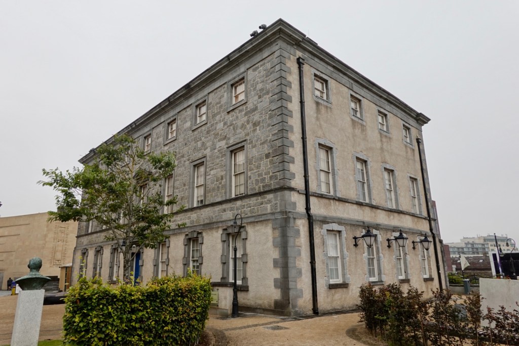
The Bishop’s Palace was built in the site of the medieval palace. It has been describes the finest 18th century ecclesiastical palace in Ireland.
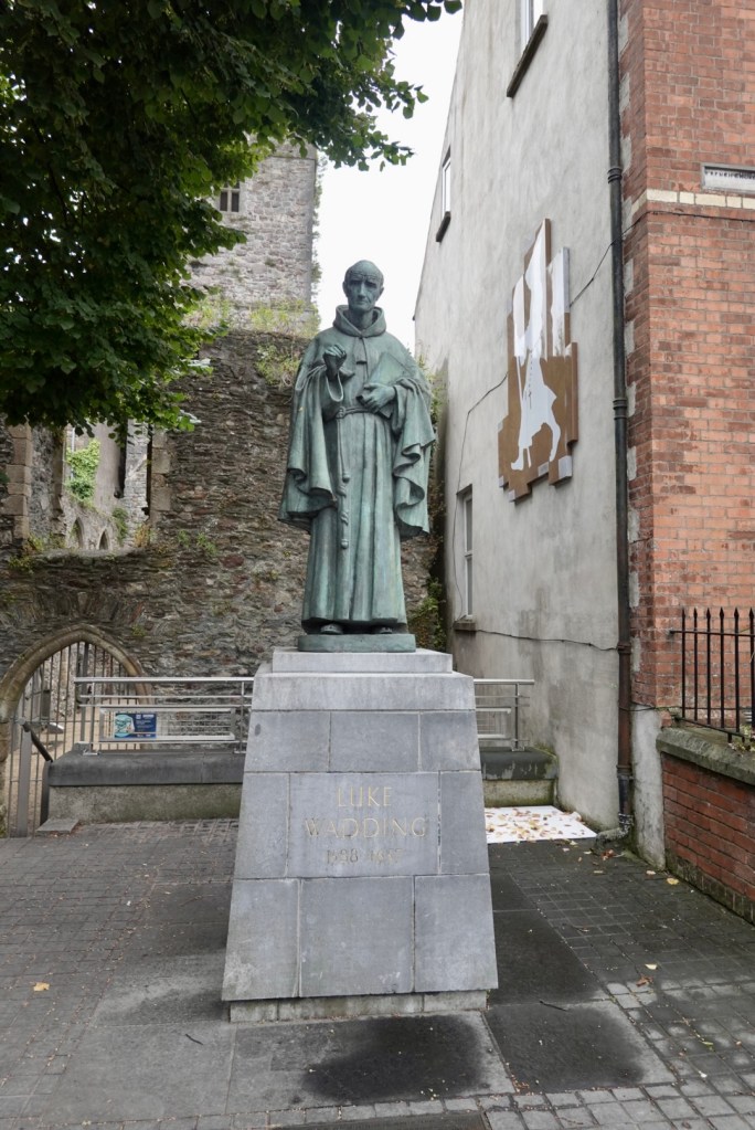
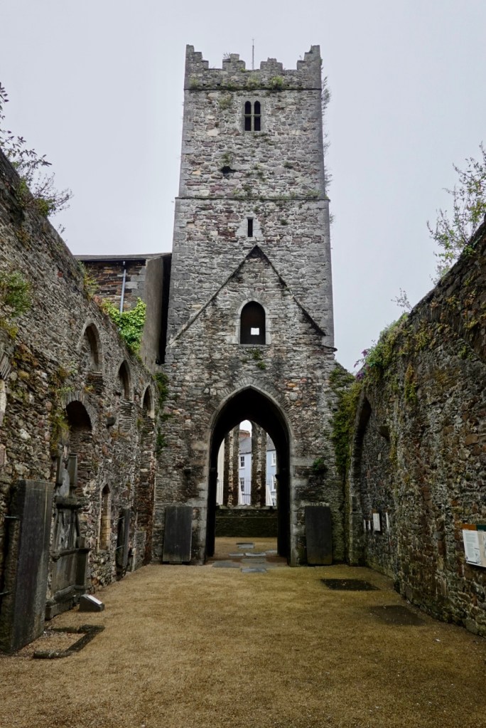
These are the remains of the Franciscan Friary, funded in 1241 by King Henry III. In 1541 King Henry VIIIclosed the monasteries and it reopened as an alms house. Inmates were required to pray for the soul of Henry VIII right up until the middle of the 20th century!
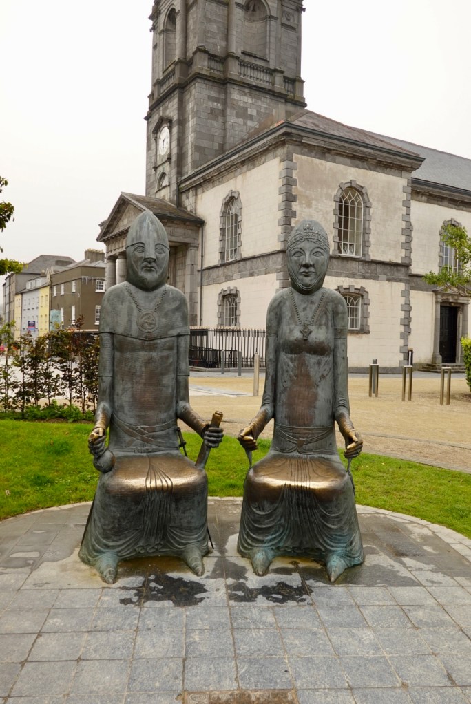
The entrance is watched over by Luke Wadding the only Irishman to have ever received votes in a papal enclave.
There are a number of museums in the area including Waterford crystal, medieval and a Time museum. Everything had closed when we wandered around by this installation is outside the Time Museum.
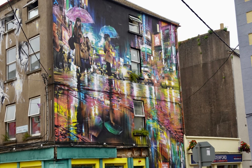
Paintings on building exteriors is another feature in Waterford. Many clever ones, but given it was rainy, this seemed appropriate.
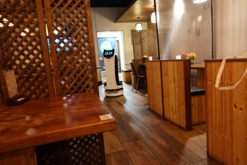
We had dinner at a Japanese restaurant. It has a robot that delivers food to tables, and takeaway to the front. It’s name is Bella.
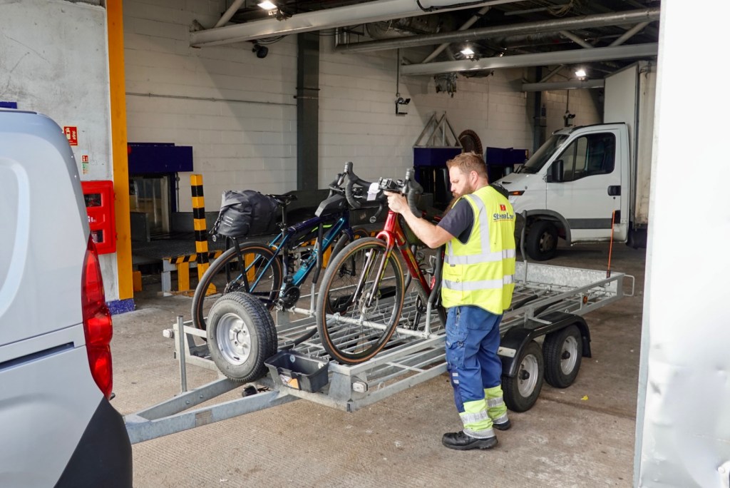
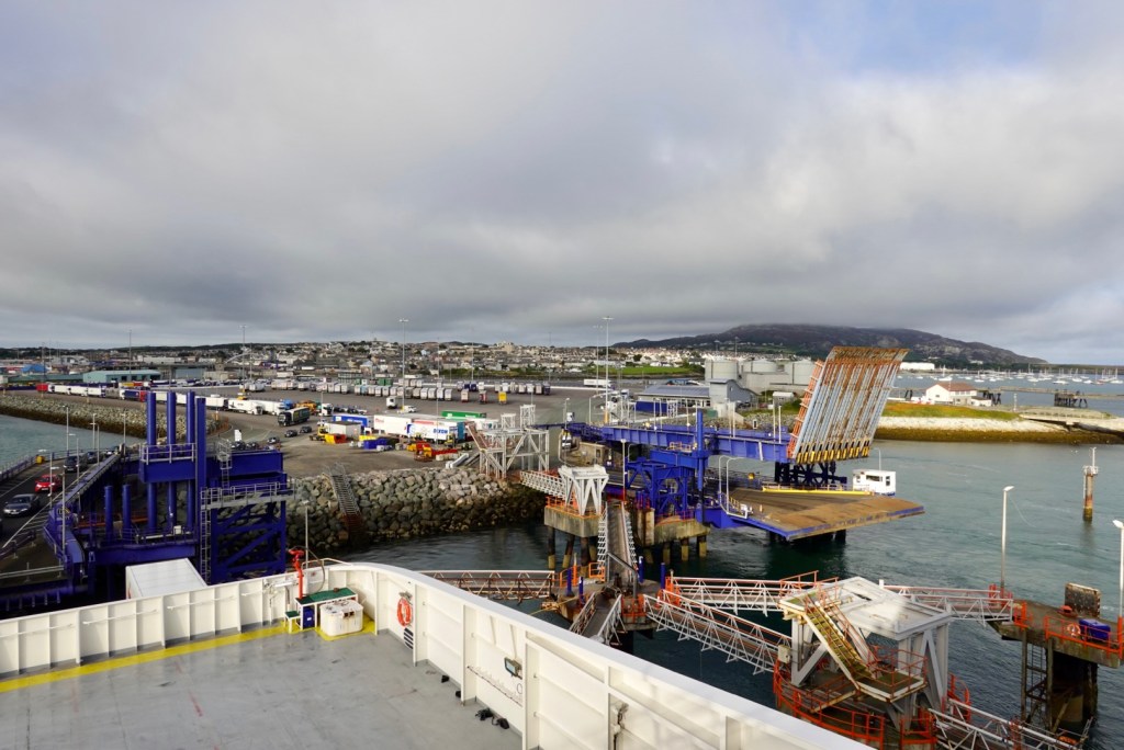
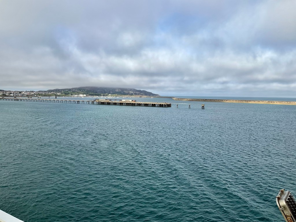
We headed off to the ferry around 730 am. You cannot head directly in to the port as there is a very long security fence you need to get around first.
As we headed to the ferry, view of boats in the harbour at Holyhead
Once in, check in was quite simple. Security even simpler. Foot passengers were having luggage and belongings xrayed and walking through a scanner.
Take a bike, security not checked. We were sent around the side of security to meet two men at oversized luggage. That lack of security surprised us for cyclists vs foot passengers.
The bikes are strapped onto a trailer, that is towed onto the ferry, remains in situ for the trip, trailer towed off in Dublin.
We then boarded a transfer bus that drives onto a vehicle deck, and we then headed to our cabin on deck level 9.
Looking back to Holyhead port , an Irish ferry had just departed from the next berth. We had initially tried to book on that one as it left earlier, but they do not take bikes on that crossing.
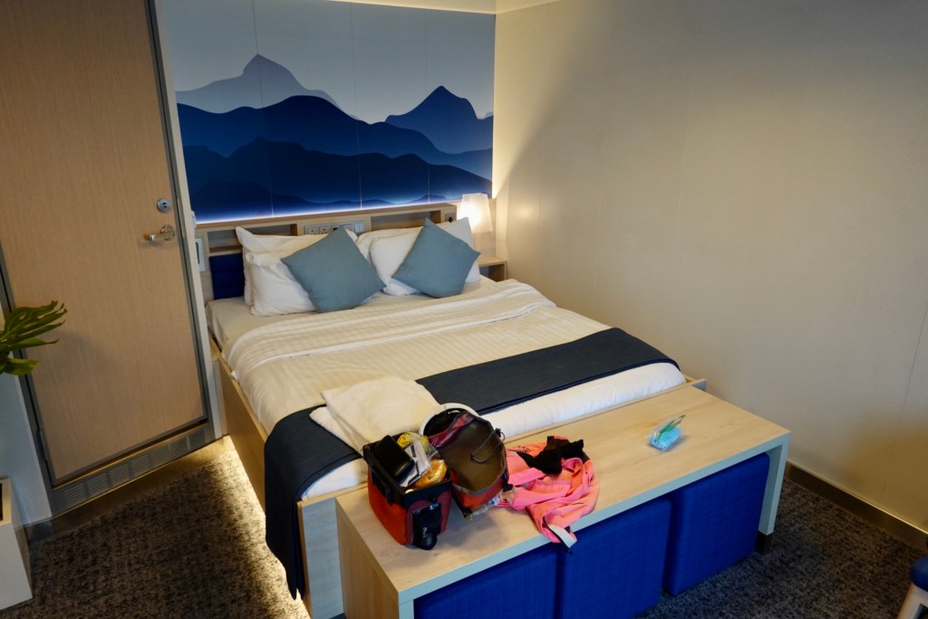
I had purchased a cabin for the trip, a superior portside. We were both very impressed with it vs our experiences in Tasmania and Croatia with ferry cabins.
The cabin was so spacious it had a full sized double bedPod coffee maker with a huge range of coffee pods, and hot chocolate. The fridge had 6 drinks in there. Plus there were chocolate and chips. There were two lounge chairs, plus a huge window. You could sit up on the bed and see out the window.
So we had a super chillaxing trip. We were in the cabin for over four hours, with the actual travel time 3 hours 20.
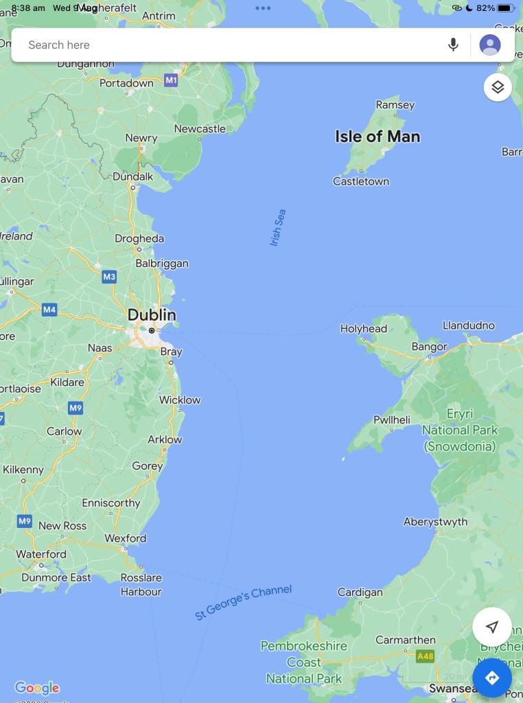
Leaving the harbour, Holyhead Mountain under cloud.
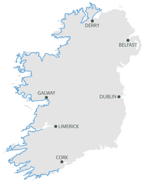
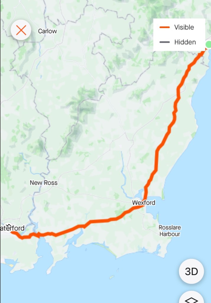
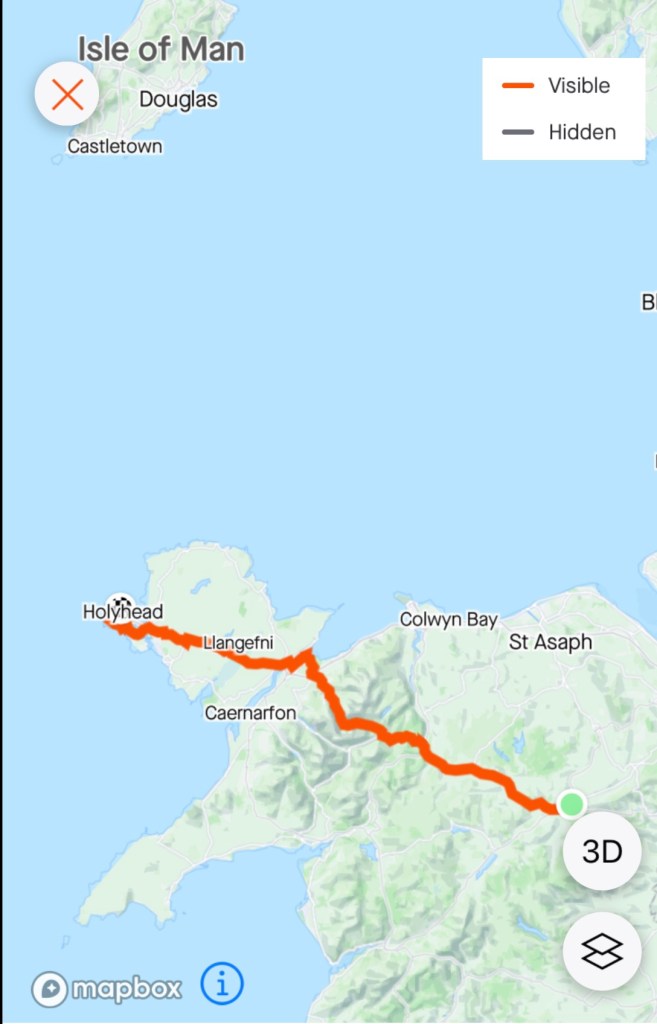
You can see both Holyhead and Dublin on this map, close points between Wales and Ireland. Arklow, to the south, was our destination today.
It was a non eventful crossing. Tony slept for part of it.
As we closed in on the Irish coast land ahoy.
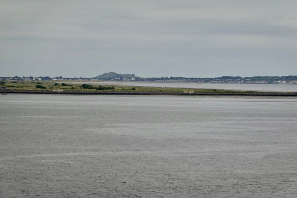
Looking south towards the Wicklow Mountains, where we were headed.Looking north, Howth, a nice suburb of Dublin. Looking north towards North Bull Island, a flat sand island and Howth. We have just entered Dublin Bay and the mouth of the River Liffey.
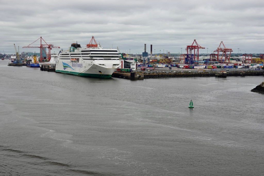
The port is spread out over a larger area. Our ferry nosed into its dock, as it is a roll on, roll off ferry with openings either end.
Being a foot passenger, keen to get pedalling, was super frustrating. It took maybe 45 minutes to leave the ferry, transfer onto a bus, then get our bikes, waiting for us at the luggage carousel.
Then getting out of the port took time. It is hugely busy with big trucks and cargo container movements. . There is a cycle path and many red lights. After a few km we left the port premises to begin the next part of our ride.
Dublin is the capital of the Republic of Ireland, located on a bay at the mouth of the River Liffey It was established by the Gaels around the 7th century followed by the Vikings.
Today it seems we had the route ‘tour de red lights, road works and crazy antics’ to commence our Dublin memories.
It was super stressful riding out. There are some crazy drivers, but also patient ones. Thencyclists were the worst. No helmets, going across the flow of traffic, weaving in and out of cars, whilst we just went with the flow, obeying everything.
It is taxing as you do not realise until later how exhausting it is concentrating so hard. Make no mistake, we do concentrate on the open road too, but the intensity and adrenaline factor is just different.
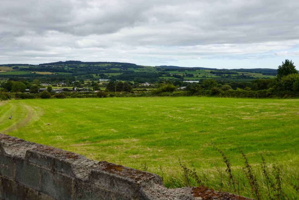
After about 10 km, we were on quieter arterial roads heading towards the Wicklow Mountain National Park, Irelands largest national park covering 23,000 hectares.
The area we went through was Djouce and Tonduff on the eastern flank.
We stopped at a local convenience store and grabbed some food, as were were both hungry. The map on the outside of the local park section. We had just been through Killegar Woods, and Knocksink Woods were next.
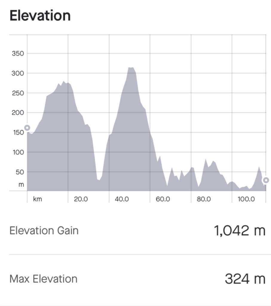
The area was hilly. The graph below shows our bigger climbs. The first was getting out of Dublin from sea level. The second was ahead through the Wicklow NP.
When we climb, our bike computer has a graph for each climb, showing where you are, what the gradient is currently, what the gradient is ahead, and each gradient section is colour coded. This climb had a red section, ie steep steep steep.
The view on the red section looking westThe view looking eastEast West
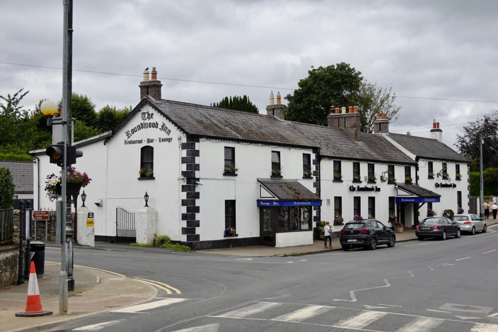
Looking towards Roundwood, where we stopped at the chemist to grab more toothpaste, and Panadol for Tony.
The pub in Roundwood
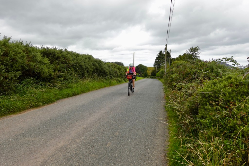
Riding through forests was to be a feature for the rest of the ride. Lush, green, stone walls edging.
Most of these were taken by Tony as he rode. Without slowing significantly, he opens up his front bag, gets the camera out, takes the photos, puts the camera back. I watch from behind knowing I would end up on the ground if I tried that.
Rathdrum situated high on the western side of the Avonmore River valley, flowing through the Vale of Clara.
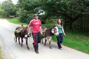
A local business promoted in the area is “donkey walking” where you travel from village to village at a donkey’s pace and overnight in local accommodation. The donkey can carry 15 kilos and cover 10-15 km per day.
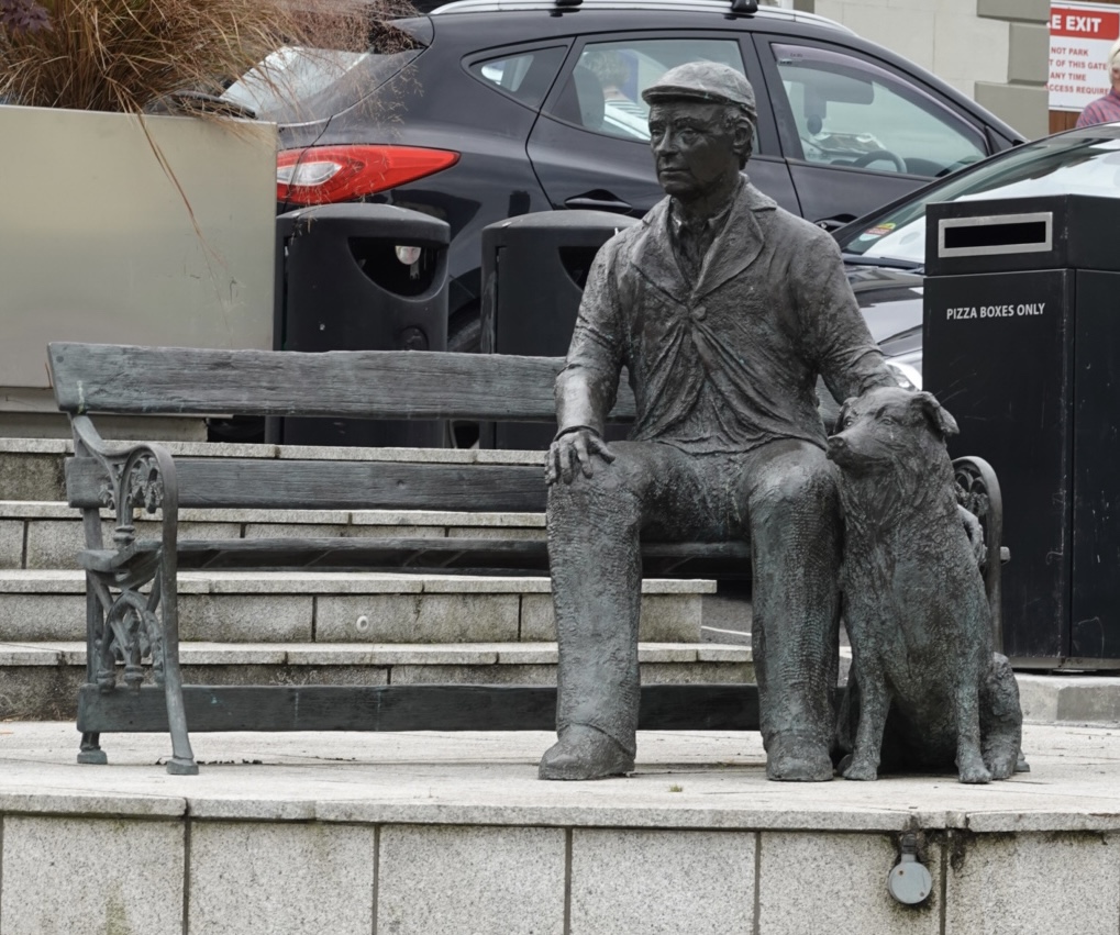
We did not see the donkeys today, but saw this statue. Named the Farmer and his dog. It was placed as part of a town rejuvenation project in 2019.
The Vale of Avoca was very pleasant to ride through, as it was predominantly downhill, following the River Avoca. The area is known for its woven products, with many smaller mills and local producers having signs out.
River Avoca
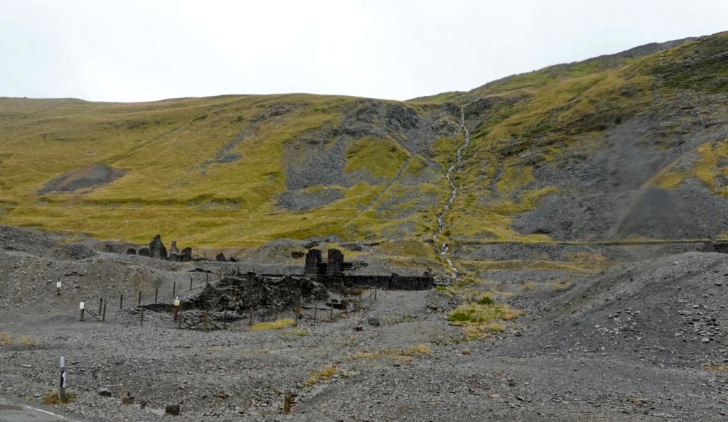
Looking up the hill from the river, is this old mine installation, known as Williams Engine House, one of the few remaining in Ireland. Mining was huge here in the 1800’s predominantly copper and pyrite.
Williams engine house
These are both newer churches, from the 1800’s, one in better knick than the other.
The final major town today was Woodenbridge, where I originally had us staying. It has a stone bridge known as the “wooden bridge” – only in Ireland!
Arklow was today’s final destination and we are now on the southeast coast of Ireland. The town was founded by the Vikings in the ninth century. The town is at the mouth of the River Avoca, the longest river within County Wicklow.
We were really pleased to arrive at our accomodation. Super friendly lady stored one bike in a locked area but she was apologetic for the junk in there leaving no room for the second.
She would find another area to lock the second bike. I casually suggested perhaps we could take it to our room? (That always tests the accomodation providers and you get a very clear no if unacceptable to them).
She said, oh yes you can, but won’t it be in your way? We are like…..nope ! So we have one bike with us. That means we can get it set up before breakfast at 7.15.
We had a great meal in their restaurant. Fish and vegetables for me, beef, sweet potatoes chips and vegetables Tony.
So that’s a wrap for today. Total km less at 81 for the day with just over 800 metres of climbing.
Tomorrow is about 113 km, 900 metres of climbing ( I think?) and we are heading to Waterford. A bit of rain is possible, but we will see.
We said farewell to Sue and Alan this morning. We had a lovely time and thankful for the friendship. 😊❣️
Leaving Sue and Alan’s house
Todays ride was excellent. The scenery was amazing, the weather was good, and despite fairly solid and consistent traffic on the A5, on the whole, the drivers were patient.
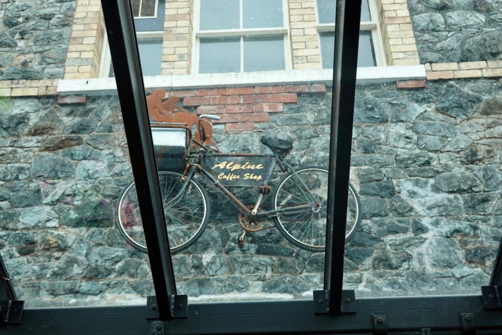
Sue and Alan had recommended a coffee stop in Betws y Coed, a popular town to visit within Snowdonia, a centre for outdoor activities within Gwydyr Forest.
Over the road from the town sign, Tony checking maps to THE coffee shop
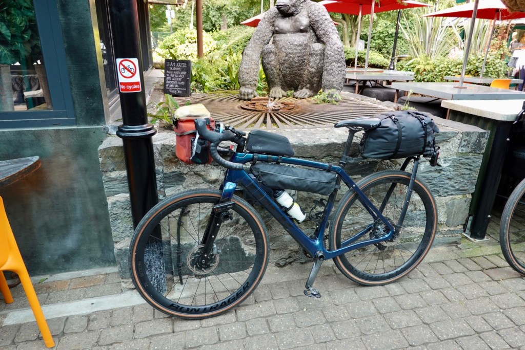
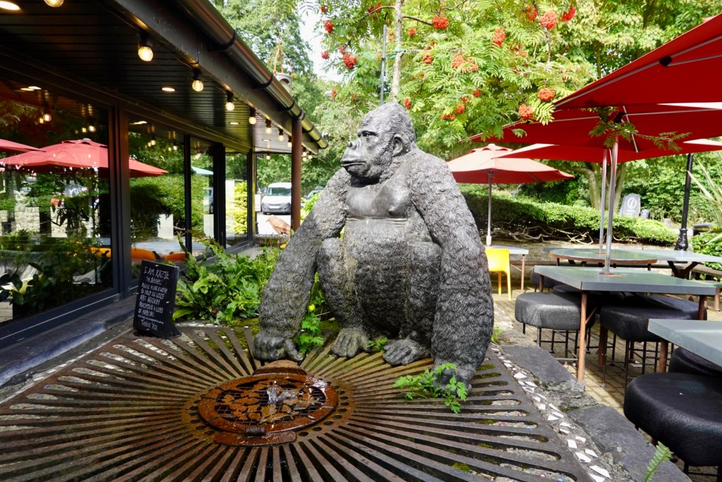
We found it! The Alpine coffee shop, complete with a bike on the glass roof, and an orangutan.
The No Bikes signs were everywhere.
Inside the coffee shop they have items to sell raising funds for the preservation of endangered orangutans. This is a cause dear to my heart, as for a number of years I was the Tasmanian Coordinator for the Australian Orangutang Project, aiming to raise awareness and funds to assist stop these intelligent and beautiful animals becoming extinct.
How can you help? Do not buy products with palm oil (unless certified sustainable), donate or sponsor an orphaned orangutan, and learn more about their plight. Australian Orangutan Project
I threw some pounds into the wishing well ❣️
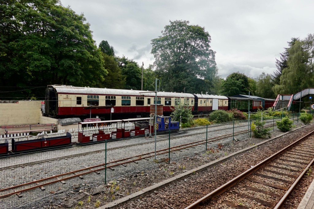
Behind the cafe are old railway carriages, and station platform.
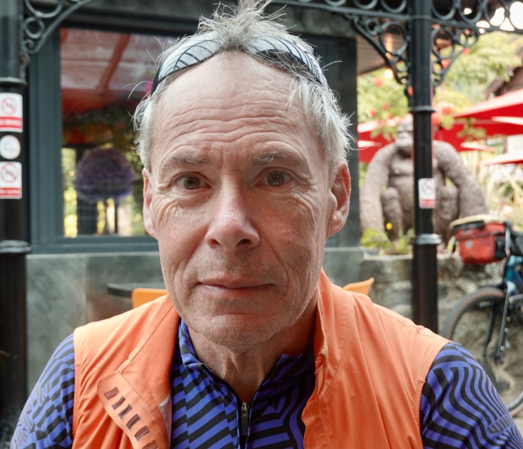
Tony looking suitably impressed
Next door to the Alpine Cafe is another cafe, with this sign. We did laugh.
Leaving town we passed by this church. A relatively young church built in 1870, replacing the former 14th century church.
Heading out of town we climbed from about 28 km to 50 km. It was very doable and easier than the graph looks.
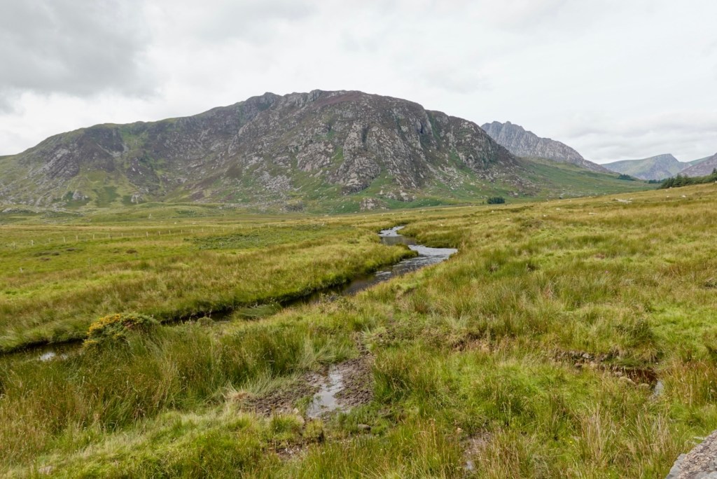
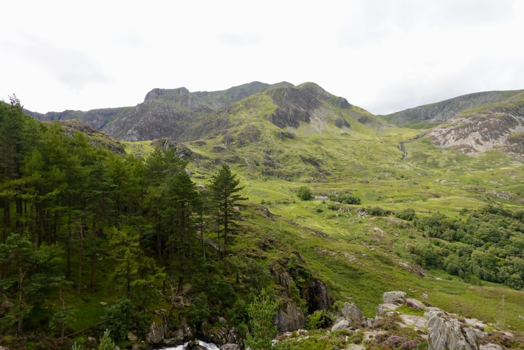
We were riding along the A5 between two our twin ranges of Snowdonia, the Carneddau and the Glyderau.
It was spectacular, and the photos do not show how high they really are. It was awesome riding this region. Lots of ‘wows’.
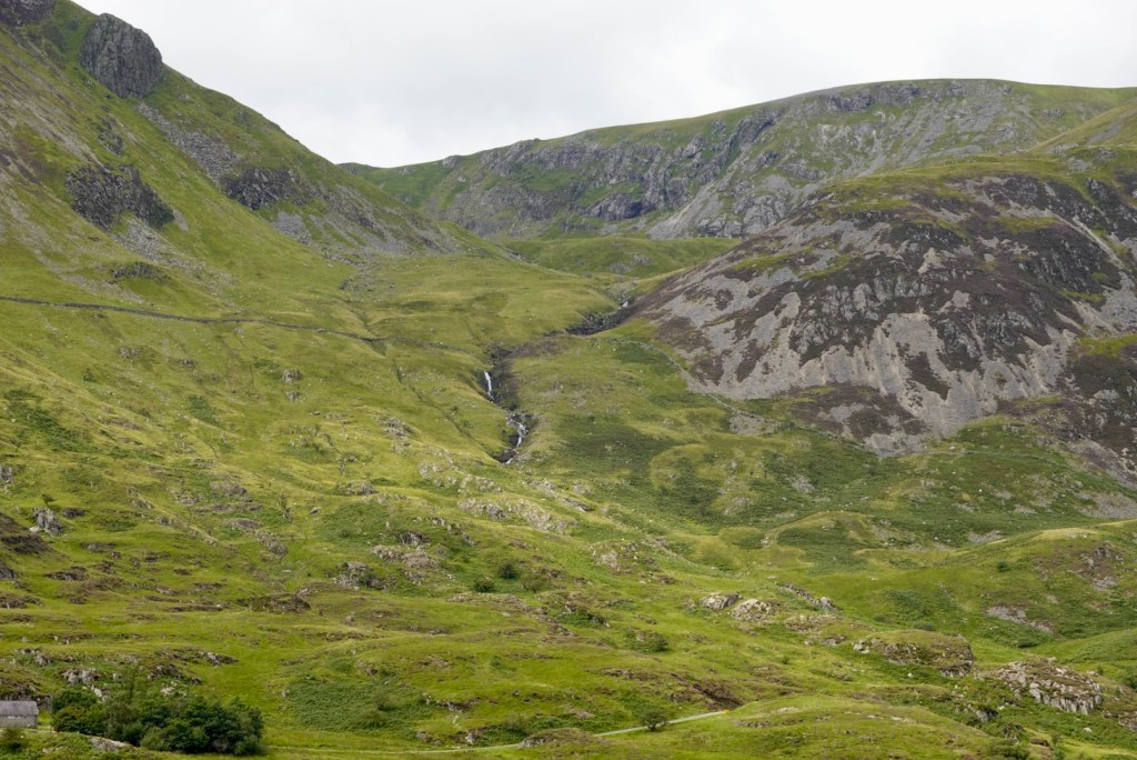
A string of photos as we progressed along the road.
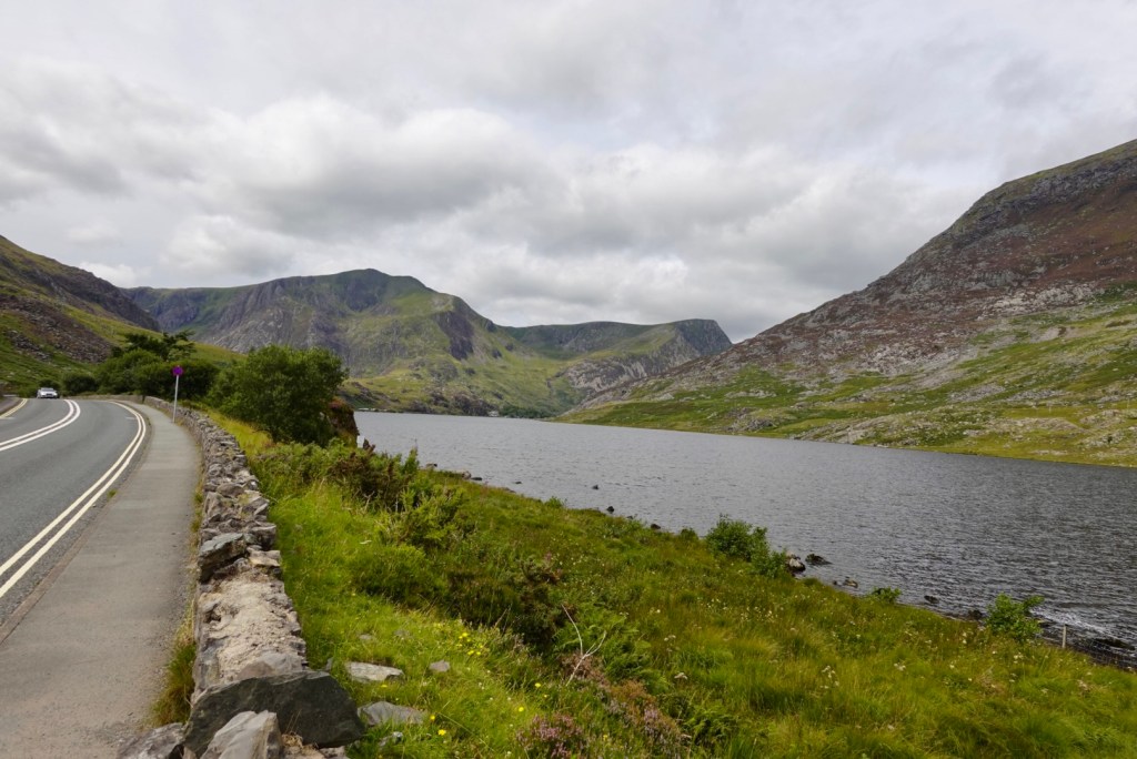
A lake approached. Llyn Ogwen lies at a height of 310 masl, and has an area of 78 acres. It is very shallow with a maximum depth of 3 metres.
Of far greater interest though, it is claimed that after King Arthur’s final battle (Battle of Camlann), Sir Bedivere cast the sword Excalibur into this lake, where it was caught by The Lady of the Lake.
One of the Zwift clubs has referred to me on many occasions as The Lady of the Lake, when we are having a Monty Python banter fest, so riding by this lake did give me a laugh and giggle.
Click to view a video of the lake area.
Before we descended we pulled off the road as we crossed a bridge to have a look.
Looking back up the mountains you can see old stone fences.
I particularly liked this one looking down the valley.
Over the road walking trail signs pointed the way.
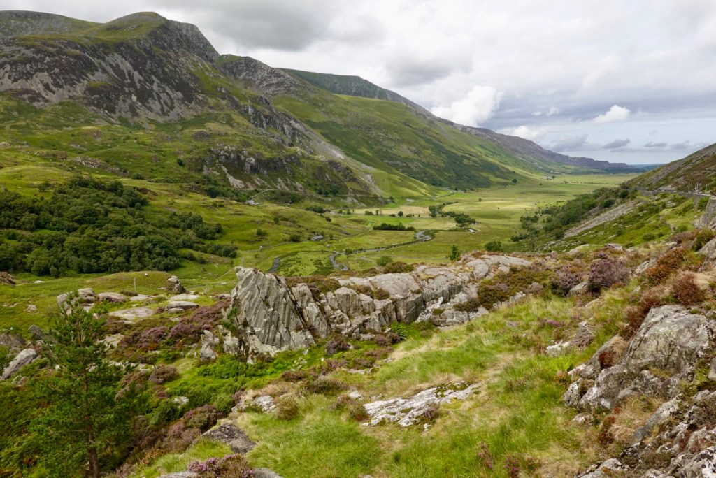
Descending and looking back
note all the stone fences
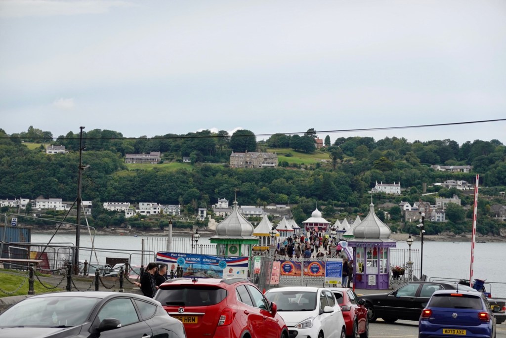
Having left the mountains we arrived back on the coast at Bangor at the Menai Strait. The jetty was super busy.
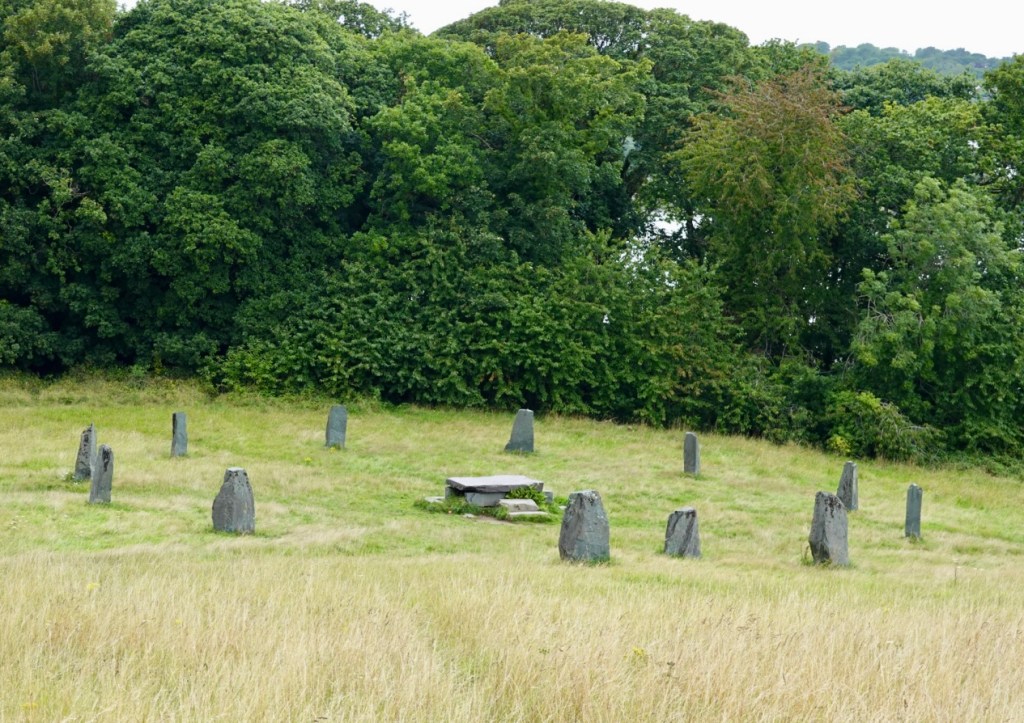
Although there was no interpretive panel, these stones and sacrificial slab are not ancient ruins. I think these are Gorsedd stones, which form an integral part of Druidic Gorsedd ceremonies.
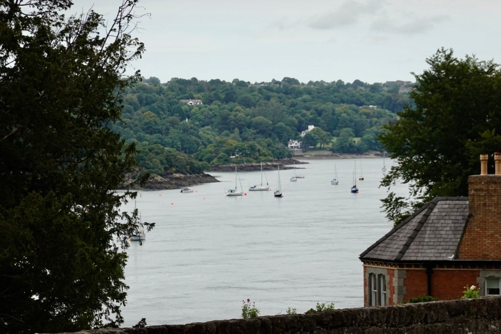
There were pleasant views across the Menai Strait to the island of Anglesey.
The Menai Bridge was built by Thomas Telford in 1826….I mentioned him yesterday re the aqueducts we visited. He was a super busy man! We crossed this bridge to Anglesey.
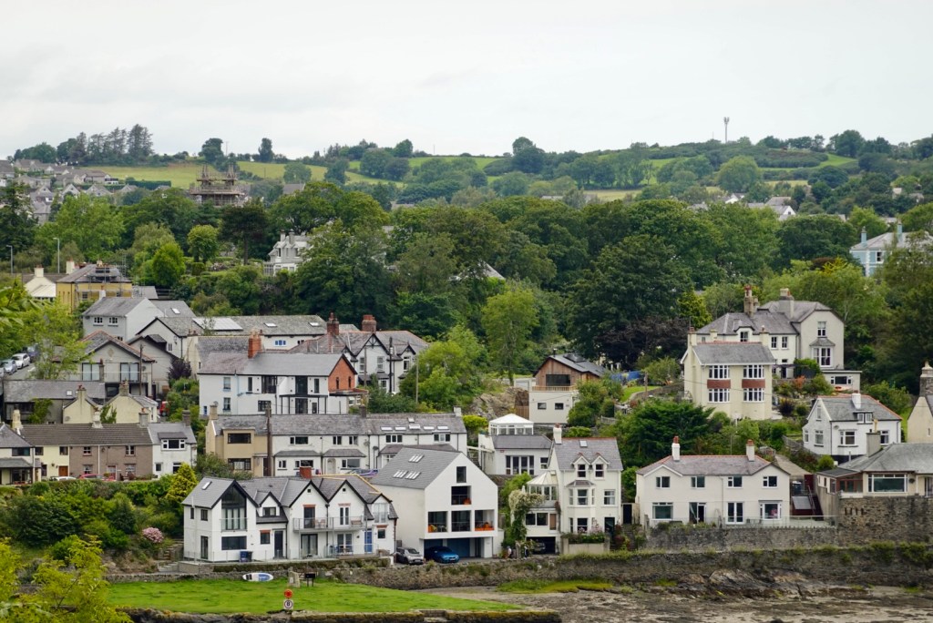
Looking back towards the Menai Bridge.
Looking forwards towards the second crossing, the Britannia Bridge.
Nice views and forests.
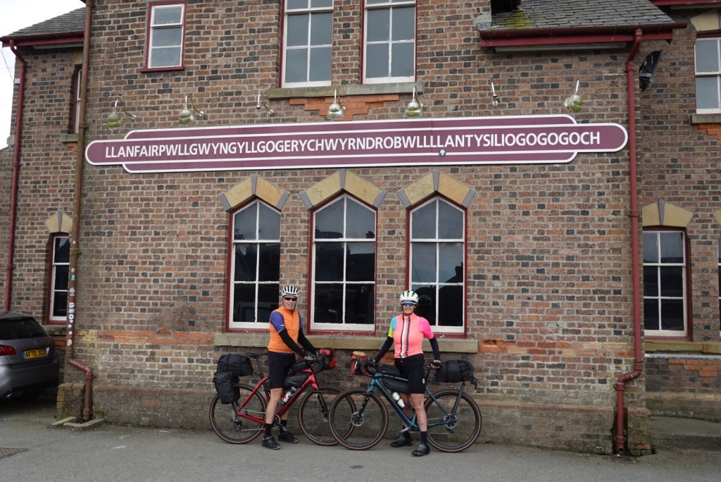
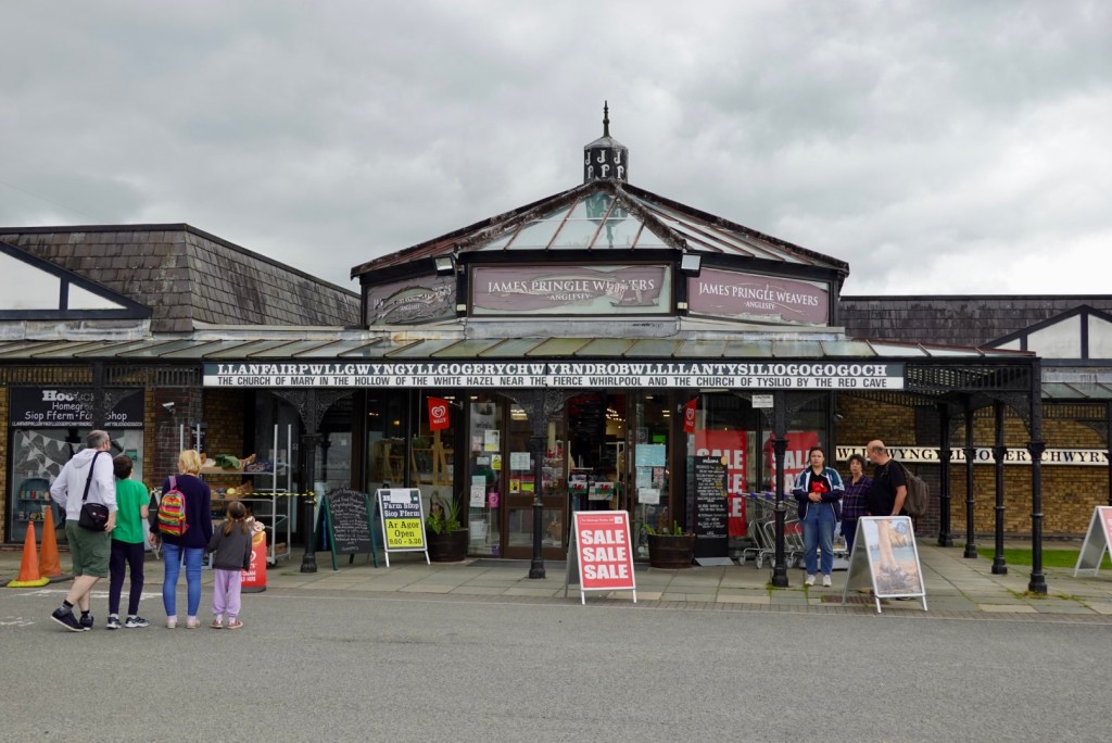
Then we arrive at the town with the unpronounceable name! That is the shortened version.
In full, knock yourself out!
The tourist hub has what it means.
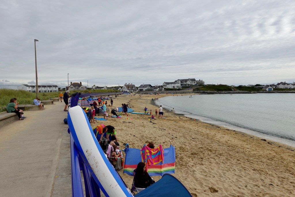
The next point of interest was on Holy Island reached by bridge crossing the Cymyran Strait. Trearddur Bay was busy with bathers and families on the beach. I checked the weather gauge. It was 17C.
The toilets had a recharge station for e-bikes.
We were now only 5 km from our accomodation so we moved on.
The end of the last climb.
We are now in Holyhead. Another solid day, 117 km and over 1000 m climbing…again!
We ate our breakfast for dinner. Tony has a pinched nerve in his neck/shoulder area so hopefully that might abate overnight.
The weather was cool and blowing a gale when we awoke. We had beautiful harbour views and amazing long, bay windows to enjoy the view.
I can recommend the Glenrowan Hotel for cyclists. We had cleaned our filthy bikes up before checking in, and they allowed the bikes in our room. The bathroom was huge and could easily hold multiple bikes without issue.
We had a big bowl of porridge and fruit for breakfast and headed off. We were surprised just how cool and breezy it was.
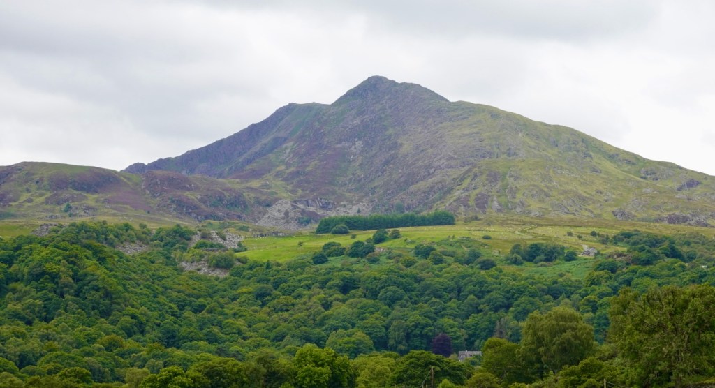
After a flat one km or so, we entered a nasty one km steep climb up last the Aberystwyth University. With cold legs, lungs and a racing heart, the body did protest greatly, so I walked the second half.
The ride levelled out with ups and downs, and the first of the rain showers hit us. So we stopped in a lay by and popped our booties on.
You can guarantee when you do that, it will stop raining. Looking forward, the rain stopped!
Looking north, it flattened along the coast, and this picture is looking towards Aberdovey, at the mouth of the Dovey river.
We had noticed signs re an osprey project, then saw this metal art work, and stopped to look at it.
Whilst there we got chatting to Shaun and Jason, who were from Cardiff and off on a day trip to the Snowdonia’s.
We headed back in the road in the search for coffee, hoping the town of Machynnlleth would have something open on a Sunday morning.
Machynlleth is a market town in the Dyfi Valley, and the seat of Owain Glyndwr’s Welsh Parliament in 1404, thereby claiming to be the ancient capital of Wales. Owain was the last native born Welshman to hold the title Prince of Wales.
There was a pub open, and we were able to grab a coffee, sitting outside pondering whether to out the rain jacket back on.
I reckon the rain jackets were on/ off 25-30 times today. Put them on, rains, climb a hill, get too hot, take them off. Repeat.
This is a stolen photo showing the town clock, which was significant covered by scaffolding due to refurbishment works. It looked to be the nicest structure in town.
We headed off onto quieter rural roads and crossed this bridge, smiling at the life buoy. It was quite shallow, but fast flowing. I am sure older kids who can swim competently would have some fun here.
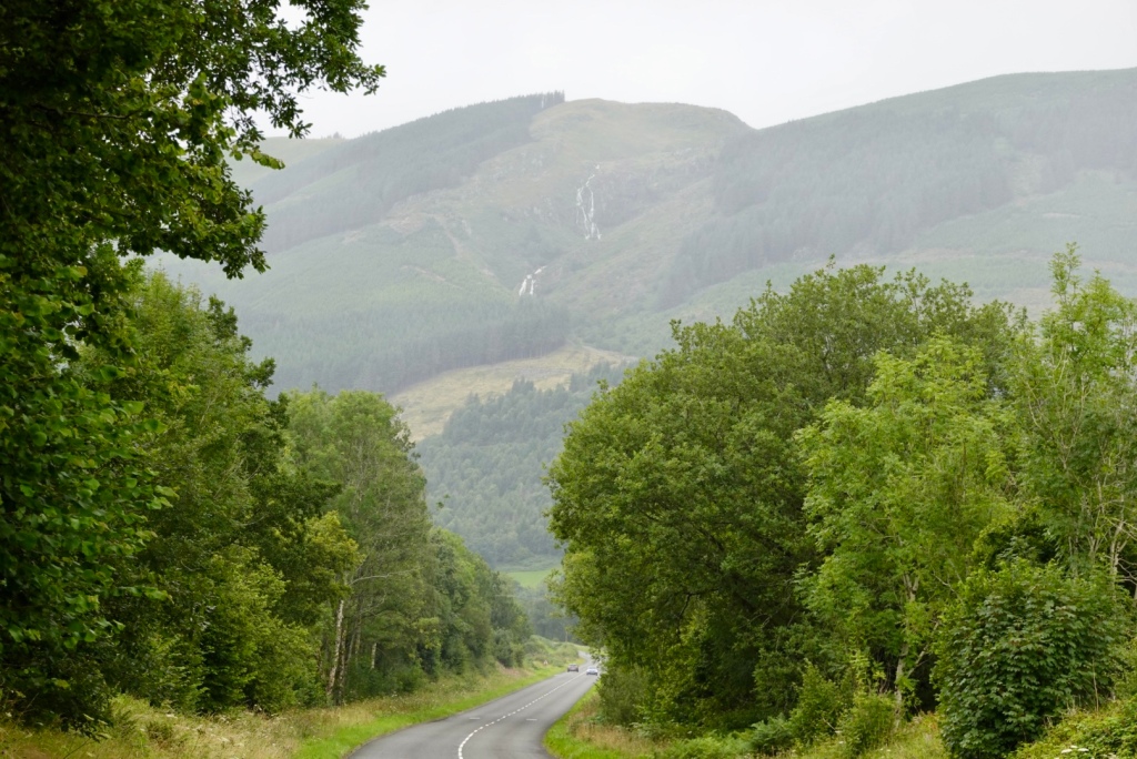
This section of the ride was very pleasant, passing through Llanwrin, Mathafam, Cemmaes Road, Cemmaes, Aberangell and Mailwyd.
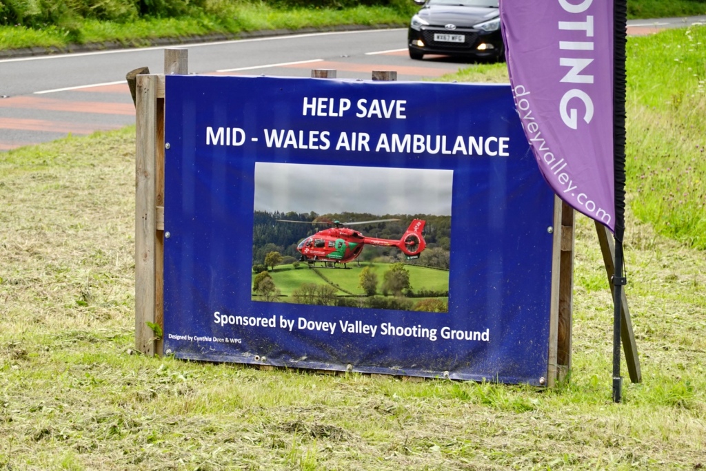
It was a fairly quiet road, except around the shooting range. It seemed very active in the range, with the sound of gunshot echoing around.
It was good that they sponsor the Air Ambulance.
The hardest task of the day way just ahead. We knew it was a tough one. It started to rain again, and we could see waterfalls high in the hills.
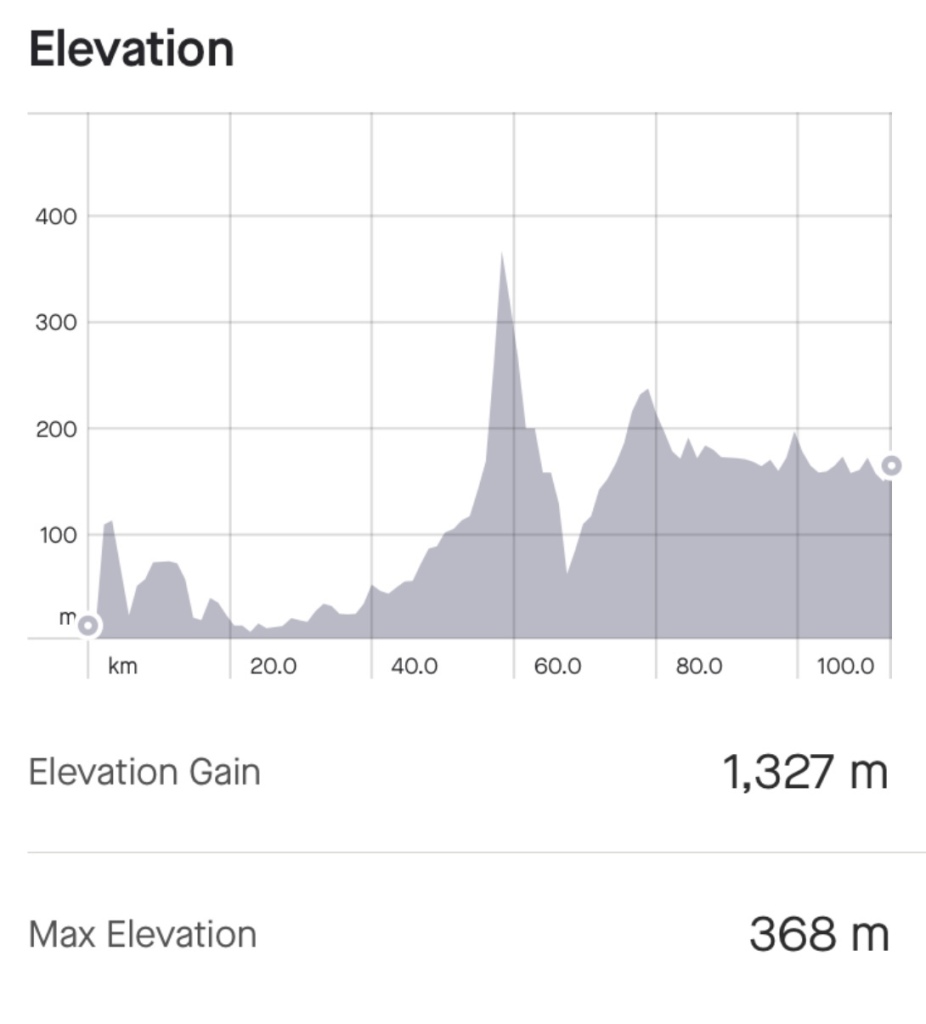
This is our climbing graph for the day. You can see that we had gradually climbed from about the 20 km mark to 47 km. Then there is that brute of a chapel spire.
We did not find out until later that this hill had a name, Bwlch Y Groes…or Hellfire Pass.
On the upside, it did offer brilliant views of the surrounding Welsh countryside of the Aran mountains. On the flipside, it was a seriously difficult and brutal climb on a loaded bike.
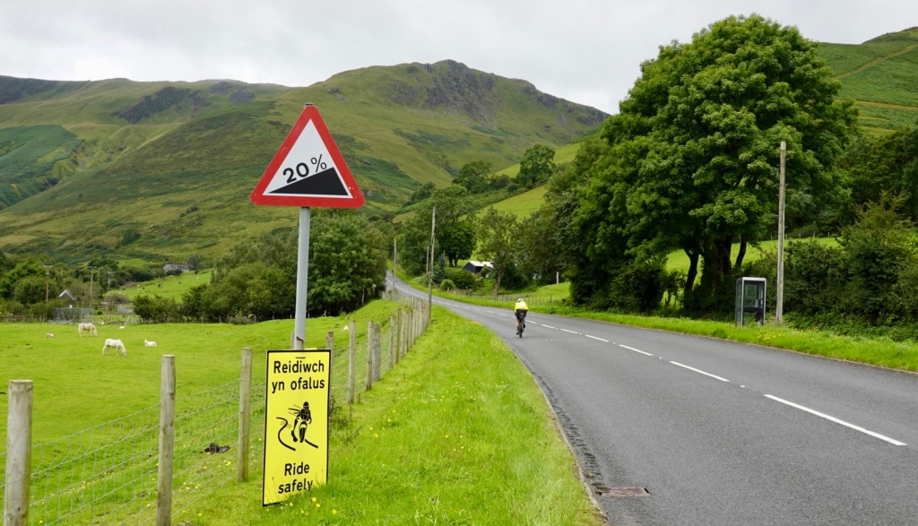
The road is sealed, but narrow with no verge. It hits a maximum of 25% through some of the ramps. It is regarded as one of the steepest, toughest and most spectacular climbs in the country and regarded as a truly definitive climb.
It was used between and after the wars by the Austin Motor Company and the Standard Triumph Motor Company to test prototype cars and their performance during hill climbing.
Heading up here was the first warning sign and there is me peddling along to start the serious stuff some few hundred metres ahead.
Well I lasted 300 metres or so, and got off the bike. There were a few issues.
I need space climbing so I can weave a little. With the heavy flow of traffic this was impossible.
Then there was the headwind, it was fierce.
The cars back up on a climb with no verge, and with lots of cars also descending you can frustrate drivers ( mind you, the Welsh drivers have been friendly and fantastic). You stop to let them pass, but climbing is super hard to start again on a slope once stopped.
With an imminent total knee replacement now scheduled, recovering open heart surgery and let’s face it, I did not have the strength nor skill to ride up this. I made the safe decision and walked.
Taking the next few photos was super hard. Holding the bike on the slope, in the wind, without it falling over took all my strength. Pushing the bike up is also very hard.
I swung back to snap this one of Tony. He lasted about another 20 metres. You can see the lack of space on the road.
I did get back on the bike for a few short sections but walked the majority. A camper van stopped and asked if I would like a lift. I immediately said “yes” but then changed my mind as I knew I’d be disappointed to not do this under my own steam.
At the top looking back down the valley you can see the road to the left.
The top
Once at the top Tony took a video he later put onto social media. Near the end of the video there was a toot from two motor cyclists. Amazingly it was Shaun and Jason whom we had met earlier in the day.
Descending was pleasant. We liked these old stone walls.
The views opened up, and we looked forward to Cross Foxes, a pub located at a busy road junction part way through the descent.
Boom, and here we are. We got a table outside, and do you note something? It is sunny!! It had been slow progress to this point and we felt we would be getting to Corwen at dinner time!
The post lunch ride was totally different. It was downhill for a while, then a series of uphills, and then undulating for the rest of the ride. We made up some time as we were able to ride at a faster pace.
Some of the views.
This is Lake Bala. To the left, there are people swimming in the lake. there was a campground full of campers.
Bala Lake was the largest natural body of water in Wales before its level was raised to provide water for the Ellesmere Canal. It lies between the Aran and Arenig mountains at the fringes of Snowdonia National Park.
Getting closer to,our destination we enjoyed this forest.
Stopping to photograph this bridge, that we then rode over.
Looking down towards Corwen, we were ready to finish.
Nearly there!
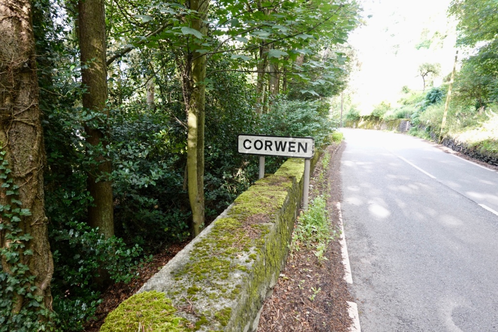
Corwen stands on the banks of the River Dee beneath the Berwyn mountains. There is a man standing in the river fishing.
After 114 km and 1327 m climbing, we arrived at the home of Alan and Sue. We have not seen them since they visited Australia around 2015. We had ridden Lands End to John O’Groats with Alan in 2013.
I did not write the blog last night as we chatted. Instead I got up before 5 am, whilst the house sleeps, to do the blog. It is now 7.15 am, and the house is still quiet.
We have our first and only scheduled rest day today. The day is looking beautiful.
Following on from last nights Storm Antoni warning, we were in a conundrum as to what to do. Safety is paramount.
Options included getting the train to Shrewsbury, staying there, or getting a second train to Aberystwyth from Shrewsbury.
Our friend Graeme rang us with his thoughts and he suggested a taxi to Rhayader and riding from there.
We went down to breakfast at 7.30 am still unsure. There was a lady cyclist from Germany there pouring over train time tables. We chatted and she was also unsure as to what to do.
The guy in the corner said it was going to hail today. I jokingly told him we did not need that kind of negativity, laughing. He laughed and said it was a typical Welsh summer.
The owners of the accomodation said the only taxi was a sedan.
We has a very yummy breakfast and went outside and looked around. We rechecked the rain radar, wind forecasts and thought we would just go for it. Whilst it was likely to be wet, for the majority the wind would not be an issue.
Heading out of Builth Wells past the random cow, we followed the river. Park Run was setting up for the diehards.
The first two km was pleasant following a bike path adjacent to the river. Then the climbs started.
Down one hill and looking up to the next short climbWe were predominantly in an agricultural area except for this church.
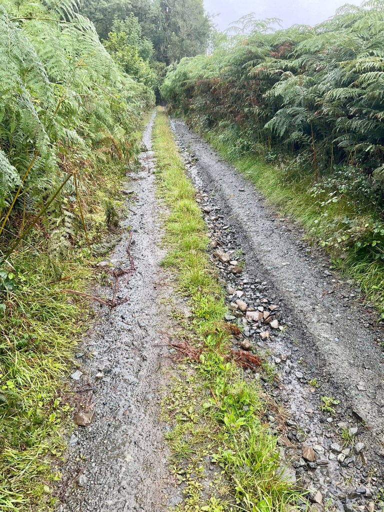
When Graeme suggested we bypass the first part of todays ride it was partly because of this ‘cycle path’ being unsealed, and of course, the recent rain, that was continuing to fall.
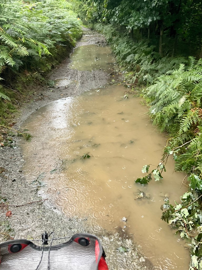
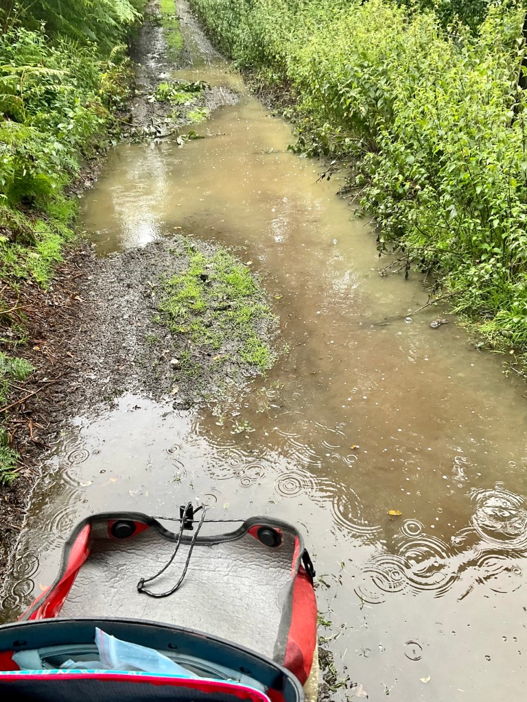
When we started, it looked like this. Ok, we could cope with that. But then it went into a 2 km climb and the puddles dominated.
It is hard to tell how deep the puddles are, unless Tony is ahead of you 🤣🙈 but then he coped better than me, and pulled clear.
I really thought I would end up on my side, soaked. However, proud to say I got through this 5 km quagmire unscathed, bar my filthy legs and bike.
Tony managed to snap me going through one. There was one super deep puddle. The water went up to my ankles as I peddled through.
There were pleasant views, and this looked like a pretty fancy home.
We popped out at this village, and I did not write down the name. From the signpost, it appears to have many walks in the area.
Tony managed to be considerably cleaner than me on his legs. He grabbed his drink bottle and squirted water over our disc brakes to clean them.
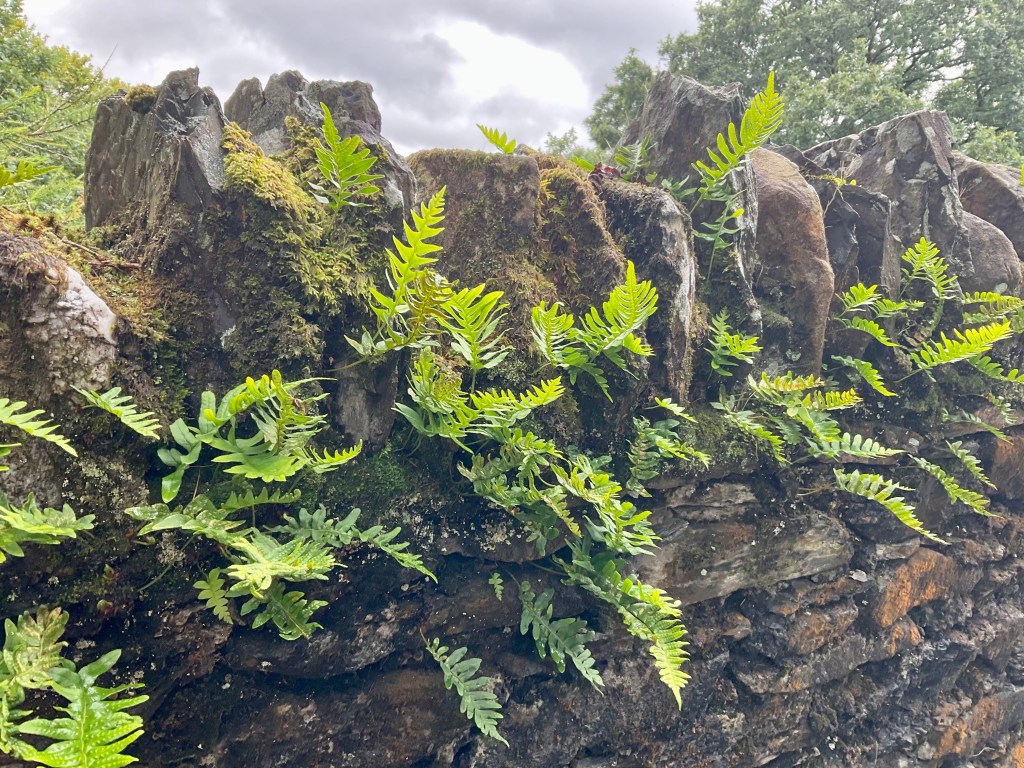
On the next sets of climbs, we were on sealed single track, with the occasional house or farm. I really liked the ferns on the stone wall.
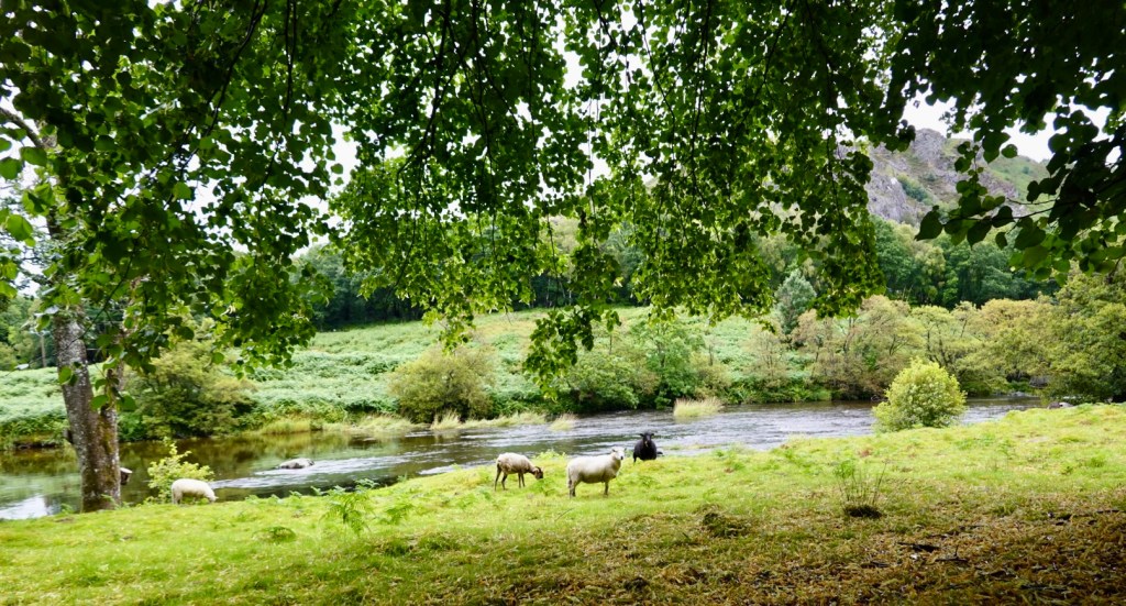
We stopped here, as we thought this was a very pleasant sight by the river, with sheep grazing. Sheep seem to freely roam these parts.
Another flash home.
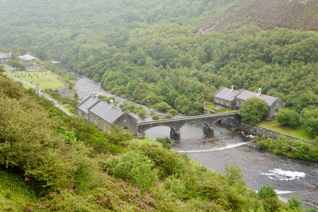
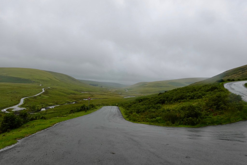
We turned right to ride through the Elan valley. We arrived at the Elan Village looking for a toilet and food, as we thought the visitor centre looked closed as we rode past.
I went up to the Elan Valley Lodge to see if we could purchase a drink. I was told “No, this is a private lodge”.
The village and reservoirs were designed by the architect Herbert Tudor Buckland as part of the scheme, and the village is the only purpose built model village in Wales.
Call me ignorant, but the village seemed to me to be a string of building all in a row. Maybe I missed something.
Heading back out across the river, there are these old bridges.
The Elan River, looking south from the bridge
As we rode past the visitor centre, the buildings we presumed to be closed, were in fact, not in use. We needed to ride a farther 300 metres or so past the entrance. We found our food and coffee!
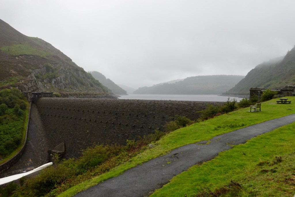
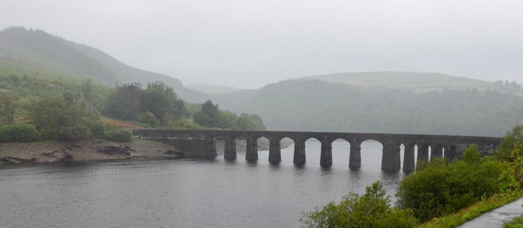
The Elan Valley contains four dams along the Elan River.
It is also famous for its picturesque scenery. Over 80% of the valley is designated as Sites of Special Scientific Interest, and a popular cycle trail, the Elan Valley Trail, makes a loop from Rhayader around the reservoirs.
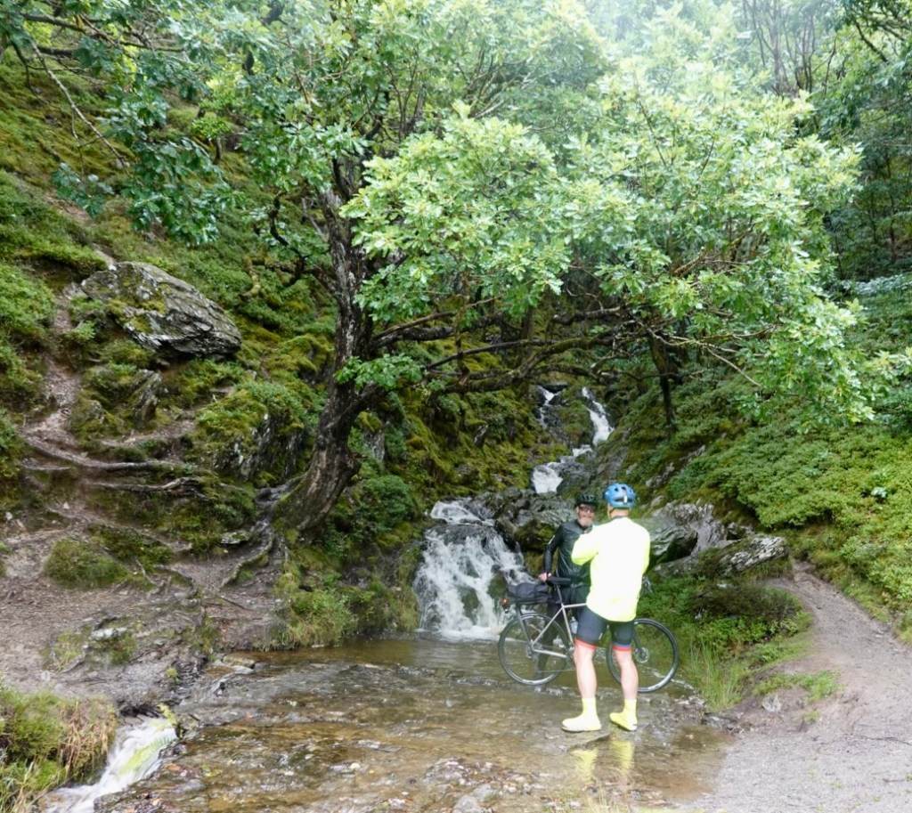
In between dams we were passed by these two cyclists. We did laugh at how keen one was for this photo, standing in the water with his bike.
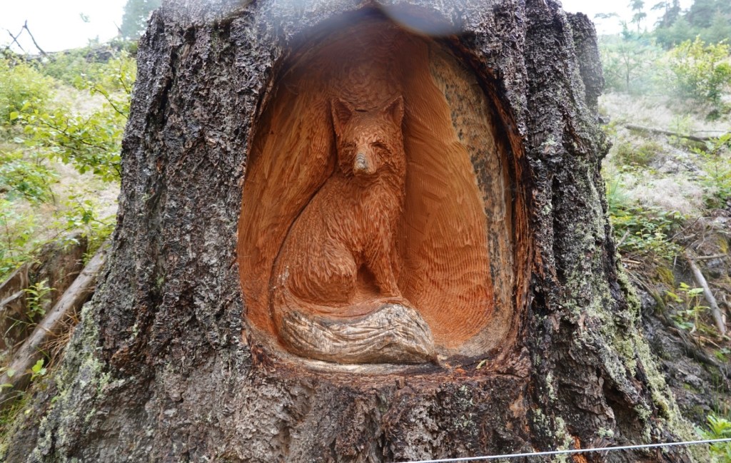
We noted many trees had been cut down. Carvings had been done on numerous.
Back to the dams….
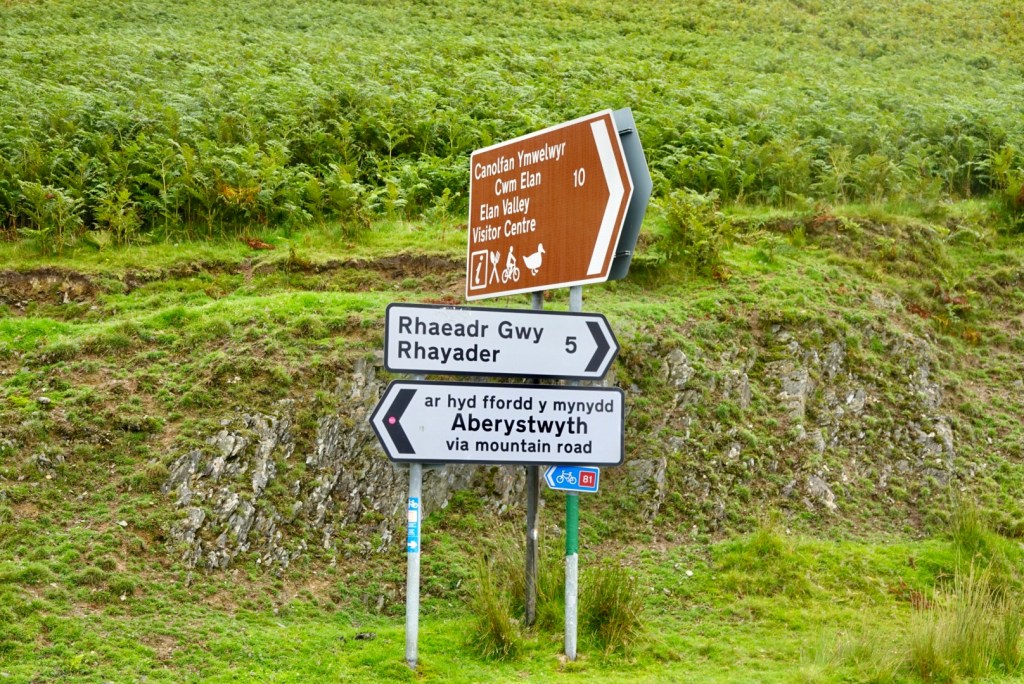
The dam is overflowing here, going under the lovely bridge.The road goes up, then up a bit more to the junction. You can see further down the valley.Eek, via mountain road …hmmm
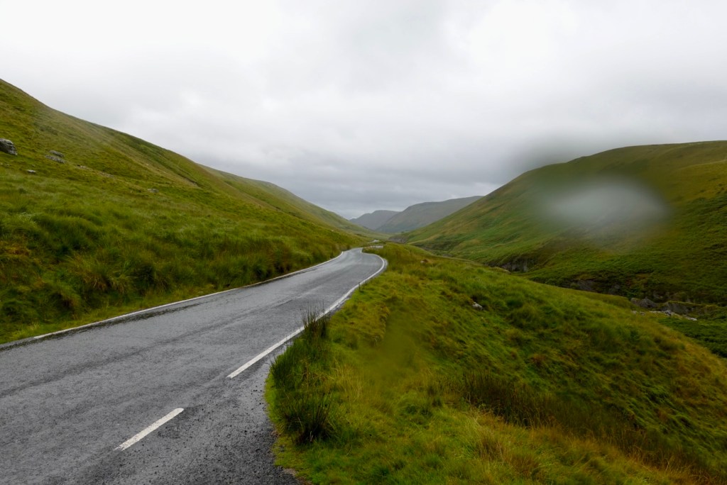
As it turned out the mountain must have been more hill like, but the views were outstanding here. The area reminded us very much of Scotland.
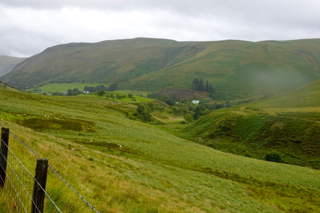
We descended down to that white dot of a house
This area was interesting, with many km of mining residue on both sides of the road. Lead mining used to be very prevalent in the region. Piles of waste are dumped everywhere. Old buildings are all destroyed, looking like there had been fires within?
Oh here I am again, climbing, with Tony waiting. Today there were six climbs that had pinches over 20%. Tony rode each of them. I walked those pinches! No way can I do 20% even without gear on my bike.
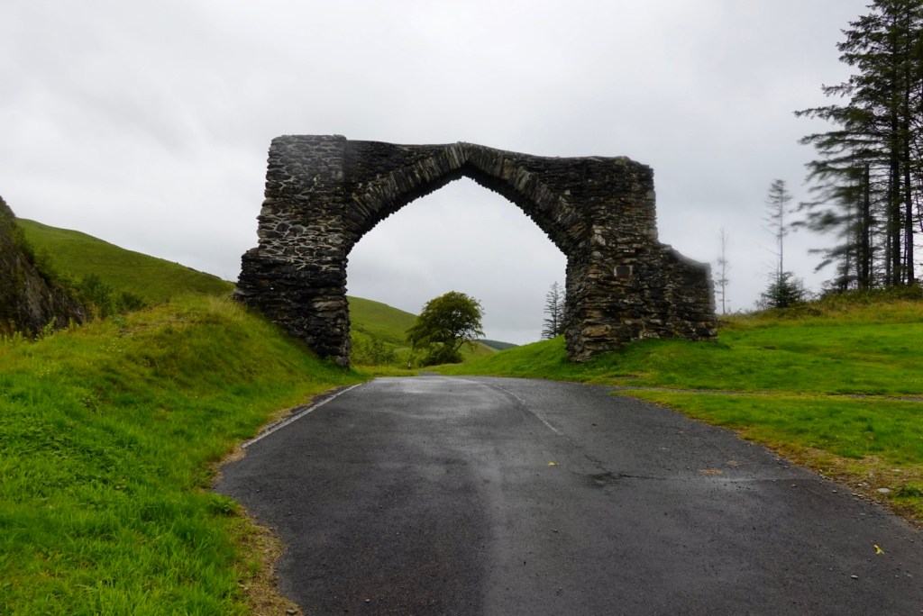
At the top of this climb was “the arch” a former gateway to a local estate. But marking the start/finish of the Elan Valley
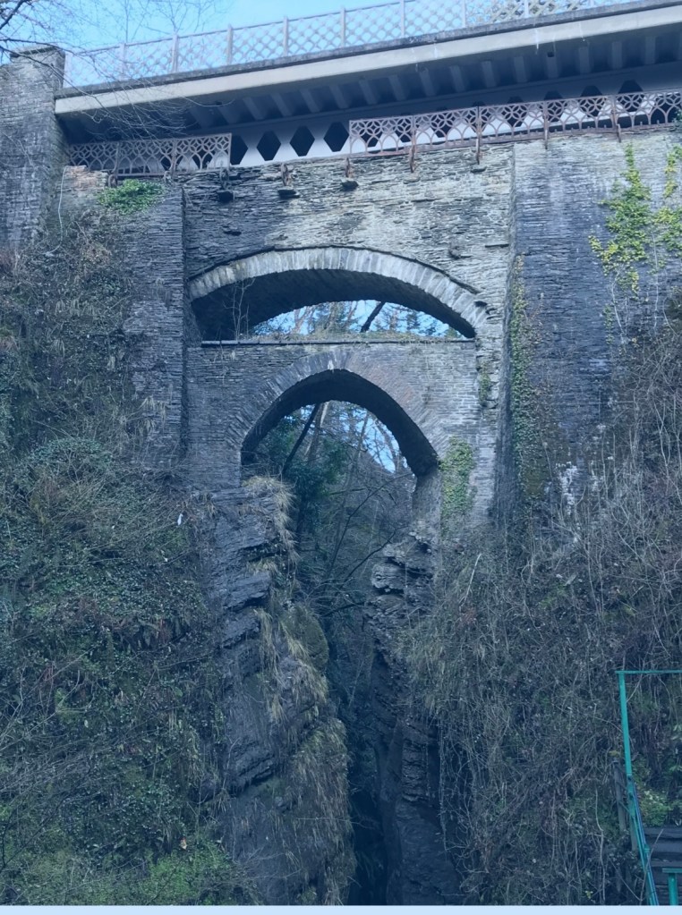
Next stop was Devils Bridge – unique in that there are three separate bridges, each one built upon the previous bridge. The most recent was an iron bridge erected above the older arches in 1901. The original bridge is medieval and the second was built in 1753.
The name Devils Bridge was named reportedly after an old woman lost her cow and saw it grazing on the other side of the river. The Devil appeared and agreed to build a bridge in return for the soul of the first living thing to cross it. When the bridge was finished, the old woman threw a crust of bread over the river, which her dog crossed to retrieve, thus becoming the first living thing to cross it. The devil was left with only the soul of the dog.
Not taken today, I’ve stolen this one, but showing the three bridges.Standing on top of Devils Bridge, looking down, walkers head down to admire the bridge and river.
During the summer a narrow guage railway (The Vale of Rheidol) runs 19 km from Aberystwyth to Devils Bridge. The railway opened in 1902. Since 1989 it is operated and maintained by a charity group.
After all our climbing, we needed to get back to sea level. We did this on a cycle trail down this narrow road. The skies are lifting, and the rain has stopped.
It was super steep. My hands ached from squeezing the brakes so hard. There were pitches in excess of 25%.
On a steep descent section, we needed to give way to the train heading back to Aberystwyth.
There was about another 10 km before arriving in Aberystwyth, and it was blowing a gale on the waterfront. It was a super strong headwind with gusts.
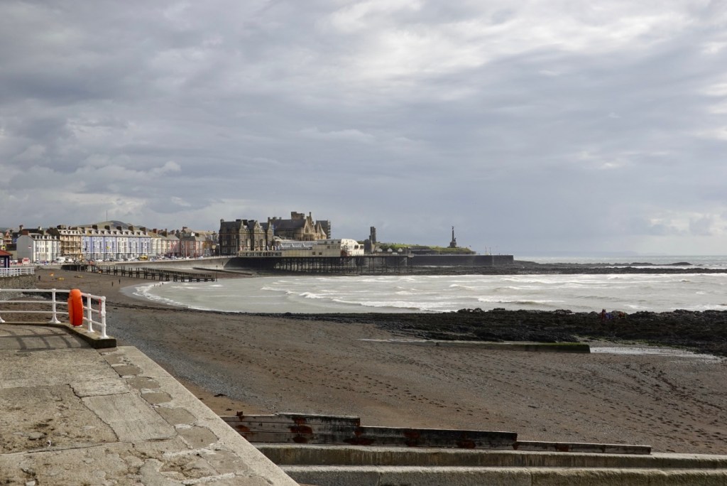
Aberystwyth, a university town, is situated on Cardigan Bay on the west coast of Wales. A long seafront with a pier stretches from Constitution Hill at the north end of the Promenade to the harbour at the south.
The beach is divided by the ruined Aberystwyth castle (1277) that was destroyed by Oliver Cromwell in 1649.
Part of the remains. Look at the angle of the tree limbs. It is super windy.What the castle looked like way back,when.
Our final stint was to head down the far end of the waterfront to the coloured buildings. Our accomodation is in one of those. The tide is low, with substantial exposed rock.
Nearly at our accomodation looking back towards the castle ruins
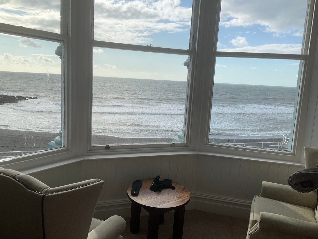
When we arrived at our accomodation, the sun came out. Of course!
The beach over the road from the hotel Waterfront sea view looking towards the Republic of Ireland, with the Irish Sea in between. We arrive in Ireland on Wednesday.
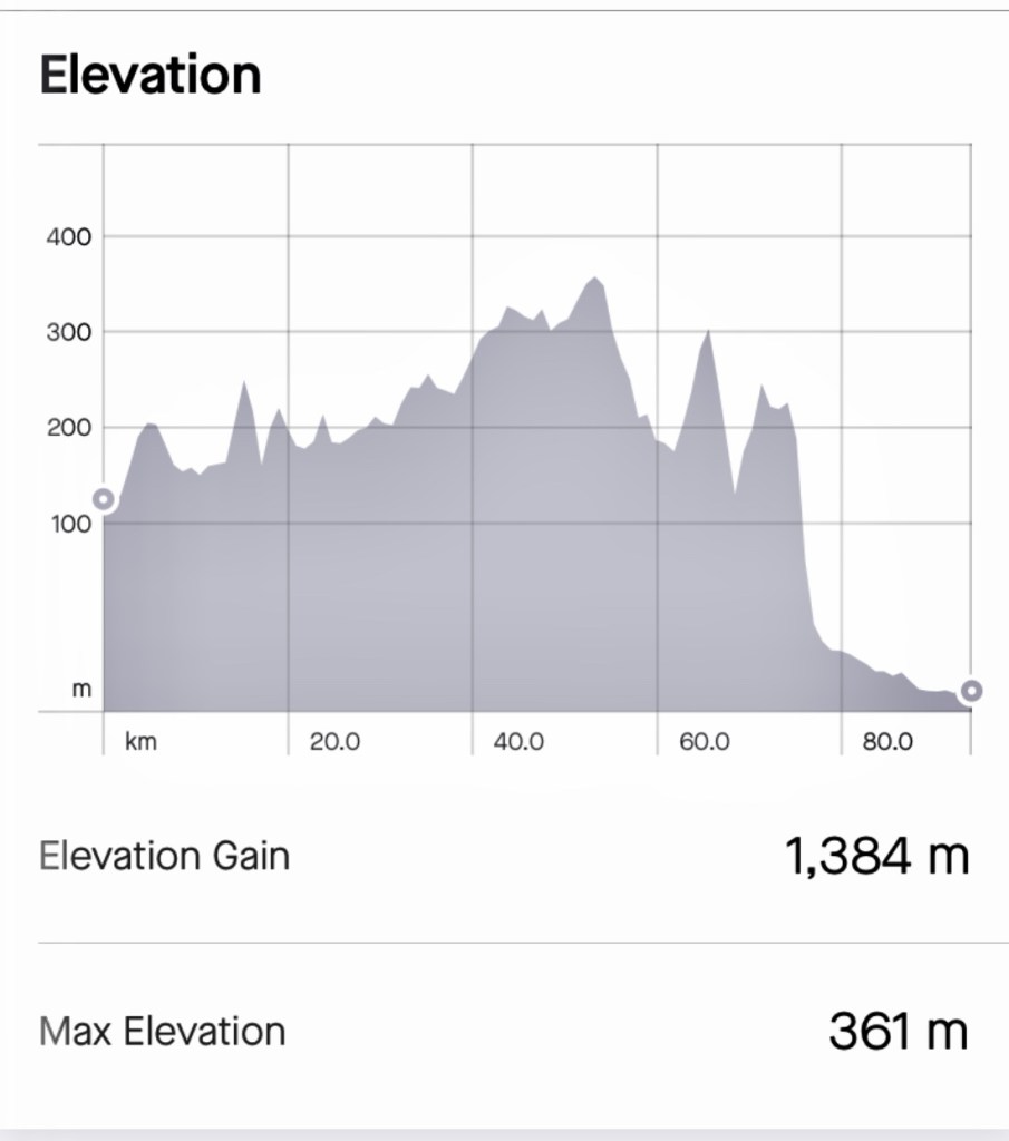
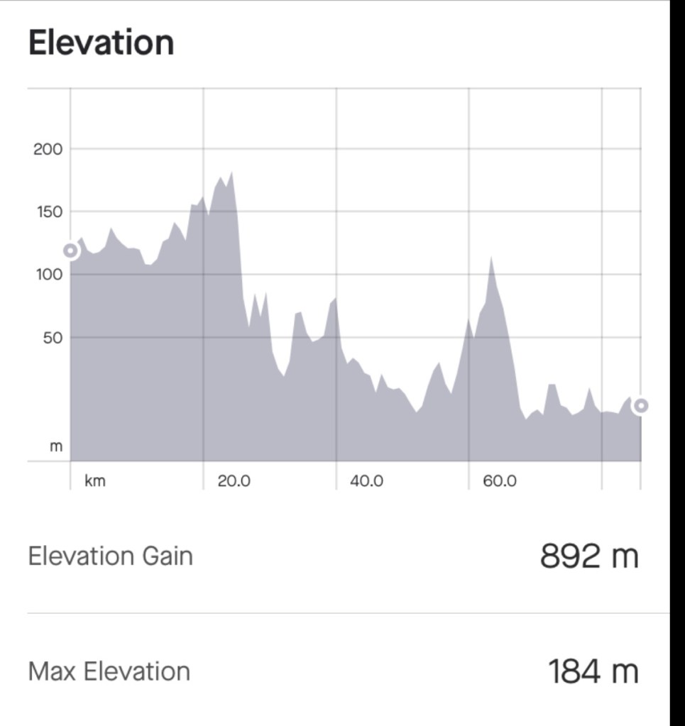
Today was tough (95 km and 1385m ascent). Yesterday was tough too. It rained today for about 90% of the ride. Just consistent mizzle and drizzle interspersed with some heavier showers.
We did get a bit cold there for a while thinking about warmer clothes in our bags. We could have stopped but did not fancy stripping off in the rain.
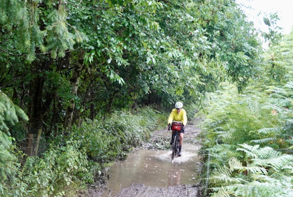
The challenges today were definitely the 5 km of dirt and mud. I found that super challenging.
We had six climbs with over 20% but got through them each in our own way.
The views scored highly!
Thanks to Graeme for this route. He did this with his daughter Matilda only a few weeks ago, also staying in this hotel. Great recommendation.
Tomorrow is another day. It is another biggie with 115 km planned and about 1500m climbing. I’m not even checking the weather tonight. I tend to wake by 5 am so I will do it then.
Thanks for reading, I’m going to get some shut eye now. 😊❣️
We were awake by 5.30 am, but breakfast was not until 8 am 🙈😳 The bikes were packed and ready to go and at 8 am we presented ourselves.
Whilst waiting for our order, a couple from Chicago turned up. We had spoken with them the previous day. They are walking the Thames Path to London and were starting today.
The lady busily chopped raw onion, added sliced pancetta, and sliced a 1 kg block of cheese, making bread rolls for the day. I did wonder how long the left over cheese and pancetta would last in her backpack en route to London.
I’m being a total sticky beak here, but somewhat bemused and curious re the cheese and meat, let alone carrying a large partial.lt cut onion in your back pack.
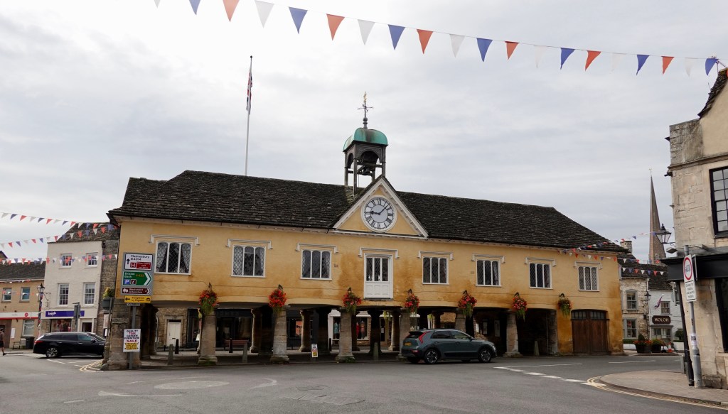
We were on the road by 8.35 and the first 12 km or so was on the very busy Bath Road. I was certainly pleased to reach Tetbury.
Tetbury is the village location of King Charles III private residence, Highgrove House, although legally, I think it is actually now owned by the new Prince of Wales via the Duchy of Cornwall.
The town has a history over 1300 years, since 681, when King Ethelred of Mercia gifted the land to an Abbott.
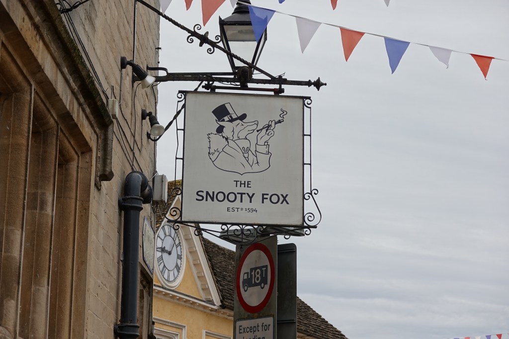
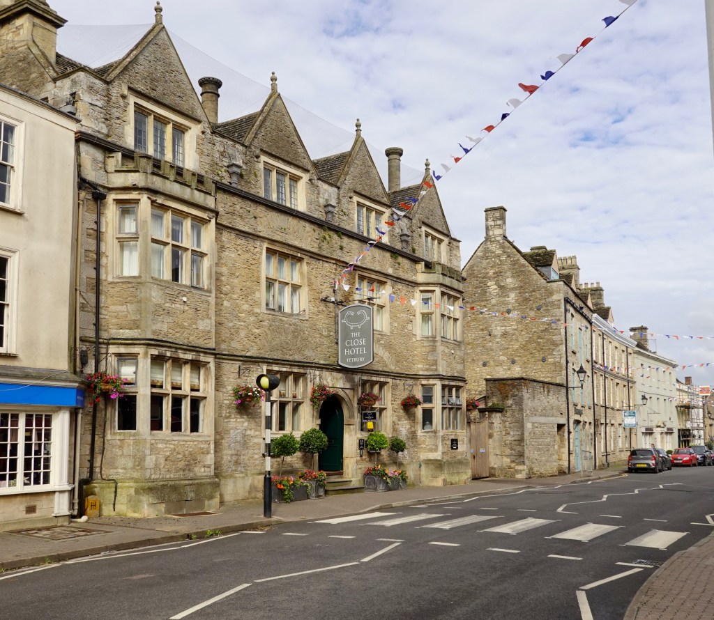
The Snooty Fox, a pub in town, great name.
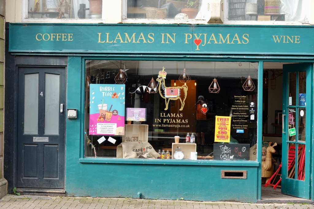
Some of the town buildings including the old market square, Cotswold stone buildings and Llamas in Pyjamas 🤣
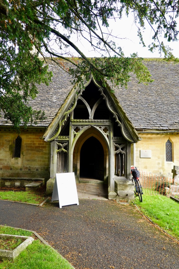
Nice old church entrance
Leaving Tetbury we were riding along farming lanes connecting villages. The one below is around the rear boundary of Highgrove land.
The stone walls have been incredibly well constructed. They are all dry and works of art.
In the village of Leighterton is St Andrew’s, a thirteenth century parish church. I like the timber clad belfrey with its shingle roof. The church has a slate roof.
More agricultural views. It makes for pleasant riding, despite the continual up and down slopes and infrequent cow pats on the road (one of the reasons our drink bottles have enclosed lids).
Lovely forests and distant views towards Wales. Riding laneways like the one below are great, but you always need to be wary as this is quite narrow and cars pass with difficulty.
It was a hilly ride today, climbing around 900 metres. Here I am near the top of yet another climb. Most of the rural climbs were upwards of 12%, which is more than enough with the extra gear on the bike.
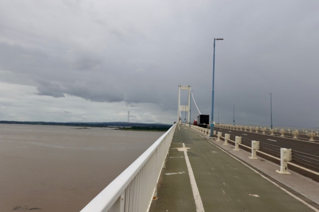
You can see Wales now in the background. Just out of view on the left is the Severn bridge, where we will cross into Wales.
Another interesting town, but we really busted our boilers here. Our mapping took us up the seeming shortest route to the Main Street, with a nasty 15-16% climb up Ludgate Hill.
I was hoping I did not need to give way at the top as I need a metre or so of flat to be safe in removing feet from the cleats to give way ( versus falling over)! Fortunately no cars and I was ok.
The Main Street half way up from Ludgate Hill junction
A series of super narrow lanes ensued. These are barely one car wide. If a car comes either way you need to either get into the bushes or move forward hoping to find a lane access into a farm.
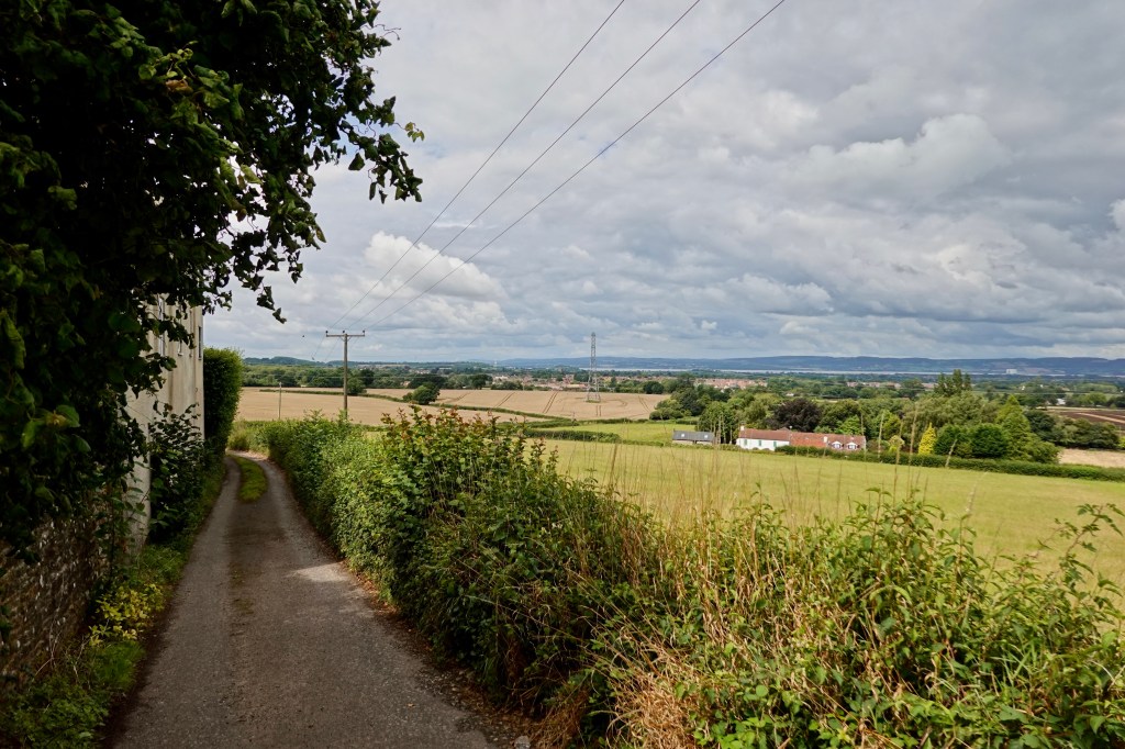
Chunks of our route today were on the Avon Cycle Way which is an 85 mile circular route around Bristol. We were on parts of the northern section.
This laneway was a bit of a goat track. You can see the Severn bridge to the left with its white tall towers. Behind the crane is the Thornbury parish church.
Thornbury is quite pretty. I liked this regal flower display.
Thornbury Castle is a Tudor structure commenced in 1511. The castle was confiscated by King Henry Viii who stayed there for ten days with Anne Boleyn in 1535. The castle fell into disprepair after the English Civil War, but was renovated in 1824 and now serves as a hotel and restaurant.
I was fortunate to have stayed in the Castle in 2007 for two nights so passing by today was to admire the building only, as this was not to be our destination tonight.
The Parish church of Saint Mary started in 1340 with latter major additions. The church is the resting place of the entrails of Jasper Tudor, uncle and mentor to the young Henry Tudor, later Henry VII of England.
We were hungry but we pushed on. The sky was quite dark in patches, and rain was forecast.
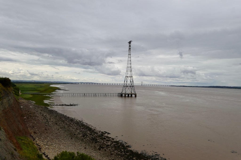
As we crossed the Severn river and entered Wales, it started raining. The river is the longest in Great Britain at around 354 km in length. It is tidal here, and quite muddy.
Heading into Wales
We stopped to put our rain jackets and booties on after exiting a narrow laneway, and sat under a rail tunnel.
Looking down the lanewayTony coming down the lanewayColourful graffitiWhere we sat.
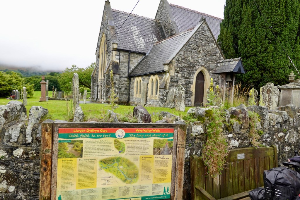
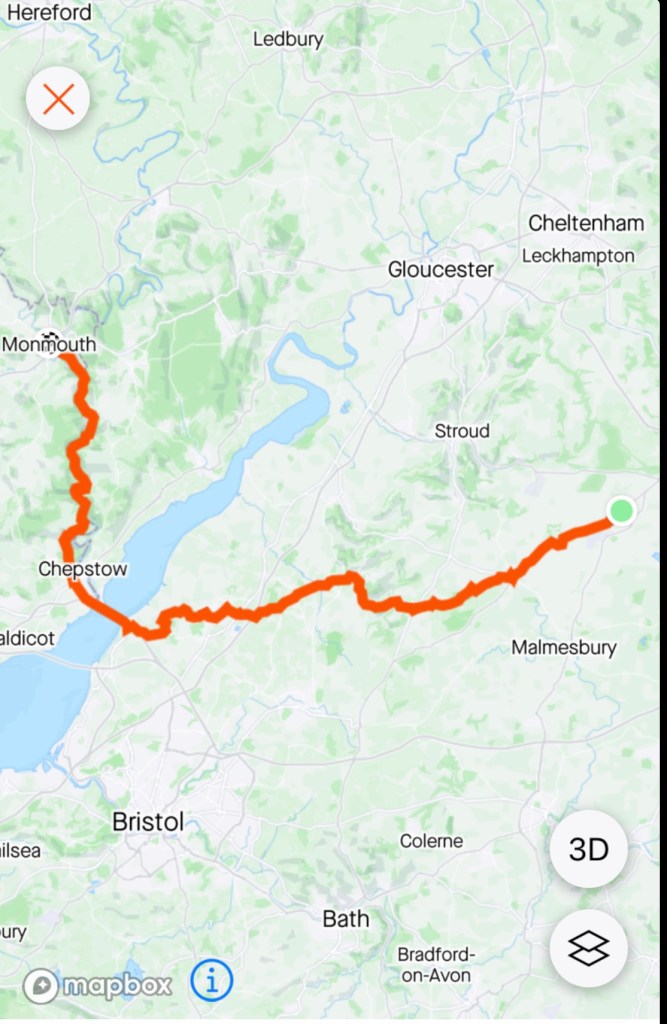
Chepstow, is the first major town we entered in Wales, adjacent to the border with Gloucestershire, England. It is located on the tidal River Wye.
We stopped at a small supermarket on the busy road versus heading into the town, as the rain motivated us to keep moving. Lunch was a fresh bread roll with a banana in it.
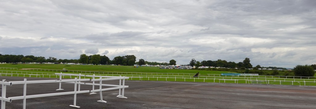
We passed the Chepstow race course. There were cars everywhere, including a flea market in one car park. Families were heading down with their children.
A small section of the racecourse marquees
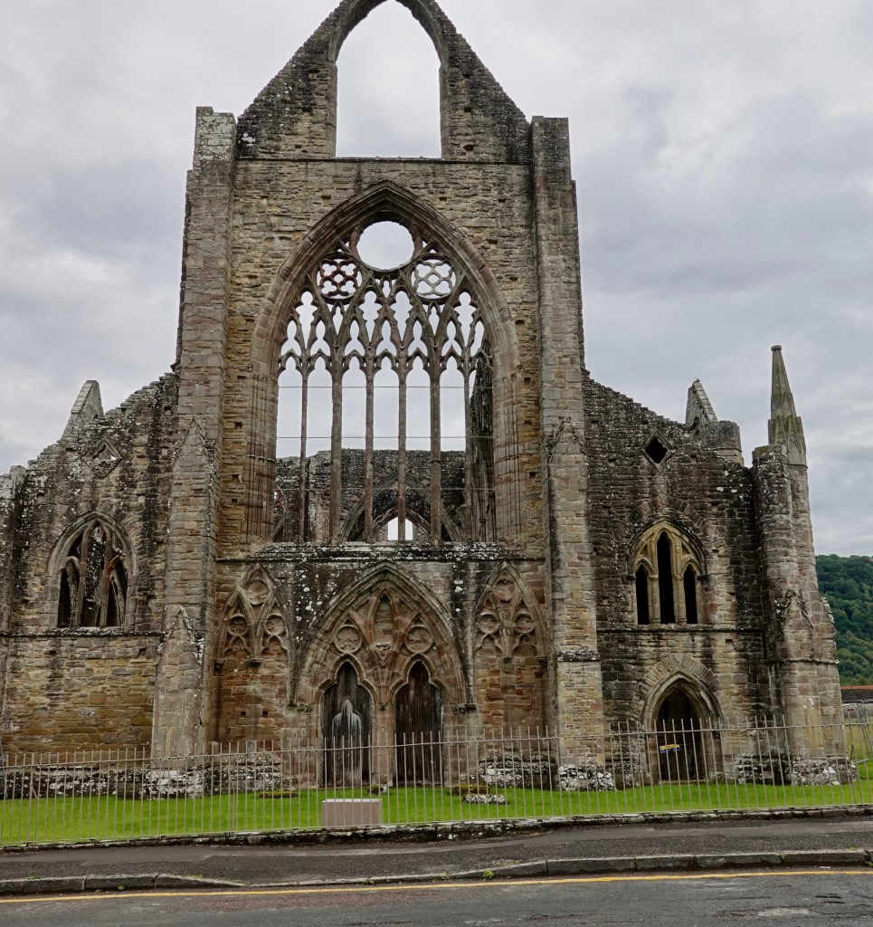
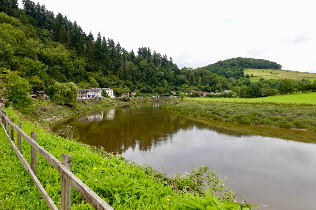
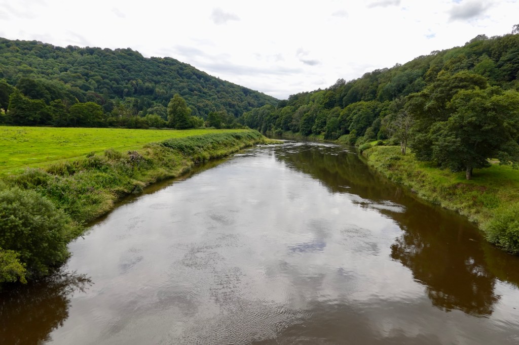
Wye Valley, is an area of outstanding natural beauty, running along the border between England and Wales here. We followed the valley for the rest of our ride today. Tintern Abbey is a site that encourages you to stop and stare.
Tintern Abbey was built by Walter de Clare, Lord of Chepstow, in 1131. It was the first Cistercian foundation in Wales, and only the second in Britain. It fell into ruin after the Dissolution of the Monasteries in 1536(good old King Henry VIII!), treasures were removed, lead from the roof was sold, and the building decay began.
Over 70,000 visitors year visit the abbey – and this is also my third visit (2007, 2013)
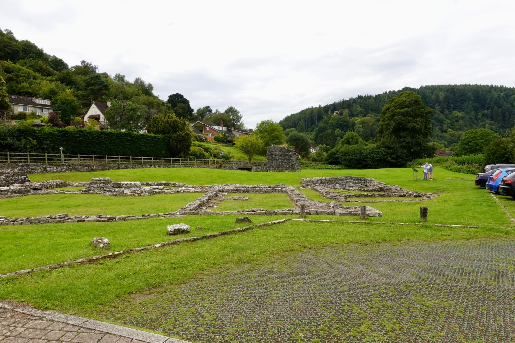
Old adjacent ruins
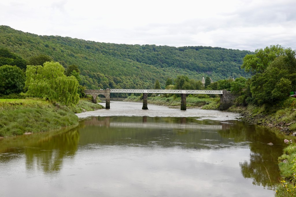
Continuing on we followed the Wye River as it meandered along the picturesque Wye Valley.
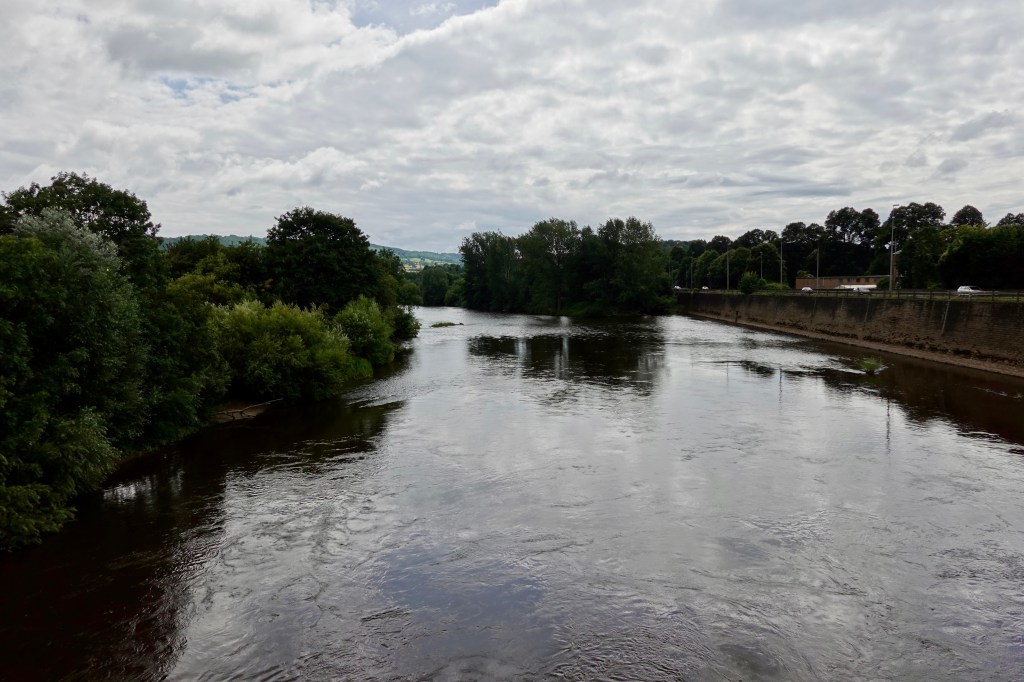
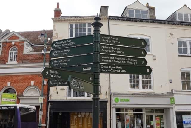
Eventually we arrived in Monmouth which is situated where the River Monnow joins the River Wye. The town was the site of a small Roman fort and became established after Monmouth Castle was constructed in 1067.
Crossing the first bridge, looking at a local boys schoolSignage in dual languages
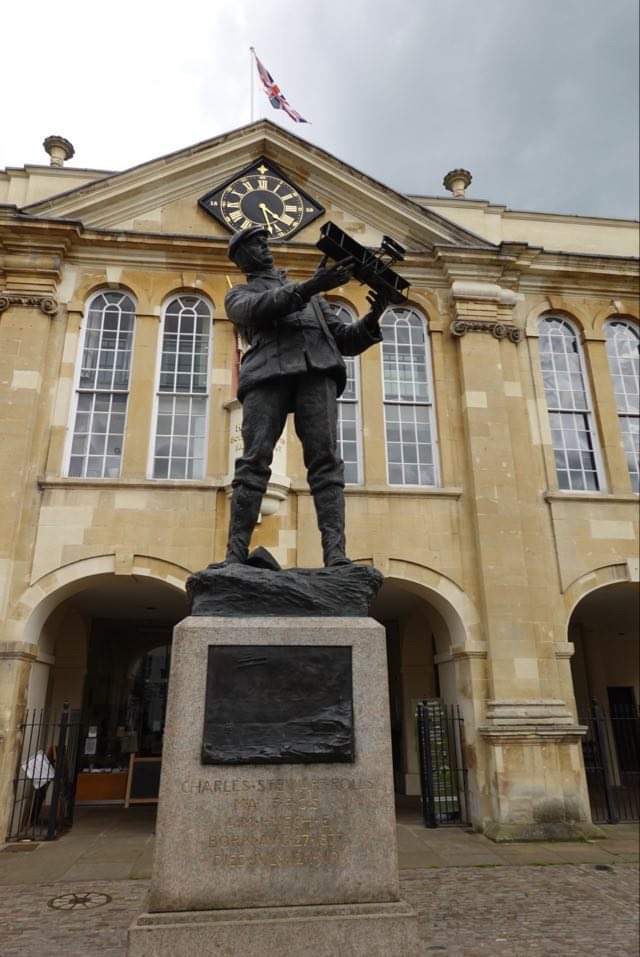
This is an interesting statue of Charles Rolls, as in Rolls Royce. Aside from that venture, he was an aviation pioneer and a cyclist, having captained Cambridge University cycling club. Despite a great future he was killed at the age of 32 in his plane during a display. He was the first Briton to be killed in an aeronautics, accident, and the 11th internationally.
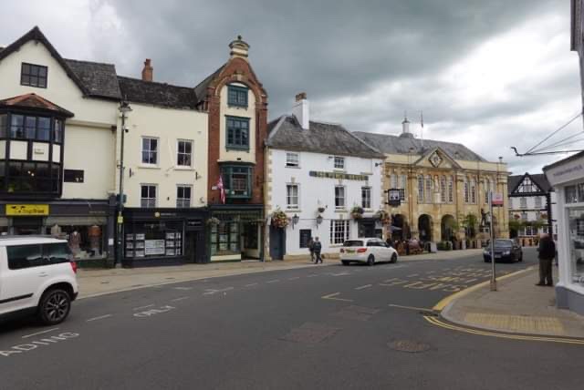
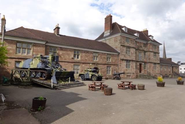
Agincourt Square with our hotel in the background.Local military museum adjacent to the castle
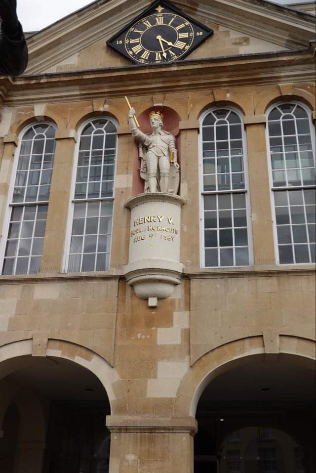
Monmouth castle was the birthplace of King Henry V in 1396 is now in ruins. There is a statue of Henry V in town. Sadly not much remains of the former stronghold of Henry IV.
Another old church….
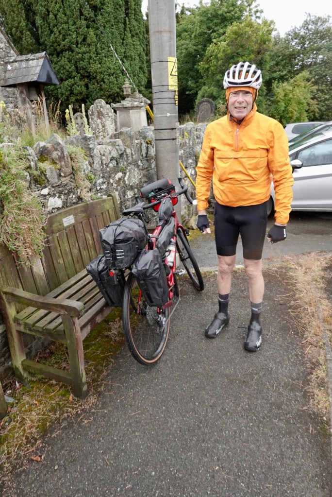
Our accomodation is here tonight. The reception lady has been super helpful and our bikes are stored in their ‘bike shed’ under lock and key.
A solid day on the bike with a doubling of the climbing to gear us up for more tomorrow. We are weary tonight and looking forward to a good sleep.