The good, the bad and the ugly…not necessarily in that order.

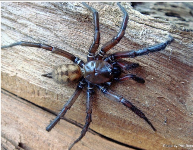
After I finished my blog last night, I jumped into bed. As I lay there I was aware of something touching my upper legs (and it was not Tony!). I reached my hand down and grabbed what I assumed to be a moth, and threw it out across the bed, towards Tony as I expected it to fly.

The room was still quite light and when I checked to see if maybe I had inadvertently killed the moth, I was alarmed to see a reasonably large spider on Tony!

I jumped out of bed, as did he as he was alarmed at the sound I made.

The spider having been flicked off by Tony then tried to hide between the mattress and tucked in sheet…we ultimately won the battle and New Zealand has one spider less.

I have since identified it as a Tunnelweb spider..described as a very fast New Zealand spider and somewhat shy!

Shy or not, it was not sharing my bed and crawling over my body! This creeped me out! I do not think this has ever happened to me (knowingly) before.

Despite that, we both slept very soundly in lovely accomodation at an Air BnB.

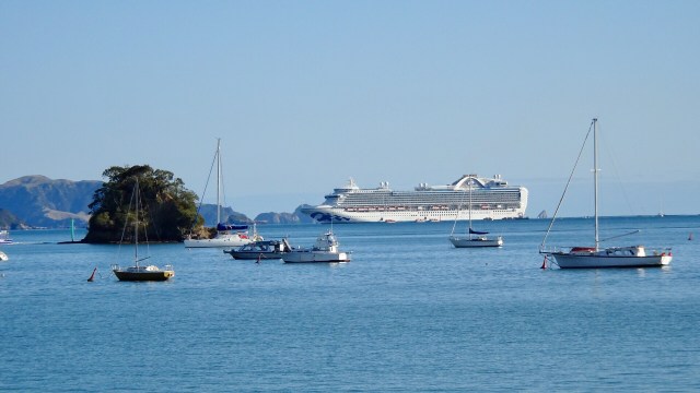
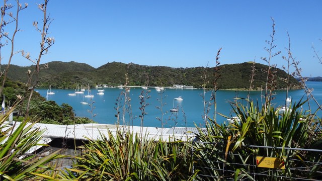
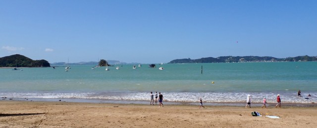
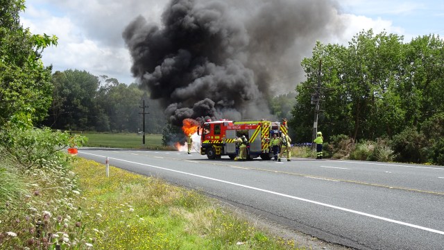
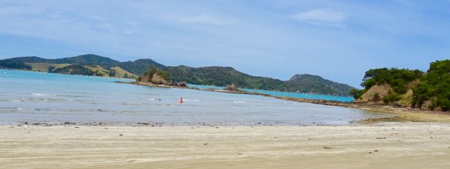
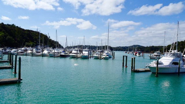
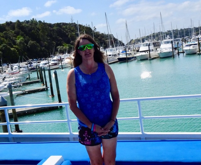
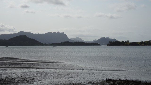
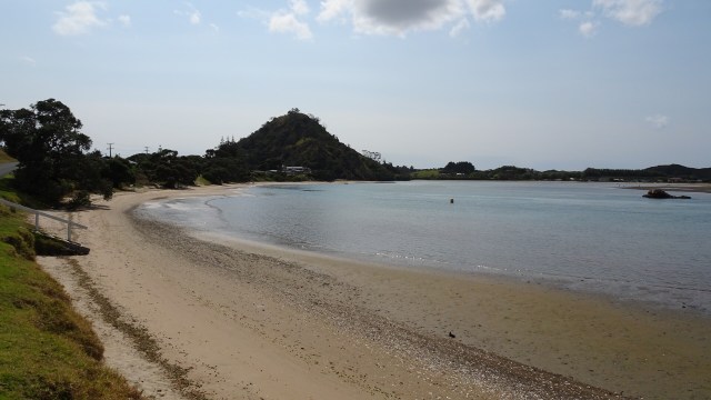
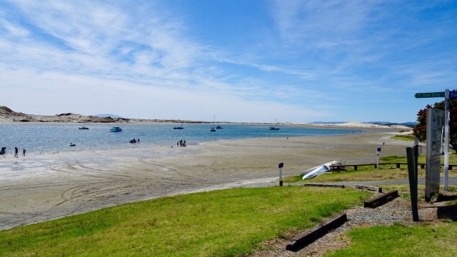
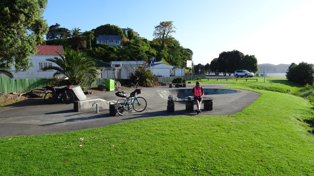
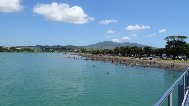
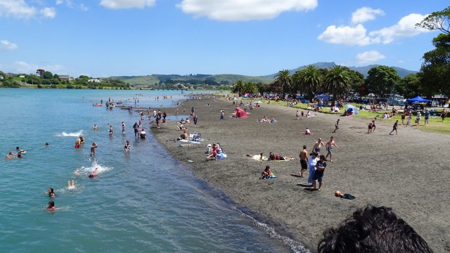
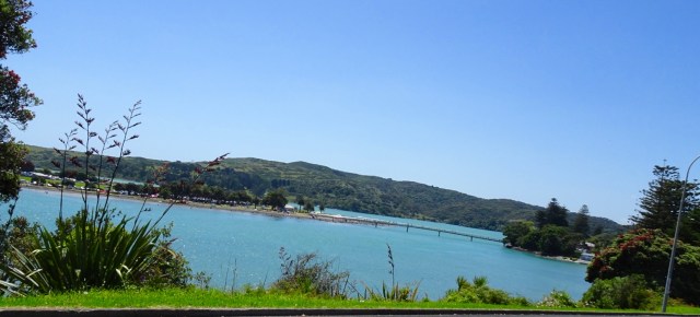
We were on the road by 8 am and look what had already arrived in the harbour…yes, 3,500 Aussies. We beat a retreat and headed out of town!

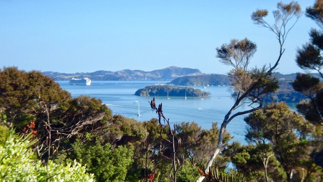
Looking in the opposite direction provided a nicer vista.

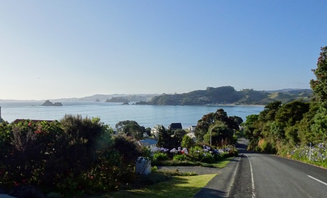
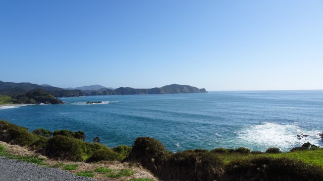
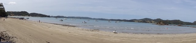
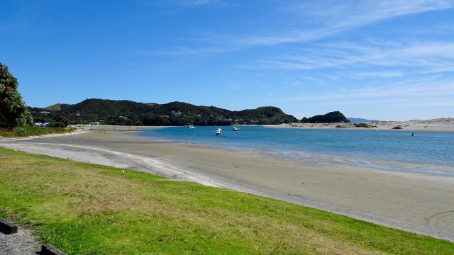
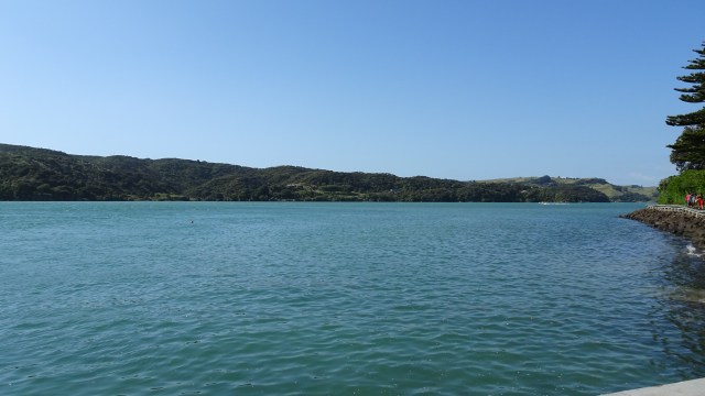
We climbed a few hills and had one final view back towards Russell and the Aussie’s.

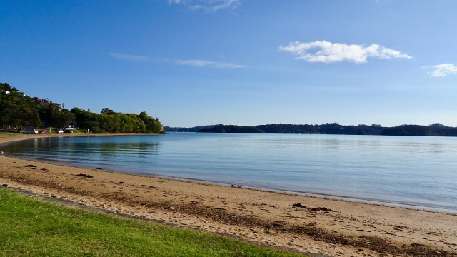
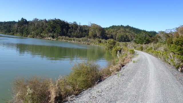
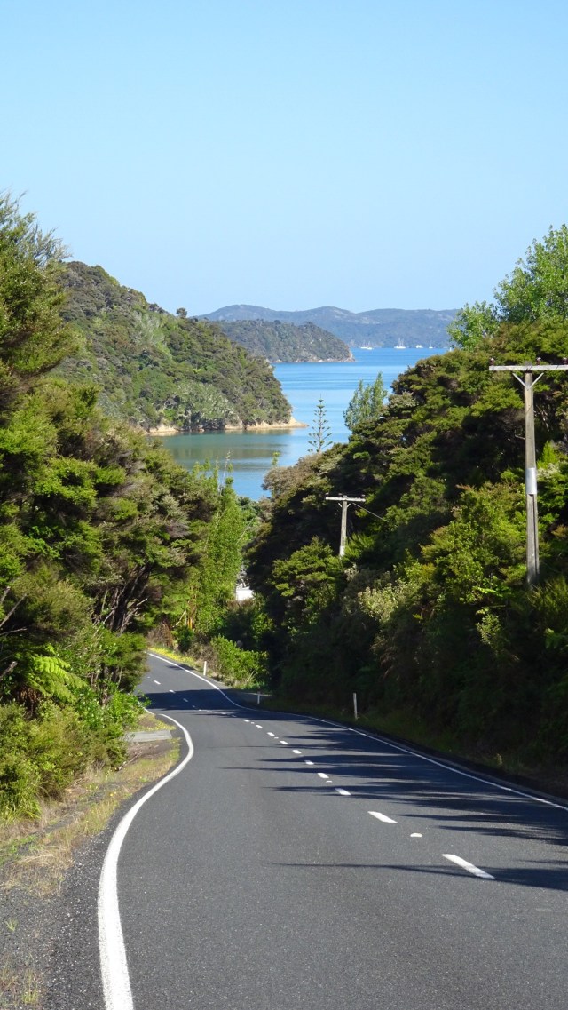
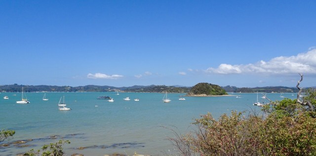
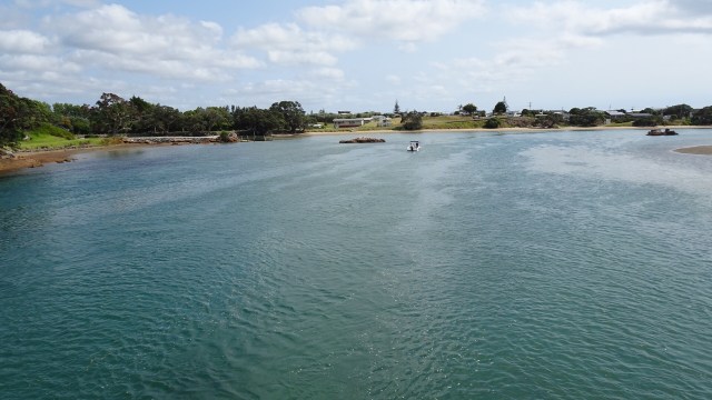
Following the harbour shores….

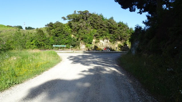
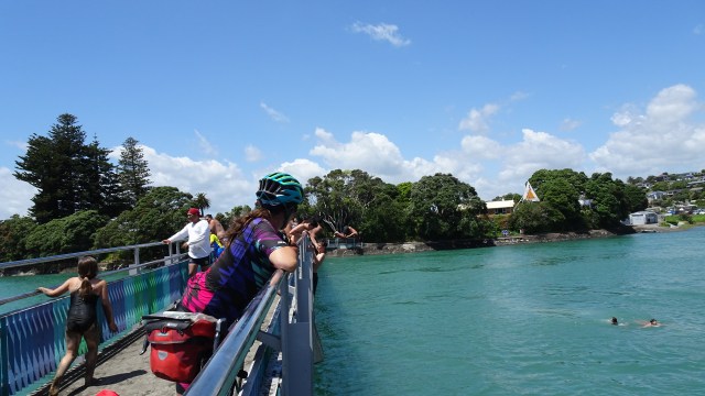
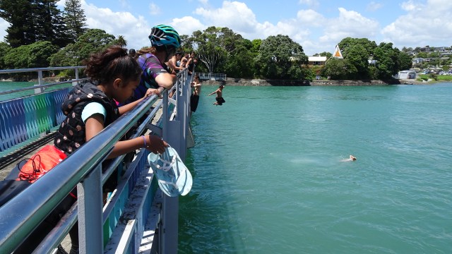
We hopped onto the Twin Coast cycle trail.

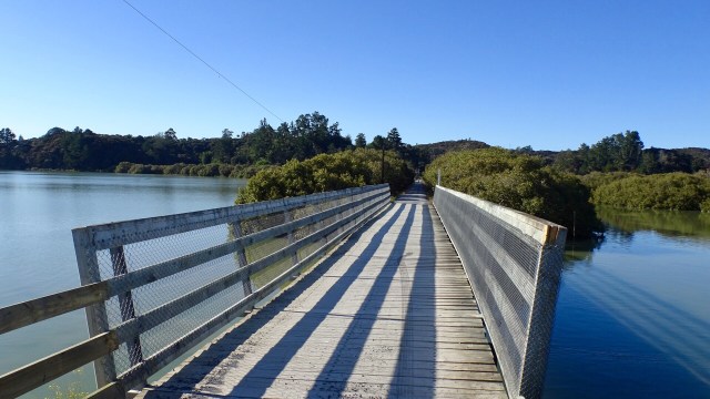
The first few km were excellent quality. Compacted gravel on top of existing railway infrastructure. At the bridge, an additional deck had been constructed on one side.

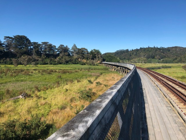
We entered at our own risk, but could not see what the issue was.

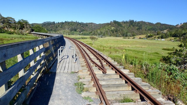
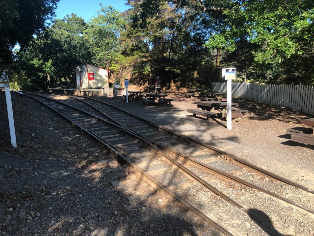
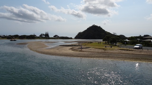
We arrived at the old Taumarere Railway Station, now used as a tourist railway from Kawakawa, but formerly supporting a thriving town of 1,500 people with industry and tourism benefits.

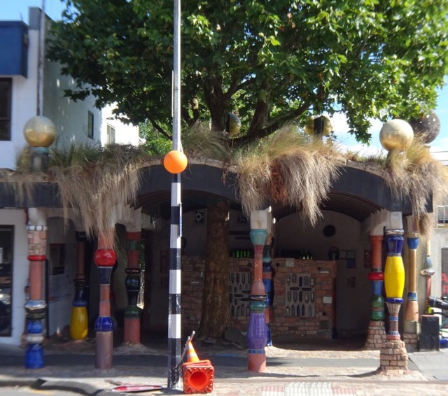
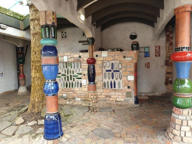
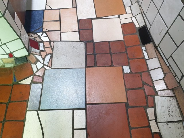
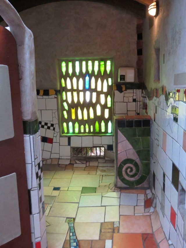
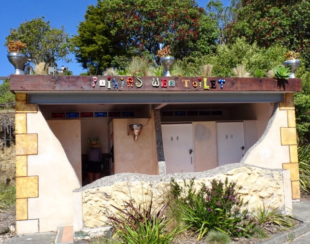
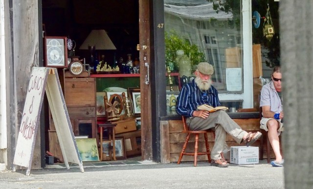
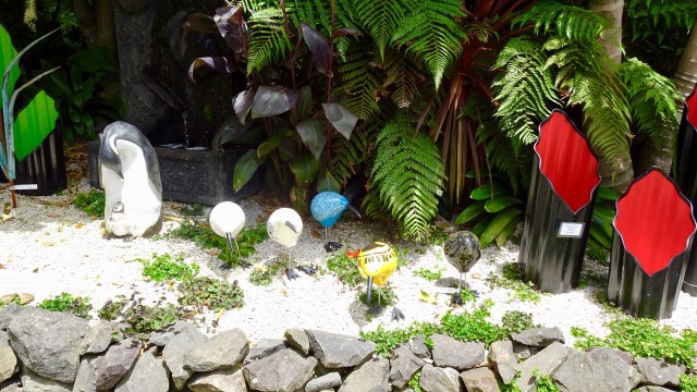
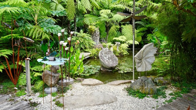
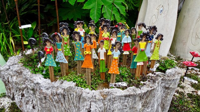
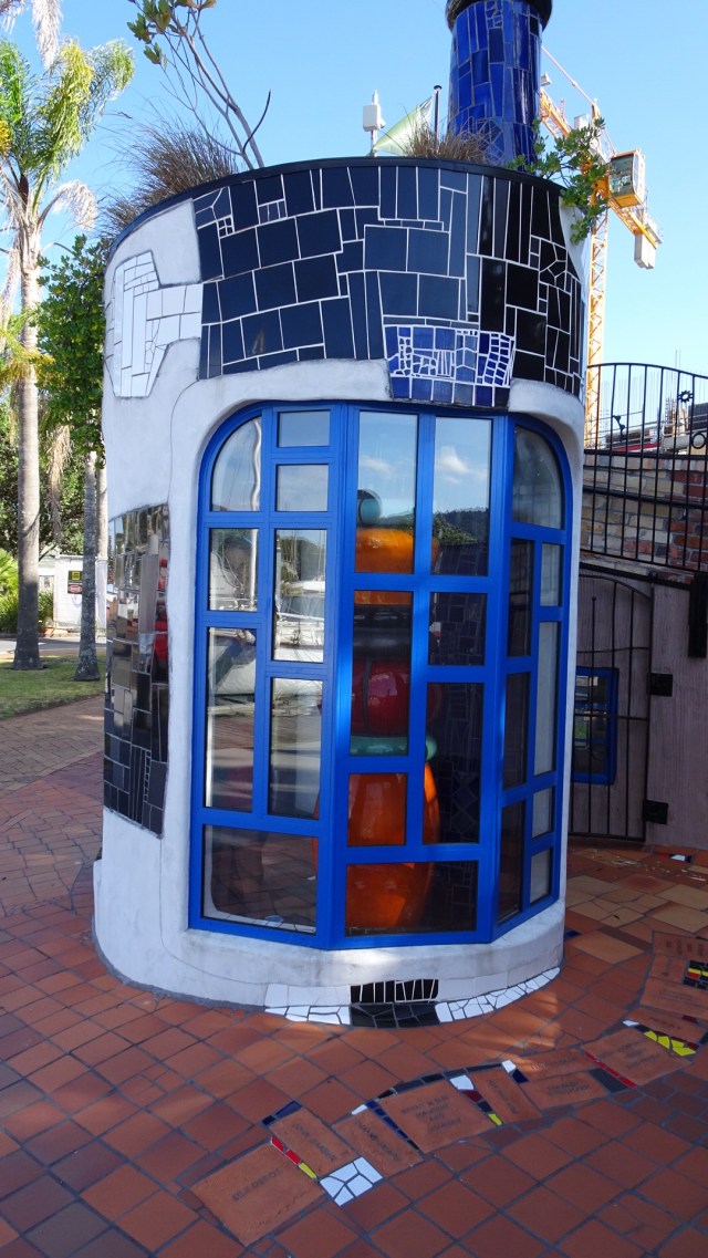
Our first stop was Kawakawa. Originally we were going to head further north to KeriKeri, as it is a lovely old colonial town, well preserved but after having been in Whangarei we learned of Freidensreich Hundertwasser, an Austrian born architect who spent the latter years of his life living in New Zealand.

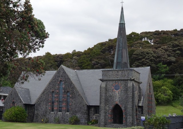
His designs feature all around the world, and Kawakawa has a toilet block he designed that is regarded as an international work of art.

The style is typical Hundertwasser with wavy lines, irregular ceramic tiles, integrated small sculptures, coloured glass and a live tree incorporated into the architecture.

Hundertwasser requested that any vegetation removed for construction should be replanted on the buildings green roof.

The toilets are Kawakawa’s main tourist attraction, and the most visited toilet in New Zealand, with tourists buses arriving to photograph the toilets.

The toilets are fully functioning.

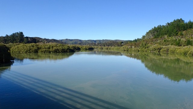
Back on the rail trail we crossed the Kawiti Truss Bridge that passes through the Ngapipto River Valley, where the descendants of the great Ngati Hine leader Kawiti live to this day.

Although Kawiti cautioned his people never to sell their land, it was confiscated for the North Auckland railway line in 1913.

This impressive truss bridge took 500 men to build and is 74 metres long.

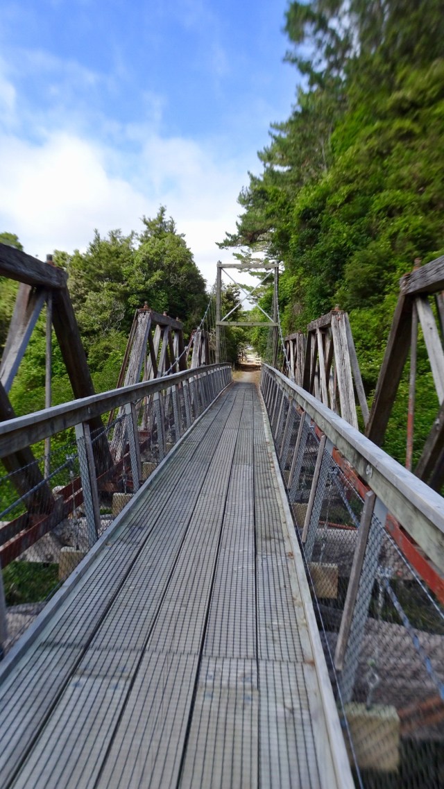
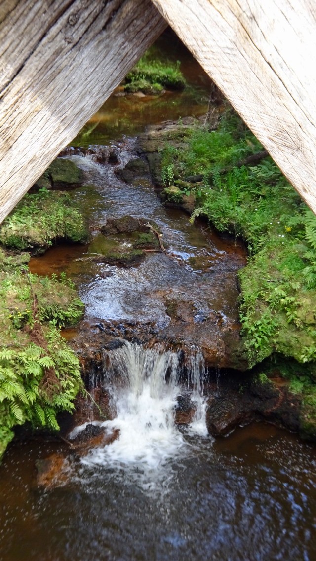
I like this photo showing some of the truss work and the river below.

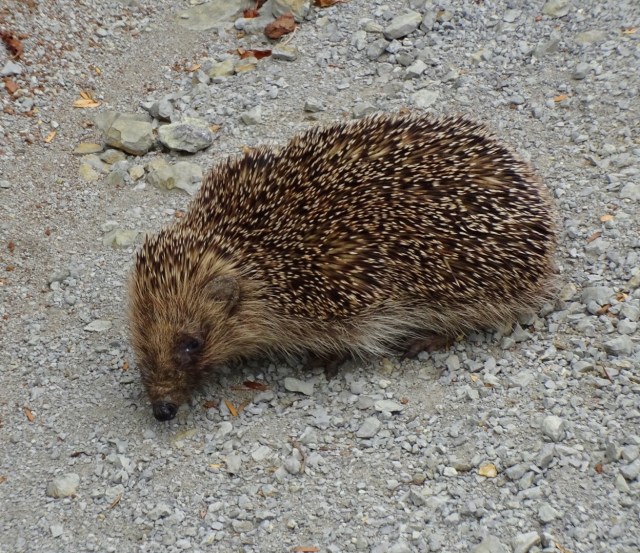
On the track we found an alive hedgehog. In the five previous trips to New Zealand we had only witnessed flattened dead ones!

I think it is cute, but apparently they pose a significant threat to many New Zealand native species due to their voracious appetites.

Hedgehogs are not endemic, having been first brought here by ‘acclimatisation societies’ to remind settlers of their homelands. They were later introduced in greater numbers to control garden pests such as slugs, snails and grass grubs.

We thought he was cute!

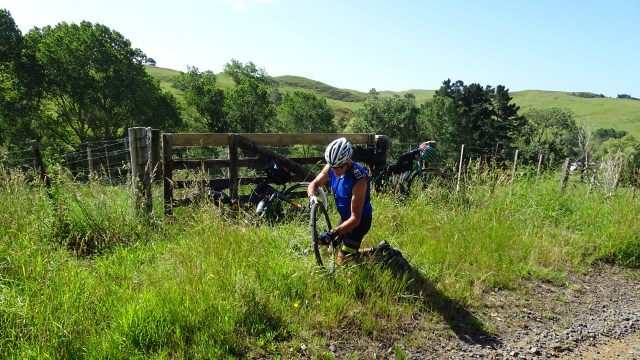
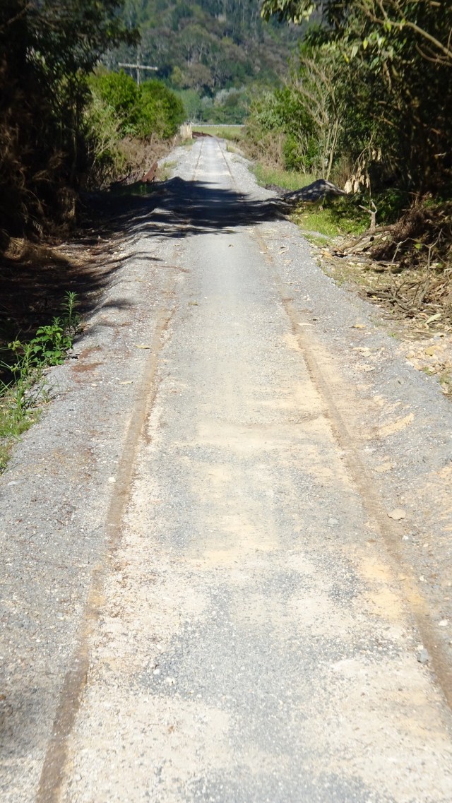
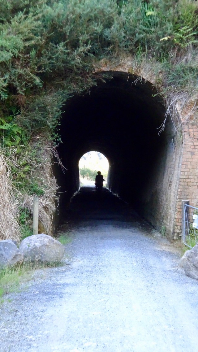
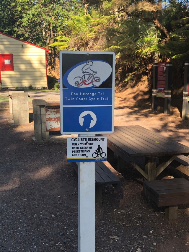
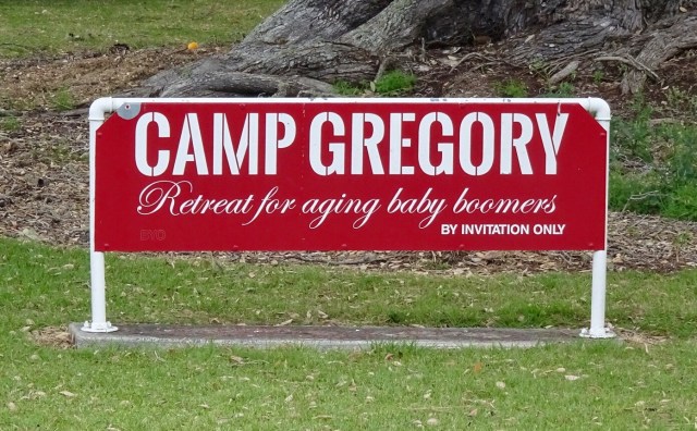
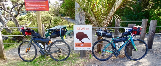
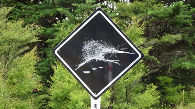
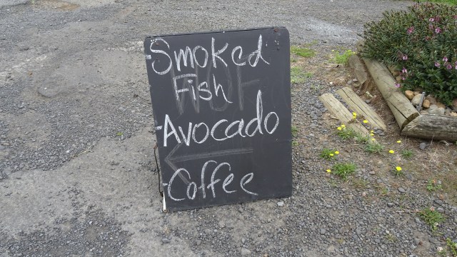
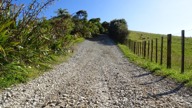
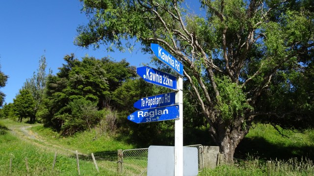
Further along the cycle trail, which certainly was not as well constructed as the first few km, and in many parts, was just a single true track, we found this sign. Interesting.

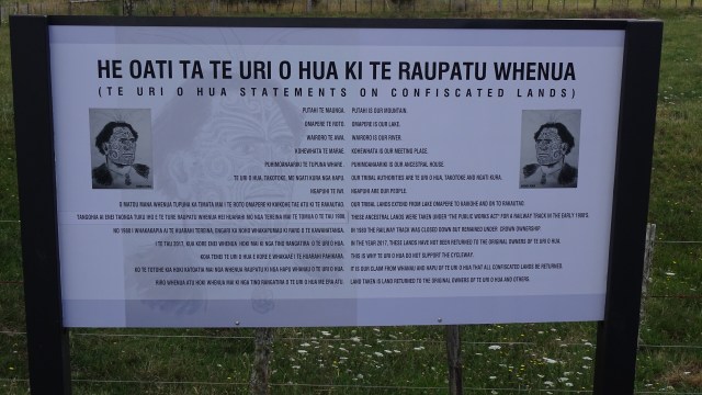
Kaihoke was the town we hoped to grab some refreshments, apparently a thriving town in its history. When the train line opened in 1914, 1000 people came out to celebrate. The town peaked as a trading centre in the 1950’s before falling on harder times.

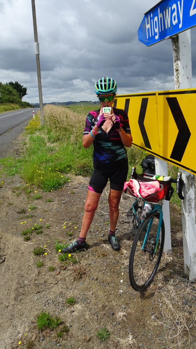
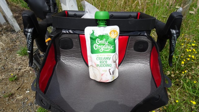
Heading into the local Countdown supermarket for a cold, large bottle of water proved a futile exercise. Despite two laps of the supermarket I could not locate any large bottles. I asked and was told not available, but proudly showed me their extensive range of cold alcohol! 😂😂🙈

So in desperation I headed into McDonalds to buy iced coffee and fill our water bottles up in their bathrooms!!

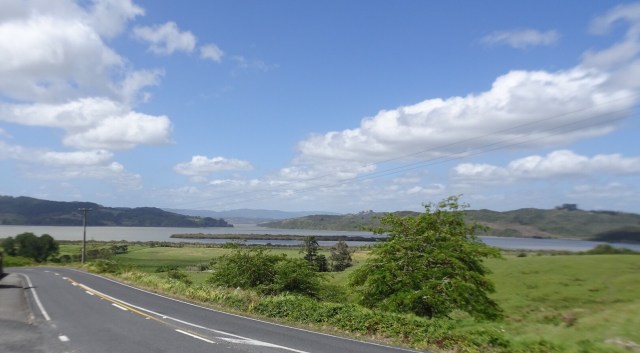
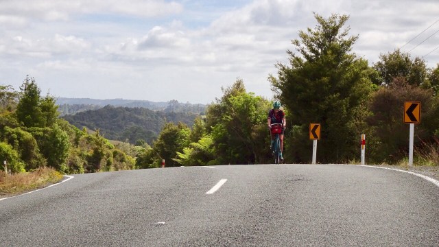
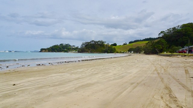
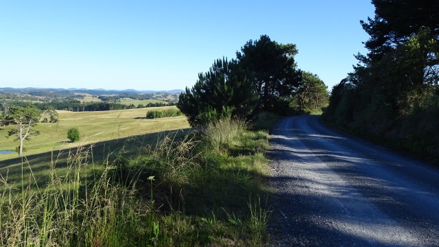
Back onto the road for the last 40 plus km to Rawene, with minimal verge. Groan. Nice countryside though.

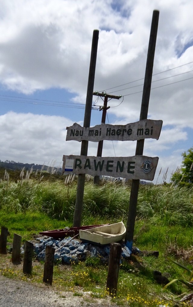
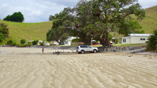
We were very glad to turn off to Rawene.

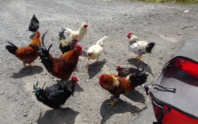
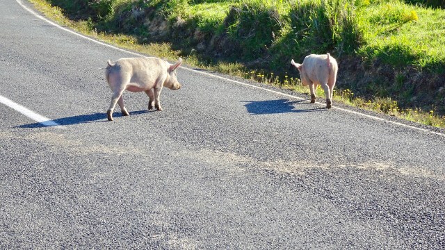
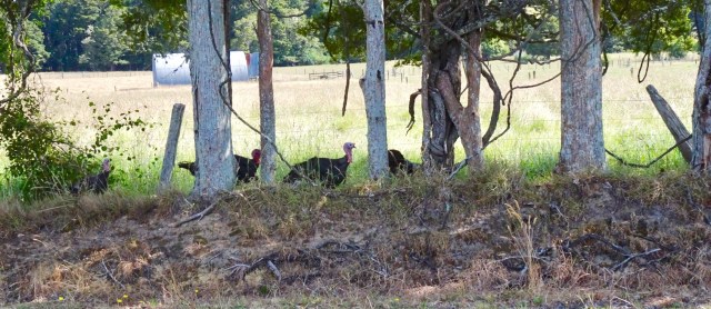
These critters seemed pleased to see us too. We later learned that this is the local dump point for roosters!

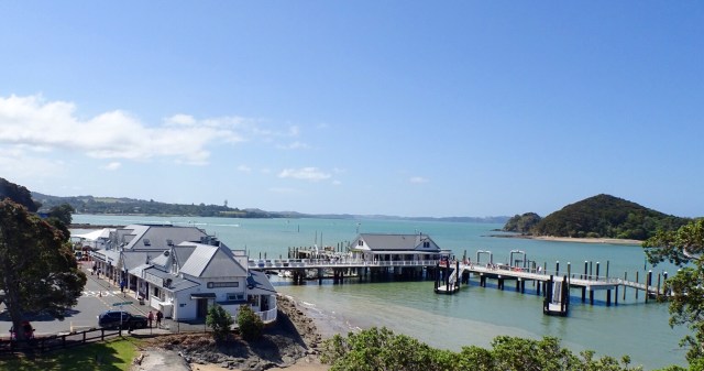
Quick trip to Rawene, as it is only 6 km in from SH12.

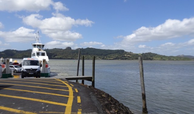
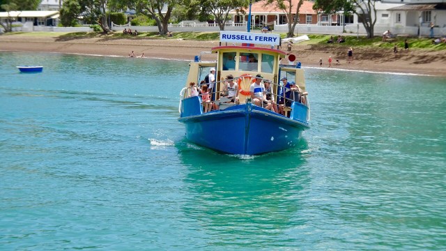
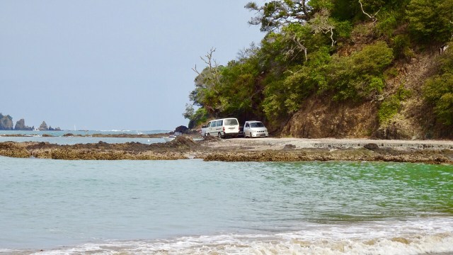
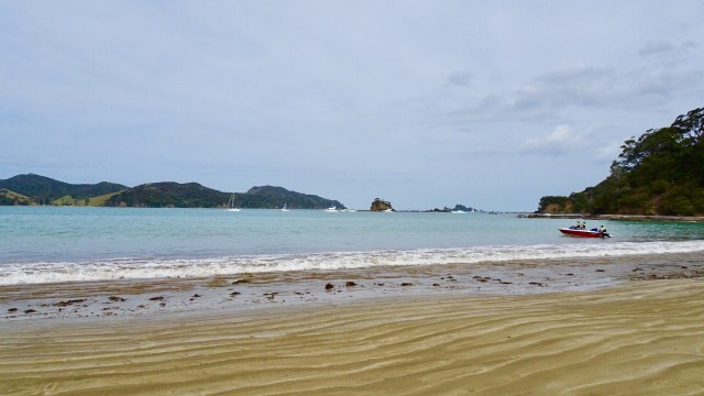
Down to the ferry at the road end….I caught this ferry last year on my return journey from Cape Reinga, arriving into Rawene to stay with Blair, an Air BNB guy that I have kept in contact with since on Facebook.

Great to see Blair again. Blair is a professional chef, and we have just finished an awesome meal that he cooked. Vegetables and greens all from his garden. We sat on his deck looking out to the harbour.

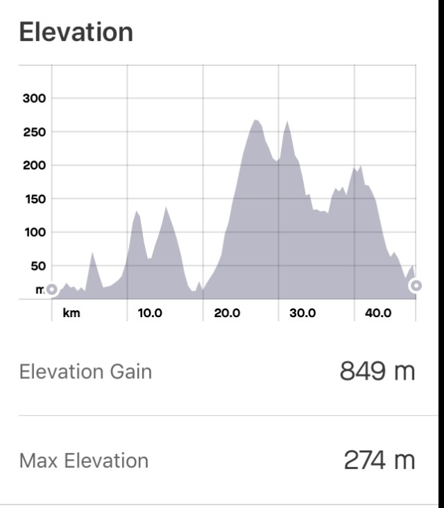
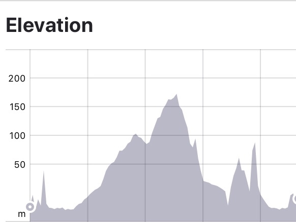
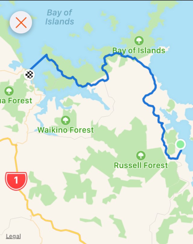
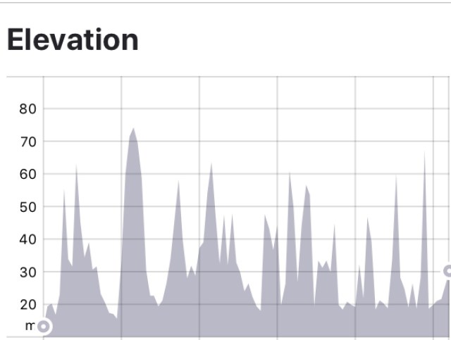
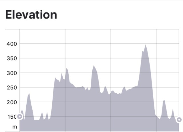
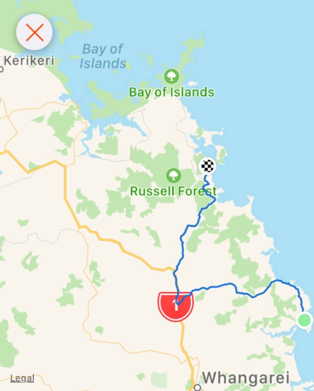
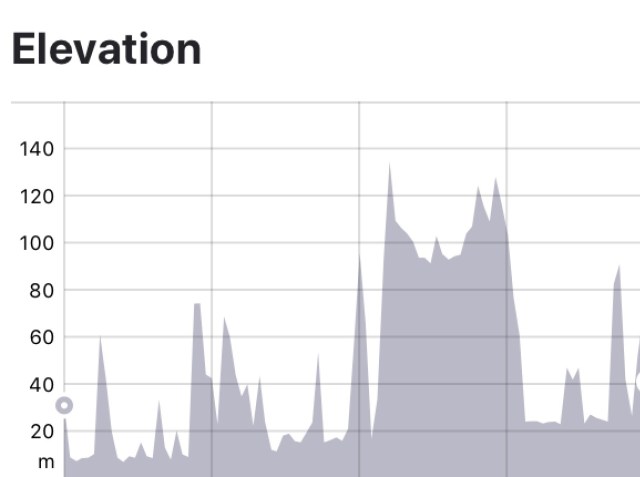
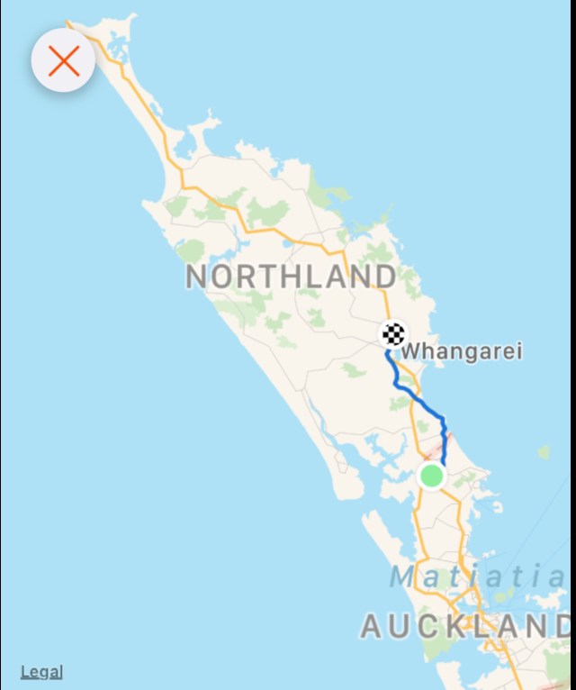
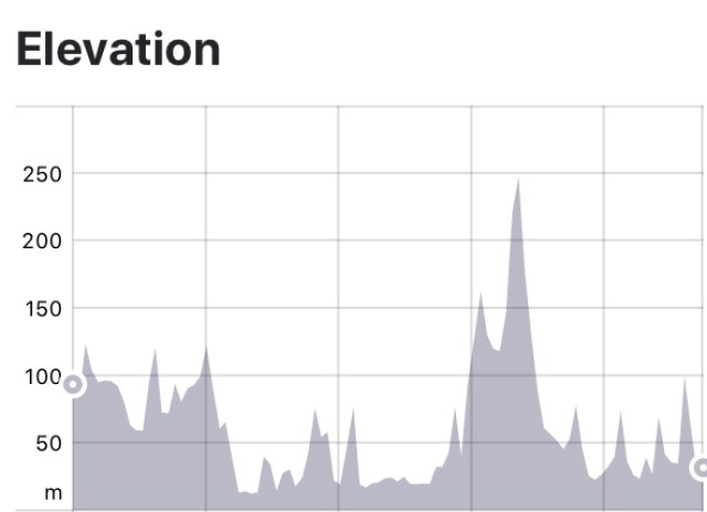
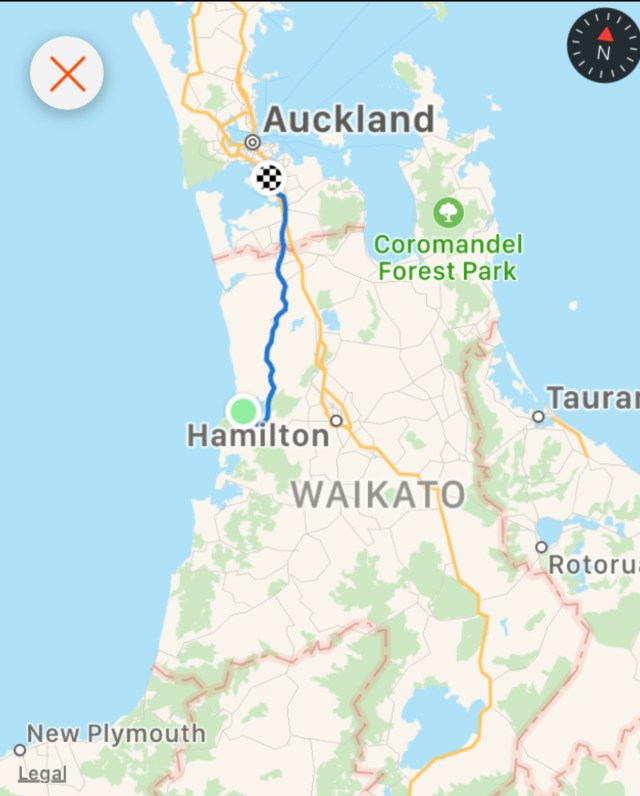
Todays route and elevation that has taken us from the east to west coast of New Zealand.

Tomorrow is another day…more climbing and over 100 km ride as we head south towards Auckland.

Thanks for reading, I need my beauty sleep…first I’ll check for spiders!!

Ooroo

Bay of Islands

The Bay of Islands comprises around 140 sub tropical islands, known for undeveloped beaches, big game fishing, and Maori cultural artefacts.

It is home to the 19th century port of Russell, with a waterfront promenade lined with remnants from its days as New Zealand’s first colonial capital.

To get to this area from Oakura means a lot of hills and today did not disappoint, with an 18 percent climb from our overnight accomodation…..again!! Around the corner, and again, climb out of the village. Nice views looking back towards Oakura Bay.

I have had to stop riding many times for various animals, but never for pigs! These guys must have escaped knowing the inherent dangers for them, particularly at Christmas time.

Climbing gives great perspective to the surrounding landscape. This first one is looking south.

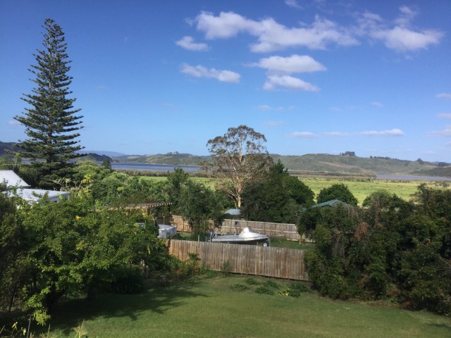
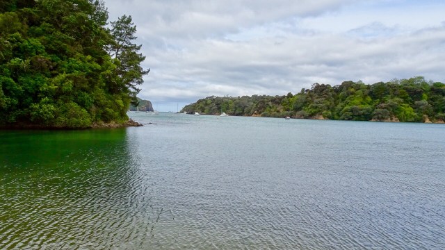
From the same viewpoint is this boat…waiting for the tsunami action plan? It is about 75 metres above sea level and not in the greatest condition either.Looking north towards the Bay of Islands.

I quite liked the campsite chosen by these people. Highly unlikely to have many others join, as to get there you need to clamber down a steep bank with your gear.

We liked this view, just before a descent, looking at the boats in the harbour.

A few more coastal views before we headed towards Russell.

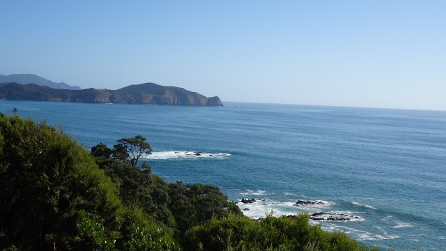
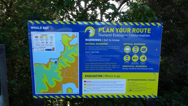
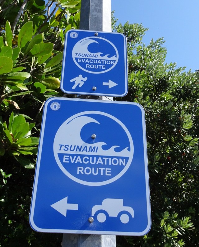
I could not resist taking a photo of this sign. 😂🙈
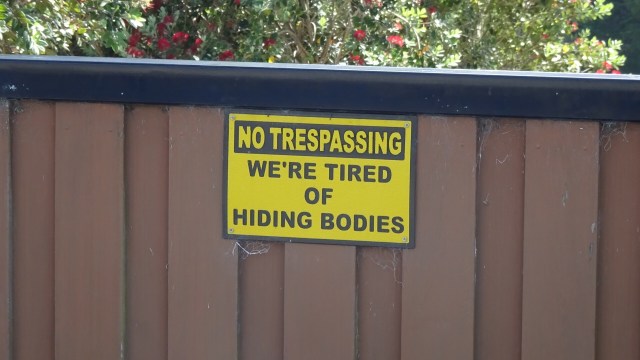
Arriving in Russell we headed straight to a cafe I had been to before for an iced coffee….but they gave us iced chocolate. Ho hum, but for the first time in 5 days we had more than two bars reception.

We met a father and daughter (Dave and Annelise), who had just ridden into town. They are on holidays in the region, but live in Whakatane, near White Island volcano. Lovely to have a chat before they headed off for a family lunch.

Russell was the first permanent European settlement and seaport in New Zealand. A small population of 720 in the last census, numbers are swelled by significant tourism.

Before European settlement, Russell was inhabited by the Maori, attracted to the area by its climate, and the abundance of fish, food and fertile soil.

In the early 1800’s the indigenous Maori recognised the advantages of trading with the Europeans, and started to supply food and timber to the Europeans using the Bay of Islands for safe anchorage.

In return, Maori sought respect, firearms, alcohol and other goods of European manufacture.

However, whilst Russell (then known as Korarareka) blossomed, it quickly earned a bad reputation for a town with no laws and rife with prostitution. It became known as the “Hell hole of the Pacific”.

The Main Street today is colonial and quite sedate, bearing no resemblance to its former reputation.

Nevertheless, we headed out of town via the ferry to cross over the harbour to Paihia.

Nice views whilst crossing.

Farewell Russell.Looks like fun
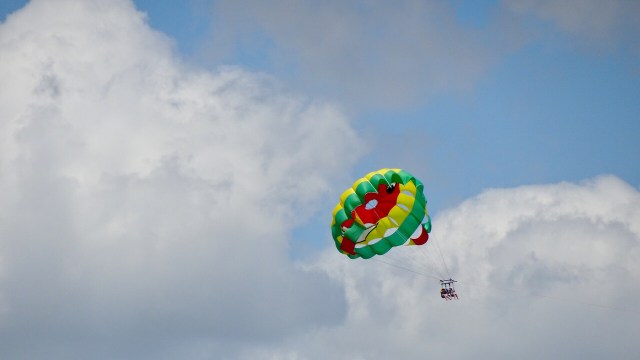
Hello, or Hi ya Paihia and the big marlin. You can see me pushing my bike through here.

Paihia is very touristy. There are less colonial looking buildings, replaced by many modern accomodation businesses. There are some little gems though, such as this ‘wee’ toilet.

Camp Gregory also appealed to me. I think this is a sign in a private home garden….I do like their sense of humour.

Nice views from a lookout, just above the ‘wee’ toilet. The first one you can see Russell on the far shore.

This one is looking South.

The local ferry terminal with requisite tourist activity businesses selling everything from parasailing, helicopter tours, kayaking, artisan arts and crafts to plastic junk.

Tomorrow 3,500 Australians arrive on a large cruise ship!! Horrid!! Glad we’ll be on the road out of town!

In town earlier I had noted this stall promoting a Maori made product for eczema and dermatitis. I have both skin conditions and I have a spot of eczema on my arm currently driving me nuts. So we went back to check it out. I met two lovely local Maori sisters, Karina (left) and Judy (right).

I have purchased a small tub of the Taiamai balm made from the kumarahou plant, used by indigenous Maori for the treatment of bronchial, kidney infections and topical remedy.

The best value tub size was the large one but given my ceramic purchases yesterday, space is now ultra critical! Fortunately Karina can post to Australia. Check out her Facebook page, as I can tell you now, the itching has already stopped, so that should allow the skin to heal. ( Facebook….Taiamaiheritage).

Heading back to our accomodation, we passed an interesting stone church with an information plaque.

In 1831, thirteen Maori members of the northern tribes petitioned the King of England, William IV for a representative of the English Crown to be sent to New Zealand to establish law and order and give protection to all Maori people.

In response, the King appointed James Busby the first British resident, who in 1833 landed on the beach nearby. He was accorded a naval salute of seven guns and greeted by 600 Maori’s with a ceremonial haka.

Both Maoris and Europeans then assembled in the church grounds to break the letter on the royal seal. This ceremony was the precursor to the signing of the Treaty of Waitangi seven years later. This current church is the fifth built on the grounds.

Another day done and dusted. Route and elevation maps.

A shorter ride today, but plenty of climbing to keep us ‘honest’. We have been lucky with the weather, and hoping that continues.

Thanks for reading

Ooroo

Oakura

For those regular readers of my blog, you may recall Oakura was an overnight stop on my solo Auckland to Cape Reinga and return ride March 2018. It was an unmitigated disaster, as it was the day Cyclone Hola hit this region and I was on my bike. Alone.

It was also the day I really needed a friendly face and warm accomodation but found myself in danger of electrocution in a dodgy, sub standard caravan operated by an even dodgier character, Jason.

Nevertheless, I found a kind couple who helped me out, picking me up from the dodgy accomodation and transferring me a kilometre or so to their motel/caravan park, greeting me with a mug of hot soup and a token to operate the clothes dryer.

I was so thankful and decided to revisit their site.

First off, we needed breakfast and had purchased eggs, bacon and cheese when the Tutukaka General Store was open on Christmas Eve.

Bidding our Air BNB host Michael farewell we tackled his driveway…18 percent gradient, warming us up for a day of hills.

Up and down into Tutukaka we then climbed and descended to Matapouri Bay where we spent time chillaxing yesterday.

Climbing up another hill to the parking bay for walks to Whale Bay. Some beautiful views and more tsunami warning signs.

Descended to Woolley’s Bay where the surfers were out in the water waiting patiently for their big wave!

Sandy Bay was next, and we then headed in a westerly direction through rural farming properties, up and down hills. More wild turkeys, and then another one cresting yet another climb.

Passing through the small settlements of Waipaipai and Marua we stopped to buy water and iced coffee in Hikurangi, a quaint little town.

There we met Tim, a very friendly guy who stopped us as we left the General store to talk cycling. He suggested we could wander up to the Curios shop, as that was where he had left his bike.

So after refuelling and using the local amenities we did that.

Turns out Tim lived in Tasmania for a number of years and still owns a property at Carlton Beach. Small world. He is now a drilling engineer in the oil industry working down at Taranaki near where we spent Christmas last year.

Tim also took a photo of us, which he kindly emailed.

Bidding Tim farewell (but not before a rendition of Waltzing Matilda played on a sheep herders whistle), we headed out of town to join State Highway 1. Air raid sirens sounded, and it was a very eerie sound.

We had only ridden about one km on the highway when we encountered all traffic at a complete standstill. We kept riding down the verge until we got to the front of the queue, and it was apparent why the air raid sirens had sounded.

We were hoping no one was inside the car. The car was making many loud explosive noises as bits started flying up in the air. We were well clear….in this photo Tony has used the zoom feature.

The fuel tank exploded and flames extended along the road.

The boys in red arrived.

They quickly extinguished the fire. Then the police arrived…having missed everything!

Fortunately the occupants were fine. A young Maori couple were brought through by police, including their very cute puppy. We were very relieved that they were safe and sound.

We were given the all clear to proceed, which was handy as the road was blocked on the other side for about 2-3 km. Many asked us what was going on.

We were pleased to leave SH1 and turn off towards Oakura. The traffic, curiously enough, was far busier than SH1 with most vehicles towing something ( trailers full of holiday items, caravans, boats).

Rolling hills looking considerably drier now.

Descending towards Helena Bay we noticed signs for a cafe and art gallery. We ummed and aaahed before deciding to check it out. It was down a gravel track!!

What a find it was. Bike racks and out of sight from this picture, security cameras watching the bikes!

Beautiful gardens, fantastic gallery, and scrumptious cafe with some amazing views.

Touring means you cannot buy much in the way of extras. Soooo we needed to rearrange our luggage as I purchased two ceramic items. The bikes really need to stay upright now!! I would photograph the items but they are nicely secured within bubble wrap and tape. They can stay like that until we return home.

Next stop, Oakura Bay.

The dodgy Air BnB is still running, and I noticed that the even dodgier Jason replaced the cracked caravan windows but still has a power lead running through the window to the power point.

Moving right along, we climbed the last hill and descended to our accomodation on the shores of Whangaruru Bay.

Interestingly the lady at reception remembered me from last year!

A curious place as the beach is used by owners of shacks on the next bay, only accessible at lower tides. Traffic gets a bit tricky at times.

Some really lovely shacks and views.

Here is a map of today’s route.

Today is day 6, and it was thoroughly enjoyable. We loo, forward tomorrow as we arrive in the Bay of Islands region.

Thanks for reading,

Ooroo

Matapouri

Christmas Day, our third in New Zealand. Twizel, New Plymouth and now Kowharewa Bay, just outside Tutukaka. Beautiful views, very serene.

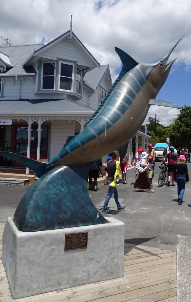
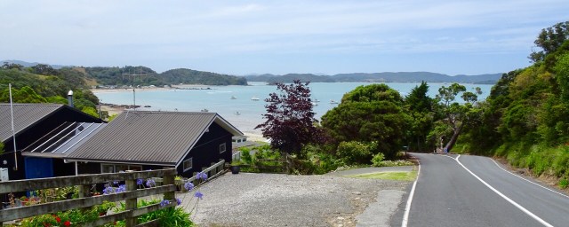
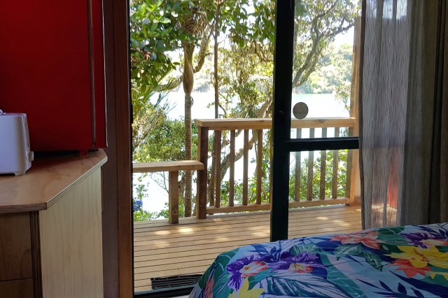
We are staying in a cosy little cabin, akin to an enlarged cubby house.

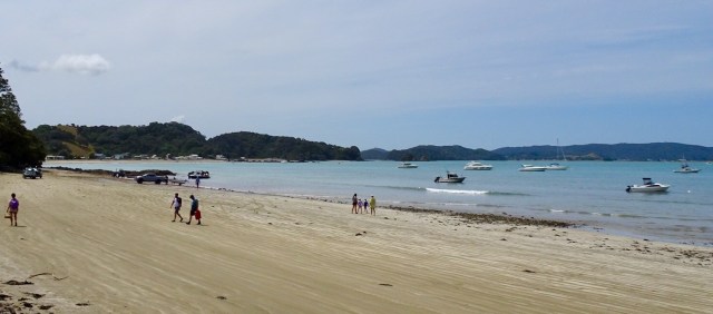
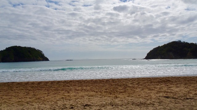
We decided to do a short Christmas ride cruise to Matapouri Bay, some 9 hilly km away. Bonus was the local store was open and we were able to grab a nice coffee. The owner was doing a roaring trade with a constant stream of customers.

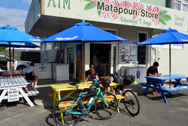
Matapouri Beach is a long crescent shaped beach.
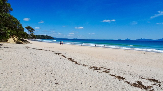
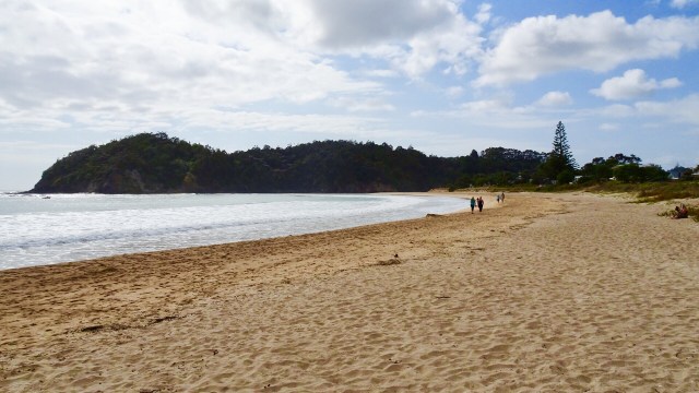
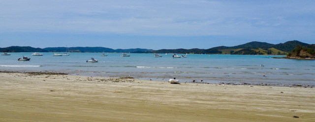
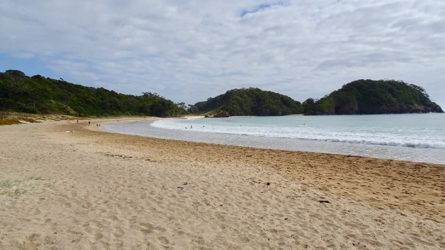
We parked the bikes on the beach and got our bathers our to test the waters.Brrrrrr….not immersing the whole body!
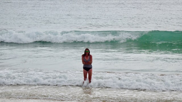
Heading down the beach….

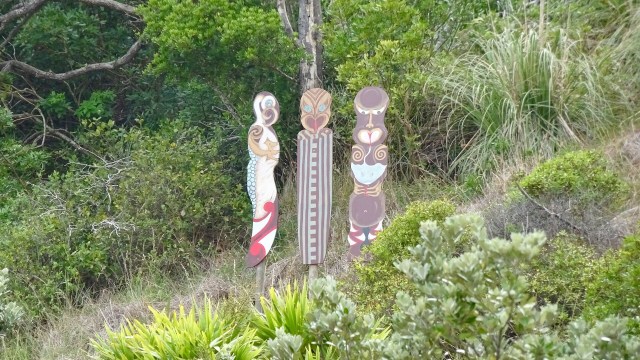
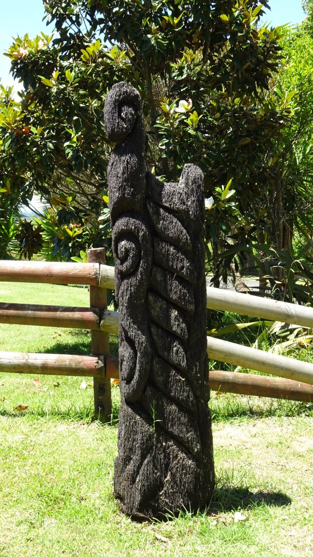
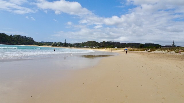
A walkway to another beach reveals these Maori totems.

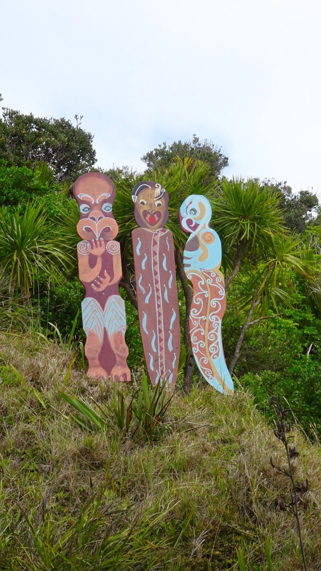
Volcanic beach on the other side.

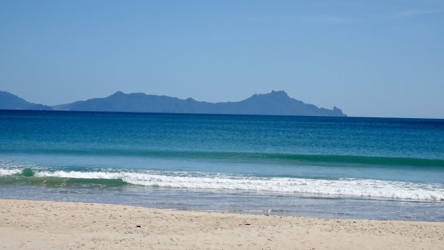
Continuing along Matapouri Bay…wading through water to find a couple of small and private beaches.More totems. The area where these totems are has a tapu on it, and is closed for regeneration.

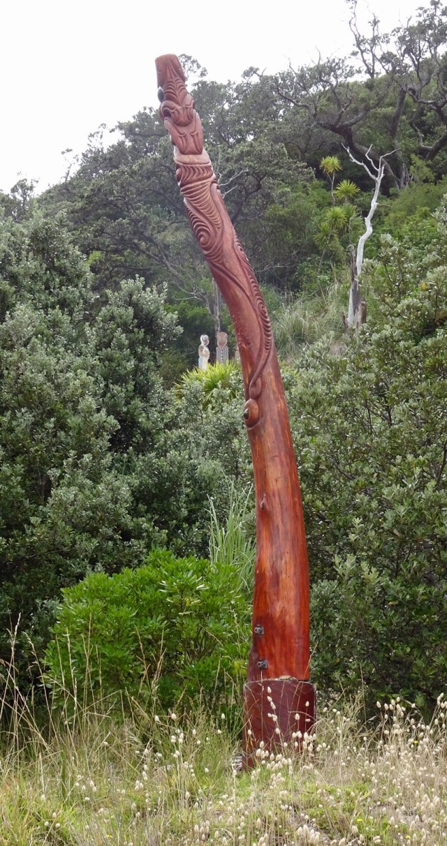
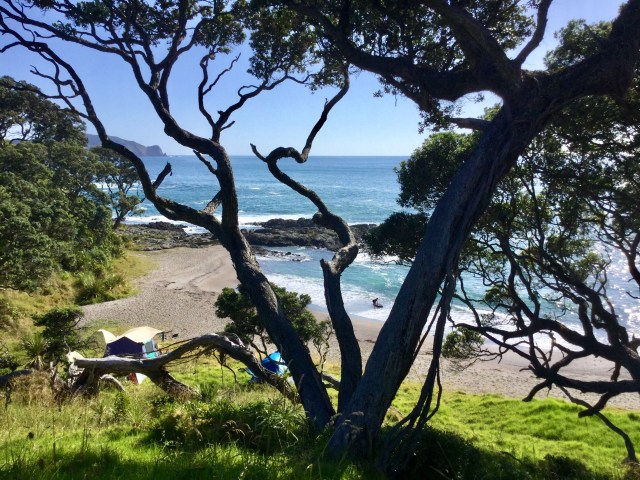
A lazy day, but very pleasant day.

Our Air BNB host Michael invited us to share some food and company with him, which was exceedingly kind.

We are ready to move onto our next destination, keen to get back into touring mode.

Ooroo.

The Knights who say Ni!

We paid a lot of money today to see something special, very special. There was lots of shrubbery too, so that makes it expensive shrubbery, enough to satisfy the Knights who say Ni.

I’ve always wanted a reference to Monty Python and as loose and flimsy as it is, we did visit the Poor Knights Islands today, there was shrubbery, but terribly inaccessible at that.

These world renowned islands are 24 km off the Tutukaka Coast and feature protected marine and island reserves.

Captain Cook first sighted the islands in 1769 and named them such, but unknown why. Two theories exist.

The first one is that at a distance, the shape of the islands look like a poor knight burial. On the battlefield the slain Knights were laid to rest with their shield on their chest, and a light covering of dirt.

You can see that in the photo below….head, chest with shield and feet.

The second theory relates to the English delicacy, Poor Knights Pudding. Sailors would leave their home port with plenty of bread. After some time at sea, the bread would be mouldy. Instead of feeding it to the fish, they caked it in egg and cooked it, adding raspberry jam to the top. It was suggested that as Cook first saw the islands with the Kiwi Christmas tree in flower, the green shrubbery with bright red flowers reminded him of the dessert he would have frequently eaten onboard.

This is an example of the tree from elsewhere as they have just finished flowering on the Poor Knights Islands. So the green shrubbery (mould) and red flowers (raspberry jam).

I think I prefer the first theory!

Before we headed out to the boat, we walked to the marina from our accomodation…no mean feat with the terribly steep hills.

We saw this sign!

The marina was calm.

We were first on board. Cyclist tan marks already! Noice!

I managed to be one of the first into the water, Complete with wetsuit, flippers and snorkel. I headed straight over to this cave, as the skipper told us you could swim through the narrow entrance and it then opened up once inside.

It was very dark in there, but the highlight is when you then snorkel out. The underwater light as you snorkel to the opening is incredible, with the most amazing schools of fish hovering around the entrance.

It was entrancing!

Not all snorkelled, as there were plenty of aquatic options.

We spent a wonderful few hours in this magical spot. Beneath the ocean surface there is spectacular water clarity and warm subtropical currents providing a rich, varied and abundant sea life. Steep cliffs plummet 100 metres below sea level, broken only by caves, archways and fissures that are habitats for over 125 species of fish, soft corals, sponges, vibrant anemones, kelp, forest, stingrays and myriad of other life forms. Jacques Cousteau has ranked this spot in the world top 10 diving locations.

The islands also have a rich cultural history and Ngatiwai, who used to reside on the island, are now the kaitiaki (traditional guardians) of a sacred covenant placed on the islands by the ringa kaha (chief) Te Tatua in 1822. This tapu was placed following the massacre of his people while he and his warriors were absent. It also covers the surrounding waters because some of the occupants had jumped from the cliffs to avoid being taken prisoner by the invaders. Landing on the islands is prohibited.

Before heading back to Tutukaka we cruised around a few of the islands and the skipper told us we would be entering the largest sea cave in the world by volume. Rikoriko Cave measures 130 by 80 metres with a ceiling height of 35 metres.

The opening does not look that big though…

The top of the boat in the cave.

The acoustics are quite amazing. Concerts have been performed including Crowded House.

Love this view from inside looking out.

This arch is the largest in the Southern Hemisphere.

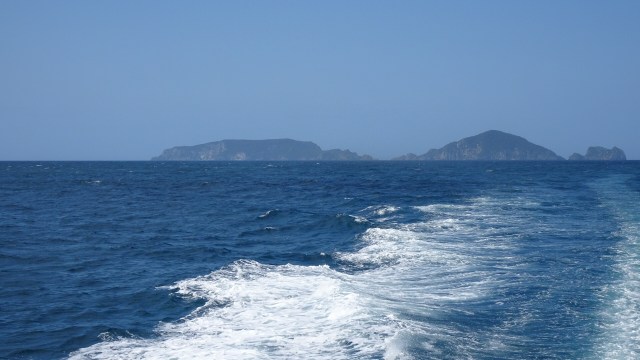
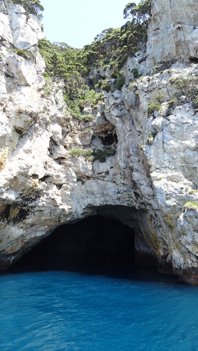
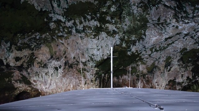
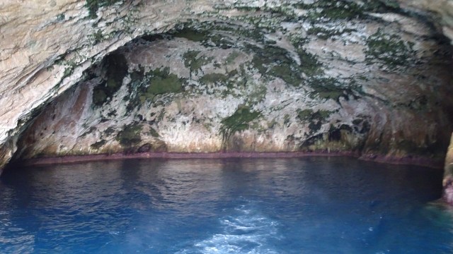
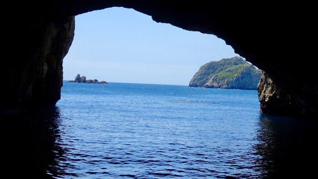
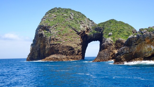
We motored through it. So the reverse view…

The end of a perfect day….on Perfect Day (Dive Tutukaka). I can highly recommend this trip. It is not cheap ($450 NZ for two) but certainly memorable.

Tutukaka

I mentioned yesterday that our Air BNB driveway was steep. Photos seem to show angles accurately, but I assure you this has a 28 percent pinch…the second photo is me walking my bike down to the road with Tony looking back up.

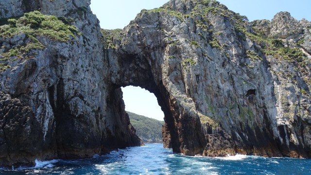
I probably should have entitled this ride something to do with the letter S.

As you can see from the map, we weaved around. From Whangerei to Tutukaka there is a direct route, but to see more, and add more km to our day, we decided to head out via the Town Basin towards Whangarei Heads following the shoreline of Whangarei Harbour.

The ride undulated all day but was quite pleasant despite the wind.

At the top of one of our earlier climbs we met Peter, from Linz in Austria. He is doing his very first cycle tour. I love this aspect of touring, meeting people with similar mind sets and passions, comparing notes on where they have been, where they are heading, their gear set up and so on.

There were some early delightful views looking towards the coast.

There were numerous signs reminding people to keep dogs on leads to protect the kiwi, and other simple reminders such as this one.

Parua Bay village was small, but seemed to have a number of cafes, but we pushed on heading away from Whangarei Heads in a north easterly direction towards Pataua South.

Pataua South is a small village on the shores of an estuary, with a sandy surf beach behind.

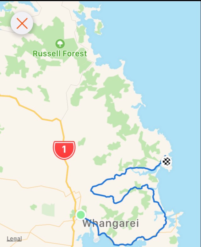
The road came to an end but there was a foot bridge connecting to Pataua North. Here I am walking my bike across the bridge.
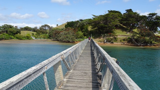
No cafes, so we pulled up on the banks of the river to have a snack and enjoy the view.

The road weaved around heading back towards the outskirts of Whangarei. We finally found a cafe! The Black Stump at Glenbervie.

A nice cold fruit smoothie went down a treat!

Another climb and a lookout.

Before heading to our accomodation (for the next 3 nights) we rode down into Tutukaka to see what was where!

Climbed back up the hill, and turned into more hills before finding a steeper driveway than this mornings! I seem to have an incredible knack for selecting accomodation involving steep hills.

The Bach is a cubby house on the shores of Kowharewa Bay. This first picture is the view from our little deck.

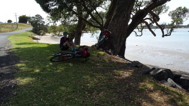
Kids playing in the bay.

One final view.

I’ve got to stop writing. The mosquitos are liking me too much, and I should go inside!!

Thanks for reading, catch you tomorrow.

Gravel is not my thing.

We had grabbed some breakfast supplies the previous night to prepare in our kitchenette. We were able to hit the road by 8.15 am with the temperature hovering around 16 degrees Celsius.

Skirting around the back of Wellsford we quickly hit the first patch of gravel for the day, but fortunately it was only for about 5 km, and very rideable. We chose this track to minimise our riding on State Highway 1, busy most days, but even more so now that people are heading off on Christmas holidays.

Rural scenes, still very green.

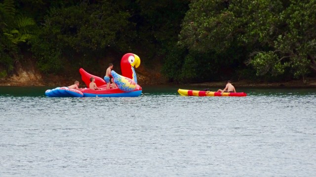
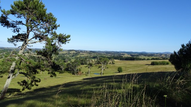
I liked this view with the distant knobby hills.
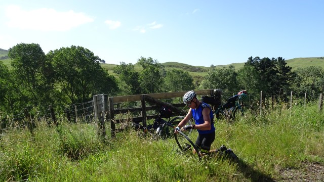
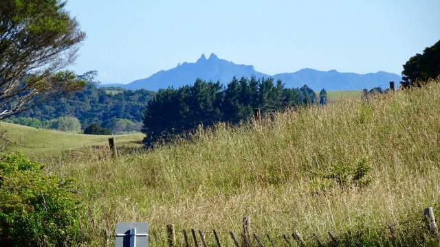
Back onto bitumen these photos were taken from the top of a climb. The lower one shows an electric fence that Tony needed to get over, as the reflective flag had blown off the rear of his bike in the gusty winds.

First stop of the day was Mangawhai Heads, a town that I had stayed at during my solo ride last year. We rode around and settled on coffee at this joint. They also provide free, very cold, sparkling water for your drink bottles.

We did a reccy of the town and this is the local waterway…low tide.

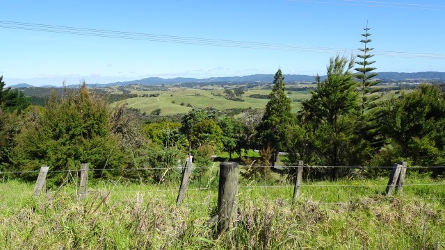
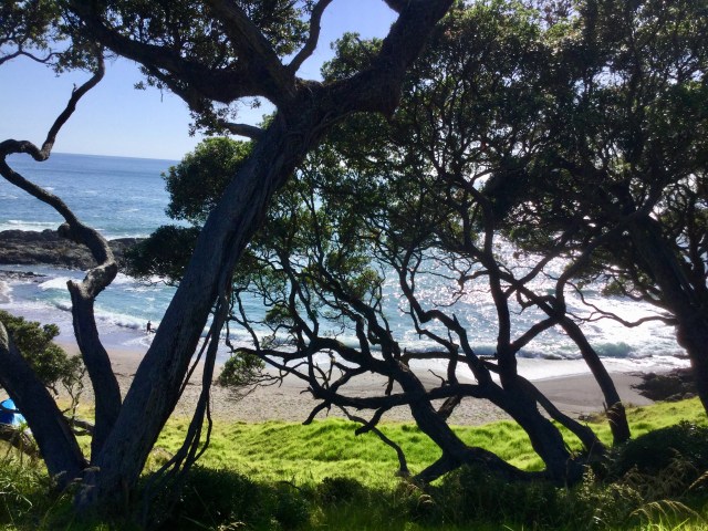
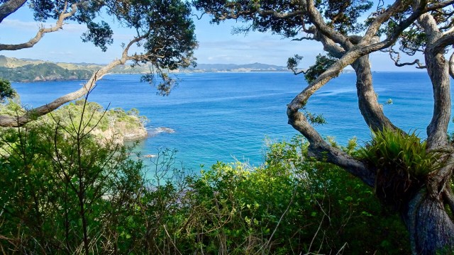
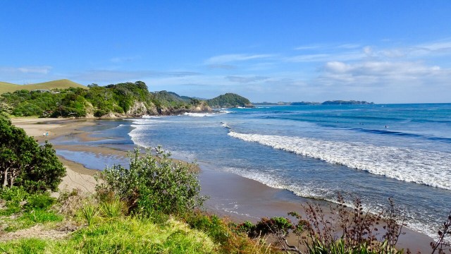
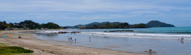
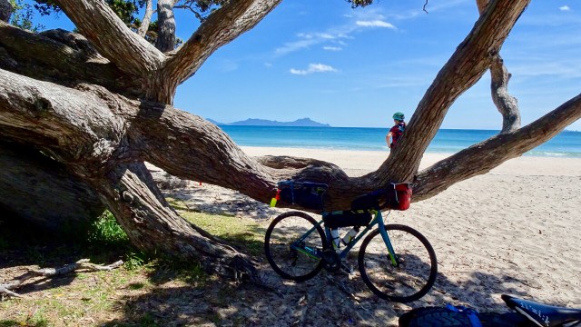
For me, the day’s highlight was beautiful Lang’s Beach, a stunning white sandy beach framed by craggy headlands, gnarled trees and wonderful views to offshore islands.

The islands that can be seen from the shore are Tauranga and Marotiri or, the Hen and the Chicks. They are the remains of long dormant volcanoes, once part of the Pacific Ring of Fire and are now wildlife sanctuaries.

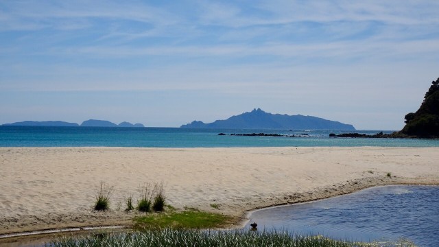
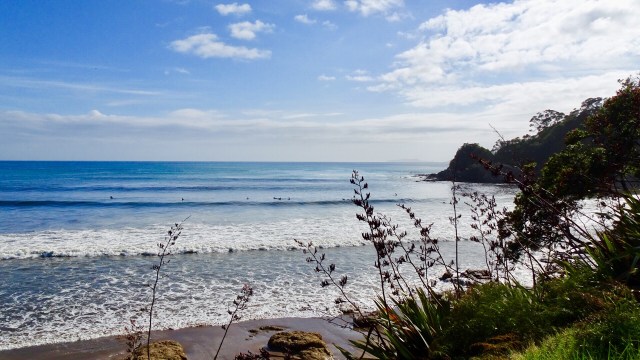
The lone rock on the right hand side is known as Sail Rock, a common mark used for yacht racing.

A few more beaches and then we headed inland to Waipu.

Waipu is a village rich in Scottish heritage. The Waipu Highland Games are held every New Years Day and people come from around the world to dance and compete in traditional Celtic challenges.

Today we just wanted lunch. There were plenty of choices, but we chose one promoting ‘honest’ food. Very nice iced coffee and an omelette later and we were back riding.

This is where the day got tough. We had been subjected to strong winds all ride. We were close to the junction of State Highway 1, the quickest route to our overnight destination of Whangarei.

However, quickest is not always the safest, and we chose to head further inland, across some lumpy hills towards Waipu Caves. We figured there was a chance they may be gravel, but to start with they were bitumen.

Then our luck ran out. It was dry, lose, slippery gravel with drifts on bends, adverse cambers, punctuated by some cussing. I knew where I needed to be, but my bike seemed to head to where it ought not.

Very frustrating and I will admit on some of the 13 plus percent climbs I jumped off on bends as I did not want to fall. Downhill I was even more cautious!

Anyway…life goes on. We liked this totem.

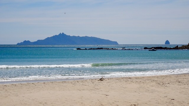
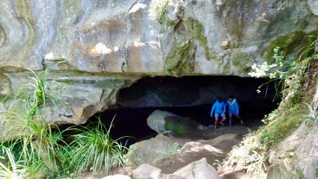
The dirt road had very few cars on it, so that was a plus. We were shocked when we arrived at the Waipu Caves how many cars were there. The place was packed.

Below is a group picnicking near the cave entrance. There were many other such groups in the area.

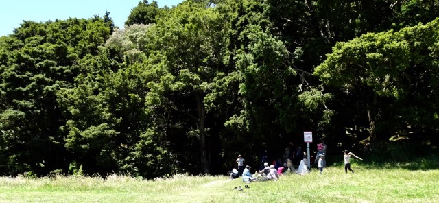
The cave is unmanned and you can just wander in. There is a 175 metre chamber. The limestone cave has stalactites, stalagmites and glow worms near the entrance. The cave system is considered regionally important for geomorphology because it is the largest cave passage in Northland.
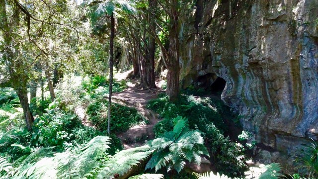
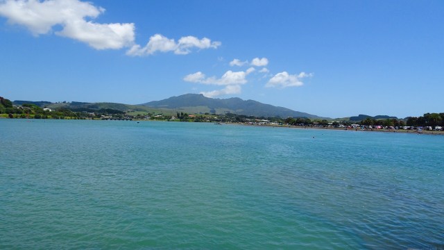
There is also a 4 km walk through the reserve, through karst limestone formations.

The hardest section of ride was as we left the cave. I got really excited at one intersection as we started to descend on bitumen. Alas, it was for max 100 metres!

Some more lovely views though looking towards our destination of Whangarei.

A few more km and we returned to bitumen, and we could pick the pace up from our gravel grinding crawl.

The road joined State Highway 1 and we were low on liquids, so headed to the service station up the road. Here I am chilling in the shade.

The State Highway was crazy busy with traffic so head down and maximum concentration. There was a verge ranging from 30cm to maybe 80 cm so we survived ok, and the cars were pretty well behaved really.

We headed straight to our Air BNB accomodation, a unit alongside the owners house….at the top of what they described as a ‘steep’ driveway. Yep, they were right. It was 28% gradient at its steepest point. We pushed our bikes up!

Today’s route…minimised to show our positioning north of Auckland. The elevation graph shows the up and down nature of the ride…biggest ones being on gravel 😢🙈🙅‍♀️😀

After showering we headed to the Town Basin, a mecca for local and international yachties, craft and art galleries, cafes and restaurants. Many were closed as it was later Sunday afternoon.

Can you see me in this quirky art ‘installation’?

The busy Basin.
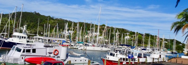
Looking up the hill towards our accomodation 
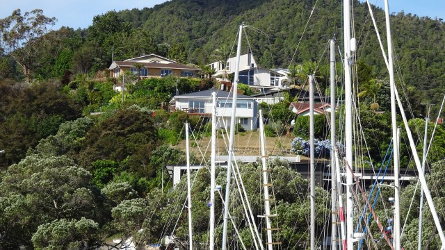
The clock museum with a giant sundial. 
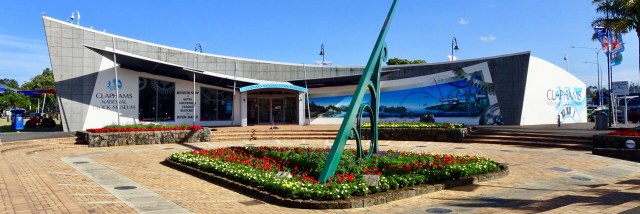
A telephone box with a working telephone. 
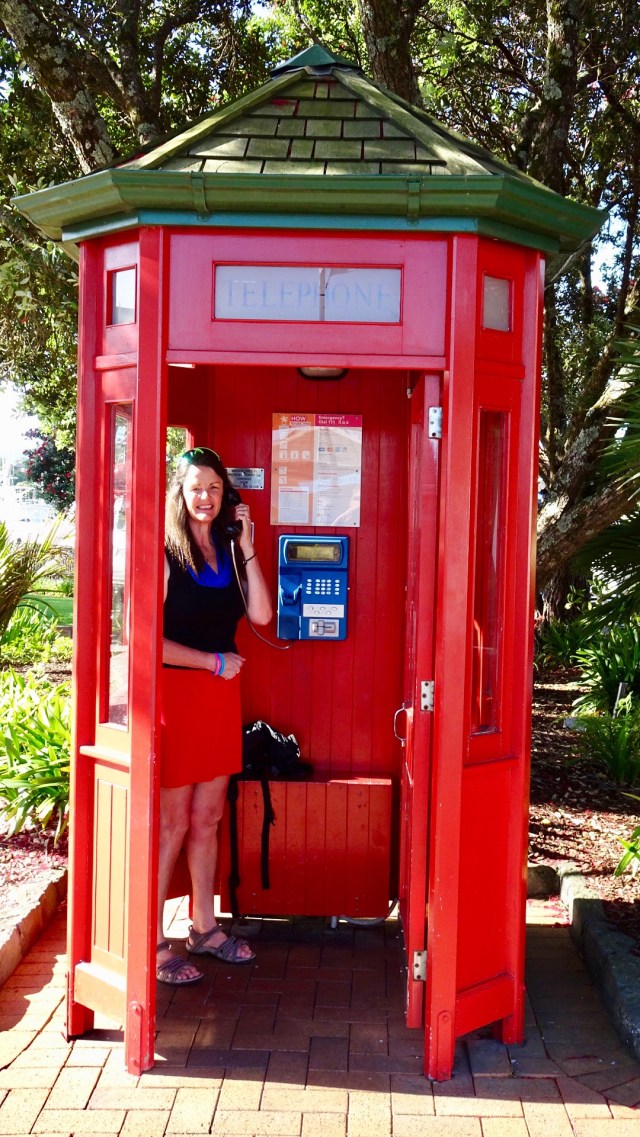
So day 2…done and dusted. Despite my anxiety on gravel, I lived to tell the tale. I really do suck at gravel!

Below is my favourite picture of the day. Taken at Lang’s Beach. Think this one will ultimately feature on a wall at home.

Kia ora

For the third consecutive Christmas , we are in New Zealand to do a cycle tour. I guess you could say that we like the place!

Kia ora is Maori for welcome. As a kid I knew the word Kia ora….it was the brand of sickly sweet green cordial my mother used to buy for us to drink. I do like the way that New Zealand has embraced its Maori heritage with so many examples of dual naming ( ie. English and Maori). The Welsh do it very well too, and can only wonder why we do not in Tasmania to acknowledge, recognise and value our extensive Tasmanian aborigine history.

Our flights out of Melbourne were delayed for multiple reasons. The plane arrived into Melbourne late due to the 44 degrees Celsius temperature accompanied by very strong winds and bushfire smoke closing one runway. All flights in and out of Melbourne were taking off and landing on the one runway.

When we finally boarded, the plane was incredibly hot. The pilot apologised. We could not have any air conditioning until he turned the motors on and we were waiting for two passengers who ‘will arrive shortly’. Famous last words.

Some 20 -25 minutes later two ladies boarded. Still they did not shut the doors. Waiting, waiting, waiting.

15 minutes later, the two ladies left the air craft.

Still the door remained open……

Maybe 10 minutes later, the two ladies reboarded the plane, with one holding the hand of a stewardess who seemed to be very insistent.

Immediately the captain asked for the door to be closed and cross checked!! She was trapped!!

As a result, we did not arrive into Auckland until around 12.45 am, and then at our overnight stay at Gervase and Deb’s house close to 2 am this morning.

First job, after some sleep, was to put the bikes together and Tony discovered my rear disc had been bent in transit. Poop! This needed to be rectified, or a new disc purchased otherwise I could not ride.

Here are Gervase and Tony discussing the situation. Fortunately for us, Gervase has the most bike friendly house ever, including a wide range of tools….disc was straightened successfully.

I am so fortunate to have a number of wonderful friends in New Zealand. I truly value and appreciate the friends I have made through cycling. Coffee and Christmas tarts with Gervase and Debra and we were on our way leaving Forrest Hill around 11 am.

We had arranged to have coffee with Dave at Waitoki. He is a Zwift friend, with us both being leaders for The Big Ring (TBR). When I used to lead Mink’s Centurion ride, Dave would regale us with corny jokes (sorry Dave), and describing his yoga efforts.

Proof of the catchup!
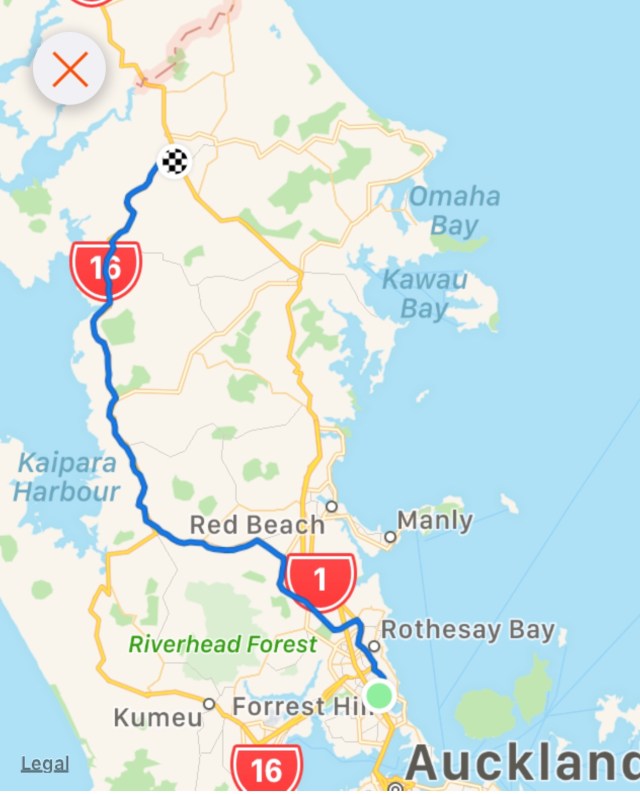
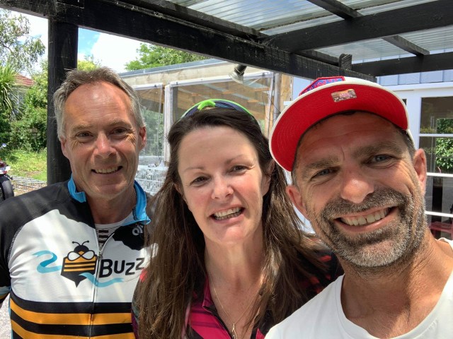
Kaukapakapa was next after bidding Dave ‘ooroo’. This was the town where my stolen backpack was located in March last year by an eagle eyed cyclist.

Local park in the town with some interesting features.

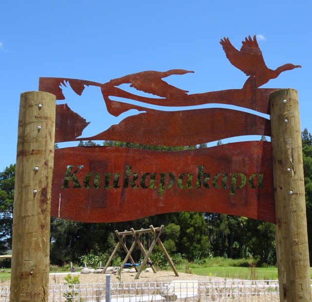
The bikes all geared up.
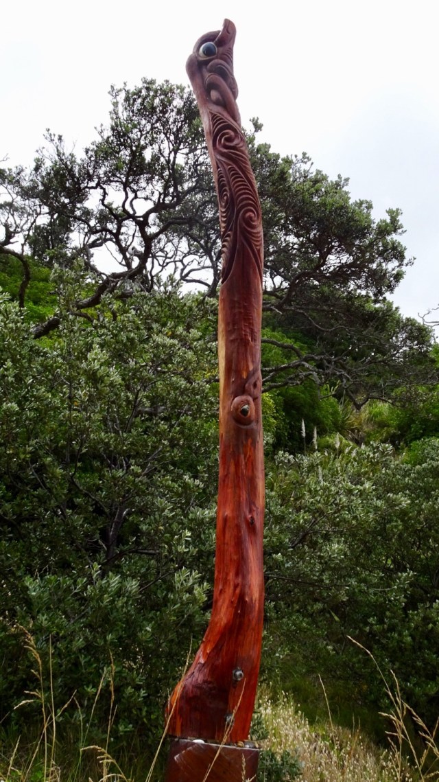
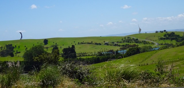
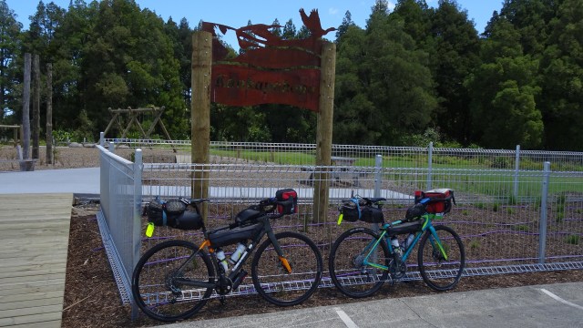
I am not sure what this is…fish? Maybe you can stand on it and walk along it for balance? Maybe you just look at it and photograph it.
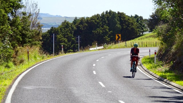
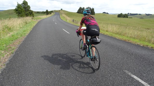
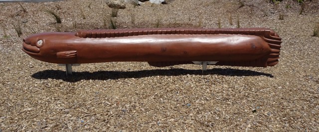
The hills started to get a bit more serious with some 13% pinches. The temperature had picked up to high 20’s. There was a really stiff breeze. Predominantly a headwind with occasional side gusts from our left, pushing us further from the verge.

The elevation map shows a few steep and nasty little pinches.

You climb, you get great views as a reward. Lush green farmland with sea views.

I like this sculpture and the cows who could not give a hoot.

Up and down, more views, more sculptures.

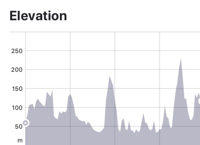
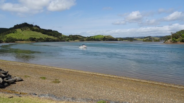
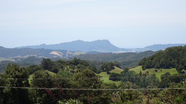
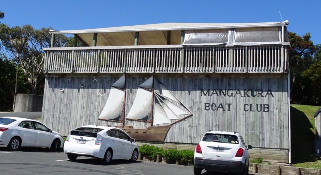
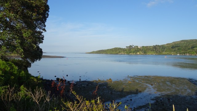
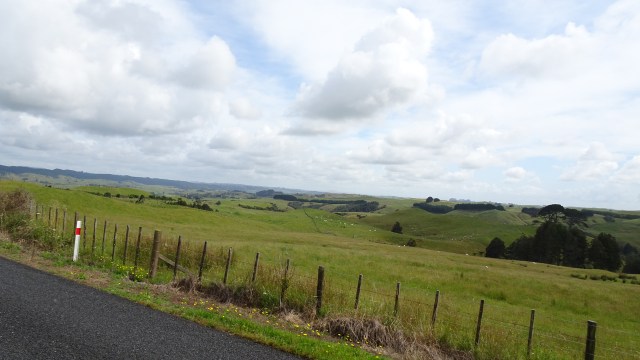
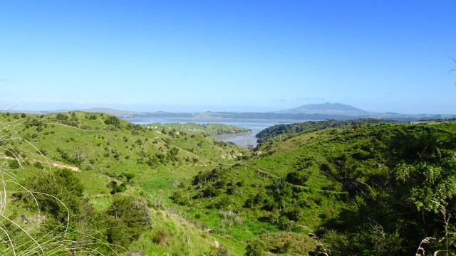
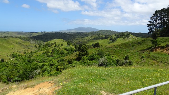
A very tidal river does not prevent a boat club from existing. Mangakura Boat Club has a lovely position alongside this river. We could see from tops of hills, that this river feeds out to a larger harbour and the west coast of North Island.
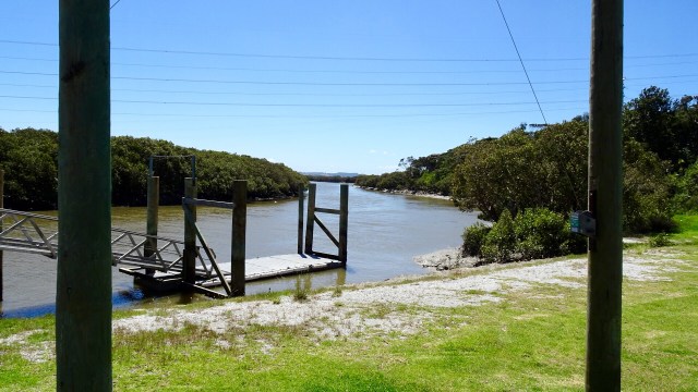
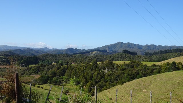
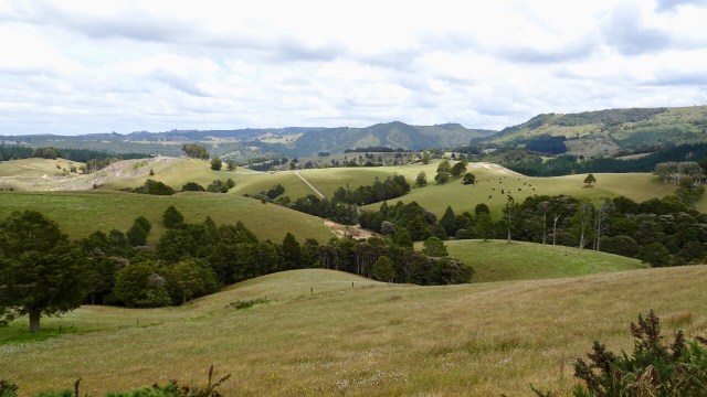
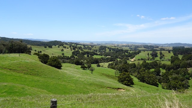
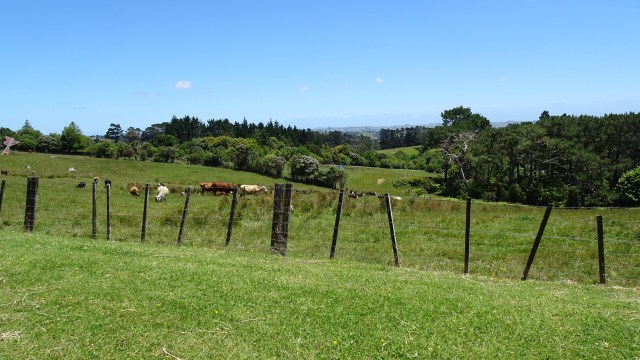
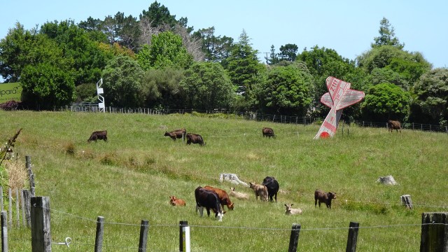
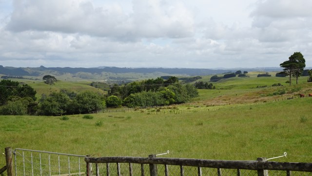
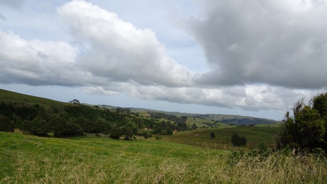
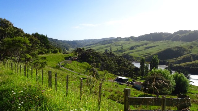
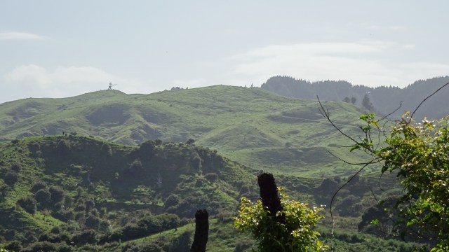
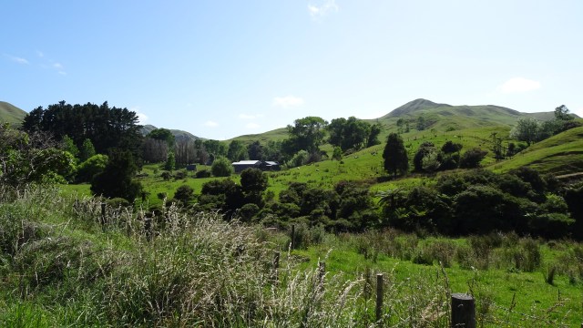
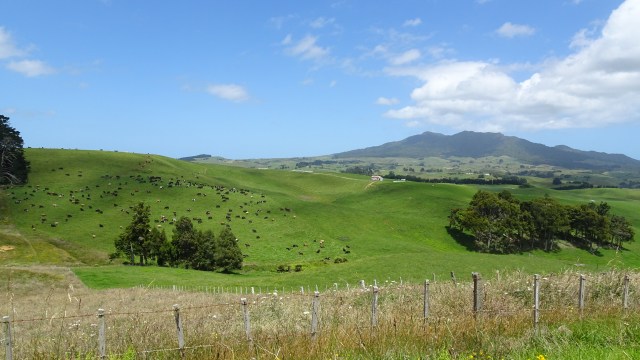
Incredibly lush green farm land. In Tasmania many farms are already very dry and brown, so there must be solid rainfall here.

The last climb was a nasty little climb that just kept giving. I was very glad to be at the top and enjoy the views. Really any excuse to stop at the top of a hill….’oh, I just want to admire the views…”

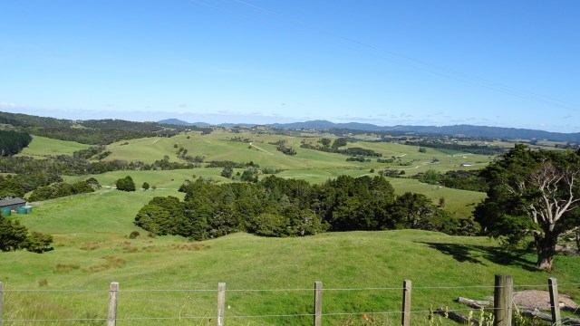
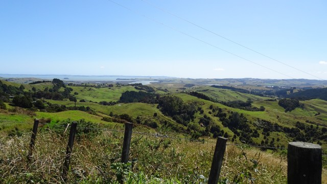
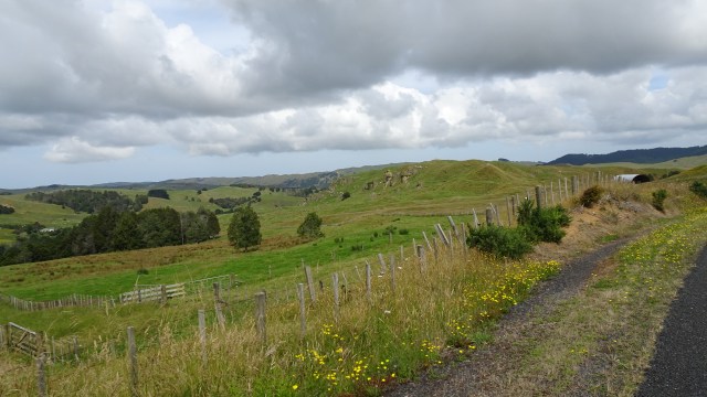
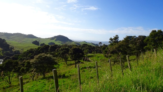
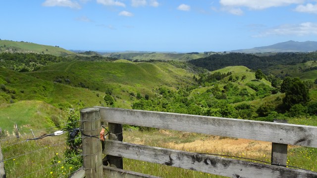
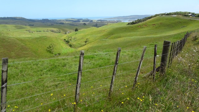
Looking to the west.
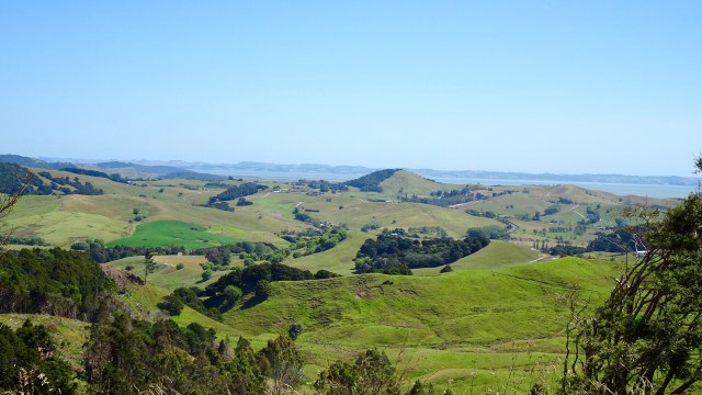
What goes up, must go down….so it was a nice descent and a few more rolling hills to arrive in Wellsford, a busy service town, and our overnight stop.

We were pretty keen for dinner, and walked the length of the town (that might sound impressive but maybe only 1km each way from our accomodation 😂 enjoying using different muscles for a stretch!)

The meal choice was standard pub fare bar the local cuisine speciality….wait for it…stew on toast!

We chose steak…Tony ate my chips and I ate his salad. The home made plum sauce ( in the wine bottle) was actually very nice, packing a peppery punch.

We will hit the sack early tonight to catch up on our beauty sleep.

Today’s route ( bar a straight line section where my Garmin was turned off under the Highway One sign).

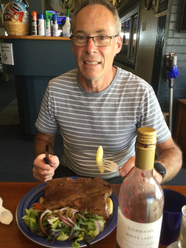
Returning to our accomodation two final sights.

The heritage museum murals reminded me of Sheffield. Tasmania.

I did wonder why it was named Albertland having a quiet chuckle, as in my teenage years when I did cross country, there was an elderly lecherous athletic official named Albert who used to chase my running friend Catherine and I around the place as we tried to escape him (and we were very successful being far more agile and nimble).

I was somewhat stuck with Albert as my mother had arranged for him to give me lifts to cross country but she was unaware of his ‘tendencies’. I kept quiet as it was my only way of getting to the different venues to run until I got my drivers license and purchased a car.

I later figured it out…Port Albert is not too far away.So thanks for reading. Tomorrow is another day…new adventure….new memories.

Llamas or alpacas?

Papatoetoe

Our local copper Air BNB host got home at 2 am…we assumed…so we snuck out as quietly as we could so as to not disturb him. He has left us food out for breakfast but we decided to find somewhere in town…again, so as not to wake him.

DD0401AA-FA62-41B1-BF7C-E0EC8A595FC0

Town was rocking at 730am, and we found ourselves a nice spot to enjoy our breakfast.

Setting off up the hill out of Raglan the day was gorgeous. No wind, and a very rideable 18 degrees.

The day was a tough one to finish on. It was literally up and down all day.

63DDBD2B-7A27-4FF6-AE73-66075024AFA5

BE2C50C1-9CCF-4E81-B90E-13A2167CE888

At times we had no idea where we were, but kept following our Garmin instructions.

7A49ED18-BC3B-4993-A854-429B60B89E40F3EB139A-FD25-4E7B-8905-E52DBBC9A8CF5C6AD3FB-97DC-4C0B-9BB0-B5BA75E5FD4609D445F3-5D71-4C2C-9EAE-B9C5AB1745B3CC00F3CB-1993-4E1C-9CF7-39BE8E550C4F

B11DC849-24D8-43F8-99DA-759027519CEE

We were both really thirsty today and were drinking heaps. Water became an issue with no towns in sight. I noted a lady outside her farmhouse , so wandered in and asked if we could possibly have some water for our bottles. She was more than happy to oblige.

Another 30 km later, we were running dry and still had seen nothing open. We found a community hall so checked it out, and found a house with water coming from their storage tank.

We soldiered on.

CEF47D79-DDF0-444E-8763-BE2DC61D970F

91097AF5-5873-4CF3-AE24-913E9BCED87A

BCC83033-EEEB-4A2B-AF50-18DA168EE118

We stopped at this signpost as Garmin was turning us right, rather than following Highway 22. It was pretty warm now, and our Garmin indicated mid 30’s. We had some of our emergency food….in my case, pear and mango baby sachet!

C2673075-94EF-46D4-8C0C-3B441085C932

Here is Tony’s preferred baby food…..

225C255B-539D-4D22-B29C-D4FCB9D0487F

This is where I disagree with Garmin’s route. It took us off the highway up a bitumen hill…that’s ok…then turned us left onto a damn gravel road….that had the worst camber incline to date …it was so steep  loose and slippery…

Anyway 4 km later I popped out the other end.  It was a tad shorter than the highway but about 4 times slower….

We were hankering for more food and were very excited to see this sign as we were climbing a hill.

90D7B92B-3D27-4EFF-A9B0-1E1D0A46FEC4

An odd combination to advertise for a petrol station but surely they had cold goods. We were hot, thirsty and hungry.

$40 later….

062105A0-C6EB-4E5A-AB0D-EA44395296EA

It was interesting to note the difference between diesel and unleaded. In Australia diesel is more expensive. Note the differential in New Zealand.

07C6EE0B-25BA-4ABD-9E45-79F31CAD4B2D

Our accomodation is in Papatoetoe a southern suburb of Auckland chosen because of its proximity to the airport, and the start and end point for this tour.

Nevertheless we needed to negotiate a fair bit of built up humanity and traffic, complete with the normal offenders such as the dude who did a u-turn into the bike lane, or the other guy who sped past us to then turn left….we needed to break heavily to ensure we missed his side passenger doors…morons!

After 138 hot, sweaty, thirsty kilometres we arrived in Papatoetoe…

It is always mixed feelings I have at the end of a bike tour. Lots of memories, lots of hard work, great sense of achievement and accomplishment, but…it’s over!!

This was also the longest unsupported tour I have completed. I have done longer supported rides ( ie where someone transfers your gear, and your bikes are heaps lighter).

Tomorroe is another day and my kiwi friend Jacqui is putting on a bbq for us tomorrow, and friends John and Suzanne have invited us up to Snells Beach for NY…and have  Tasmanian champagne on ice!!

The bikes have been cleaned and in the process of being disassembled and packed for the trip home.

There they will undergo further work and upgrades ready for our next tour….in April we head to Europe for 5-6 weeks…..with our bikes!!

2018 has been a wonderful cycling year!

CDDFD872-A229-48D9-AF3F-536495639F22


Raglan

Today was our shortest riding day scheduled for this tour, but we were still up before everyone else at the holiday park. Mind you, I think we were first to bed too listening to the kids running riot until at least 10 pm.

Enter a caption

Today was our shortest riding day scheduled for this tour, but we were still up before everyone else at the holiday park. Mind you, I think we were first to bed too listening to the kids running riot until at least 10 pm.

We headed into the local shop to grab some ‘breakfast’ and coffee, which we took to eat in the local park. The day promised to be a cracker weather wise.

2C3D22D4-E05E-4DD9-8AB7-BFC18933E6BD5A0F5554-098D-4516-9050-F8DE7310B3BE

14ED862A-64BA-4D89-A3AA-A37711D4B19E

We enjoyed 4km of sealed road climbing out of town, before turning left onto gravel. The first bit looked fine.

7C8136F0-2938-4398-9D07-76EA2FD22550

Whilst today was a short 49 km, 38 km was to be gravel, 11km sealed. There was over 800 metres climbing in that shorter distance, and around 750 metres of that was gravel.

The views were great though.

F0C91412-6B06-41DD-8DDF-2F02CE3B4F4A62F3C686-BDAE-4696-920A-2702CA8F1077B5C7B641-C09F-44FF-A85B-FCC2405C7EFA

009626A7-0DBE-43CB-8A77-578DD9A68490

A lot of the gravel was shite. The cambers were very steep with lots of loose gravel. My bike and I had a few words! The bike wanted to head to the lower side of the camber, whereas I wanted the higher side.

You know the going is tough when you are descending at 11kmh! I also only had one foot cleated for the majority…wanting that uncleated foot ready to hold me firm.

4EDDB666-F92F-46EE-A6EF-5CE8C5B7AE92

We moved on, slowly and surely, ticking off those kilometres.

F1FDD48C-2910-4A47-A1F6-B437E5043000

FFA1CD2A-DE2D-4071-8EBC-1F115040C7A9

Then it was Tony’s turn for a puncture. That did not resolve all his technical issues as his rear disc brake pads were making noises and he pulled them out to inspect.

They were worn out so he replaced those as well. Amazing what he has learned off You Tube to become a handy bike mechanic.

Nice views from our repair site  although we were only part way up a climb. It is nice being able to sit in long grass in New Zealand knowing there are no snakes. At home you would be wary of the longer grass, although snakes also like short grass.

In Tasmania, all of our snakes are deadly poisonous….and protected!

1B0BC416-86E3-4156-BB9C-3680F04F9049

081AB760-FA0A-4ECC-ACF2-7F5E4BEE9C4A

The area was again, outstanding.

0CC624BA-6EB7-412A-9ED8-995F5397B147

933525D1-8B92-41AB-AF4A-95DBC5D3DAEF

676336F0-D6DB-4984-9485-2A8D611C4B61

I was delighted to finish the ride to Raglan with a few more km of sealed road. What bliss!

We arrived in Raglan, along with half of New Zealand it seemed. The traffic was heavy and the streets were packed. Sitting at a cafe having some lunch, we felt somewhat overwhelmed. We had enjoyed so much peace and tranquil places, devoid of crowds, that the sudden crush left us craving that peace.

Notwithstanding that, Raglan is a great town with a strong vibe. Great cafes, craft breweries, quirky shops.

We met a young family, with three young children. They have travelled from overseas and are able to cycle some of the areas we have been. Dad is riding a tandem with the eldest child ( maybe 6-7 years old), towing a cart with the say 5 year old. Mum will ride towing a cart with the youngest. Wow!

They will be riding from Matamata to Rotorua, which concerned both of us, as that has been the hairiest day of all, with the large trucks, impatient drivers and minimal verge.  The carts with the kids are significantly wider than the bikes…..I wish them the best of luck. I have provided my details for strava so they can check our routes and a few suggestions we had.

The natural harbour is magnificent, and was being very well utilised.

BC3881B0-1E9A-4CB8-BC51-6F50CF2CD1602BEDC52C-0EF8-45D5-A2AC-6D7EA5071AB9E0E8E10B-D604-4BEB-8756-B415DAABAAF3

52161165-3408-4E2B-B4C0-5B50532043F7
Whilst the sand may look muddy, it is in fact black volcanic sand

We spent quite some time watching kid after kid jump off this bridge. They were having an absolute blast.

0B07F4DC-F070-41D3-AE23-8E1691652826EDA51AF9-655B-4E05-93E3-771F4BF88961

E4B495F8-F4A7-4DB2-8FE8-726087E01CC7
A closer look at the throngs on this section of the harbour

D6DABD4D-D725-4B9A-9268-9DF3FAB9A349

2052A185-640D-4454-9186-D5F7334D1696

22FE7BD2-897E-461D-A6A6-C60F69A691FF
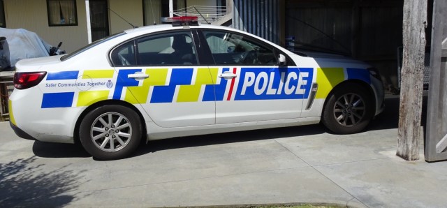
My last two touring trips in New Zealand have involved Police. On the Auckland to Wellington trip, Sue and I were flagged down by the Highway Patrol ( flashing lights, siren – the full works),  as we had inadvertently made our way onto the motorway heading into,Wellington. Very nice man!

Then with my solo Auckland to Cape Reinga return tour, I ended up at the North Shore Police Station after my backpack was stolen whilst I was in a shop, under ‘unusual circumstances’.

So why should this trip be any different??

86D4A964-6BCE-423A-84A3-2A7D40B19EEB

Well fortunately all is good!! We are staying in an AirBNB owned by the local cop. He does not lock his house, assured us our bikes will be fine outside, as in 6 years no one has knicked anything.

Chatting to him I asked what the main issues were in town…drunk and disorderly, domestic violence, car accidents and……house burglaries! We have used our cafe locks!

So tomorrow is our final day. We need to make our way back to Auckland. We have revisited the route for this as it is a decent ride…anything between 140-160 km depending on ‘which way’. It is not flat either!

We will ponder firther, and get some sleep.

Ooroo


75AAD230-E6DB-470B-ABD8-DBD8D79CF31D

0209AA9D-FD2C-4577-84A4-255E1D3F6892

9D58B64D-C929-4F5C-A1E8-280EBC3BFB86