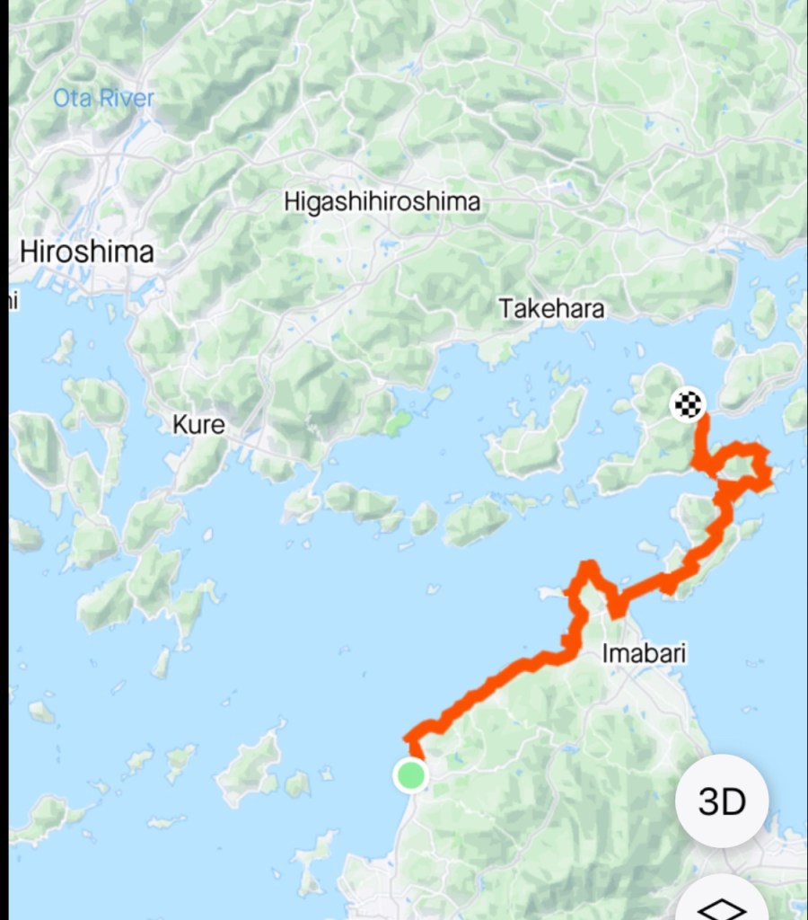
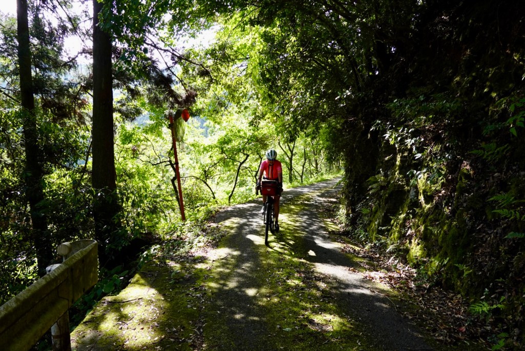
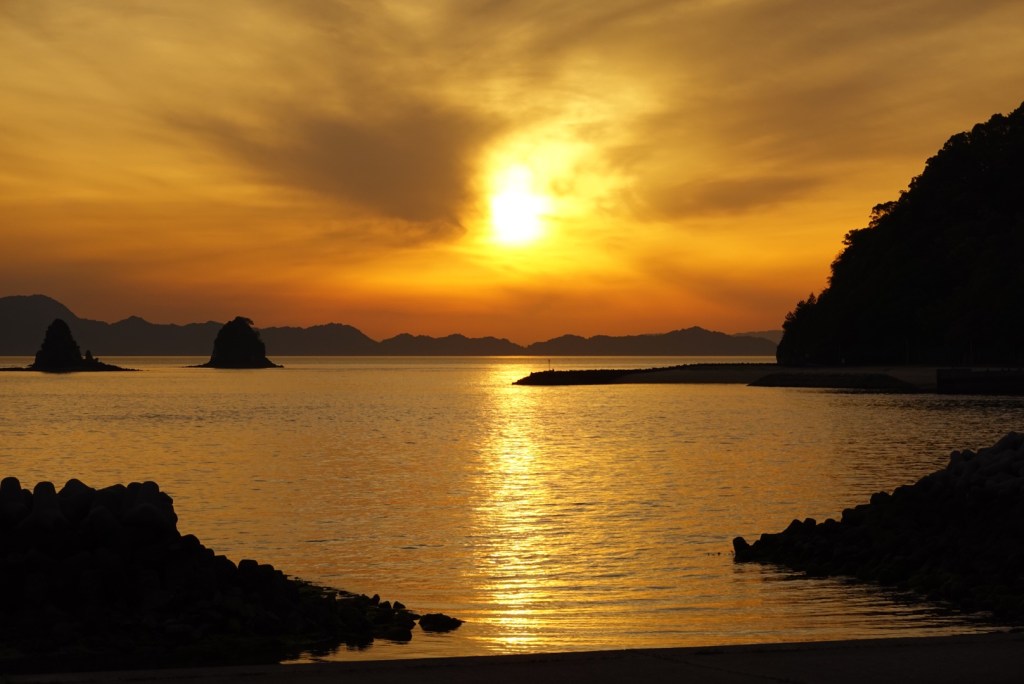
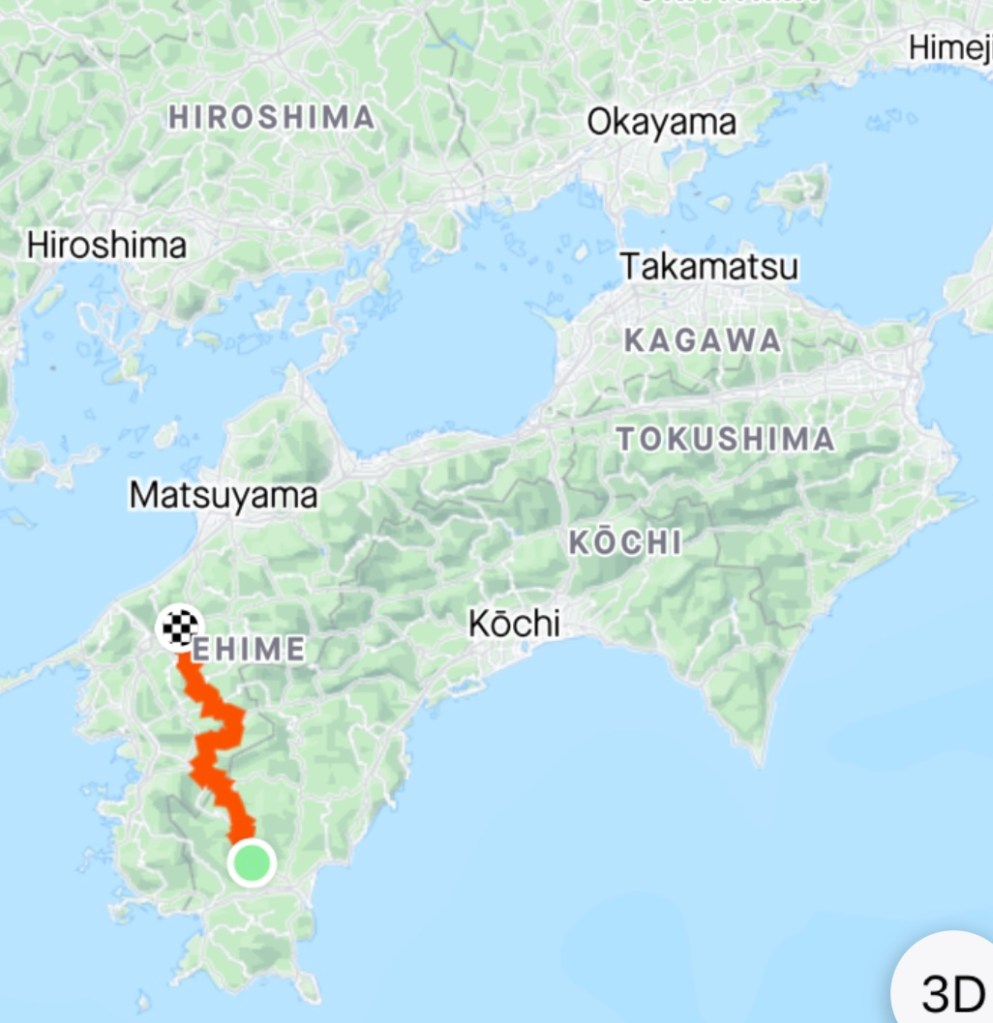
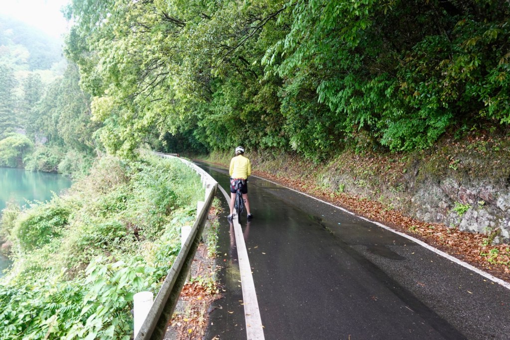
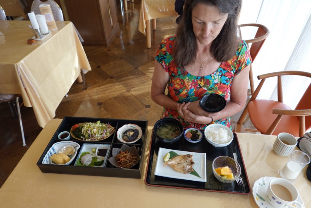
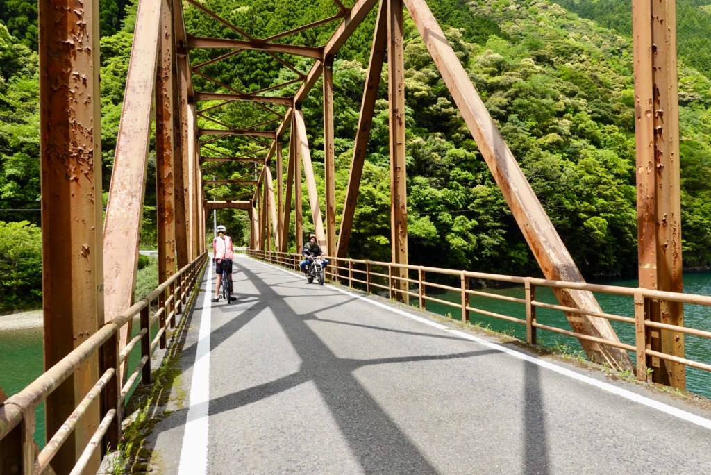
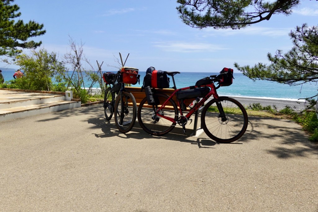
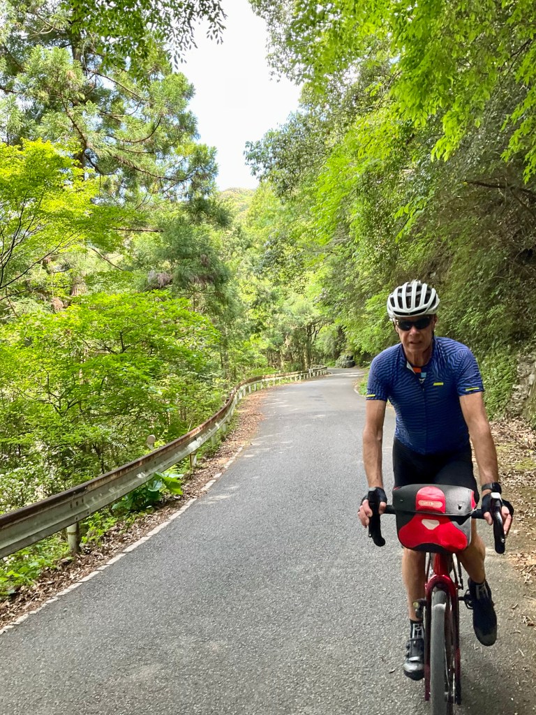
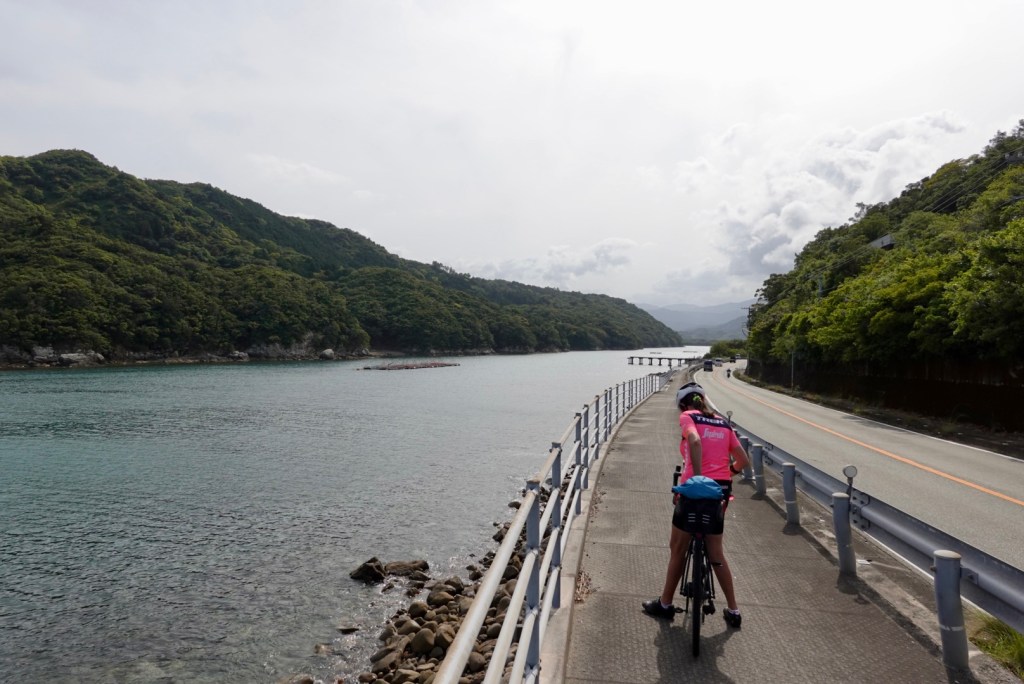
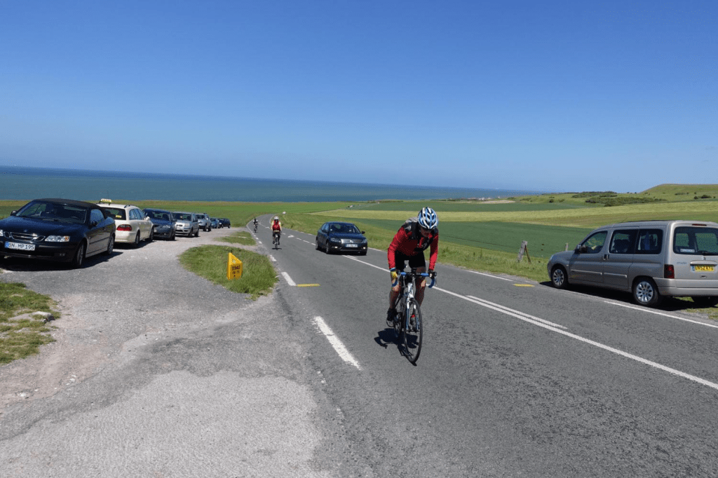
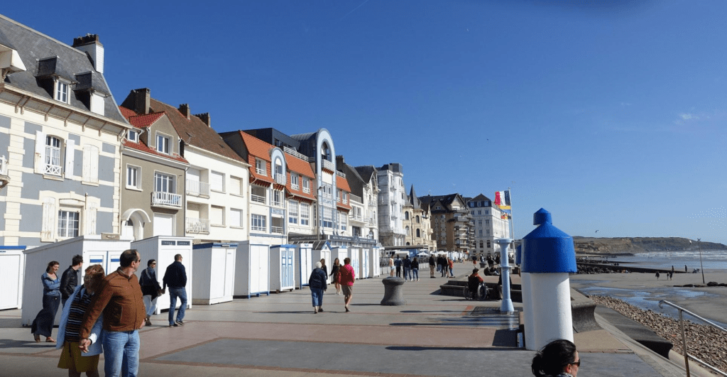
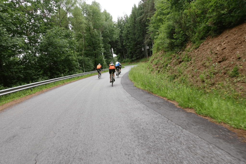
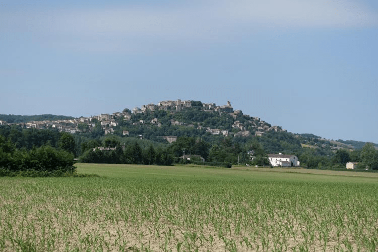
The weather was warm and sunny. The wind left us alone most of the time. The views were beyond our expectations. The infrastructure amazing. We’re a bit sunburned. 92 very enjoyable km.
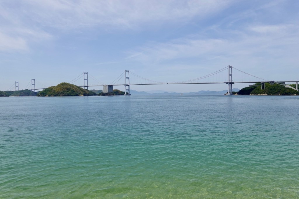
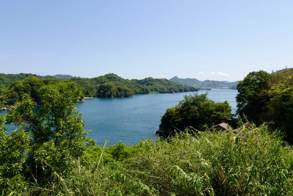
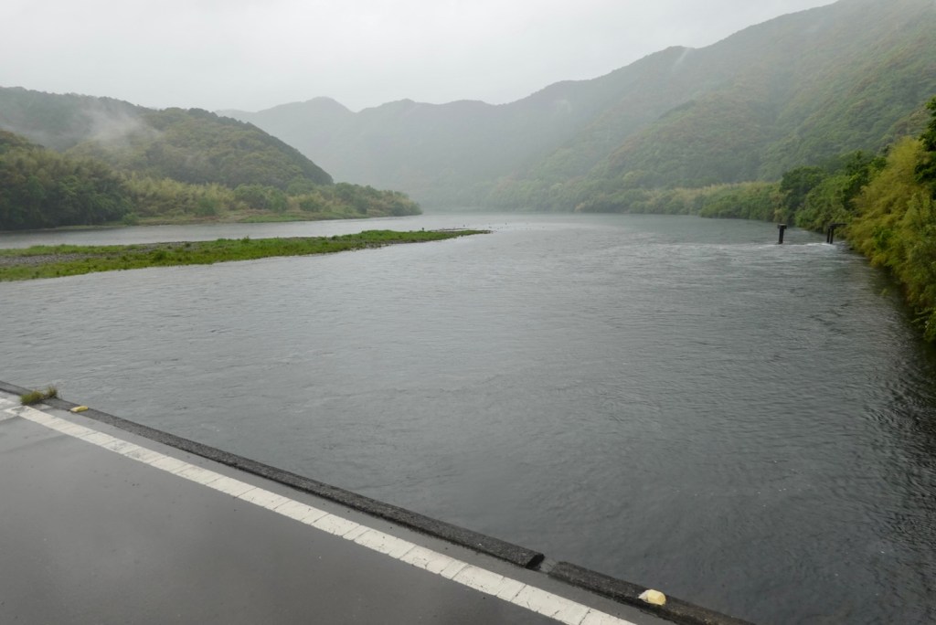
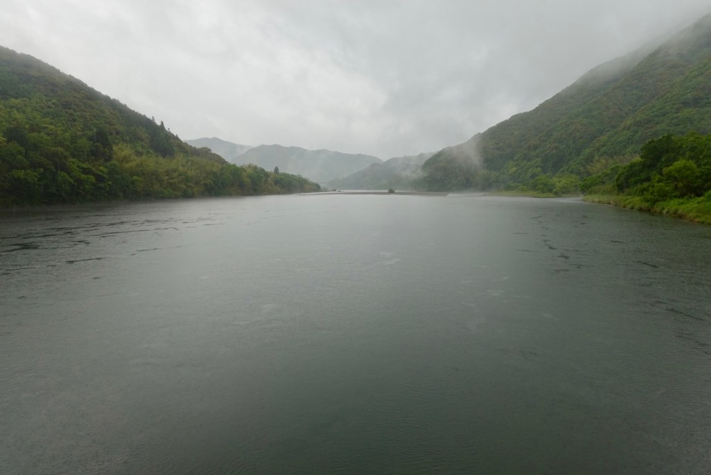
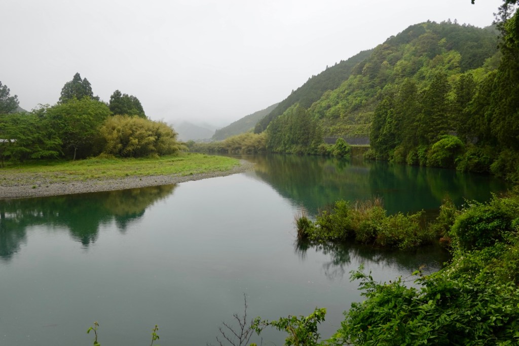
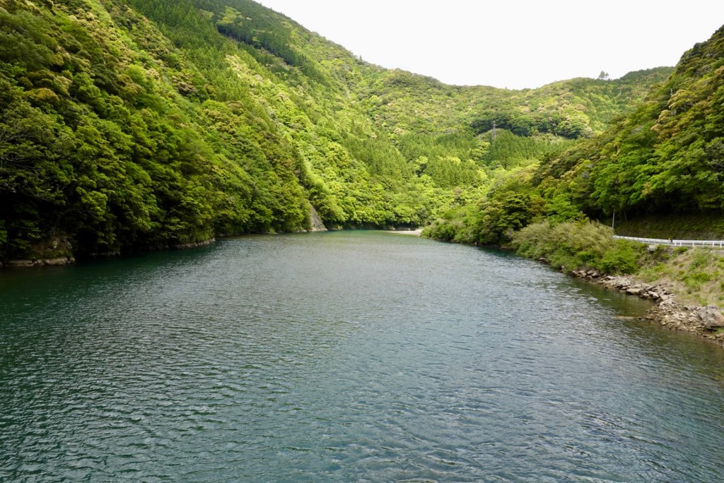
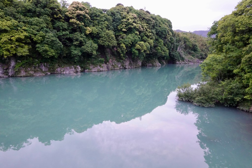
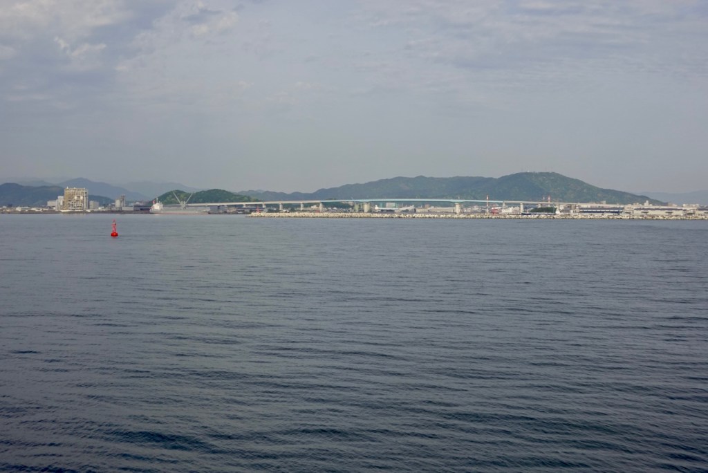
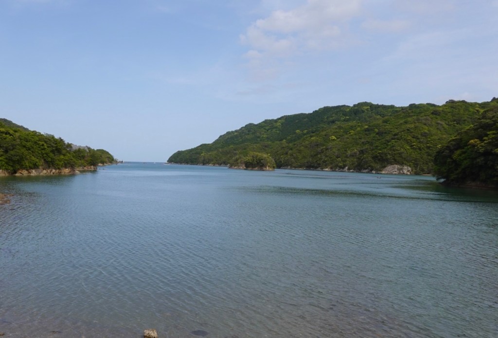
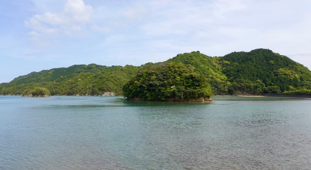
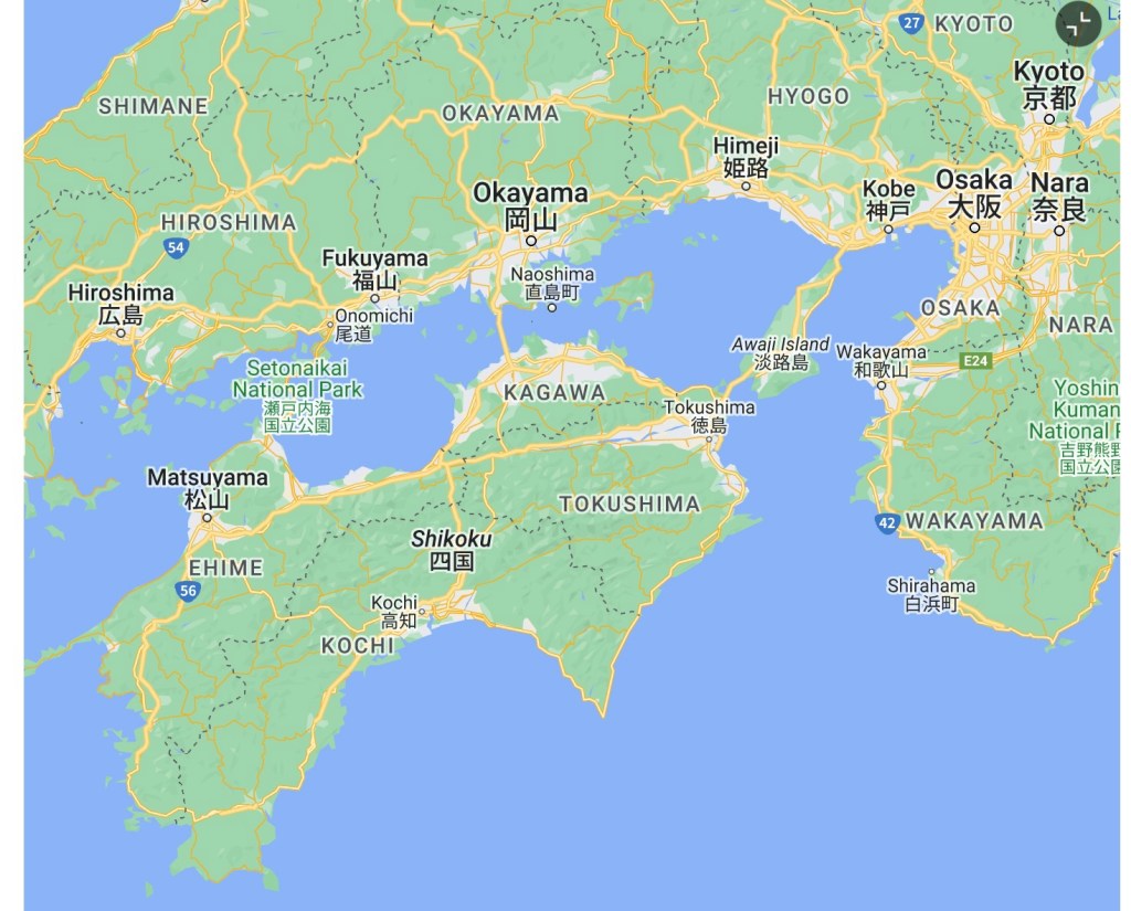
We predominantly followed the coastline today. The body of water on the map is the Seto Inland Sea, and it separates three of Japan’s main islands (Honshu, Shikoku and Kyushi). It serves as a waterway connecting the Pacific Ocean to the Sea of Japan, and contains over 3,000 islands.
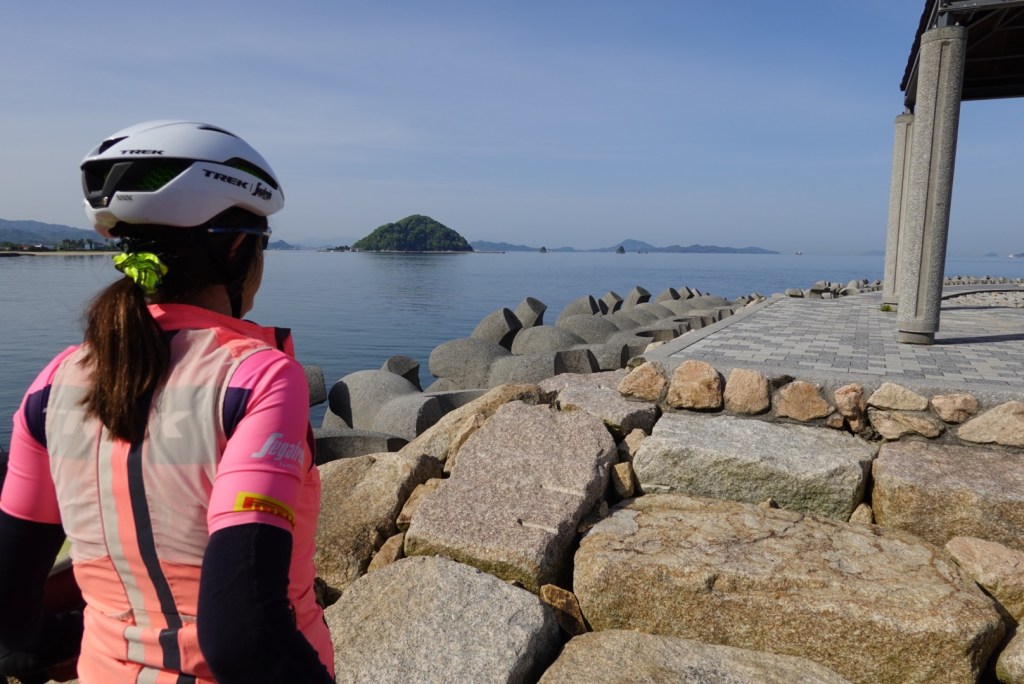
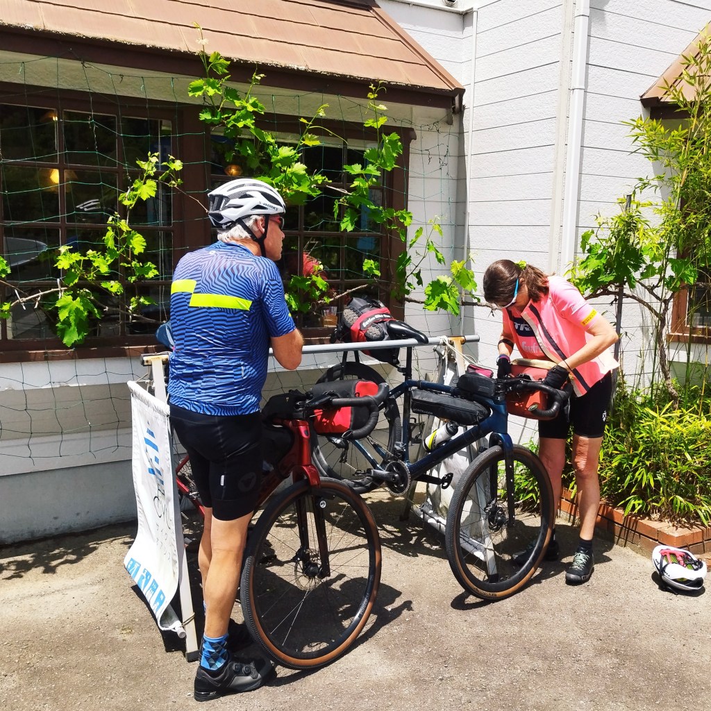
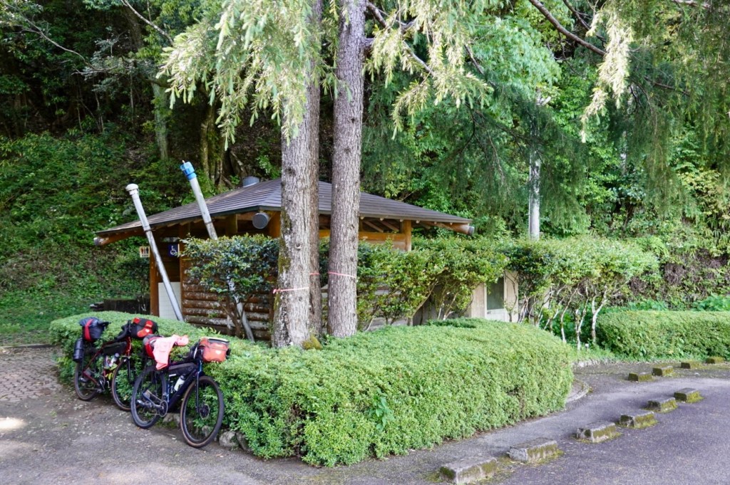
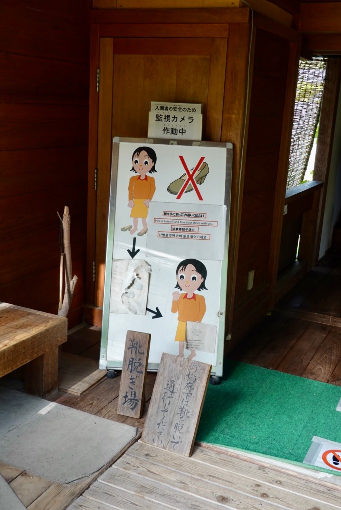
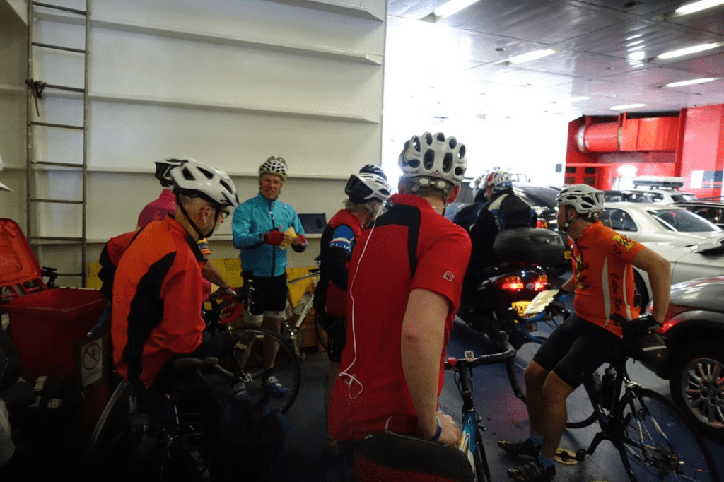
Leaving our accomodation by 8 am we stopped to pull the camera out countless times. Let’s get started!
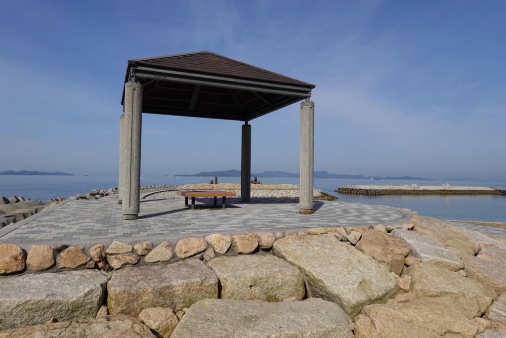
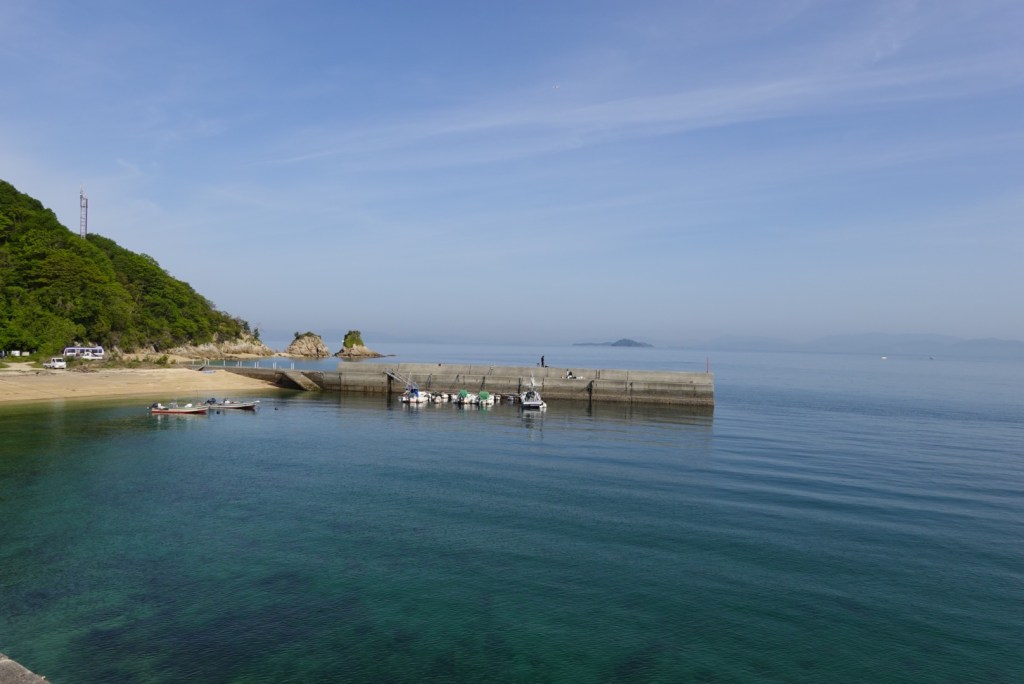
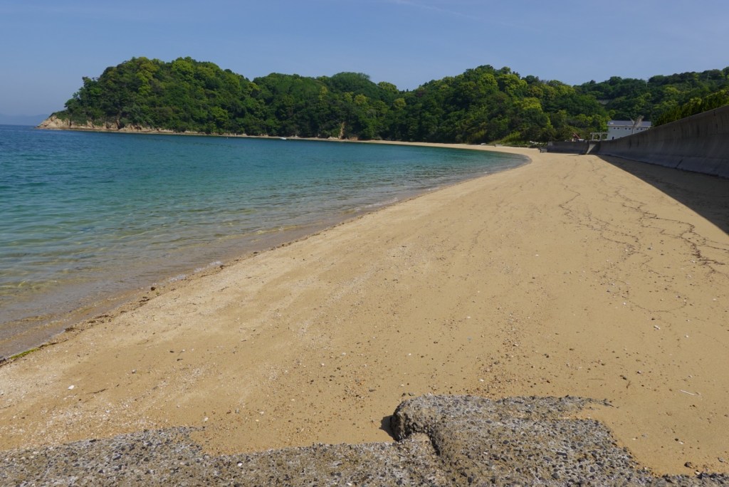
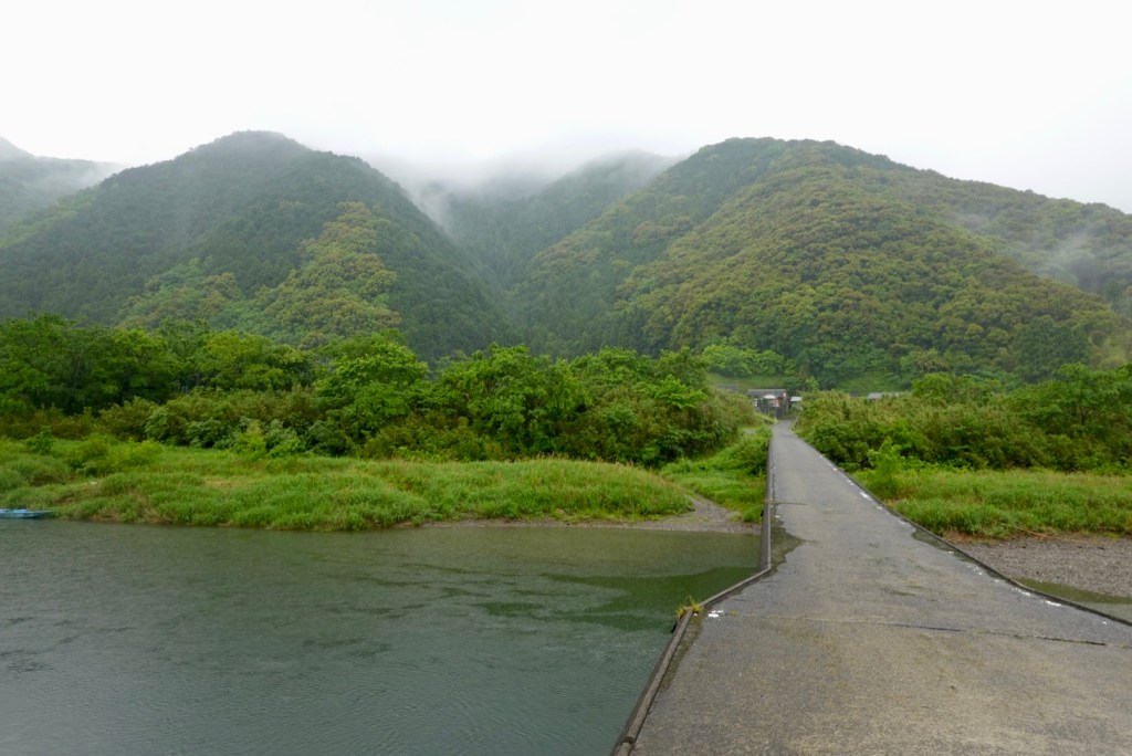
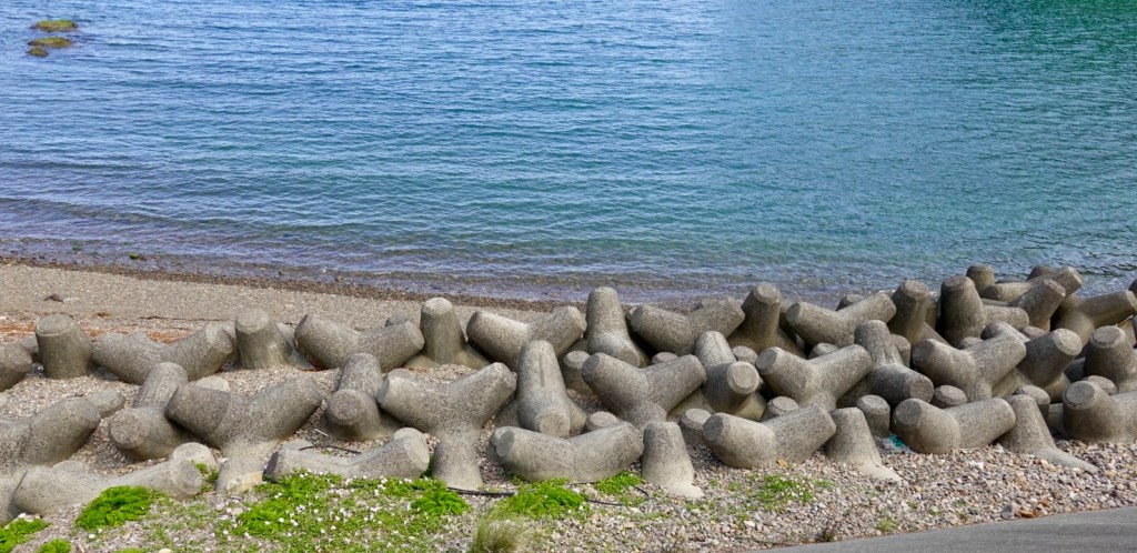
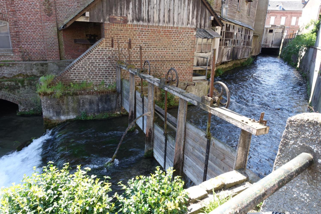
First stop just up the road was a breakwater with paved top and lovely views.
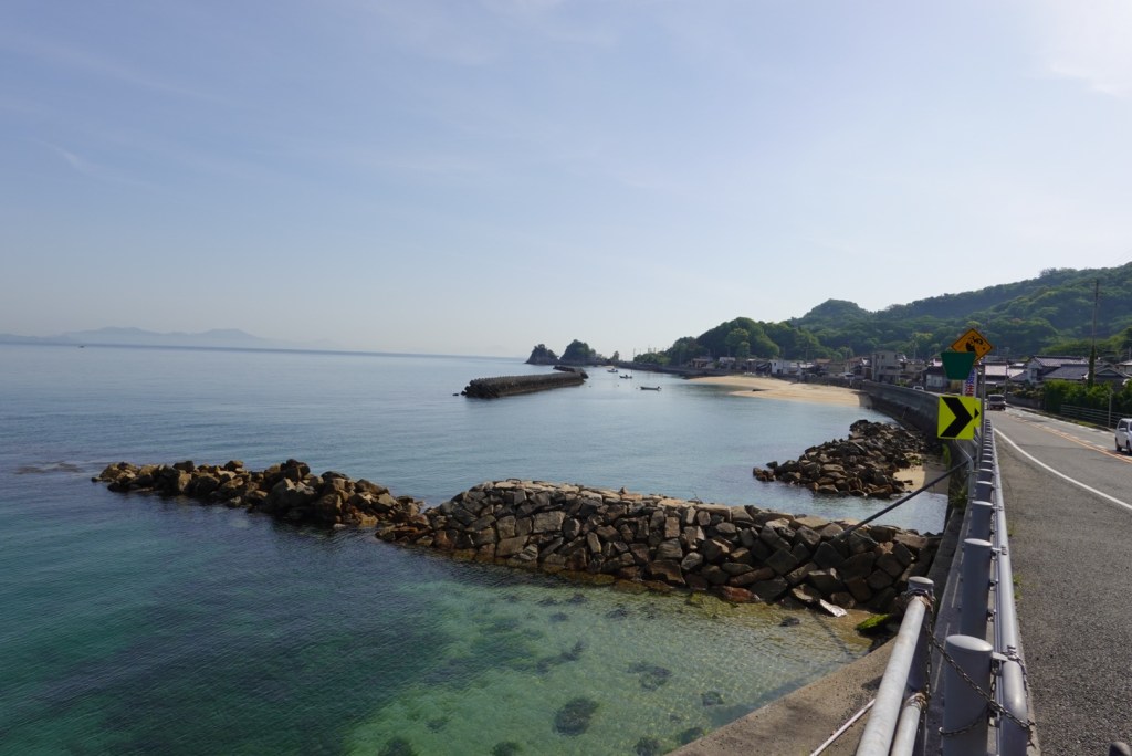
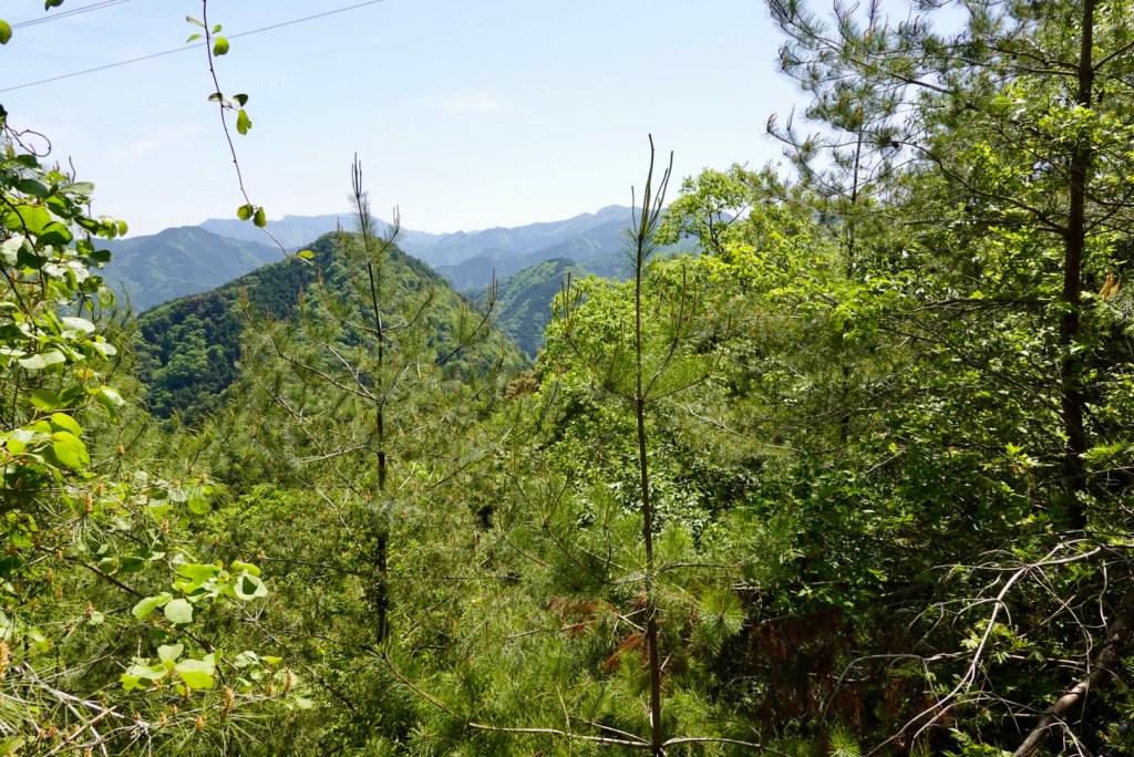
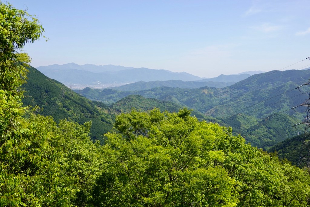
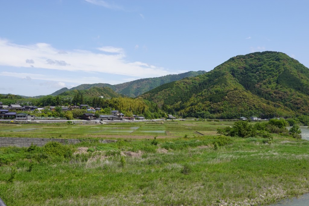
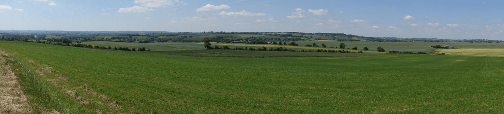
The scenery to our left as we headed towards Imabari.
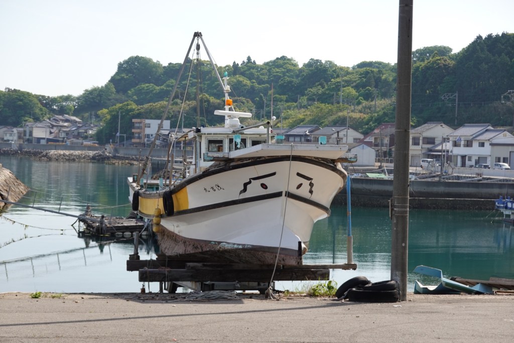
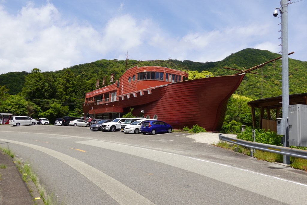
We liked the ‘eyes’ on this boat.
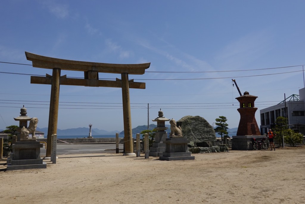
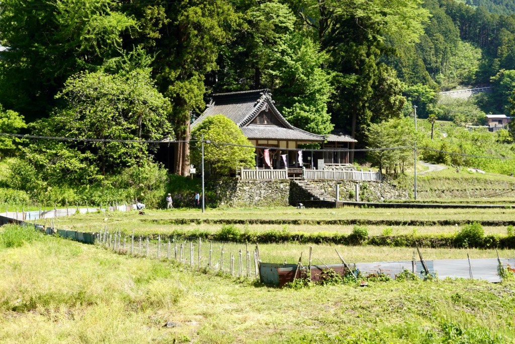
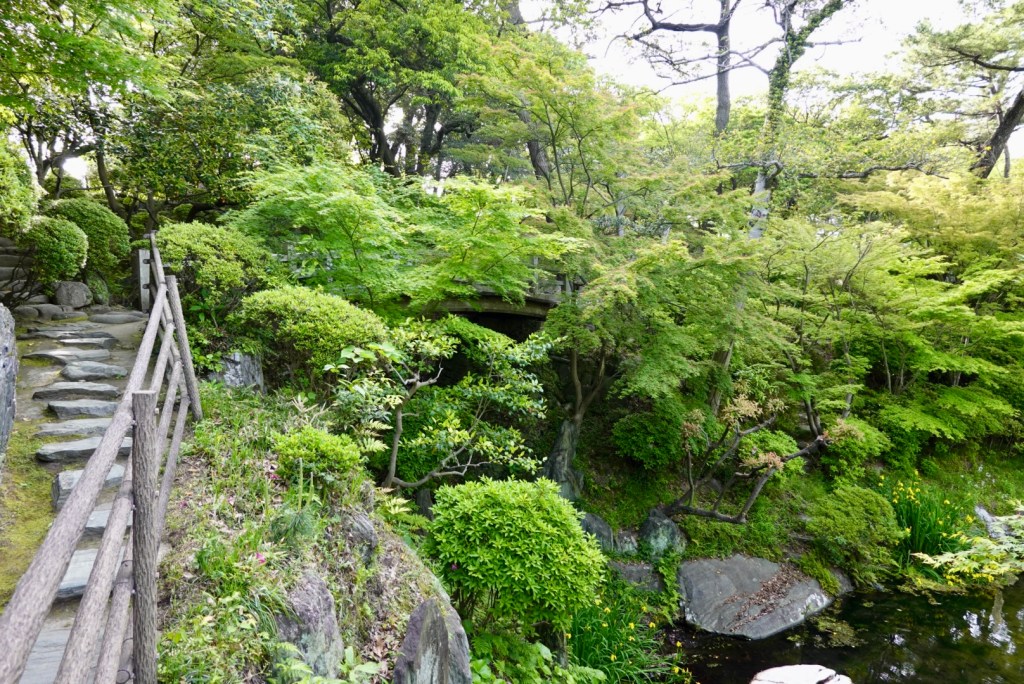
Shrines are very common. We must have passed at least 50 or so today.
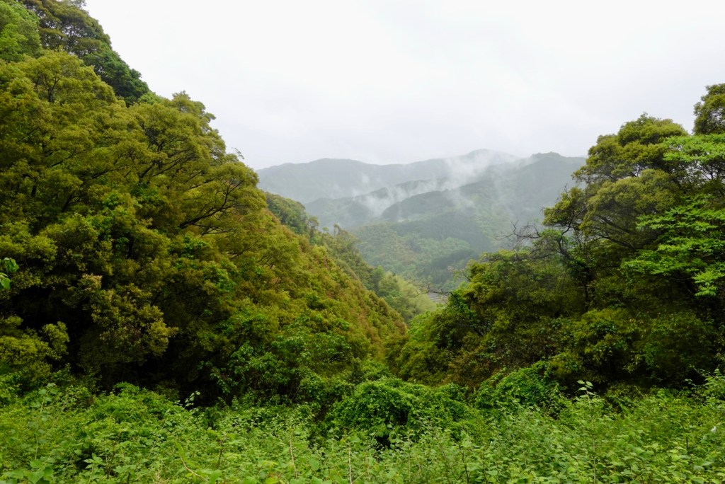
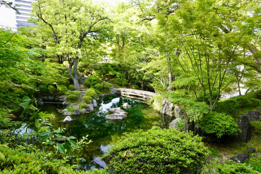
Just beautiful.
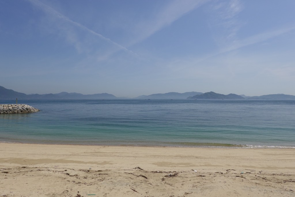
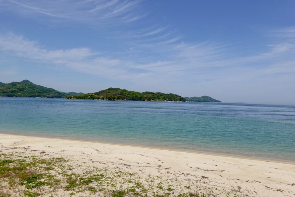
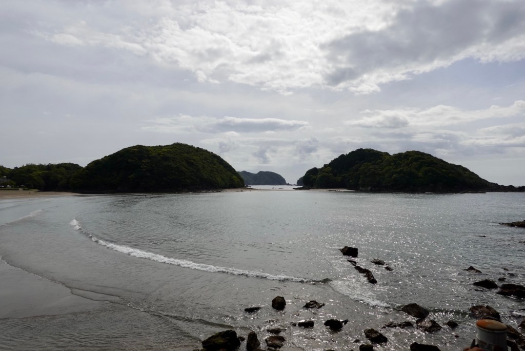
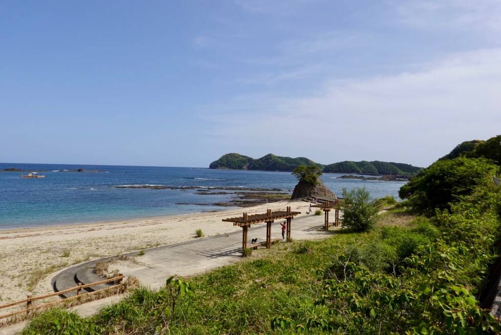
Having time to ‘kill’ today we took a few detours, including this one to Kamoike Beach. A really cute bay and inviting to swim.
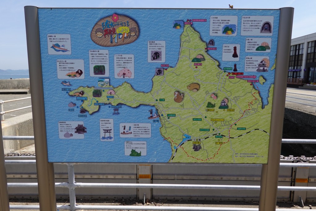
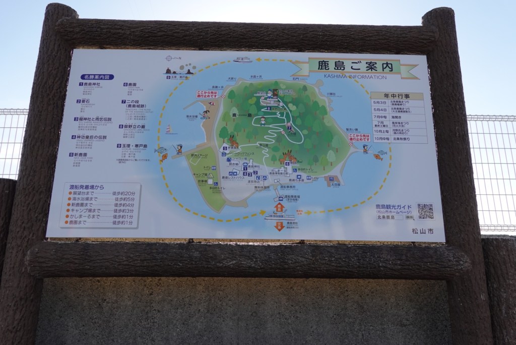
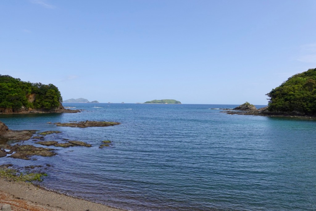
The jut of land to the left is Cape Kajitori and we headed out there winging it. We certainly did not see any wildlife depicted on the board.
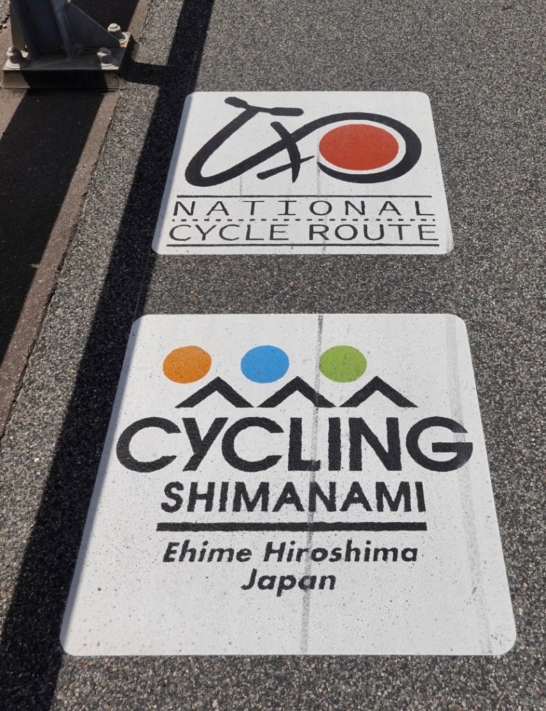
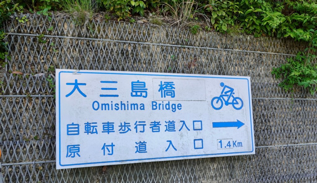
Shimanami kaido fast approached. What is the Shimanami kaido you ask?
it is a 70 km cycling road between Onomichi (Honshu) and Imabari (Shikoku).
It attracts cyclists globally to Japan due to its uniqueness. The cycle highway connects six islands Seto Sea via seven bridges.
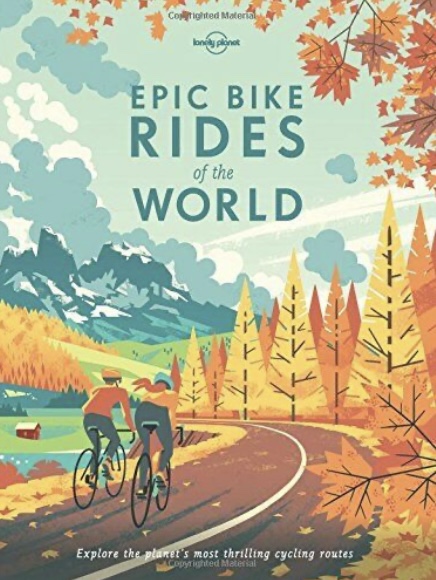
I first learned of the route from this book.
In planning this trip it was determining what we could ride in addition to the 70 km. That’s when I discovered an official around Shikoku route and the mapping started to incorporate both.
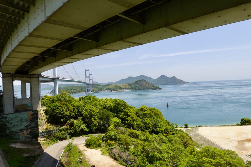
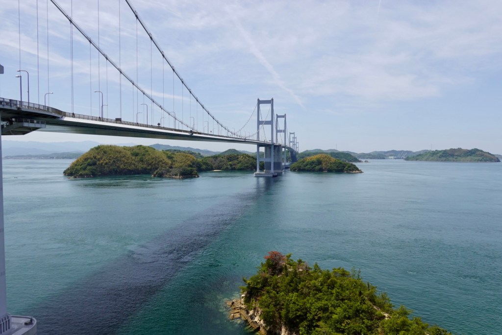
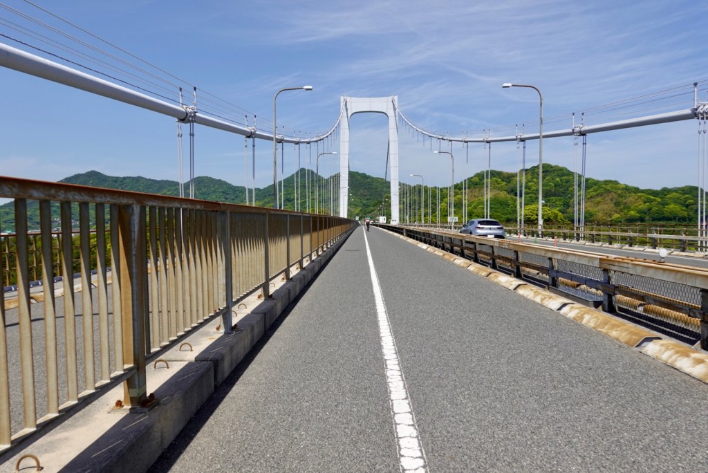
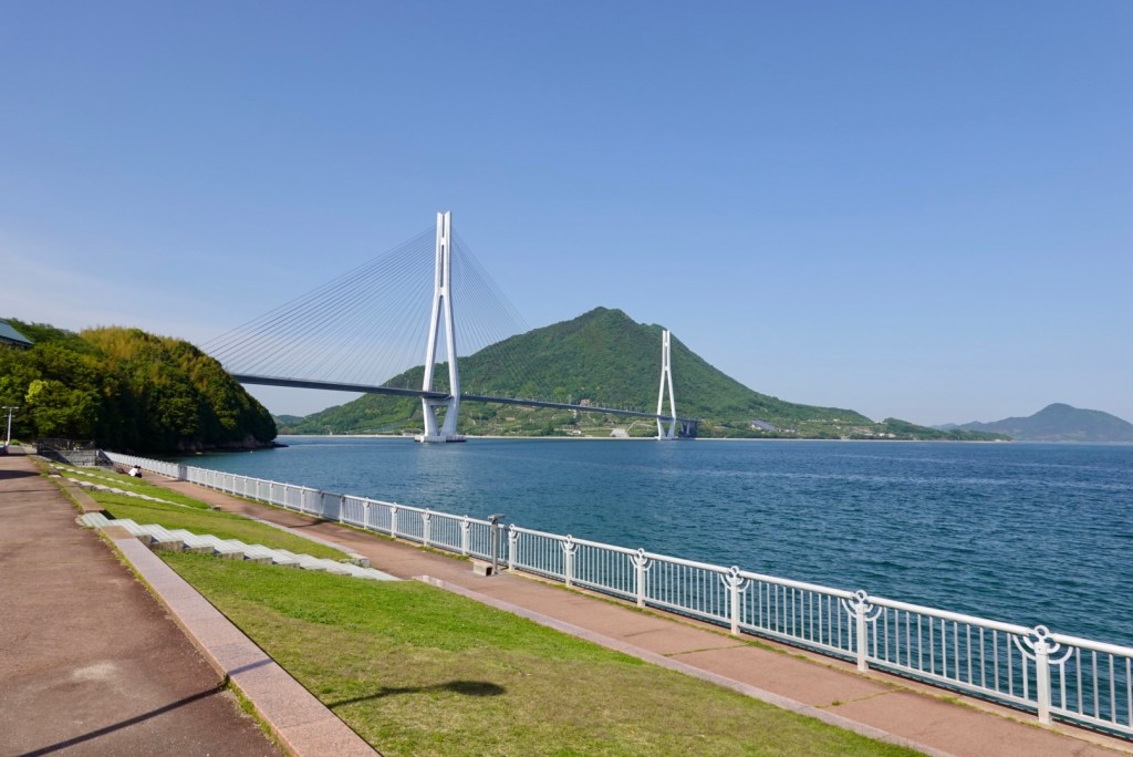
Heading from the south, the first bridge is the most impressive. The Kurushima-Kaiyo bridge, which is 4 km long, opened in 1999. the worlds first three continuous suspension bridge. It crosses Kunshima Strait.
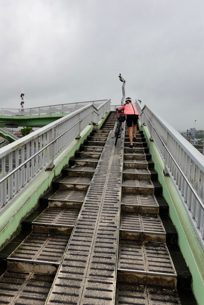
The cyclists circle up a ramp multiple times to gain the required height to access the bridge.
Here we’ve started the climb but are underneath it still. You can see a few spans.
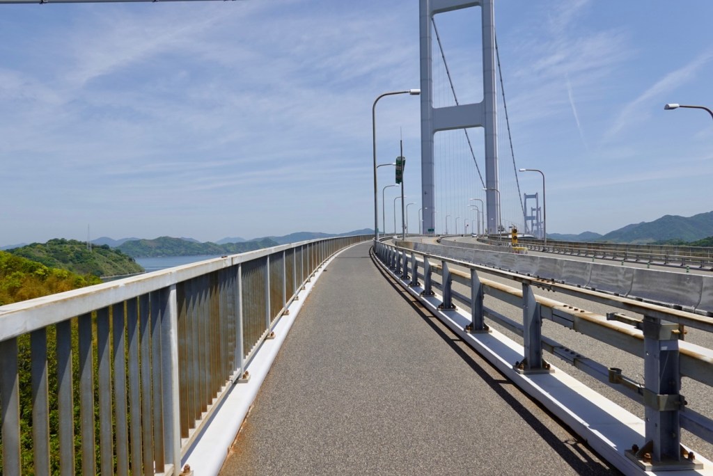
Once on the bridge, this is the cyclists path.
Tony took a video for part of the first crossing.
Spectacular views to the left.
Clear signage.
Exiting the first bridge.
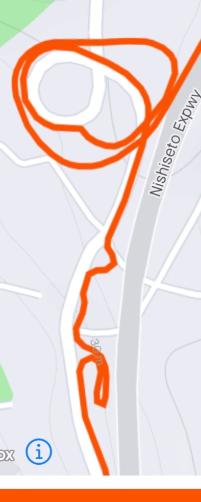
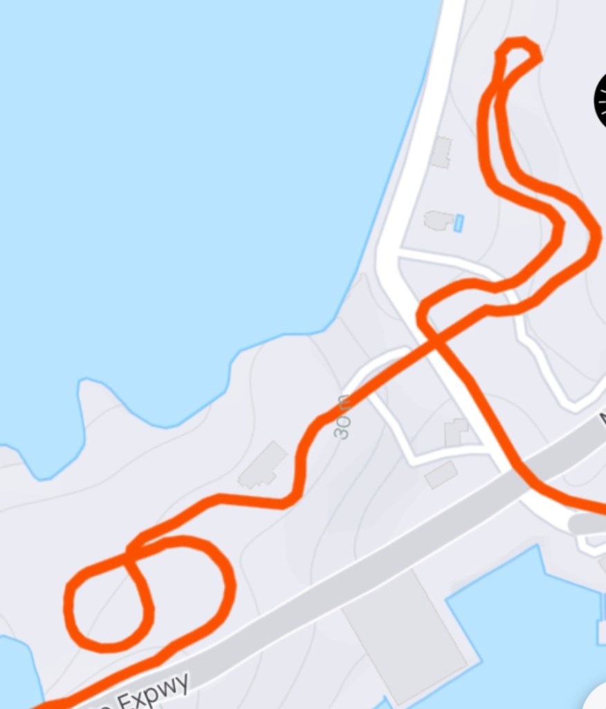
On the descent looking back towards Imabari.
My GPS data showing how the path descended.
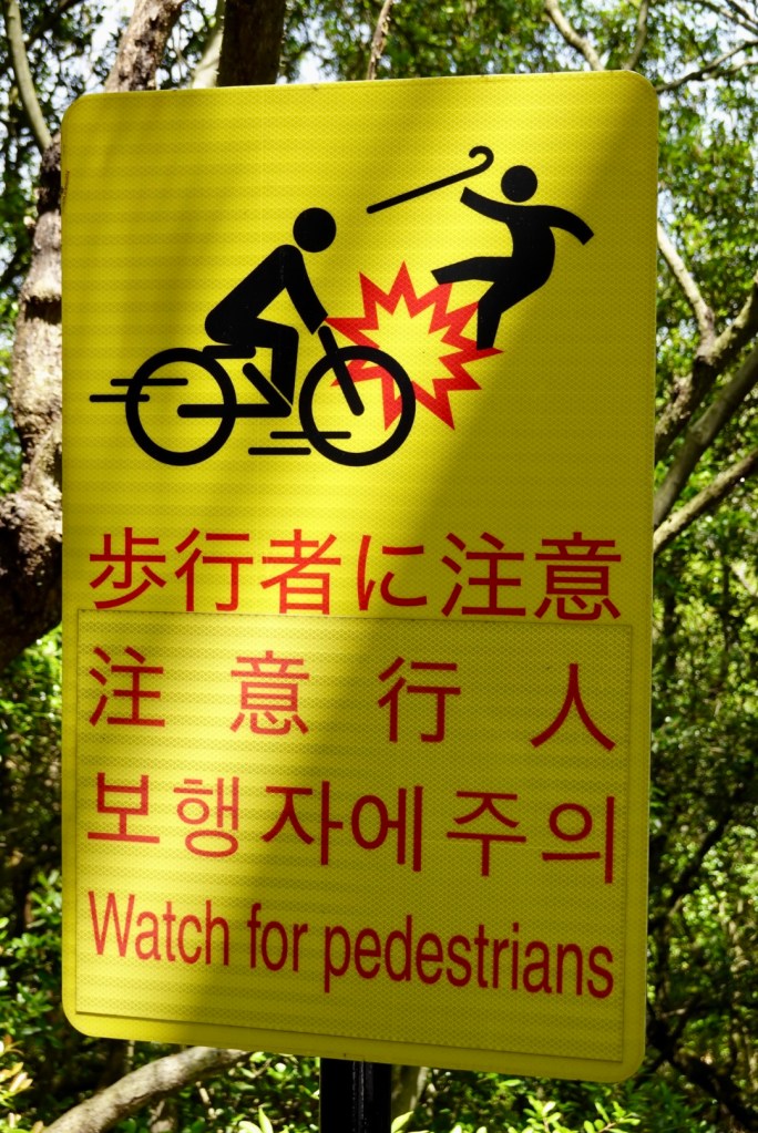
Walkers can also use the pathway!
We wandered around the first island descent, with plans to do a small loop but an elderly man in his garden indicated a big NO as we went past his house, so we turned and headed back in search of food.
We found a place but it was mainly deep fried and neither needed or desired that. We would look for a Lawsons!
This more distant view of the first bridge gives you a bit more perspective of its length.
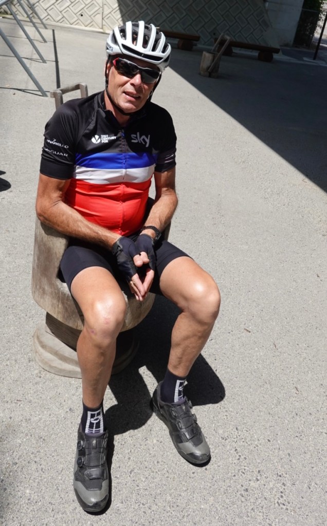
Tony found himself a comfy seat, reminding me of those baby seats.
Making our way to the second bridge more nice beaches.
The second bridge is Hakata-oshima an was built in 1988. It was the first bridge with box girder structure adopted!
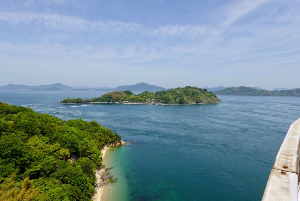
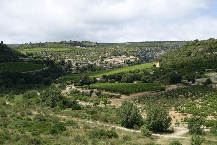
More sea views! We rode around this island and climbed a hill and found a lovely rest spot, providing wonderful views to chill for a while. We were still well ahead of schedule time wise, and check in was not until 4 pm.
Tony’s bike looking snazzy.
As mentioned earlier, the signage is excellent. An example below for the next bridge crossing. On the road, there is a solid blue line painted next to the solid white line, indicating a cycle route.
We will cross this bridge tomorrow. We are staying on the island of Omishima tonight and tomorrow will cross to do a loop to Ominichi and return.
Shimanami kaido will rate in our top ten best ever rides. I can see a blog one day with my top five or ten.
I found it hard writing tonight as I was overwhelmed with so many scenic pictures. This region of Japan just keeps giving. 😊❣️
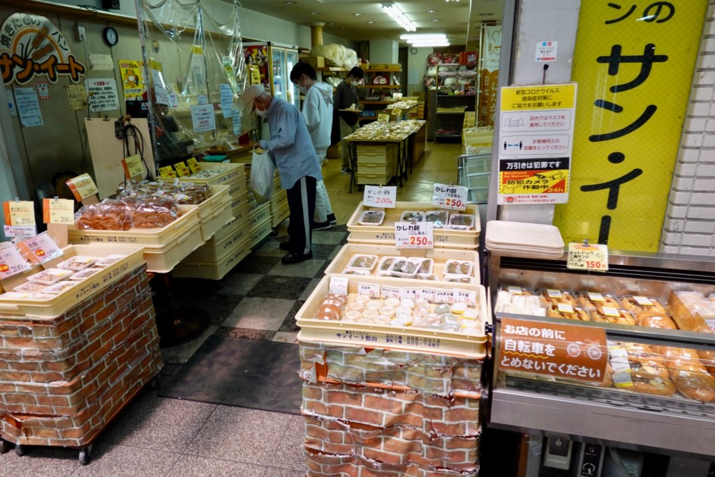
Overnight, I received an email from Takahito with the two photos he took outside his shop yesterday. Thankyou Takahito 😊❣️
Today was to be a mixed bag. The first half was rural countryside, the second half urbanisation. I prefer the first half, but urbanisation is something hard to avoid cycle touring.
We had purchased some items for breakfast and headed off around 730 am. Our accomodation had a laneway at the side, and this is where we packed our bikes.
A conga line of school children passed by us, nodding politely. They were all extraordinarily well behaved. A teacher stood at the end of the laneway marking them off her check sheet.
The children walked in groups of four or five. Often the one at the front carried a flag.
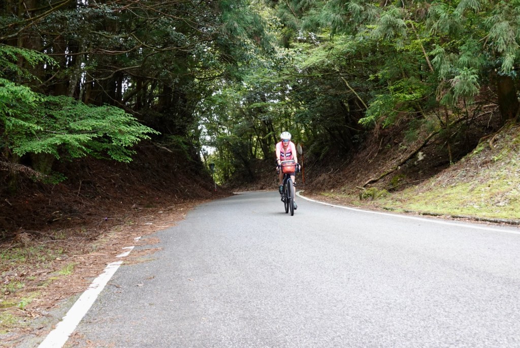
We rolled down the hill and started what was going to be a shorter ride of about 67 km. The challenge would be a long climb and the busy city of Matsuyama. It was a cool 11c.
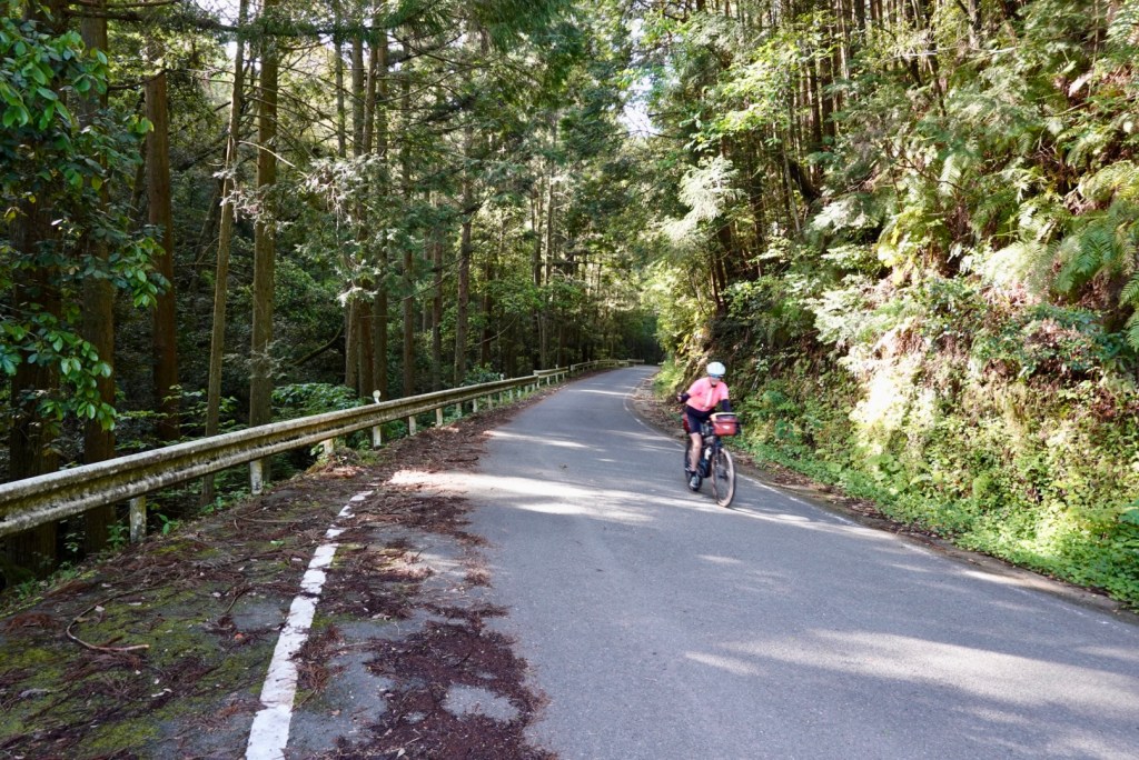
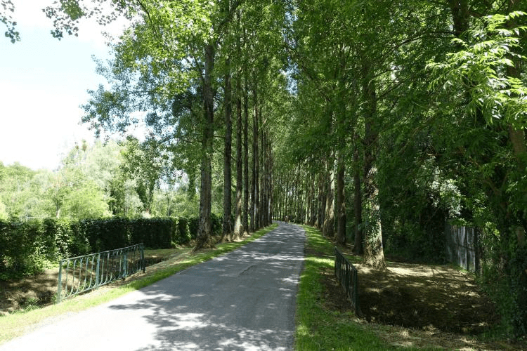
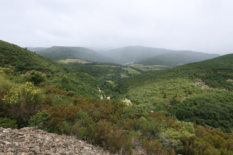
We started a short 3 km climb first through a narrow wooded valley. We passed through small villages with just a few homes and vegetable gardens.
The road narrowed.
The views backdown the valley are always worth the climb.
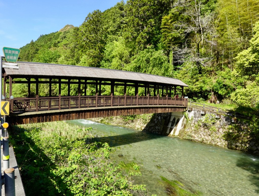
We ended up on a major road, and road a mixture of footpaths and open road. This bridge caught our eye reminding me of a longer wooden bridge over the Rhine River, between Stein (Switzerland) and Bad Sackingen (Germany).
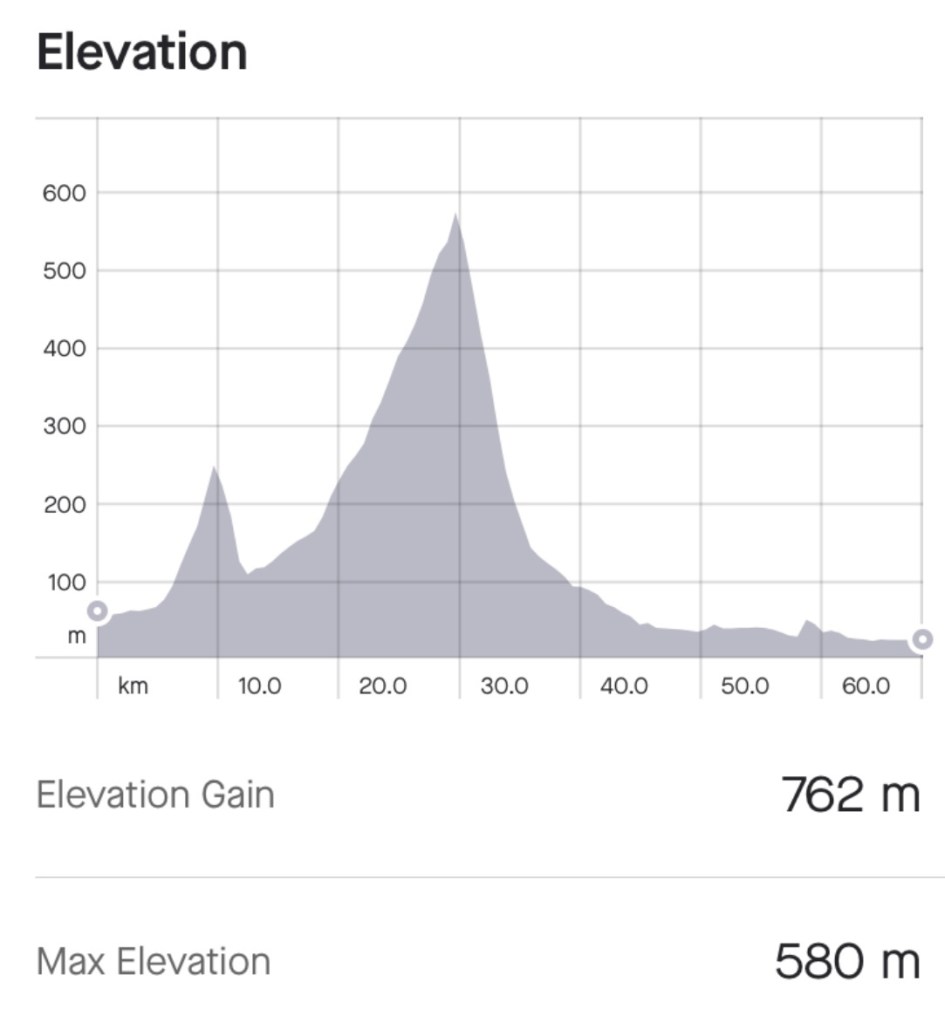
Our longest climb of this trip was about to start. 11.2 km in length, average gradient of 3.8%. Here is our climbing graph. So we would gain 500 metres in the one climb.
We just pootled up and stopped several times for photos, conserving energy. We climbed through multiple lush valleys, with rivers alongside.
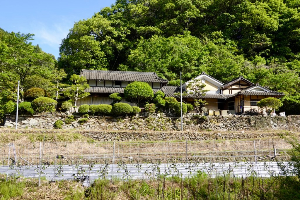
Another lovely home with their crop gardens.
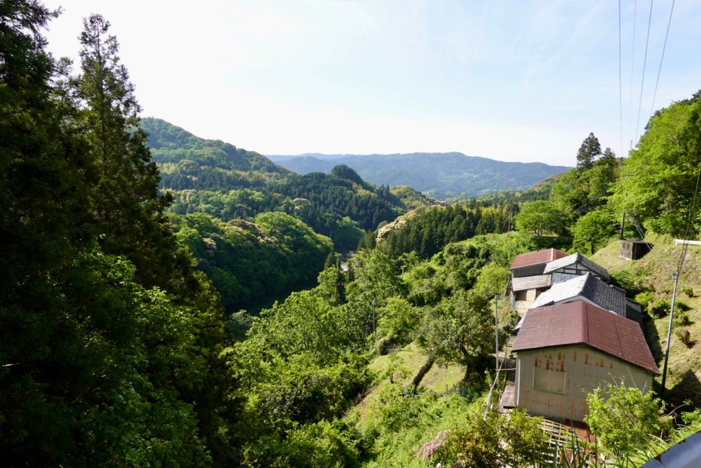
Climbing you often wonder what the view will be like at the top. Great view of just how hilly and green Shikoku is.
The descent was far shorter, but steeper than the climb. It was exhilarating. We both commented that we would not fancy climbing up our descent.
Very soon Matsuyama was upon us. The largest city on Shikoku with a population in excess of 500,000. It is the capital of the Ehime prefecture.
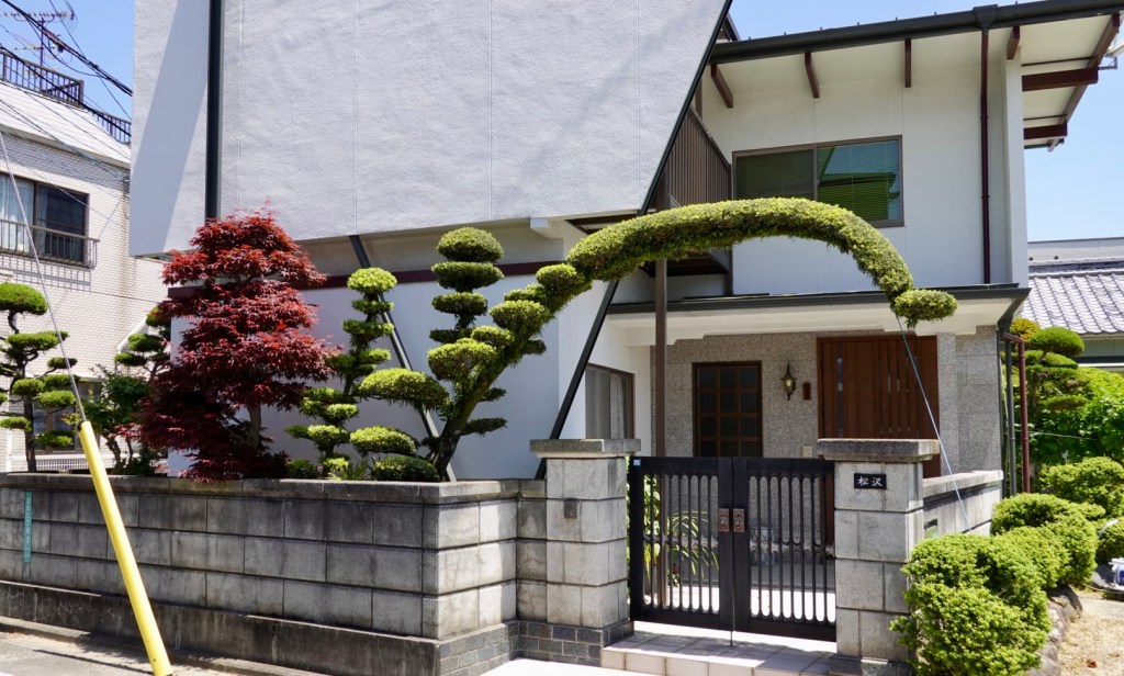
We stopped and started heaps with red lights and crossings, and the plants at this house were very spectacular.
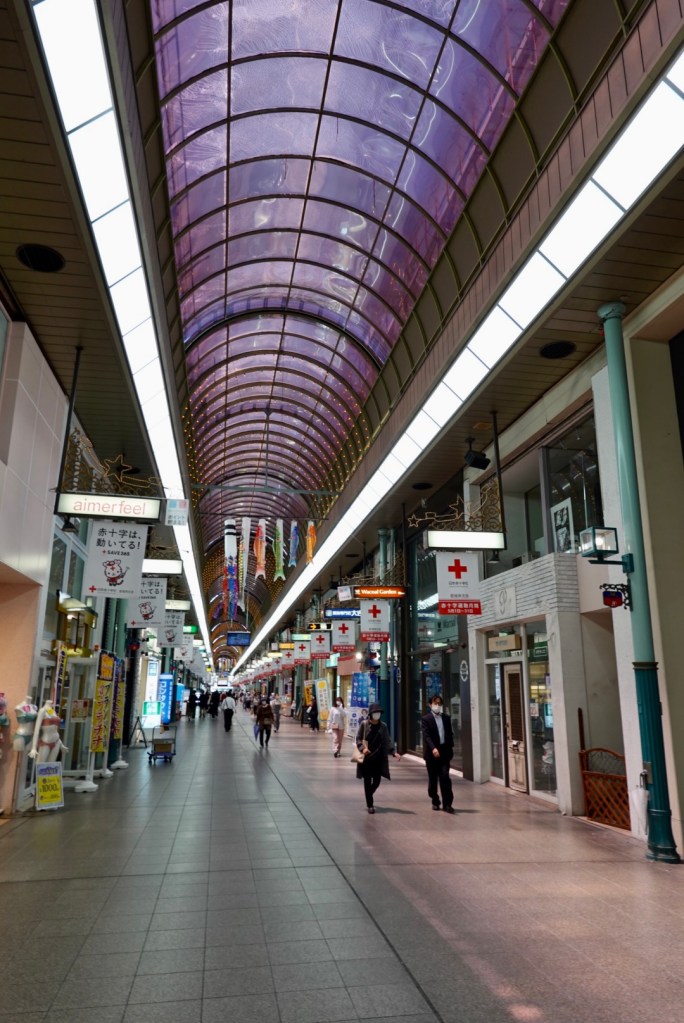
Our route took us right through this elongated indoor shopping strip stretches for over one km. I had a quick glance over 50 metres!
I walked into this small Japanese bakery. I do love looking at the different foods that are made and sold in other countries.
Leaving the mall we continued towards Matsuyama Castle which was first constructed in the late 1500’s. A bit like the story with Wakayama Castle, it has had significant portions rebuilt after damage over the centuries including the bombing of Matsuyama during WWII.
Once there, we realised we could not even push our bikes into the grounds, plus it was impossible to get a view in total from below. So I have ‘borrowed’ this one from Google giving a birds eye view!
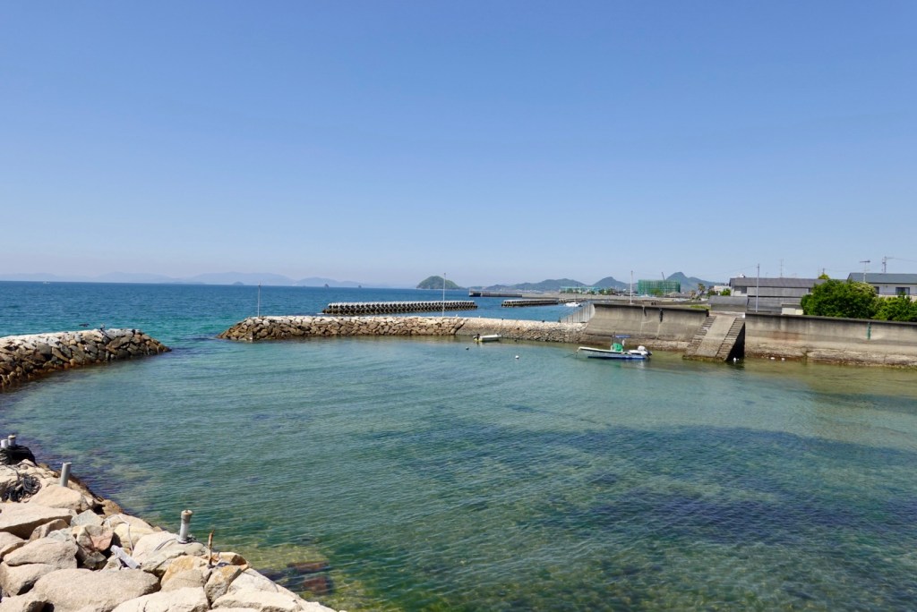
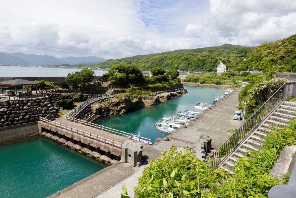
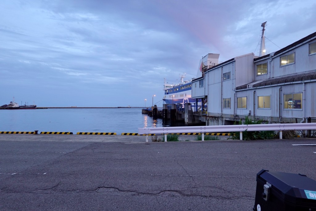
Leaving the busier part of Matsuyama we headed for the coast. As we rode along the coastline, there were numerous man made harbours.
We started to feel excitement because for the next three days we will be out on some of the islands, and at this stage, the weather is looking good.
We are staying about 10 km north of Matsuyama in a small village Doteuchi that faces the Seto Inland Sea.
Our accomodation is a unit on the second floor. It is immaculate and well appointed. The bathroom and separate toilet have glass walls!
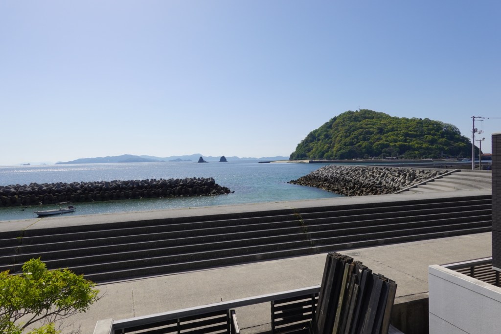
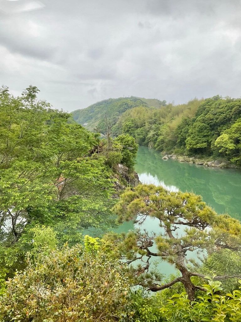
This is the view off the deck. The island to the right is Kashima.
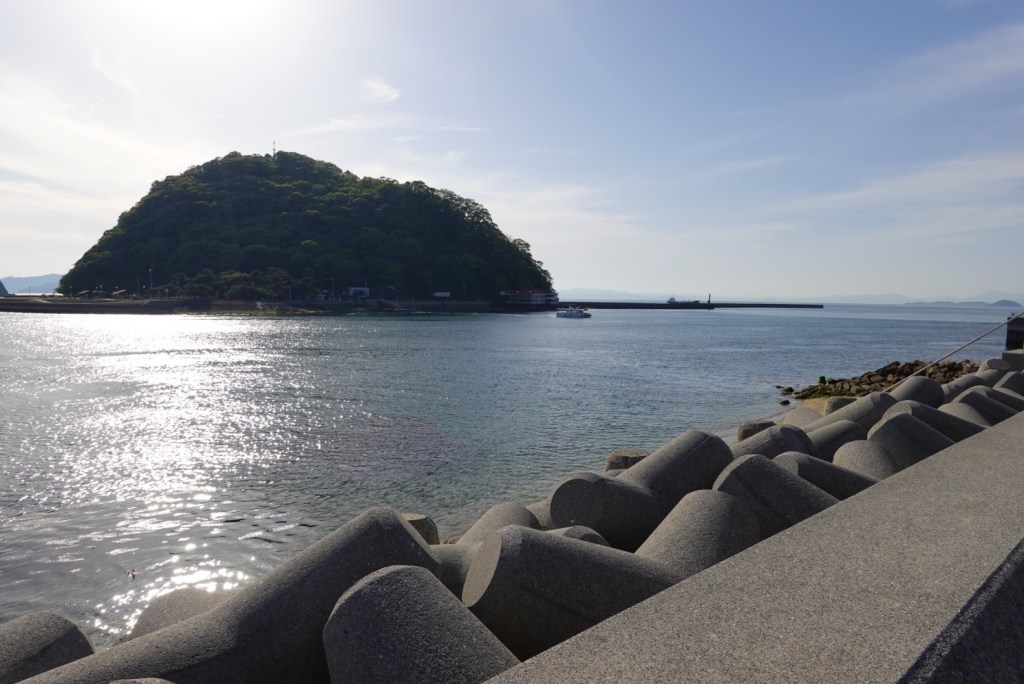
After showering, putting on a load of laundry, walking to the supermarket to buy fresh supplies for a home made dinner, we headed up the sea front to the ferry terminal.
If we had a few spare hours, this could be a nice half day trip.
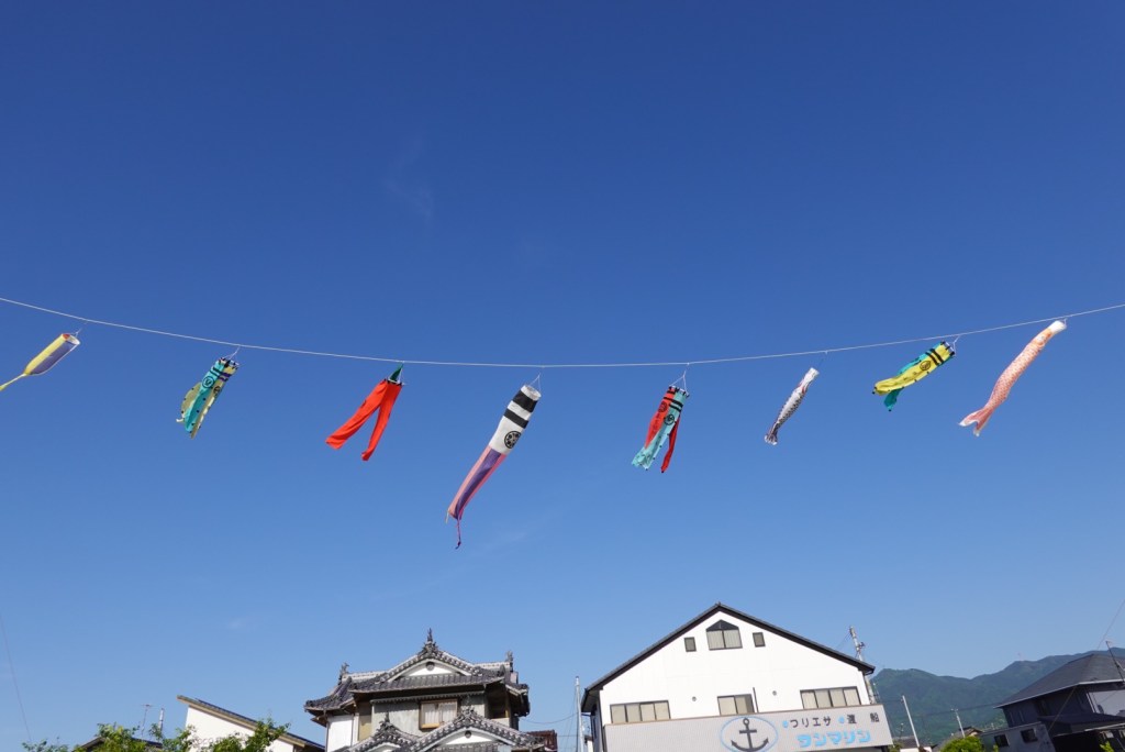
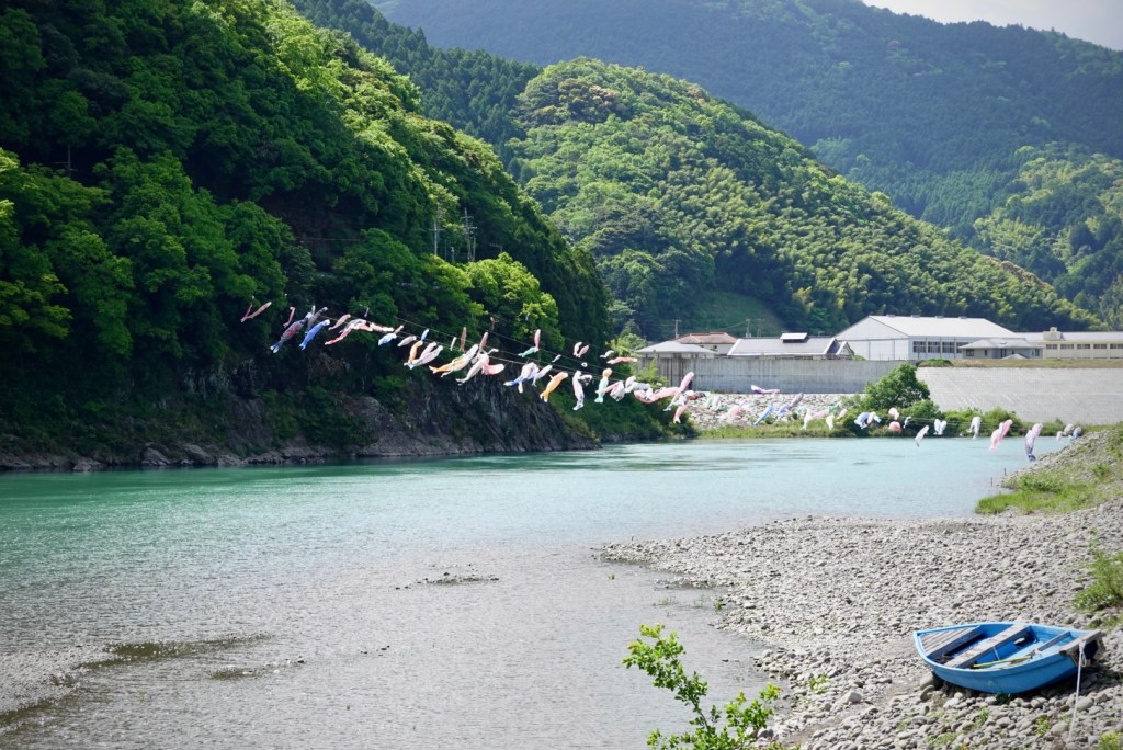
Heading back to the unit, fish flying high.
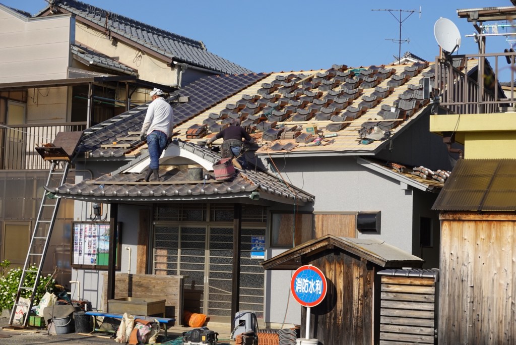
A local house being reroofed. No harnesses required here!
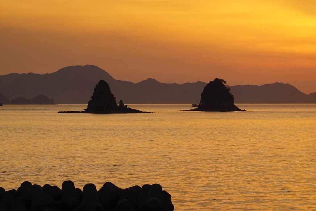
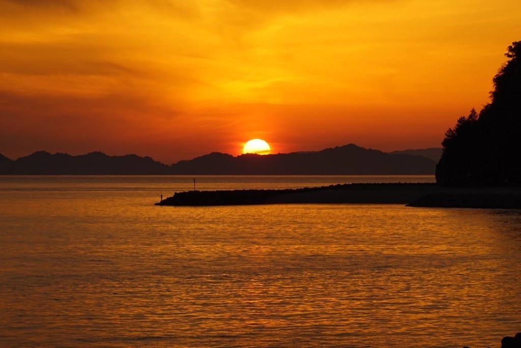
What a magnificent sunset to end the day.
Thanks for reading as we continue our cycle tour of Shikoku.
We awoke early, and it was not raining! However it sure was windy, per the forecast.
We had enjoyed our stay with Kenji who was a lovely, friendly, helpful guy. We also had the opportunity to meet the other guests. A couple from Paris, and two female friends from Germany.
Kenji had arranged our dinner the previous night from a local fishmonger, and it certainly was very fresh and tasty.
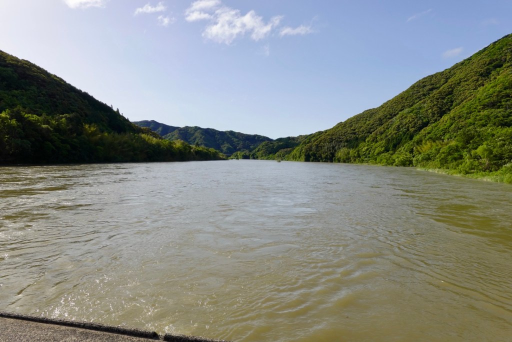
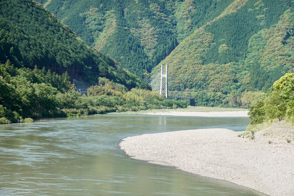
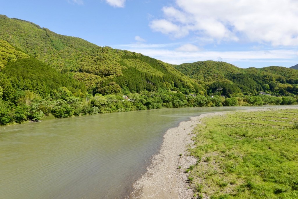
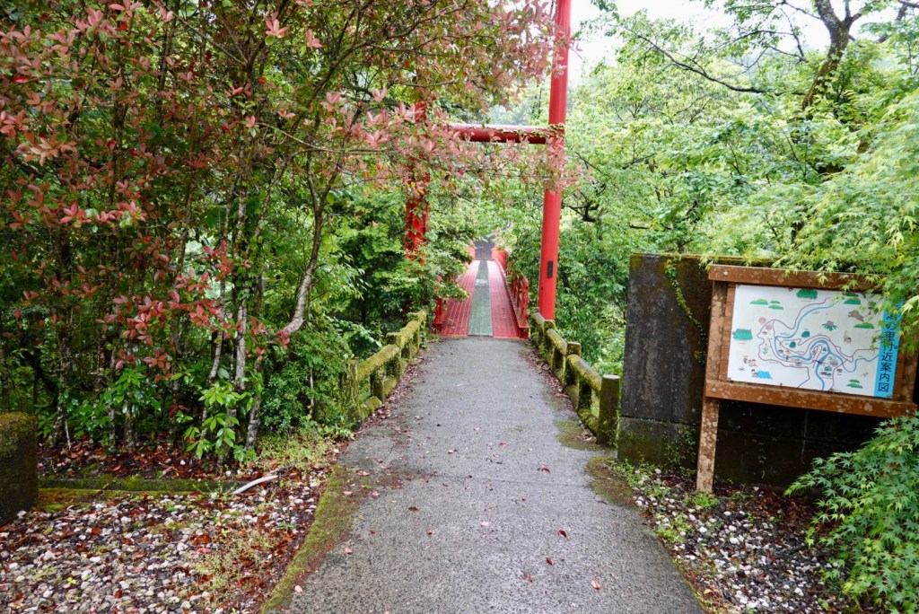
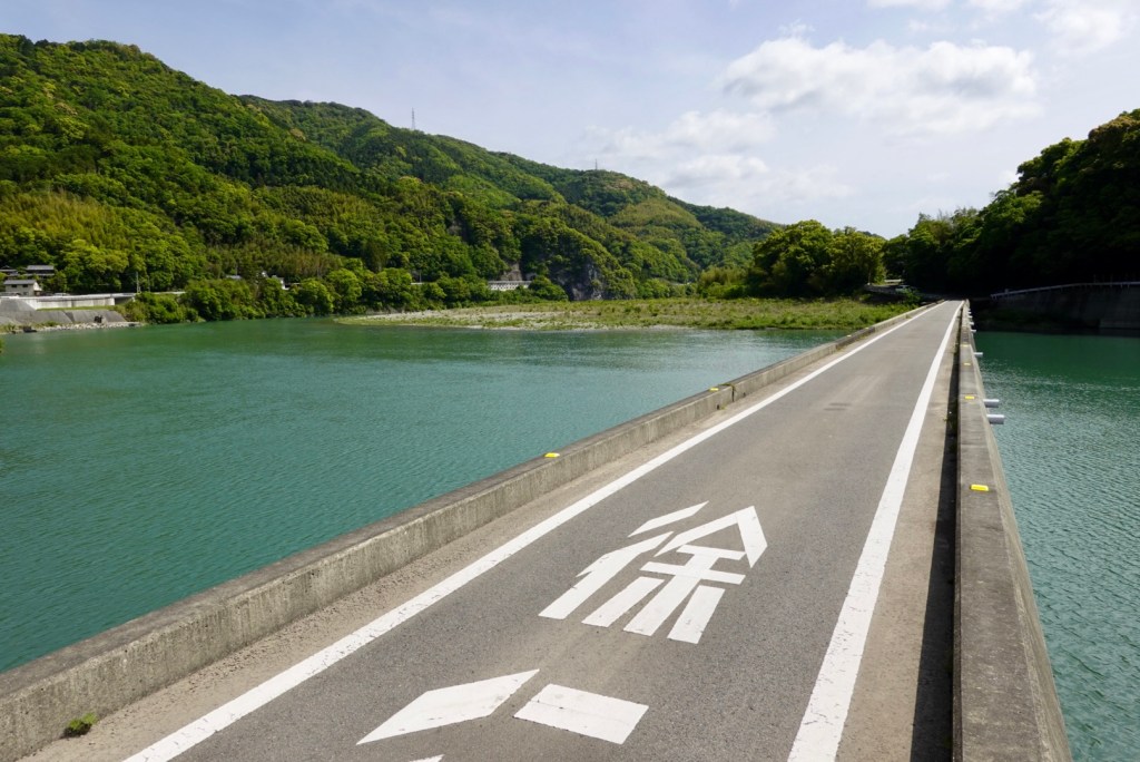
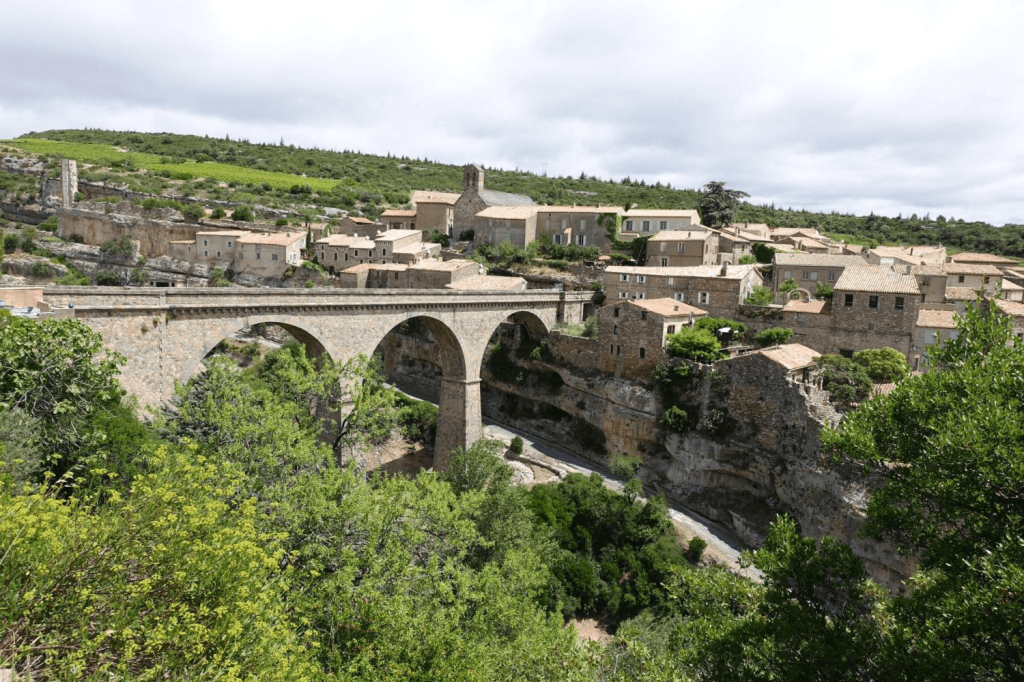
After bidding our farewells, we headed back across the Takase chinkabashi bridge. The Shimanto River would be the focus of our ride today, following its path through valleys heading to our destination Uchiko some 100 km to the north.
I think the submersible bridges are a great idea in areas susceptible to flooding but they are narrow. As we crossed, a car came up behind us and we stood by the edge to let is pass. I’m glad he held his line!
I found this video on the bridges that may be of interest.
.
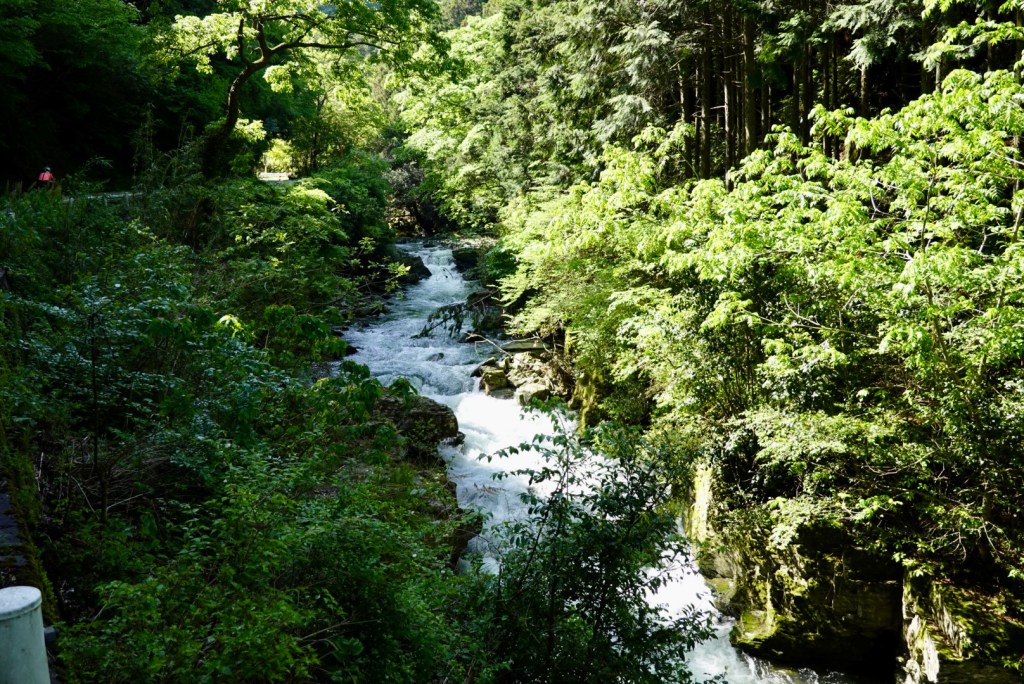
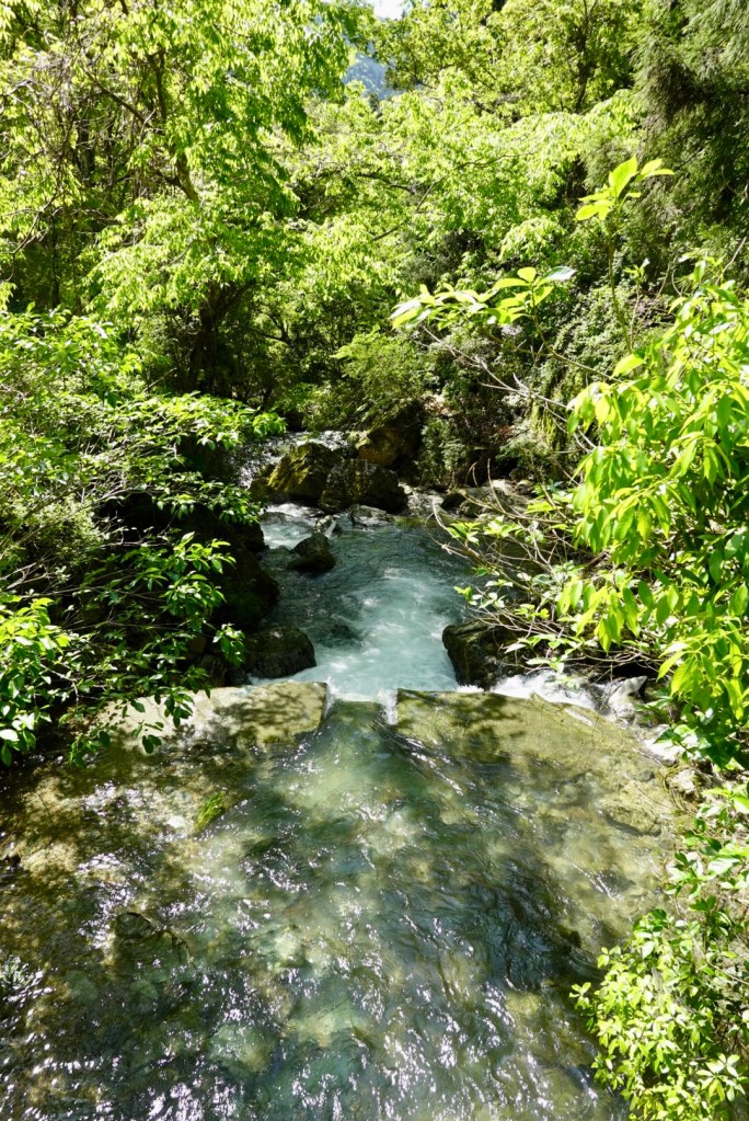
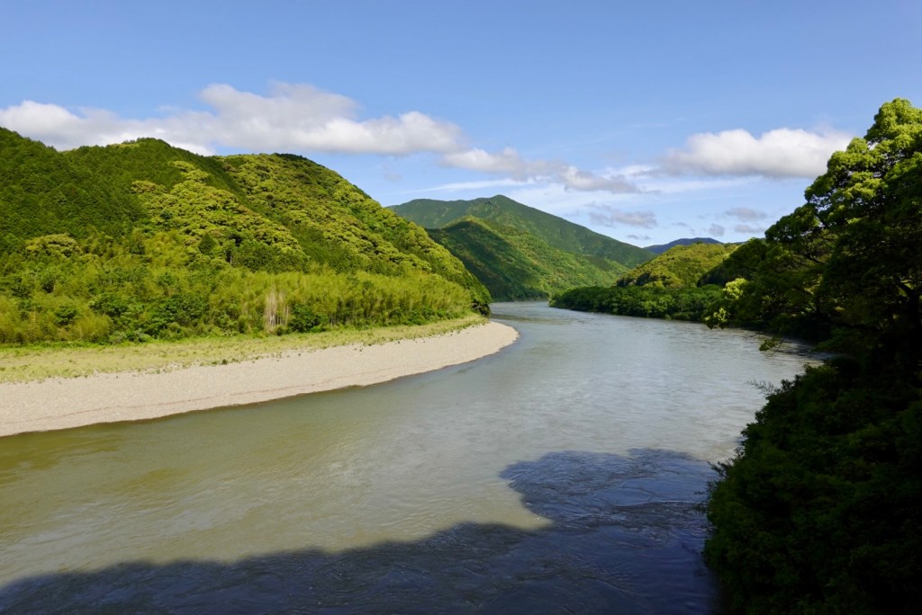
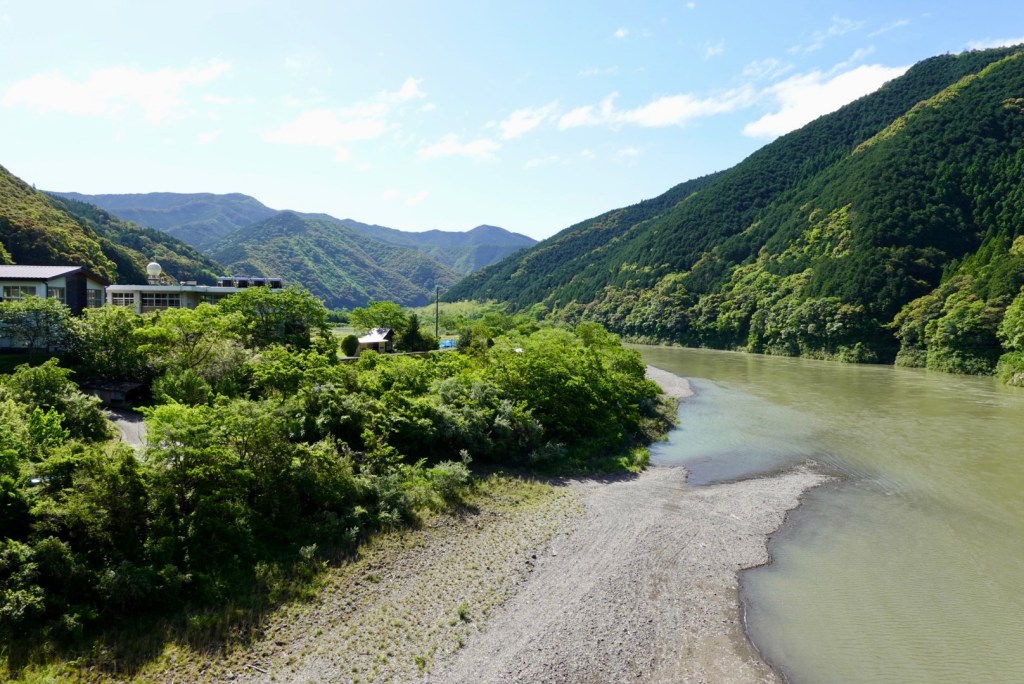
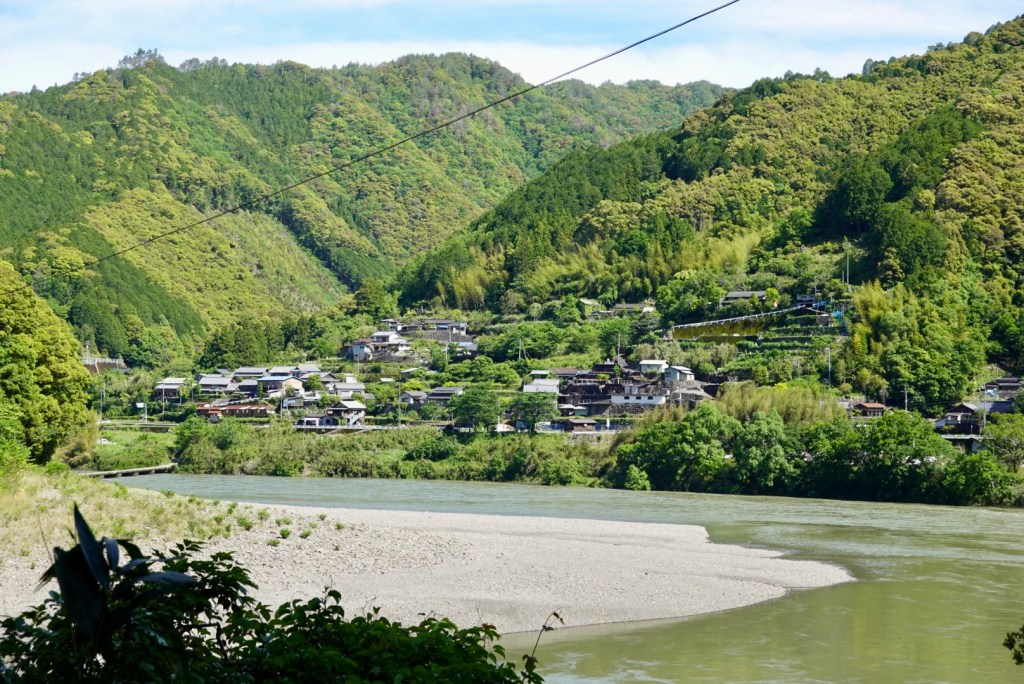
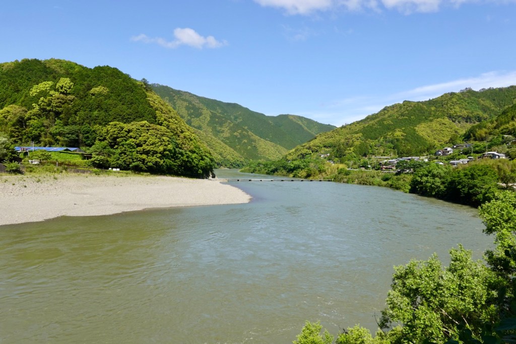
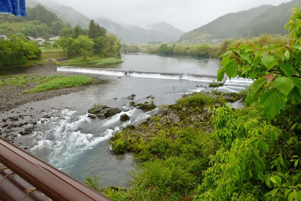
The river was flowing faster today, and was muddier, courtesy of the last few days heavy rain. Here are a few earlier shots of the Shimanto.
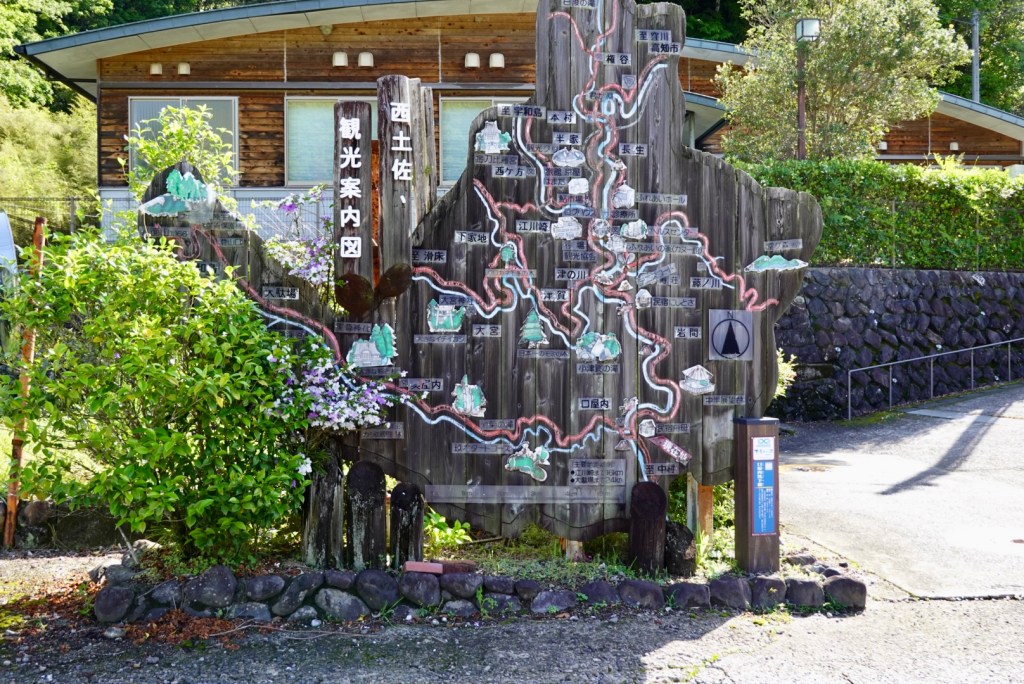
We thought this local attraction sign was well crafted.
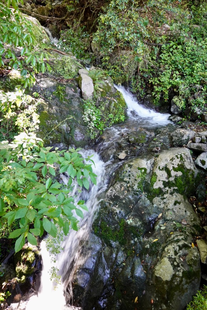
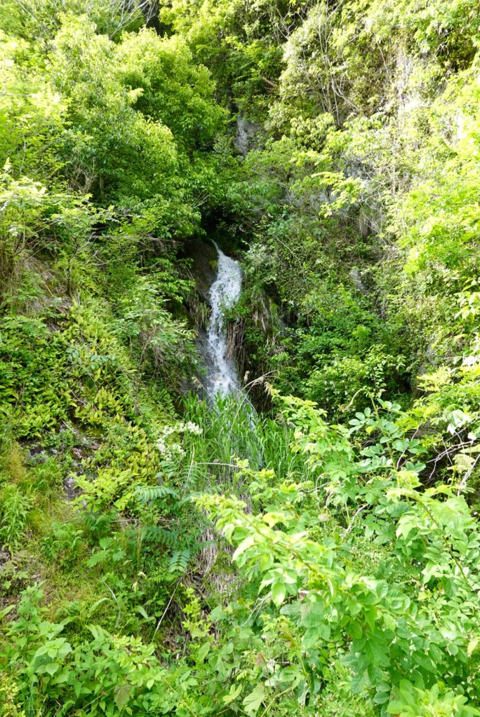
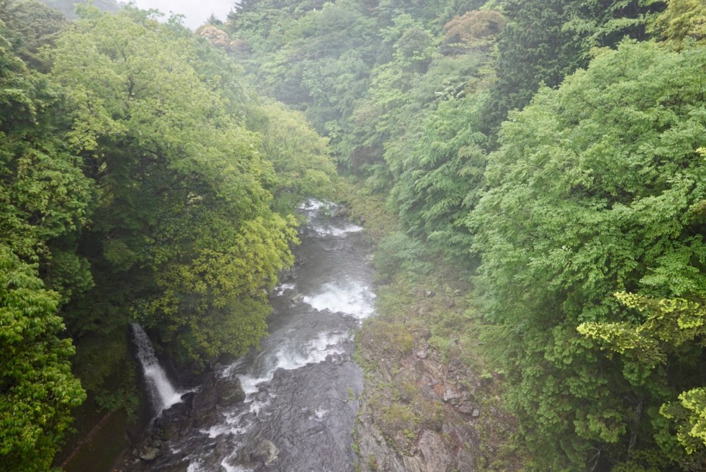
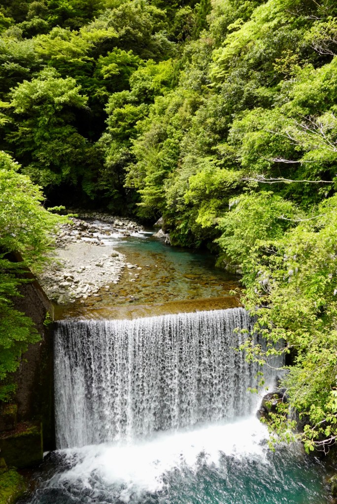
Our first toilet stop was very scenic. Lush vegetation and a waterfall.
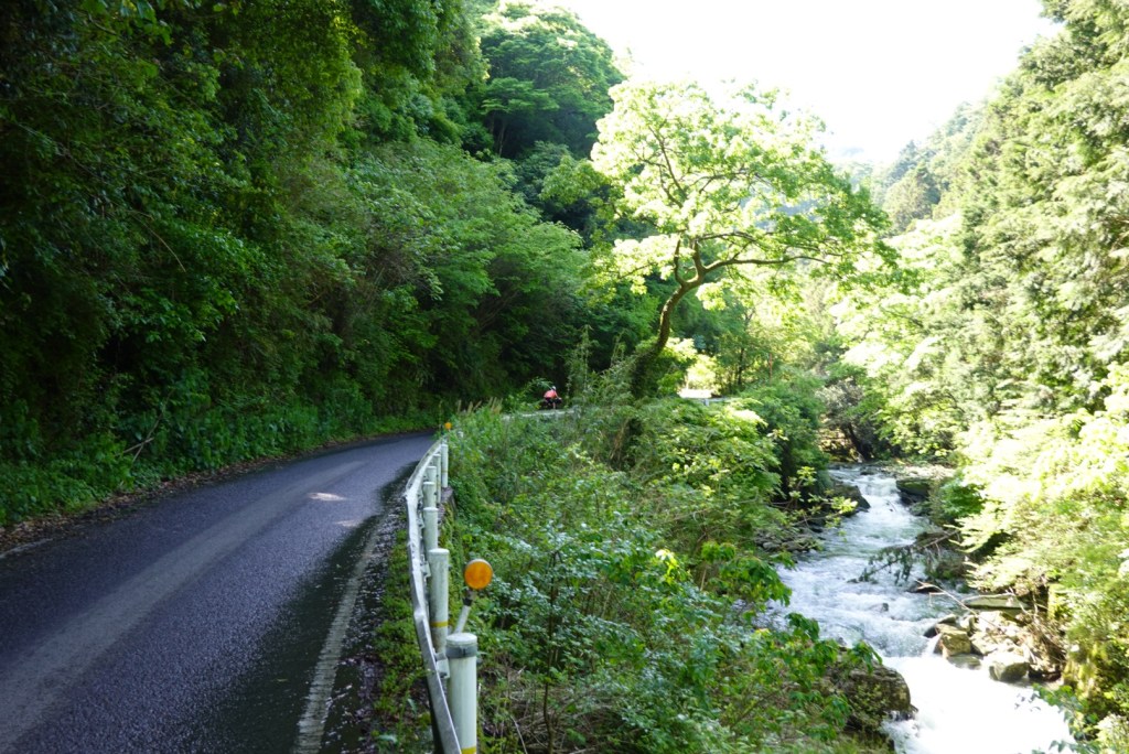
The roads varied today from narrow riverside, seemingly suitable for one lane, but in fact are two lanes, to national highway verges/‘pathways’.
The only hassle today was the wind. It was a very strong headwind and we both had some back tension, likely from holding the bike tight in the gusts. We carry Panadol!
Wind is crazy. The first few days we were heading south westerly, and the wind? South westerly of course, but maybe no more than 15 kmh. Today we headed north? The wind wanted to share our adventures and turned to the north, but more like 30 plus kmh. The forecast was up to 75 kmh gusts for the area.
But looking at the pictures, all looks serene!
An older man was tending his vegetable gardens. I love that aspect of cycle touring, watching people get about their day to day activities.
Proof that I occasionally sit on the front!!! 🤣🤣
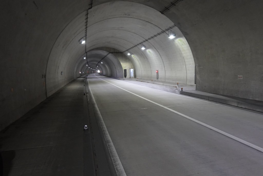
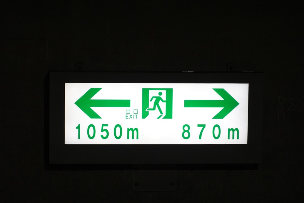
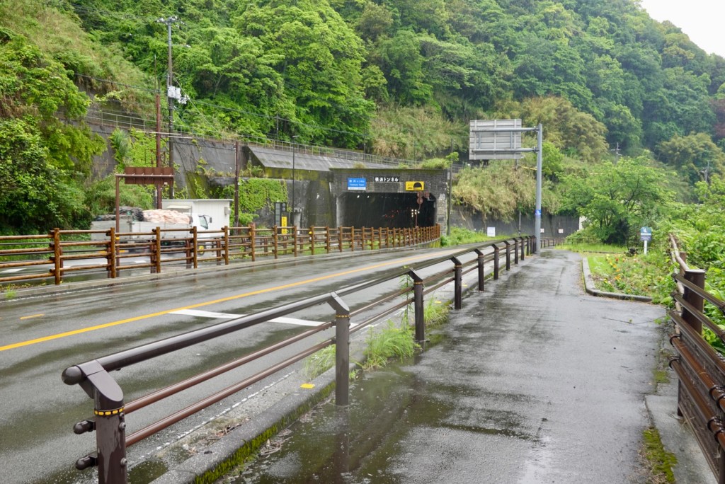
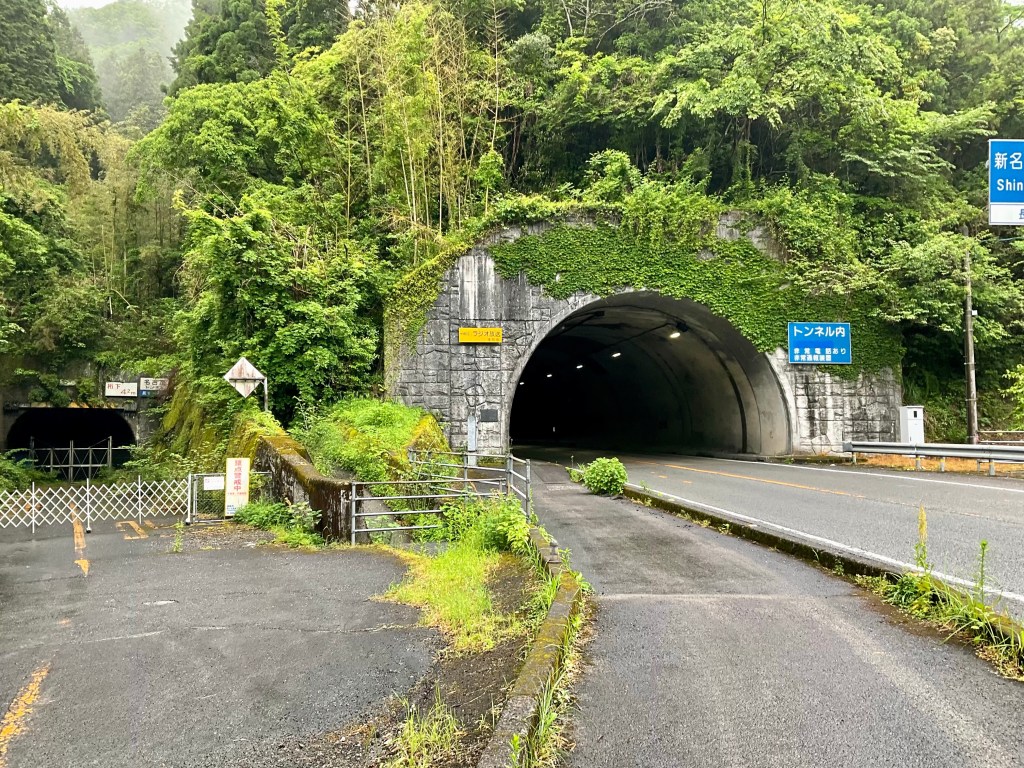
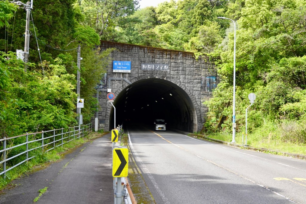
Today we had over 4 km of tunnels, including our longest to date that was 1.92 km long. This is quite a new tunnel, with a great shared pathway. It is well lit, and is even brighter if you remove your cycling glasses!!
Features on the wall include regular signage indicating how far to each opening. There are regular SOS telephones and a few wider bays that a car could pull into.
We only had snacks for breakfast today and was keen to buy some solid food. Alas it was not here. But you could buy a beer in one of the vending machines.
More hills and rivers.
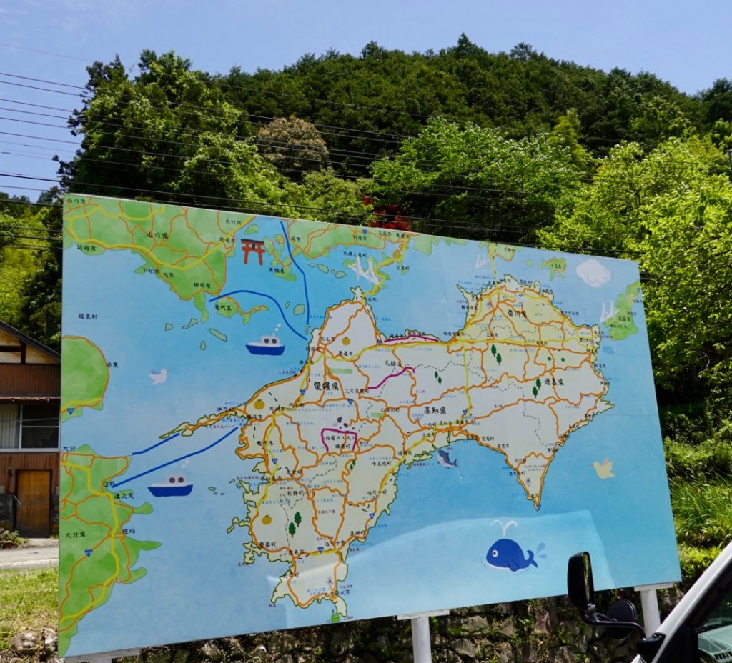
Tony noted this large map of Shikoku and we stopped to take a photo.
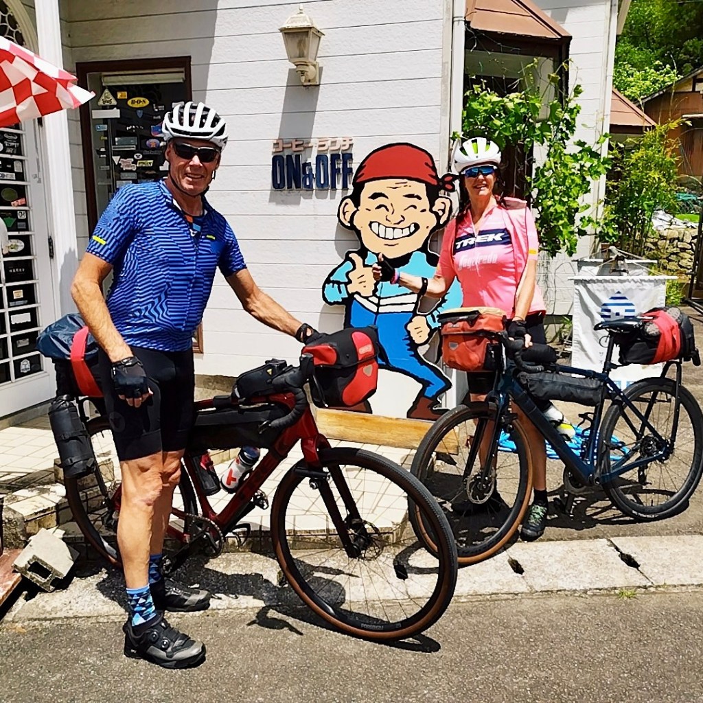
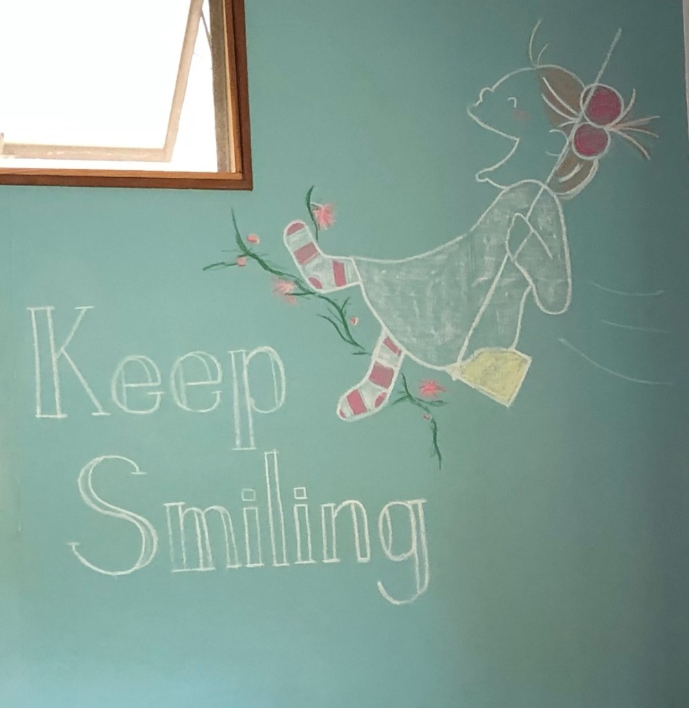
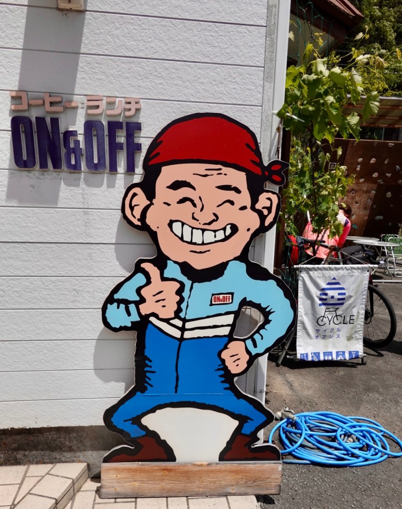
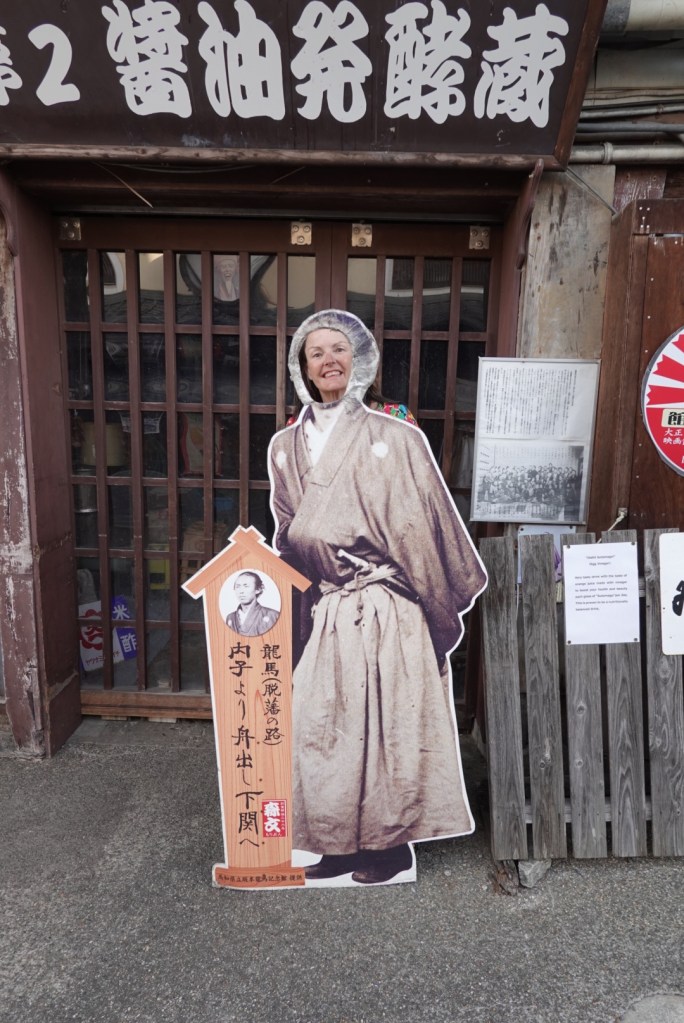
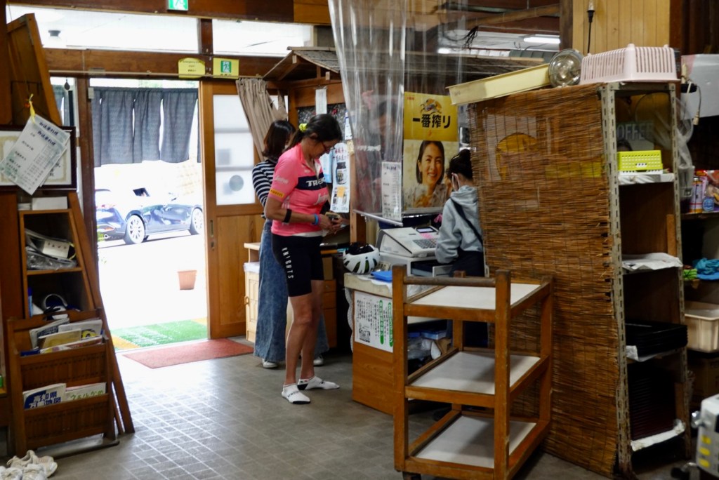
Then we saw a bike rack outside the business. The owner came out encouraging us to use his rack. I asked what he sold. One word had us. “Coffee”.
So we entered and this was at our table.
On the back wall this cute painting. I think it makes you smile 😊
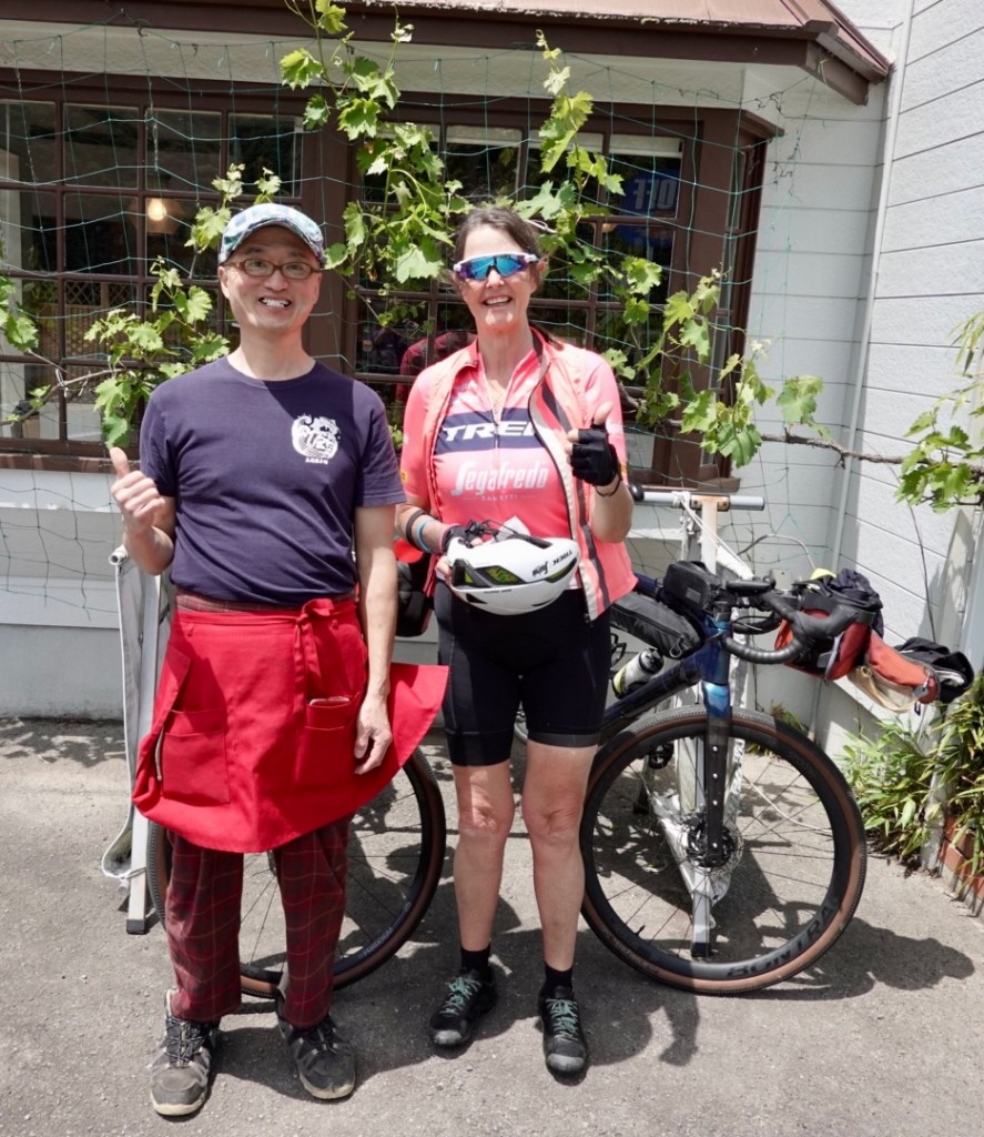
We learned the owners name was Takahito. He was super friendly and chatty, telling us his father had established the business in 1987. His niece had done the drawings.
He showed us photos of some motorbike rides he’d done and was impressed that Tony used to sell Honda and Yamaha bikes.
When we left, he took some photos of us with our bikes in front of this dude. I explained how to find my email on this blog, so hoping he does and we can get a copy.
We took one with Takahito and me.
Arigato Takahito 😊
The stop at Takahito’s was very worthwhile. It was delightful to engage with him. We also had spare time. Check in was 5 pm. The headwinds had made slower progress but we were not fussed, just chugging away and preserving energy.
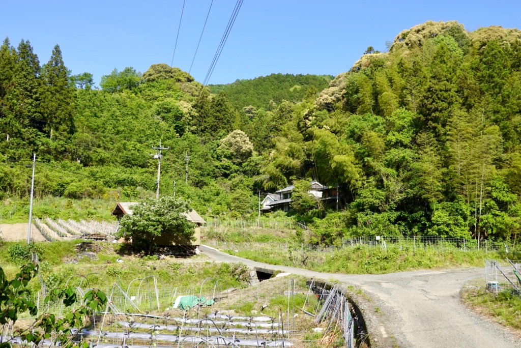
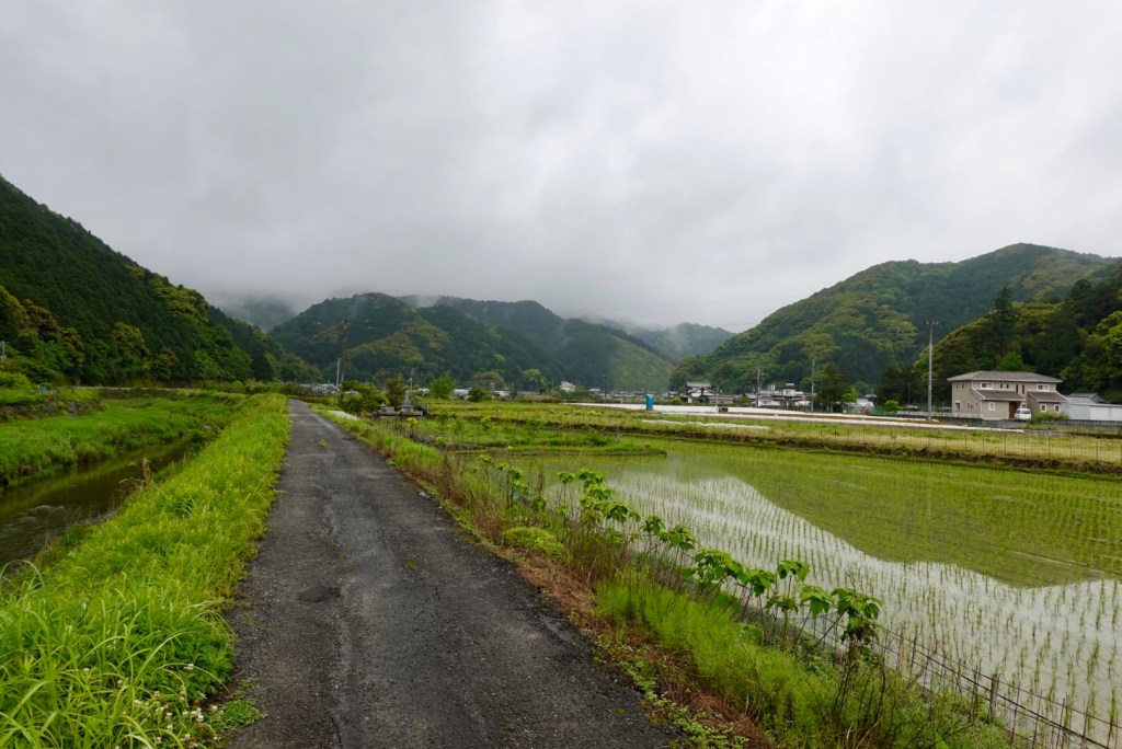
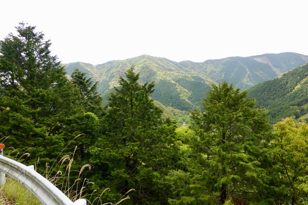
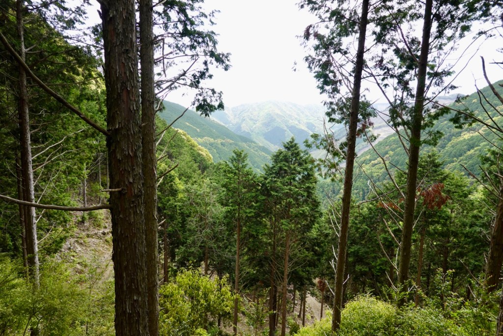
We continue to be amazed just how hilly and green Shikoku is.
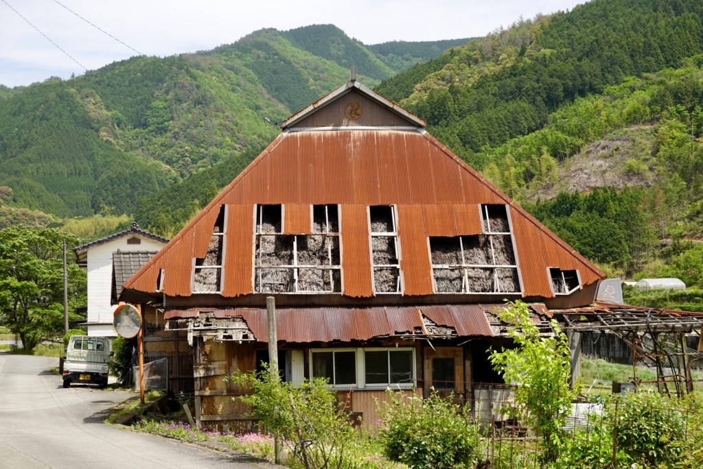
Not all that glitters is gold. There are houses abandoned, seemingly beyond repair. What is interesting are the layers of straw under the old sheeting, presumably used as insulation.
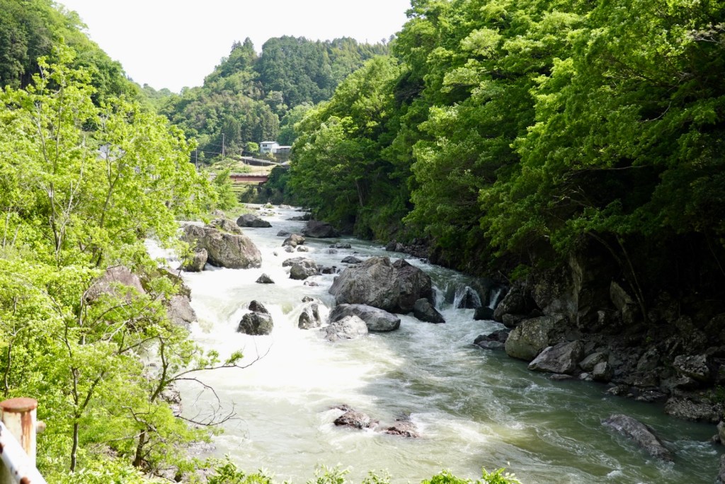
Did you know we followed a river today?
Off the side of the road, there were so many waterfalls of various heights. I guess flowing more after the rain. We had ridden through many puddles today, and now with the wind, trees litter scattered, and a few rocks that had slidden down the slopes.
We arrived in Uchiko an hour early, but were let in. We are in hostel style accomodation tonight, with about 4 other guests here. Towels are not included! I needed to hand over 300 yen for two towels.
We have a room with a double bed, but there is a common roof and I can hear three men chatting. I hope they are quiet soon enough! I also hope I do not have one of my very audible nightmares otherwise they might have a night to remember!! 🤣🙈
At dinner we sat with an architect who lives near Mt Fuji. He is here to prepare plans for a public park over the road from the accomodation.
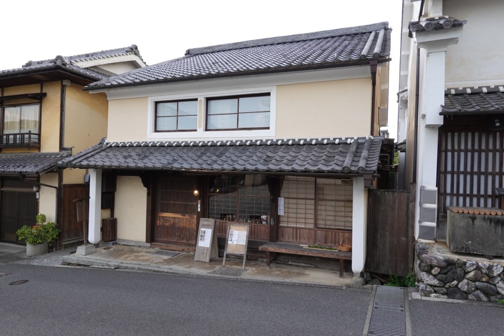
Wandering around the town there are such delights as below. Reminds me of someone….
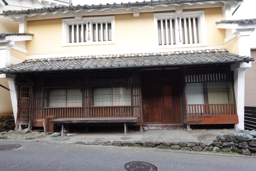
The town of Uchiko became famous for the production of wax. Rich merchants lived in cream coloured houses that were rendered with a mix of wattle and daub mud walls.
This house is a few doors up from our accomodation and is rendered as described above.
This is our accomodation.
To summarise today….it was a fantastic rides and route. Despite the persistent headwind, we enjoyed riding alongside the Shimanto River for a good part of our 100 km today, through lush, green valleys with lots of waterfalls flowing.
Meeting Takahito invigorated us, as he was so positive and excited for what we were doing in his country and that he met us! He made our day. 😊❣️
I slept restlessly listening to the rain and hoping it would all blow over. I played through a Plan B and a Plan C. I got up at. 4.45 am to check out the plausibility of B and C.
We had another extraordinarily good breakfast and got ready to leave. It was a steady drizzle.
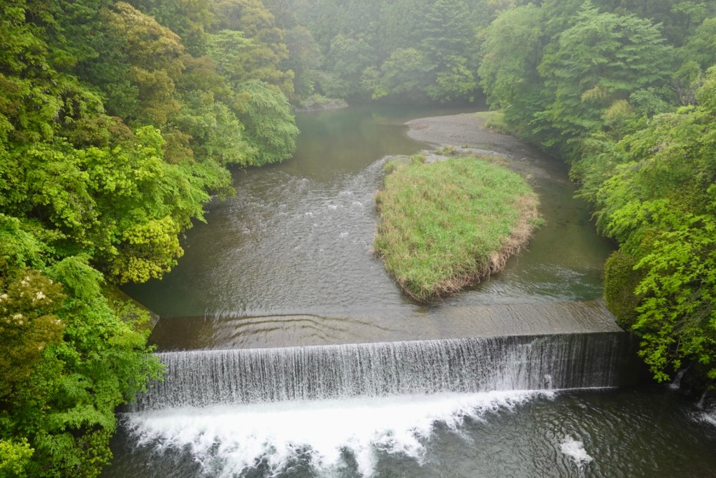
Once the bikes were ready we headed out across the red bridge adjacent to the hotel for a quick squizz.
To the right.To the left.
I noted this sign at the hotel, and could not agree more.
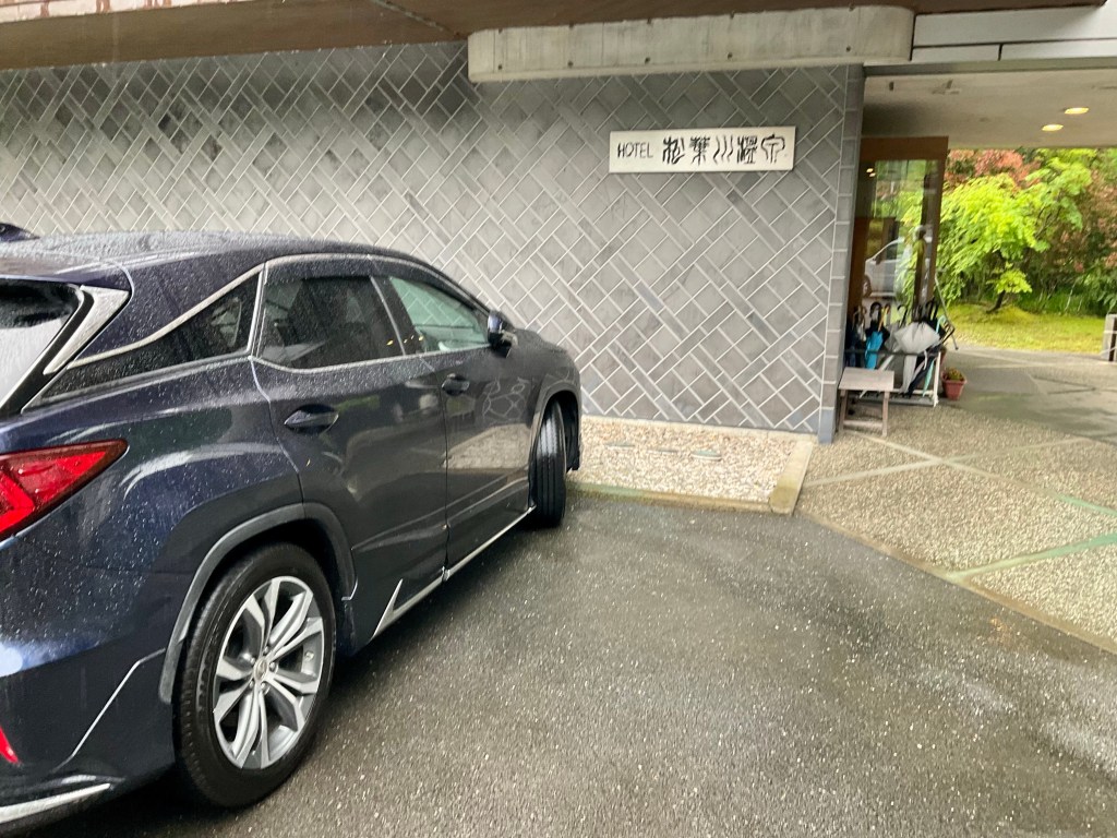
This is the ‘huge’ hotel sign we missed in yesterdays location confusion.
This sign led to our confusion, but all ended well and we had a good overnight stay, with two wonderful meals.
The rain was a heavy drizzle by now and we hoped that it did not deteriorate. The upside was that there was minimal wind and it was not cold. So getting wet was more tolerable.
The camera does not come out very often when it rains either, so less photos today.
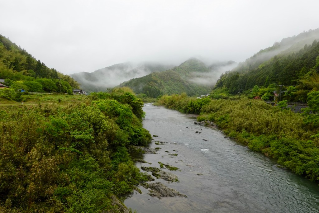
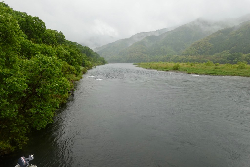
We followed the Shimanto River from our accomodation for maybe 12 plus km. Here are a couple of photos. It is a pretty river, with lush vegetation.
We had over 2 km of tunnels again today, and this one was a bit of fun. for about half the length we had it to ourselves. I practised my best Freddy Mercury ‘ay-oh’ calls. They reverberated beautifully.
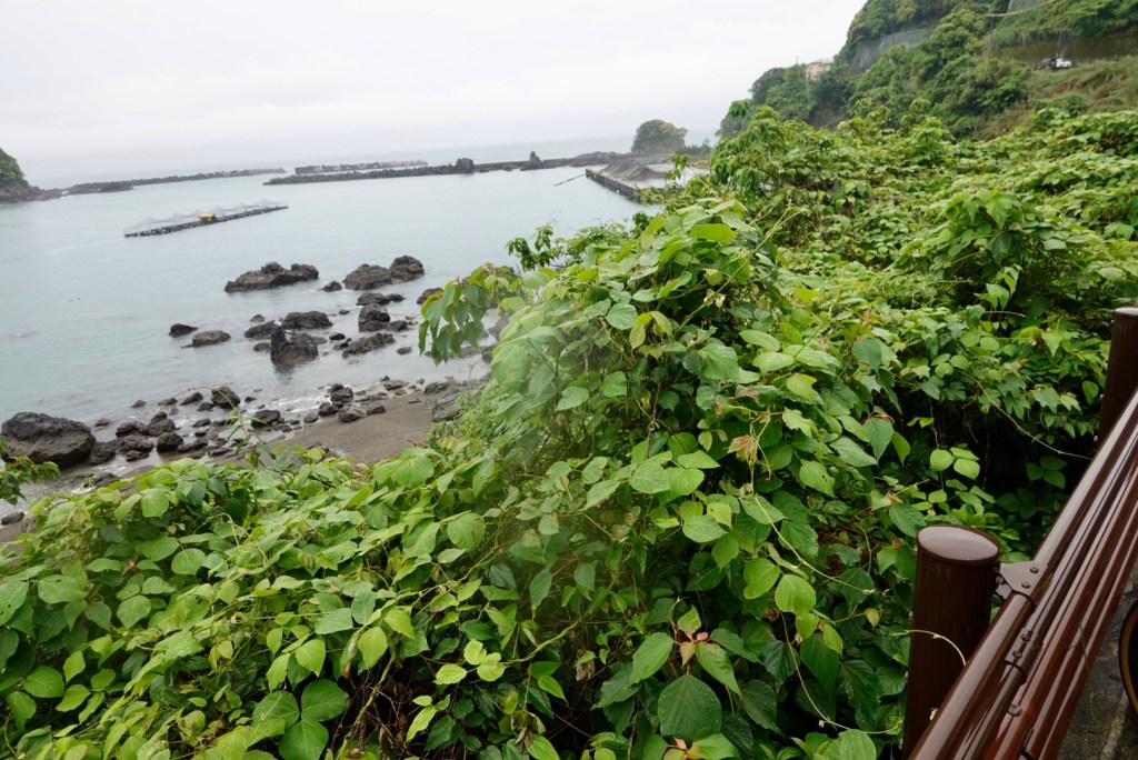
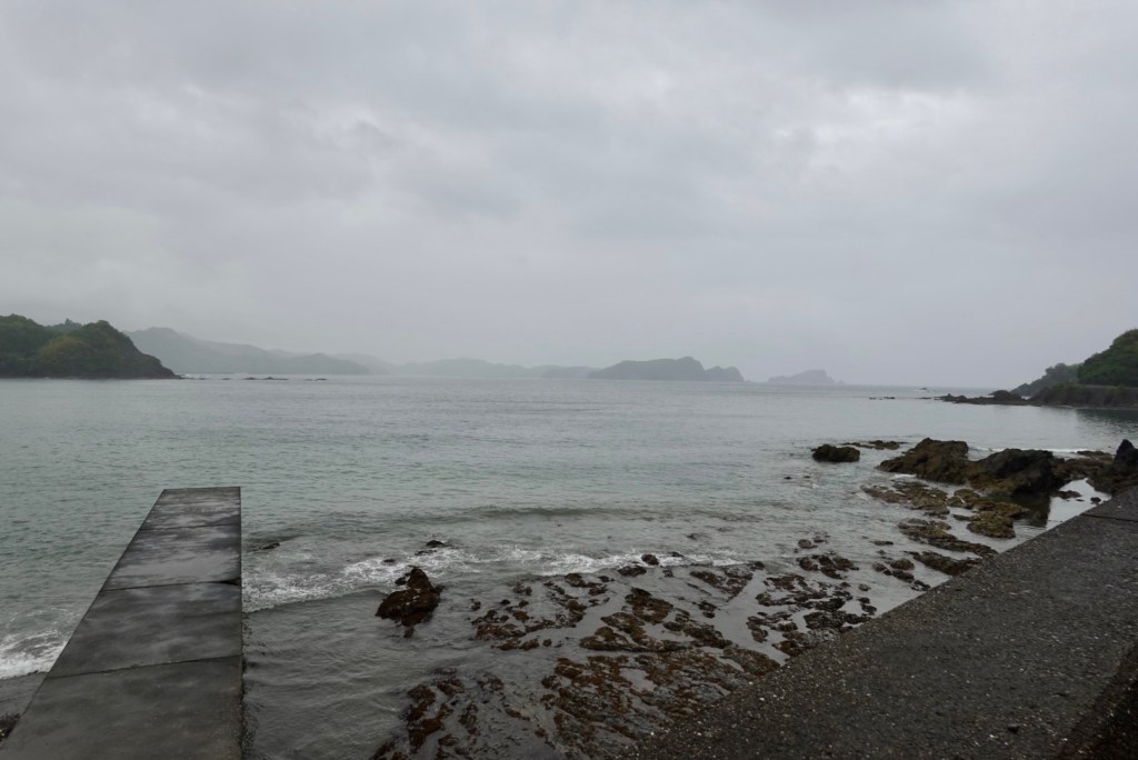
Hitting the coast it all looked a bit dismal.
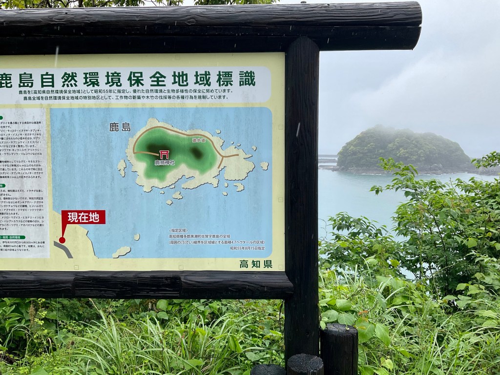
This island has a shrine on it. Guess the pilgrims need a boat. In the photo you can just see the opening to the shrine path at water level.
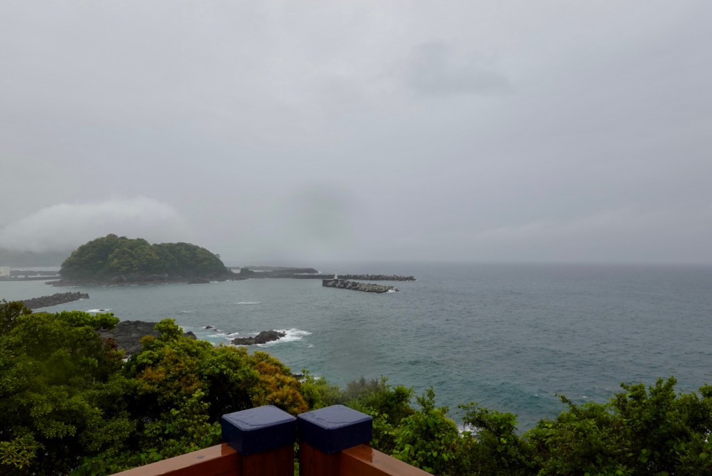
Same island a bit further on.
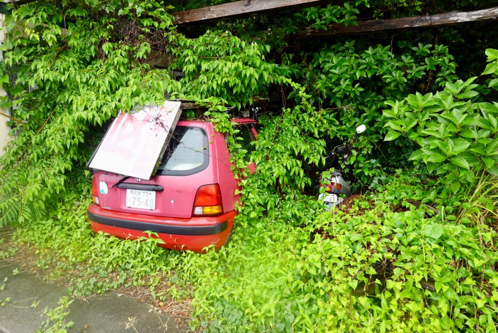
This car and motorbike have been consumed by the creeper.
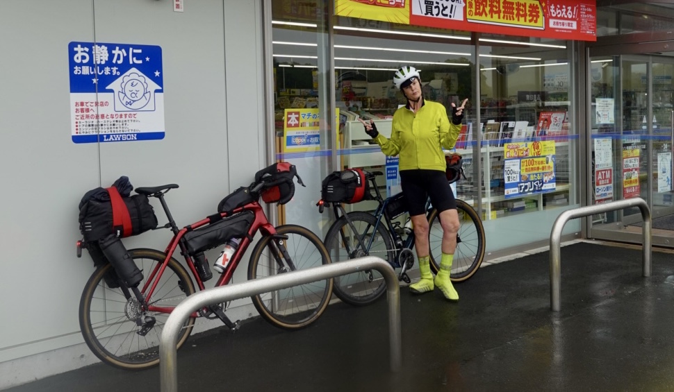
Today we stopped at a few Lawsons shops so I started calling the day Tour de Lawson. We had time to kill as the accomodation check in was 4 pm and we had a shorter day of about 77 km scheduled.
Lawsons have clean toilets, a wide variety of fresh food to eat, and this one had a coffee machine. It provided us shelter and we could watch some of the heavier rain despite the fact we were soaked.
Ride bikes, have fun, feel good!
Shimanto city arrived soon enough, another Lawsons to grab some food to take to our accomodation as it does not provide any food options, and is somewhat remote.
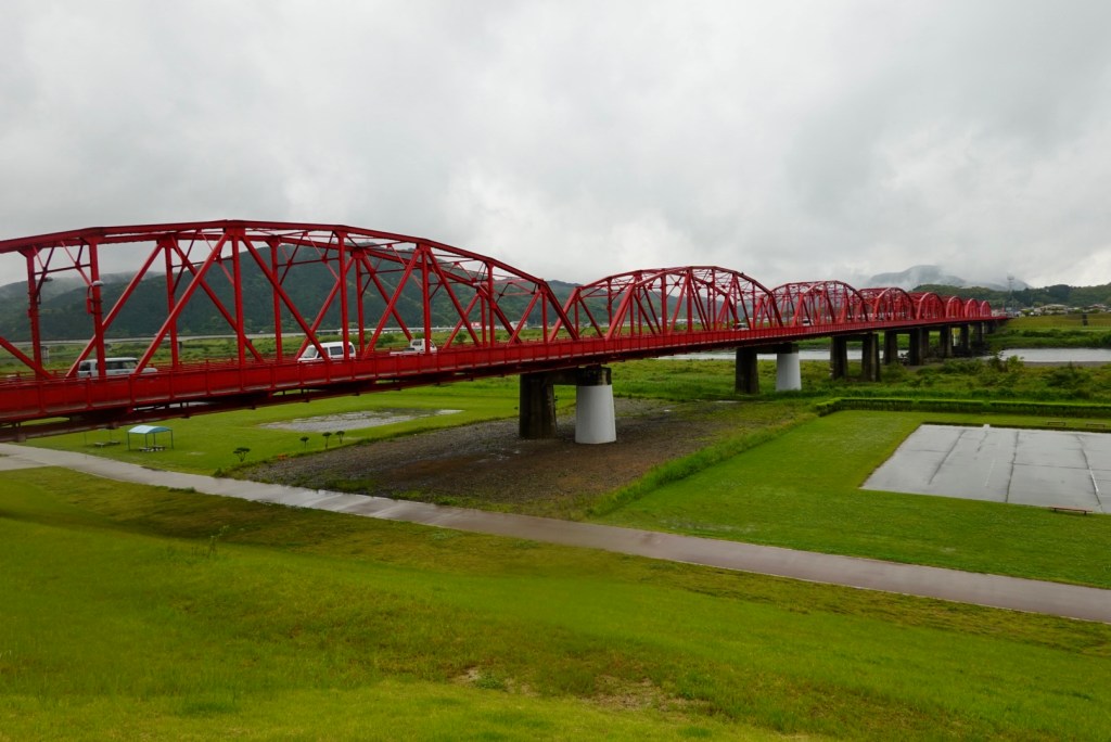
Red seems to be the favoured bridge colour. I must look into why.
In Shimanto City we were meant to turn right about 50 metres short of the bridge but decided to see what the road was like adjacent to the river. It was a great little road and we were able to follow it to our accomodation.
The full length of the Shimanto River is 196km. There are 47 submersible bridges. They are designed to withstand the forces of floods, which occur 3-4 times a year courtesy of typhoons.
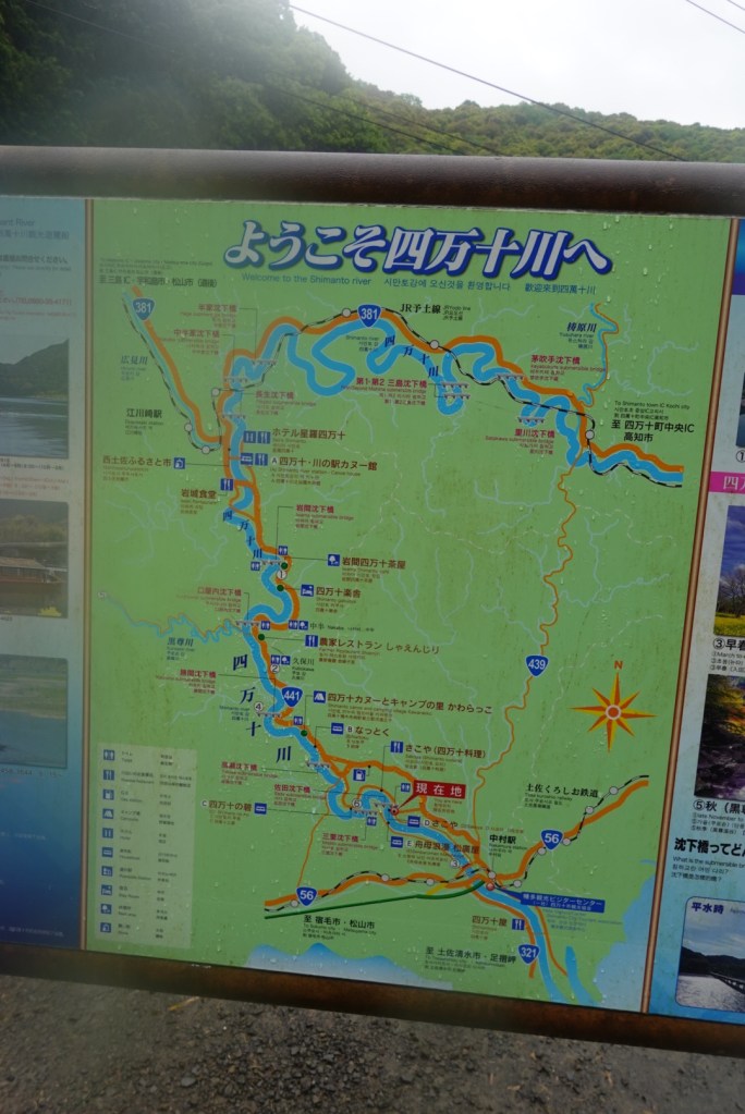
A map showing some of the bridges
We had time to spare so decided to visit the first bridge. Curiously there was a security guard at the car park. There were about 6 cars there, in a car park that could take say a hundred.
As we rolled down to the bridge there was another security guard who indicated we could not ride on the bridge. We dumped the bikes and walked out, took our photos and headed off.
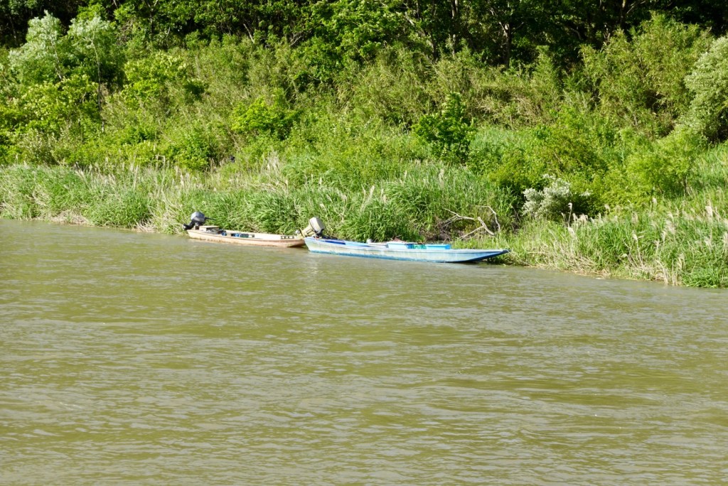
Imanari submersible bridge (chinka bridge)View from the bridge upstreamView from the bridge downstream
Closer to our accomodation these boats were moored alongside the rivers edge.
Our accomodation is over the Takase submersible bridge.
Looking upstreamLooking towards Takase
Thankfully the owner was willing to let us in early. The bikes are stored in his bike shed along with out wet gear and shoes hoping it might dry a bit overnight.
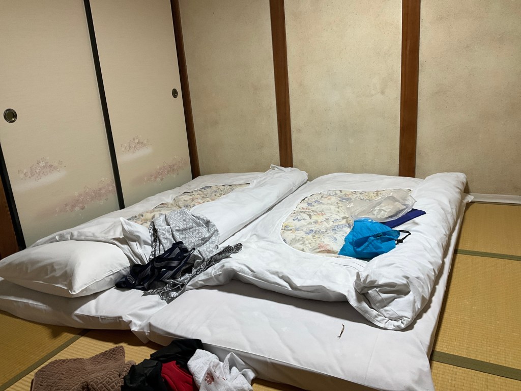
Kenji relocated here from Tokyo many years ago, buying this house and developing three accomodation rooms. Ours is made up of two rooms, both with tatami flooring (no shoes, sleep on the floor Japanese style).
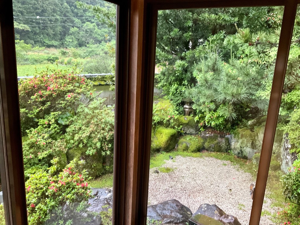
Our windows look out on this lovely garden.
What a day. Certainly less than ideal riding conditions that make it all a bit slower, but it was actually enjoyable and refreshing. I think the fact that it was a Sunday helped, as the traffic was less than it might have otherwise been.
The weather forecast indicates tomorrow should not rain, but instead is talking about a northerly wind of up to 50 kmh. Guess which direction we are heading tomorrow 🤣. You just have to laugh and hope it all works out fine. 😊
Thanks for reading. I’m looking forward to getting to bed a bit earlier tonight as last night was later, and I got up earlier.
What a brilliant trip this has been so far. We have covered just under 400 km in four days. Huge cultural learnings, wonderful scenery, lovely people.
I slept restlessly listening to the rain and hoping it would all blow over. I played through a Plan B and a Plan C. I got up at. 4.45 am to check out the plausibility of B and C.
We had another extraordinarily good breakfast and got ready to leave. It was a steady drizzle.
Once the bikes were ready we headed out across the red bridge adjacent to the hotel for a quick squizz.
To the right.To the left.
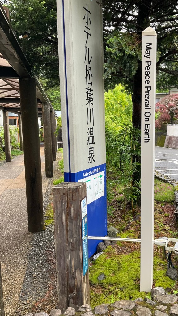
I noted this sign at the hotel, and could not agree more.
This is the ‘huge’ hotel sign we missed in yesterdays location confusion.
This sign led to our confusion, but all ended well and we had a good overnight stay, with two wonderful meals.
The rain was a heavy drizzle by now and we hoped that it did not deteriorate. The upside was that there was minimal wind and it was not cold. So getting wet was more tolerable.
The camera does not come out very often when it rains either, so less photos today.
We followed the Shimanto River from our accomodation for maybe 12 plus km. Here are a couple of photos. It is a pretty river, with lush vegetation.
We had over 2 km of tunnels again today, and this one was a bit of fun. for about half the length we had it to ourselves. I practised my best Freddy Mercury ‘ay-oh’ calls. They reverberated beautifully.
Hitting the coast it all looked a bit dismal.
This island has a shrine on it. Guess the pilgrims need a boat. In the photo you can just see the opening to the shrine path at water level.
Same island a bit further on.
This car and motorbike have been consumed by the creeper.
Today we stopped at a few Lawsons shops so I started calling the day Tour de Lawson. We had time to kill as the accomodation check in was 4 pm and we had a shorter day of about 77 km scheduled.
Lawsons have clean toilets, a wide variety of fresh food to eat, and this one had a coffee machine. It provided us shelter and we could watch some of the heavier rain despite the fact we were soaked.
Ride bikes, have fun, feel good!
Shimanto city arrived soon enough, another Lawsons to grab some food to take to our accomodation as it does not provide any food options, and is somewhat remote.
Red seems to be the favoured bridge colour. I must look into why.
In Shimanto City we were meant to turn right about 50 metres short of the bridge but decided to see what the road was like adjacent to the river. It was a great little road and we were able to follow it to our accomodation.
The full length of the Shimanto River is 196km. There are 47 submersible bridges. They are designed to withstand the forces of floods, which occur 3-4 times a year courtesy of typhoons.
A map showing some of the bridges
We had time to spare so decided to visit the first bridge. Curiously there was a security guard at the car park. There were about 6 cars there, in a car park that could take say a hundred.
As we rolled down to the bridge there was another security guard who indicated we could not ride on the bridge. We dumped the bikes and walked out, took our photos and headed off.
Imanari submersible bridge (chinka bridge)View from the bridge upstreamView from the bridge downstream
Closer to our accomodation these boats were moored alongside the rivers edge.
Our accomodation is over the Takase submersible bridge.
Looking upstreamLooking towards Takase
Thankfully the owner was willing to let us in early. The bikes are stored in his bike shed along with out wet gear and shoes hoping it might dry a bit overnight.
Kenji relocated here from Tokyo many years ago, buying this house and developing three accomodation rooms. Ours is made up of two rooms, both with tatami flooring (no shoes, sleep on the floor Japanese style).
Our windows look out on this lovely garden.
What a day. Certainly less than ideal riding conditions that make it all a bit slower, but it was actually enjoyable and refreshing. I think the fact that it was a Sunday helped, as the traffic was less than it might have otherwise been.
The weather forecast indicates tomorrow should not rain, but instead is talking about a northerly wind of up to 50 kmh. Guess which direction we are heading tomorrow 🤣. You just have to laugh and hope it all works out fine. 😊
Thanks for reading. I’m looking forward to getting to bed a bit earlier tonight as last night was later, and I got up earlier.
What a brilliant trip this has been so far. We have covered just under 400 km in four days. Huge cultural learnings, wonderful scenery, lovely people.
The view out our bedroom window, through the glass. Rain was forecast, but was ok at this point.
Had another amazing breakfast presented in a series of smaller dishes and we carefully negotiated out way back up the shiny, slipper stairs in the one size does not actually fit all soft slip ons that you are required to wear.
I walk up sideways, as my feet are also longer than the tread, so probably a comical look.
As we left, the manager used his iPad translator to express his concern for us as rain was forecast. So far, the Japanese people have been incredibly nice and humble and wanting to help as much as possible.
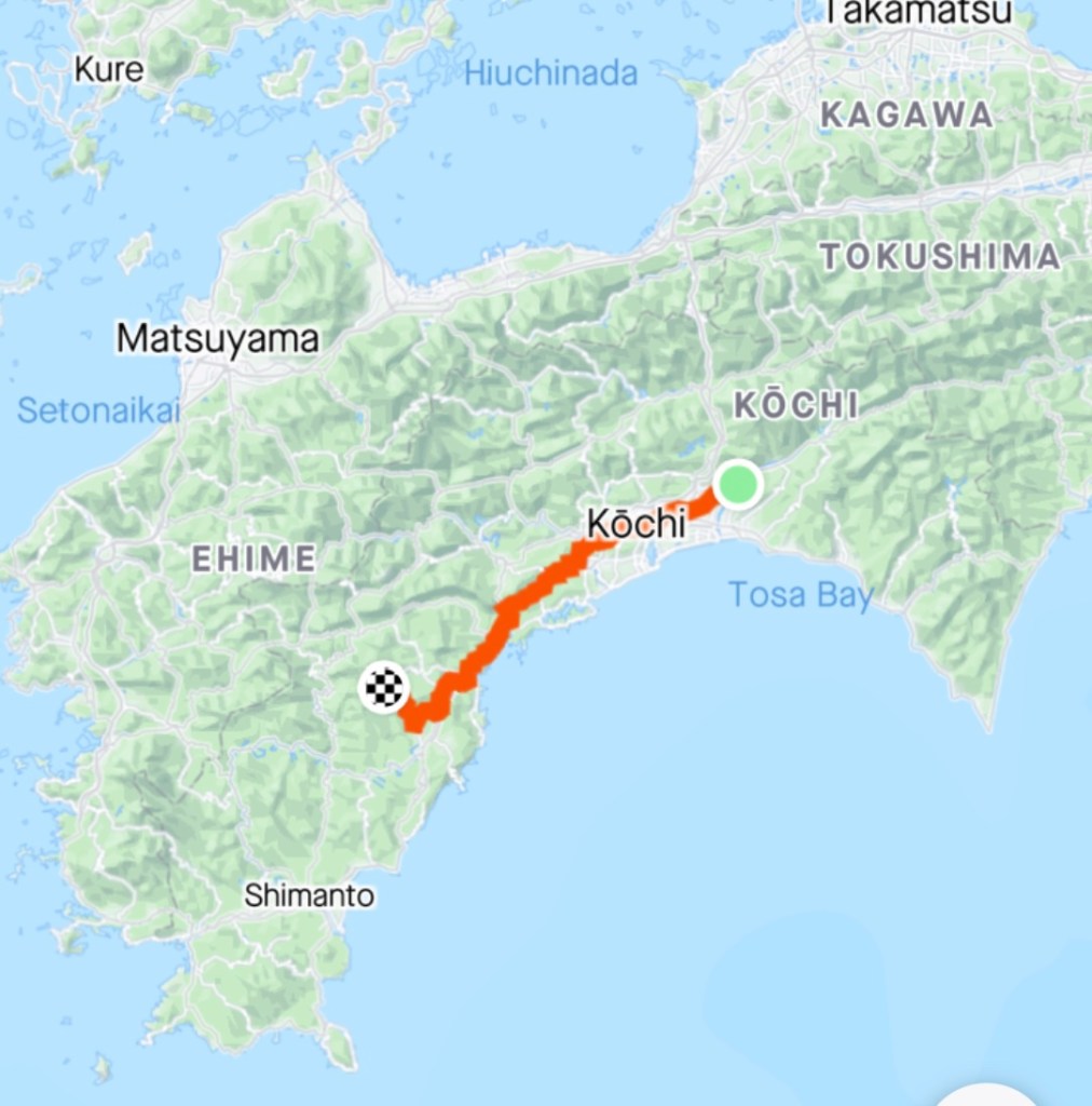
The first part of the ride, some 30 km or so, was getting through Kōchi. We followed a series of shared pathways, and on the whole it was a good route.
We stopped and started a lot as there were many road crossings. At this one, Tony readjusts his gear.
An example of an excellent snared pathway alongside the river
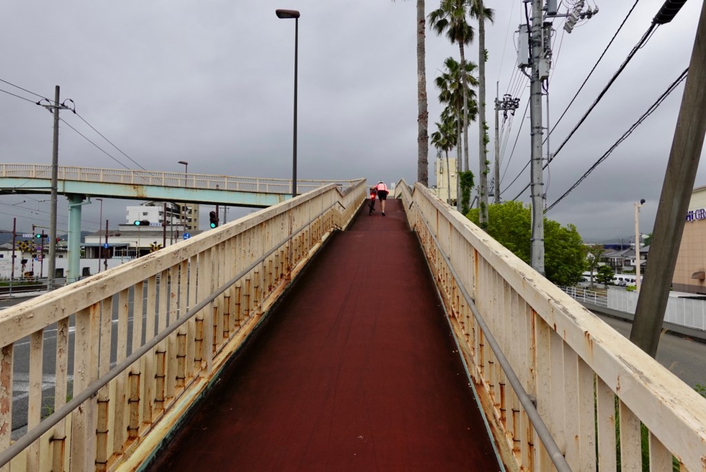
Big cities have busy intersections. It was not always a matter of crossing at the lights. We had a couple of very steep overhead crossings to negotiate, pushing our heavy bikes up, then controlling the descent with the brakes.
This one was smooth, but steep. That’s me pushing, nearly at the topThis one is different again. Push the bike up the ramp, whilst walking stairs. This particular overhead crossing had four such arms, descending to your required corner,
In a small residential, mixed farming area we noted this beautiful blossom tree.
Not far away, this lovely couple appeared.
This was their view through the tunnel under the rail line.
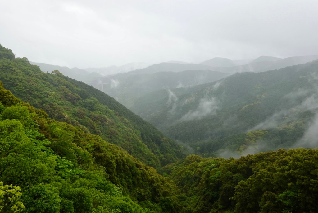
By this point we had donned our rain coats several times for rain showers. Up in the hills heavy mist descended.
We passed through another two km of tunnels today. The longest was 983m long. There is an older tunnel to the left no longer in use. This tunnel was ok as it had the shared pathway through.
We eventually reached the coast, but the weather ensured less than ideal viewing conditions.
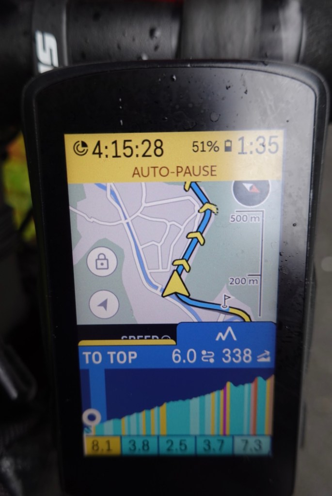
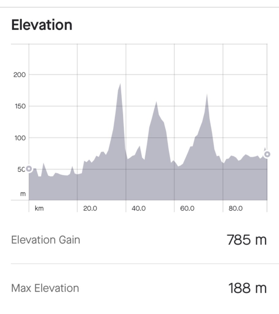
The longest climb today was 6.2 km. Yesterdays tough one was 5.8 km. Distance is less relevant than how much climbing you have to do.
Yesterday the climb averaged 7.9% for the entire distance. That’s not an easy climb. Today the average was around 4.6% so much more ‘doable’.
This is Tony’s bike computer showing the climb. He was 200 metres in, as indicated by the white circle. The colours on the grid relate to steepness. Red and orange are the worst.This is our ride data for the whole day. You can see the climb in question.
Climbing usually means great views. We climbed in drizzle. We took our rain jackets off as climbing makes you hot and you become a sweat box. We preferred the drizzle.
A few photos taken by Tony during the climb.
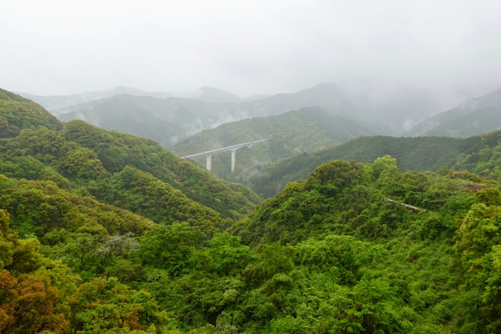
Looking back to the bridge we had crossed.
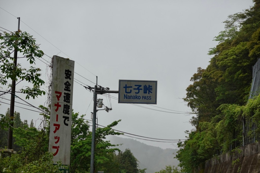
The climb had a name….Nanako Pass. It’s always a great feeling to reach the top.
Heading towards our overnight accomodation we rode alongside the Shimanto River. Our accomodation was well signposted…so we thought. Great road.
Arriving at what we thought was our accomodation, it turned out it was a day spa. I was very confused as I was certain I’d mapped this correctly. I had a horrible thought I’d totally stuffed it and was getting frustrated because the last 5 km it bucketed down, and it was still pouring and I was not keen to head back out.
After maybe 20 minutes of uncertainty, it turned out there were two adjacent buildings and only 50 metres away was a little sign saying ‘hotel’. Phew!!
Happily ensconced in another traditional Japanese style room, we both headed off to the day spa!! There is no shower in our room, you go to the onsen.
You wear your designated gown, strip off, enter the onsen, sit on a little bucket stool and shower, enter the spa, sit, soak, get out, shower again and wash your hair….then leave into another room where your towel is to dry and dress.
Tony progressed to the showering stage but chose not to go another few metres to the spa. The water is incredibly warm.
Dinner was at 6 pm. We approached three rooms with closed sliding doors. We were not sure which to open but then I saw this.
We had an incredible meal. We thought we were done after the first few dishes, plus our own little hot pots cooked next to us.
Then out came the tempura, then the salted fish, then the rice and miso, then the savoury custard.
Finally icecream turned up and we presumed that it was done!
A great day on the bikes, despite the weather. We are somewhat concerned about tomorrow as this is the radar. I sometimes wonder why we dry clothing knowing it’s going to get wet incredibly quickly.
The weather forecast for tomorrow is 4-6 mm each and every hour!
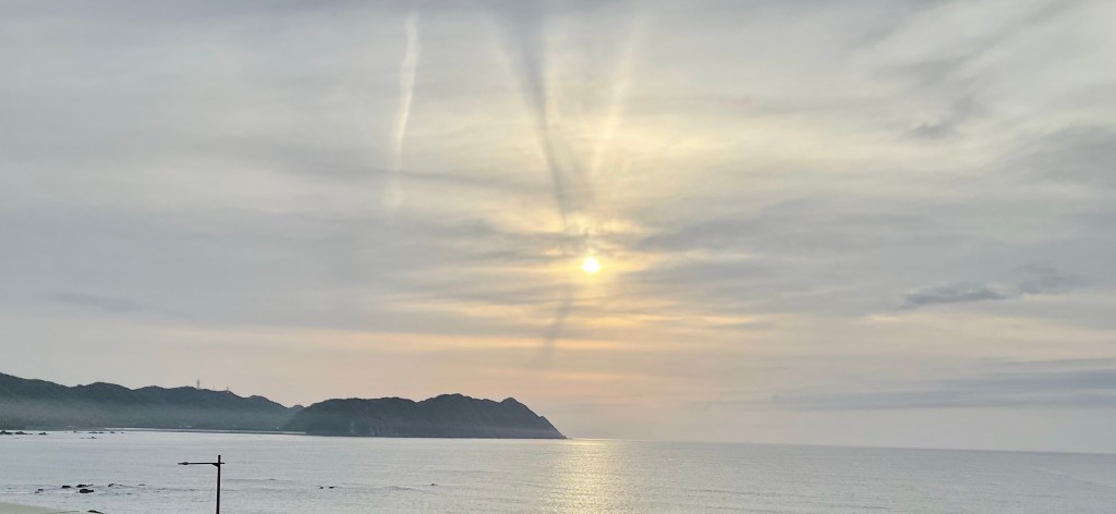
Hardest mattress ever, with a pillow that actually felt like it had woodchips in it, I slept ok! Looking out the window, this lovely view greeted me.
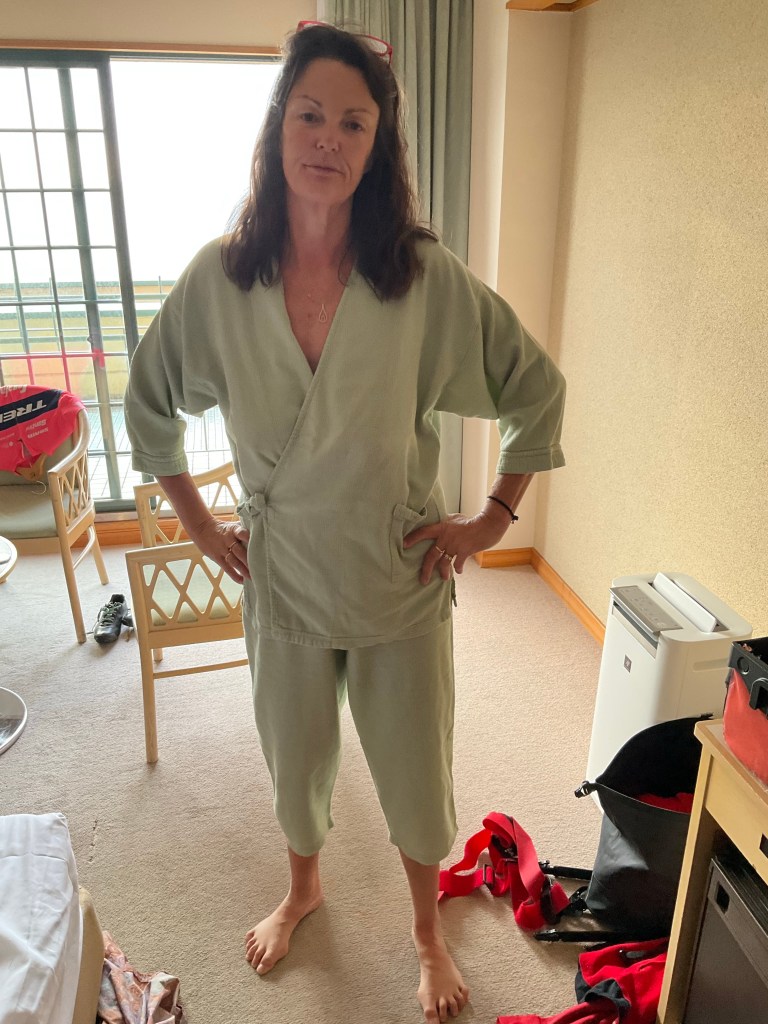
I had to show you these. Each place we’ve stayed has had different attire for us to wear, so I tried this on for size, and it was surprisingly comfortable. I felt like I was off to theatre to operate!
Breakfast was at 7 am and we got dished up these 10 courses plus green tea, and awful airline style coffee. The food was great, but too much, and I over ate.
Other guests wore those operating theatre pj’s to breakfast!
Back to our room and some of breakfast did not stay with me. I felt really pretty shite with stomach cramps. But we pushed on and headed off for another day.
Our bikes were where we left them, in reception.
Heading along the coastline there were some lovely vistas.
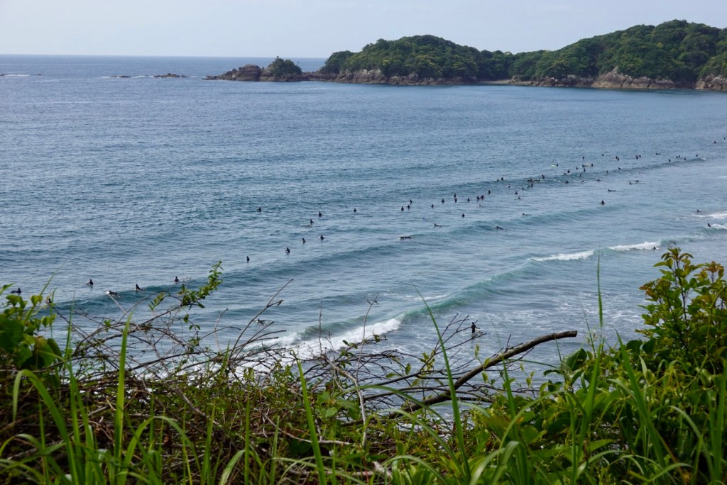
At this beach, the surfers were out. I did not see much surfing as the waves are pretty flat. Maybe they just sit and chill and chat with their mates.
Yesterday we had around 3 km worth of tunnels to ride through. One of those tunnels was super scary with a 30 cm lip for cyclists. I got off and walked as there is no room for error and if you deviate slightly, your off the lip and into the traffic.
This was our first tunnel today, and you can see there is a walking/bike path that does narrow considerably, but was ok.
Today we had a tunnel that was 960 metres long, no verge. So we put our front lights on and we already had our rear radar flashing and road through as fast as we could. Cars overtook us and were very considerate.
Our bike computers work off GPS so when in tunnels it cannot connect, thereby not acknowledging the distance. Today we did around 2 km of tunnels, so 5 km in two days.
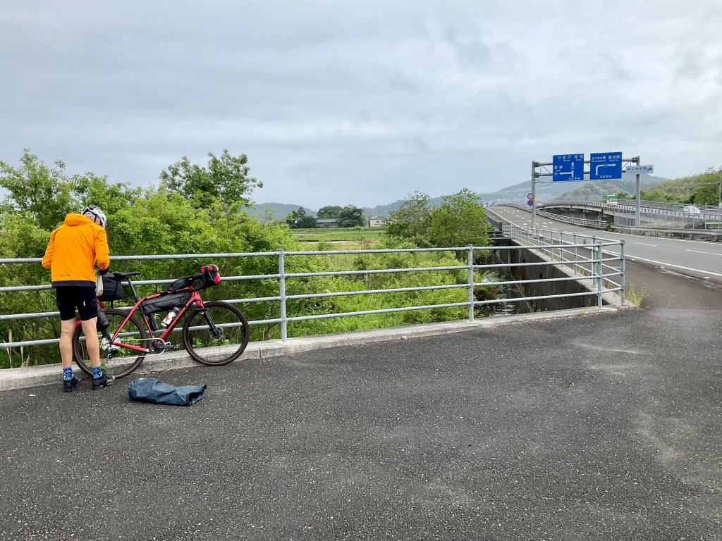
We turned right away from the coast to head inland. Looking at todays route, you can see why. We cut off the coastal tip saving many km in reaching our destination. However, Shikoku is hilly and the trade off was a climb.
It started off nice and friendly, but that did not last for long .
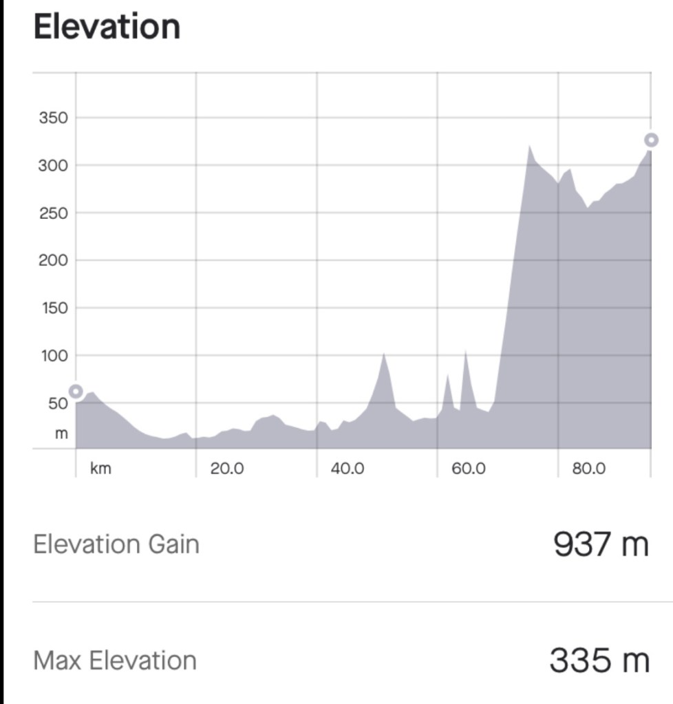
We had a decent climb to do. 5.7 km long, nearly 500 metres ascent, with pinches over 12 percent. I still felt sick as a dog. Here is the first climb graph.
I recall saying in my first blog I was at up to 90% pre open heart surgery. I am not! I found that climb difficult today. More difficult than before. I think it is more like….65-75%.
I stopped several times to decrease my heart rate, protecting those coronary grafts. My back was behaving today so that was a bonus, and my knee coped. I just spun it up in my granny gear.
The vegetation was dense forest with steep drop offs. The road was very narrow.
Here I am at the pass, thankful that I did it, given what happened to me 9 months ago. My body has been brutalised, I have had life saving surgery, but I have recovered enough to make it! I was quite emotional as I did think a lot during the climb about my cardiac journey and recovery. I know not many OHS patients get to do what I have achieved. I still hate climbing 🤣
So we spent 5 minutes or so at the pass recovering and looking around. There are a series of walks.
I found this old sign leaning against the loos. No idea what it says.
What goes up must go down. The joy of the descent. Silly me did not notice my bike computer had paused and missed 5 km of descent data at speed. Ho hum.
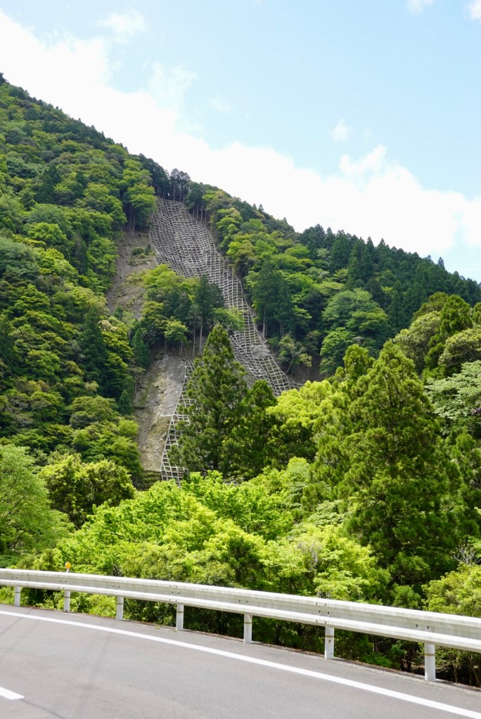
Here is an interesting scene on a hillside. Quite a significant infrastructure which we were thinking to prevent a landslide??
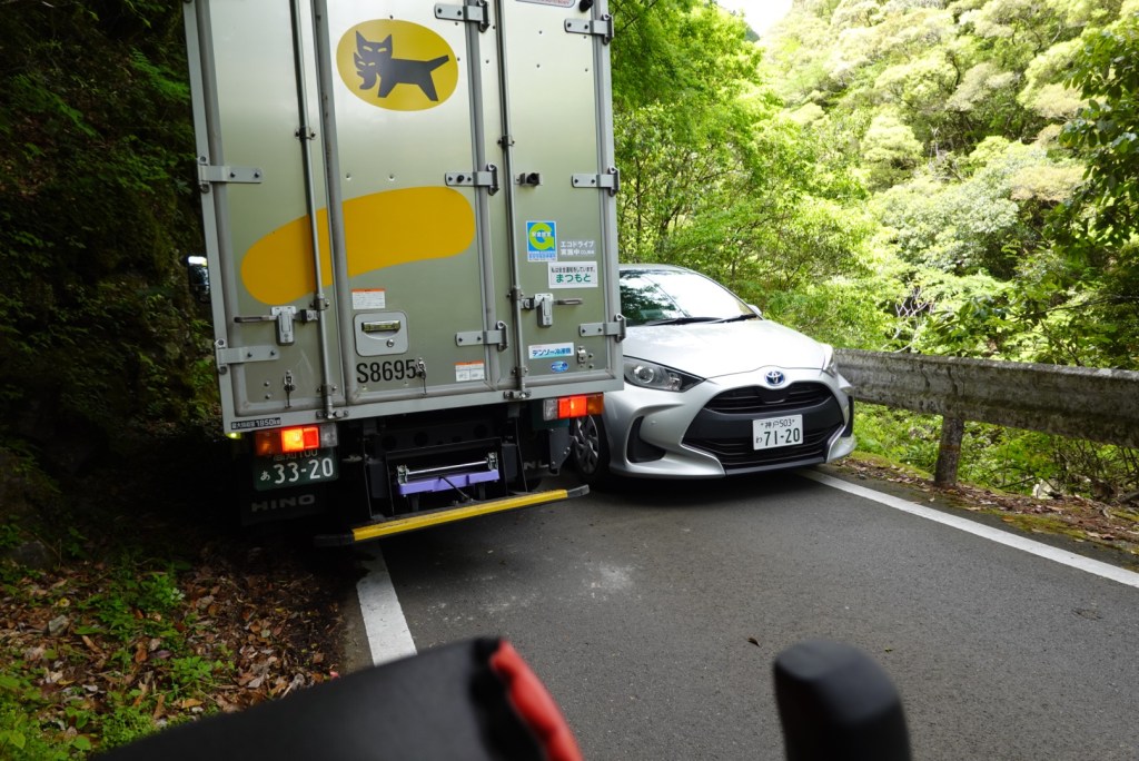
I mentioned earlier the road is narrow. We had pulled over to let the truck pass us, and boom a car was heading up.
We watched this unfold with interest. The driver of the white car did a marvellous job. He was literally only cm off the barrier. They took turns moving a few cm until they were clear.
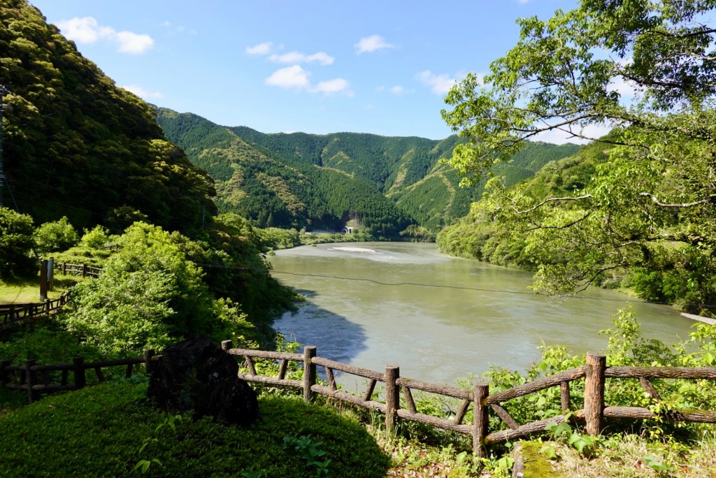
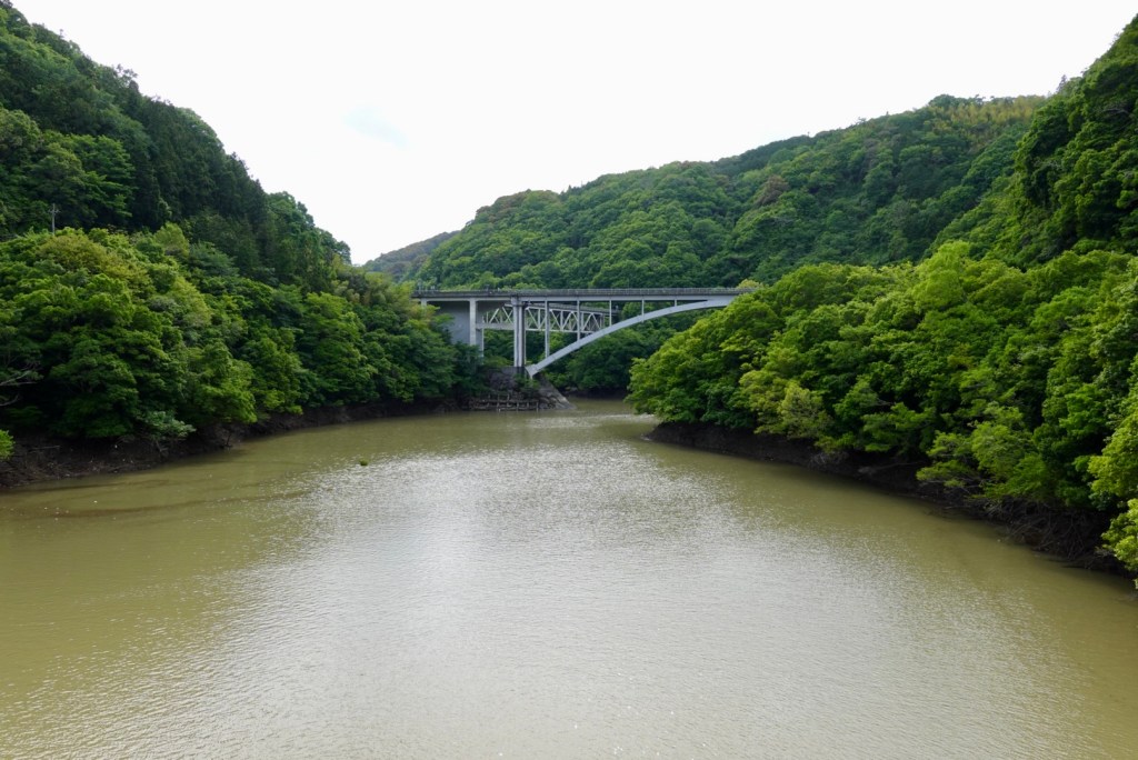
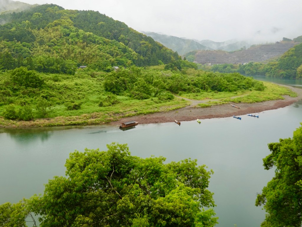
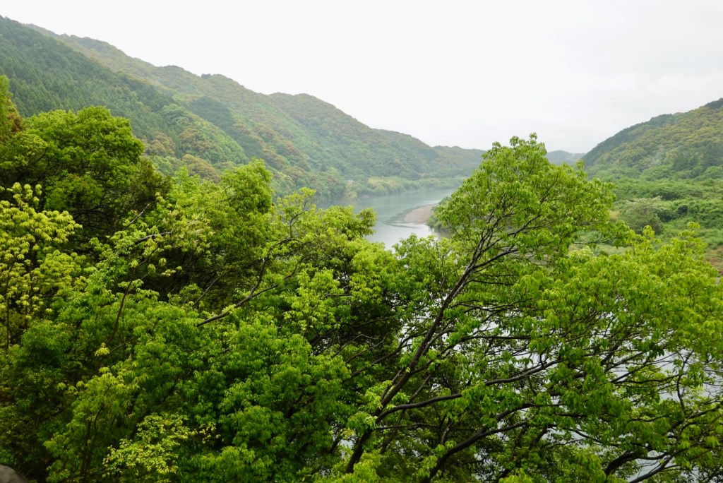
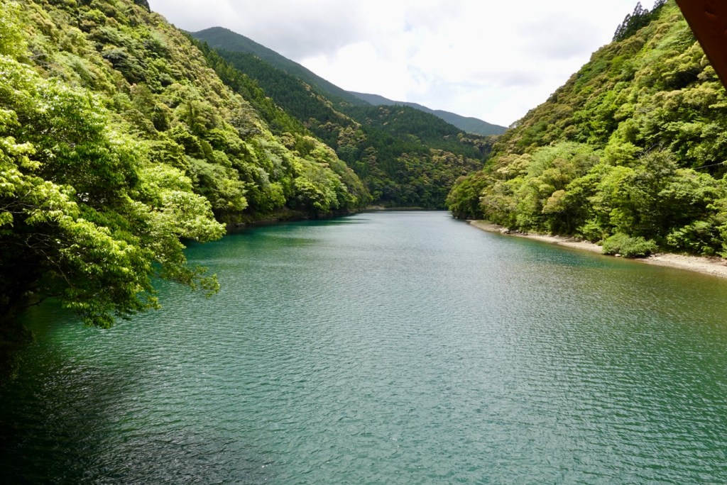
Moving on, we continued following this river, all the way out to the ocean.
I particularly like these few snaps of the river.
We found a vending machine in this village so stopped for maybe 10 minutes. I was starting to feel normal again.
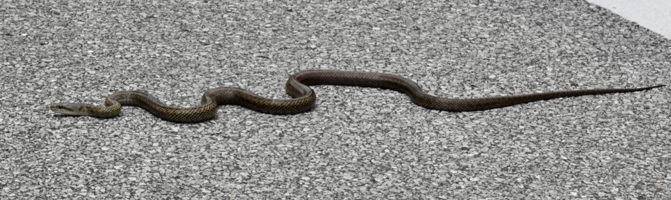
As we left the village, we encountered this reptile. Not our first this trip.
The snake is a Japanese rat snake and not venomous unlike the mamushi which is venomous and inflicts numerous deaths in Japan annually.
Yesterday Tony was within cm of running over a rat snake. The snake doubled back and there I was on Tony’s tail. I let out a shriek, as I had visions of running over the snake and it getting caught in my spokes or chain or higher, my legs. Nothing happened, the snake survived, as did I.
We stopped to look at this snake today and it did not move. We gave it a wide berth and again it did not react. I reckon two minutes later it would have as we passed a car heading into the village.
Japanese rat snake
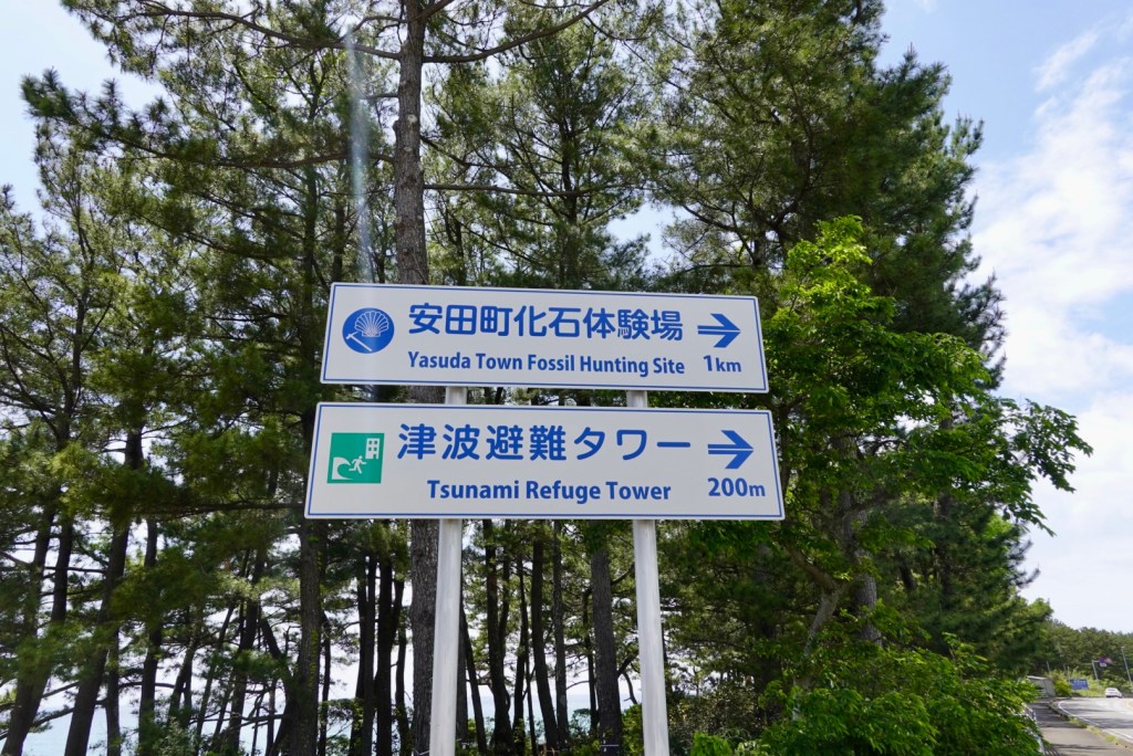
Back on the coast we noted the refuge tower. There are lots of signs along the coast warning which areas are subject to tsunami inundation. The refuge tower points to the hills.
Found some toilets so stopped here. Nice view from the seat.
By 1.30 pm I felt I could eat, so we stopped at a Lawsons ( like a seven eleven), and grabbed a few items. The older lady who served me reached over and touched my chest scar and said ‘heart.’ I said yes, and she put on a sympathetic sad face. Very sweet of her.
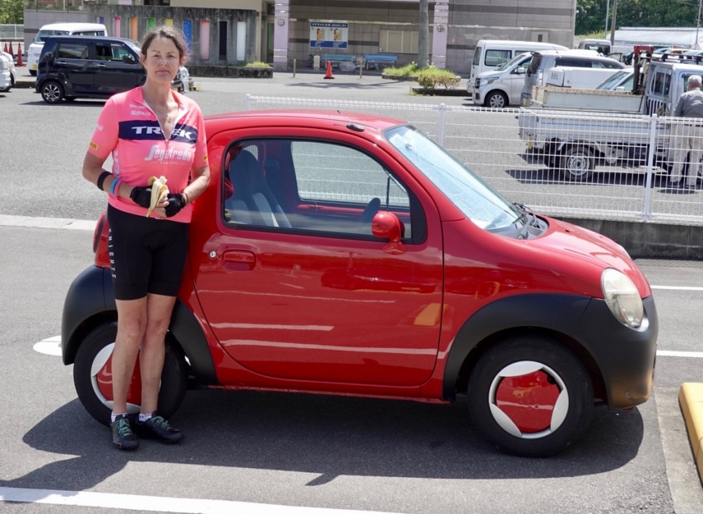
Tony noted this brute of a car. I’m standing there as a reference point. It is a tiny car.
Views along the coast as we approached Kōchi.
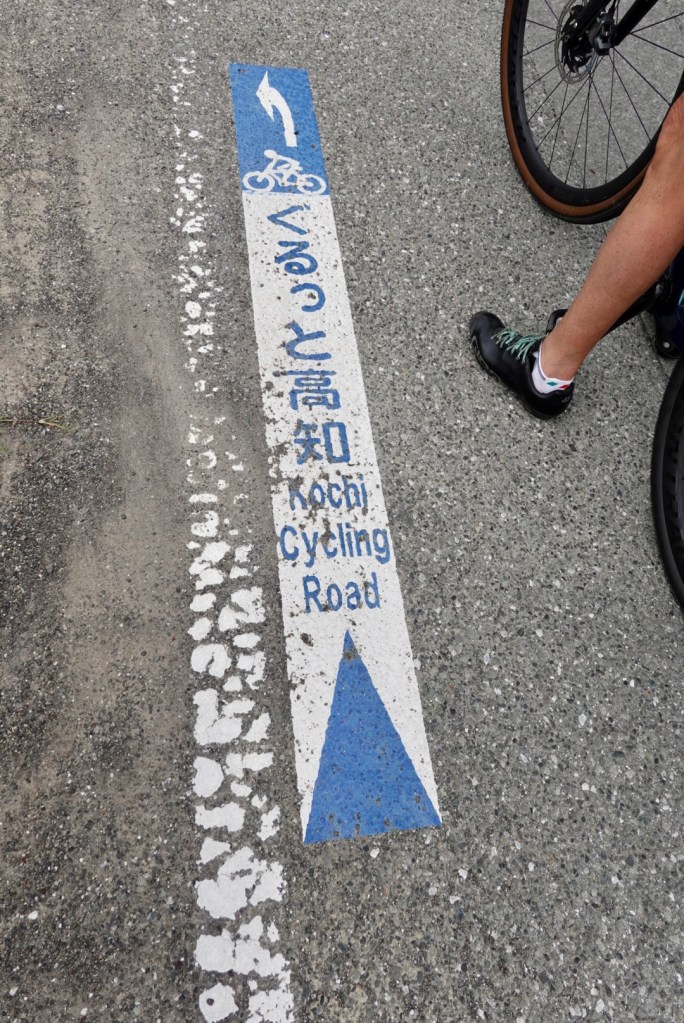
By chance, following the Kōchi Cycling Road. Misnomer of a name, as a lot of the route we went in today was footpaths, barrier wall roads, residential laneways and so on.
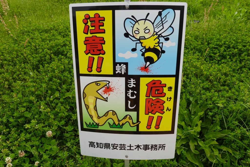
The route had a detour due to civil construction works, and took us past a rest area. This sign was on the grass, well would be grass if mowed, but it is protected for bees and snakes!
This is an example of a barrier wall path we were on. Well made and quiet. Volcanic sand beach.
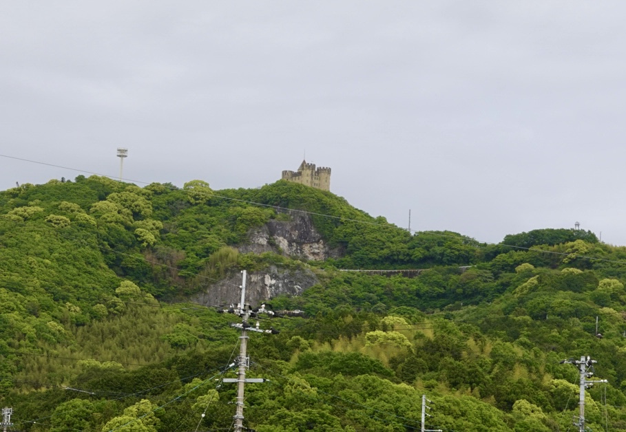
Castle like structure high on the hill.
Our accomodation has a small onsen. No bathroom. No shower. You use the onsen.
So off I go in my robe, to be confronted by 5 naked females…my first mistake was the robe needed to be left in the first room not the onsen room.
Second mistake was I brought my towel with me.
Third….I hopped into the very warm water with these women who had no inhibition vs me 🤣😳🙈
I felt like the elephant in the room! They were all so…petite…
Then a lady maybe my age but larger came in.
I sat in the water wondering how long they’d all stay….one by one they left until it was me and the other larger lady.
I got out to wash my hair (special area) and she got out and we started talking. She was Japanese and spoke a little English and told me she’d been to Esperance (WA) and had held a koala.
I got back to the room feeling somewhat….still prudish. but I had ventured further that Tony. He did not proceed past the first room.
Dinner was eaten here. We’d paid half board. A beautiful dinner with far too much food again.
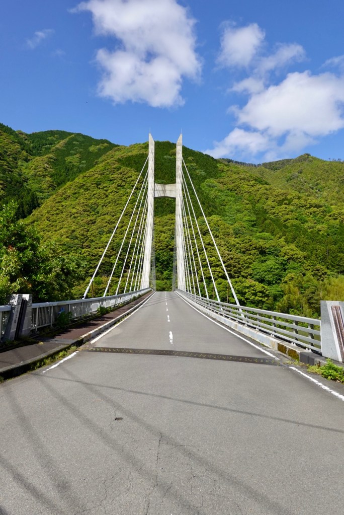
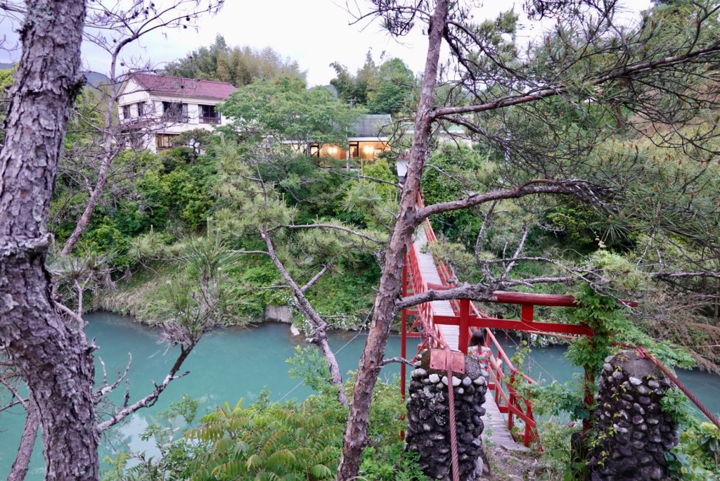
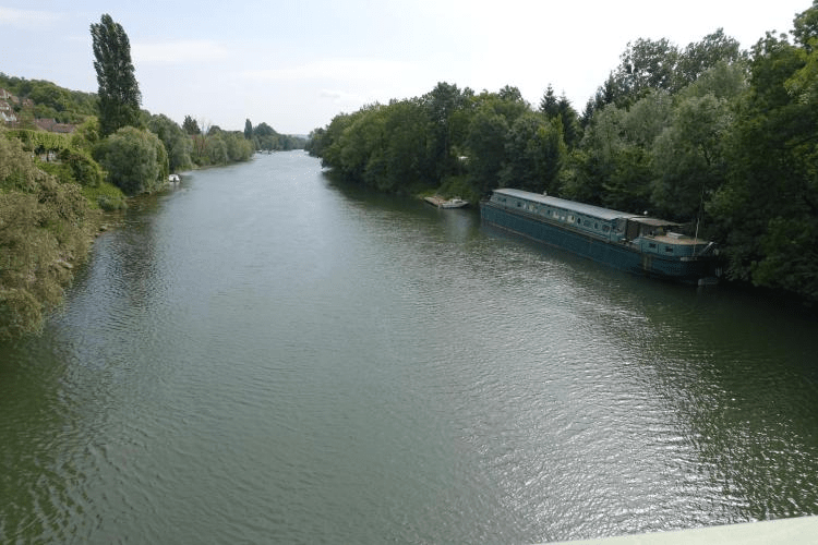
We went for a short walk to the suspension bridge by the accomodation. Lovely views of the river.
Today we rode 103 km. I climbed a decent climb and survived. ❣️
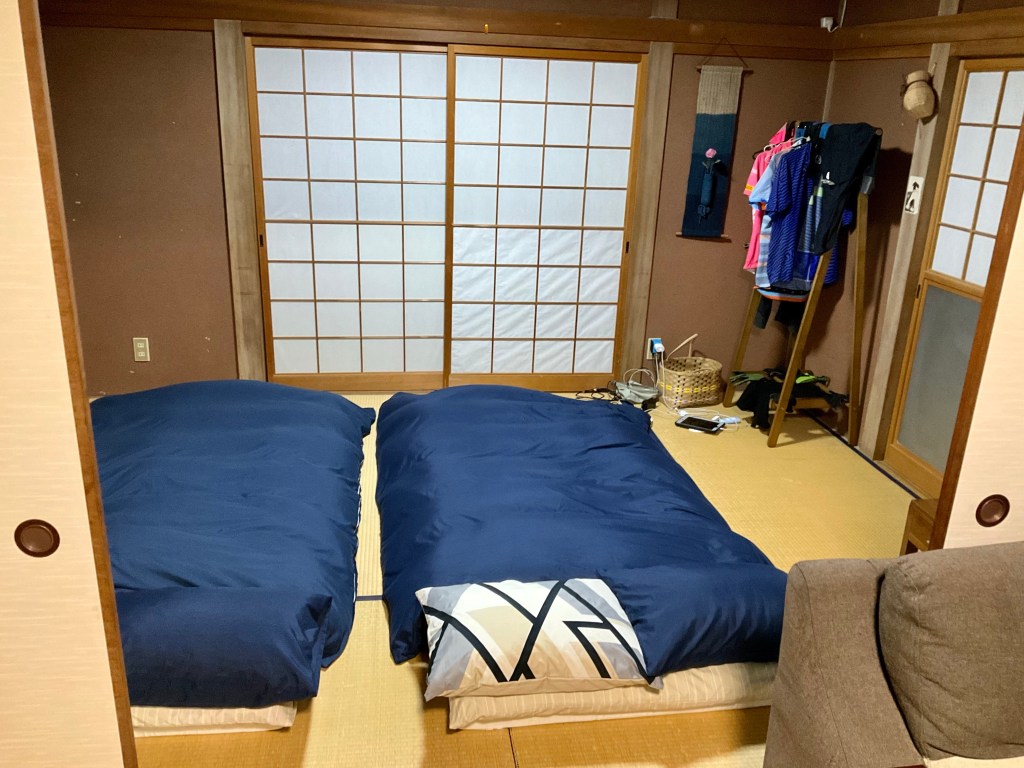
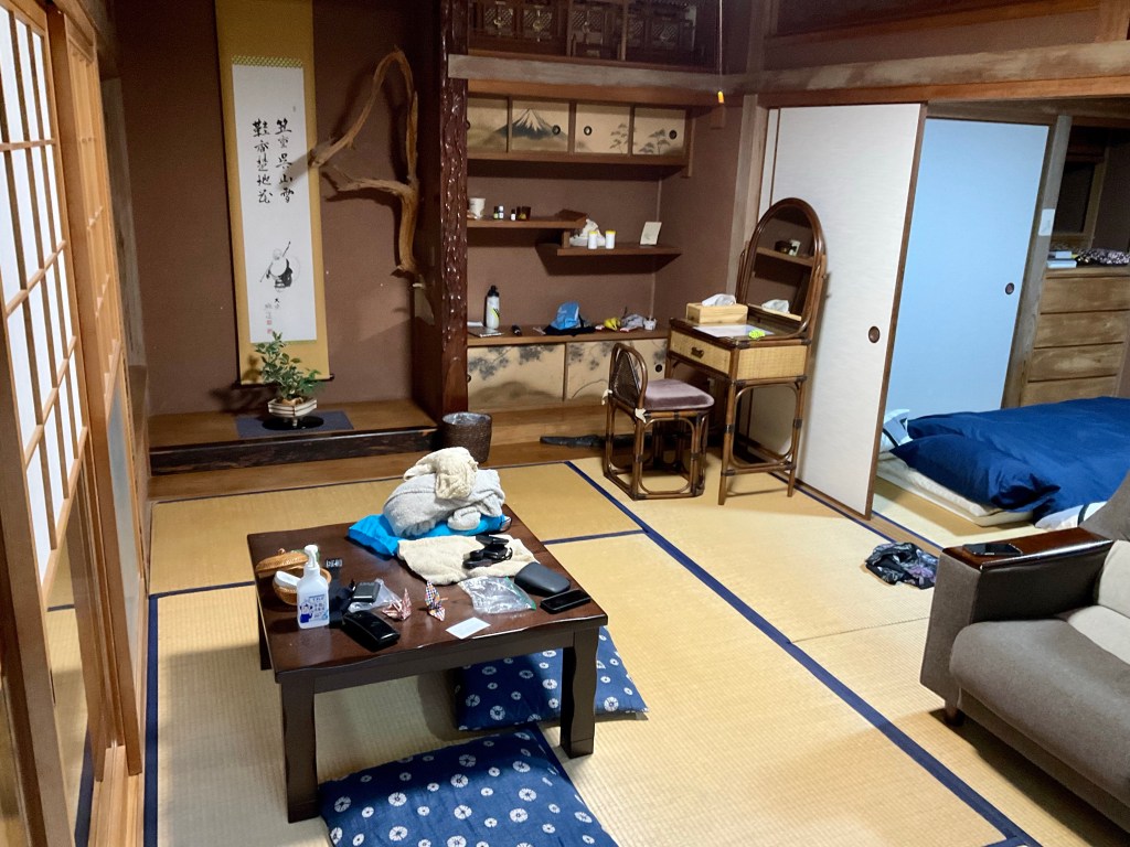
Tonight we sleep tatami room. Beds on the floor.
I did not tidy up for the photo!
Rain is forecast tomorrow. 96% chance, 45% chance of thunderstorms. Hopefully we can work around the rain, otherwise we will just get wet. One way of washing without feeling like the elephant in the room 🤣🤣🤣
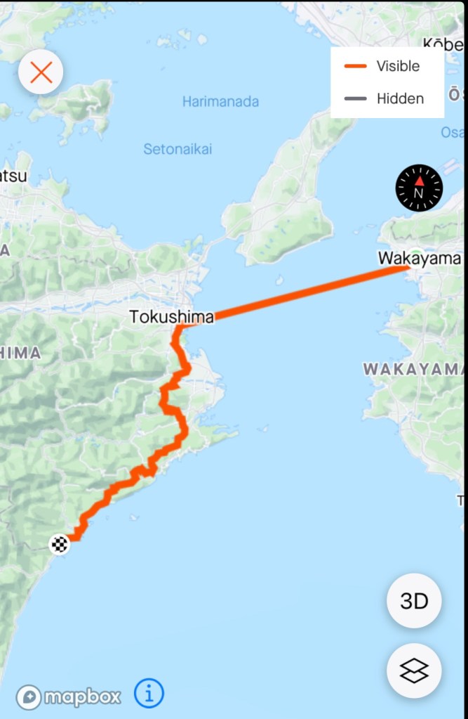
We woke up super early today as we needed to board the 5.30 am ferry from Wakayama to Tokushima on the island of Shikoku.
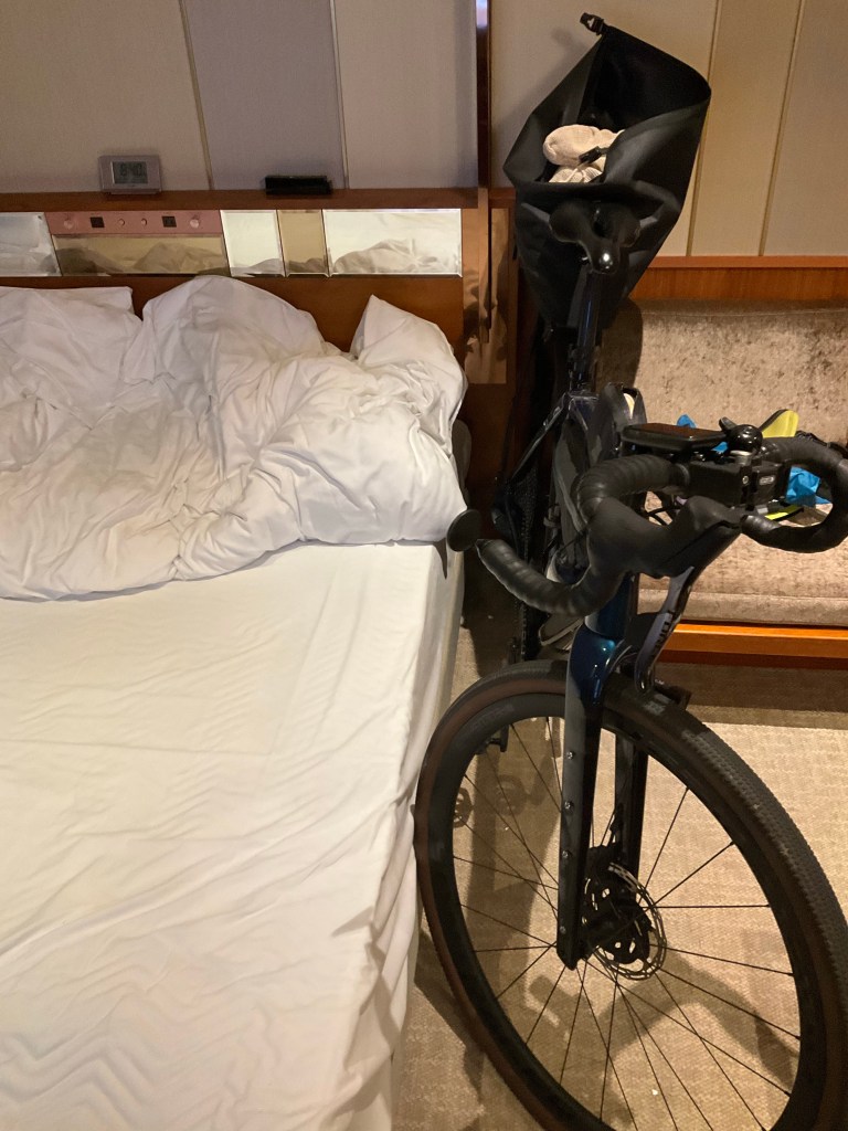
Here is my side of the bed, and that is my bike. I do love my bike, but I’ve never slept quite that close to it before. 🤣
It was only a short 3.5 km ride to the ferry. I needed to buy bike tickets (I’d purchased ours online but the bikes I needed to do at the port).
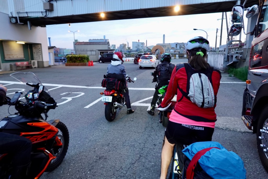
We were directed to Lane 4, alongside the motorbikes and a semi trailer in Lane 5.
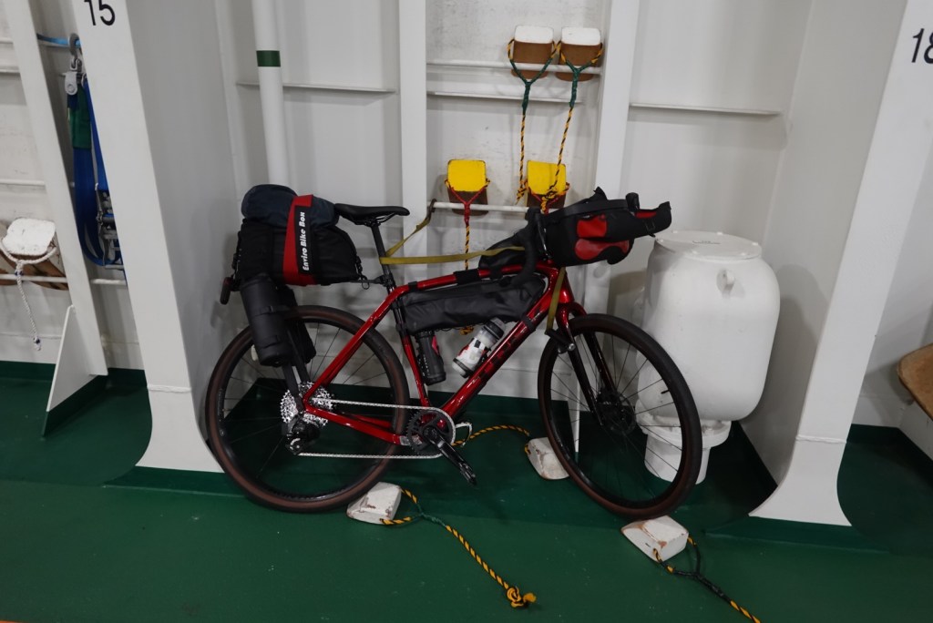
That’s me, waiting patiently. The little backpack has 3 bananas and a bun to share for breakfast.The ferry at the end of the building.Tony’s bike. The crew strapped it and placed wheel chocks.
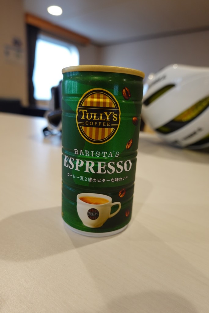
The ferry is a decent size and the vehicle deck was about 3/4 full on the first crossing of the day. On board we sat in an area with tables and vending machines selling a huge range of drinks and snacks.
That is how our coffee came today, in a can. My caffeine connoisseur would be barista son in law Rory would be super unimpressed.
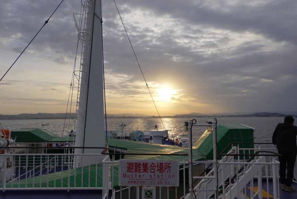
The sun was poking its head through as we left the port of Wakayama.
A few hours later we approached the island of Shikoku and the port of Tokushima. The crossing was very smooth with hardly a ripple.
Docked and we rolled off, following a criss cross of residential lanes to keep us off the main roads, but eventually they came. Hard to avoid in big cities.
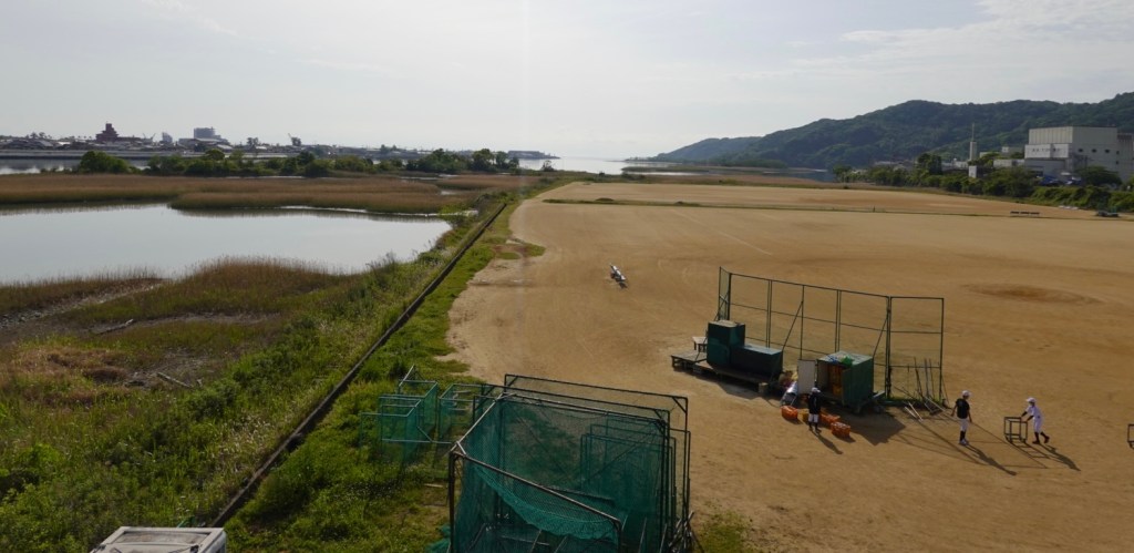
We watched these young lads setting up for their baseball. Very flat and pristine pitches. Wonder how they keep the weeds out?
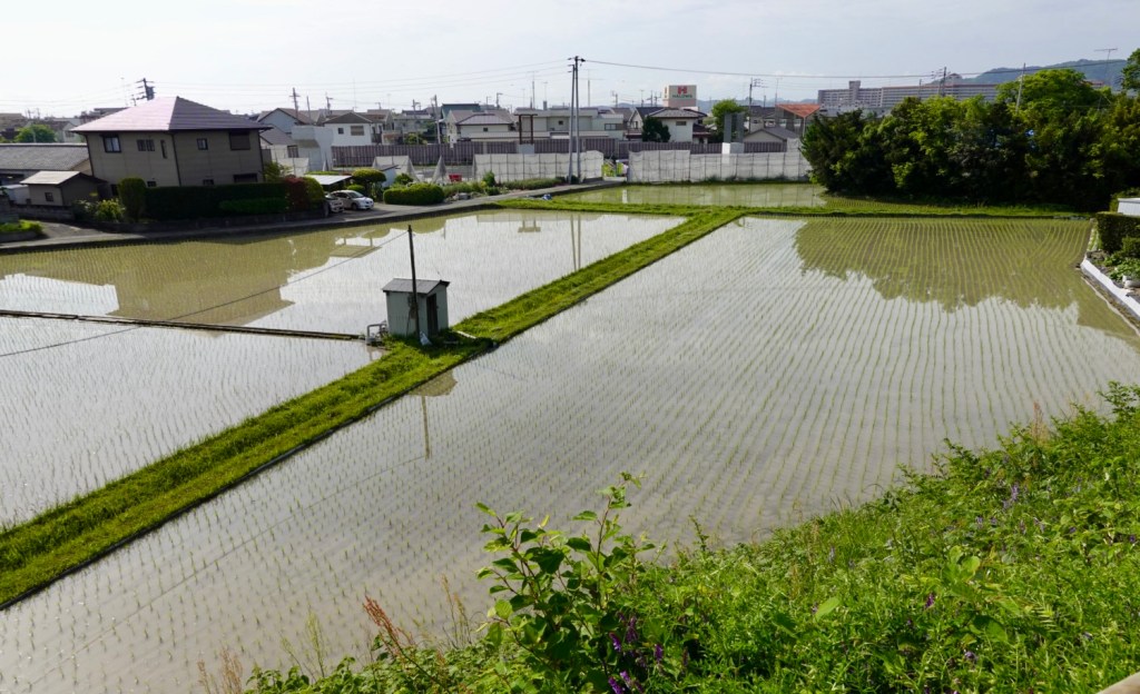
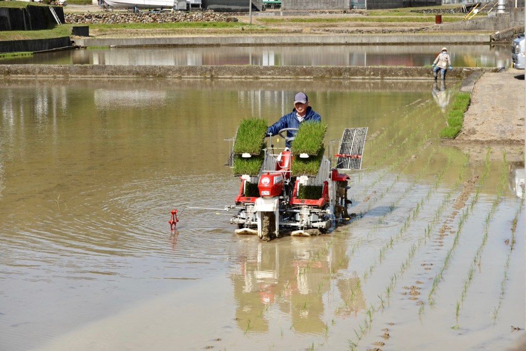
Flying into Osaka yesterday, we flew over Shikoku and was very curious about greyish looking wet areas. We now know what we were looking at.
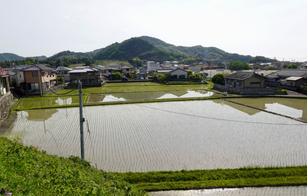
In France it is wheat field after wheat field to support their habit of eating bread. In Japan, replace the wheat with rice fields. They are everywhere, jammed between homes, anywhere that is flat.
There is an intricate drainage system in place, with turtles galore. I did wonder how they keep the turtles out of the rice fields as I imagine the turtles would be a pest there.
The rice fields are just being planted out, and it is fascinating to watch. There are tractors that automatically plant the young crops.
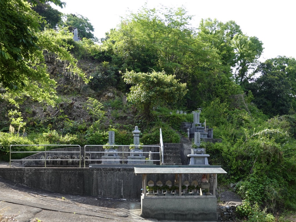
Another thing that intrigues me are the number of cemeteries on hills. Shikoku is hilly so maybe there are not a lot of options given flat land seems to be taken by the rice fields.
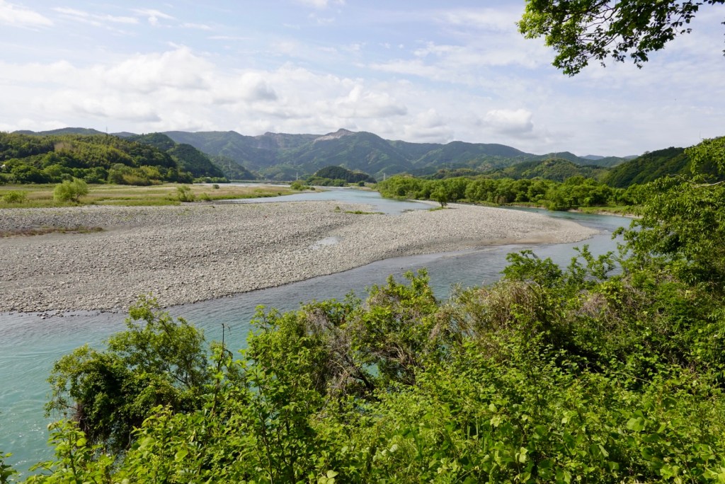
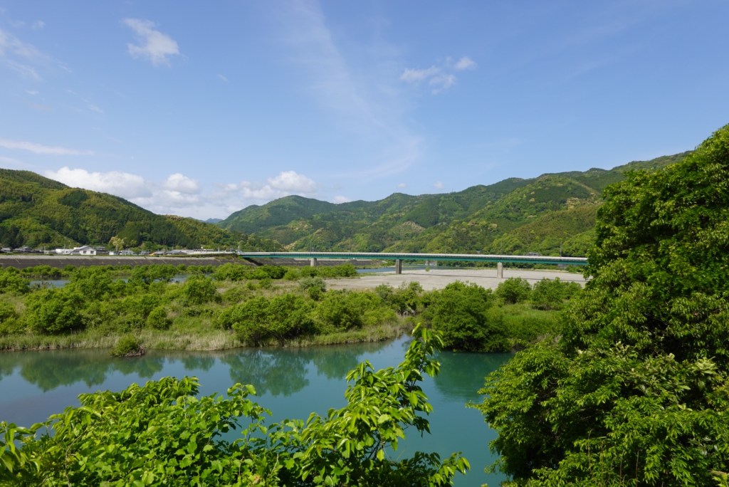
For a period of time we followed this lovely river, the Naka.
Most villages have a shrine at their entrance.
Our bike computer told us we had 15 climbs today. There were a few three km climbs, but all were quite comfortable gradients.
Many were through heavily wooded areas above rivers, and the various shades of green were lovely.
We noticed a number of walkers doing the Shikoku Pilgrimage, where they walk (or cycle) to 88 temples. The standard walking route is 1200 km can take 30-60 days to complete. The white shirt, hat, staff is part of the standard attire.
Our route seemed to bypass food options so we were delighted to come across Noah’s Ark! Not sure of the name of this restaurant but I recognised it from a v-blog I watched by two Malaysian cyclists who stopped here.
After removing our shoes we were seated at a table that is low to the ground but has a generous footwell below it. Green tea appeared.
We ordered slightly different meals, as included some sashimi with mine. It was super delicious and all up very reasonably priced at 2900 yen ( about $35 aud).
I do find paying cash in foreign currency difficult without glasses to read the numbers….the magnifying glasses are on whilst I sort the yen out 🤣
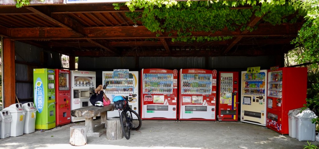
My back was being quite tweaky after lunch so we stopped here so I could stretch it, surrounded by vending machines. They are every where .
We hit the coast around the Muroto Anankaigan National Park. Very picturesque.
These man made cement blocks are interesting, used to stop erosion. Reminded me of knuckles, the game that was played when I was younger…just a few years ago, but a giants version.😊
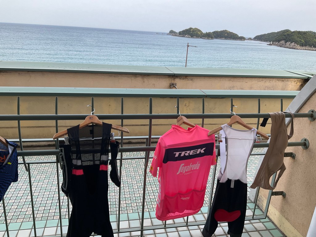
We are now in Shishikui, a coastal village. The washing is out drying, of course! A lovely view from our room. Dinner we lashed out at the Seven 11….I had a bag of salad and some pickled squid. Tony had a few nori rolls.
Breakfast is at 7 am. We will be there on the dot.
Today was a solid day of just over 100 km. It was about 50% footpaths of various construct and quality, 25% road, balance agricultural dirt and sealed tracks and residential lanes.
This is the longest day I’ve done on the bike since open heart surgery 9 months ago too. So thankful I have the opportunity to do these adventures. It will take my body a few days to adjust and adapt.
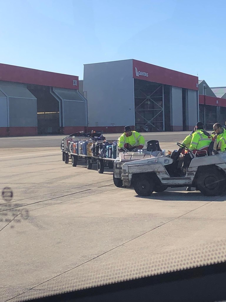
It has been a long two days, leaving Devonport 5 pm Monday, arriving in Japan 6.30 am Wednesday. We overnighted in Melbourne, had an early flight to Sydney with 90 minutes between landing and the international flight departing to Hong Kong.
We did see our bike bags in Sydney as we transferred by bus to the international terminal, by ours chance. We were pretty pleased as all that luggage had international connection tags.
We had an agonising 8 hour wait in Hong Kong leaving there at 2 am! We arrived in Osaka at 6.30 am this morning.
After showing our QR codes to immigration and customs, scanning our passports three times, finger printing and photos taken I join the queue to obtain a rail ticket.
It’s a long and slow queue and I’m tired. I get to the front to be told I’m in the wrong queue…..aaaagh. Fortunately no one was in the other queue a bit further up the way.
Two trains and we arrive in Wakayama at our hotel and it’s only 9 am, checkin is at 3 pm. For an extra 8800 yen (about 100 aud) we get to our room early (after eating tomorrows breakfast today, as they would not refund but would allow pre eating!)
Kensai airport is on the little island off Osaka (to the left of the O in Osaka on the map). We then travelled to Wakayama by train, and tomorrow Tokushima on the island of Shikoku by ferry.
We immediately hit the sack and slept for a bit over 2.5 hours feeling somewhat less tired than earlier.
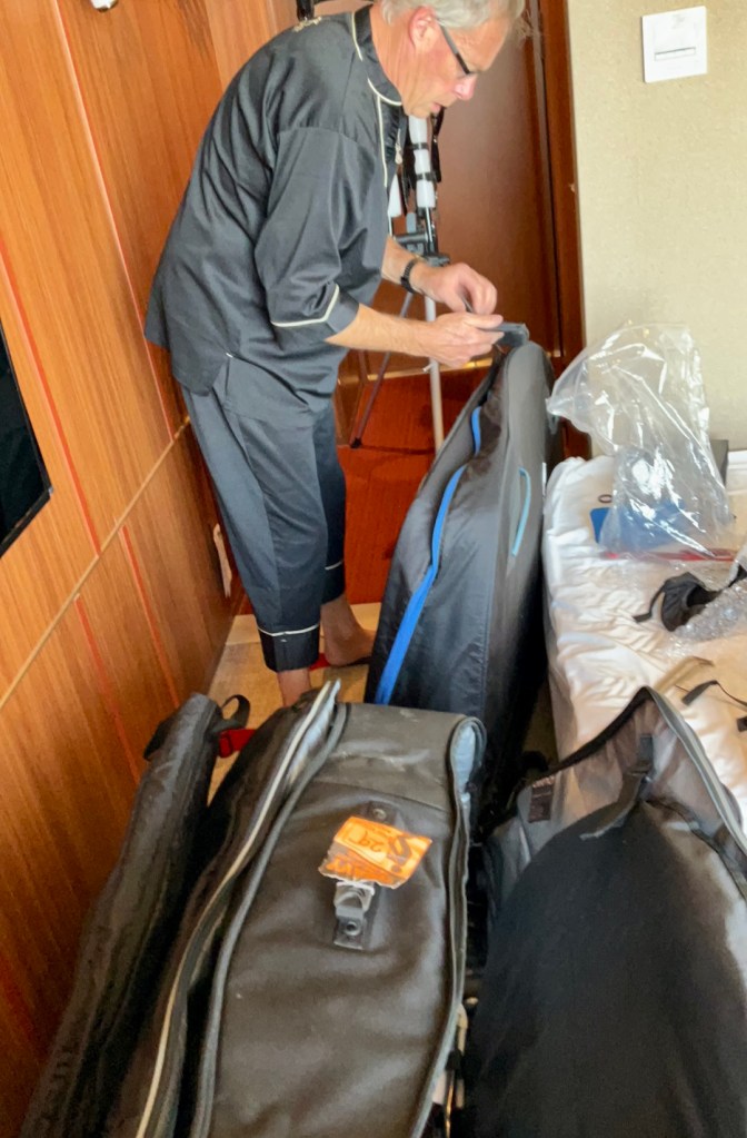
Then it was down to business putting the bikes together. Tony does a great job and today had very little wriggle room.
Tony is wearing the pj’s issued by the hotel. Curiously I have noted people wandering around the hotel in them.
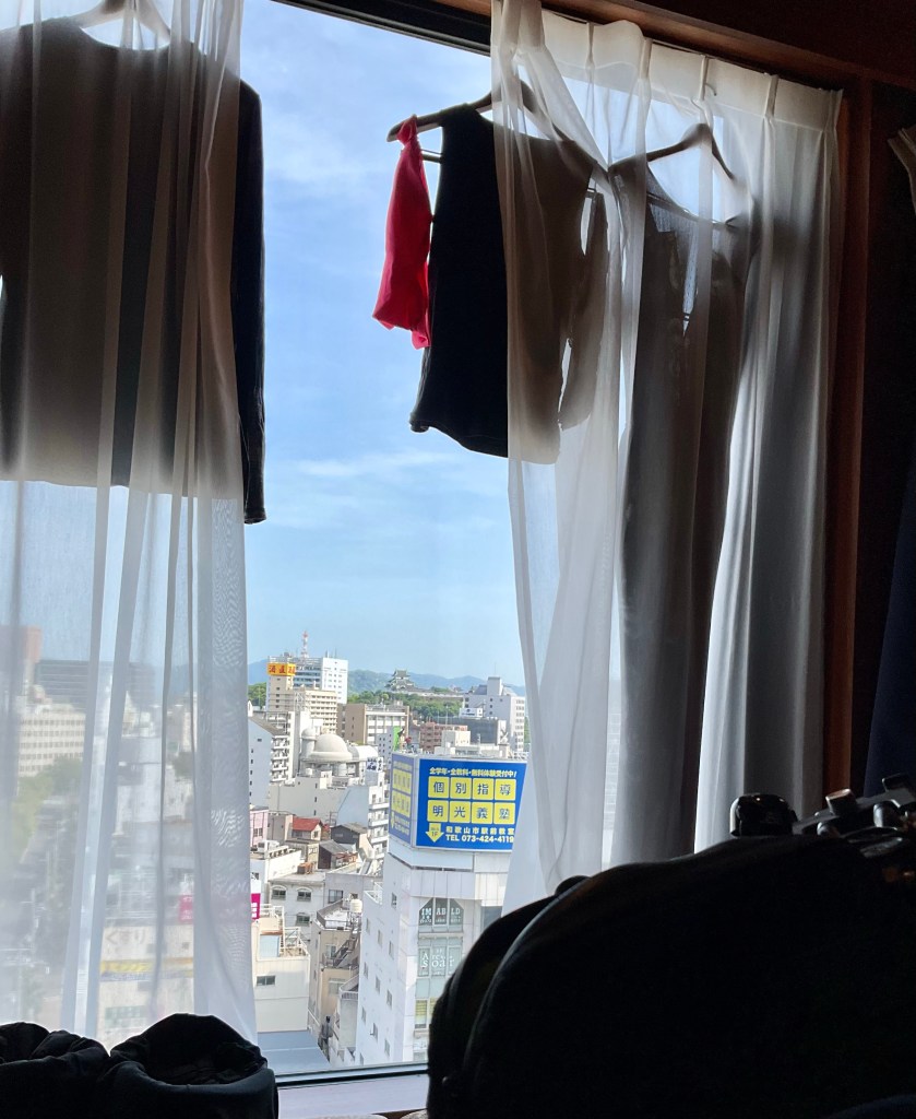
My job is to do the washing, cleaning what we wore on the plane, and hanging it up to dry. Hence why Tony is wearing the pjs.
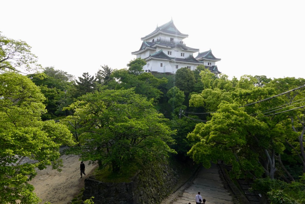
You can see Wakayama Castle in the background.
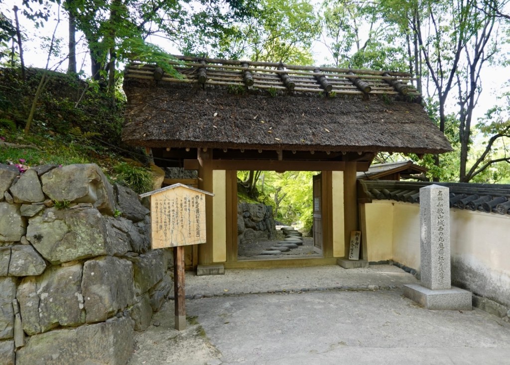
Having noted Wakayama Castle from our window, once we were all sorted and showered, we headed off for a walk towards the castle.
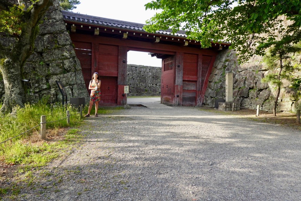
We entered via this gate
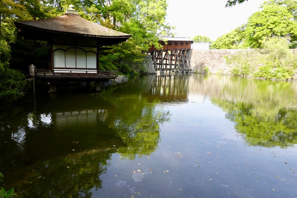
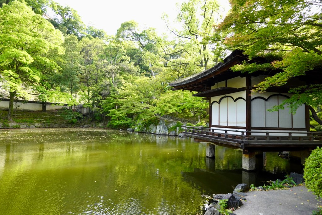
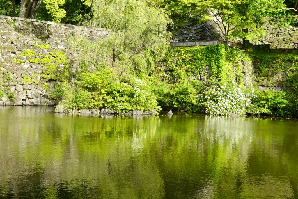
Beautiful gardens surround the castle.
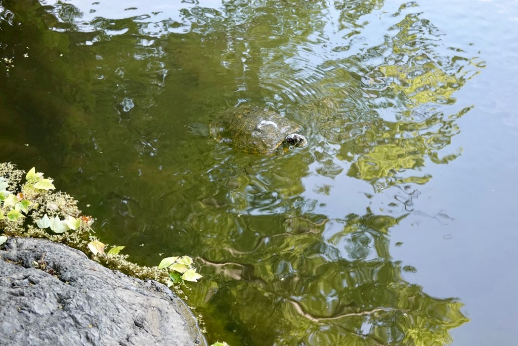
Our first animal sighted in Japan is….a turtle.
There is also a turtle basking in the sun on the small solo rock.
At the bridge entrance we were required to remove footwear.
The timber may look smooth, but in fact they are overlaid planks that hurt hurt feet longer than the plank width. So tip toeing easier.
The castle was built in the late 1500s as has been reconstructed a few times due to destruction. The last rebuild was more recent, with the castle razed during WWII.
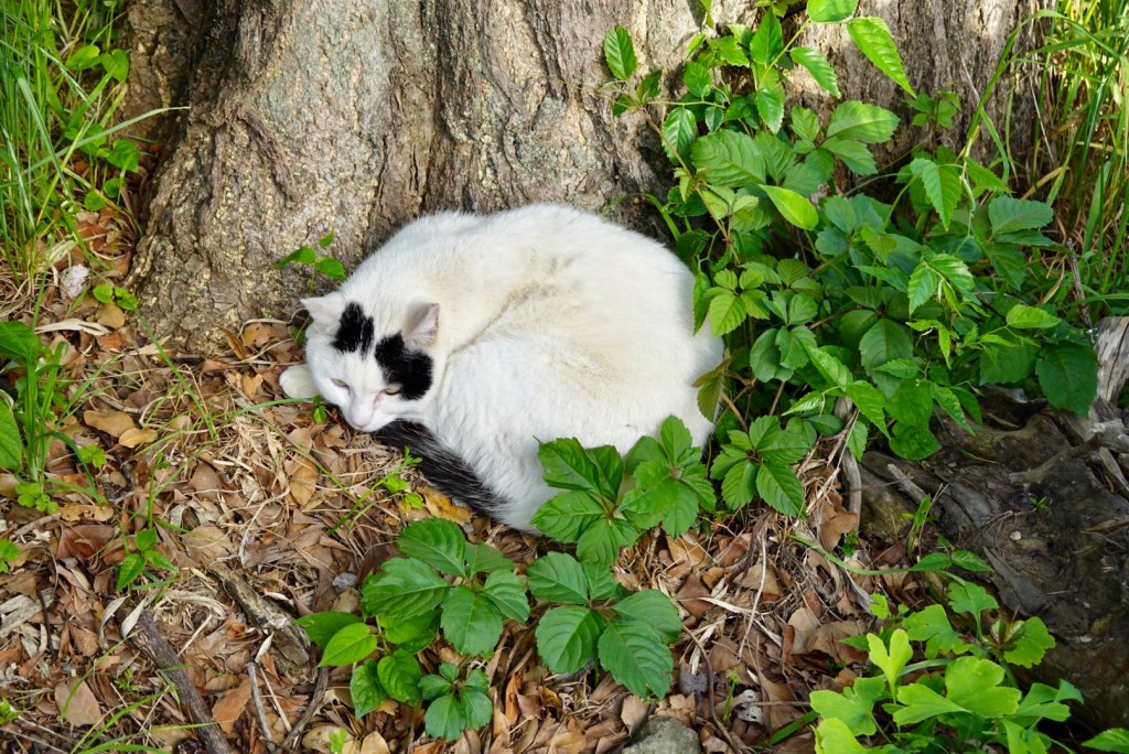
Tony finds cats hidden away including this dozing feline.
We departed by the rear gate where equine activities used to take place.
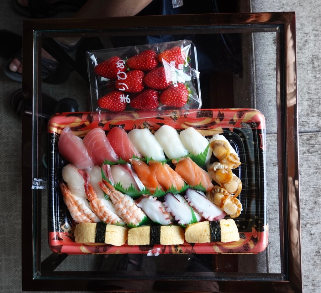
We found our dinner at a supermarket in the railway station, adjacent to our hotel. Very yummy and reasonably priced. The sushi cost around $15 aud. The strawberries were sweet and succulent.
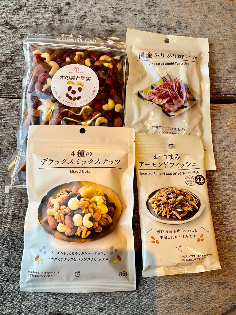
We also purchased some snacks to carry in the bikes. Needless to say, these are mine. Two of those packets Tony will have zero interest in. He has his own supply, the high sugar type.
I do love wandering around food shops in other countries to see what is on offer.
Years ago we acquired a reputation from our friend Helen, whom we met doing LeJog and then a French north to south ride. She told us she knew the Yaxleys had arrived (in Dover) by the windows.
We actually got into trouble at Cheddar (England) as the owner did not appreciate the ‘look’. 🤣
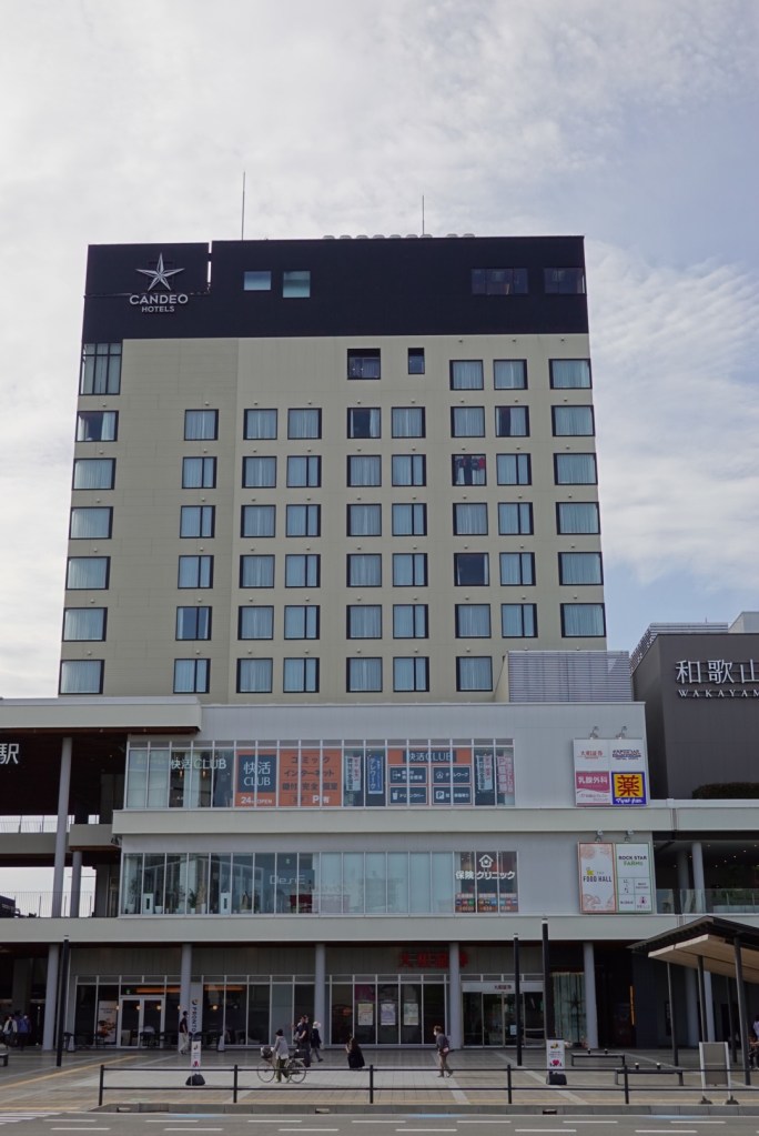
I often think of Helen and did today as we headed back to the hotel and saw this…..
Check the windows a few floors from the topClose up
Tomorrow we are booked on the 5.30 am ferry. We need to be there just after 5 am and ride there, so we will be up early.
We are going to hand over our luggage being stored here for a fortnight, then hit the sack.
NB: This is a blog from 2015 that I have cut and pasted across from its former hosting site, Crazy Guy On A Bike, where I wrote as “Two old farts on a bike”.
Friday May 29, 2015
Dear Velo Father,
It is 21 months since our last epic bike adventure, Lands End to John O Groat (LeJog) and I think we may have sinned but we are going to make amends and do something of cycling significance for two middle age velo farts by doing another end to end trip, and adding in an ever harder climb than Damn Dent – Puy St Mary.
We have trained long and hard – but have been challenged with some injuries that hopefully will not impede too much (except perhaps that Puy!!).
Sharron is carrying a torn posterior horn on her lateral meniscus – fortunately does not overly bother her cycling, but needs to be careful, particularly climbing. Since having met Jens Voight at the Tour Down Under, she does subscribe Jen’s famous words: “Shut Up Legs”!
We have toiled over the hills in our regional Tasmanian locale, with Sharron regularly doing over 300 km per week trying to maintain a degree of fitness with the rapidly approaching crispy Tasmanian winter. Tony rides on weekends and does the CAT torture training twice per week, with sparring partner Dan and the rest of the CAT crew.
Pre tour training we have cursed the headwinds, bitched about the rain hoping that it all comes together for our great Bike Adventure.
In desperation Sharron has tolerated the windtrainer ever morning for the last couple of months, and describes it as terribly boring. Tony’s windtrainer is gathering dust in the garage still, as he does not do boredom.
Tonight we left lovely Tasmania…eventually. After standing around for ages at the airport in queue an announcement was made. One of those dreaded ones when you have a connection to catch. The flight was delayed for a yet undetermined period of time and all international bound passengers would be transported via a taxi to Launceston Airport, some 115 km away.
But the best bit? ” We cannot guarantee your bikes will make it.” ” Yes madam, we realise that you are probably travelling with your bikes for a reason. ” Astute fellow!
So we waited for the promised taxi and Sharron went into organisational overdrive, securing the only possible bike spots in the maxi cab before anyone realised what was going on. She then organised the physically challenged lady over the guttering, up the steps and into to her seat to speed up the process. Think it is called LEAN management. The lady thought Sharron was very kind and thanked her profusely. If only she knew!!
Taxi driver to her passengers asks ” would you like to wait for the other taxis and we drive together”. Hell No way! Suggested to her that this had become an episode of The Great Race and that she needed together cracking and beat the others!
She did well and earned $280 plus for her efforts.
We are now chilling out in Qantas Club Melbourne overjoyed to be here knowing our bike is on board. Well theoretically it should be. Hopefully. Even more importantly we are desperate that it arrive intact with no carbon cracks.
Not keen on long haul flights as we both sleep badly in the upright position. We are scheduled to arrive at around midnight Sat night Aussie time.
What do we have to look forward to? 2 days riding in Kent, England followed by 14 days cycling in France. A French end to end all the way from the English Channel to the Meditteranean Sea, then heading inland to the medieval city of Carcassonne.
Stunning scenery, plains, hills, picture postcard villages and a Tour climb, so the brochure says. Whilst plagiarism has just commenced, lets continue that theme.
The holiday starts with the ferry crossing from Dover to Calais, riding through the pretty farming countryside of northern France into Normandy with its lush green countryside and distinct framed houses.
After crossing the River Seine we cross the vast plains around Chartres and continue south through the magnificent Loire Valley. The scenery becomes increasingly dramatic as we head into the mountains of the Massif Central including the Category 2 col of Puy St Mary.
We then continue through some spectacular scenery with the landscape becoming drier and rockier, passing over the Black Mountains. We then drop down to the plains of southern France arriving at the Mediterranean Sea.
The cycling trip finishes inland at the stunning medieval city of Carcassonne.
However our first port of call is London where we will be collected ( hopefully) by our friend Ian Cristol. We met Ian on our LeJoG ride and have stayed in touch since. We both like his humorous sarcasm and witty retorts. Noone is safe in Ian’s presence. He seems to love his dog Rupert even more than his wife Fiona, as we hear a lot about old Rupert and little about Fiona! Rupert has even taken to sending our two dogs, Simba and Jack emails, complete with photos!
We will have 4 days with Ian in Northwood (Northwood) and then will then head to Canterbury for a couple of days. Sharron wants to check out the Cathedral and burial site of The Black Prince (knowing precisely where he fits into the royal lineage!). Who you say? He was the eldest son of Edward III who died ‘before his time’ sending the inadequate Richard II to the throne! (I am sure you are glad you asked!!)
Sharron has plotted a Tour of Kent prologue – around 125 km I think – so we will check back in post the prologue.
This trip will entail a bit over 1600 km of riding (including England) and a lot of climbing.
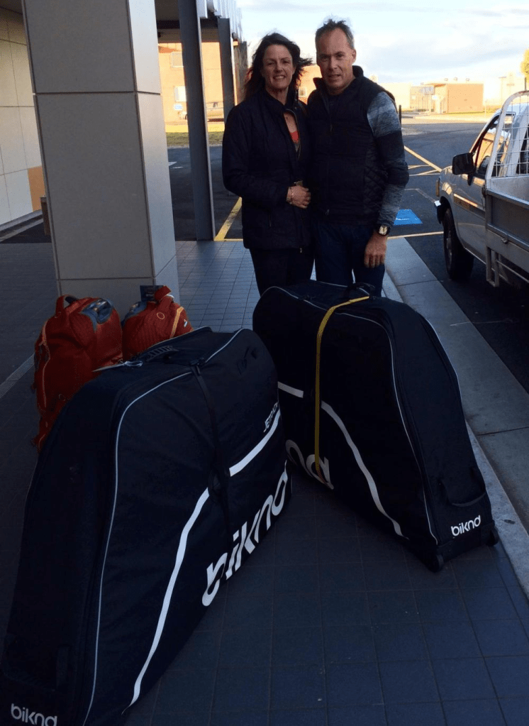
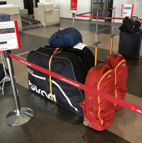
Our first holiday snap is our luggage!! This is the first airing of the new bike bags. The review will be done at the end of the trip.
Devonport airport
The new, streamlined luggage
Two Aussies get sunburned in England!: Murphy’s Law!!
Saturday May 30, 2015
Murphy’s Law dictates that if anything can go wrong it will!
We woke up starving today in our pygmy bedroom ( with bikes resting in the bathtub due to severe space limitations). It is near impossible to find breakfast food here before 8 am! In the end we went to a nice upmarket hotel ( don’t reckon bikes have to sit in the bath at this hotel!) and ordered a very nice breakfast. Then I lost Tony for 45 minutes whilst he went to the loo. I sat and waited patiently for 25 minutes but started to worry then. Given I was an point duty outside the loo I knew no other blokes had entered. So I did!! Tony was not to be found.
I walked back to the hotel. No Tony. I started to worry a bit but eventually found him sitting in an obscure spot in the hotel lobby!!
Anyway the point of telling you that was it meant we headed off later than planned.
We left Canterbury on the A road to Whitstable. 2 km up the hill we turned left and headed into the woods. Good gravel track. Rejoining the road towards Faversham Tony scored a flat tyre. Enforced stop and we were on our way following the sea wall around Faversham into Whitstable.
Only 10km after Tony’s flat, I also got a flat tyre. The first tube turned out to have a faulty valve so we were onto the third and final tube and the Co2 ran out! So the nice guy doing crazy paving over the road told Tony where the bike shop was in Whitstable ( Herbert’s Cycles were very accommodating)
I learned all about crazy paving in the meantime. He even offered me a cup of tea and told me about the guy over the road who has just bought a nice little F1 McLaren worth a serious amount of money. The car did have quite a sexy sounding roar to it!
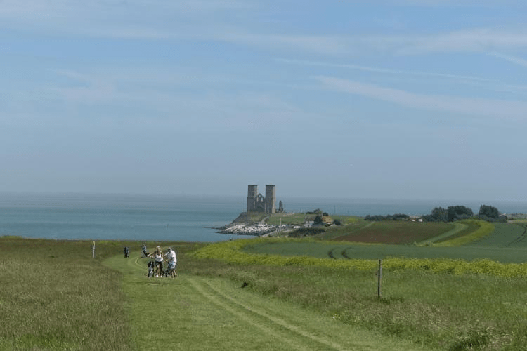
Eventually Tony returned and we continued riding around the edge of the English Channel through Herne Bay, Reculver (nice castle ruins right on the coastal point), Westgate on Sea, Margate and on into Broadstairs.
An amazing number of people were enjoying the “beaches”. The earlier beaches were pebbles but gradually improved the further we travelled. There are little shops set up on the beaches where you can hire gear or buy buckets etc. If that was not enough, they even have fairground attractions.
Loved riding around the lower sea walls and chalk cliffs. Boat sheds dotted the area and some were amazingly fitted out.
We stopped in Broadstairs for a greatly appreciated gelato. Pretty little town made more famous courtesy of Charles Dickens.
Onwards through busy Ramsgate.
Things went a bit pear shaped around Sandwich. We lost the cycle routing and the Garmin map function had died as we not had a demo UK map and the Garmin kept trying to find itself again and again chewing up battery power.
We eventually made it into Deal. Stopped at a farm shop on the A258 out of Deal buying nice full cream milk and a Dundee cake. Went down very nicely!
It had been recommended we head to the coast to ride to Dover but chose to live life dangerously and rode the A258. Not pleasant. Damn right scary in fact. Would not recommend it to anyone.
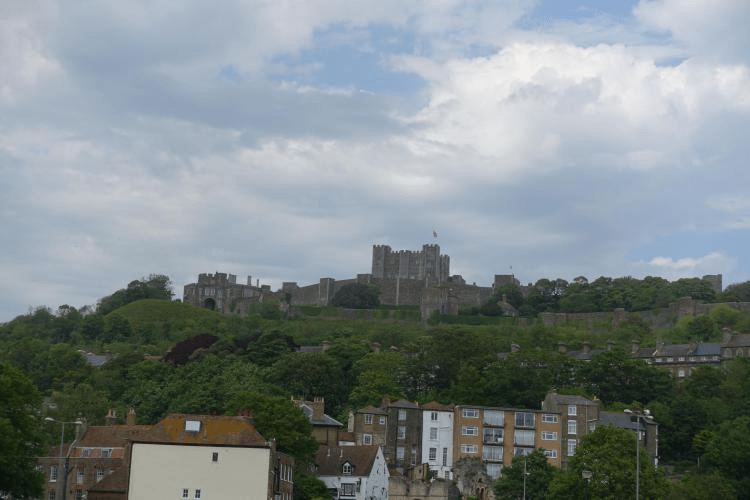
Eventually got into Dover circumnavigating the Castle and Port.
Interesting day. The bike paths were excellent and up until Sandwich well signposted. All up around 115 km. We opted to cheat and catch the train back to Canterbury as we had no maps available once the Garmin died.
The big shock are the red sunburn marks on our arms and legs. We slip, slop, slapped but the English sun got to our Tasmanian winter arms and legs.
Reculver
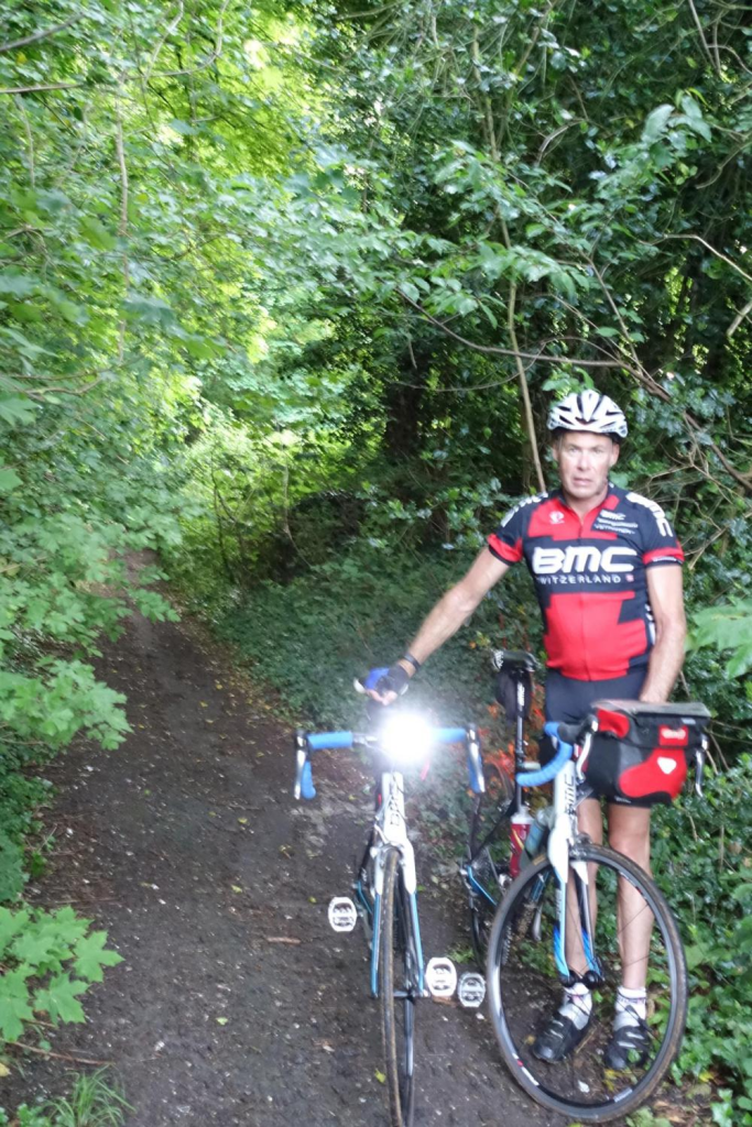
God of Thunder: Our BMC’s proved to be all terrain bikes.
Sunday May 31, 2015
We departed Canterbury this morning following the River Stour, past the Grey Friars site now run by the Franciscans. A lovely river track comprised of crushed gravel. It had been raining and thundering just prior to leaving so the track had many puddles making our once clean bikes filthy dirty.
We hopped off the bike trail track at Chartham and negotiated our way to Waltham. What needs to be pointed out at this stage is that we winged it. No map as our GarminUK map did not have enough detail and chewed Garmin power so left it off. I had written some notes down on small bits of the hotel pad in pencil, and there was a lack of detail.
We were off route for some time having missed Mystole Lane and Penny Pot Lane. Instead we ended up going through little villages including Petham, Anvil Green and Waltham. Another storm hit and we took shelter in the adjacent woods with the tree canopy providing effective shelter.
At Waltham we turned up Church Lane and wow! Steep pinch of a climb on a track, of sorts, more suited to a mountain bike. It was wet and slippery and I was unable to climb out of the saddle as the back wheel kept spinning. The gradient hit 15% for sections of the climb.
From Stelling Minnis we went through SixMile and Rhode Minnis to Lyminge, Newbarn and Etchinghill. We were somewhat concerned at Newington as the M20 ( seriously busy motorway servicing port towns of Dover and the Channel Tunel) offered no bridge over it. So we chose to head west, knowing we needed to head south and then east.
Eventually an opportunity arose to cross the motorway and head to Sandling and Saltwood.
We got lost in Saltwood but asked for help and were pointed in the right direction for Hythe.
With great relief we glimpsed the coast and hopped back onto the bike track which went through Sandgate and onto Folkestone.
Then the thunder and rain hit so we took shelter along with 50 or so 6 year old kids.
Folkestone is a pain in the butt. We lost the bike path and ended up climbing a decent hill on an A route. The operator of a food van on the side of the road provided some salvation with the suggestion of a safer, alternative route through Alkham, heading into the rear of Dover.
We caught up with Helen and Joyce who both did LeJog with us, for a drink and tea. Phil and John also arrived (our esteemed tour leaders, also from LeJog) so it was a great reunion… all on a very special day. My 53rd birthday. So happy birthday to me.
Kent farm
Folkestone
Dover Castle
Taking shelter during the storm
La Manche to Wimeraux (43.5 km, 750 m ): Proceed straight to Europe
Monday June 1, 2015
I am often asked if I know someone who lives in Tasmania. There are only half a million people that live there! Being in Dover it was with great delight that I did know the people in question. Anne Steele and her parents Bill and Shea Henderson. Anne was the first Tasmanian to swim the English Channel back in 2007 and I know her through my involvement in swimming, as well as her parents Bill and Shea. The world is really not that large after all. Turns out that Anne and her family stayed at Hubert House in Dover, hosted by Peter from Durban. Peter remembers them fondly.
Busy day today as 18 cyclists converged into the County Hotel to prepare to cross the Channel in a much easier fashion that Anne, on the ferry!
The port is like nothing I have ever experienced. French border control did not want to even see our passports and waved us on. English authorities also did not seem to care. So onwards we rode to Lane 184. There are around 250 lanes for vehicular movements onto ferries.
So the little cycling minnows mixed it with the massive trucks who were very considerate, or perhaps they simply questioned our sanity.
A very smooth crossing of La Manche (the Sleeve) saw us arrive in France. We had our first briefing on board and I took the opportunity to map out who sat where and to memorise their names! So in order from left to right: Bevis, Bill, Tom, Brian, David, Peter, Sue, Andy, Paul, Wendy, Liz, Derek, Graeme, Paul, Tony, myself and Helen. Jean-Marc was collected from the Eurostar station and we met him later in the day.
We did not zero the Garmins until a number of kilometres off the ship. There was a common starting point to ensure our route descriptors were accurate regardless of which area of the port we arrived at. However, Tony’s Garmin spat out a message as we rode off the ship ” proceed straight to Europe” Sure thing!
First impressions of Calais were wonderfully long beaches. The town looks pretty crappy and scruffy, with a number of asylum seekers hanging around seeking to illegally stow themselves onto trucks bound for England. Gendarmes were frequent. Apparently the English welfare system is far more generous that the French welfare system.
The most striking point though was the damn French drive on the ”wrong'” side of the road. Multiple roundabouts ( just a painted circle) felt incredibly wrong and challenging. You put your arms out to indicate you are turning left but you actually turn right in the first instance. Goes against all of my inate senses.
Moving out of Calais we initially rode as a group, but a couple of obvious Alpha males headed off trying to outdo each other. Tony, Helen and myself stuck together. We headed to Sangatte ( 10.1 km) passing through Parc Naturel Regional Nord-Pas-de-Calais. A solid but steady climb made harder by the gusty headwind which slowed us down. There were outstanding views across Cap Blanc-nez.
The alpha males were at the top with questions asked about who was KOM. I wonder how long Tony will permit that talk as they were within sight on the climbs and most of the. Battled climbing in the wind. I am pretty confident Tony could pass them if he wanted. But he will ride with his harem and take photos, which is great. I am thinking Day 11 may be the day he strikes out.
Meanwhile we took photos and enjoyed the surroundings. The descent was enjoyable despite the strong headwinds forcing you to pedal.
Escalles and Sombre were passed through before Hervelinghen (20.6 km). There the road climbed over the hill over a very poor surface.
The views in this area were of lush, green farmland growing wheat ( or rye) and distant sea views. The land is somewhat undulating with rolling hills.
We the rode through Audembert, now having even joined by young Tom ( 20 year old Scottish umi student from Biggar, near Edinburgh). I have decided to adopt him as he is such a likeable young lad, who is doing this trip with his grandfather, Bill ( whom he has already ‘dumped’), but in the secure knowledge that Phil, the sweeper, will look after him.
6 km out of Audembert the road climbed for 3.1 km, with the last 600 metres a much steeper pinch. Tony and I were first up (in the non Alphas) and Tony waited for the tandems to arrive to take their photos.
Badzinghen and the wonderfully named La Slack were the final villages before arriving in Wimeraux on the Cote d’Opale.
That damn wind ensured the going was slower than normal, along with navigational discussions.
An enjoyable, yet challenging at times, short ride. Tomorrow we crack our first century and hoping the the head winds abate overnight.
Nearly on French soil
Cap Blanc-nez
Sharron, Tom and Helen
Wimeraux
Wimeraux to Abbeville ( 102 km, 1115 m): Peaceful battlegrounds
Tuesday June 2, 2015
We were first to breakfast today, very keen for a feed. The French breakfast offered ham and a wide range of French cheeses (soft and hard), toasted ham and cheese sandwiches, junkie cereals, fruit and yogurts. I chose the only protein on offer and plenty of cheese and coffee.
Today the former alpha male group decided to socialise more (or were they buggered from their testosterone charged efforts?) and 3 decided to ride with us, along with Peter. This group of 7 (Tony, myself, Helen, Graeme, Peter, Derek and Brian) worked really well today, although Tony did put his foot down on the tougher hill climb to be at the top first. I knew that would come but thought he might wait a tad longer.
The weather looked very promising with clear blue skies and more importantly, no wind! Hooray!!
Leaving Wimeraux we followed the river of the same name for a short while before a series of undulations passing through Wimilie, Rupembert and L’Ermitage, arriving at La Capelle (9.2 km).
With more bumps we then rode through Questrecaues (20.8 km) and Samer (23.5 km), complete with cobbles. Around Dalles we were warned the road climbs steeply, which it did for a couple of km, maxing out at 16.5%. We all wondered how the two tandem bike couples would fare on this forest climb, having been told that one of the bikes suffered a chain lock up the previous day, resulting in instant dismount.
We past through Parenty(31.4 km), Beaussant (37.5 km), Inxent (39.4), Recques-sur-course (40.6), Estree (43.3)and Neuvikle ( 46.7)and were over the worst of the days climbing. The areas were predominantly agriculture( wheat, barley, corn, potatoes, linseed).
Montreuil was recommended as a lunch stop and it was fortunate that I still had teeth intact after the extended cobblestone section which included a climb. Thanks goodness for the roubaix style bikes. I noted some of the guys riding slightly out of the saddle! I wonder why?
Great little pub here, with an old fellow playing guitar. A most unlikely rock and roll player on acoustic, missing his lower teeth, but he belted out some great tunes. We enjoyed a great lunch with Graeme collecting his first scavenger hunt item!
As we were finishing up Bill, Tom and Paul ( former alpha male member) rolled in to eat their lunch. We had no idea where the other 8 riders were.
A slight navigational issue followed ( and I forgot to turn my Garmin on for a short period of around 400m), but we were back on track with only a few easier climbs.
From Boisjean (55.4 km) the road climbed gently for a few km again passing through farming fields.
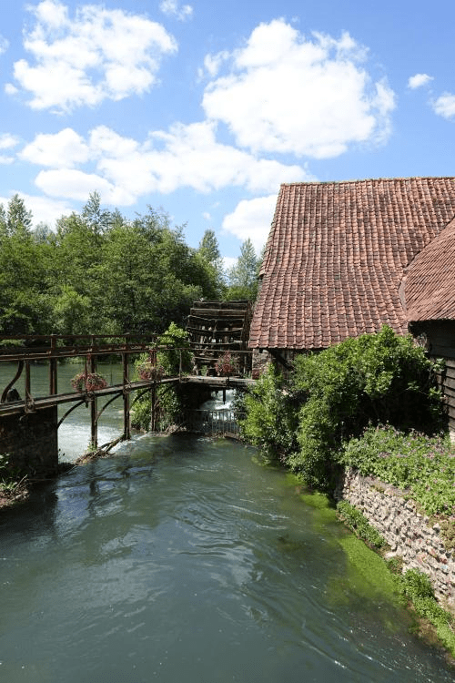
At 63.2 km we crossed a river, with a mill wheel. Obligatory photos ensued.
Another decent climb and ride min to Vironchaux (71.8 km) passing a Madonna statue ( very small).
Riding through La foret de Crecy was a definite highlight. We were able to pick the pace up a bit here as we rode through very green woods ( oak and beech trees), made famous for the Battle of Crecy ( part of the Hundred Year War), fought back in then 1346 between Edward III ( England) and Philip ( France). Edwards’ son, Edward ( The Black Prince, tomb visited a few days before in Canterbury Cathdedral) fought valiantly and King Edward guided his lesser number troops to a decisive battle victory. Edward had inherited the region through his mother Isabella ( a French princess) so was very familiar with the territory having spent many hours hunting there as a child.
Today it is very peaceful with numerous picnickers taking advantage of a beautiful Sunday afternoon. The forest is stocked with roe deer, boar and pheasants but we saw none.
Other towns we rode though included Forest De L’Abbaye ( 86.9), La Motte ( 88.7) Drucat (95.1) finally arriving in Abbeville.
Later Tony and I went for a walk around Abbeville, learning a bit about its past as we came across the bombed out remains of an old Abbey, ( courtesy of the Germans).
Abbeville had been known as a peaceful town for over 700 years, until May of 1940. The town was the last important crossroad to reach the Channel. As a consequence the city became a target of the German plan.
Before they arrived the Germans had bombed Abbeville on 20th May, 1940, using around 5000 explosive and incendiary bombs which caused great panic and destroyed a number of century old heritage buildings.
Leading charge to drive them out was Colonel de Gaulle, who soon became President of France.
A brilliant day of riding. Tomorrow is longer again, around 116 km.
Crecy
Abbeville
Abbeville to Gisors ( 116 km, 1239m): Best lemon gelato ever!!
Wednesday June 3, 2015
Abbeville is to host a finishing stage of the Tour de France soon, second time in 3 years. The owner of our hotel was certainly interested in our cycling and bikes, and was out the front to wave us Au Revoir.
Leaving Abbeville we crossed Le Somme, following its path for a number of kms, popping into the Mareuil camping area so that Helen could have her bike attended to by Phil. The campers then joined us for a period of time, dropping off after the first of the hills.
So the group today was Tony, myself, Helen, Graeme, Bevis, Jean-Marc, Derek, Brian and Tony.
The roads were gentle and undulating with the first village at 19.3 km Frucourt, followed by Vaux (21.9 km), Marquennville (22.7 km), Oisemont and Aumatre (29.8 km). The land was still predominantly agricultural fields of mainly barley.
Andainville (33.0 km), Liomer (38.5 km), La Fresnoy (43.1 km) and Aumale (49.7 km) was where we stopped for an early lunch, buying a baguette with cheese and ham and taking it to the local brasserie to eat it. Certainly alien to an Aussie is the concept of buying your food and eating it in another establishment. Great coffee there though with whipped cream on top.
For the first time since Calais we caught up with Bike Adventure Kim, so that was nice.
Leaving Aumale we climbed gently past a lake where Derek had chosen to eat his food. I think we may have woken him up.
Dogs featured heavily today, passing breeders of huskies in one village and black labradors in another. At the top of a particular hill that we waited at for all the riders in our group to arrive we certainly raised the ire of a St Bernard, reminding me of my old St Bernard Oscar.
Frettencourt (59.1 km) and then Grumnsnil at 71.6 km was where some navigational debate occurred. Riding fast we arrived in Doudeauville (77.1 km) and Gancourt (80.8 km) we decided to stop at a shop in Gournay en Bray (88.4 km) so that we did not arrive in Gisors too early.
There I had the best ever citro gelato ever in a tub for only Eu 2.50. So nice in the warm weather.
Bike Adventures sag rider Phil turned up with the tandem riders and Liz, minus his front tooth/ crown. He intends to reattach it with Super Glu. Hope that goes ok and there is not a slip up.
We motivated ourselves to ride a bit harder through the next few villages (Neufmarche 95.8 km and Talmontiers 100.3 km). Then we turned to cross a river and railway to climb out of the valley, with the hill gradually becoming steeper.
Regrouping at the top we then rode a section of the London-Paris cycle route for about 4 km. The final village before Gisors was Thierceville (108.3 km).
As we arrived at our hotel there were about 20 European electric bike riders out the front. Very popular bikes over here.
Tony and I went for a walk after showering and doing our washing checking out Gisors. The highlights would appear to be the old Castle constructed by one of William the Conquerers sons, and the last prison for Jacques de Molay, the last of the Templars.
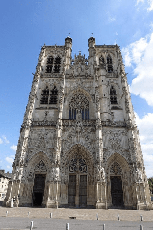
There is also a magnificent Gothic church with many statues and gargoyles missing their heads. I am not sure if that is ageing or a result of war conflict.
Tea tonight was a debacle with 12 of us rocking into a Meditterean styled restaurant. We were at the furtherest end from the waiter, who turned out to be the cook and owner, and were told we could not eat beef as the others had already ordered it. I said I preferred salad to chips.
Anyway, unfortunately there was consternation at the other end of the table. They had got what they wanted, and certainly the feeling was we should just accept whatever arrived. The meals that came out for the others looked pretty good and were main meal sized. Then for some reason we were given two entree salads, hardly ok after our physical exertions. Lucky if there was 30 grams of whatever the meat was. Could not figure that out. Tony was starving so I went to speak to the chef and noticed all the chicken sitting there on a spit so arranged some for Tony.
So I am hungry as I have not eaten enough (and about to rectify that with a protein bar hoping that will help refuel) and Tony is stating that there are a couple of riders who might regret their smart arse comments as he won’t be towing them tomorrow. A couple of them do just sit back on him and let him do the work.
Guess Tony will get a bigger rest at the top of the hills now!
Tomorrow we cross le Seine, the river that runs through Paris.
Gisors to Epernon ( 110 km, 750 m) and Epernon to Beaugency ( 113 km, 475m): The bread basket of France
Thursday June 4, 2015
I am combining two days due to shocking internet coverage last night.
Despite having woken at 2 am starving yesterday morning (due to lack of food), the day improved starting with a protein and cheese filled breakfast to replenish my hardworking body.
Leaving Gisors we rode up near the famed Castle and wove our way around the valley past where the campers were staying. The many villages and kilometres were knocked off with relative ease, supported by a tail wind. We did not go out riding too fast, knowing that would create pressure for our leaders with luggage etc.
The first larger village was Berthenonville ( 17.5 km) , quickly followed by Aveny ( 19.8) and Fourges (25.1).
After that first cruisy 32 km through wheat fields, we went through Gommecourt. Climbing the toughest climb of the day to reach the top with great views afforded of River Seine and its escarpment. The descent was steep with very tight corners, and sections of loose gravel.
We arrived in Bennecourt (37.2 km), stopping for coffee at a little brasserie.
Shortly after Bennecourt ( 37.2 km) we crossed the Seine, with gentle undulations to La Tuilarie ( 45.4 km) and St Illerie ( 48.3 km).
Phil (with his front tooth superglued into place), had joined us after lunch and the pace picked up and Tony magically appeared out the front of the pack enjoying a bit of speed fun with Phil. I need to own up that I did allow myself to get caught up in the boys fun chasing them hard on the undulations.
Phil was going to wait at Breval and hop into the van, but we suspect we may have been racing a bit too much as that was forgotten and besides, none of us saw the van (in hind sight)!
Phil continued with us for some distance until the van caught up and he hopped in to race ahead to prepare the campsite.
The villages in this region have all been so quaint, although many look somewhat rundown, needing the services of a renderer and painter. There are so many war memorials, and you do wonder what role these villages played during the war.
For the third solid day, we rode through field after field of wheat, interspersed with corn, spinach, peas, rapeseed and potatoes.
As Brian said, we are in the ” breadbasket of France”. So very true given the number of baguettes we see people holding and being sold in the boulangeries.
At 92.2 km we rode through Nogent Le Roi, a pretty village. We then rode over River L’Eure here.
A highlight for Tony was a young deer that he must have startled that darted alongside the road next to him for a short stint before darting off into the forest for safety.
The campers were well short of our accomodation so we called into their campground for afternoon tea and were quite surprised at the spread that gets put on for them. Stopping 13 km short is a mistake sometimes as your body starts to think “rest time”. It was really hard to get going again and we just putted along to Epernon to our hotel.
I ended up totally crapped off as my Garmin mucked up and failed to save my days ride. It got worse, it also deleted all my other rides from France and England. Insert unpublishable words at this point!
Great dinner meal at the hotel for 21 Euro! Very enjoyable. Nice and spacious accommodation too.(L’Epi Hotel).
Epernon to Beaugency:
So today began, just like the others, with John arriving to give us his briefing at 8.30 pm. We were warned to be careful at a particular railway crossing as one of their previous clients slipped on the protruding rails last year requiring surgery.
If I thought yesterday was easy, then today was a walk in the park. 113 of the easiest kilometres I have ever ridden. I did not change out of my large chain ring all day. However, again we had to take it easy and not ride too fast as we could not check in until 4 pm, so we took the opportunity to chill out in two of the villages,
Larger villages today included St Cheron(13.0),Cherville(17.7), Beville-Le-Compte(20.9), Voise( 25.4)and Moinville (27.7). Just before Prasville we took a recommended detour into a little village to have a break and visit their boulangeries. Too many choices!!
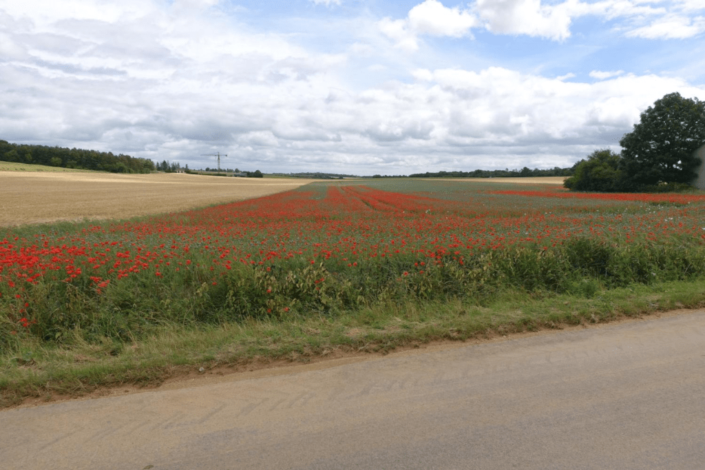
Today’s ride was very similar to yesterday: wheat fields and more wheat fields. However, poppies made an appearance today as did two flying pheasant.
One difference was that our ever present comedienne, Graeme, decided that he would do some detours and have some “me time”. It was very quiet without him as he has this knack of being able to continue talking no matter what the terrain. Yes I realise that some might say that surely I have that ability, but no I don’t. Firstly, I need that extra lung air as I climb hills. Secondly, due my deafness in one ear it is hard when you ride competing with the wind noise, so I generally cannot be too bothered.
However, he must have been stalking us as he turned up for lunch, and later for afternoon tea. He does like his tucker, taking quite a few snacks with him out of the breakfast area to continually graze on. We joke that he has the greatest nutritional input, and greatest verbal output.
So many villages! These are just the larger ones. There are often smaller ones in between. You do need to slow down heaps through these little villages that seem to very ghost like. They are deathly quiet, and you wonder where all the non school age children are. Dogs barking at us are the only noise distractions along with the occasional car.
We headed to the campers ground to find Kim getting afternoon tea ready. We did partake eagerly until in started raining and we did a mad rush back into town to ensure we did not get too wet.
Beaugency was our final destination and is a really interesting medieval town with an amazing history, positioned as the eastern gateway to the Loire Valley, located on the banks of the River Loire, which has an 11th century bridge.
An obvious target for enemy attack, it was captured 4 times by the English during the Hundred Year War before being retaken by Joan of Arc in 1429.
The town centre is dominated by a ruined 11th century watchtower, along with a 16th century bell tower and a statue of Joan of Arc. Period houses line the square.
Further down is the Chateau Dunois built on the site of the feudal castle by one of Joan of Arc’s compagnon d’armes.
Of particular interest to me was the Notre Dame Romanesque abbey church that witnessed the annulment of the marriage between Eleanor of Aquitaine and Louis VII in 1152, leaving Eleanor free to marry the future Henry II of England.
A group of us (including Brian, Peter, Tom, Derek, Bill and Helen), went out for tea together and I ordered the largest steak on the menu at 250g, charalois, rare. French rare is extraordinarily rare, but it was a damn fine piece of meat.
Interesting night sounds. There is an owl close by too-whit-too-hooing. The two town clocks chime each quarter half hour (and not in synch – midnight should be good with 24 chimes).
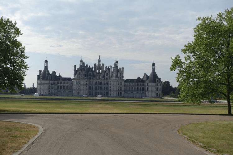
All from France for tonight. Another 103.5 km on the menu tomorrow including a detour down the Loire Valley to Chambord, one of the famed chateaus.
Climbing the hill just before La Seine
La Seine
Beaugency famous 11th century bridge
Beaugency to Vierzon (104 km, 428m): Hot and hotter
Friday June 5, 2015
The forecast stated 32 degrees today so we slip, slop and slapped, and generously smeared the lip balm onto our already swollen lower lips.
Leaving the very picturesque Beaugency, we crossed the 11th century bridge over Le Loire, turning right to follow the river a short way before taking the road to Chambord.
At the 18 km mark you enter the Chambord Park, and I kept looking for the Chateau not realising that in fact it is set in 5440 hectares of forest and parkland.
Derek and Tom had shot off (strava section?) and Derek later recalled a large antlered deer that he spooked.
We sat on the side of the road for a considerable time (20 min.)as we had lost Helen and Tony. No one had seen them stop. I assumed that they had stopped to take a photo but they did not turn up. The guys were getting restless so we moved on trying to figure out where to wait. The cafe was the result.
When they finally turned up it was revealed they had gone off course to ride down towards the front of the chateau to check it out better. Photos look like an interesting aspect and would have been good to do as well.
After leaving Chambord, the day really started to get hot and we enjoyed the coolness of the forest.
The villages today were more widely spaced, and we finally ran out of wheat crops! The land is certainly drier with no visible agricultural crops.
Villages travelled through after Chambord included Thoury (30.4 km), Dhuizon ( 36.9 km), La Morelle en Sologne (47.6 km) and NeungnS/Beuvron. At the latter we saw Kim and Phil standing on the side of the road, so we stopped for a chat. Tom and Bill wandered off hoping to find food, and the rest of us continued on to Selles St Denis (73.1 km).
A little village with one boulangerie. However, no filled baguettes so we wandered down to the brasserie. The guy there seemed somewhat perplexed when we rolled in, soon followed by Tom and Bill who had not found food in the previous village.
The guy spoke no French but with Jean-Marc interpreting I think we pretty well cleaned him out of quiche and steak, and put a pretty good dent into his baguettes.
The pace after lunch picked up, passing through La Fert Im Bault. Shortly thereafter Tom needed a comfort stop so I waited with Bill and had managed to recall Tony, in my attempt to get the pack to wait. Annoyingly they did not wait which peeved me given I was always getting the pack to stop for others. There was no rush as we were ahead of schedule and it seemed sensible to me that we take it easy in the heat.
Anyway they thought differently. Bill told me that Tom was suffering in the heat and he was concerned. I assured him I would stay with them.
We then went through Theillay (86.7 km) and Orcay (93.5 km). The front group had stopped but took off again before Bill was ready. He needed a bigger break.
Bill does a great job at aged 75. A few years ago he had a heart attack and carries medication on him which he showed me how to use.
Tom picked up considerably having additional company and he and Tony shared the lead all the way to Vierzon, where we managed to get slightly lost.
Can’t say I think much if the town. However after some difficulty we did find a chocolatier who also had the word “glacier” on their window. We had tea in the hotel restaurant and I am now well and truly ready for bed.
Chambord
Vierzon to La Chatre (90.1 km, 820m): Just cruising along
Saturday June 6, 2015
Today’s planned ride was shorter giving us the opportunity to be really cruisy. The weather forecast was potential rain and thunderstorms so we were very pleased to leave in 18 degrees and no rain. Raincoats packed though!
Leaving Vierzon we crossed le Cher passing a weir. We planned a stop at Issoudin (39.6 km) and despite strong headwinds we got there for a very early lunch buying a baguette at a boulangerie and then heading to a brasserie to buy a coffee.
It is somewhat strange to me that you can buy food in one place and eat it at another. That would not be acceptable in Australia.
On route to Issoudin we passed a number of grape crops with Quincy signage. The plants were much smaller than home. Not sure if that is a maturation or variety reason.
Today we witnessed the closest of our team to be hit by a car. There is some conjecture as to who is at fault, but Jean-Marc and a car missed each other by a matter of inches at a roundabout. I think I might need clean knicks. It does not overly surprise me that it is Jean-Marc as he is right out there with the traffic and we are often shouting at him.
He seems to think that because of his experience in Paris traffic he will be fine, but none of us share his theory.
We travelled onto Pruniers (61.0 km) having just passed through a lovely forest en route from St Aubin (52.9 km) which undulated.
At Pruniers we found a brasserie and ordered our coffees. I was very intrigued with their antiques including an old bike for about 250 Euro. We spent a very pleasant hour or so there before turning the pedals over again.
Travelling on quiet roads we went through La Pouliniere(70.7 km), Verrneuil( 78.1 km), Nohant (83.5 km) and Montgivray (87.2) which was where the campground was located. Seems like a nice village with a river and very fancy chateau.
We turned off to follow the river Le Indre around to La Chatre which is where we are tonight.
Nice hotel (Hotel Lion D’Argent) with a very busy restaurant.
Looking at the map makes you realise just how far we have now travelled through France, having arrived in the central region. 7 days riding so far in France. Tomorrow we head to Aubusson where a “rest” day awaits us.
Pruniers
La Chatre to Aubusson (90.8 km, 1375 m): Hills are my friends
Sunday June 7, 2015
Hills are my friends, according to my daughter Hannah. I often think of her and that statement when I am climbing. Today we climbed the most so far on this journey to the Mediterranean. I guess the gentle wheat fields had to come to an end.
We started off at just below 200m above sea level, went up, went down, and this pattern kept on all day hitting just over the 600m above sea level mark before dropping into Aubusson. We are now in the northern foothills of the Central Massif which is unavoidable in our quest to reach the ocean.
Leaving La Chatre we headed towards Briantes (4.2 km) then Ste Severe S/Indre (13.7 km), Vijon (22.4 km) and Nouzerines (28.2 km). We crossed the river climbing through Les Forges and into Clugnat (37.3) which is where we stopped for a while at a bar, ordering coffee.
Poor Tony suffered another interpretation failure today. He thought he was getting a hot chocolate but instead got an espresso. He is not a coffee drinker but suffered it anyway.
From there we climbed more arriving at Blaudeix (47.2 km), Jarnages (53.4 km), Cressat ( 58.1 km) and our lunch stop Chenerailles (64.5 km).
A delightful little village with a wonderful bar and charcuterie run by a little old French woman who spoke no English. There were 7 of us and she was keen to feed us and went to the boulangerie to pick up the ubiquitous baguettes, filling them with jambon(ham) for us.
We sat under a large umberella surrounded by her colourful flowers, people watching the local French.
We could have sat there all afternoon but the day was heating up somewhat and we were mindful of the forecast for a thunderstorm at 3 pm. Grudgingly we hit the road.
We kept climbing up and down passing through Marzet(68.4 km), Le Treix(70.7 km) and then St Maixant( 83.2 km). At the latter there was the most gorgeous chateau now operated as a hotel. Obligatory photos.
St Amand was the final village before we descended into Aubusson which is a curious town with lots of funny little laneways and cobblestones,famous for its tapestries.
Most pleasing was a glacier right over the road from our hotel!
Tomorrow( Sunday) is our one and only scheduled rest day. Not sure if we will go riding at this stage. Will see what the day brings.
Sharron and Graeme
St Maxiant
St Maixant
Aubusson to Neuvic (95.4 km, 1415m): Danger of death
Monday June 8, 2015
An interesting and more challenging ride today saw us head out of Aubusson and almost immediately commence a 13-14 km climb heading towards Fellatin. It was a gradual climb and I spun my legs in a lower gear as much as possible to warm them up, being a little concerned with my torn meniscus in the right knee which was reminding me of its existence today.
The weather was coolish and we were all pretty keen to keep moving onto the next climb of 5 km which was steeper than the first climb.
We arrived in Boucheresse(30.3 km) and rode into a French military zone that is used for armoured tank to play war games and fire shells. You cannot miss the warning signs of potential death should you veer from the road. The signs were about every 25 metres and on both sides of the road. I guess now was not a good time to go bush for a pee! Better hold on a bit longer!
You could easily see the tank tread marks on the edge of the forest. The military zone is around 10 km in length and we then descended into La Courtine (42.2 km) where we stopped for a coffee in a funny little brasserie full of military badges and memorabilia. The military garrison is based in this town so I guess so I guess the pub is frequented by its members.
After coffee there was more climbing arriving in Sornac(53.1 km), followed by another climb of a few km.
Alleyrat was at the 66.5 km mark and a number of the guys had their photo taken against the town signage.
We decided to continue further before eating lunch, so headed to Saint Angel (76.8km).
The brasserie here was run by a lady who spoke no English but certainly communicated to us in no uncertain terms. I think most of us failed her first test by putting our bike helmets on the table. Big mistake!
She prattled on in a continual French banter about the food available. There were 5 serves of guinea fowl and 2 of pork left. There were 7 of us so that worked out. Goodness knows what the rest would eat!
The town has a very impressive church high up on the hill so Tony and I decided to linger longer in the town to check it out.
The Priory of Saint-Michel-des-Anges was once operated by the benedictine monks, and still dominates the village despite the monks having left long ago – it was abandoned by the monks after the French Revolution.
It is said that the first monastery on the spot dated from the 8th century, although no written evidence exists to confirm a building until the 11th century. The Roman style church we saw attached to the priory dates from the 12th century, although partly rebuilt having been damaged by fires during the Hundred Years War and the Wars of Religion. The rebuilding is in the gothic style, rather than the roman style of the original church.
During the period called the ‘Reign of Terror’ (French revolution) when the monastery was empty it was used as a prison for the noble ladies of the region.
Today there were no ladies imprisoned in the church as I wandered through. It was eerily silent.
Alone now in the village we puttered off spinning the legs again determined to use this as a recovery ride in readiness for tomorrow’s torture trial up Puy St Mary.
I do have some reservations given my knee injury niggles and asthma but have determined that I will not be silly and push my knee too hard as I don’t want to damage it more that already is. The asthma will depend on the weather. I am hoping for dry and warmer air rather than cold and moist.
We are now lodged in a lovely hotel on to edge of a lake – Hotel du Lac! Fancy that!
The campers are only a few hundred metres away and are the closest to us all trip. We trotted over for afternoon tea which was very pleasant. I am glad to have all the creature comforts of a hotel though being soft!!
Saint Angel
Neuvic to Aurillac (106 km, 1823 m): The ecstasy and the agony
Tuesday June 9, 2015
Today was judgement day! I was to attempt my first ever Tour de France climb to reach the top of Col du Pas Peyrol (Puy Mary, 1589m).
I was nervous carrying a knee injury in the form of a torn lateral meniscus and also being an exercise induced asthmatic. I needed to have my head in the right space and not get caught into doing someone else’s pace.
Four of us left the idyllic peace of the lake at our Neuvic hotel with the same dogged determination, knowing we each needed to do it ‘our way’.
The weather was not ideal for my asthma being cold and moist. I was not sure what to wear either and chopped and changed for most of the day.
We started climbing pretty well straight away with a gentle climb for around 13 km following the path and gorge of the Dordogne. It was really special with green lush forests around us and a massive drop on the left hand side to the river.
Descending to cross the bridge we rode through a tunnel and stopped on the bridge to take photos.
We then had to climb up and out of the gorge and this was steeper than our first climb. I was getting pretty hot by this stage.
At the 33 km mark the road descended again. Bugger. Seemed a shame knowing that we would be climbing from around the 40 km mark.
The valley that we were climbing was absolutely beautiful. The sounds were even more inspiring with lots of bells being rung, not by the local churches but from the bells hanging around the many cows necks. Even sheep had bells around their necks.
The village of St Vincent de Salers was reached at 46.0 km. A particularly pretty village, but the cafe was closed which was our suggested first stop.
I made the decision at this point not to stop until the top of the Col. Most of the others did, with the exception of Graeme who had shot off earlier, and Tony, who after taking some photos took off after me.
I passed through a number of villages clinging to the edge of the valley as I kept climbing. Le Vaulmier (49.8 km), Vedelon (54.6 km) and Le Falgoux (56.1 km). The road steadily climbed even more through more forests, with ever present waterfalls.
At the 61.6 km mark I took a left turn to head towards Mauriac, and within 3 km the road started to climb very steeply. I was out of the saddle by now and faced with a roadwork truck reversing towards me, in my lane!
The workers on the road spoke to me in French, but I was concentrating very hard as the road was wet and slippery, and besides, I could not understand them!
The last couple of km are known as being particularly nasty on this climb (there are three different roads you can take to arrive at the top of Puy Mary). The average climb is a tad under 14% and yes it hurt!
As I battled on I nearly lost hope as I was fatiguing fast and my back was killing me. I rounded the right hairpin bend which I knew was 19% (on the wrong side to decrease the camber) and it did seem a tad easier. Within a km I thought I saw Tony walking out of the mist and he was there. I was somewhat confused as my garmin told me I was still 1 km from the top.
Tony told me that I was in fact only a few hundred metres from the top. Boy that hurt and you can tell from the photo that I was stuffed. Pleased but stuffed!!
We had a decent recovery in the cafe congratulated by those tourists who had driven up and comaraderie from numerous cyclists from all over the world who had converged at a similar time.
The descent was a very cold but spectacular affair. It was around 5 degrees at the top and I was in my summer knicks! All clothes in my possession were now being worn for the descent – also trying to avoid the cut grass on the wet road.
We zipped through the various towns in the valley including Rodez(75.6 km), Mandailles(78.5 km), St Julien(80.3 km), St Cirgues de Jordanne( 87.0 km), Velzic(91.4 km) and St Simon(97.3 km) before arriving in Aurillac.
Done and dusted. Nothing else to say.
Dordogne
Aurillac to Villefranche-de-Rouergue (97.3 km, 1352 m): Hot and in need of an ice cream.
Wednesday June 10, 2015
Leaving the more industrial section of Aurillac during peak hour required a bit of concentration to get out of town. At 2.9 km we turned left heading towards Montauban, with the first little village being Le Bex (7.7 km) which involved a quite steep climb, before descending into the village.
There was a lot of climbing today, despite the fact that we ended up some 300m lower than Aurillac. It has been noted that these climbs are rarely mentioned in the route notes now so a couple took us ‘by surprise’ and the hills received appropriate titles!
Having said that, I did enjoy the morning ride as there were some great descents(despite Tony’s water bottle jumping out onto the road on one hairpin bend, just in front of me and Tom). There were also some great sections of rolling up and down where you could gain significant momentum to drive you up the next incline.
We went through Saint Mamet( 17.1 km), Corbrette (20.0 km)stopping at the really pretty village of Boisset (29.8 km) for a coffee. As per normal, the poor old brasserie staff looked quite stunned/bemused as we all rolled in over a period of time to claim all the tables and chairs.
We descended out of the village and on to yet another climb arriving at St Etienne de Maurs(40.9 km), Maurs(42.2 km), Bagbac(49.4 km), and our lunch stop at Capdenac(64.4 km).
Capdenac is a great little town on the river, where we spotted one keen fly fisherman. It is in a valley with houses high up in the valley which apparently was the old walled village.
There is a Lot valley nature reserve that we rode through which was also really nice.
We crossed under a number of large railway bridges which Brian advised are no longer used by the railways due to being financially non viable. I imagine that they would have been very scenic to travel along.
We dropped down into St Igest (84.8 km) and were assaulted by the worst smells of the trip. Not sure how this farm managed it given how many we have been past but it sure stunk! We stopped to photograph the lovely church in the town.
By now it was really hot and our group had split at lunch so there were just 4 of us, with Bill and Jean- Marc choosing to have a breather in the shade for a while.
We rode past a wonderful old chateau promoting glaces. If we had been on our own I would have detoured to both check out the chateau and to enjoy an ice cream.
There was a couple of simple climbs to get into Villefranche but I was feeling quite hot and a bit dehydrated now so I was really glad to arrive at our funky Hotel. Some of our team report having round beds! We have a pebble shower.
It was good to have some time to check the town out. Very old with lots of narrow laneways and cobblestones. Checked out two delightful churches and the large village square and river. All in all, worth a visit.
Long day tomorrow with around 125 km riding and over 1400 metres climbing. Hope it is not too hot.
Did I get my ice cream? Certainly. I have mastered the basics of asking for ” un citron glacier deux boules” (2 scoops of lemon gelato). Important to know the basics.
Villefranch-de-Rouergue
Villenfranche to Castres (121.2 km, 1697m): Busy roads and more hills
Thursday June 11, 2015
Today we seem to have run out of the really small French villages that have been such a fantastic feature of this ride. The main reason ( I think) is that today we were on busy roads following the D922 for over 60 km, then swapping onto other D roads. So speeding cars were frequent.
Leaving Villenfranche we crossed the river and immediately started climbing. Not pleasant with cold legs and a full tummy. Perhaps I should not have had that second coffee? The climb continued until the 8.4 km mark, and at 9.4 km we rode through Sanvensa.
We then undulated passing through La Lande(18.0 km), St Endre De Najac(23.2 km) and Laguepie(32.5 km).
John had warned us that it was a nasty climb out of Laguepie and he was not wrong. There was a particularly steep section including a switchback and our group split up somewhat during this climb with only a few of the guys in front of me.
We stopped at Cordes( 45.1 km). A nice looking town with a little train to take people around. At the boulangerie there were glaces so we had one, rather than solid food. It was stinking hot – I suspect high 30’s.
We did not stay long as I was keen to keep my warm knee moving so we left the others to do their thing, whilst we did ours. I actually really enjoyed just riding with Tony for the rest of the day.
There was a lot of climbing and decent descents in overbearing heat.
We went through Cahuzac (57.8 km) and Baillac (65.5 km) getting a bit confused with the route descriptors in the latter village. I think the notes need some adjustment as there were some signage issues. Road works provided further complications with a road closure that we chose to ignore.
We stopped at Graulhet for lunch (86.7 km) in a small restaurant before moving on to climb yet more hills.
We fully intended stopping at Lautrec(103.2 km) as it is apparently one of Frances prettiest villages. What we did not realise was that when we turned right at the roundabout we totally missed the village. Wish I could memorise everything John said better. Anyway we realised a few hundred metres downhill, and we were not climbing back up a hill that we did not have to, in the scorching heat.
We soldiered on into Castres choosing not to go into the campground as we had not seen the van since morning tea.
More roadwork created confusion in central Castres and we the found our delightful hotel, Hotel Europe. We are in the London Suite, a very swanky room indeed.
Another tough day in the office as this was our longest day yet and we have to cross the Black Mountains tomorrow. More hills!
Castres to Narbonne ( 108 km, 1393m): Questioning life
Friday June 12, 2015
I loved Castres. Could have spent longer there. Philippe the host was very kind and we had a wonderful breakfast.
As soon as we left the weather clouds looked ominous and it started to spit lightly but we ignored it for some 10 km or so when it was flat but once we started climbing it got a bit heavier so out came the rain jackets.
We passed through Valdurenque (7.6 km), Rigatou (14.5 km) and Pont De L’Arn ( 18.3) before crossing onto a gravel bike pathway. It would be a good path in fine weather but in the wet it spat up so much mud that it looked like I had a serious gastro problem. After putting up with this for a number of kilometres we decided to ignore the route instructions and ride on the road.
At the 31.7 km mark we turned off the main road to take the Montagne Noir route ( Black Mountain). This was to be a 12 km climb up to the mountain top in solid rain, with heavy forest dripping buckets of water down, variable driving wind and an eery mist meaning visibility was poor.
There were 4 boys ahead of me and 13 riders behind me, somewhere. For the majority of the climb I was on my own once young Tom pulled clear and I had plenty of thinking time.
I thought about some of my warmer cycling clothing I should have been wearing. I wondered about what my kids were up to. We’re my dogs clean and dry as Joshua had told me there had been lots of rain at home. I wondered what motivated me to ride up a mountain in the rain.
Technically it was not that difficult a climb, but it was long and the weather made it far worse. We had been told there would be wonderful views and that the camera would get a workout. Not today unfortunately.
Once I got to the top the 4 guys were huddled around the van and were keen to keep moving. I agreed as I was damn cold and soaked through.
I needed to be careful on the descent as my brakes were affected by the rain and not as responsive. the further down the mountain we got we started to feel occasional warm air.
We rode through Ferrals Les Montagnes at 52.1 km and it was really starting to warm up. When we arrived at Minerve ( 69.4 km) we were blown away by the area. The vegetation was just so different.
Minerve is quite parched and arid, surrounded by vines and not much else. It appears quite defiant on its rocky outcrop, with two rivers merging ( Cesse and Briant). There is an imposing skinny medieval relic of a building that stands out. The locals call it Candela.
The town has a chequered history. in 1210 the town resisted Simon de Montfort who was the scourge of all Cathars. The siege lasted 7 weeks, culminating in the execution of 140 Cathars, burned at the stake.
To enter the village you cross a high bridge spanning the impressive gorge. Photo below.
From here we had a very fast, tail wind assisted to Narbonne, knocking the kilometres off very quickly. I did manage to take. 2.5 km detour by accident going downhill through a very scenic area only to realise the errors of h ways and have to turn around a climb back out! Bugger!!
Our accommodation in Narbonne is not central to the old city, or the canal, or the ocean, which has disappointed most given this is promoted as going to the Med!
Tony and I walked into town ( about 45 min to get to the good bits) and upon needing to head back to the hotel we were aided by two endearing gendarmes who walked us to a bus stop, waited with us for the bus to arrive, told the driver where we needed to go, and saw us off. Great service.
Tomorrow is the last day. Pity the riding stops as I am feeling stronger each day and happy with my riding. Broke my speed record today setting it at over 67 km/hr. Have also broken my climbing records, and done with only two chainrings.
Looking back towards Black Mountains
Minerve
Narbonne to Carcarsonne ( 81.8 km, 1010m): The final countdown
Saturday June 13, 2015
It was blowing a very strong wind when our group headed off on the last day to finish our epic adventure that had started at the northern port of Calais two weeks prior. I don’t think I realised then just how challenging this ride would prove to be.
I awoke in the final morning at 4 am with stomach pain and cramps and the ominous bowel gurgling had me sitting on the loo from 6 am. I was really crapped off!! Disappointed and concerned as I wanted to finish the ride on my bike, not in the van and a toilet!
I started throwing the Imodium in and by 830 with 4 tablets behind me and crossed fingers we set off, me armed with a roll of hotel toilet paper. I felt very washed out and not myself.
We encountered fairly heavy traffic leaving Narbonne and could not believe that the route had us on a goat track for some distance. It was very bad throwing our road bikes around in the pot holes. Most were suitably unimpressed.
We arrived at the town of Peyriac-de-Mer, taking obligatory photos as it was a Mediterranean ocean fed waterway. I was disappointed that our route did not take us to the actual beachfront. A number of the group decided to deviate at this point to achieve the aim of dipping their wheels into the ocean. Had I been feeling stronger I too would have been keen. However I knew I was going to battle not feeling myself at all.
We also had the pressure of having to strip and clean our bikes to Australian border controls very squeaky clean bike policy of “no dirt”.
Our group had diminished to 4 (inc Helen and Jean-Marc),and I was delighted that on this final day we got to share it with Helen. That was special.
Despite feeling crap, three of us took turns sitting at the front to face the wind. JM sat abreast of us seeking the ultimate wind protection. As the kilometres went on this annoyed the three of us as he was a good rider and it annoyed me that he would let a woman provide him protection without doing his bit.
So when he stopped to pee, again, we took off and he must have stared to feel guilt as he had to work hard, and on his own, to get back on our little train, and even took the lead a couple of times, much to our grateful surprise.
We stopped for a coffee at Thezan Des Corbieres(37.3 km) for a coffee where we found Peter, who joined our train.
Through Feralls (45.1 km), Moux (52.8 km), Saibt Couat D’Aude ( 55.7 km), Marseillette ( 65.7 km) it was just bloody hard work. It was very not and the headwinds were particularly strong and gusty. We were sweating heavily through the undulations. It was so dry and arid with grapes only growing in shale.
We pulled in at the edge of the Midi Canal at Trebes. Some of us needed more fluid to get us though the remainder. Peter and JM stayed for lunch but Helen, Tony and myself filled up with ice and water and plodded back out into the unrelenting heat and wind.
I felt like I was in Arizona, or perhaps my perception of what that would be like to ride.
I had been counting down the kilometres for most of the ride, comparing it with where I would be if home. 32 km = Crustys to home, but never had that particular ride been as difficult as this.
With only 2 km remaining, Carcassonne finally came I to view as we rounded a bend and hill. WOW!
Arriving at our hotel was extraordinarily anti climatic. It did not feel like the end of an epic adventure. This time there was no champagne, no signposts, no team photo waiting for us like at John O Groats. Just a garage beckoned where we were to strip down and clean our bikes. Reality check.
We had arrived by 1.40 pm, and by 4 pm bikes were cleaned and packed ready for export. We were showered and trotted off with Helen to quietly explore and celebrate the wonders of Carcassonne.