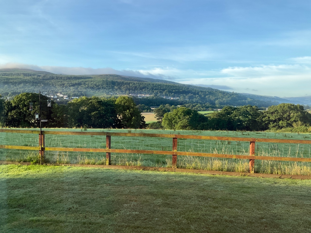
Today was a rest day. Our first and last for this cycle tour.
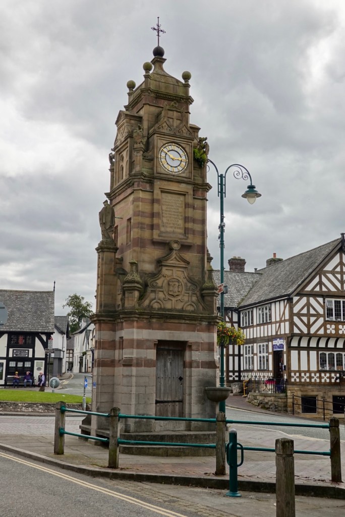
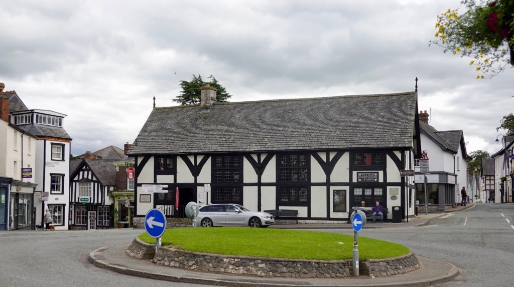
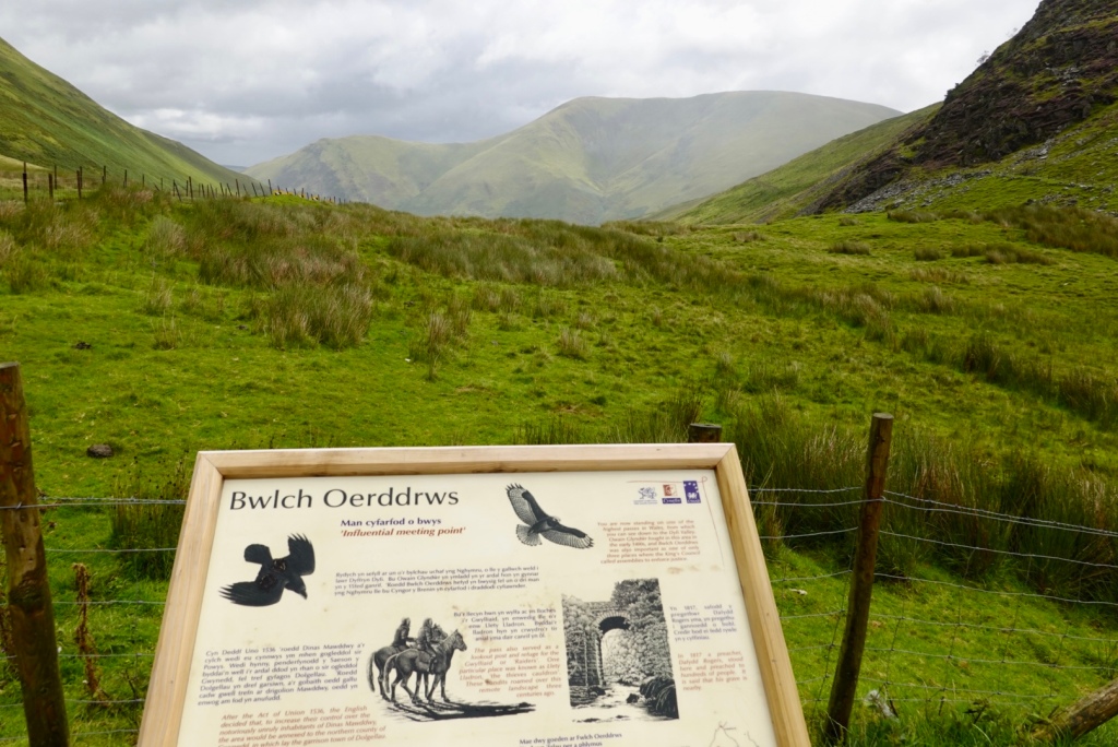
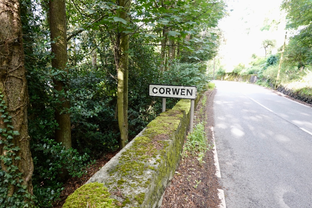
We headed off with Alan and Sue for a tour of their area. First stop was the town area of Corwen and a bit of history.
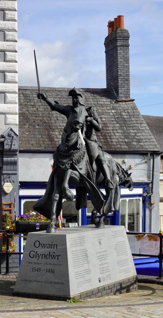
Owain Glynwr was the leader of a national revolt against English rule in Wales beginning in 1400 with an attack on Ruthin, a town full of English, from his stronghold near Corwen.
Proclaimed Prince of Wales by a Welsh Parliament, the only one ever to receive such an honour, he gained control over much of the country, winning battles and capturing castles. He summoned several parliaments, held an alliance with France, Ireland and Scotland, and proposed an independent church and two universities for Wales.
Owain sustained the hopes of his nation for over fifteen years and his myth lived on even though he died in obscurity, never having accepted the pardon offered to him.
In succeeding centuries he became a potent symbol of the Welsh spirit and the father of modern Wales.
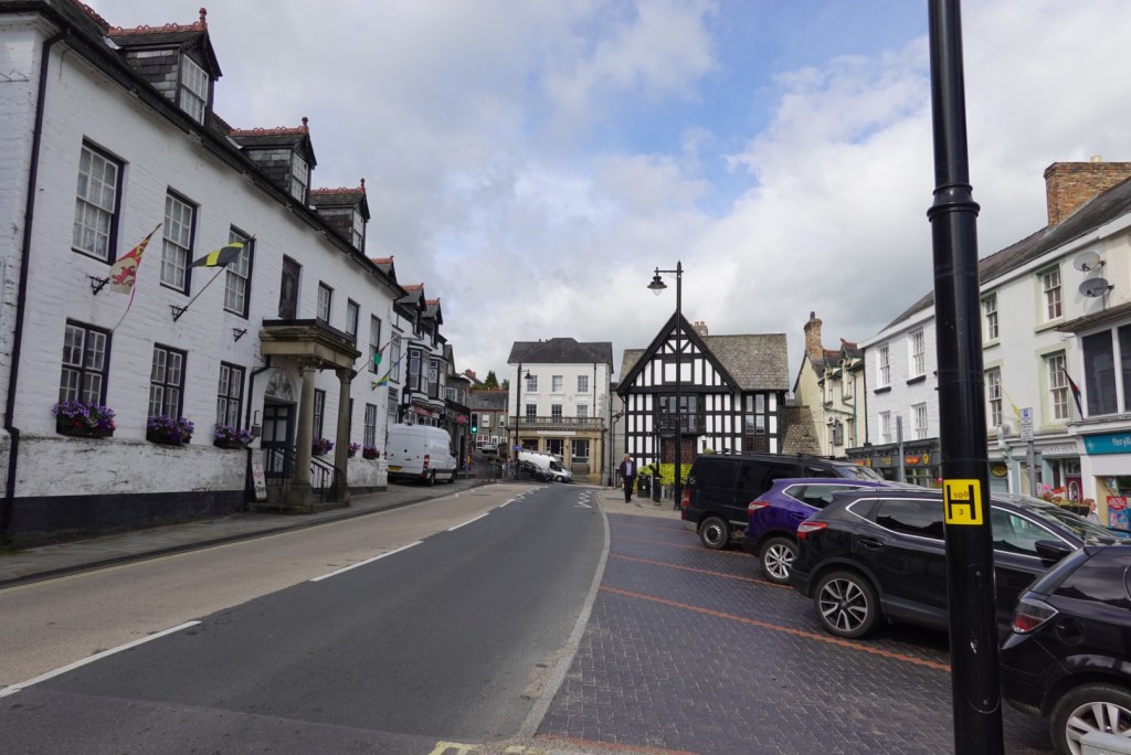
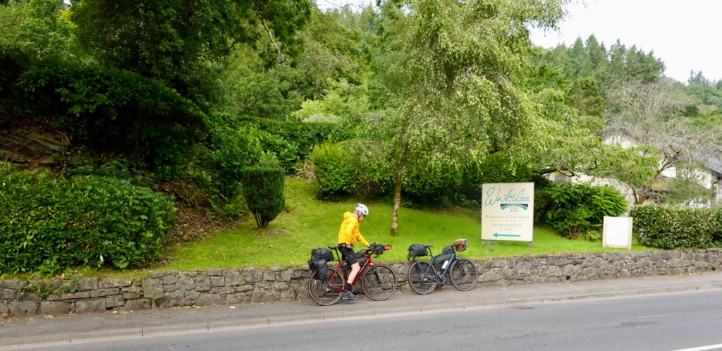
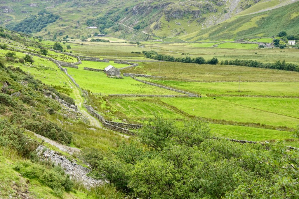
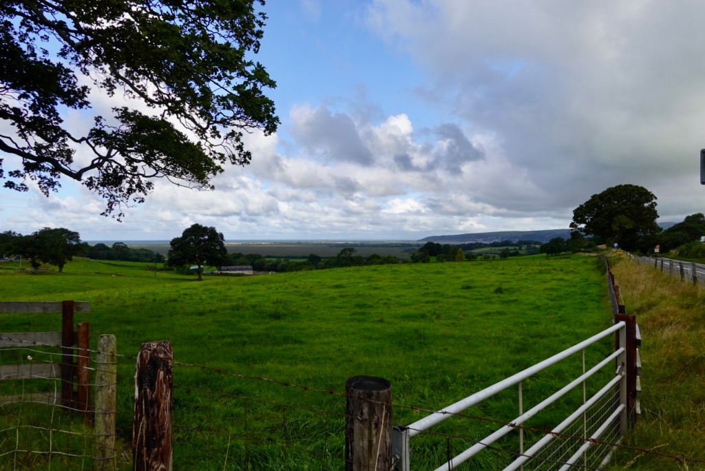
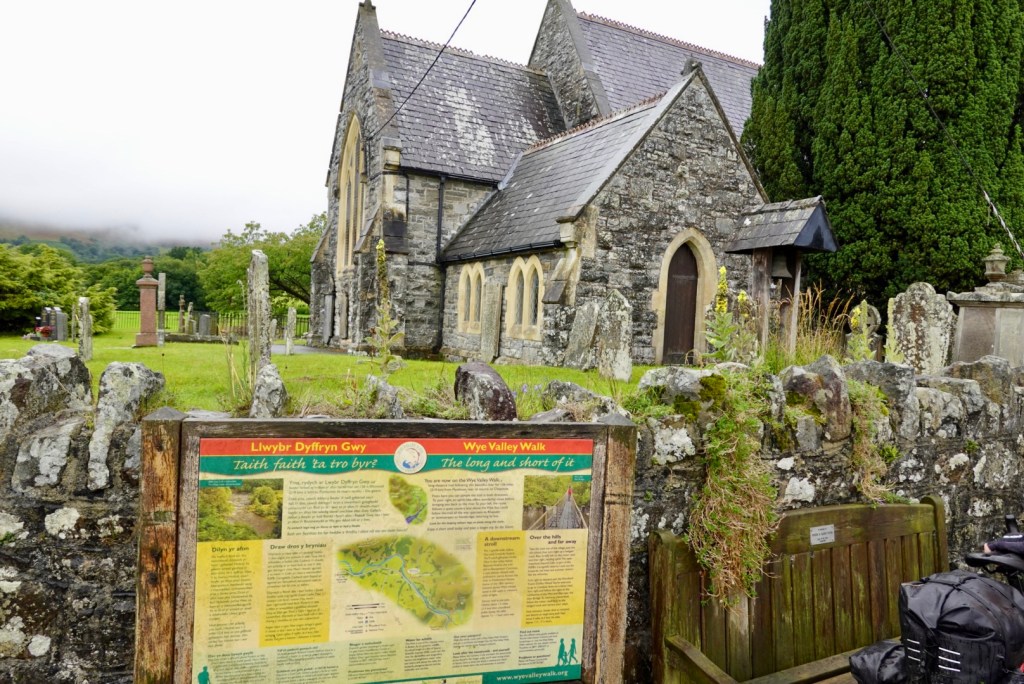
Looking down the Main Street of Corwen
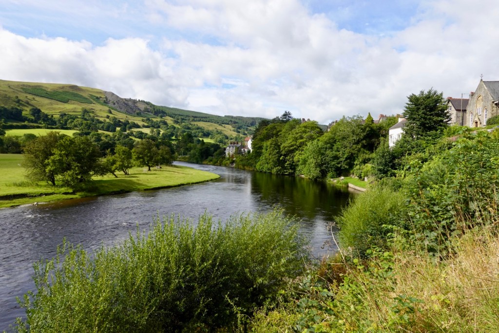
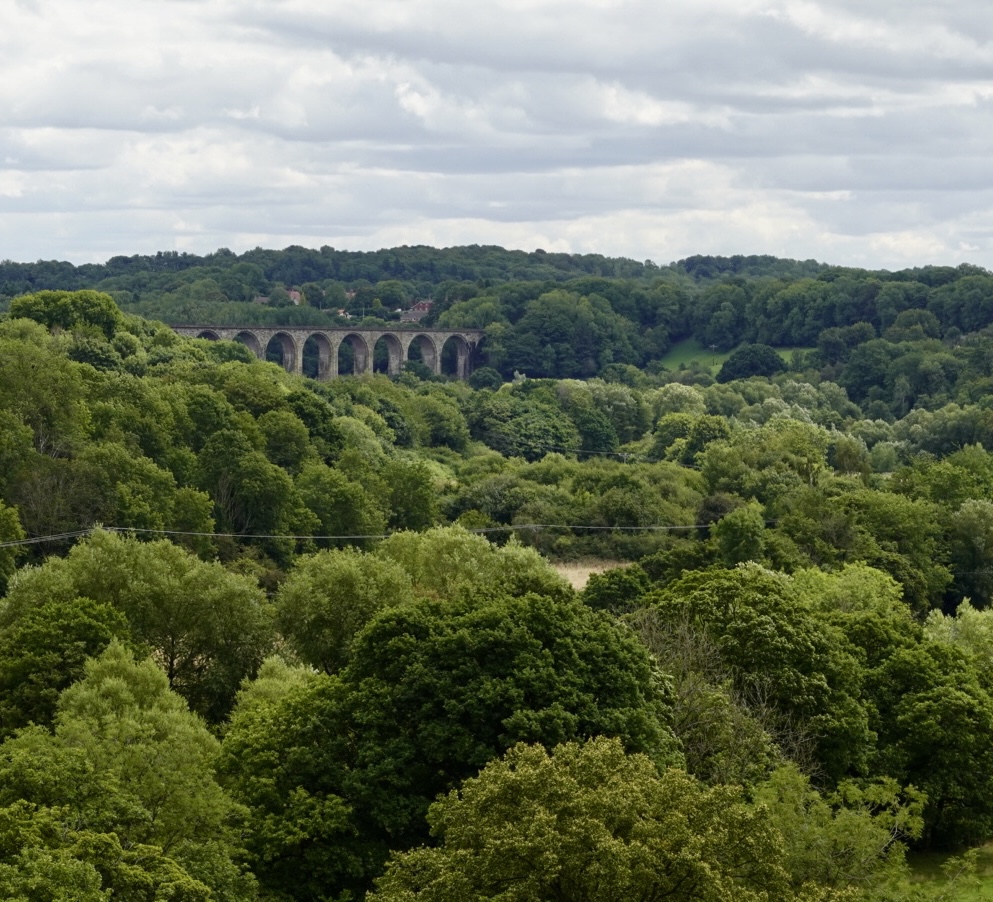
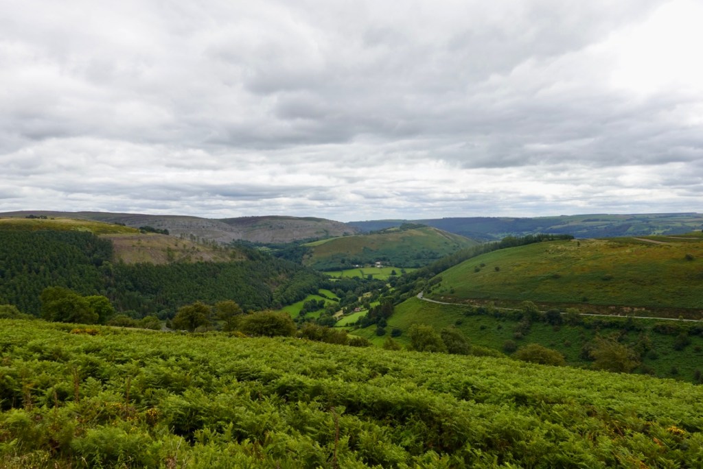
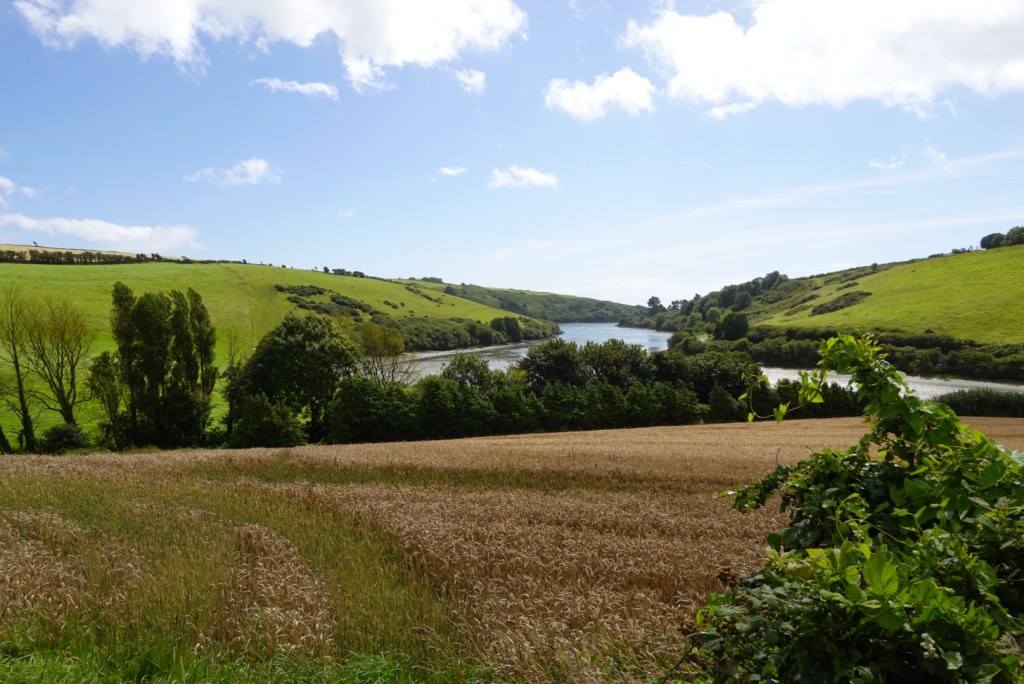
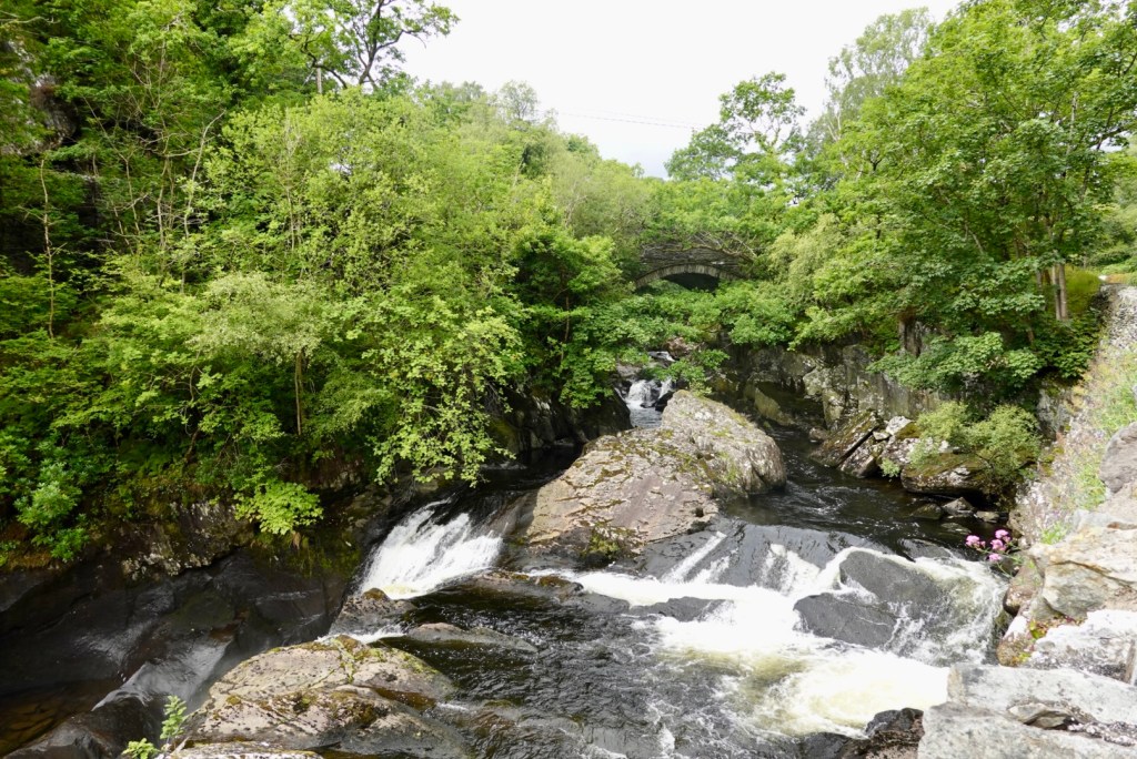
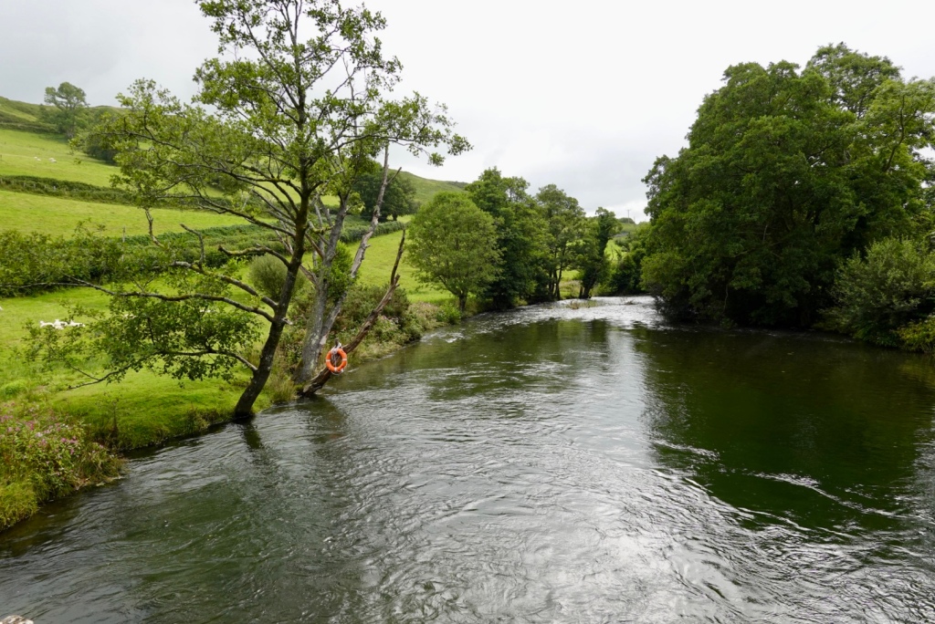
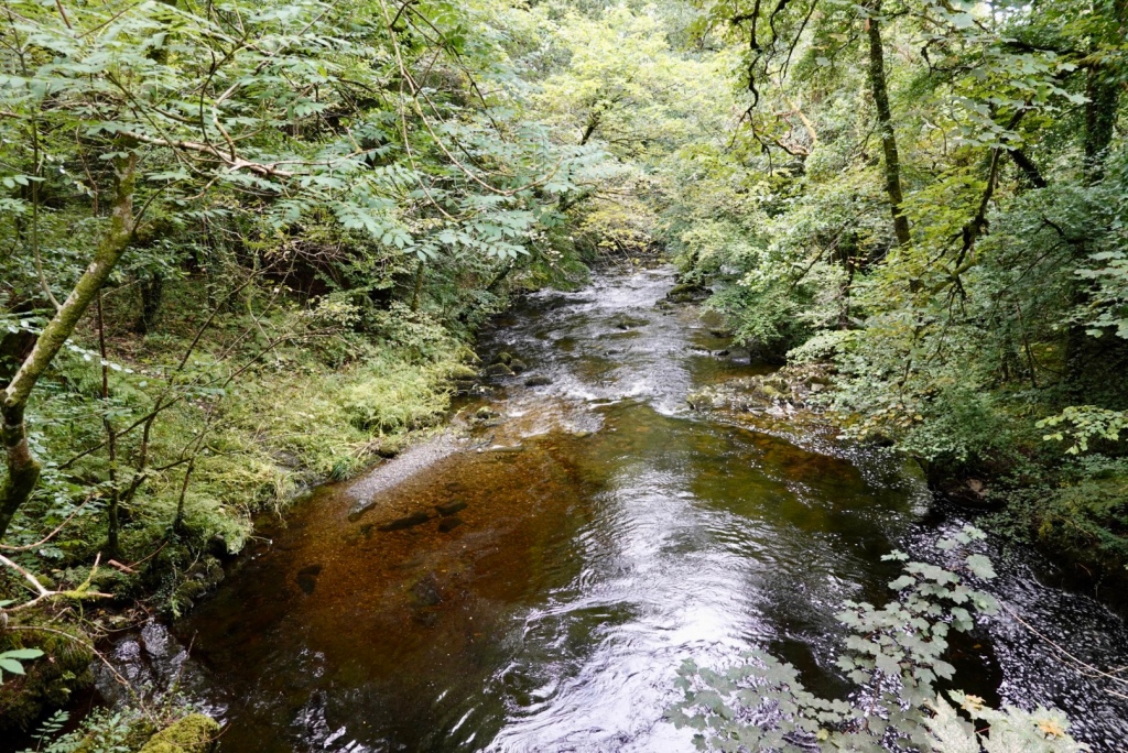
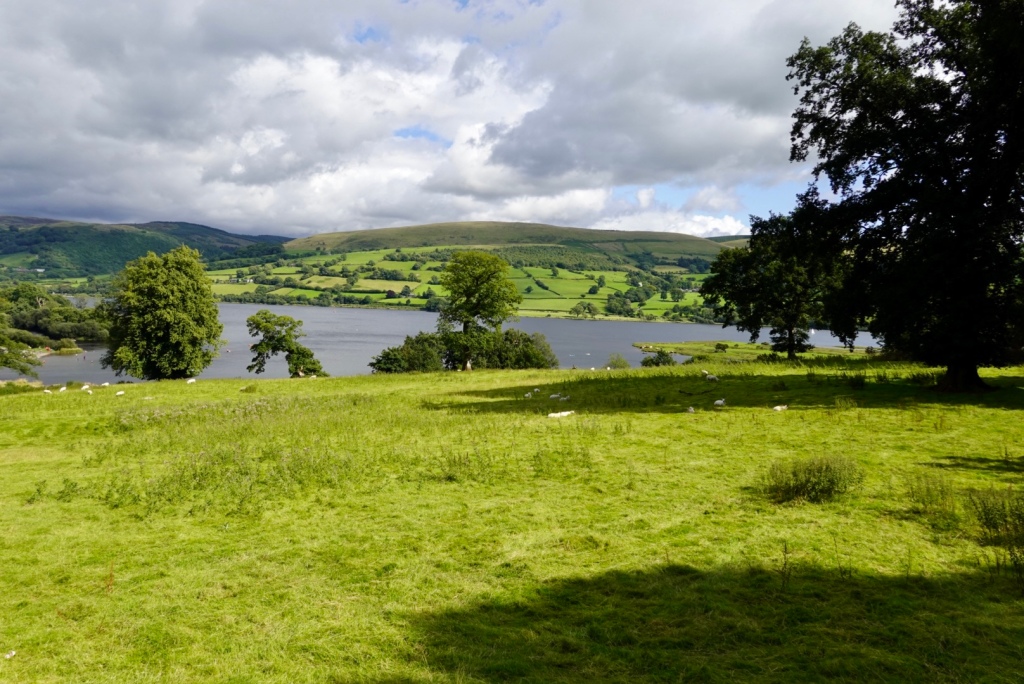
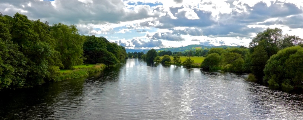
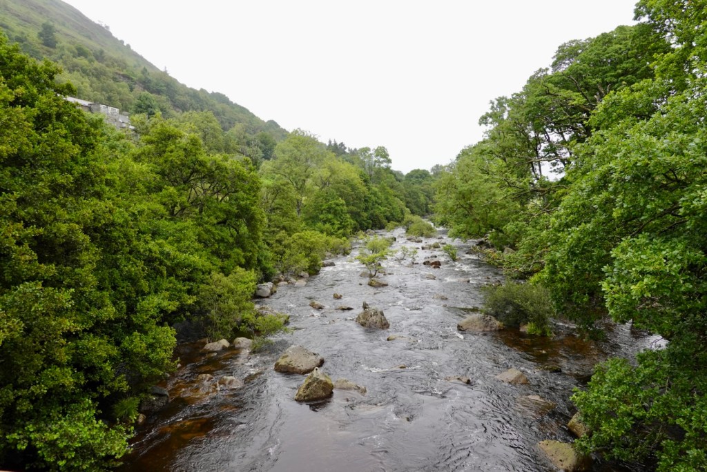
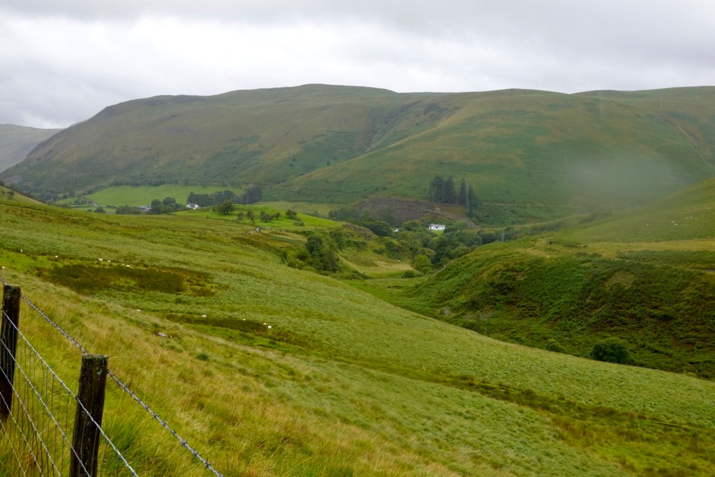
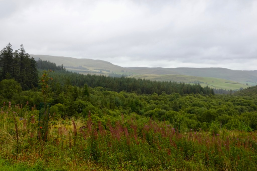
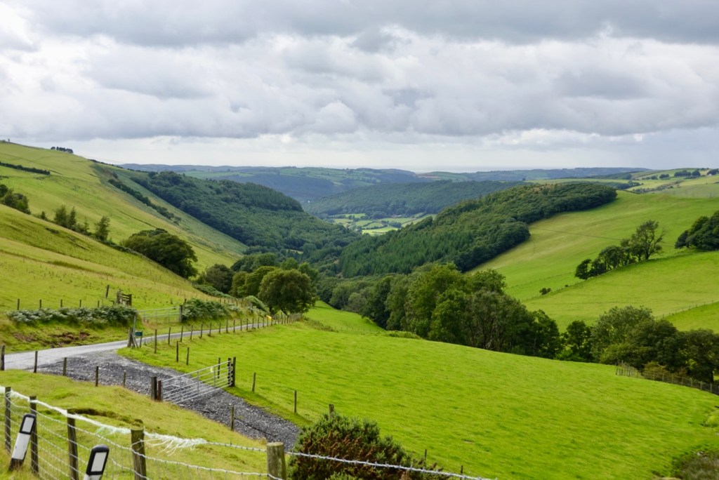
The river Dee flows through the region. Beautiful views.
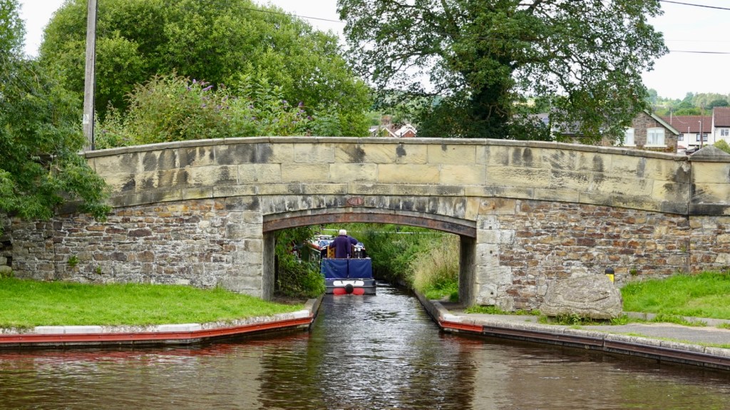
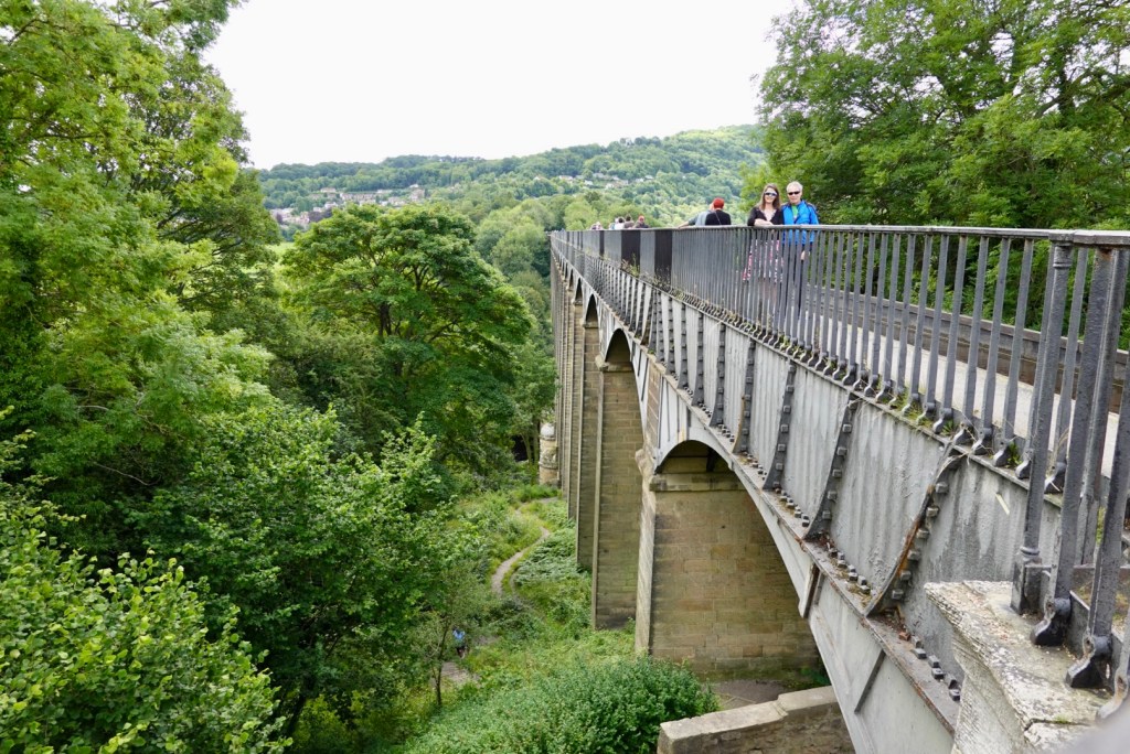
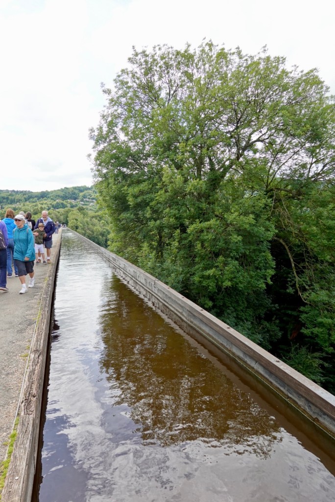
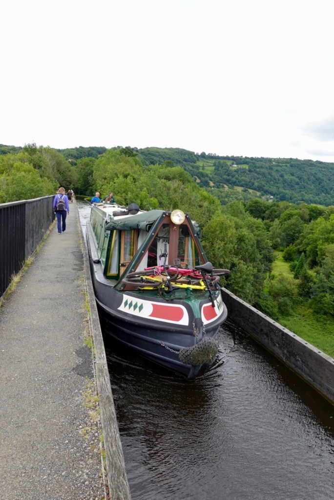
Trevor Basin is the junction point of the Llangollen canals. This then feeds into an incredible aqueduct. Originally constructed to move cargo around the country, today it is a tourist attraction and used for holidays on barges.
The Pontcysyllte aqueduct was built by Thomas Telford. There are 18 piers made from local stone. The canal runs through an iron trough that is 11 foot wide and 5 foot deep. It was the largest in Britain and cost 47,000 pounds constructed between 1795-1805.
Tony and I on the aqueduct The aquaductA canal boat crossingThe view from the aqueduct looking towards the Chirk aqueduct
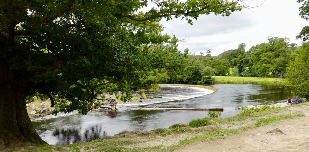
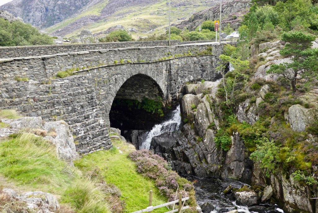
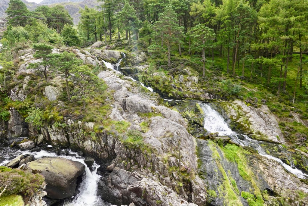
We then headed to Horshoe Falls, that provides the water for the aqueduct.
Tony and I Horshoe FallsWalking back from the falls
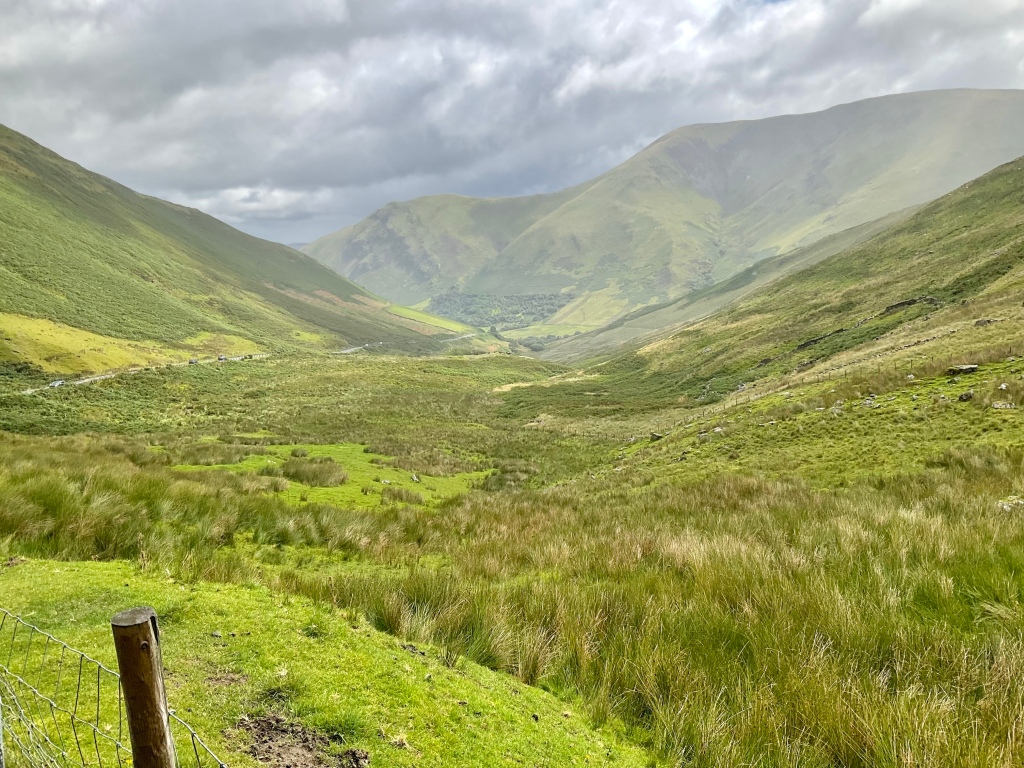
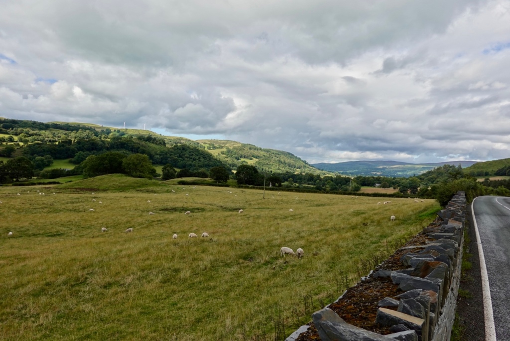
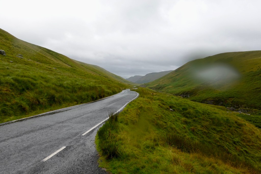
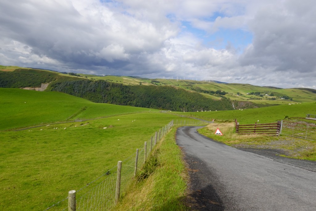
Next part of our tour today we headed up Horshoe Pass, where we had lunch and there were lovely views across the hills and mountains.
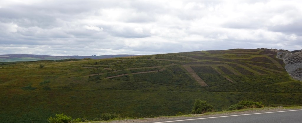
The vegetation has been clipped back to encourage the native heather to flourish
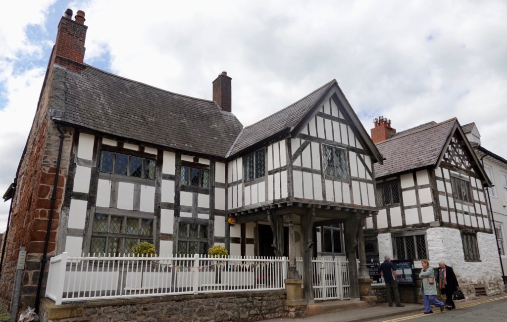
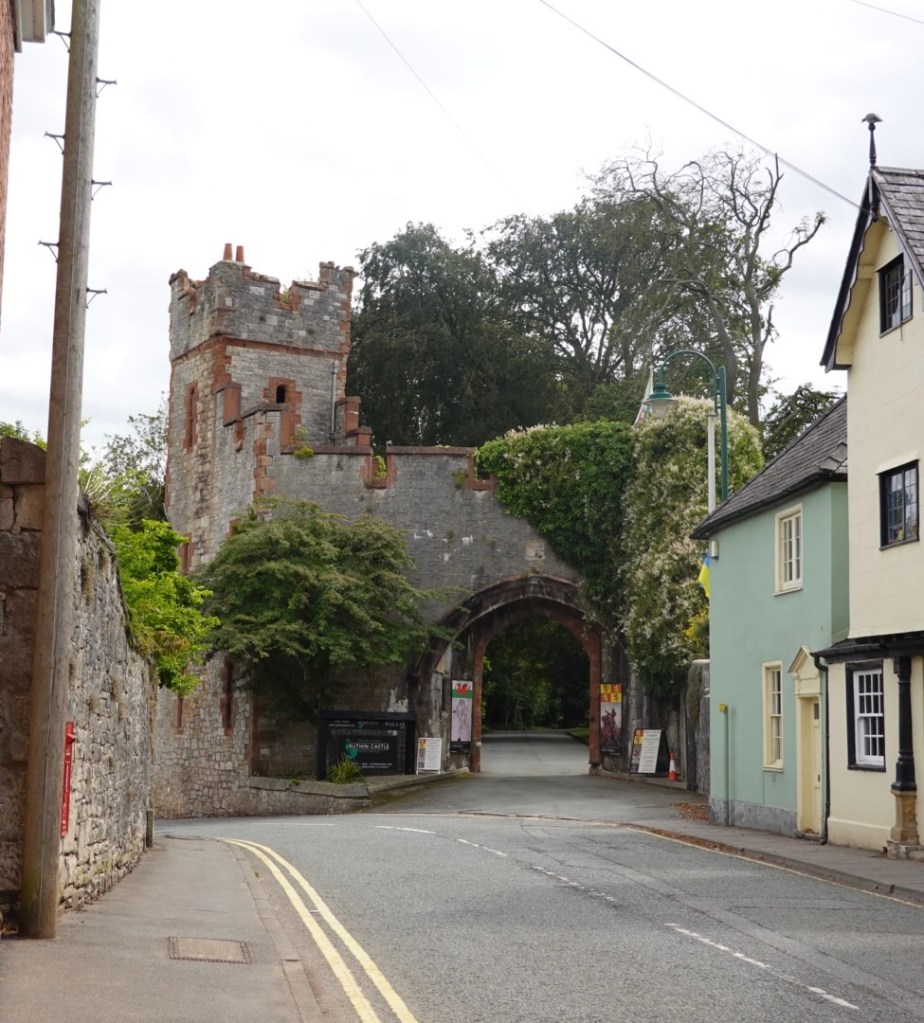
Finally we visited Ruthin, a historic market town. The castle was commenced in 1277 by Dafydd, the brother of Prince Llewelyn at Gruffud. He forfeited the castle to King Edward 1.
In 1400, Owain, from earlier Corwen fame, burned it to the ground in a show of Welsh patriotism.
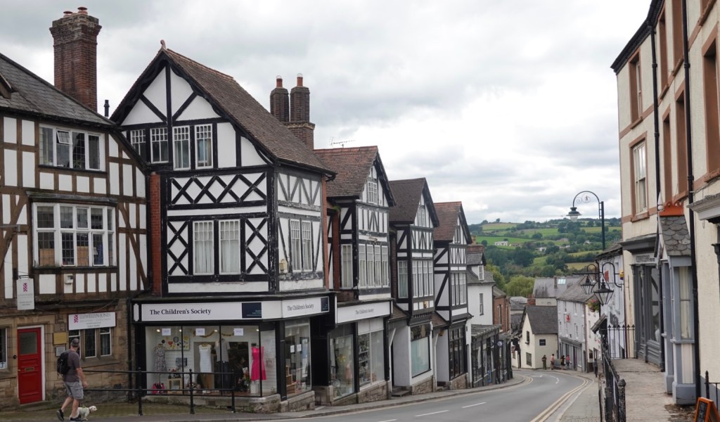
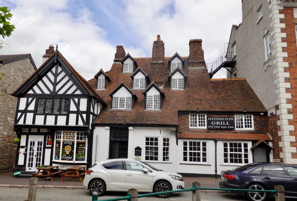
As we walked up to the castle, there were many interesting old buildings from the 1400’s onwards.
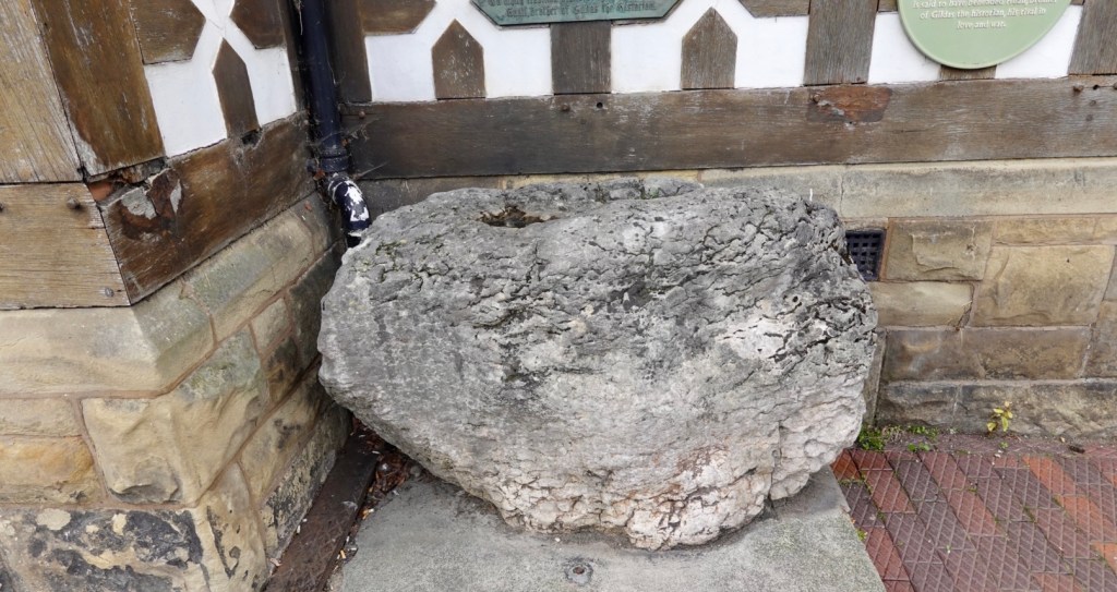
This rock is interesting. It is believed that King Arthur beheaded his rival Huail in this rock.
The entrance to the castle.
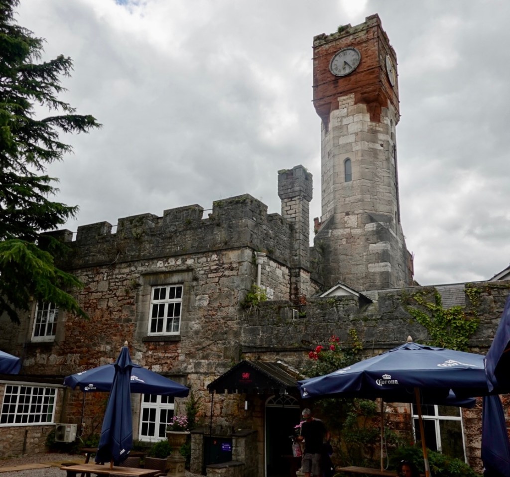
Part of the castle. King Charles III spend the night before his investiture as Prince of Wales in this castle.
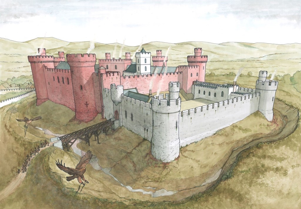
Reconstruction
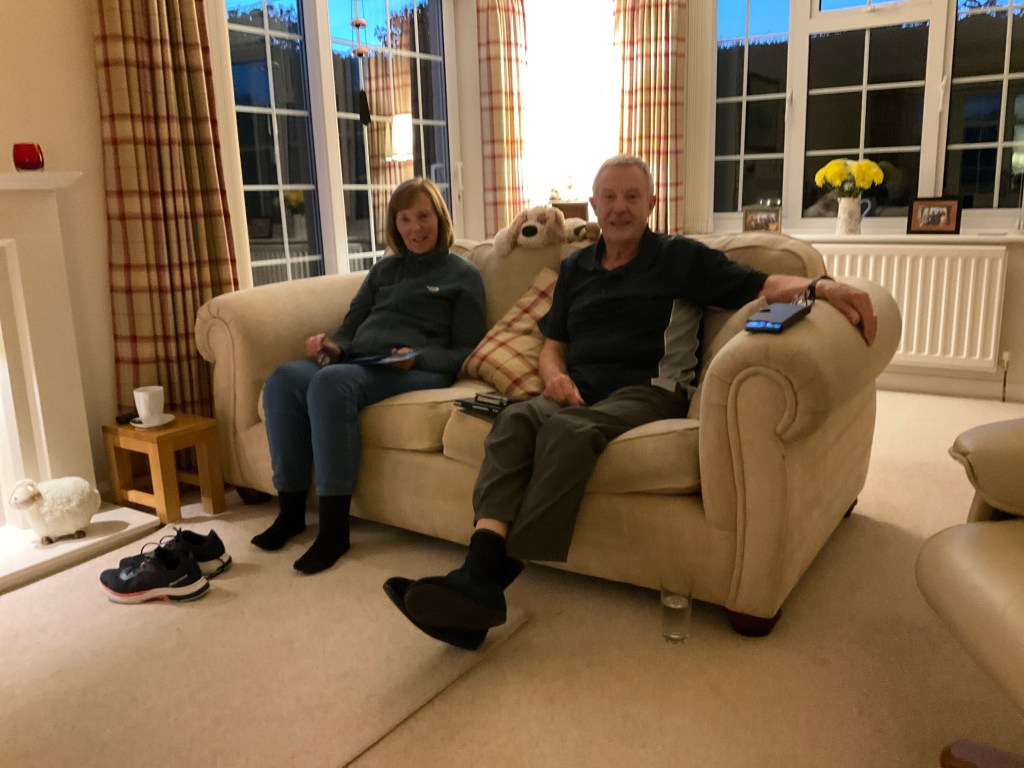
So a lovely day with our friends. It has been a wonderful opportunity to catch up with them again reminiscing about our adventures riding LeJog, and their trip to Tasmania, and things that have happened un between.
Here are Sue and Alan chilling after a day with us 😊❣️
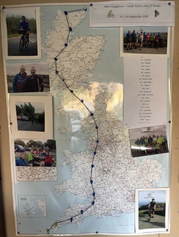
In their garage is this map of memories from our 2013 LeJog ride. I like the string concept and might look at what I can do with our rides.
Tony and I are I are in the bottom left photo and the two group photos. This is the route taken in 2013 LeJog ride.
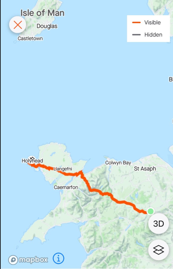
Tomorrow we head to Holyhead, preparing our crossing to Ireland the following day. A long day ahead.
I did something today that I do not recall happening before. The house we stayed in is very old. The floors are not even. I felt that the bed was on a slope.
During the night, sound asleep, I must have rolled over, and I fell out of bed, hitting my face on the bedside table as I crashed onto the timber floor from the high bed. It woke me up 😳🤣
I did get back to sleep but it took a while.
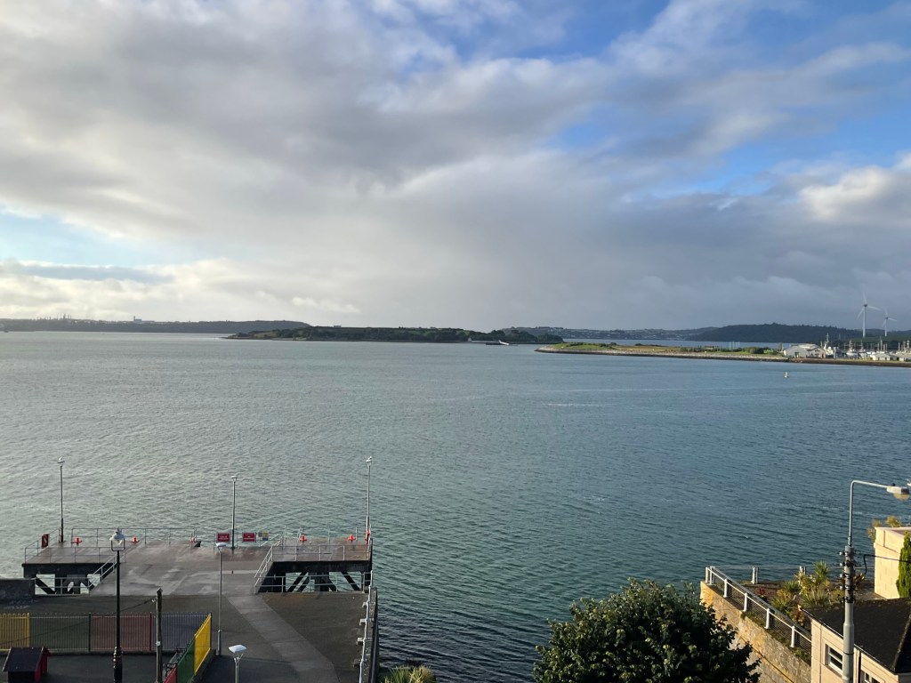
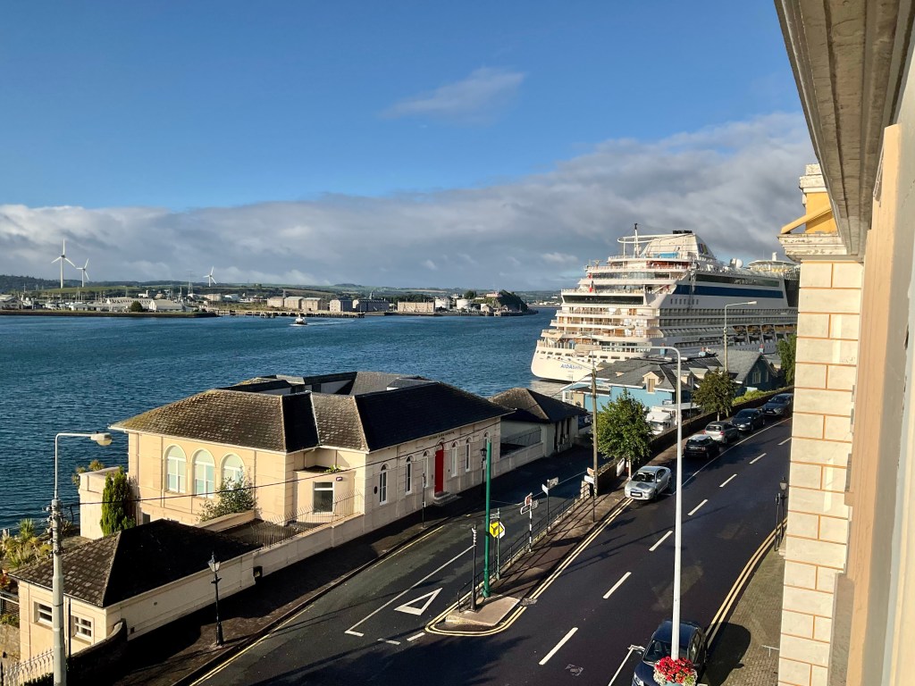
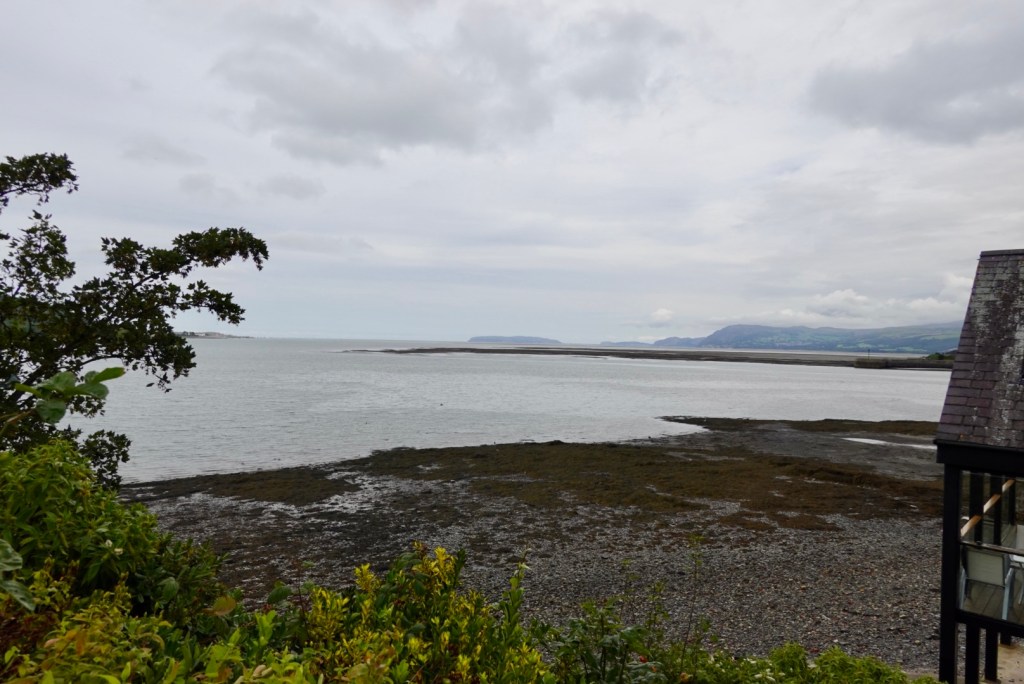
Looking out the window in the morning this was the view.
Looking straight ahead towards Spike IslandLooking hard right, a large cruise ship had arrived in town. Many of the larger towns today had cruise ship, bus tour people just wandering around. We did not hang around. Anything you tried to photograph, they were sitting on! Give us the quietness and genuineness of the little villages
The allotted croissants had not arrived per the male owner’s time slot. We were super keen to pack the bikes and get cracking so I took a few pieces of our luggage down to the front door, with reason, as the kitchen is adjacent.
I found Mary busy chatting to other guests, and as they left, took our croissants outside to where our bikes were safe in the courtyard. We smashed the croissants down, packed our bikes and headed off.
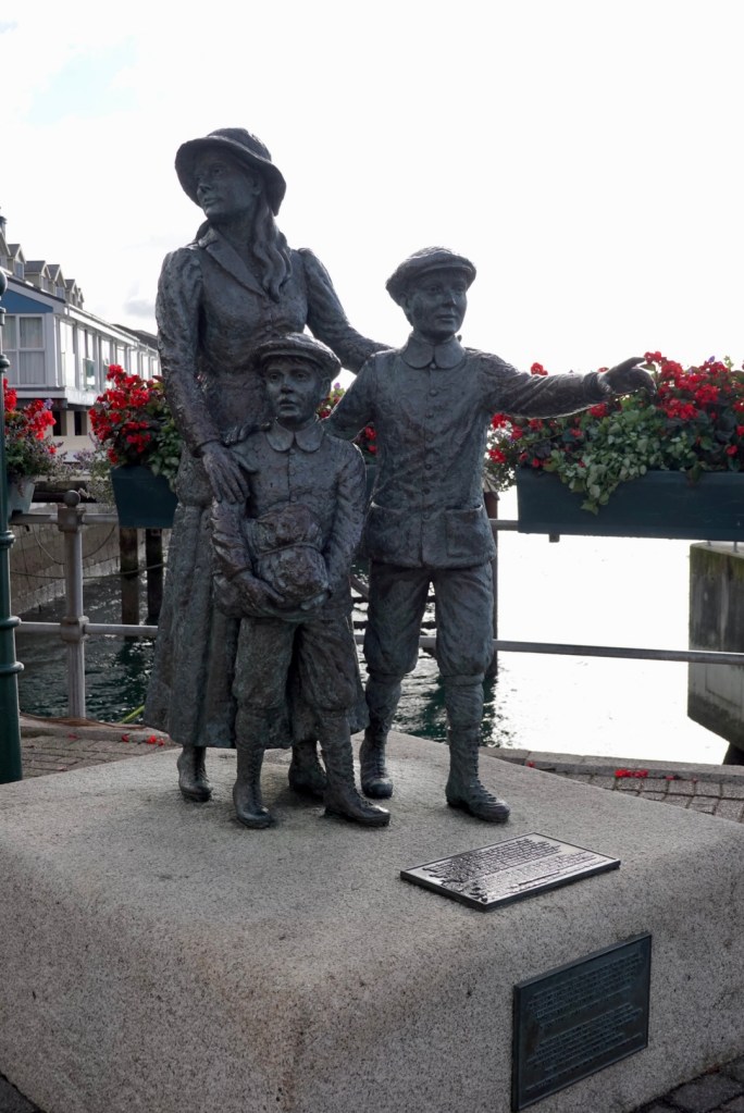
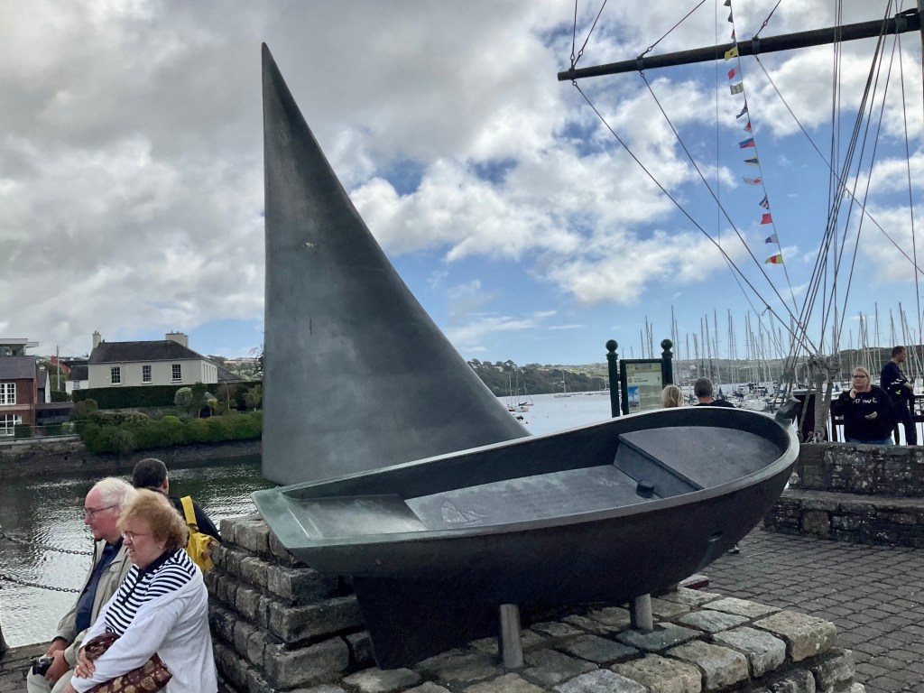
Soon enough we were in our way, and first stop was this statue celebrating Annie Moore and her two brothers who emigrated to New York from Cobh. They were the first immigrants to be processed at Ellis Island. A similar statue is on display at Ellis Island.
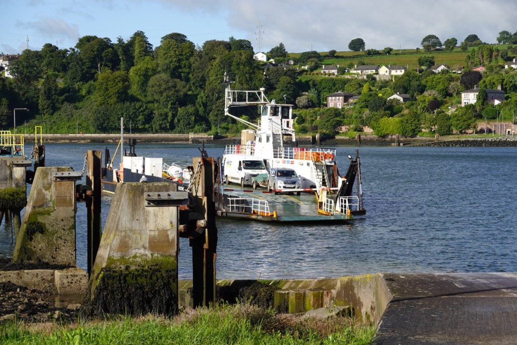
Then it was a 3.5 km ride to the ferry. We waited for it to arrive, walked the bikes on, and then it waited maybe 10 minutes for anyone else to board.
It costs about 3 euro each way and only takes about 5 minutes to cross.
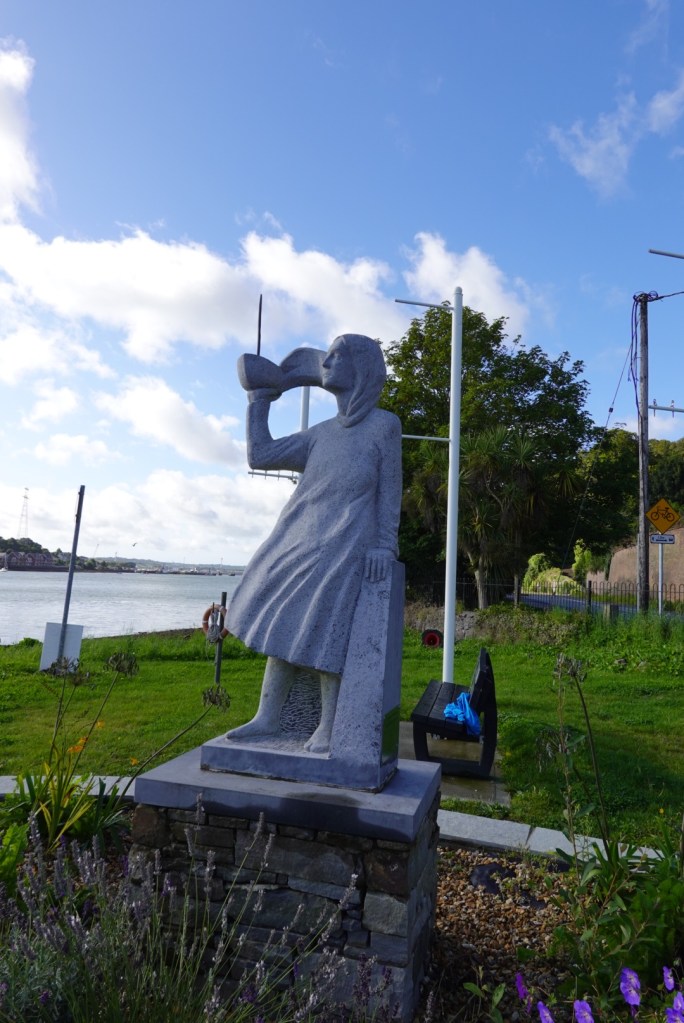
On the Glenbrook (southern) side is another statue of a young woman holding a boat looking towards where the Sirius left to emigrate to America. the Sirius was the first steamship to make the trans Atlantic crossing with immigrants.
Up to 2 million Irish immigrated after the Great Famine. Death from the famine and immigration saw a loss of 25% of the population.
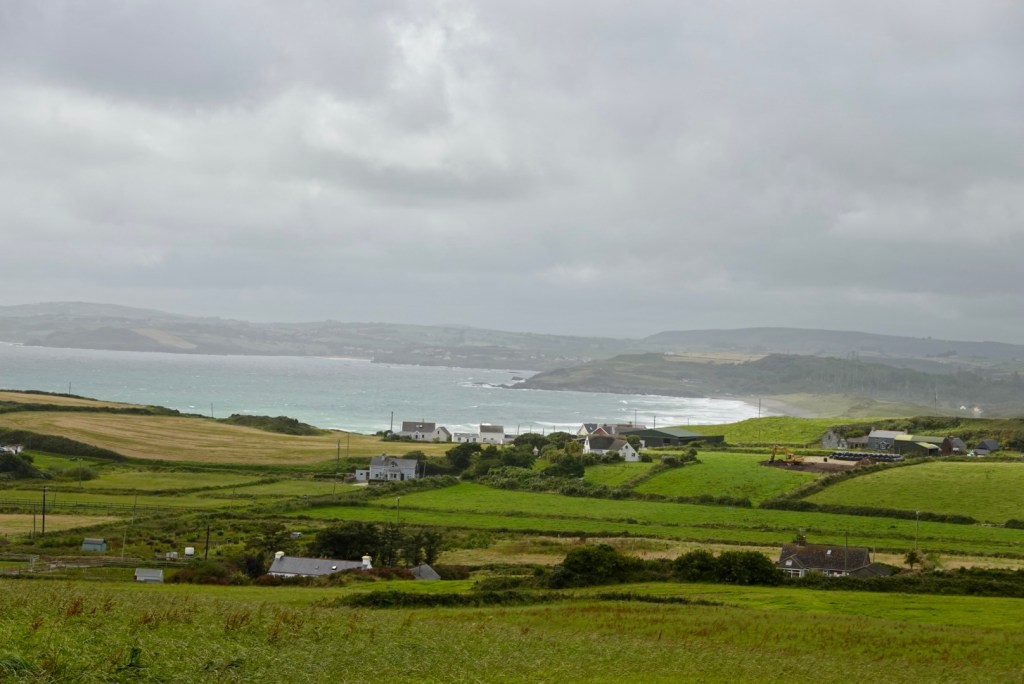
Water was to be a feature today as we crossed rivers, inlets and saw the coastline as we headed in a south west trajectory. Wind was the other feature. The forecast was for a WSW wind of 32 kmh. It was very tough.
At times, on the flat, we struggled to push 12 kmh into the headwind. At other times, the road might deviate to a different angle and we would welcome a short reprieve. Out of the wind when we rested, it was quite warm and we enjoyed the sun.
Lovely rural sceneDisengaged bus tourists sitting on what I wanted to photographNear the top of a climb. We climbed over 1200 metres today.Lovely sea inlet. The tides were fairly low.Very flat beach, low tide.An inletQuirky roadside feature Looking towards the ocean An old derelict church A newer church
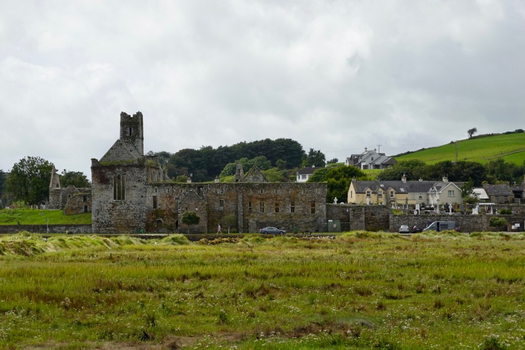
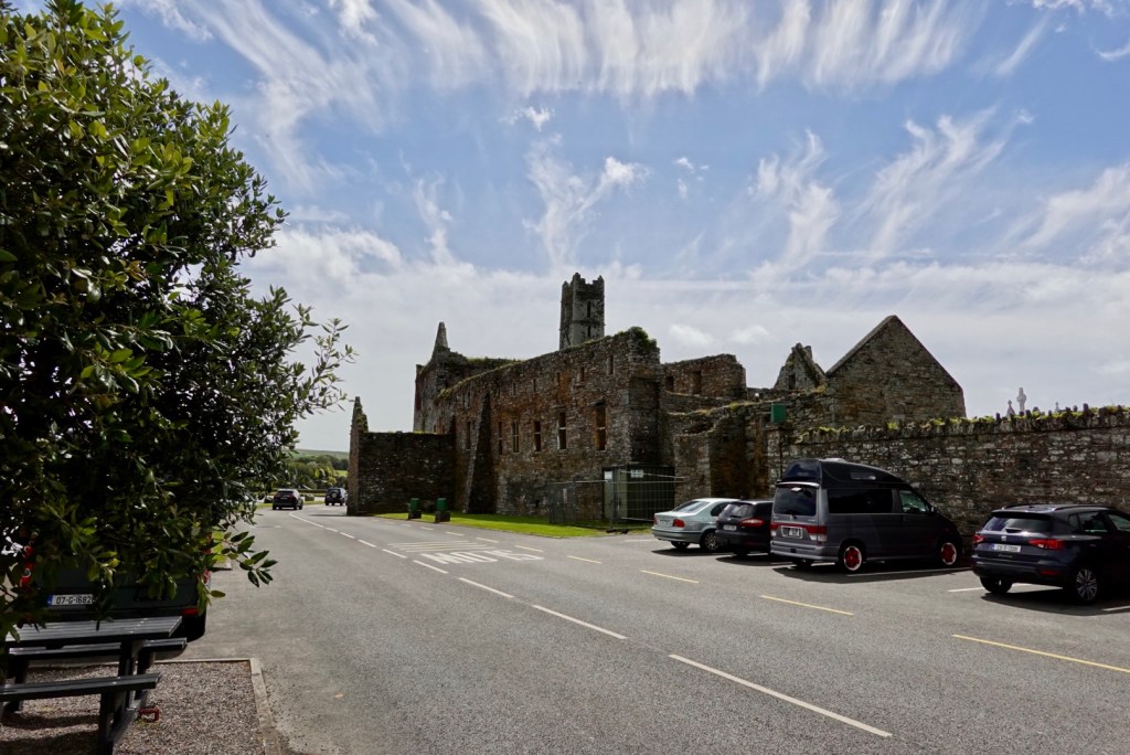
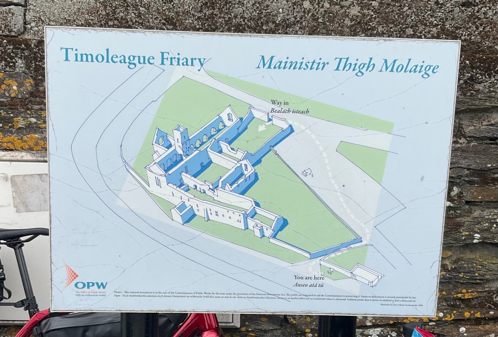
Timoleague Abbey is the main focal point in Timoleague standing picturesquely at the water’s edge at the head of a long sea inlet. In its day it was one of the largest and most important religious house in Ireland. It was founded in 1240 by the Franciscans.
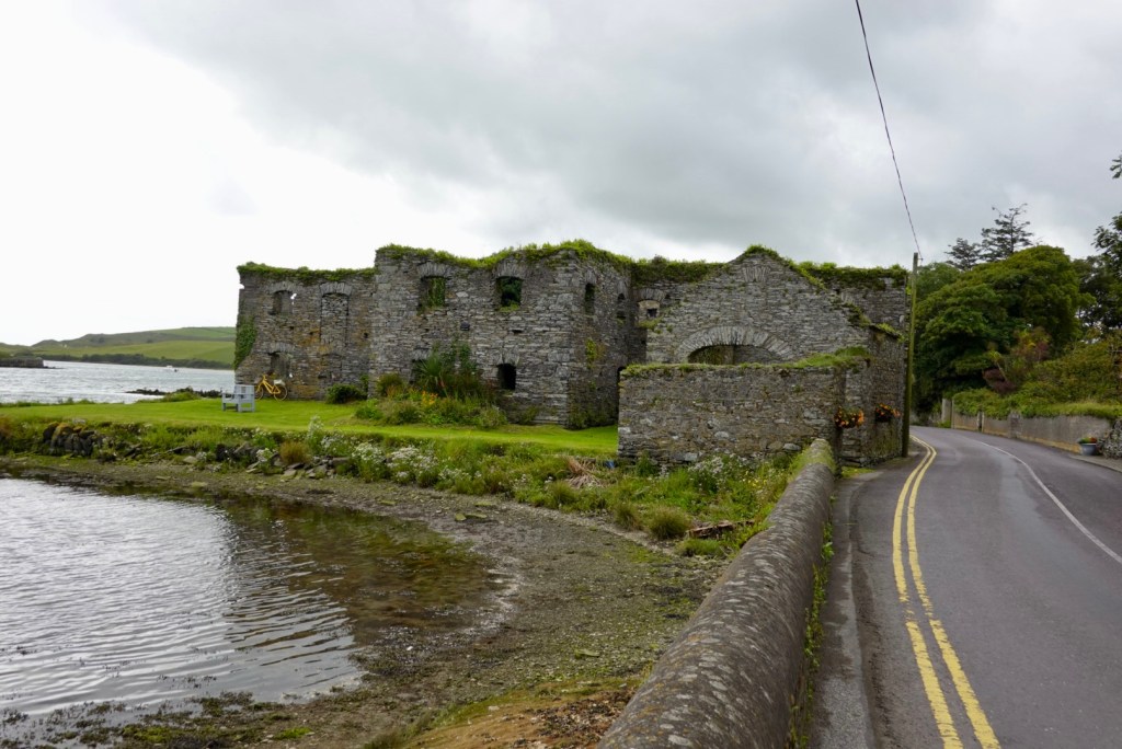
A little further on was the old Arundel Grain store built in the 16th century to store grain for a nearby flour mill. Later it stored potatoes and coal. In 1837 the local port of Ring exported 5,000 bushels of wheat, 1,000 tons of potatoes and large qua titles of ‘superior’ slate.
We stopped at this intersection. Our route was heading left, but we noted EuroVelo went straight ahead. We changed plans and took EV1, as Tony said ‘it surely won’t have a nasty hill’. But it did 🤣
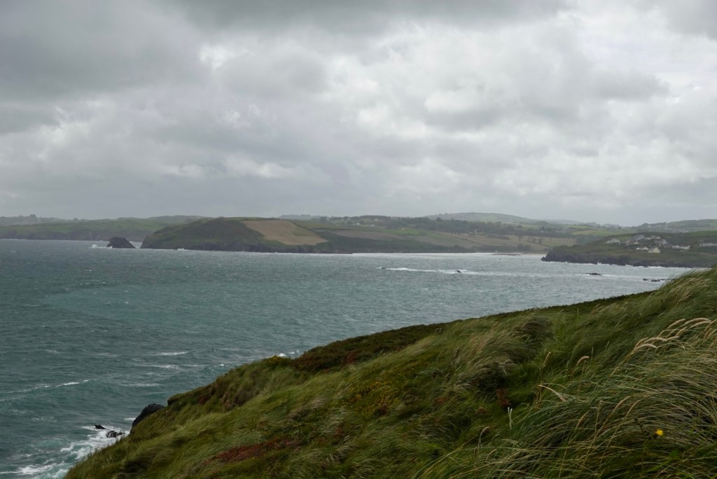
As we crossed the top the sea views came into focus.
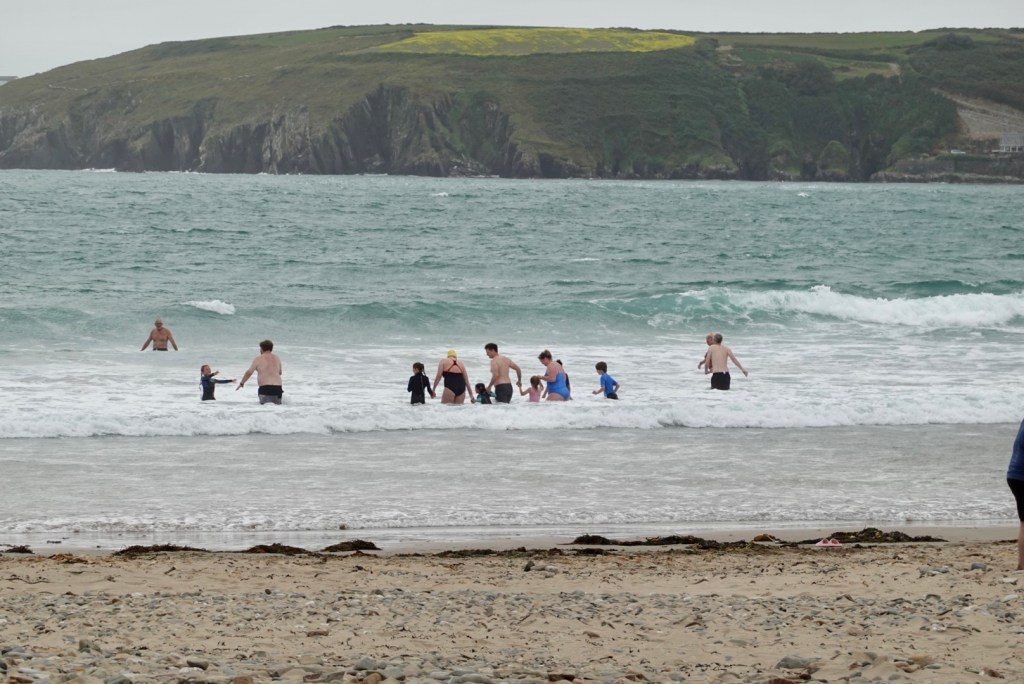
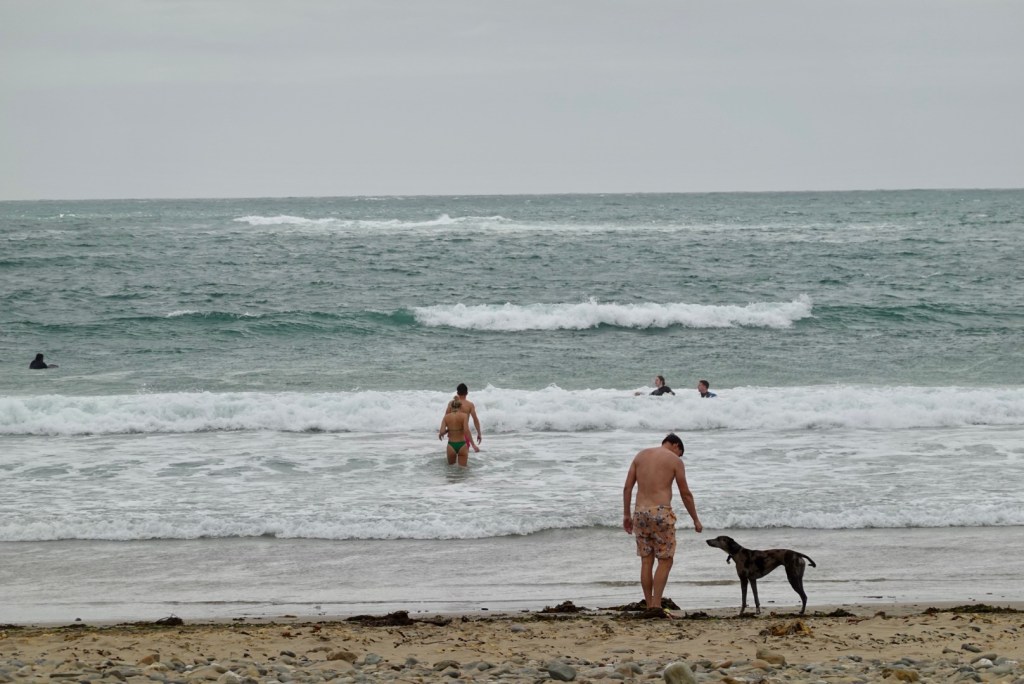
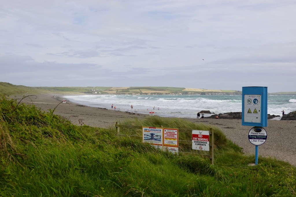
Castlefreke Beach at Warren Bay was the place to be. These swimmers have a seriously strong headwind smacking into them and it is only 17c. The beach also had a portable barrel shaped sauna that people were hopping into after the beach.
The scenes as we headed south were delightful. Remote housing, green pastures, wind blown, like a rural tv show with mystery.
I quite like this one as I finish yet another climb. Note the birds to my right.
What a gorgeous vista these houses have.
Desolate isolation of an old church.
Another beach with the waves smashing in.
After climbing up the hill, there was a lay by we pulled into.
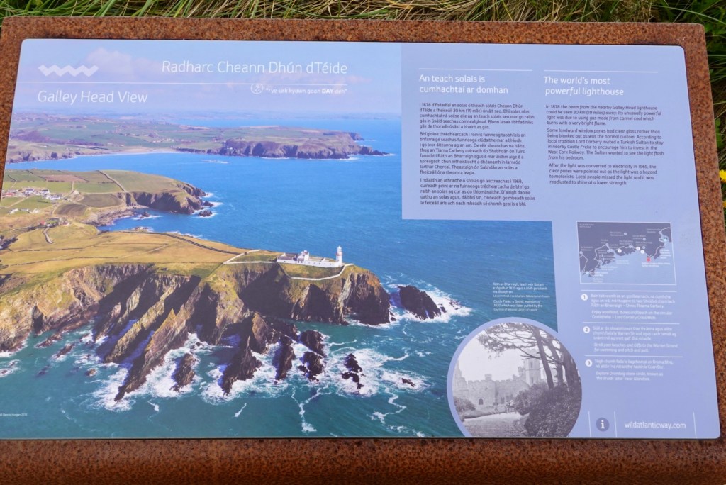
Looking south Information board on the area and the worlds most powerful lighthouse
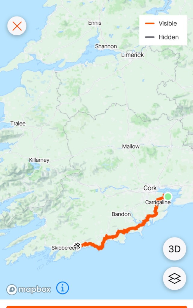
The Wild Atlantic Way is a 2,600 km route (road) and one of the longest defined routes in the world. We are only riding a section of the route from south of Cork around to Limerick, before we cut back to Cork to catch the ferry to France.
There is signage along the way. Route signs plus metal art, all with the same waves,
Dromberg Stone Circle, the Druid’s Alter, is a small axial stone circle, and one of the most visited megalithic sites in Ireland.
It originally consisted of 17 closely spaced stones, of which 13 survive. Radiocarbon dating of samples indicate it was constructed around 1100-800 BC.
The only other people there when we visited were these three French siblings enjoying a touring ride together. Michael, Laura and David live in Grenoble. They will be heading to Australia in a few months, and if visiting Tasmania, have offered them beds at our house.
It was refreshing to see their closeness and joy in their touring endeavours. Tres Bon!
Closing in on tonight’s destination, the waters were calm and protected! Finally some reprieve.
Glandore is known locally as Cuan Dor – Harbour of the Oaks. It was one of the earliest settlements in West Cork, with the Normans building two castles here in 1215.
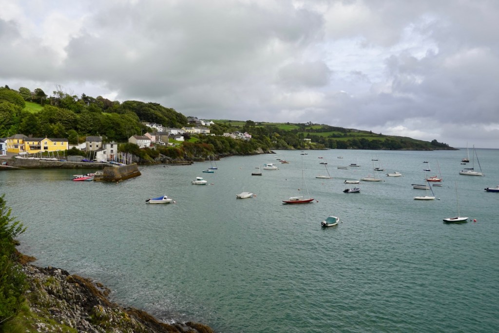
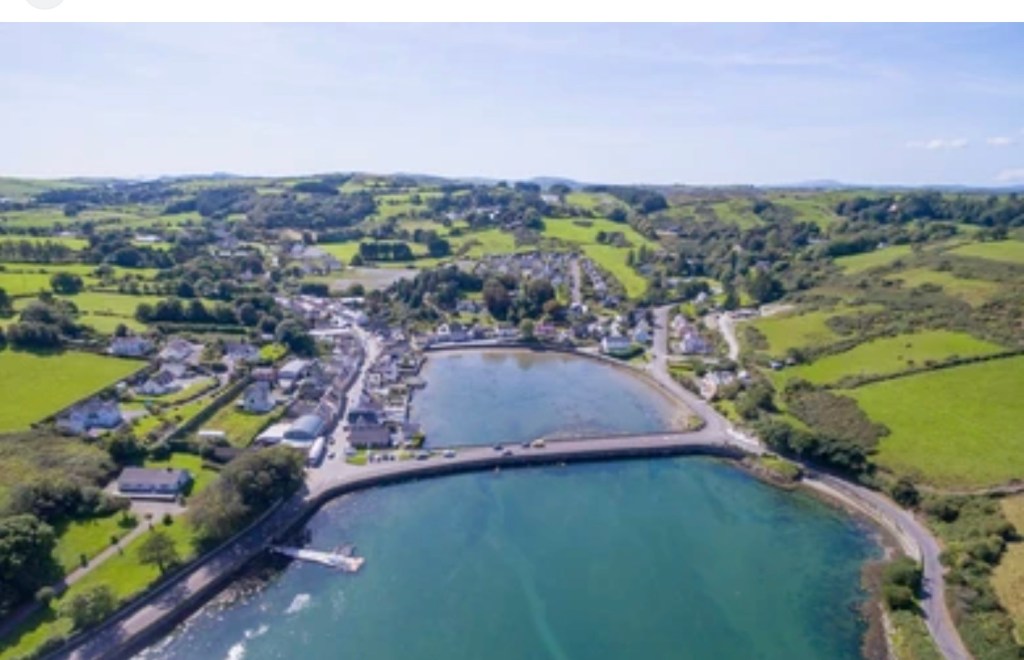
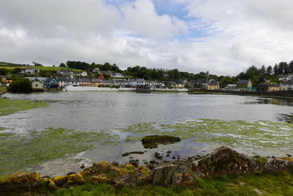
Union Hall is a small fishing village, with its own ice plant and fish processing factory.
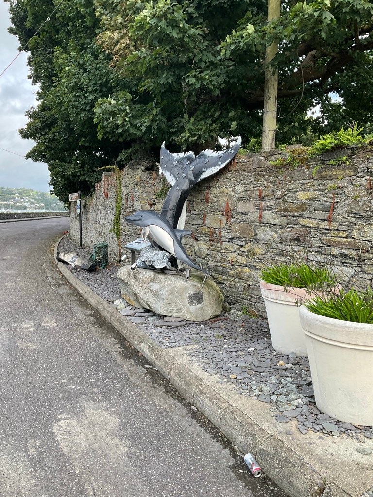
A borrowed photo aerial view of Union Hall. Our accomodation is at the top of the hill in the background.In town the inner harbourLocal roadside art
As time was getting on, and the accomodation was up a hill, we decided to grab dinner first. We ordered at this pub as there were seats outside, so we could keep an eye on our bikes.
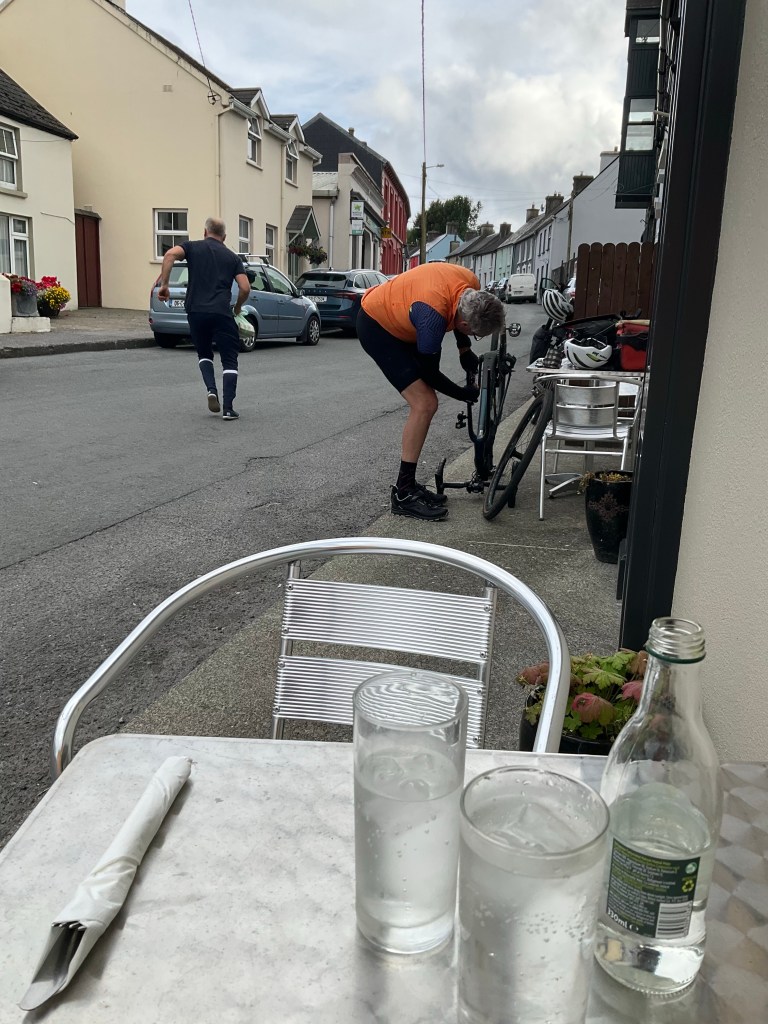
Whilst we waited for our dinner, Tony changed my brake pads as I’ve worn a set out already! That’s probably a record for me at 1,000 km and indicates how hilly it has been. Thankful Tony can do it for me too.
After dinner getting up to our accomodation was hard. Cold legs, full tummy, steep hill are not great partners.
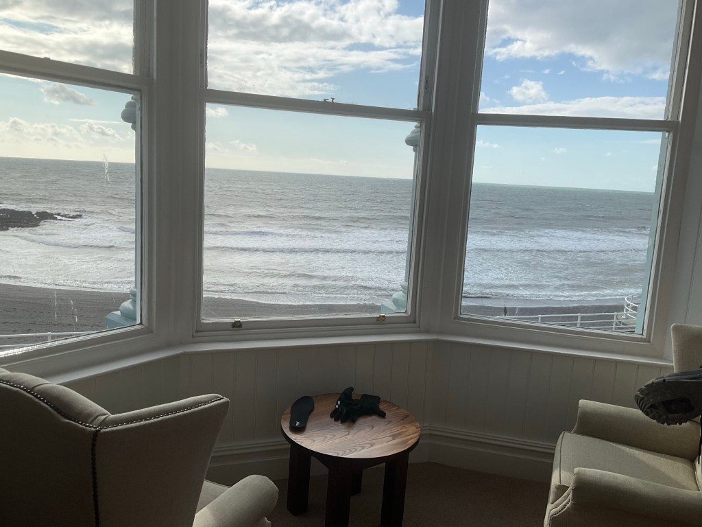
Our room here is amazing. It is very large and spacious with beautiful views.
We were given options of 7.30 am or 9 am for breakfast 😳🤣 I said 7.30 am please. She responded “that was quick, you didn’t have to think about it?” No….
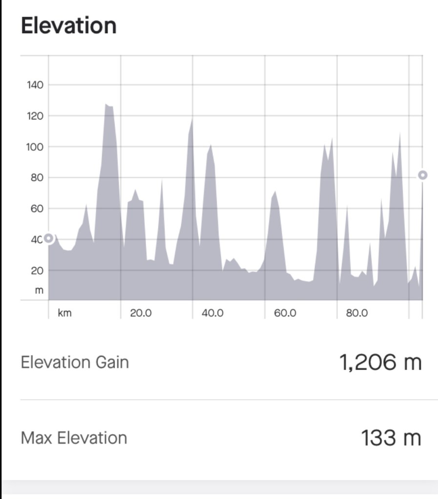
Another day (105 km, 1200 m climbing) and that’s a wrap. Thanks for reading. 😊❣️
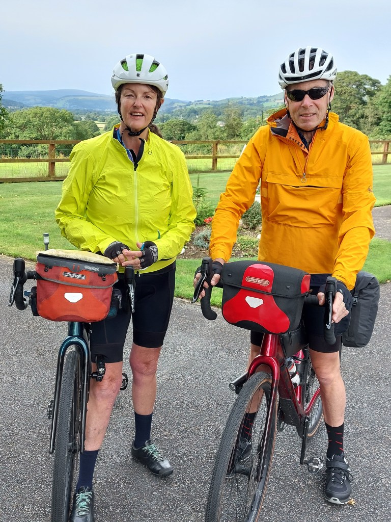
We said farewell to Sue and Alan this morning. We had a lovely time and thankful for the friendship. 😊❣️
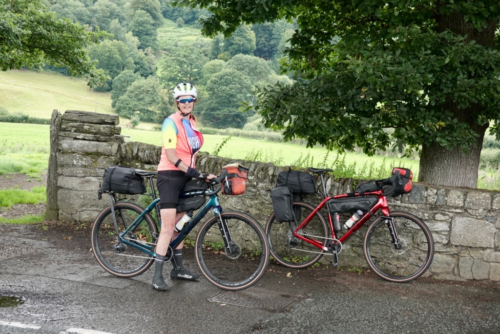
Leaving Sue and Alan’s house
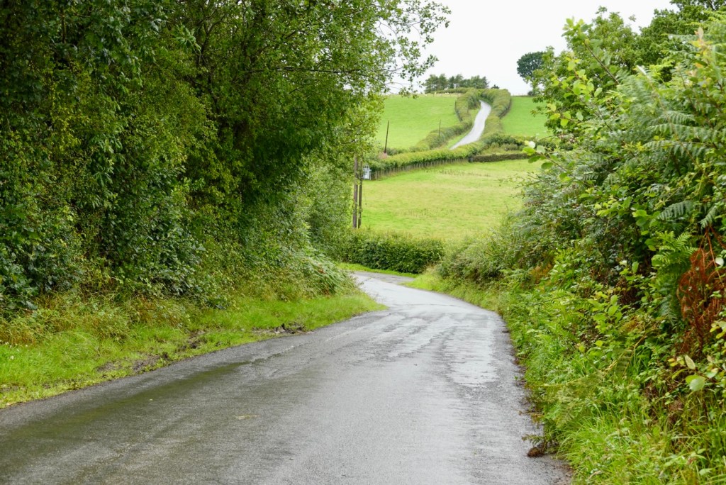
Todays ride was excellent. The scenery was amazing, the weather was good, and despite fairly solid and consistent traffic on the A5, on the whole, the drivers were patient.
Sue and Alan had recommended a coffee stop in Betws y Coed, a popular town to visit within Snowdonia, a centre for outdoor activities within Gwydyr Forest.
Over the road from the town sign, Tony checking maps to THE coffee shop
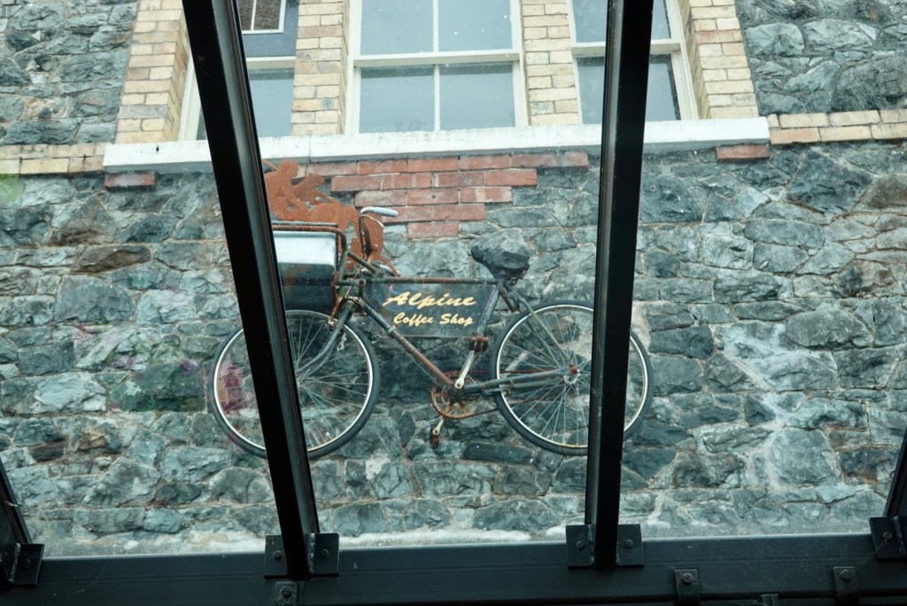
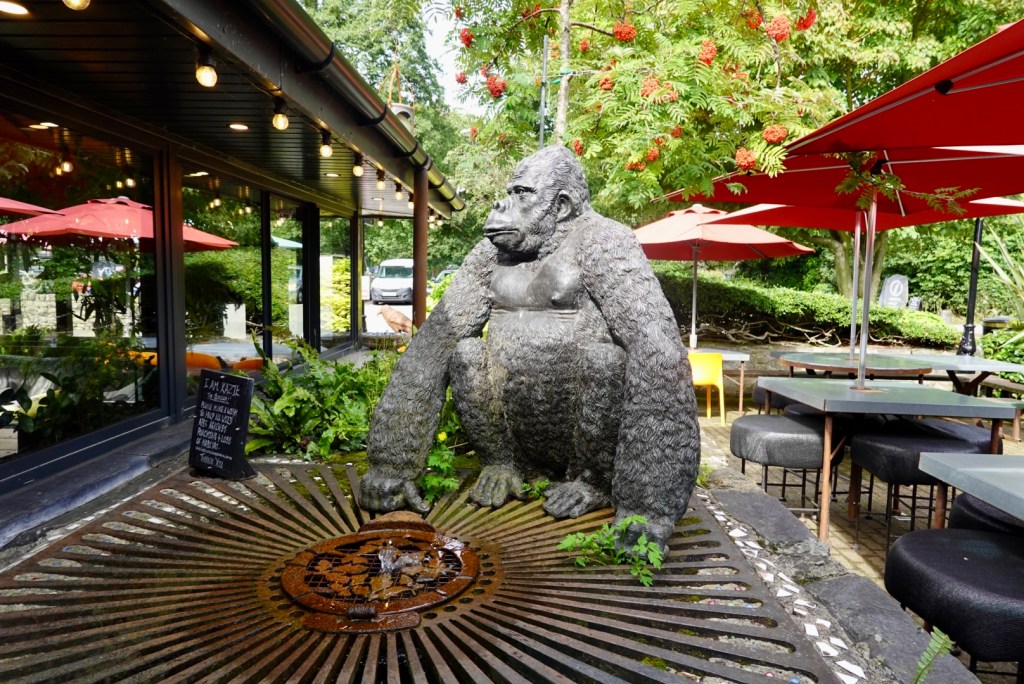
We found it! The Alpine coffee shop, complete with a bike on the glass roof, and an orangutan.
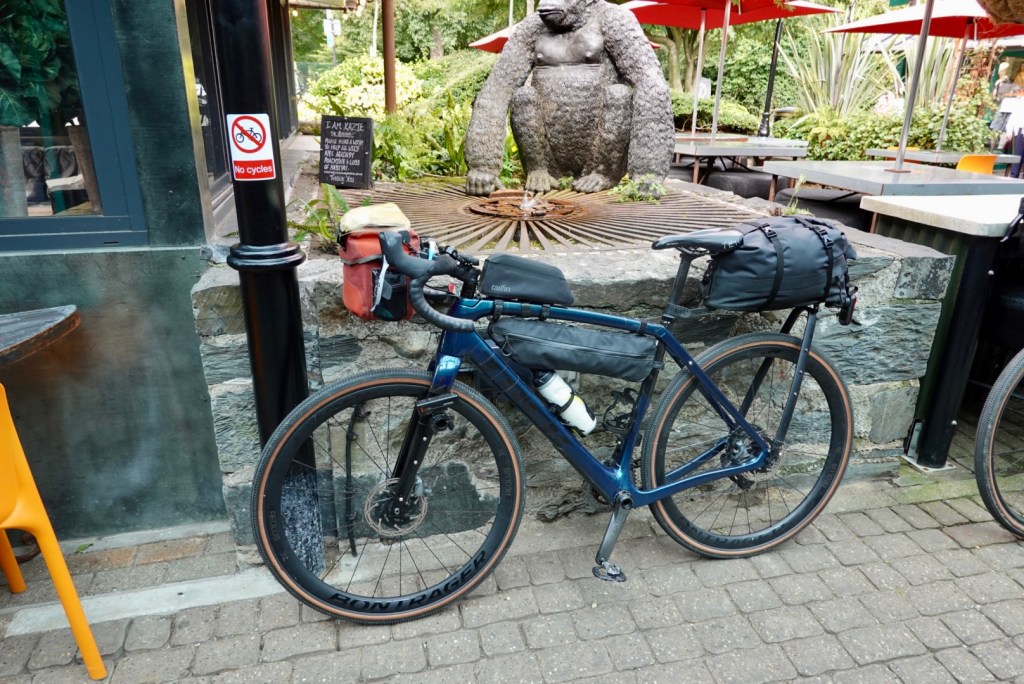
The No Bikes signs were everywhere.
Inside the coffee shop they have items to sell raising funds for the preservation of endangered orangutans. This is a cause dear to my heart, as for a number of years I was the Tasmanian Coordinator for the Australian Orangutang Project, aiming to raise awareness and funds to assist stop these intelligent and beautiful animals becoming extinct.
How can you help? Do not buy products with palm oil (unless certified sustainable), donate or sponsor an orphaned orangutan, and learn more about their plight. Australian Orangutan Project
I threw some pounds into the wishing well ❣️
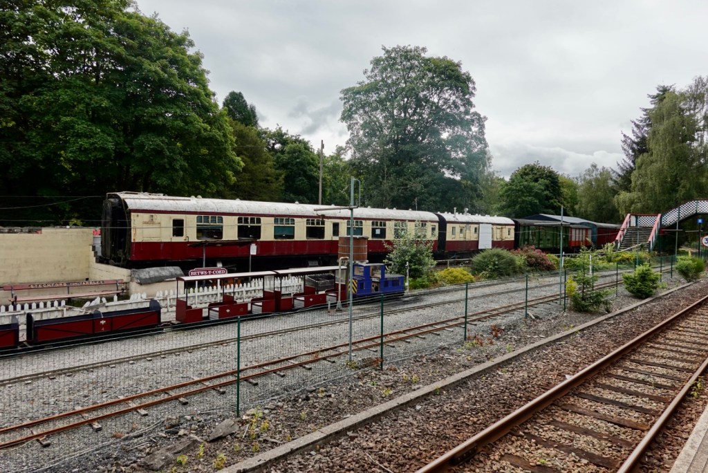
Behind the cafe are old railway carriages, and station platform.
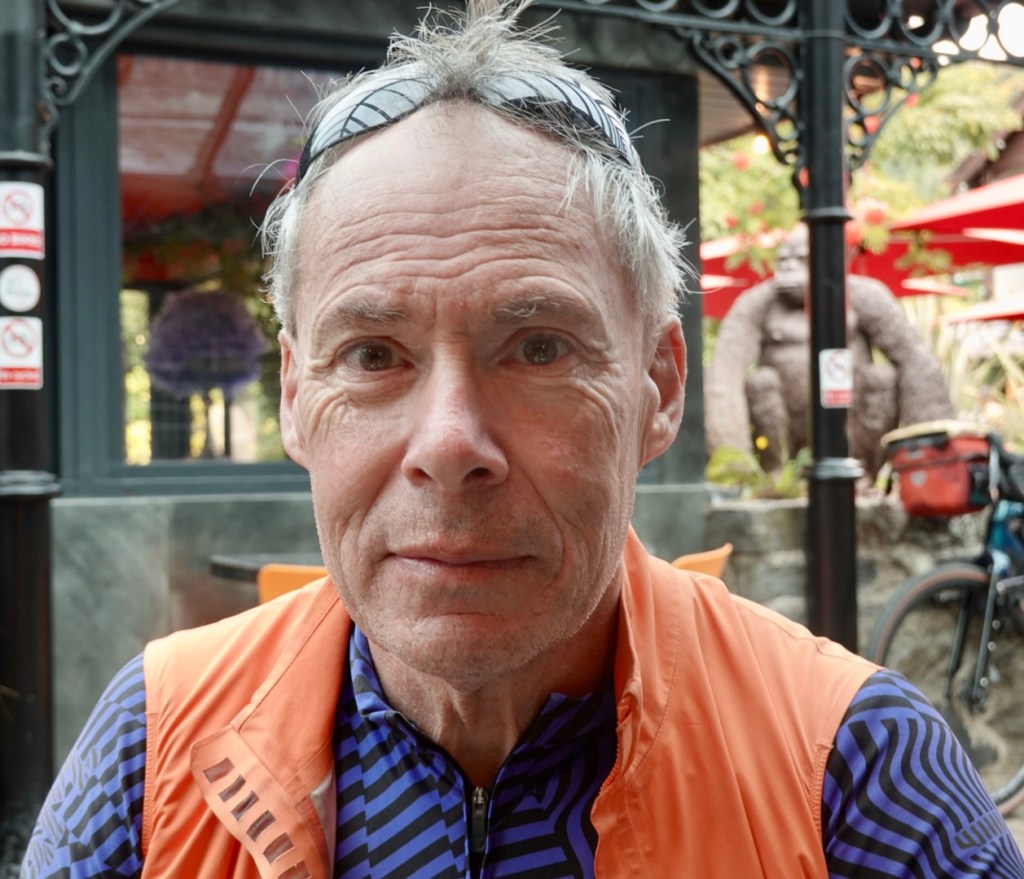
Tony looking suitably impressed
Next door to the Alpine Cafe is another cafe, with this sign. We did laugh.
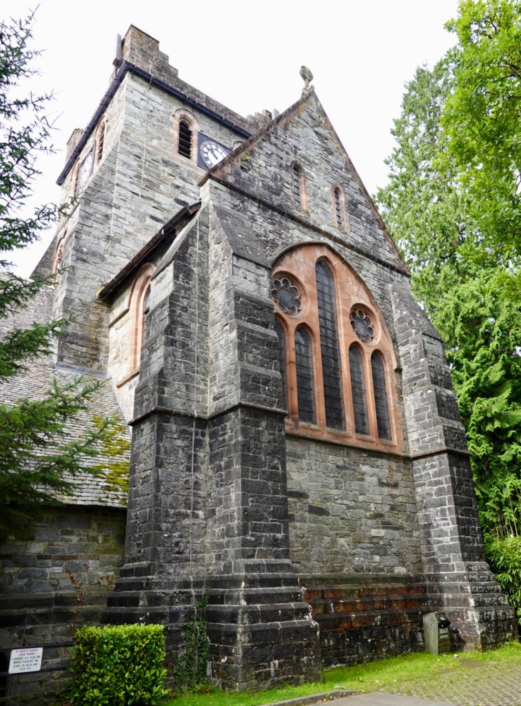
Leaving town we passed by this church. A relatively young church built in 1870, replacing the former 14th century church.
Heading out of town we climbed from about 28 km to 50 km. It was very doable and easier than the graph looks.
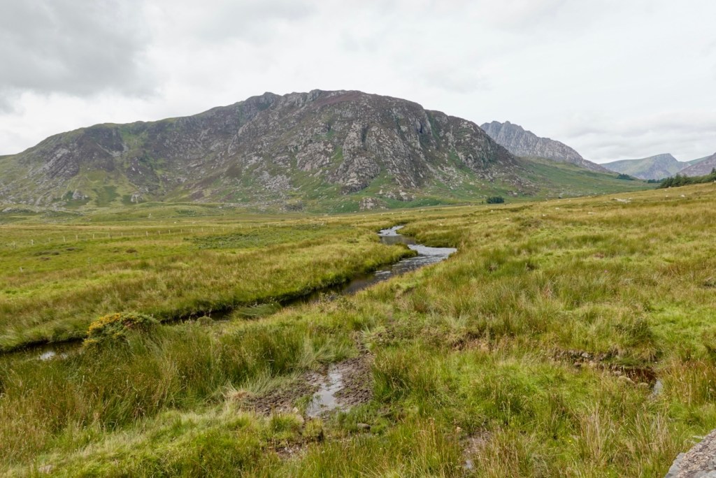
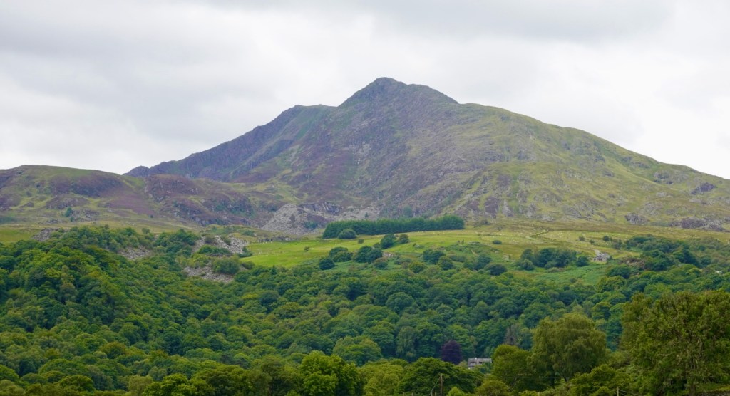
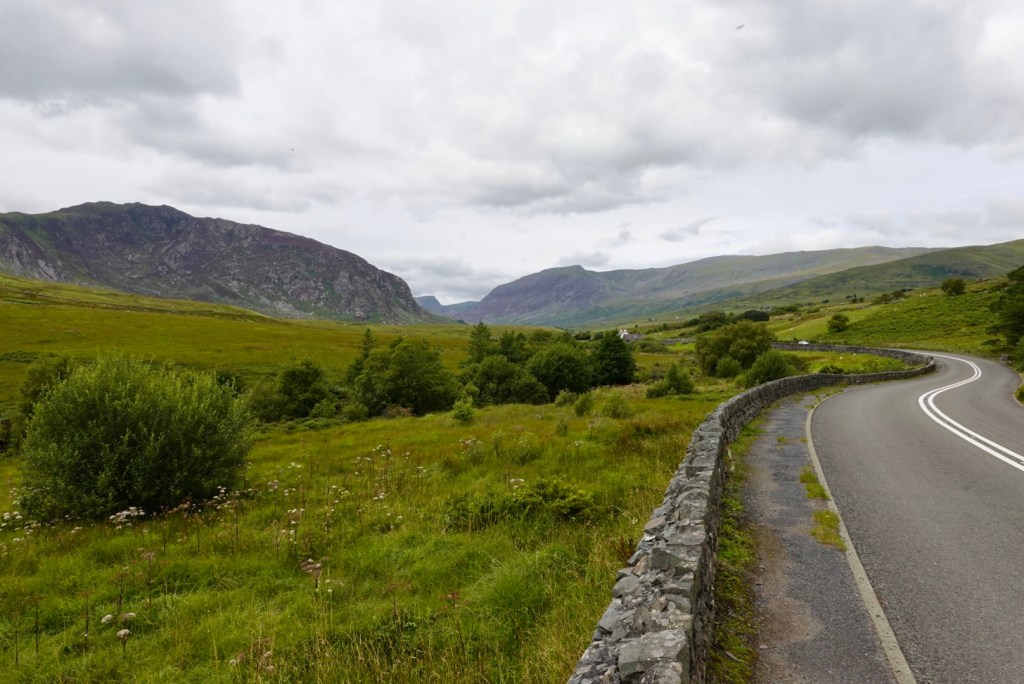
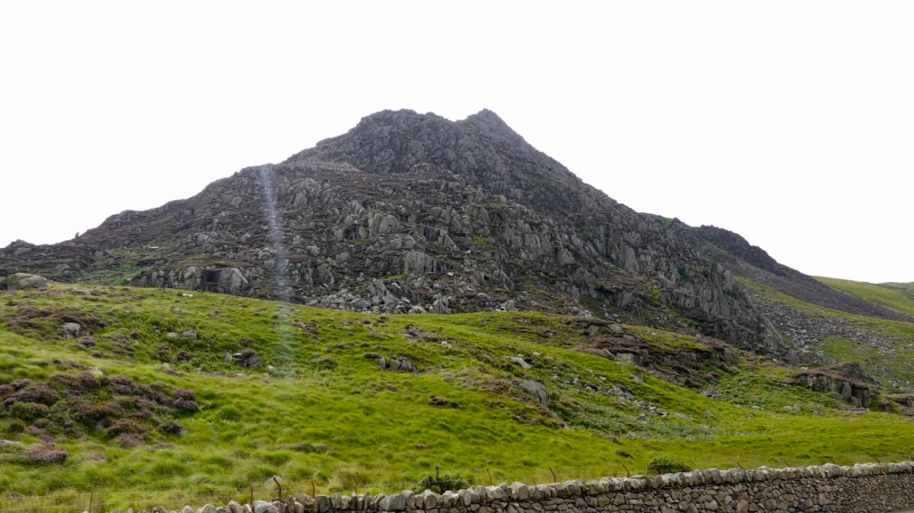
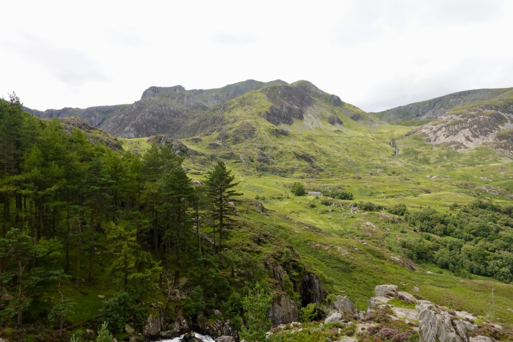
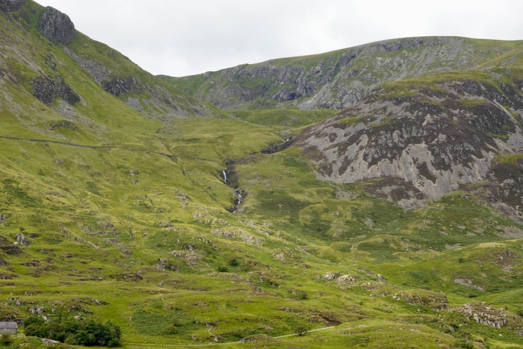
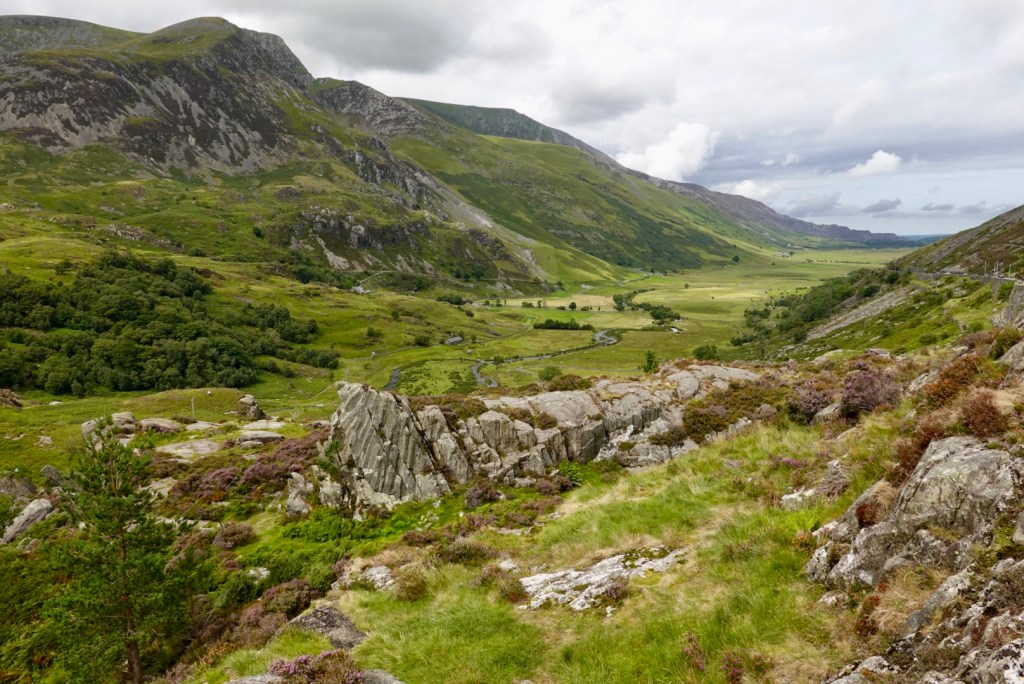
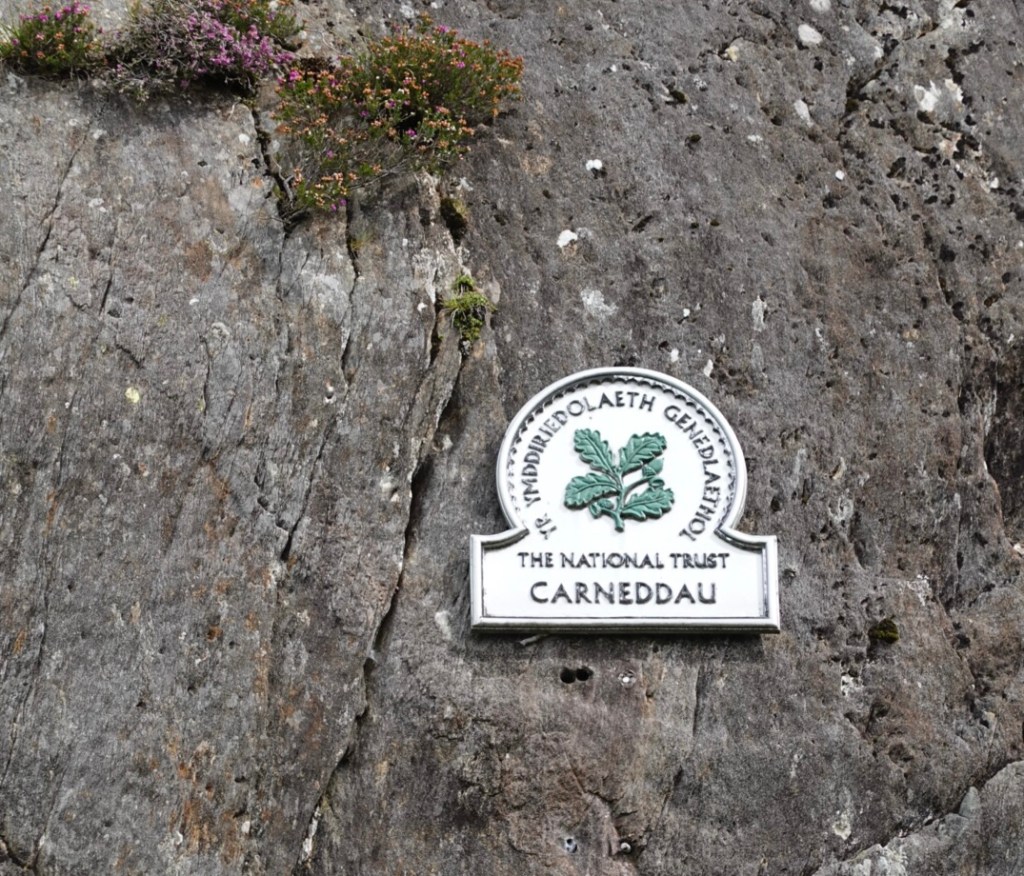
We were riding along the A5 between two our twin ranges of Snowdonia, the Carneddau and the Glyderau.
It was spectacular, and the photos do not show how high they really are. It was awesome riding this region. Lots of ‘wows’.
A string of photos as we progressed along the road.
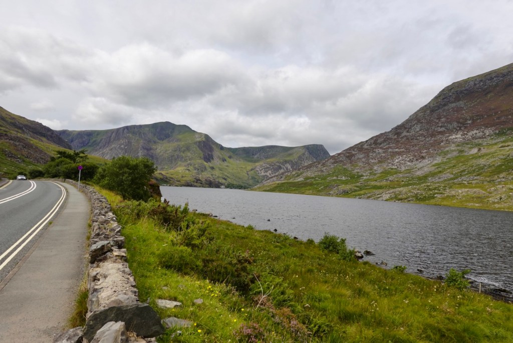
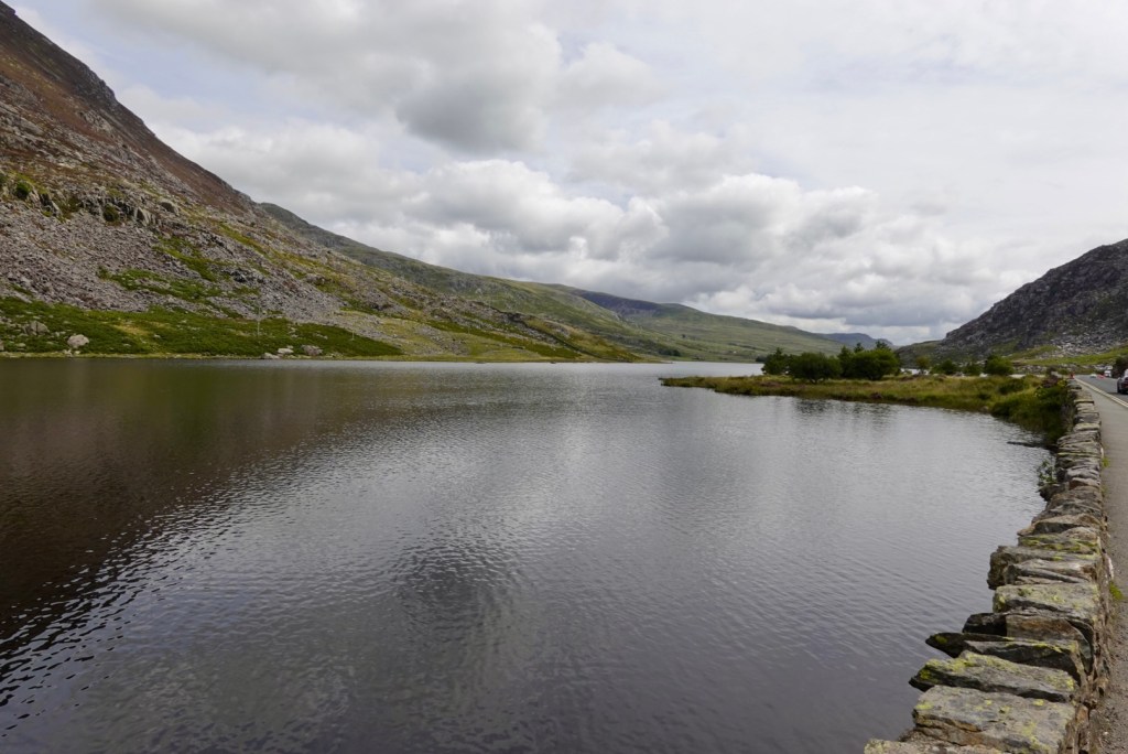
A lake approached. Llyn Ogwen lies at a height of 310 masl, and has an area of 78 acres. It is very shallow with a maximum depth of 3 metres.
Of far greater interest though, it is claimed that after King Arthur’s final battle (Battle of Camlann), Sir Bedivere cast the sword Excalibur into this lake, where it was caught by The Lady of the Lake.
One of the Zwift clubs has referred to me on many occasions as The Lady of the Lake, when we are having a Monty Python banter fest, so riding by this lake did give me a laugh and giggle.
Click to view a video of the lake area.
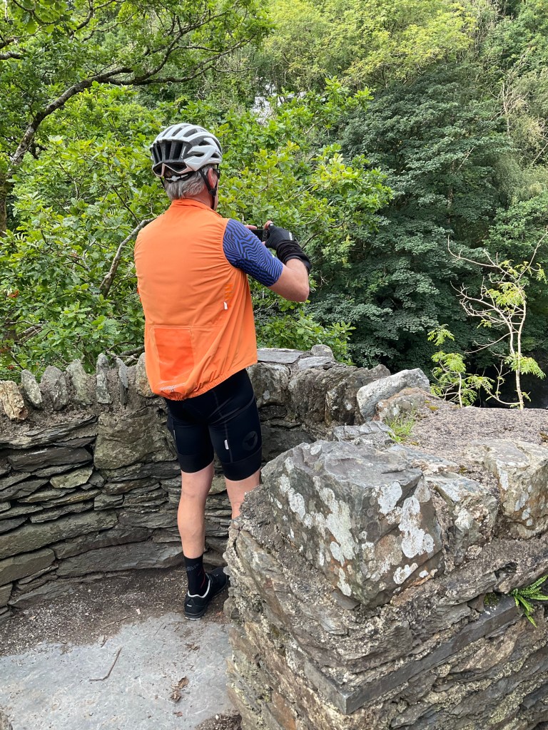
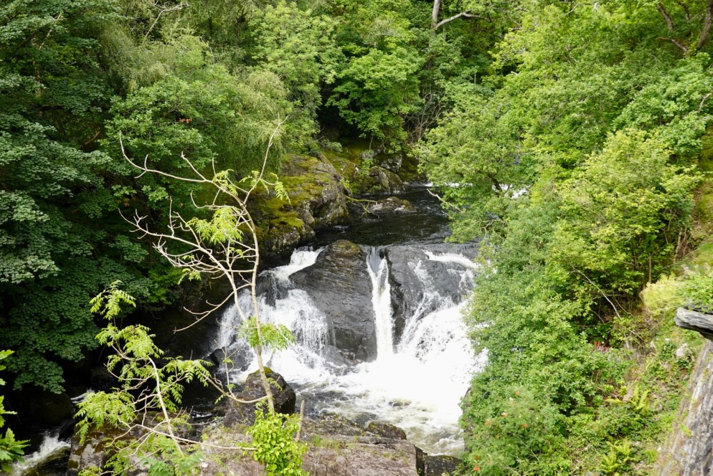
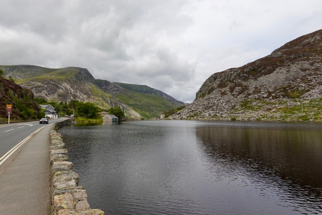
Before we descended we pulled off the road as we crossed a bridge to have a look.
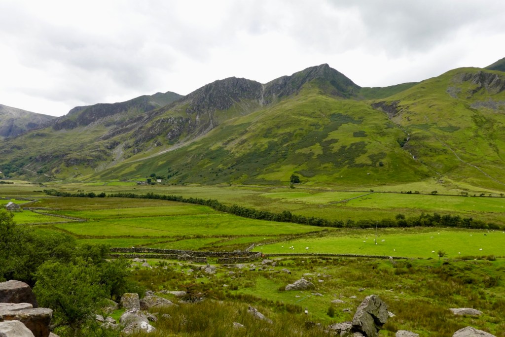
Looking back up the mountains you can see old stone fences.
I particularly liked this one looking down the valley.
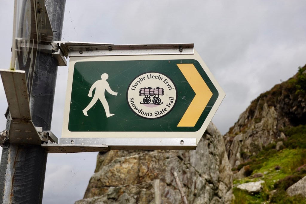
Over the road walking trail signs pointed the way.
Descending and looking back
note all the stone fences
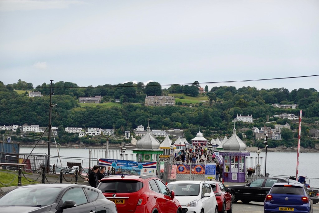
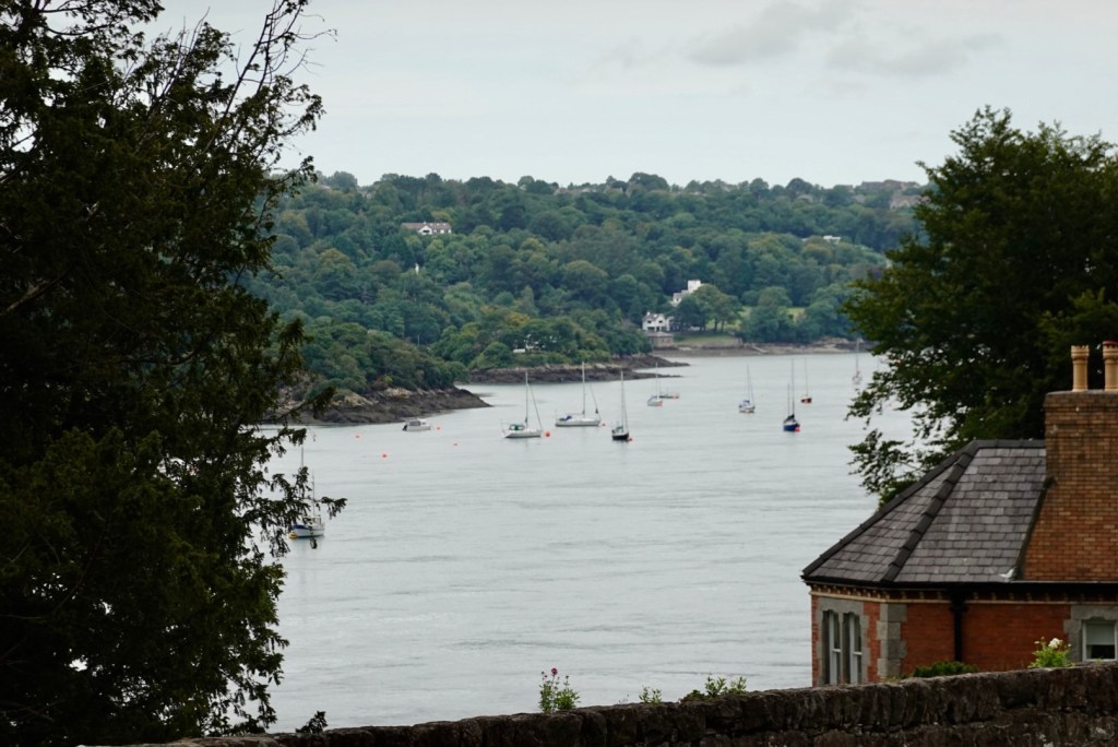
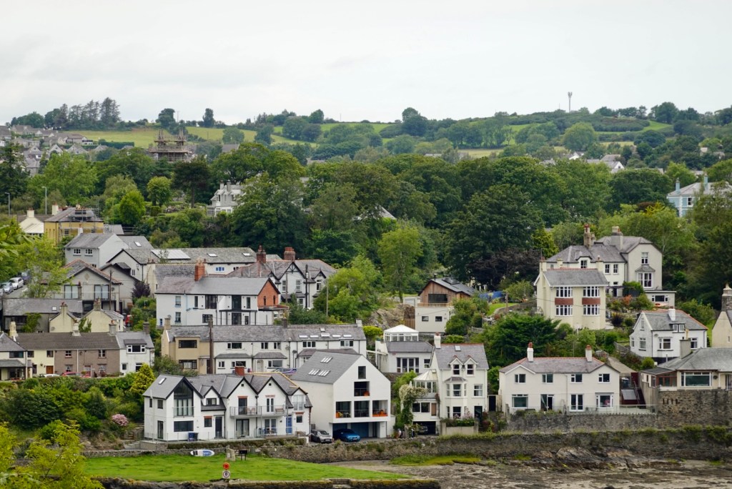
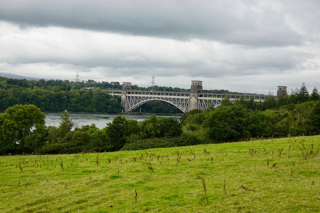
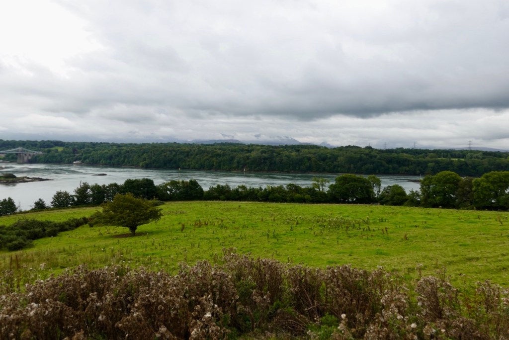
Having left the mountains we arrived back on the coast at Bangor at the Menai Strait. The jetty was super busy.
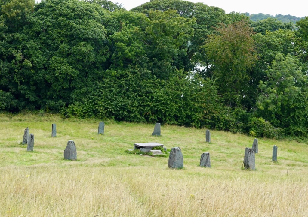
Although there was no interpretive panel, these stones and sacrificial slab are not ancient ruins. I think these are Gorsedd stones, which form an integral part of Druidic Gorsedd ceremonies.
There were pleasant views across the Menai Strait to the island of Anglesey.
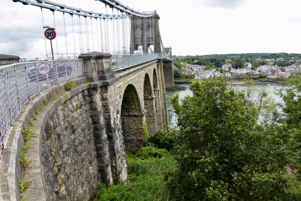
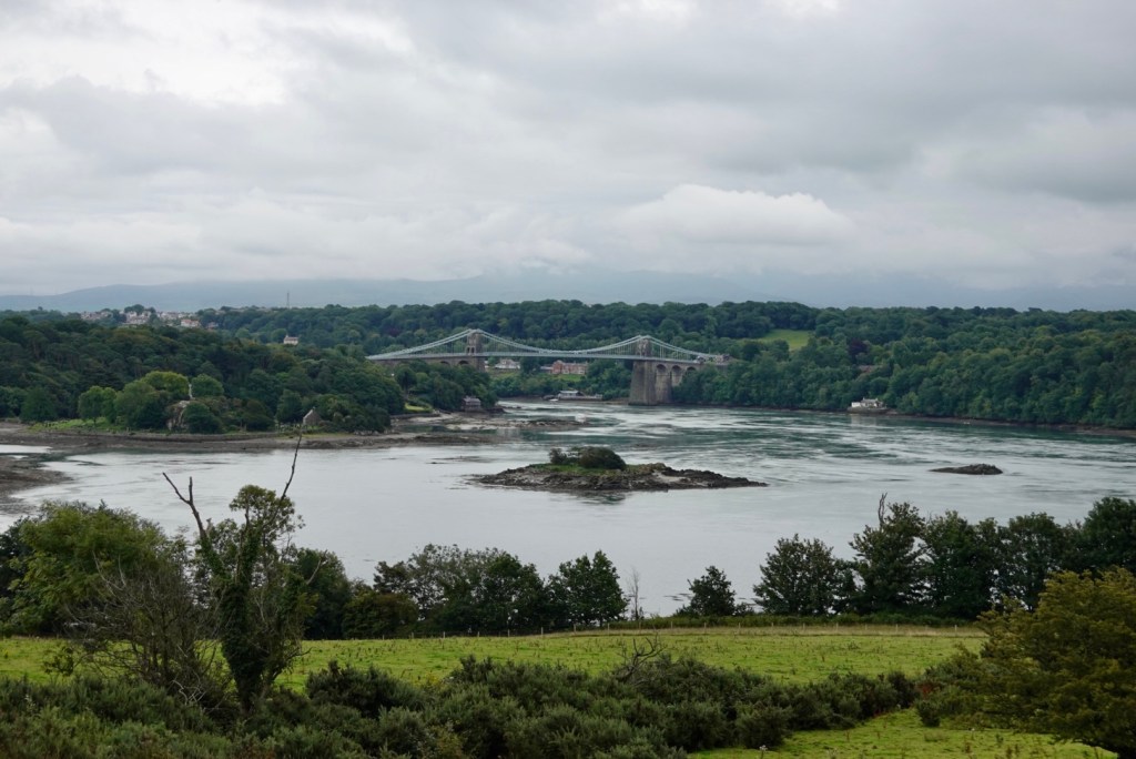
The Menai Bridge was built by Thomas Telford in 1826….I mentioned him yesterday re the aqueducts we visited. He was a super busy man! We crossed this bridge to Anglesey.
Looking back towards the Menai Bridge.
Looking forwards towards the second crossing, the Britannia Bridge.
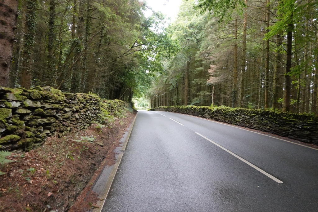
Nice views and forests.
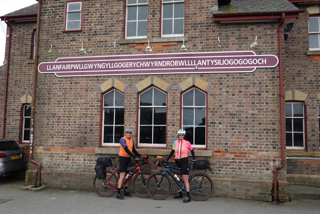
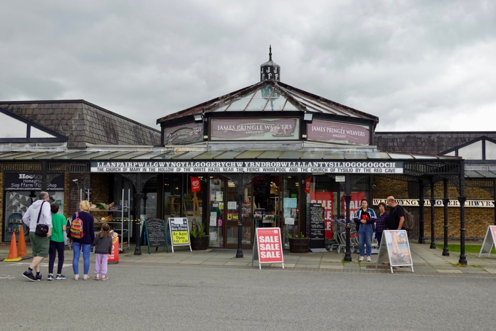
Then we arrive at the town with the unpronounceable name! That is the shortened version.
In full, knock yourself out!
The tourist hub has what it means.
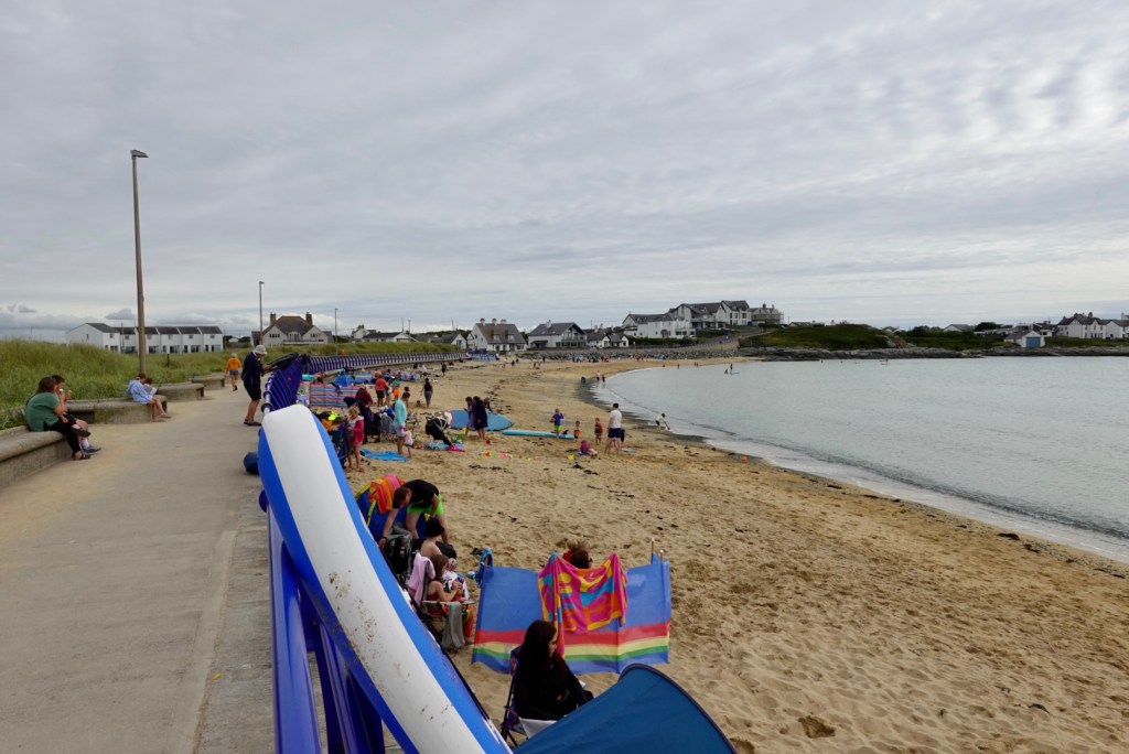
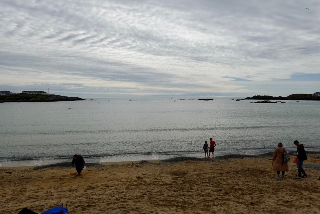
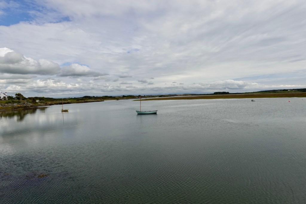
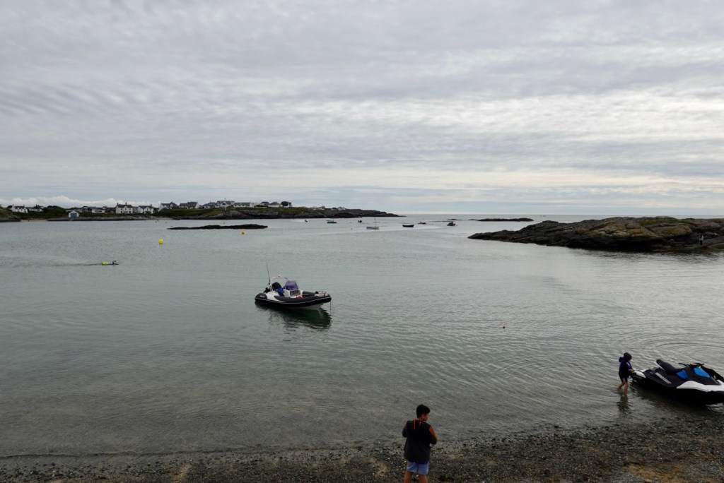
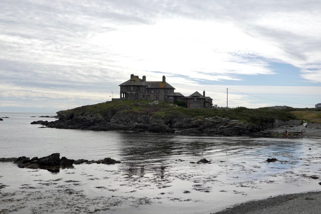
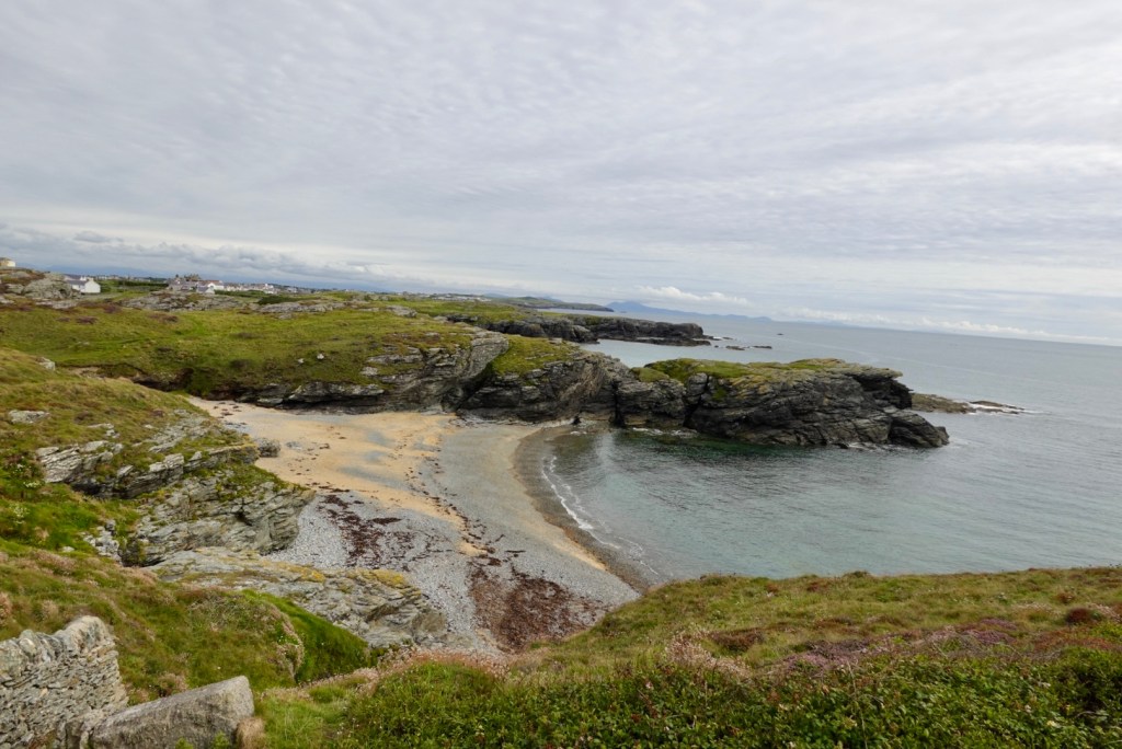
The next point of interest was on Holy Island reached by bridge crossing the Cymyran Strait. Trearddur Bay was busy with bathers and families on the beach. I checked the weather gauge. It was 17C.
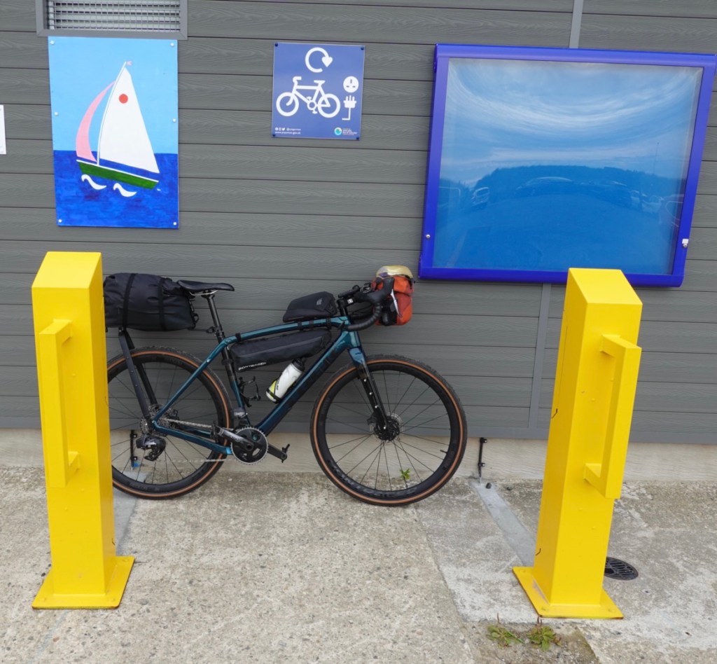
The toilets had a recharge station for e-bikes.
We were now only 5 km from our accomodation so we moved on.
The end of the last climb.
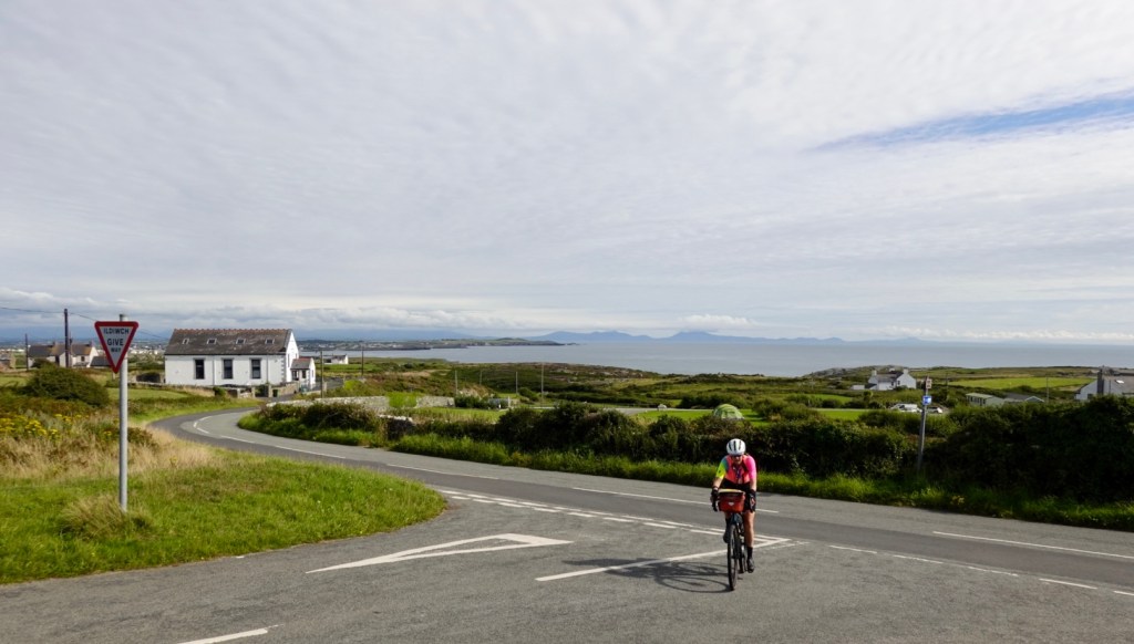
We are now in Holyhead. Another solid day, 117 km and over 1000 m climbing…again!
We ate our breakfast for dinner. Tony has a pinched nerve in his neck/shoulder area so hopefully that might abate overnight.
The weather was cool and blowing a gale when we awoke. We had beautiful harbour views and amazing long, bay windows to enjoy the view.
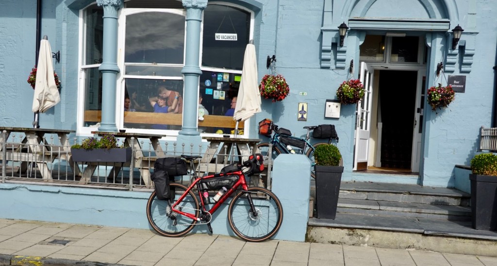
I can recommend the Glenrowan Hotel for cyclists. We had cleaned our filthy bikes up before checking in, and they allowed the bikes in our room. The bathroom was huge and could easily hold multiple bikes without issue.
We had a big bowl of porridge and fruit for breakfast and headed off. We were surprised just how cool and breezy it was.
After a flat one km or so, we entered a nasty one km steep climb up last the Aberystwyth University. With cold legs, lungs and a racing heart, the body did protest greatly, so I walked the second half.
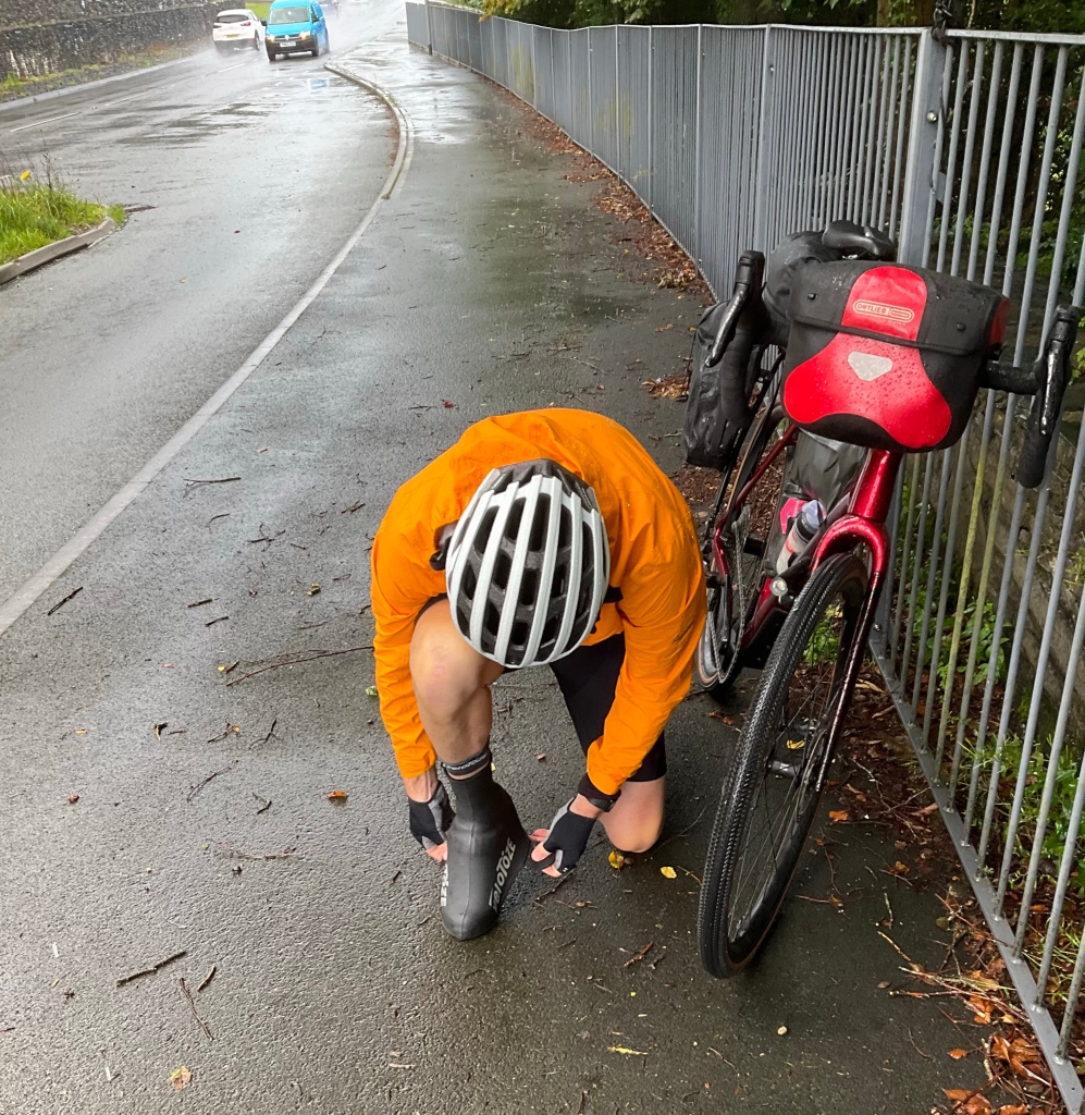
The ride levelled out with ups and downs, and the first of the rain showers hit us. So we stopped in a lay by and popped our booties on.
You can guarantee when you do that, it will stop raining. Looking forward, the rain stopped!
Looking north, it flattened along the coast, and this picture is looking towards Aberdovey, at the mouth of the Dovey river.
We had noticed signs re an osprey project, then saw this metal art work, and stopped to look at it.
Whilst there we got chatting to Shaun and Jason, who were from Cardiff and off on a day trip to the Snowdonia’s.
We headed back in the road in the search for coffee, hoping the town of Machynnlleth would have something open on a Sunday morning.
Machynlleth is a market town in the Dyfi Valley, and the seat of Owain Glyndwr’s Welsh Parliament in 1404, thereby claiming to be the ancient capital of Wales. Owain was the last native born Welshman to hold the title Prince of Wales.
There was a pub open, and we were able to grab a coffee, sitting outside pondering whether to out the rain jacket back on.
I reckon the rain jackets were on/ off 25-30 times today. Put them on, rains, climb a hill, get too hot, take them off. Repeat.
This is a stolen photo showing the town clock, which was significant covered by scaffolding due to refurbishment works. It looked to be the nicest structure in town.
We headed off onto quieter rural roads and crossed this bridge, smiling at the life buoy. It was quite shallow, but fast flowing. I am sure older kids who can swim competently would have some fun here.
This section of the ride was very pleasant, passing through Llanwrin, Mathafam, Cemmaes Road, Cemmaes, Aberangell and Mailwyd.
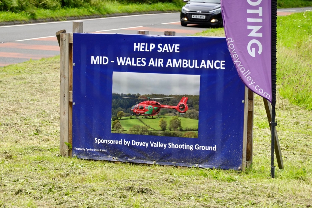
It was a fairly quiet road, except around the shooting range. It seemed very active in the range, with the sound of gunshot echoing around.
It was good that they sponsor the Air Ambulance.
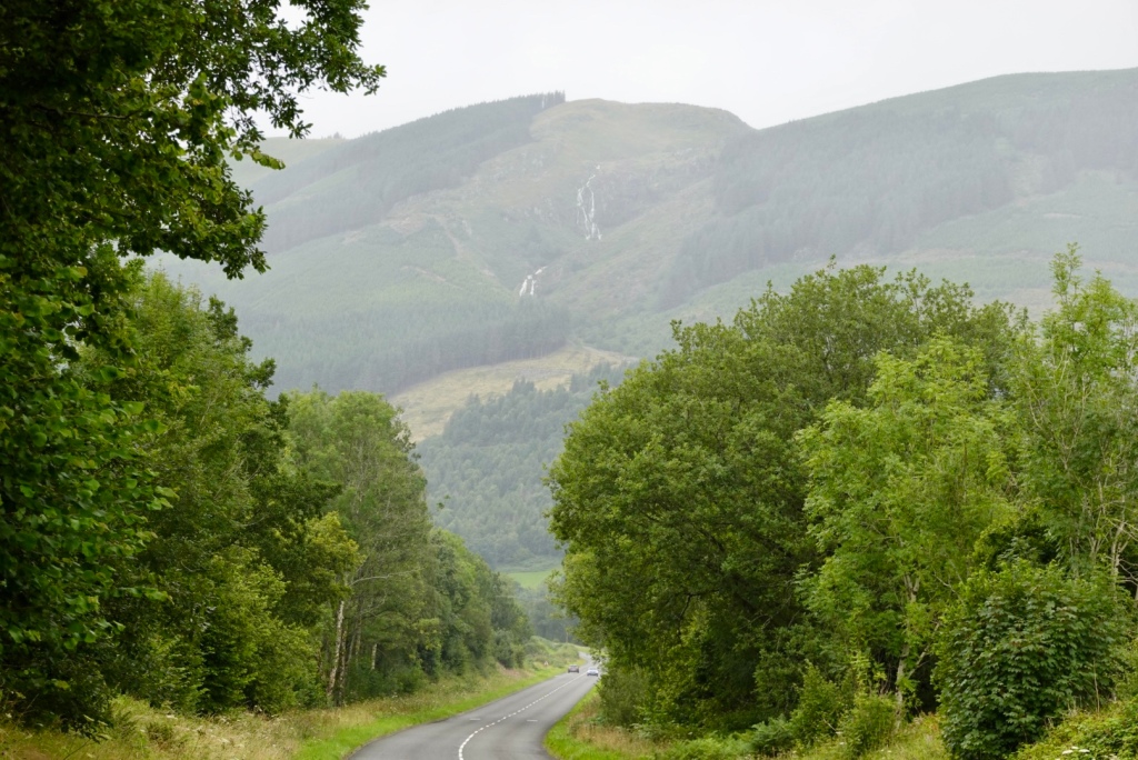
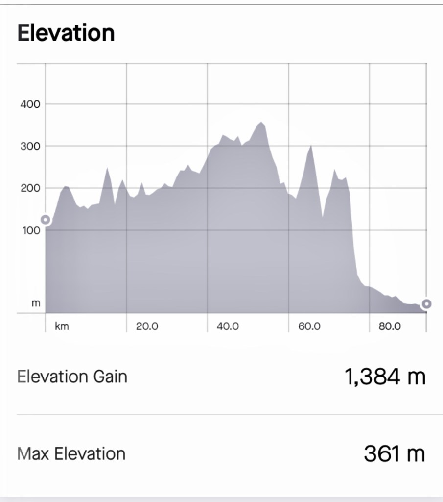
The hardest task of the day way just ahead. We knew it was a tough one. It started to rain again, and we could see waterfalls high in the hills.
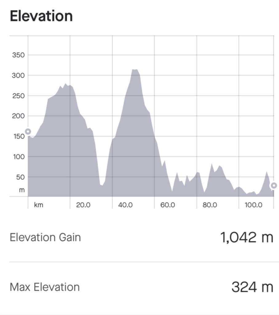
This is our climbing graph for the day. You can see that we had gradually climbed from about the 20 km mark to 47 km. Then there is that brute of a chapel spire.
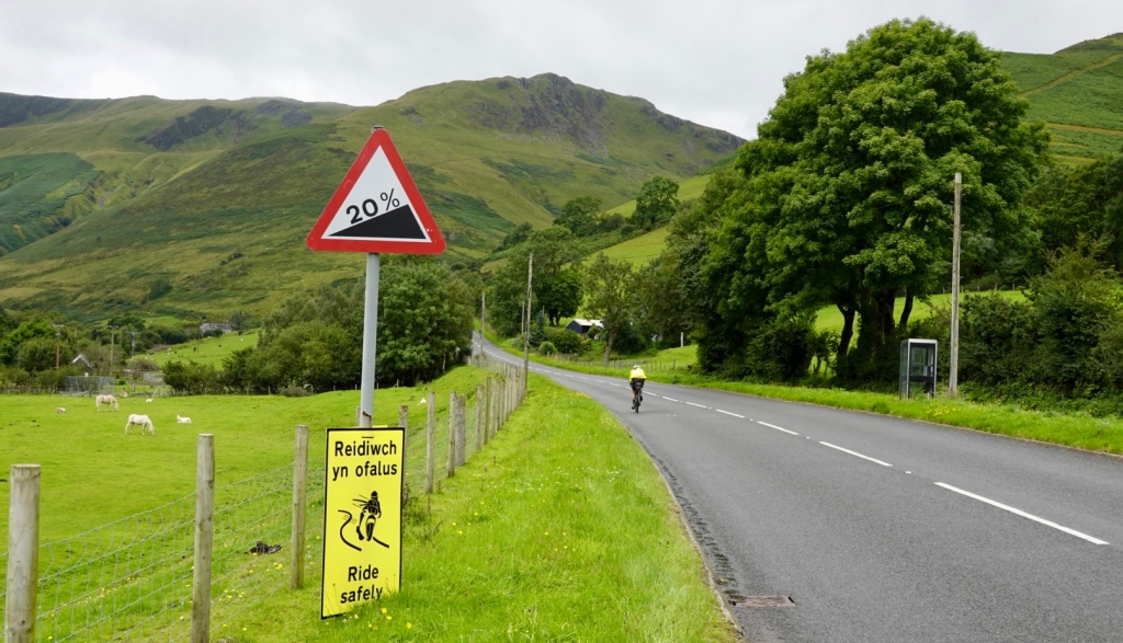
We did not find out until later that this hill had a name, Bwlch Y Groes…or Hellfire Pass.
On the upside, it did offer brilliant views of the surrounding Welsh countryside of the Aran mountains. On the flipside, it was a seriously difficult and brutal climb on a loaded bike.
The road is sealed, but narrow with no verge. It hits a maximum of 25% through some of the ramps. It is regarded as one of the steepest, toughest and most spectacular climbs in the country and regarded as a truly definitive climb.
It was used between and after the wars by the Austin Motor Company and the Standard Triumph Motor Company to test prototype cars and their performance during hill climbing.
Heading up here was the first warning sign and there is me peddling along to start the serious stuff some few hundred metres ahead.
Well I lasted 300 metres or so, and got off the bike. There were a few issues.
I need space climbing so I can weave a little. With the heavy flow of traffic this was impossible.
Then there was the headwind, it was fierce.
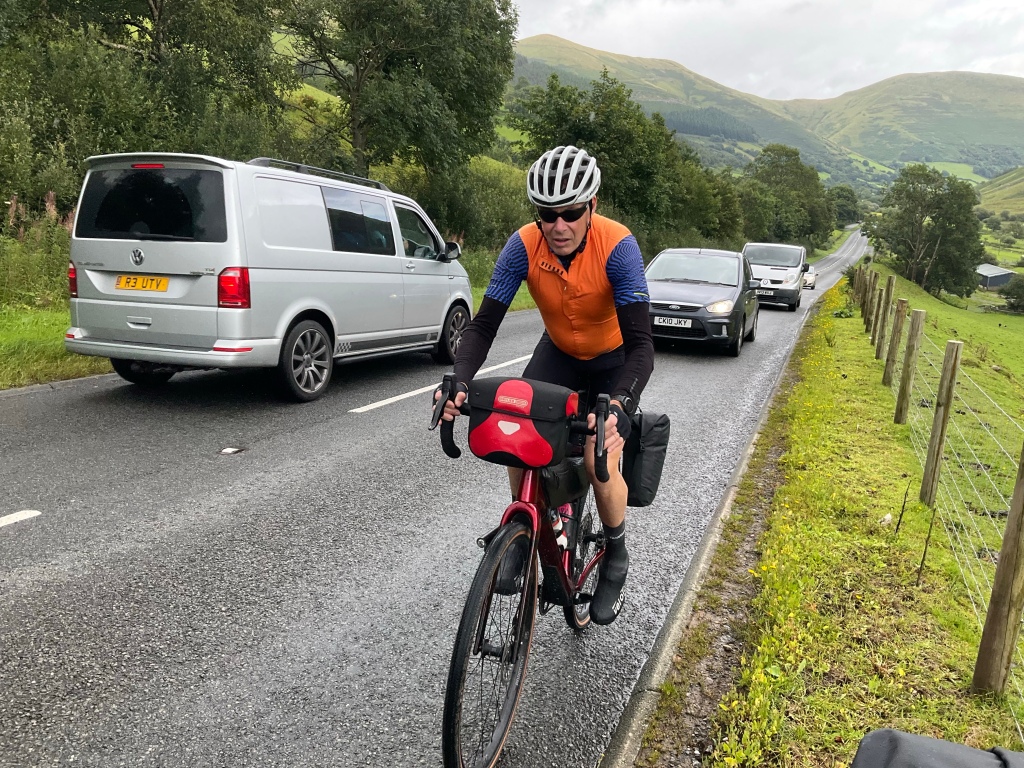
The cars back up on a climb with no verge, and with lots of cars also descending you can frustrate drivers ( mind you, the Welsh drivers have been friendly and fantastic). You stop to let them pass, but climbing is super hard to start again on a slope once stopped.
With an imminent total knee replacement now scheduled, recovering open heart surgery and let’s face it, I did not have the strength nor skill to ride up this. I made the safe decision and walked.
Taking the next few photos was super hard. Holding the bike on the slope, in the wind, without it falling over took all my strength. Pushing the bike up is also very hard.
I swung back to snap this one of Tony. He lasted about another 20 metres. You can see the lack of space on the road.
I did get back on the bike for a few short sections but walked the majority. A camper van stopped and asked if I would like a lift. I immediately said “yes” but then changed my mind as I knew I’d be disappointed to not do this under my own steam.
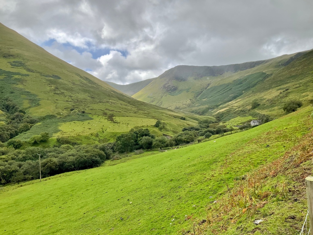
At the top looking back down the valley you can see the road to the left.
The top
Once at the top Tony took a video he later put onto social media. Near the end of the video there was a toot from two motor cyclists. Amazingly it was Shaun and Jason whom we had met earlier in the day.
Descending was pleasant. We liked these old stone walls.
The views opened up, and we looked forward to Cross Foxes, a pub located at a busy road junction part way through the descent.
Boom, and here we are. We got a table outside, and do you note something? It is sunny!! It had been slow progress to this point and we felt we would be getting to Corwen at dinner time!
The post lunch ride was totally different. It was downhill for a while, then a series of uphills, and then undulating for the rest of the ride. We made up some time as we were able to ride at a faster pace.
Some of the views.
This is Lake Bala. To the left, there are people swimming in the lake. there was a campground full of campers.
Bala Lake was the largest natural body of water in Wales before its level was raised to provide water for the Ellesmere Canal. It lies between the Aran and Arenig mountains at the fringes of Snowdonia National Park.
Getting closer to,our destination we enjoyed this forest.
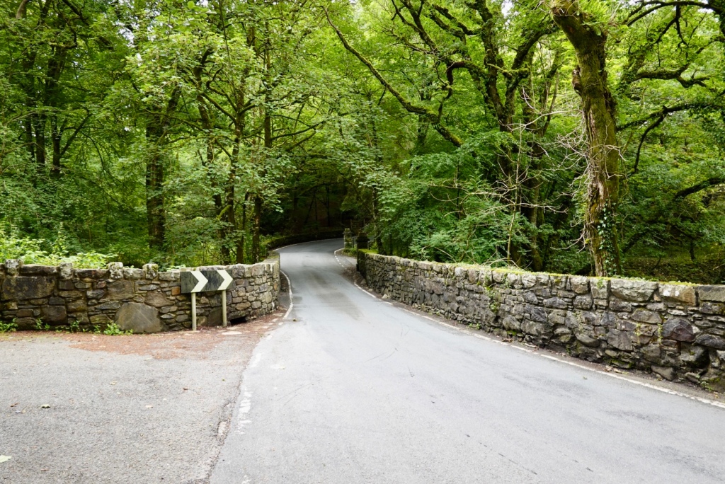
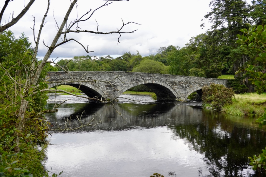
Stopping to photograph this bridge, that we then rode over.
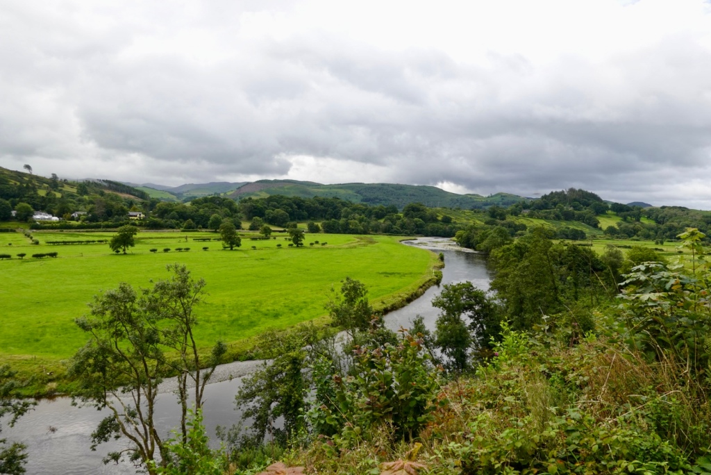
Looking down towards Corwen, we were ready to finish.
Nearly there!
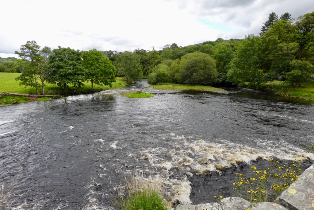
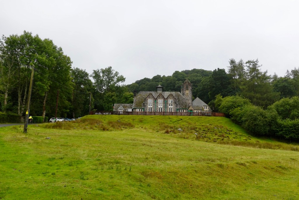
Corwen stands on the banks of the River Dee beneath the Berwyn mountains. There is a man standing in the river fishing.
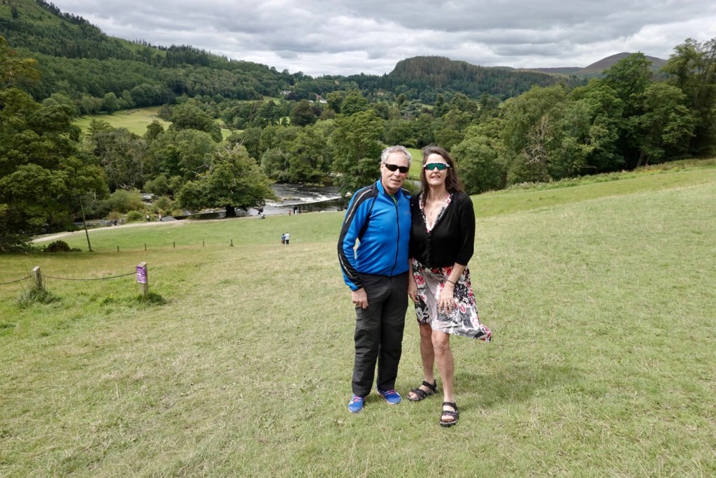
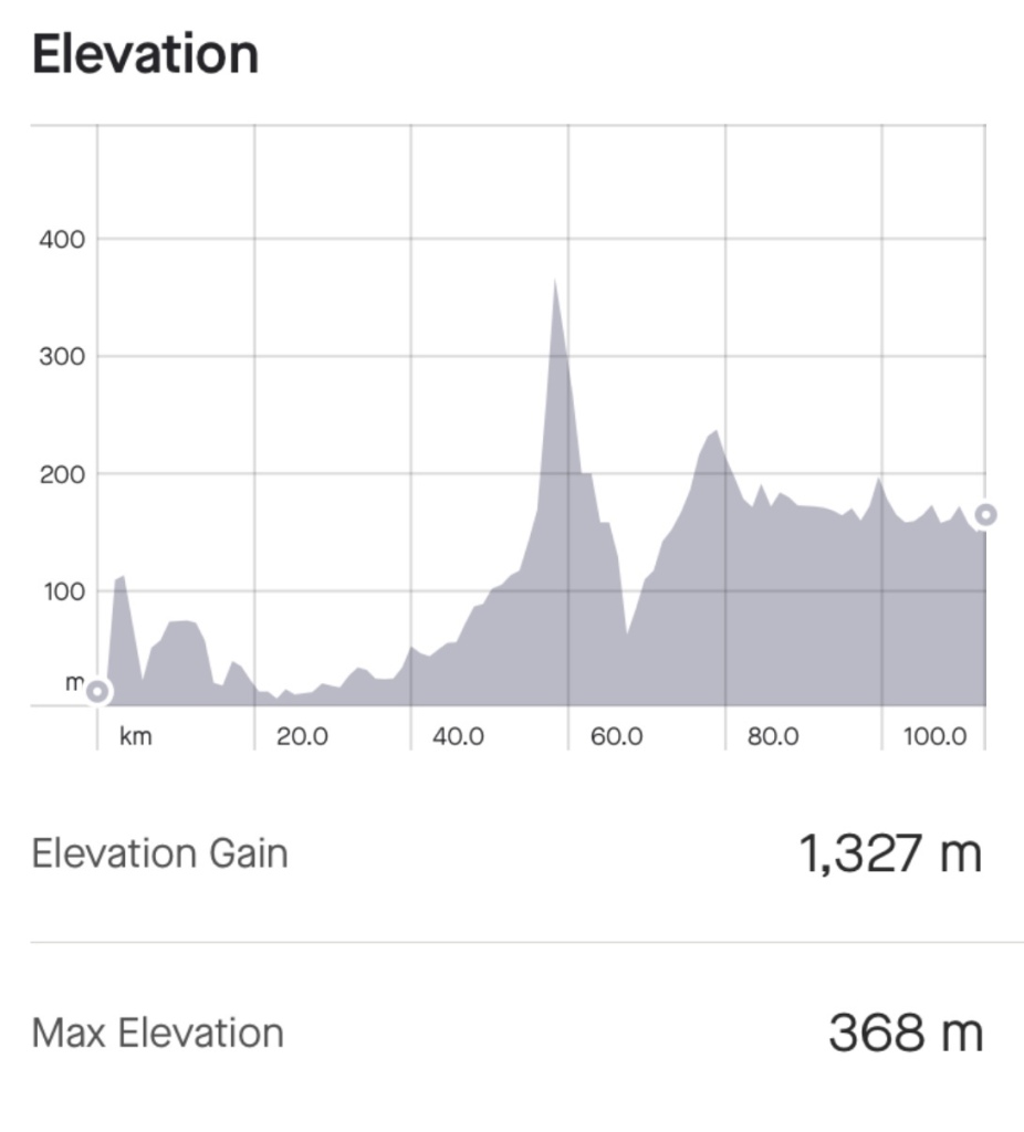
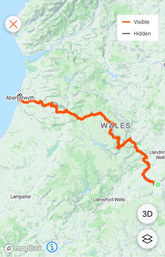
After 114 km and 1327 m climbing, we arrived at the home of Alan and Sue. We have not seen them since they visited Australia around 2015. We had ridden Lands End to John O’Groats with Alan in 2013.
I did not write the blog last night as we chatted. Instead I got up before 5 am, whilst the house sleeps, to do the blog. It is now 7.15 am, and the house is still quiet.
We have our first and only scheduled rest day today. The day is looking beautiful.
Following on from last nights Storm Antoni warning, we were in a conundrum as to what to do. Safety is paramount.
Options included getting the train to Shrewsbury, staying there, or getting a second train to Aberystwyth from Shrewsbury.
Our friend Graeme rang us with his thoughts and he suggested a taxi to Rhayader and riding from there.
We went down to breakfast at 7.30 am still unsure. There was a lady cyclist from Germany there pouring over train time tables. We chatted and she was also unsure as to what to do.
The guy in the corner said it was going to hail today. I jokingly told him we did not need that kind of negativity, laughing. He laughed and said it was a typical Welsh summer.
The owners of the accomodation said the only taxi was a sedan.
We has a very yummy breakfast and went outside and looked around. We rechecked the rain radar, wind forecasts and thought we would just go for it. Whilst it was likely to be wet, for the majority the wind would not be an issue.
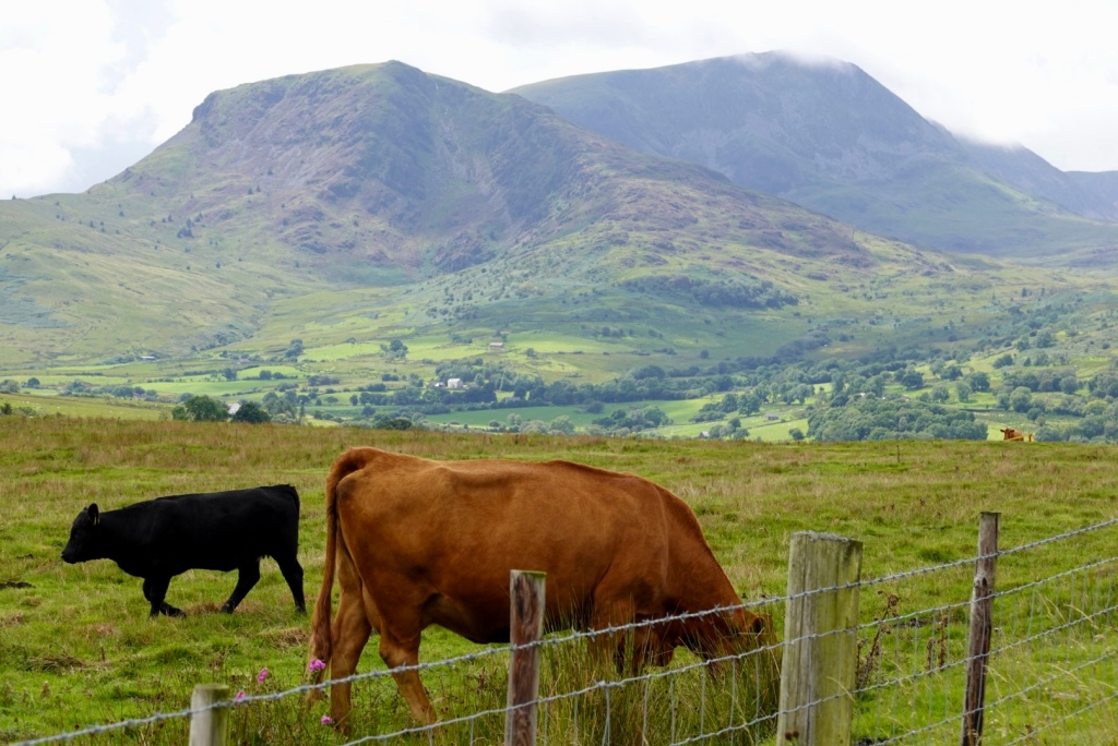
Heading out of Builth Wells past the random cow, we followed the river. Park Run was setting up for the diehards.
The first two km was pleasant following a bike path adjacent to the river. Then the climbs started.
Down one hill and looking up to the next short climbWe were predominantly in an agricultural area except for this church.
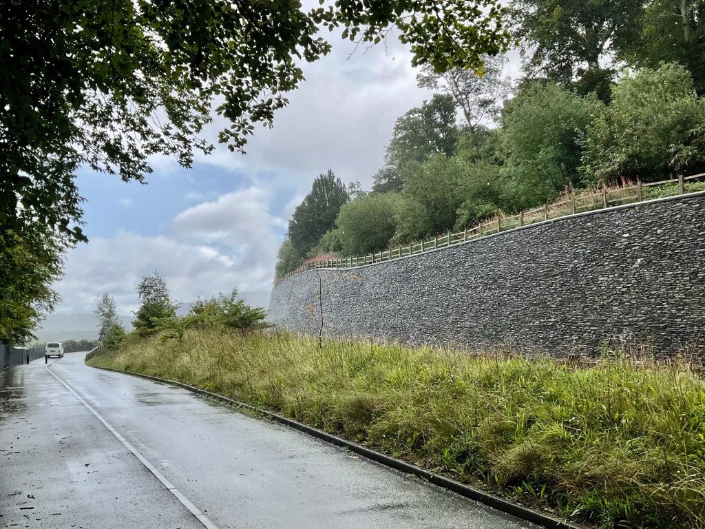
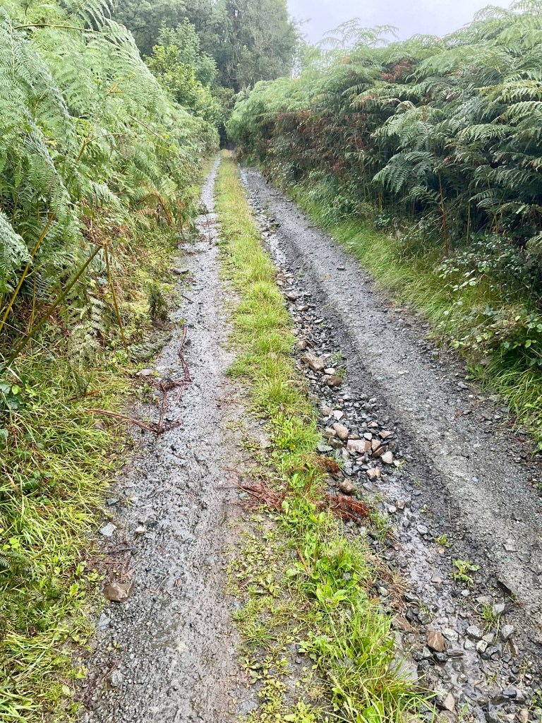
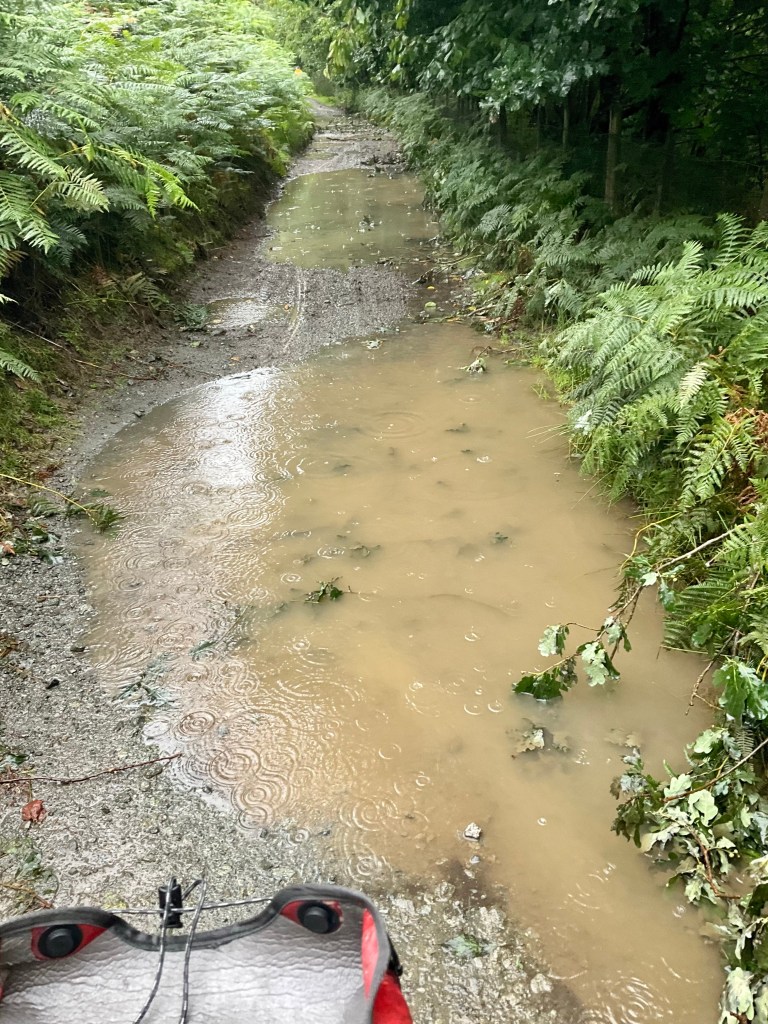
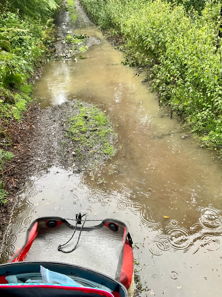
When Graeme suggested we bypass the first part of todays ride it was partly because of this ‘cycle path’ being unsealed, and of course, the recent rain, that was continuing to fall.
When we started, it looked like this. Ok, we could cope with that. But then it went into a 2 km climb and the puddles dominated.
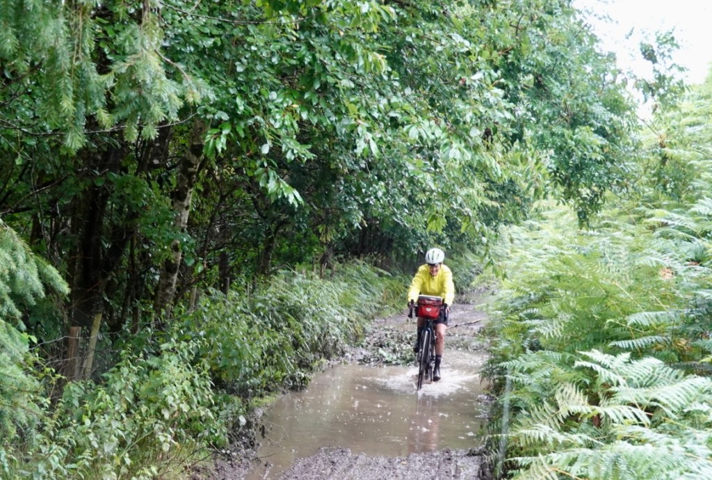
It is hard to tell how deep the puddles are, unless Tony is ahead of you 🤣🙈 but then he coped better than me, and pulled clear.
I really thought I would end up on my side, soaked. However, proud to say I got through this 5 km quagmire unscathed, bar my filthy legs and bike.
Tony managed to snap me going through one. There was one super deep puddle. The water went up to my ankles as I peddled through.
There were pleasant views, and this looked like a pretty fancy home.
We popped out at this village, and I did not write down the name. From the signpost, it appears to have many walks in the area.
Tony managed to be considerably cleaner than me on his legs. He grabbed his drink bottle and squirted water over our disc brakes to clean them.
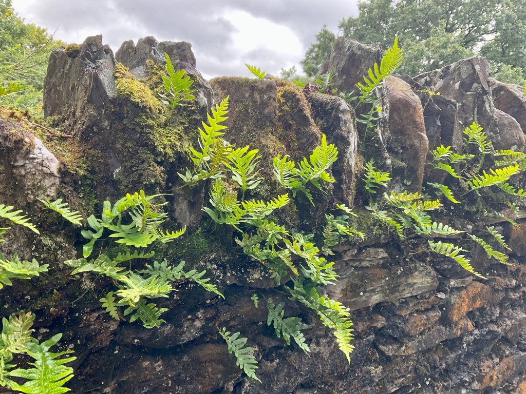
On the next sets of climbs, we were on sealed single track, with the occasional house or farm. I really liked the ferns on the stone wall.
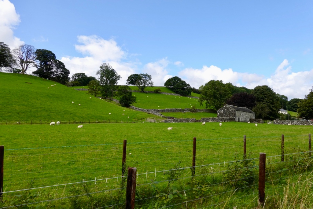
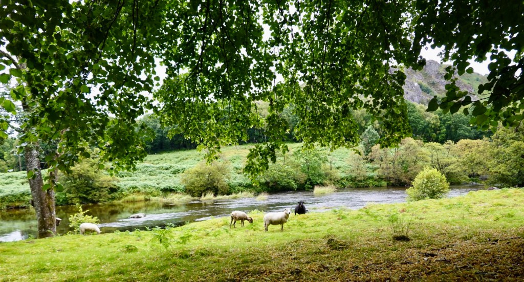
We stopped here, as we thought this was a very pleasant sight by the river, with sheep grazing. Sheep seem to freely roam these parts.
Another flash home.
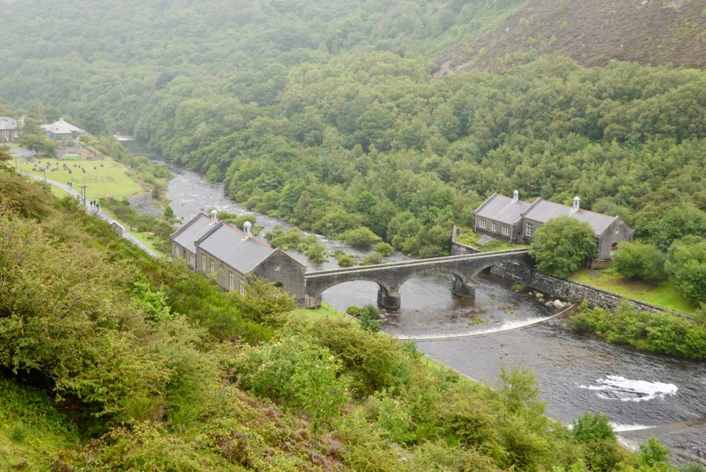
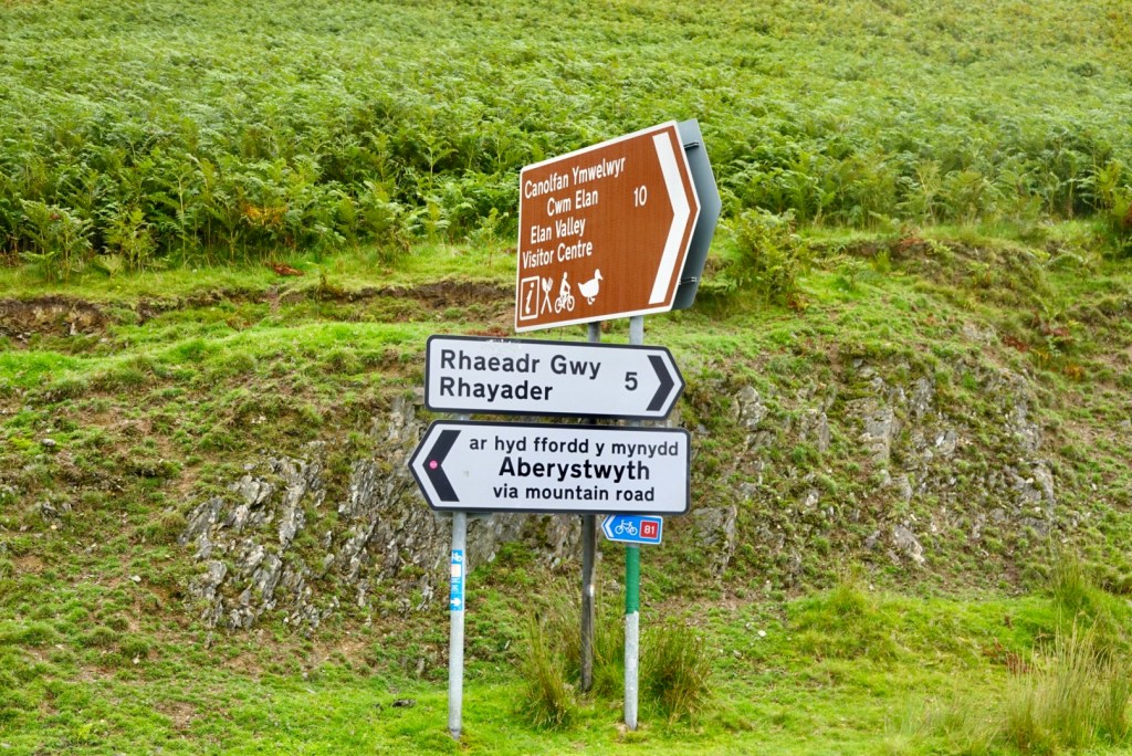
We turned right to ride through the Elan valley. We arrived at the Elan Village looking for a toilet and food, as we thought the visitor centre looked closed as we rode past.
I went up to the Elan Valley Lodge to see if we could purchase a drink. I was told “No, this is a private lodge”.
The village and reservoirs were designed by the architect Herbert Tudor Buckland as part of the scheme, and the village is the only purpose built model village in Wales.
Call me ignorant, but the village seemed to me to be a string of building all in a row. Maybe I missed something.
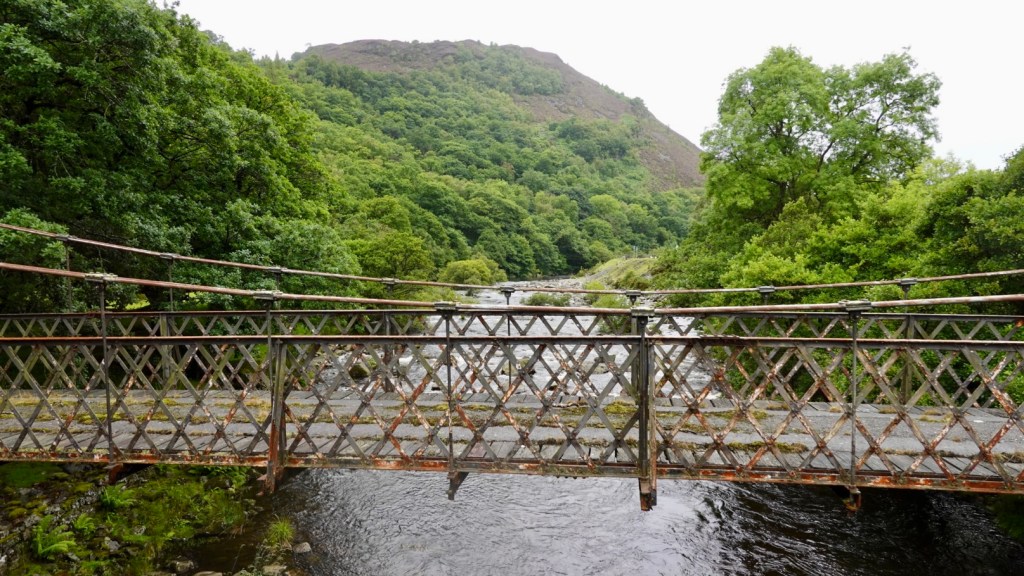
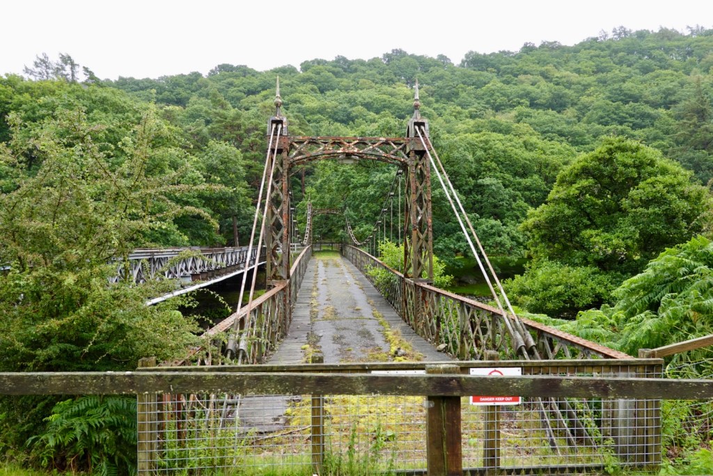
Heading back out across the river, there are these old bridges.
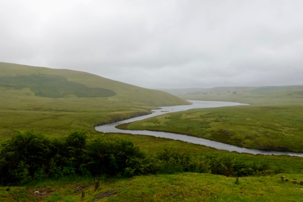
The Elan River, looking south from the bridge
As we rode past the visitor centre, the buildings we presumed to be closed, were in fact, not in use. We needed to ride a farther 300 metres or so past the entrance. We found our food and coffee!
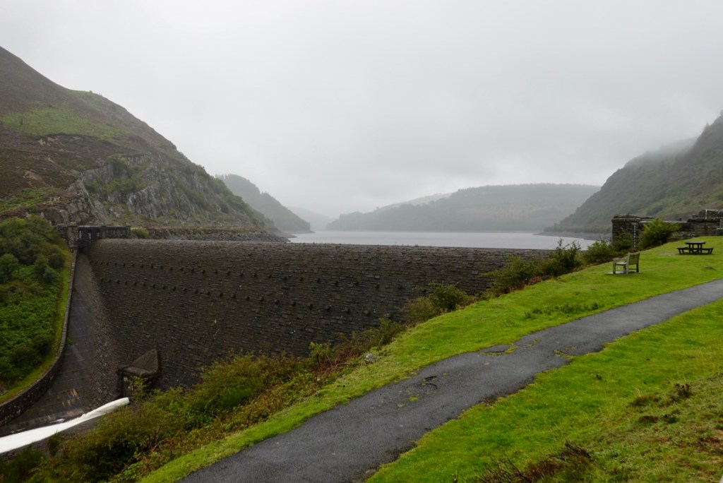
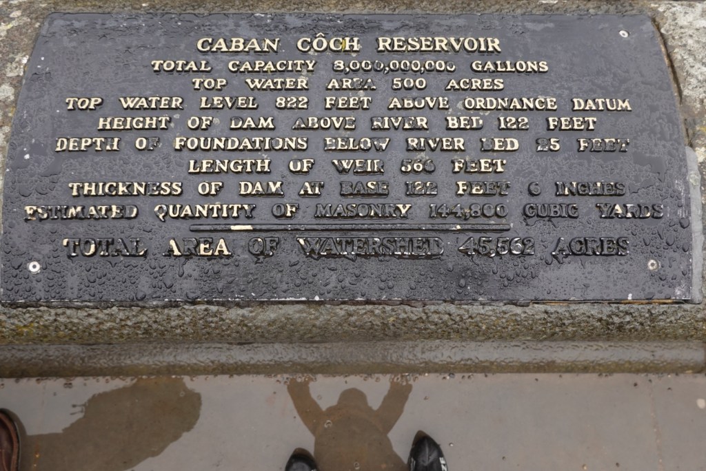
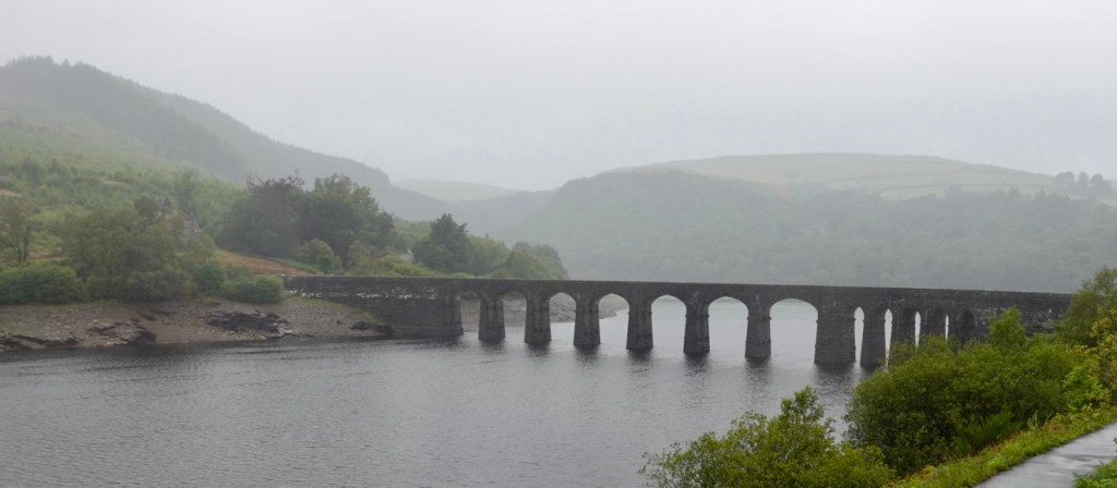
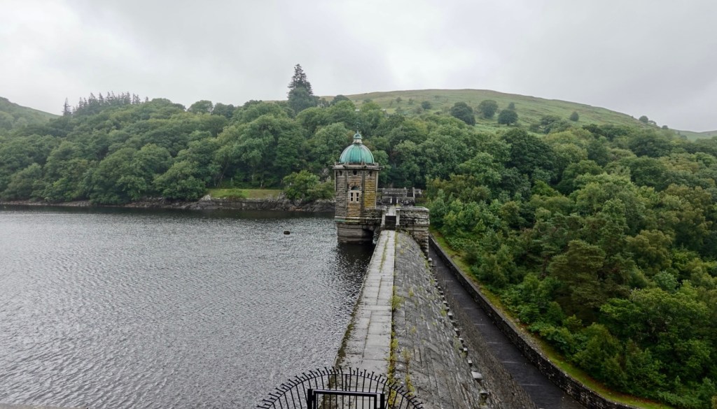
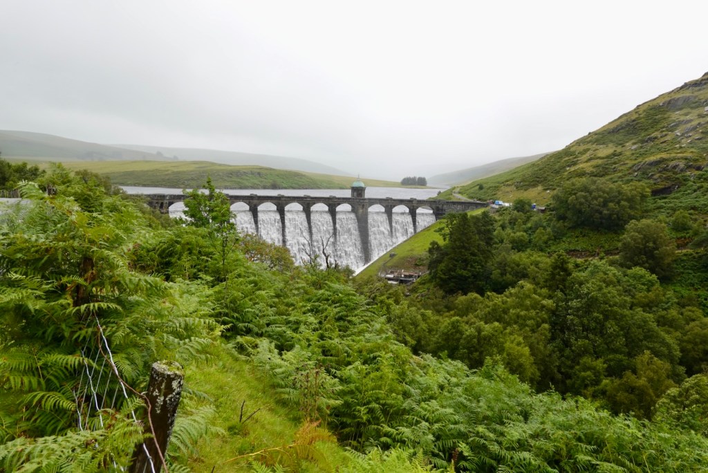
The Elan Valley contains four dams along the Elan River.
It is also famous for its picturesque scenery. Over 80% of the valley is designated as Sites of Special Scientific Interest, and a popular cycle trail, the Elan Valley Trail, makes a loop from Rhayader around the reservoirs.
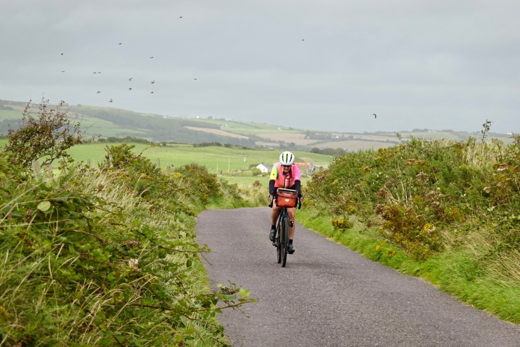
In between dams we were passed by these two cyclists. We did laugh at how keen one was for this photo, standing in the water with his bike.
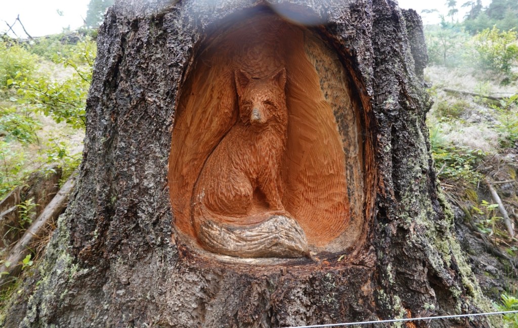
We noted many trees had been cut down. Carvings had been done on numerous.
Back to the dams….
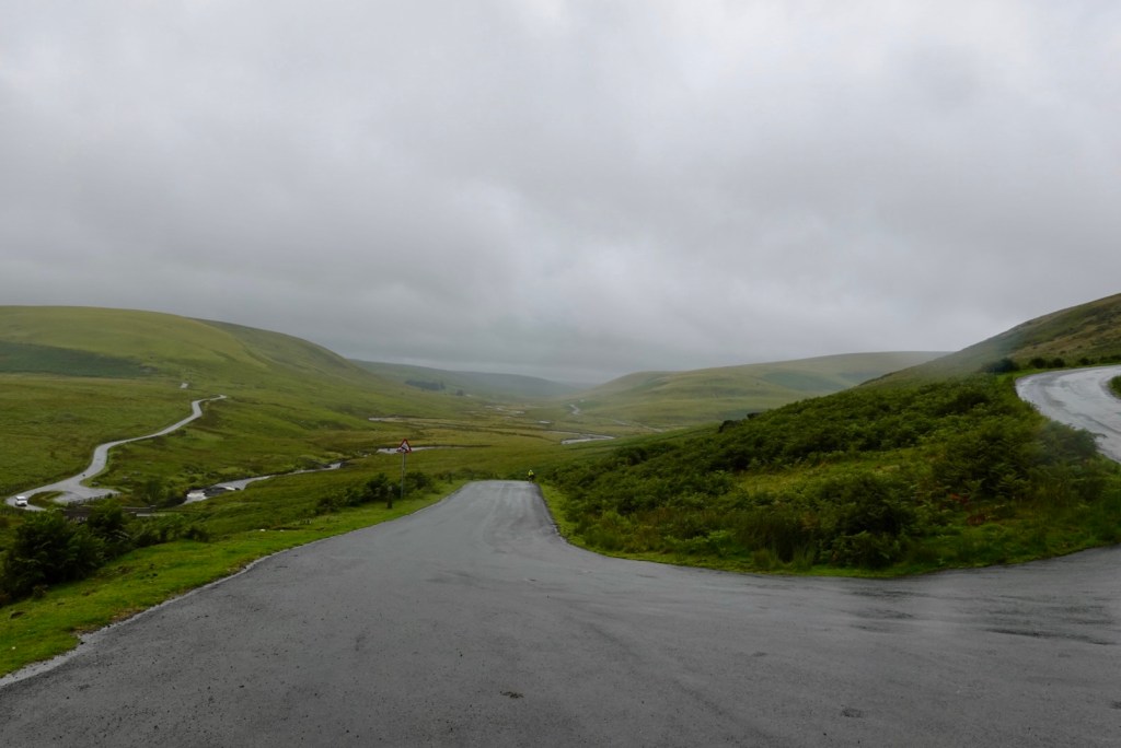
The dam is overflowing here, going under the lovely bridge.The road goes up, then up a bit more to the junction. You can see further down the valley.Eek, via mountain road …hmmm
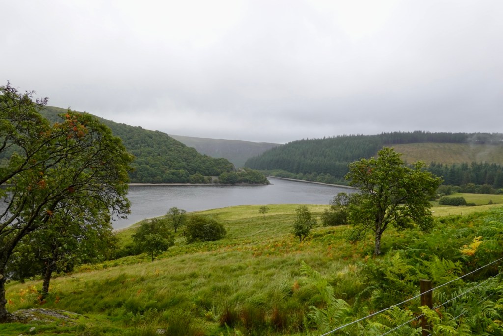
As it turned out the mountain must have been more hill like, but the views were outstanding here. The area reminded us very much of Scotland.
We descended down to that white dot of a house
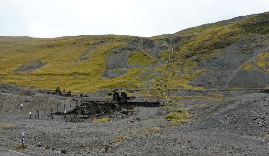
This area was interesting, with many km of mining residue on both sides of the road. Lead mining used to be very prevalent in the region. Piles of waste are dumped everywhere. Old buildings are all destroyed, looking like there had been fires within?
Oh here I am again, climbing, with Tony waiting. Today there were six climbs that had pinches over 20%. Tony rode each of them. I walked those pinches! No way can I do 20% even without gear on my bike.
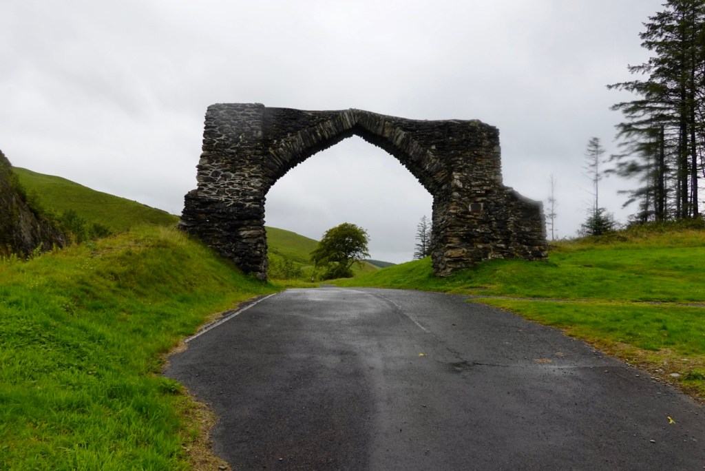
At the top of this climb was “the arch” a former gateway to a local estate. But marking the start/finish of the Elan Valley
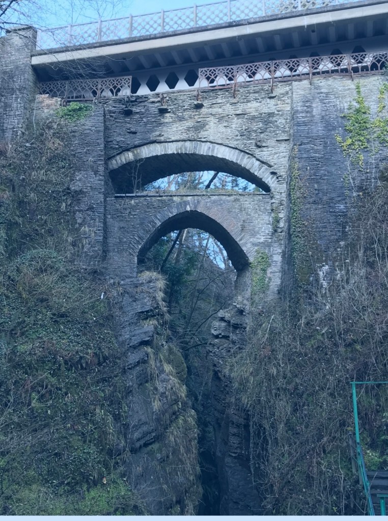
Next stop was Devils Bridge – unique in that there are three separate bridges, each one built upon the previous bridge. The most recent was an iron bridge erected above the older arches in 1901. The original bridge is medieval and the second was built in 1753.
The name Devils Bridge was named reportedly after an old woman lost her cow and saw it grazing on the other side of the river. The Devil appeared and agreed to build a bridge in return for the soul of the first living thing to cross it. When the bridge was finished, the old woman threw a crust of bread over the river, which her dog crossed to retrieve, thus becoming the first living thing to cross it. The devil was left with only the soul of the dog.
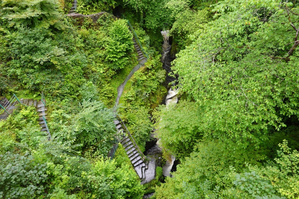
Not taken today, I’ve stolen this one, but showing the three bridges.Standing on top of Devils Bridge, looking down, walkers head down to admire the bridge and river.
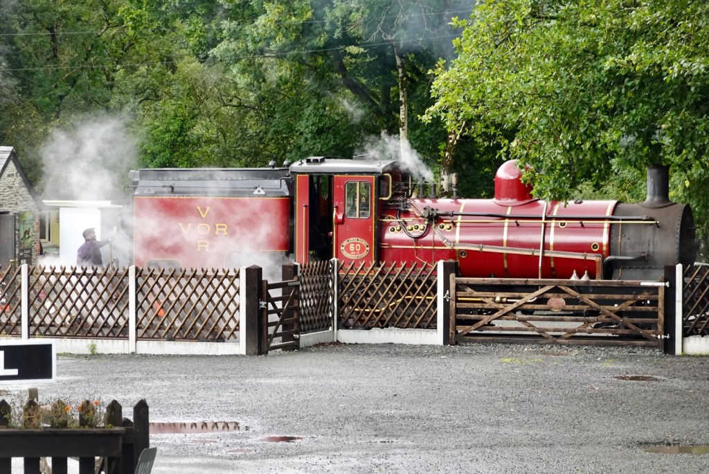
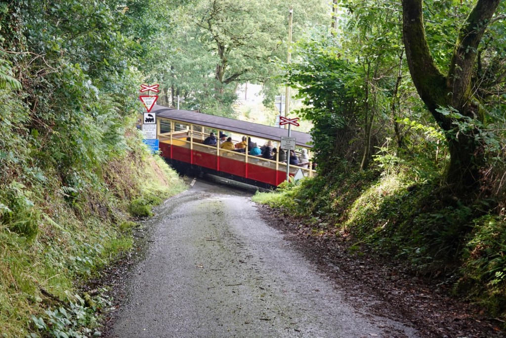
During the summer a narrow guage railway (The Vale of Rheidol) runs 19 km from Aberystwyth to Devils Bridge. The railway opened in 1902. Since 1989 it is operated and maintained by a charity group.
After all our climbing, we needed to get back to sea level. We did this on a cycle trail down this narrow road. The skies are lifting, and the rain has stopped.
It was super steep. My hands ached from squeezing the brakes so hard. There were pitches in excess of 25%.
On a steep descent section, we needed to give way to the train heading back to Aberystwyth.
There was about another 10 km before arriving in Aberystwyth, and it was blowing a gale on the waterfront. It was a super strong headwind with gusts.
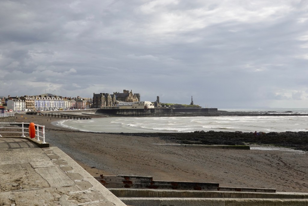
Aberystwyth, a university town, is situated on Cardigan Bay on the west coast of Wales. A long seafront with a pier stretches from Constitution Hill at the north end of the Promenade to the harbour at the south.
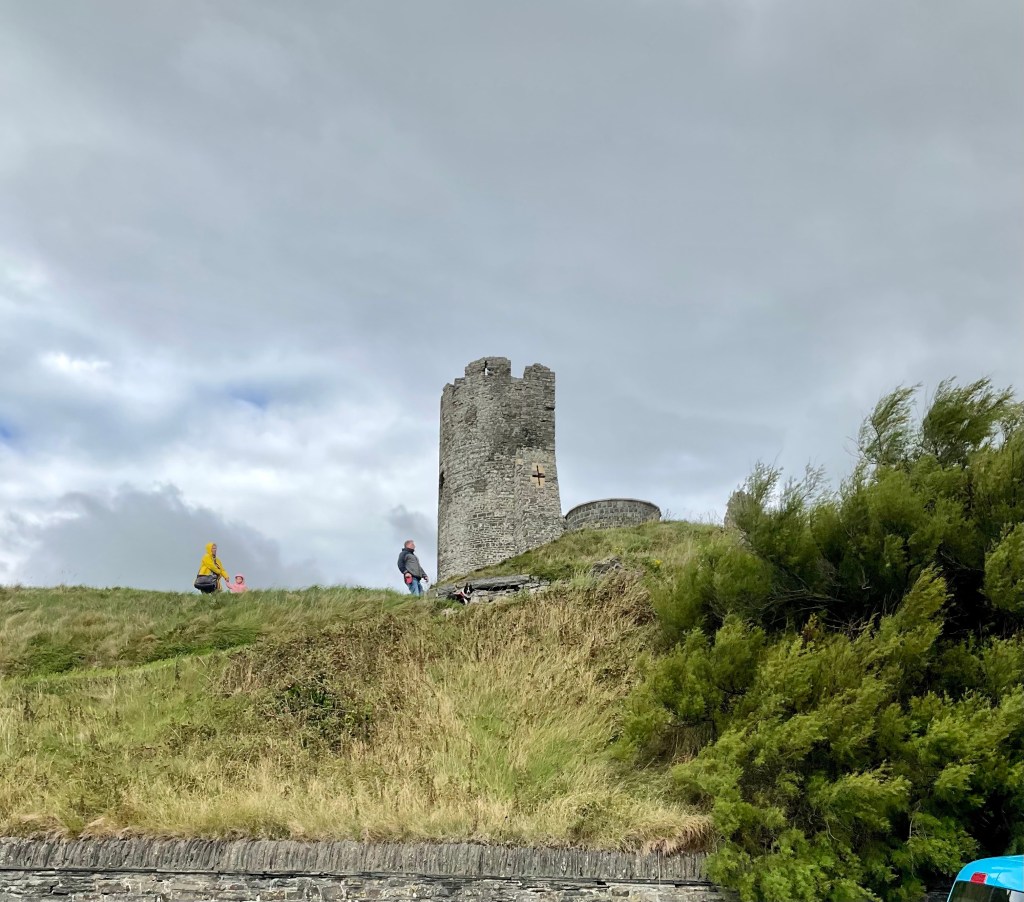
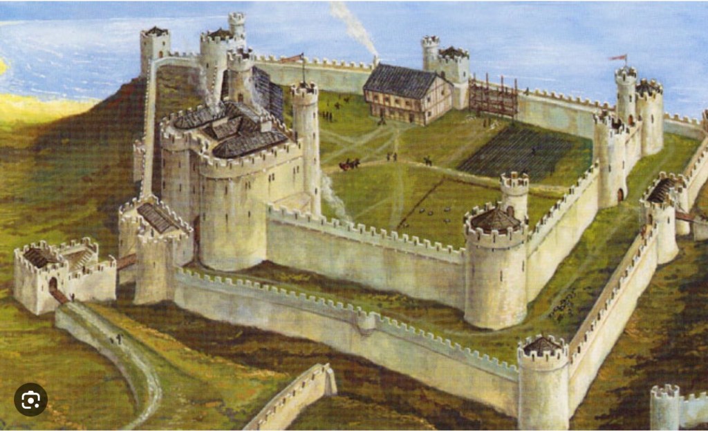
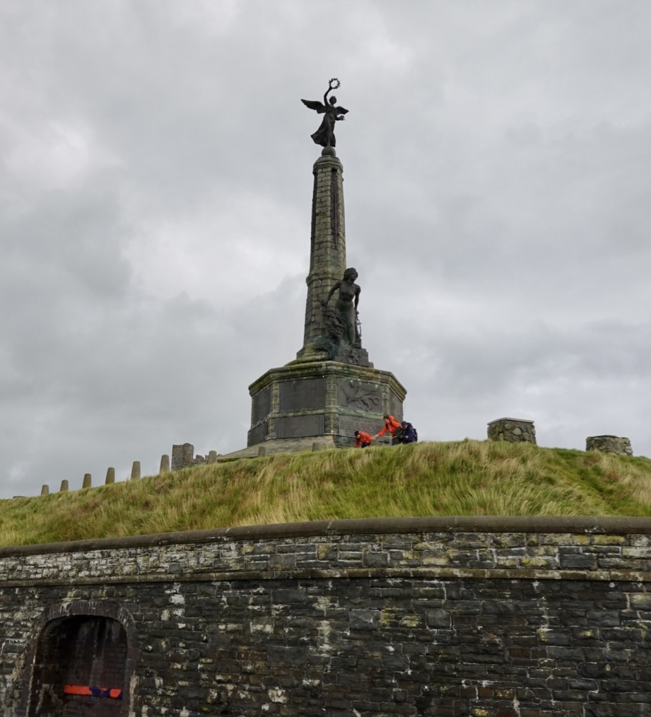
The beach is divided by the ruined Aberystwyth castle (1277) that was destroyed by Oliver Cromwell in 1649.
Part of the remains. Look at the angle of the tree limbs. It is super windy.What the castle looked like way back,when.
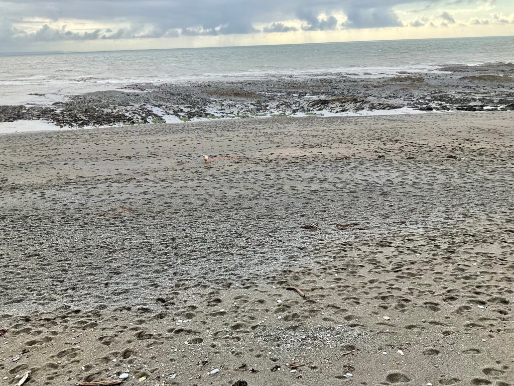
Our final stint was to head down the far end of the waterfront to the coloured buildings. Our accomodation is in one of those. The tide is low, with substantial exposed rock.
Nearly at our accomodation looking back towards the castle ruins
When we arrived at our accomodation, the sun came out. Of course!
The beach over the road from the hotel Waterfront sea view looking towards the Republic of Ireland, with the Irish Sea in between. We arrive in Ireland on Wednesday.
Today was tough (95 km and 1385m ascent). Yesterday was tough too. It rained today for about 90% of the ride. Just consistent mizzle and drizzle interspersed with some heavier showers.
We did get a bit cold there for a while thinking about warmer clothes in our bags. We could have stopped but did not fancy stripping off in the rain.
The challenges today were definitely the 5 km of dirt and mud. I found that super challenging.
We had six climbs with over 20% but got through them each in our own way.
The views scored highly!
Thanks to Graeme for this route. He did this with his daughter Matilda only a few weeks ago, also staying in this hotel. Great recommendation.
Tomorrow is another day. It is another biggie with 115 km planned and about 1500m climbing. I’m not even checking the weather tonight. I tend to wake by 5 am so I will do it then.
Thanks for reading, I’m going to get some shut eye now. 😊❣️