Farewell to The Alps ( Torbole to Vicenza – 90 km, 1481m)

day15l2v

image
The view outside our bedroom window at 7 am.

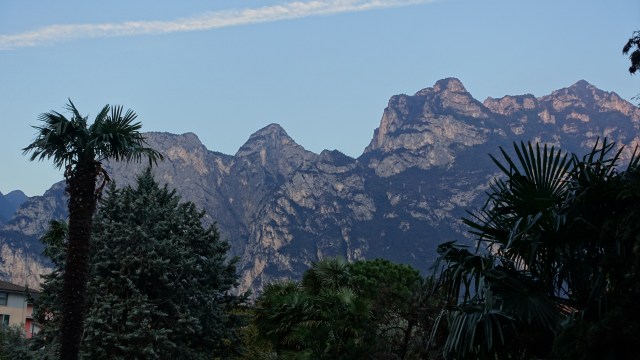
Today we bid farewell to The Alps that had challenged us in so many ways in the last week but first we had other issues to contend to at the hotel in Torbole. Breakfast.

Breakfast opened at 7 am. There are 75 rooms at this hotel on Lake Garda and they had guests including a bus load of obese Germans. Getting into breakfast was a difficult descent down the stairs as the Germans pushed and shoved to get there first. Elbows were flying. Quite a blood sport.

Amazing how fast they can move when food is involved. They piled their plates so high that structural engineers were required! Hungry cyclists who are averaging over 100 km per day and have been climbing peaks can eat! But we were unable to match the mighty Germans and conceded defeat to their superior eating abilities.

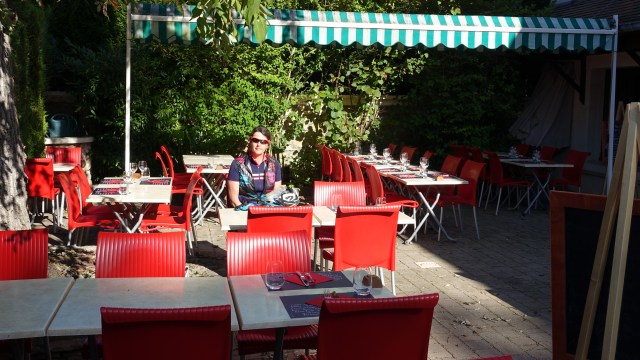
We sat away from the fine German team quietly pleased that they had not discovered not one, but two coffee machines that we were working hard. But alas the caffeine smell permeated attracting a few of their alpha males.

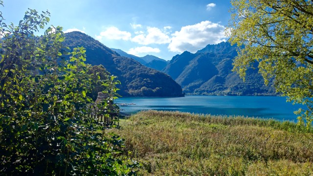
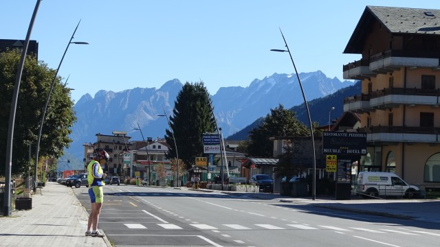
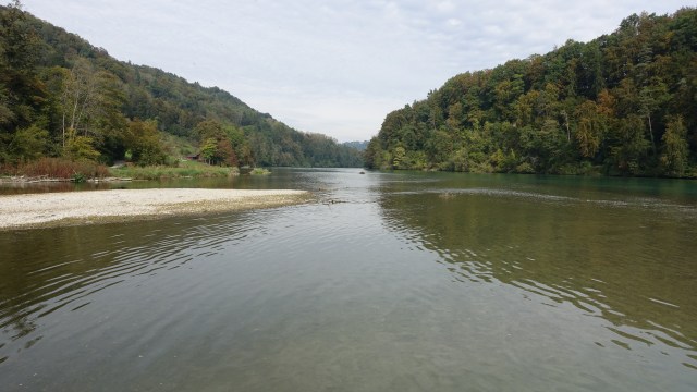
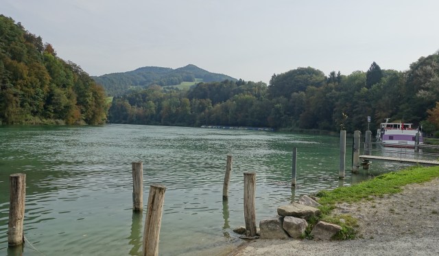
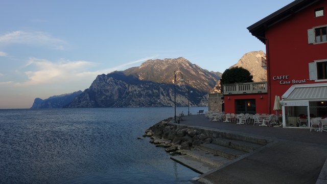
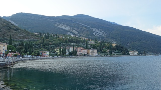
Back to cycling! We headed off out of Torbole taking a quick look at the Lake. There was a strong wind blowing.

image
Lake Garda
image
Lake Garda
image
Lake Garda


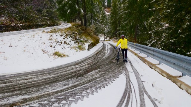
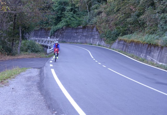
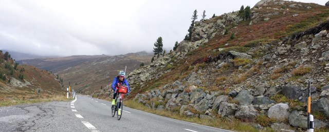
Just like yesterday we launched directly into a steep climb with cold legs with gradients of up to 14%. It was around 7 degrees Celsius and the big leg muscles did protest quite loudly!

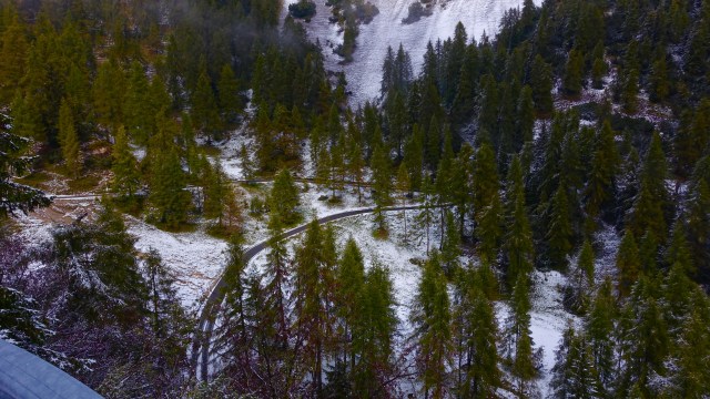
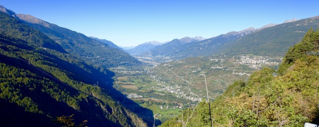
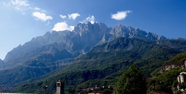
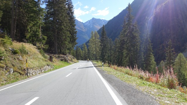
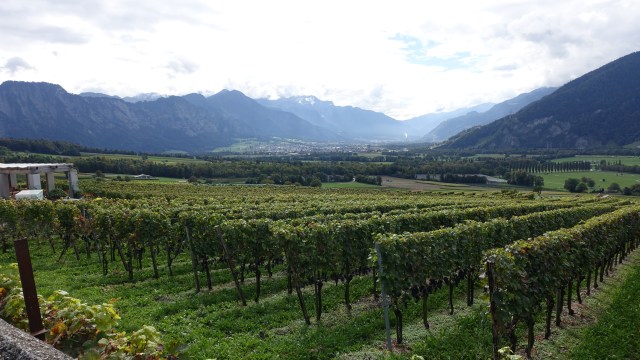
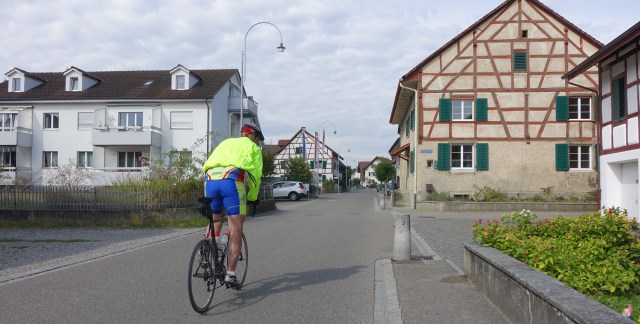
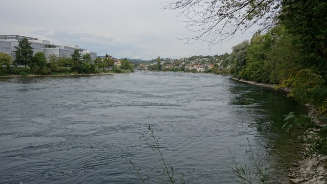
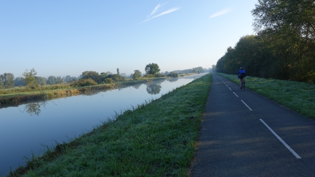
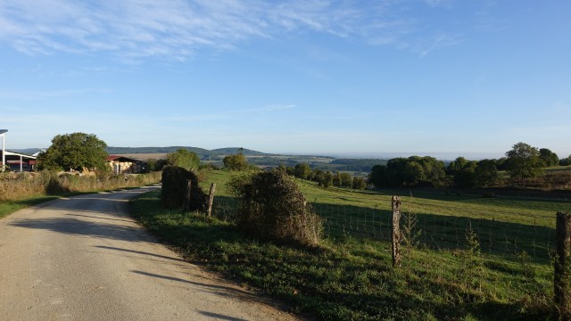
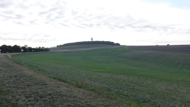
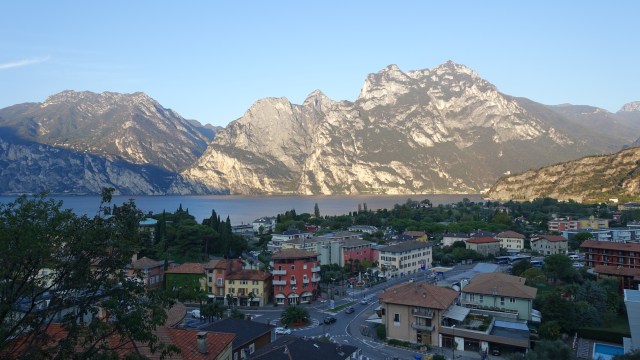
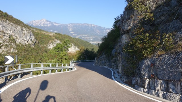
This is the view around 1 km from Torbole as we climbed.

image

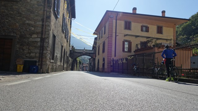
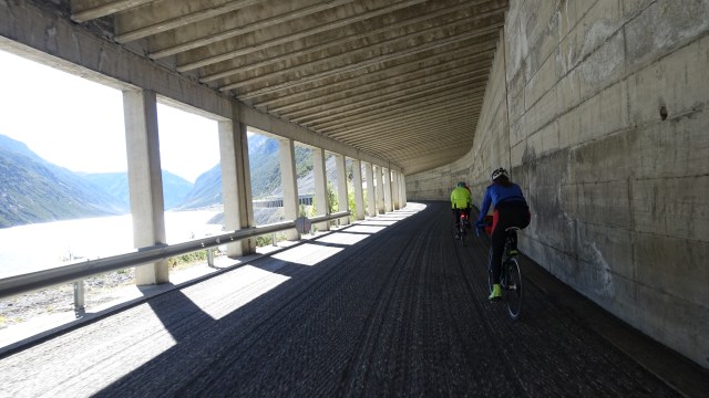
The first village was Nago ( 1.8 km), we then turned onto a cyle track that weaved up and down, under roads and across and so on.

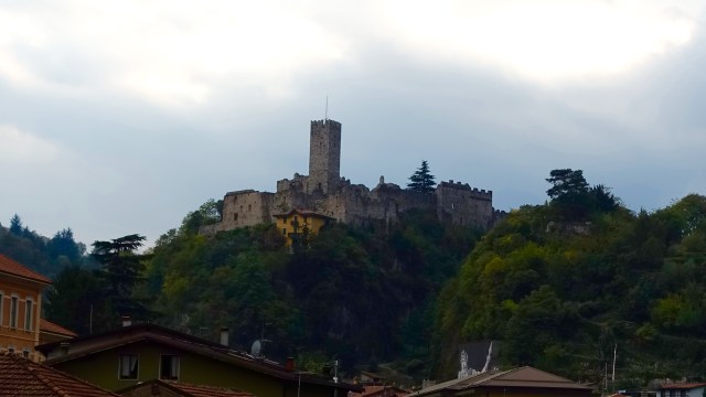
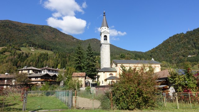
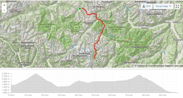
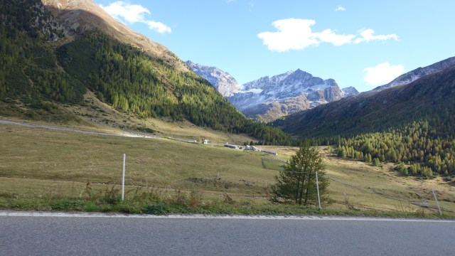
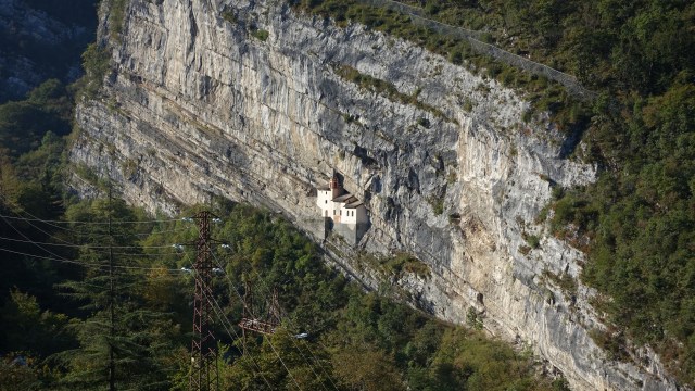
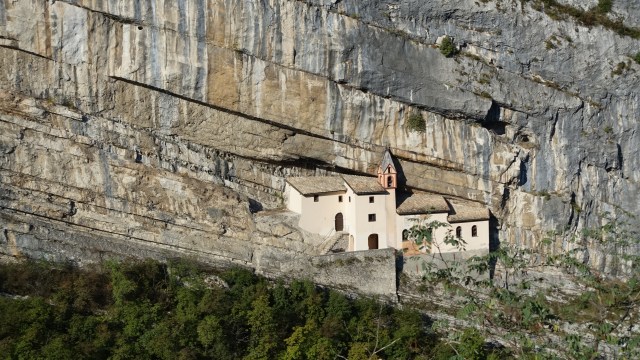
After Rovereto ( 18.3 km) the real climb for the day started. It was a 26 km climb. On the way up we noted the church on the cliff. Rumour has it that the church is concerned about dwindling attendances on Sunday’s. I think this church would be a Mecca for rock climbers!

image
The church for rock climbers


image
Close up of the church

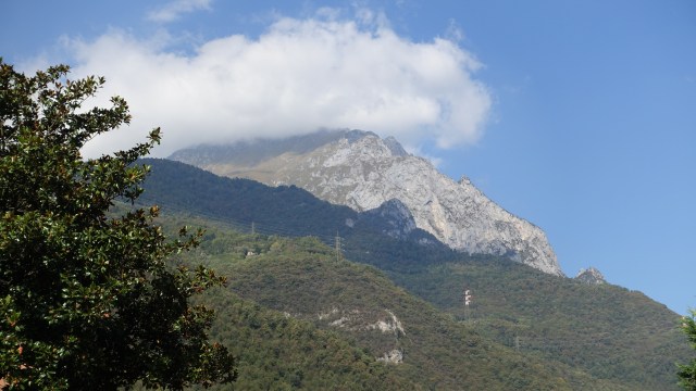
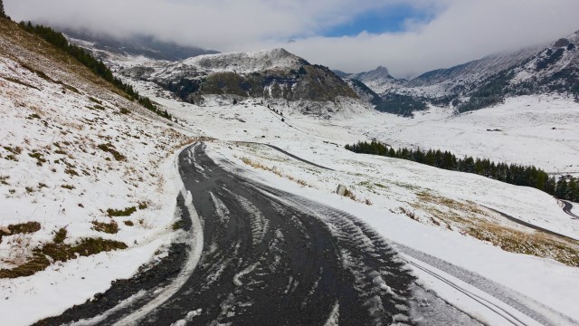
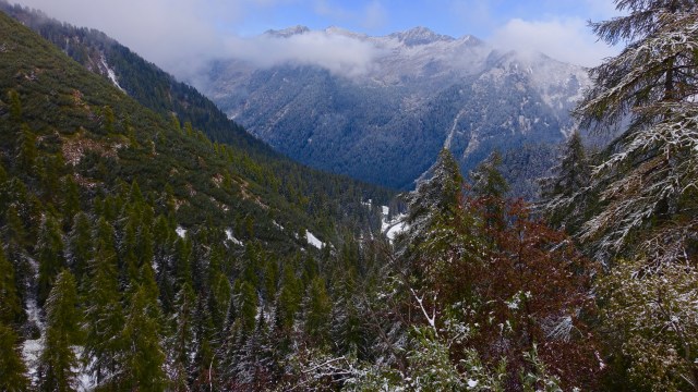
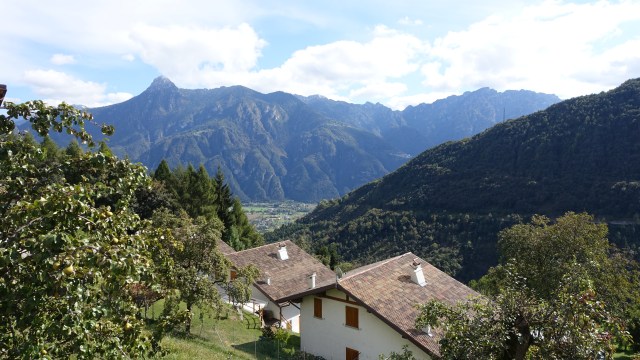
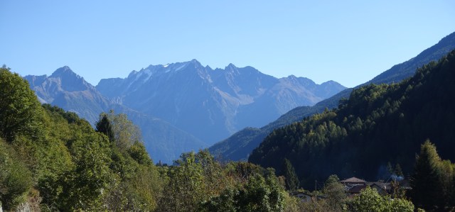
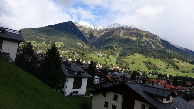
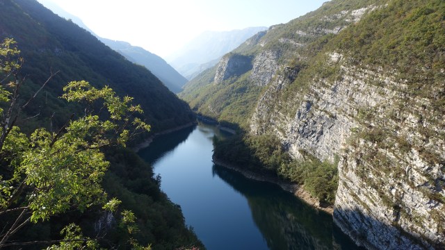
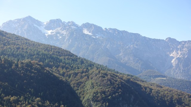
The climb today was tough going and I think it was made more difficult due to muscle fatigue. The views however were very rewarding.

image
The river gorge
image
Still the road keeps climbing
image
Still climbing

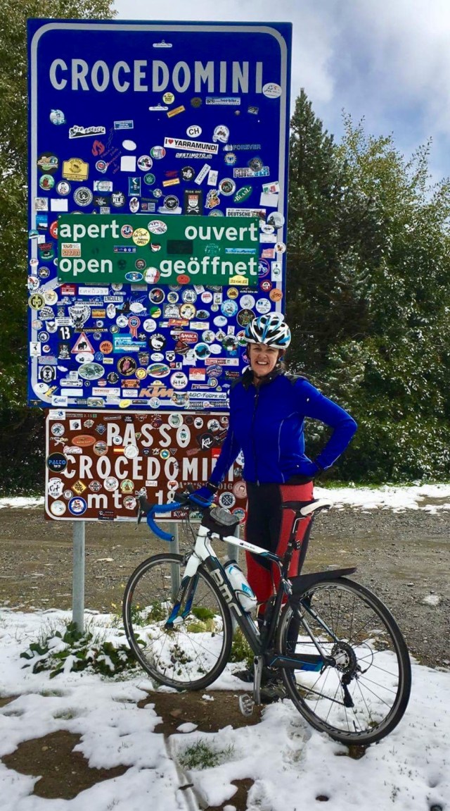
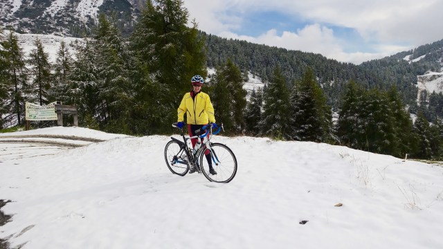
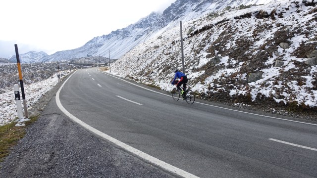
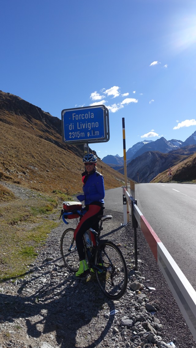
Eventually we made it to the top!

image
Another pass

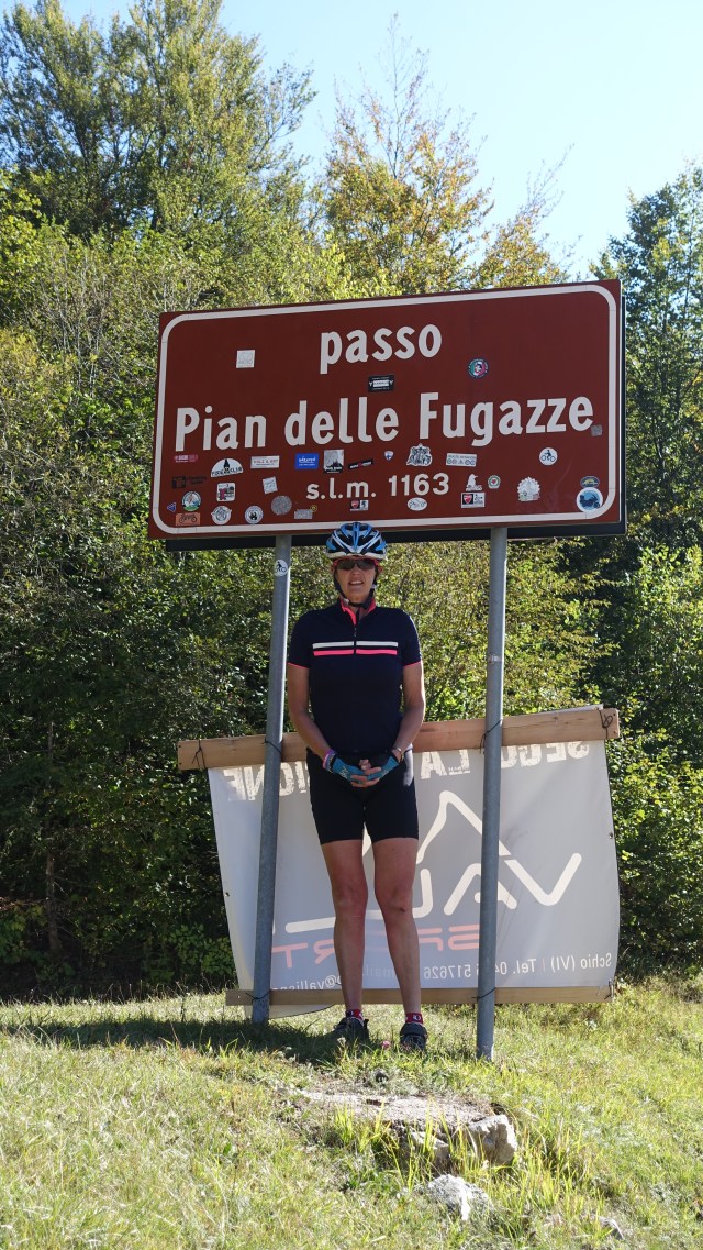
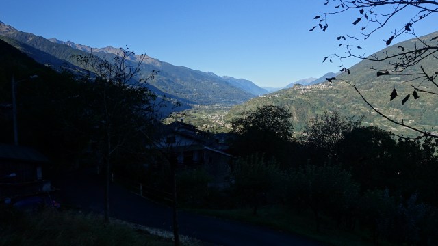
Reaching the top also indicated that we were saying farewell to the Alps. One last look before descending.

image
Farewell Alps

The rest of the ride was a descent. Slow albeit due to poor road conditions  Tony’s worn brake shoes, and we also got stuck behind a very large gravel truck.

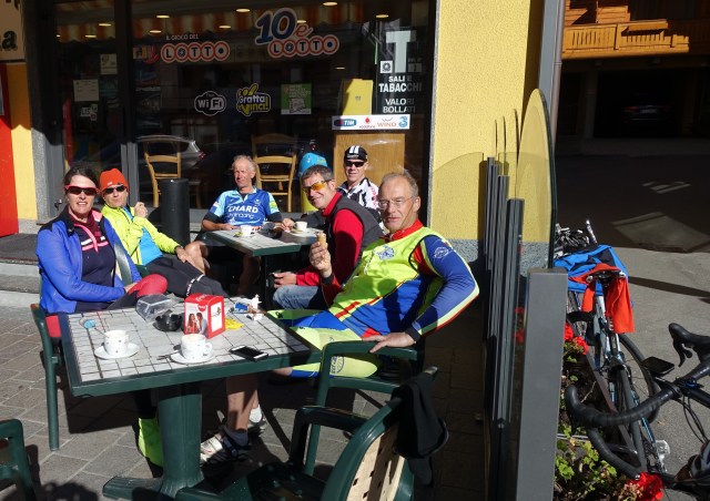
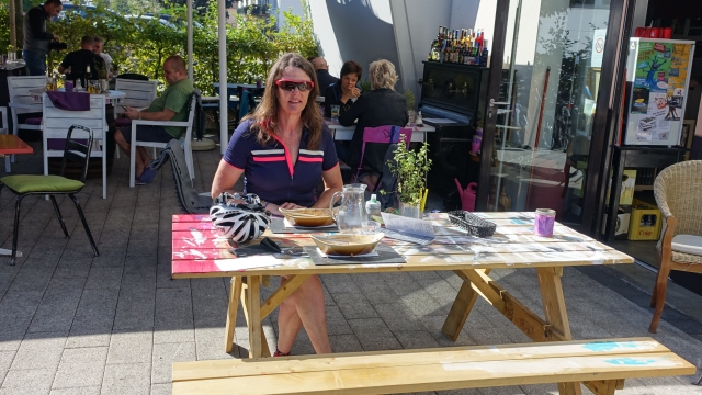
We were unsure where to stop for lunch and Sant Antonio ( 52.8 km) and Vali Del Pasubia (55.5 km) flew by and at the 60 km mark we arrived in Torrebelvicino and found a little bar open with 3 paninis left. So we purchased 2 of them plus 2 cappuccinos. I used their toilets…unfortunately as the only choice was a multi gender squat loo!

So from lunch we headed straight to Vicenzia a busy city with plenty of crazy car drivers and crappy roads. We did find a nice gelato shop though!!

Passo Di Domini Croce ( Breno to Torbole, 96 km 2400m)

day14l2v

Today was always going to be our toughest day on the bike. Little did we know what adventures the day would being when we awoke early, checking outside our window to see what the weather was like at 6.30 am. Was the sky clear? We certainly did not want rain for this tough day.

This is what we saw:

image
The old castle in Breno and the promise of a blue sky.


We enjoyed a nice breakfast and geared up to leave by 7.45 am to give ourselves extra time. Steve told us there would be a 7 pm curfew, but we all knew that would not effect us. David was ready to roll at the same time.

We turned left only 100 metres or so from the hotel and it was straight into a 13% climb! At the 1 km point we had already climbed over 100 metres, so an average of 10 percent! Some words were said to express our thoughts about such a “nasty” climb with cold legs!

We quickly gained height and looking back towards Breno this was the view:

image

We were heading to Passé de Croce Domini at 6217 feet. It is a tough climb over 22 km. There is no flat sections in that 22 km!

I was on my own for the majority of the climb as Tony and David rode together, taking the photographs. I passed an older lady collecting chestnuts, I could hear gun shots regularly, and I enjoyed the vista from greater heights. I could hear cows with their ringing melodic bells and even saw some horses wearing cow bells.

Eventually I was so high that I was surrounded by snow and I was sweating from the efforts of the climb. Steve came last in the van at about the 18 km point and Il papa (Gibbo who was in the van opting not to ride today) later told me that I had such a determined look on my face! Yes, I was very determined that this berg was not going to get the better of me.

I finally reached the top of Croce Domini totally delighted! After the ubiquitous photo at the sign, it was inside for a nice warm cappuccino courtesy of David ( as the van had headed back down the mountain and we had no money with us.

image
Feeling proud of my achievement.


Time to put extra clothes on for the descent and head off. It quickly became apparent that this descent was fraught with danger. The other side of the mountain road was covered in a mix of slushy melting snow, thicker snow in parts, and ice. We stopped to have a better look as really it was not rideable with a road bike!

We looked up the hill to see Steve walking down. That was odd and knew there was an issue. Walking back to him he said that he had a report from Tony D ( who had been dropped off at the top of Croce Domini) that the road would not be suitable for either of the vans. He was unsure what this would mean logistically with the other riders who were still making their way up the big hill.

We decided to proceed but at this point could only walk our bikes. What an adventure we had though in the next few km that just made this day the most brilliant “ride”.

We came across truck trying to bring cows up the hill:

image
So cute I might have to stop eating beef!!!

Just as we walked down from this truck I could hear cow bells and could see three shepherds herding a group of cows up the road towards us. Meet my new friends:

image
Aren’t they just gorgeous?

This is the road we were meant to be riding down:

image
The very slow descent!

I never thought I would have my photo taken with my bike like this:

image
Road bike in the snow!!

So a little further down we made new acquaintances of the human variety. These guys were having troubles with their motor bikes in the snow. They are from Switzerland, living at Lake Constance where we had been a few days before.

image
Tony warmed his hands up on this motor bike carburettor.

These are a few pictures of the scenery as we kept descending.

image

image

image
Majestic!

Eventually we were able to ride our bike but it was slow and careful as the road was wet. The bends were often in the shade and quite a few degrees cooler so possibly slippery.

We rode through Bagolino at 42.5 km and Cerreti ( 44.4 km) but pushed on to Storo. We needed to stop as we had no drink left. The water at the cafe at Croce Domini was not potable. We stopped at various shops on the way but they were closed for the long lunch break. We found a pizzeria and I topped up our water bottles and asked for the biggest cappuccinos she could make. They came out in milkshake glasses. Awesome!

We we had another climb to attend to and it was pretty cold. We were surrounded by mountains/cliffs and could not see how we would get through, but bit by bit we climbed up and around the gorge and made our way through to the other side.

Some different views.

image

image

image

Now it is time for some sleep. A big day and another tomorrow with around 1700 m climbing. In two days we will be in Venice. What a journey and adventure.

Blood, sweat and fantastic views – La Prese to Breno (73 km, 1000m)

day13l2v

It was very cool when we left our hotel this morning as La Prese is in a valley and it would be hours before the sun hit it. WIthin a few km we could see the sun in the next broader valley and the promise of a great day weather wise.

image
Great view of the next valley.


At the 9.7 km point we said farewell to Switzerland, after having done numerous crossings over the last week. Italian border control did not even glance our way. Cyclists are obviously deemed a low security risk.

Passing through Tirano we were keen to keep moving as we had a reasonable climb to knock off to get to Aprica. Steve said it was easy after yesterday’s but I do not think any of us concur.

The climb starts at the 16 km point with a series of steep hairpin bends. It continued to climb for 10 km.

My face was a bloody mess, quite literally, as I noted blood soaking my gloves and splattered on my bike.  I assumed I had a blood nose. It kept up for the majority of the climb. I later discovered I had a little cut on my nose which I found preferable to a higher altitude nose bleed.

image
Climbing to Aprica.

There were really nice views the higher we climbed.

image

I was very pleased to reach Aprica where we had a very enjoyable, and cheap morning tea. So cheap we all ordered second cappuccino’s. According to the signs Aprica is a very old Roman town from around 160 AD. It was hard enough for us to get to Aprica let alone the Romans nearly 2000 years ago. How inspiring they were!

image
Morning tea at Aprica with Tony (1), Neil, Geoffrey, Mike and David

image

As we left Aprica the view moving forward was pretty ok too.

image
Heading out of Aprica.

We descended down to Cortina Golgi and the road was seriously crap. Huge fissures just big enough for a bike tyre to jam in, along with some crazy drivers.

We predominantly descended for most of the rest of the ride into a very strong headwind with a small section of gravel roadworks. Arriving in Breno at just after 1 pm we parked our bikes at the restaurant located next door to our hotel and enjoyed a nice protein feast.

Tomorrow is the day that is causing us the most consternation and discussion as it is the toughest for this tour. We start with a climb up Passa Crocedomini with no opportunity to warm up. We start climbing only 100 metres down the road and it is a climb that goes for 20 km with an average of over 7 percent, with a 19 percent section.

Below are a few photos from the rest of the ride before we rode into Breno.

image

image

image

image

I’ll meet you in Switzerland (Davos to La Prese – 95 km, 2000m)

day12l2v

When we awoke this morning it was minus 5 degrees Celsius. I was filled with trepidation for a few reasons. Firstly I was concerned about black ice and slippery conditions but more importantly I am an exercise induced asthmatic and cold air under exertion is a major trigger for bronchospasm and an asthma attack.

I take steroid preventers morning and nightly and before and during exercise use ventolin so followed my usual preventative precautions. I also ensured that the Bike Adventure leaders were aware.

We delayed our start by cleaning our bikes hoping the temperature would improve and in fact it was 2 degrees when we left. Leaving Davos we headed towards the roads indicating Fluelapass, our major climb of three for the day, at 7818 feet.

The climb was solid! I concentrated hard on regular breathing. The scenery was beautiful and I really enjoyed listening to the many cows roaming with bells around their neck. The higher we climbed we noticed snow flakes falling around us.

image
Not far out of Davos
image
Climbing
image
Still climbing
image
Snow on the side heading up the Fluela Pass

I was very pleased to make it to the top!!

image
Fluela Pass 7818 feet

The descent was extraordinarily cold. I think I can safely say I have never been so cold ever on a bike despite all the great quality bike clothing I was wearing. The scenery was brilliant and Tony kept stopping to take all of the photos.

image

We rode straight through Susch (27.4 km) having made the decision to stop for a coffee at Zemez (33.6 km). We caught up with Geoffrey and David there. David was shivering having descended slowly due to losing a wheel spoke and suffering wheel shudder during his descent. Awful coffee for 3.90 Swiss francs but it was great to sit in the sun and warm up.

image
Tony and Geoffrey playing Garmins at our coffee stop

Immediately after leaving the coffee shop the road started climbing up the side of a river valley. It was a 6 km climb and not too bad. Nice views again.

image
View from the second climb

We then descended five km down to the Livigno tunnel. Bikes are not allowed so the Bike Adventures van was to ferry us through. As we were the second and third riders to arrive at the tunnel we were transported through fairly quickly. It was an “oh wow ” factor as we came out the other side, in Italy!

image
First view after coming out of the tunnel
image
We rode through numerous of these tunnels (galleries) today. Garmin did not like it.

The four of us ( plus Gerry and Neal) decided we would head to Livigno for lunch (56.2 km). I love the photo below and wondered whether the Giro had been through here in previous years?

image
We thought this was pretty cool.

We found a cafe and had a light lunch. Great coffee and toasted sandwich all for five euro! Bargain compared to Switzerland morning tea.

image
We enjoyed the company of Gerry and Neal at lunch today

After lunch we needed to mentally prepare for our third climb of the day to over 7500 feet. I probably “enjoyed” this climb the most, for want of a better word. I was happy with my lungs and the weather had warmed up nicely so suggested to Tony that he shoot off at his pace and that I would ” see him in Switzerland”. It was a solid climb again with the pass at 7595 feet, just a few hundred short of the Fluela Pass.

image
View early on the Forcola Di Livigno Pass
image
Third big climb for the day and ready for the big descent.

It was time to put all the clothes back on ready for the long descent from the pass. It is too dangerous to just fly down. There are multiple bends, huge cravines and drop,offs and you need to concentrate. One slip could be fatal. The road is also quite busy!

I sat in the middle of the road near the white line to ensure I had as much space between me and the drop off as possible. Sections of the descent ( as per the other two) were gravel with major roadwork repairs having ripped up the bitumen leaving gravel.

We passed through a couple of towns including San Carlo and Poschiavo before 9arriving in Le Prese.

We have just completed dinner which was really nice as we were all together ( does not happen often). Tomorrow is an easier day but the following day is the killer.

Swiss Alps beckon ( Bregenz to Davos, 123 km, 1500m)

day11l2v

Today started off in the rain, leaving our hotel in Bregenz, Austria. We skirted around a section of Lake Constance to say goodbye and could see that the weather looked OK on the other side, hoping our side would improve quickly. 4 km out of Bregenz we crossed this river below.

image
A small river that flows into Lake Constance

We were mainly on cycle paths, both sealed and cinder following a flood dyke path. As one would imagine it was flat, but given the wet conditions and cinder grit flying around we just pooled along quite happily as today was to be a long tough day, with most of our altitude to be climbed in the last 20 km.

Lichenstein came into view across the river. Magnificent mountain backdrops everywhere.

image

We rode over a bridge at the 45 km mark, the midway point being the border between Switzerland and Lichenstein.

image
Countries apart
image
David taking a nap

We spent 18 km in Lichenstein all up before crossing back into Switzerland. We planned to have lunch prior to the climb and did so in a pretty little village named Maienfield (72.9 km). Turns out we had 10 minutes to buy some supplies at the local shop because at 12 noon all the shops were closing for lunch. So one litre of milk, 2 bananas, 1 toblerone and a half roll each constituted lunch, eaten at the local water trough.

image

image

Some gentle climbing ensued and we passed through Jenins ( 75.3 km) and then Malans (78.2 km). The ominous note descriptor at the 80.3 mark was that the road continued to climb for the rest of the day.

We skirted around Schiers, rode through a farm, continued with a mix of cinder and sealed bike paths, arrived at Jenaz (94.0 km) and Saas (101.2) still climbing gently. From Saas it became more serious and tough going arriving at the expensive ski resort of Klosters (111.2 km).

image
Arriving in Klosters

The mountains were becoming increasingly majestic and snow capped.

image

The rest of the climb was really tough and I am told was consistently around 10 percent. My lower back ached so I took the opportunity to stretch it a few times before proceeding with the us relentless climb.

Cars and trucks passed by very closely on the narrow and busy road. I decided to move a foot or so out into the road to force the vehicles to give me more space rather than constricting me into the side retaining wall.

I was very relieved to reach the top of the climb and then descend into Davos!

Davos is extraordinarily touristy. It is another expensive ski resort currently in off season.

image
The side of our hotel – the one directly in front

image

Excuse me waiter, can you please tell me what country we are in?(Neuhausen to Bregenz – 109 km, 404m)

day10l2v

We headed off as a threesome again today (with David) all prepared for the wet weather. It had been raining and the air was damp and crisp. From our hotel in Neuhausen we descended to the river following the paved cycle path to Schauffhausen (3.2 km) which is a nice old town on the River Rhine.

image
The ‘other’ side of Schaffhausen on River Rhine

We followed the river for some distance on the road rejoining the cycle track just after Busingen AM Hochrhein. For the next 11 km there was a significant portion of cinder pathway parallel to the river and also through agricultural farm land and forests. Given the wet weather this ensured that our bikes, backsides and lower backs were nicely covered in light coloured dirt.

image

We made the first of our many border crossings on a cycle path leaving Switzerland and entering Germany near a cowshed. No fuss, bother or ado.

We passed by Diessenhofen (13.4 km) and Hemishofen (19.5 km).

image
Stein AM Rhein with exquisite painted exterior walls.

We the rode through a nice old arch into the centre of Stein AM Rhein, a very pretty and ornate German village. As we were already a bit cold and wet we briefly thought about stopping for a coffee but decided it was a bit too early.

We followed a railway line fairly parallel for some distance on the cycle path before leaving it to enter Steckborn (34.3 km). Shortly thereafter I slipped on the road whilst crossing to the cycle path falling, adding more bruises to my growing collection and removing some skin. I was a bit sore a shaken but think my main concern was ” is my bike ok??”

Having already crossed back into Switzerland we entered Germany again at the 49.4 km mark.

We arrived in Konstanz at the 52 km point and negotiated our way through heading to the ferry to cross Lake Constance. It is a short 15 minute crossing. Enough time to have a coffee, toilet break and try and dry your Knicks under the hand dryer in the bathroom!!

image
The car ferry. My bike is just on front of the cars on the side.

Once in Meersburg we were playing dodge with hundreds upon hundreds of tourists, on wet cobblestones to boot. We decided to have lunch but needed to find somewhere that may be sympathetic to three wet and dirty cyclists. We located an Italian styled pub and there was initial consternation with the waiter but the boss man came out and showed us where we could sit!

image
Tony and David at our lunchtime stop.

None of us were sure what country we were in having crossed borders multiple time in only a few hours,  and having just crossed Lake Constance by ferry. So David asked the waiter ” excuse me, what country are we in?” We all had a good laugh as Australia is such a vast country that most of us do not get to experience multiple countries in one day.

The answer was Germany – good answer as we could pay in Euro rather than our limited and precious Swiss francs.

While we waited for our lunch I wandered out to the foreshore attracted by a pole with gargoyles. An artist with a dark sense of humour I suspect ( I have not photographed the odder ones…). But these couple took my fancy.

image
Enter a caption
image
Enter a caption

Vineyards up the hill on the foreshore.

image

This is just as we departed Meersburg.

image
Nice and clean, ha ha

It started to rain again on and off which made riding quite slippery. As it is autumn here, the deciduous trees have started to shed their leaves which in places densely litter the ground along with what we think are chestnut husks.

We were quite slow and careful with turns and descents not wishing to have any more spills. The alps beckon and we need to stay uninjured.

We rode through more towns and villages including Hagnau (61.0 km), Immenstaad (64.9 km) and  Friedrichschafen (74.4 km) home to the Zeppelin museum.

This is the view across the lake at this point with storm clouds brewing again.

image

We had the option of shooting out to Lindau Island but given the inclement weather erred against it.

Pricing through a series of apple orchards we came across a small food establishment with a beer garden so we opted to have an ice cream and seek shelter hoping the rain that had just recommended would soon pass.

image
Random photo taken at the ice cream shop

We were very pleased to ride into Bregenz and rock up to our hotel at 2.45 pm. We were the first in and were able to strip off and enjoy a nice warmshower and wash our clothes.

At the time of writing our friend Gibbo is yet to arrive. Not always the best at following route instructions he turned left when he got off the ferry ( instead of right) and ended up around 110km off route and in Switzerland somewhere.  The van was despatched to retrieve him. I hope he has remembered it is his wife’s birthday today and that Australia is 8 hours ahead of us otherwise his troubles may not have ended!! Happy birthday Anita!!!

Rhein riding ( Rheinfelden to Neuhausen, 101 km, 707m)

day9l2v

The weather forecast was concerning..heavy rain and thunder storms were forecast so many of our group got up a little earlier in order to hit the road earlier in the hope of not getting wet! Fortunately the hotel has breakfast from 6.30 am and we were fed and ready to roll by 7 am.

We set of with Bob, Al and Debs but within 500m had become separated from them. We headed off across the bridge leaving Germany and re entering the Swiss Rheinfelden. Market stalls were being set up all around the various cobble stoned streets.

We headed up to Mohlin and shortly thereafter we were joined by David who rode with us for the rest of the day. He had a slight delay to his start as he could not find his helmet. He subsequently found it his shower!

image
David riding through one of the many little Swiss villages

We rode through Stein (14.0 km), Kaisten (21.4 km), Laufenburg (24.6 km) and then crossed the river Aare ( which feeds directly into the Rhine). We just happened to ride past a BMC bike dealer so stopped to see if they had the BMC rear derailleur hanger we were after. No luck but I did purchase my second trip item ( a pair of Swiss short cycling socks). David lashed out and purchased a very bright fluoro jacket.

About 100m up the road we found a restaurant open so decided to have coffee. We were immediately chastised in German by the owner for wheeling our bikes into the courtyard and she gesticulated towards the bike racks ( that we had not previously noticed).

We enjoyed our coffee and out stop and headed up the hill to Bad Zurzach (50.1km), Rekingen (52.9 km) with the course undulating to Zweidlen (67.3 km) and Seglingen (71.9 km).

The course to date had generally run reasonably parallel to the Rhine, but not directly adjacent. We had been riding on a mix of open roads and cycle paths (both sealed and cinder).

At the 74.4 km point we descended on gravel to the river. It was steep and slippery and I was very cautious as I am not overly confident on steep gravel descents. The view of the river was inspiring.

We stopped at the bottom for photos.

image
Westerly view


image
Easterly view

After crossing the bridge the notes said to turn right and that the path  climbed steeply last the car park and continued to climb steeply for a few km. I was hoping the steep climb was not gravel and was very pleased to see that it was sealed.

At the 79.5 km point we had reached the top of the climb and were rewarded with a nice descent through Bergum Irchel and then Flaach. Low and behold, there was another BMC dealer in this village. No luck with the derailleur hanger though.

The rest of the ride was pretty cruisey. We knew now we would not be getting wet as we were within comfortable striking distance of our accomodation. At Dasche (96.1km) we stopped at the little cafe and David kindly shouted us coffee and Black Forest cake! Very yummy too. Thankyou David, who coincidentally is celebrating his 39th wedding anniversary today, and had remembered to order flowers and ring his wife!

Rheinfall is a spot where you can view the Rheinfall! Fancy that. Rheinfall ( or the anglicised Rhine Fall) are Europe’s largest and we were keen to see them. The car park was overflowing with hundreds of cars and the place was crawling with tourists. We battled our way through with our velo babies only timing that the view is obscured unless you pay Swiss francs.

I had a bit of fun.

image


There are multiple cycle paths here.

image

We decided to move on, descending down a cinder track with a descent warning sign.

image
I am the back rider there about to roll down the 20% gravel path

A little along the track we had a nice river view of the upcoming towns.

image

Only a km or so on we arrived at our accomodation in Neuhausen. After showering and setting up the Chinese laundry we headed off on a walk as we had been told you could get a good view of the falls from this side of the Rhine.

We walked down a really steep hill and were quite blow away by what we saw. The photos do not do justice to the size of these falls. They are 150 metres wide, with a 23 metre drop. The water depth is around 13 metres. In summer 600,000 litres of water per hour flow through ( versus 250,000 per hour in winter). Very impressive.

image
View below the falls


image
View above. The building on the opposite bank is where we had been earlier ( and the photo of me on the rocking horse)

Tomorrow is another three country day – Switzerland, Germany and Austria. Forecast is rain but we cannot head off early as breakfast does not start until 8 am. I will be starving by then!!!

Au revoir France, guten tag Switzerland and Germany ( 118 km, 352m)

day8l2v

We woke up to blue skies and the promise of a brilliant days riding in favourable climatic conditions. Firstly we needed to backtrack 6 km from central Belfort back to Danjoutin to pick up the route descriptors.

We then headed towards Vezelois picking up the cycle path adjacent to the canal. We were able to sit on a nice and steady pace along a well sealed/cindered bike path.

image

The canal path went on and on and on, but it was quite picturesque, passing by the edge of numerous villages. There were many fisherman sitting on the edge of the canal often with multiple rods out. Not sure that I would be keen on eating the fish as the water is quite muddy looking and I am pretty sure the fish would taste muddy too.

At the 48 km mark we needed to negotiate the large city of Mulhouse before rejoining the bike track. This was quite slow and fiddly.

We passed an open spot featuring a field gun and over the canal an army tank. I gather the area saw a battle involving the sad demise of around 1500 soldiers during World War II.

image


As the day was so nice and easy we decided to continue on and break just before the Swiss border at Huningue, as we had a good supply of euro but no Swiss francs. We found a delightful cafe called Le Shakespeare adjacent to the canoe centre and enjoyed a great lasagne. The waiter talked us into having tiramisu. Whilst I was already full it was very, very nice!

image

Back onto the bike path following the Rhine river to cross the Swiss border we saw Basel looming ahead.

image

The Swiss border theoretically was just a few hundred metres ahead but  access was blocked by a very large locked fence and gate. So we needed to use our nous and create our own deviation path backtracking and heading away from the river. I think the path was blocked due to the demolition of a large BASF building.

The Swiss border toll point was reached without so much as a glance towards us so we rode on.

Hitting the central section of a busy lunch time in Basel proved interesting as we were told to climb a steep road adjacent to Davidoff Geneva. It was very steep, cobbled and full of pedestrian traffic which is not ideal when climbing.

At the top was Munsterplatz, a quite large communal cobblestones square adjacent to Basel Cathedral.

image

image

A few km on from this we spent about 29 minutes trying to resolve route instructions at a very busy vehicular interchange junction including flyovers. By using a mix of the yellow sheet route descriptors and the Garmin Gpx map files we eventually found ourselves on the correct route and heading towards Rheinfelden.

image
To the east of Basel crossing this river numerous times

We also passed an old Roman amphitheatre. I found the outside more interesting as the interior was redeveloped using modern rock retention methods of rock inside metal cages, as commonly used now for retention.

image

Rheinfelden is a town that is in both sides of the River Rhine, meaning one section is Swiss and the other half German. We had ridden on the Swiss side from Basel but crossed over into Germany by way of a pedestrian footbridge.

We were very pleased to have found our hotel! Tonight we are to spend time with my friends Ralph and Sandra who live in Sissach, Switzerland. I met them in 1985 in The Maldives and stayed with them in early 1987 in Switzerland but not seen them since. What a great opportunity to catch up. Can’t wait!


Cyclists in the mist (Bourbonne-les-bains to Belfort 113 km, 1053m)

day7l2v

We rocked down to breakfast this morning famished. One thing about cycling over 100 km every day for over a week is that you have a ferocious appetite. Breakfast is my favourite meal of the day, setting me up for whatever challenges the day may throw at me.

Normally on these bike trips we are well catered for. Today we received the same “rations” as the phlegmatic geriatrics in their dressing gowns who were seated around us! So what did we get! Three different types of bread.

There was the one piece of thin toast that I reckon had been pre toasted last night to save time today. It would surely chip your teeth and be more practical as a frisbee. Secondly there was one dried out, sweet brioche. Finally the ubiquitous baguette chopped up into small pieces. This was accompanied by percolated coffee, needed to help swallow the brioche. Might be fine for the oldies who were sitting around doing not a lot but for us about the burn up a few thousand extra calories it was nutritionally deficient. Bring on my Trip Advisor review!

So we headed off with Bam Bam, Al and Bob. It was cool and crisp but sunny.

image
The promise of a nice day


Todays course descriptor was “a day of typically French riding with enough undulations to keep things interesting”.

Certainly this was true. Undulations were routine for the day.

image
Still in the sunshine, Bam Bam just behind me.

Just before we rode though Villars-Le-Pautel the fog curled around us, making us moist. Visibility ranged from 50-100 metres and at time was quite eerie.

image
Eerie but nice

At Polaincourt (31.4) km we turned left at the house with blue shutters. Well that is what the route note said, but the owners had obviously been painting since the reccy was done.

This bike on the side of the road tickled my fancy.

image
I think this is one of my favourite photos so far

The riding was so moist in the fog that drop,tea of moisture dripped off the helmet, and I was unable to wear my glasses as they fogged up on the outside and I had to keep wiping them, so I just took them off.


At last the sun shine through and it was time to start stripping some gear off. We rode into Breuches at the 56.8 km point and noted a brasserie and pizza restaurant/supermarket. We entered the latter and I ordered two hug slices of ham (yummy) and a slice of cheese quiche. I washed that down with what was meant to be a cappuccino but arrived as an espresso. Never mind. We lost Bam Bam at that point as David had just arrived into the village.

The undulations continued as the day warmed up but they were mostly quite ok and not too much of a challenge. There were a couple of nasty, shorter ones thrown in for good measure.

Shortly before Ronchamp the Bike Adventures van came the opposite way, lights flashing as we were climbing a hill. Apparently the road ahead was impassable so a detour was required. This added about 4 km to the ride, but it was very pleasant passing through a lovely dense forest. The vegetation has really changed to denser with “German” looking trees.

We lost Al around here. We think he may have taken a wrong turn somewhere.

Finally there was one longer climb left before we dropped down to follow a cycle path into the outskirts of Belfort. We were delighted to finally arrive at our hotel. We were the first three in and found out that the notes had taken us to the wrong Ibis hotel.

Another 5 km or so later we ended up at ” the other” Ibis hotel in middle of Belfort.

Tomorrow the passports will be carried as we leave France in about 80 km after outer eastward March and enter both Switzerland and Germany. The day promises to be an easier 110 km or so as it is much flatter.


Cruising in the sun – canals and open road – Dolancourt to Bourbonne-les-Bain (109 km, 985m)

day6l2v

Another brisk start as we left Dolancourt. Not all our group stayed at the same hotel last night. They had a 8 km head start on us. We caught up the them on the long climb that started at the 12 km mark and finishing 11 km later. It was an easy climb though.

8 motor cycle police plus at least 2 large vans full of gendarmes headed the other way in a hurry. Not sure what has happened but hope all has ended well.

The road undulated for the next 25 km or so through open countryside of Champagne, passing by the General De Gaulle memorial located at the top of the highest peak in the area, located close to his home town of Colombey.

image

After passing through Juzencourt (32.2 km) we turned off to Euffigneix where we had to do a detour thanks to road works but were able to navigate easily back on route.

We were warned there was a bad section of road and boy they were not wrong. Shocking bitumen that rattled your brain around.

We skirted around Chaumont but decided not to head in for coffee and a pleasant surprise was found at the bottom of the next hill in a tiny village in the form of an open restaurant with a nice courtyard in the sun. We spent a very pleasant 40 min there having coffee, using their toilets and having our drink bottles topped up.

image

Just as we were leaving David and Bam Bam pulled in for refreshments.

We then followed a narrow canal for 11 km. Slow going but quite pleasant not having to watch out for traffic. We came across a couple of canal boats and even a yacht. Apparently the canal is often used by yachtsmen heading to and from the Med and England. Nice!

image

We decided not to head up to Nogent as we were not particularly hungry and chomped on a protein bar instead. The sun was beaming down by now and was a pleasant 22 degrees.

The roads continued to undulate for the rest of the day with a mixture of wide open roads and narrow country lanes.

The last few km featured a brilliant downhill section of a couple km. Good fun.

We arrived here at 2 pm well ahead of any other riders. We had lunch and lazed about in the sun before checking in and locking our bikes away.

This village is known as being a spa centre and the place is packed with old people who have sticks or wheelchairs. Quite strange as there are no young people around. We wandered around the older area on top of the hill overlooking the town, and yes Mark I smelled the roses. In fact, I lay down in a bed of roses.

We had a pleasant tea with Bevis, Edwin, Geoff and Rachael with three wise monkeys sitting at the adjacent table ( David, Bam Bam and Gibbo).

Tomorrow looks to be similar to today – rolling hills and another