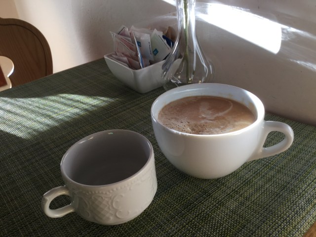
I awoke to beautiful weather in Asolo. A lovely breakfast, but my idea of a BIG coffee differs somewhat to the lady barista! 😂
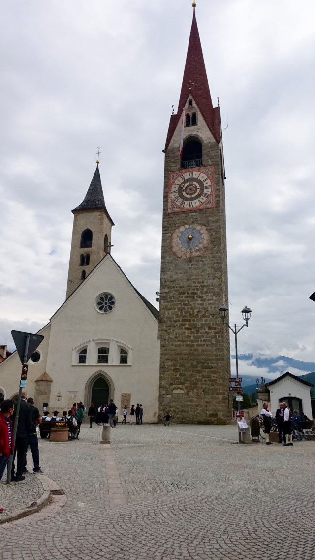
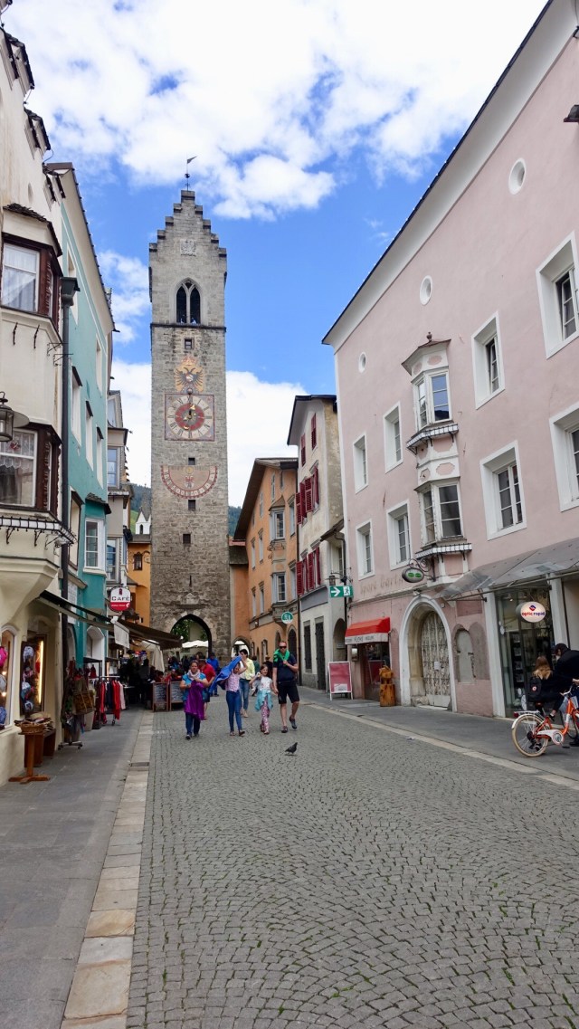
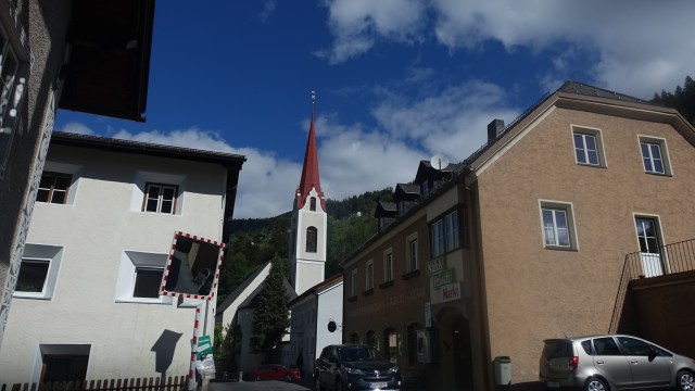
Luke, Peter and I were dropped off into the Piazza Maggiore in Asolo to have a wander around. The town has significant Roman heritage.
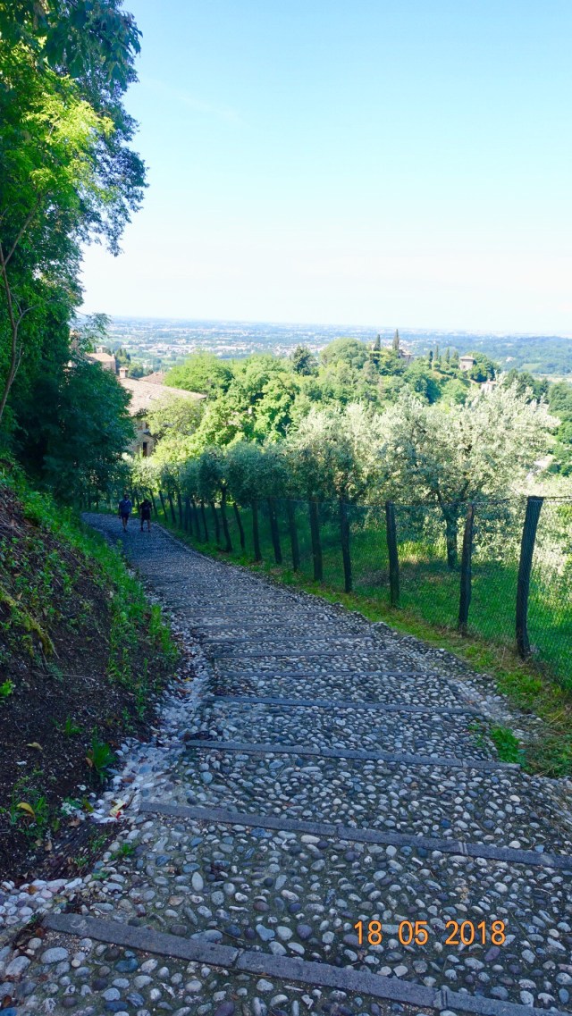
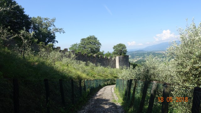
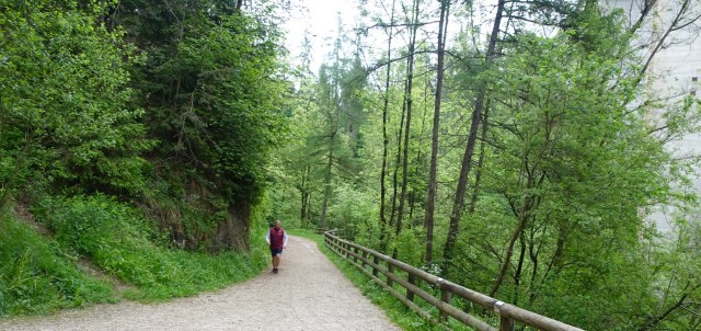
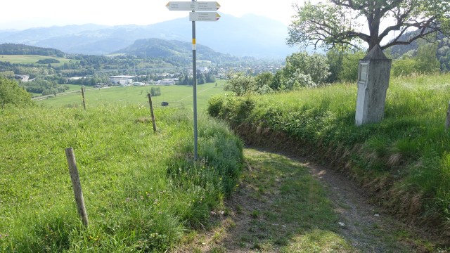
We decided to walk to Il Rocco….way up high on the hill overlooking Asolo, the Veneto and the Dolomites.
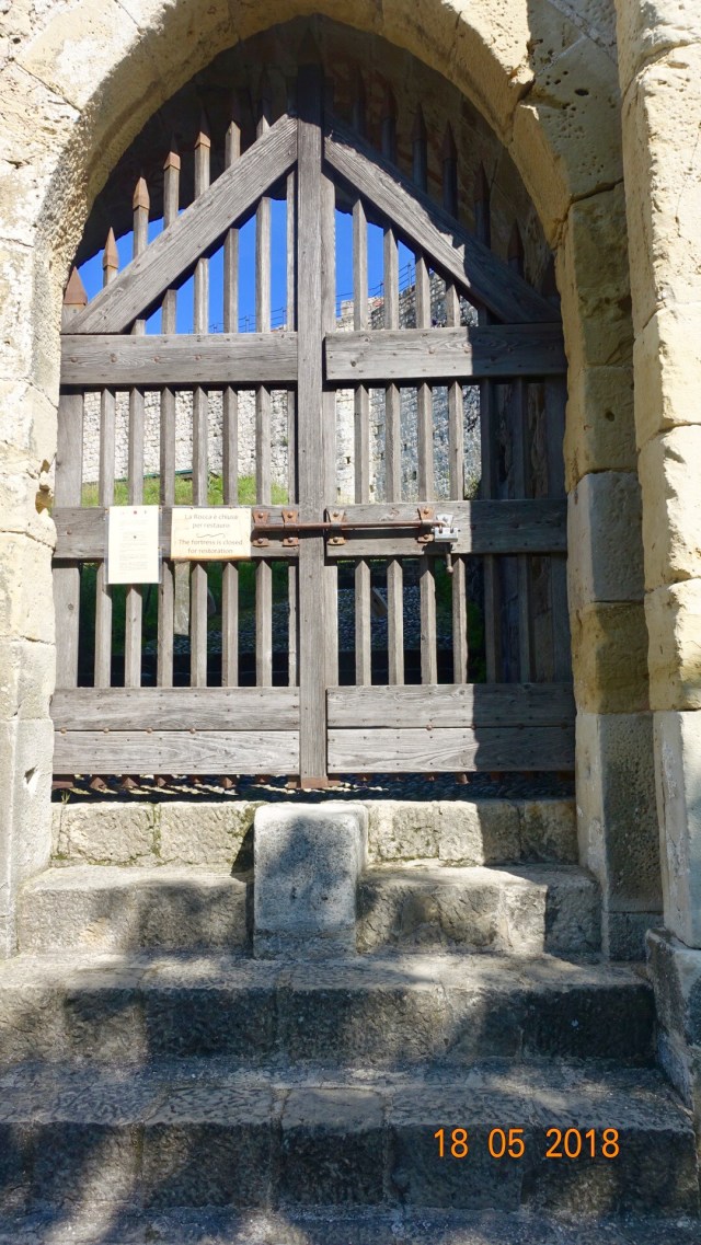
Once at the top this is the main entrance. Closed for renovations.
Walking back down there are numerous olive trees on the flats and slopes.
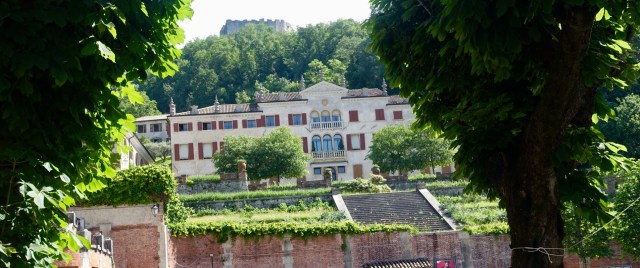
Back in the Piazza Maggiore looking up the the convent, you can see the old fortification high above.
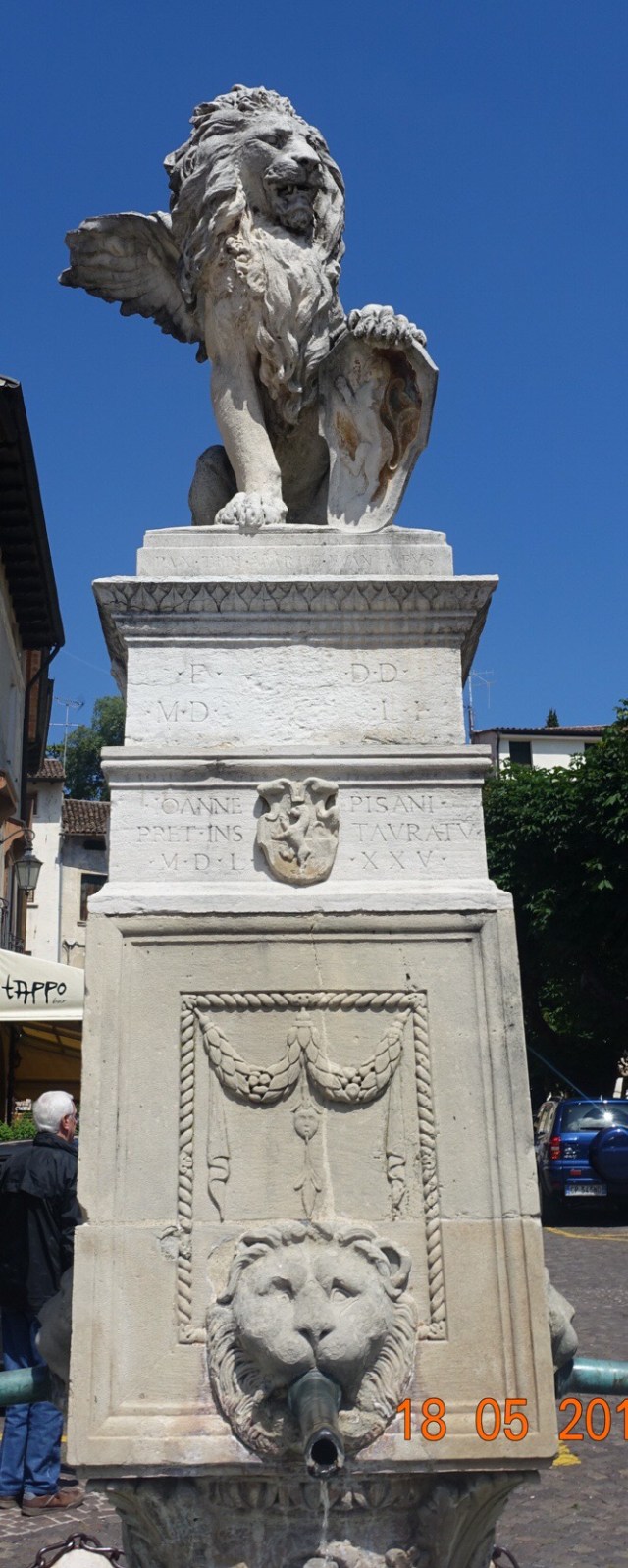
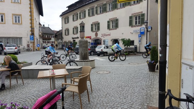
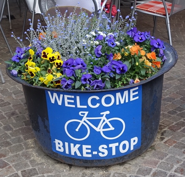
This fountain is a central piece in the Piazza Maggiore with water from an old Roman aqueduct.
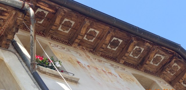
I love quirky gargoyles and building details including the wood panelling under this buildings eaves, and the metal dragon.
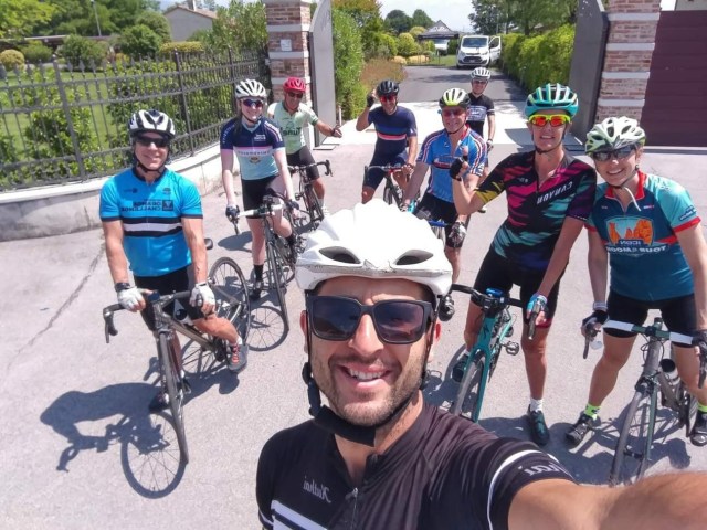
After a quick lunch it was onto the bikes to ride off to Giro.
The weather was perfect and we followed Daniele as he weaved around various roads and villages.
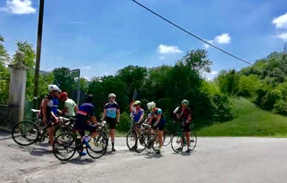
Stopping for a quick drink and catchup after the first hill…
We were able to do the Giro hill climb…only 3 km but packed with cyclists of all shapes, sizes and abilities. It was walking only under the KOM banner as cyclists just seemed to stop on the line, causing a build up behind.
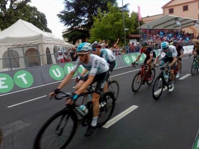
We then rode another 15 km or so to the finish line where we saw the riders come through the first time…very fast…hence the blur on my photos…
Leading rider with one loop to,go, including the KOM
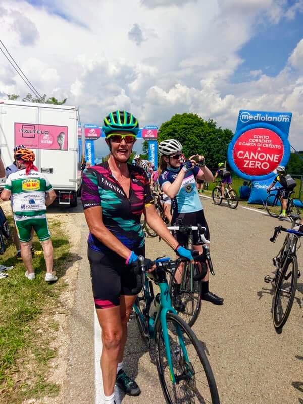
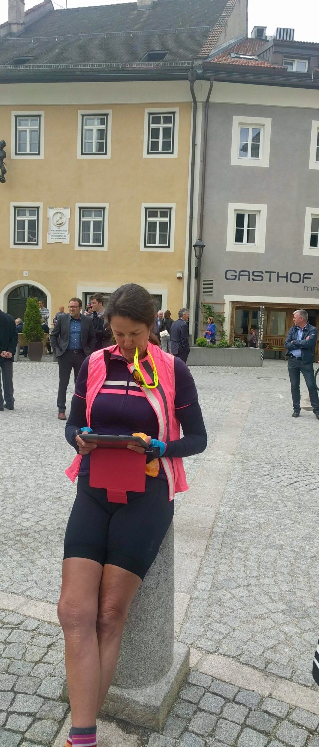
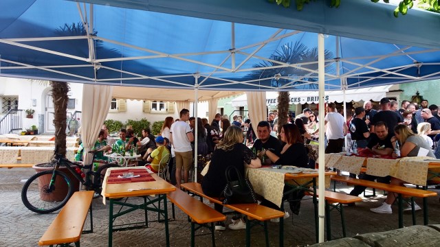
We all sat outside a local bar waiting patiently….
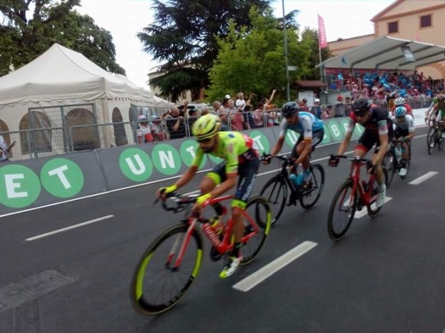
Until the final sprint…we were all hanging our arms and phones over the barriers and did a massive jump back as the riders screamed around on our side of the barricade…
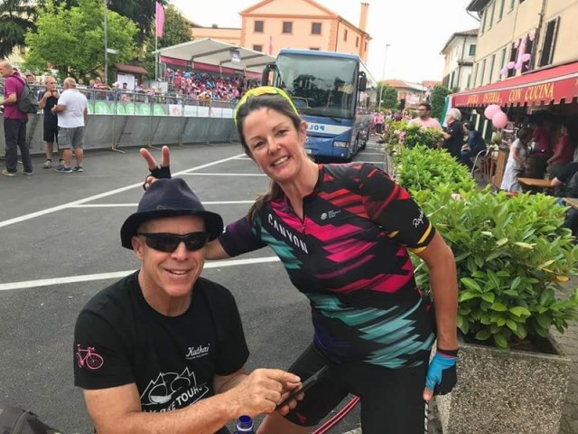
A nice win for Viviani, good friend of our leader Daniele. I did not get a photo of him…too fast for my trigger happy finger.
The crush after the race was incredible…4 police pushed through so I drafted them ( walking), and stuck with them in the gap they created.
Our team management decided to transfer us back to the hotel by van, as thunderstorms were threatening….,
Tomorrow is the challenge ….Zoncolon…to Zoncolon or not to Zoncolon, that is the question…..🤷♀️🤷♀️🤷♀️🤷♀️
Disappointingly I have very few photos today, despite taking heaps. My camera memory card seems to have had a myocardial infarction!
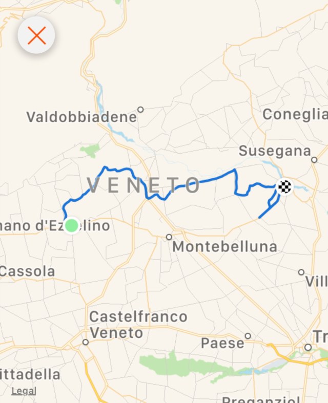
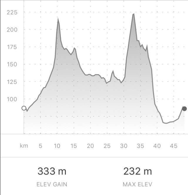
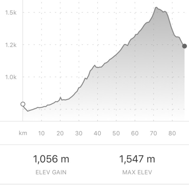
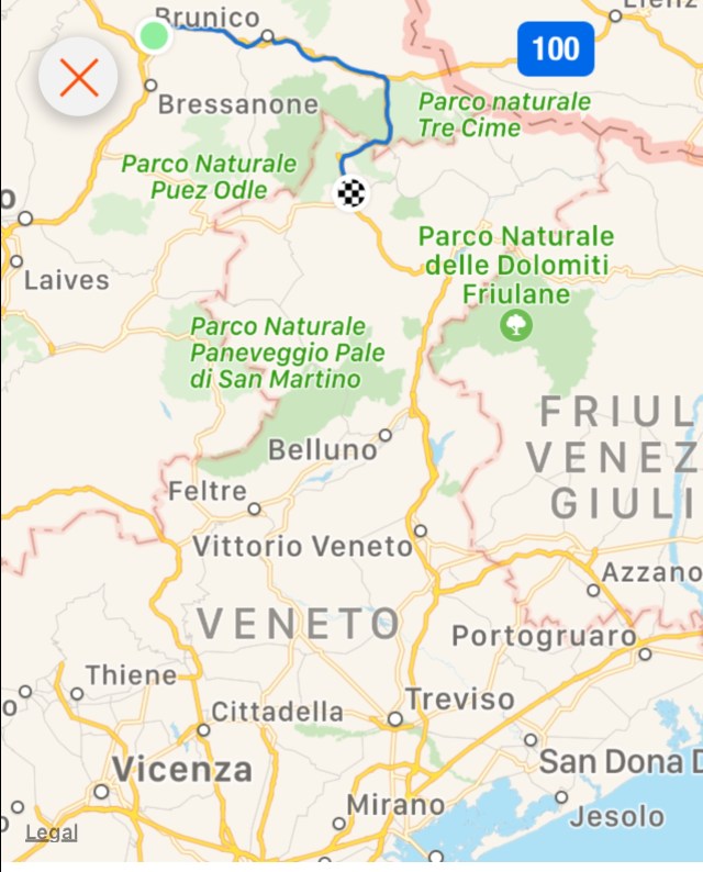
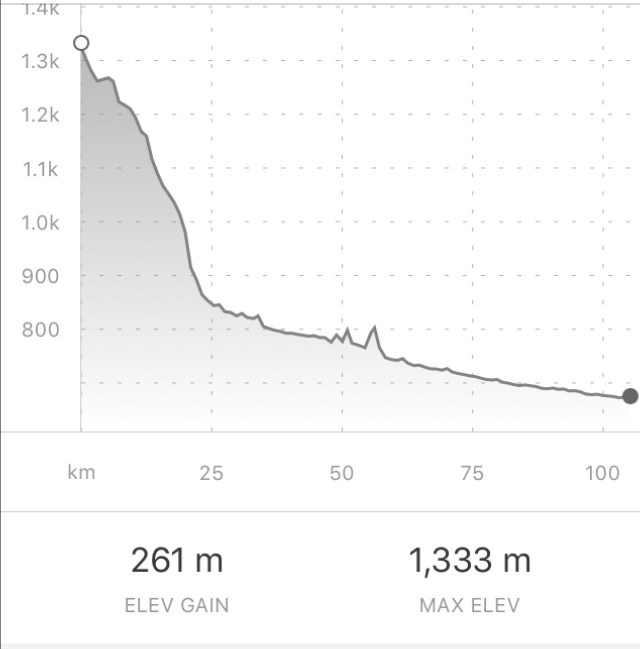
It was to be a reasonably long day..about 135 km to get from Cortina, in the Dolomites, to Asolo, in the Veneto. This was the route followed.
I was told by Geoff we HAD to be on the road by 8 am. Breakfast, get changed, pack gear, attach to bike and ready! But first I wanted to say farewell to John, the Irishman. I found him in the breakfast room. He told me he set his alarm for 6 am as he wanted to say farewell but then fell asleep. He thought he had missed me to,say goodbye. Very sweet and witty man, but I have promised to email him upon my return to Australia.
My jumbo coffee vs the standard cup on the tables. Using the machine there is an espresso plus two cappuccinos in the big cup
It was only 2 degrees and we had a descent to start with so all clothes were on. We retraced some of the previous day route in reverse. Traffic was not light.
We had coffee at the 45 km mark and then did not stop until 107 km. We rode on a variety of surfaces, roads , unsealed cycle tracks. The latter included pinches of up to 20 percent and were unrideable, for me anyway.
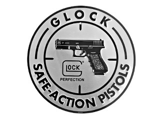
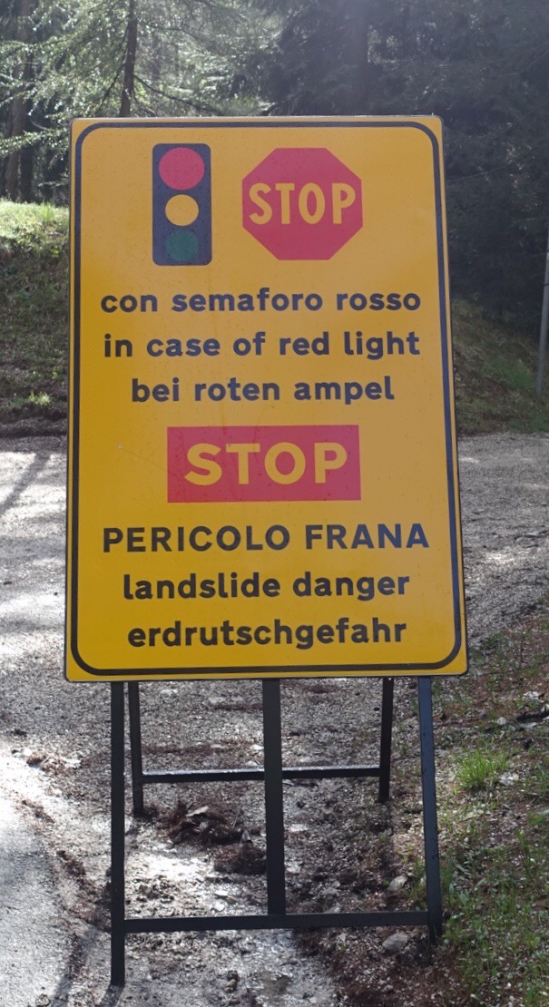
The two biggest laughs of the day….The first one was at the end of one of those unrideable bike tracks. It was horrid…steep, rocky and I was pushing my bike. It looked like a construction site…at the end there was a sign…in Italian it said that the site was a mine site, and any trespassers would be shot! Next to it was this sign….
Nice to know they would shoot you with a safe action pistol!
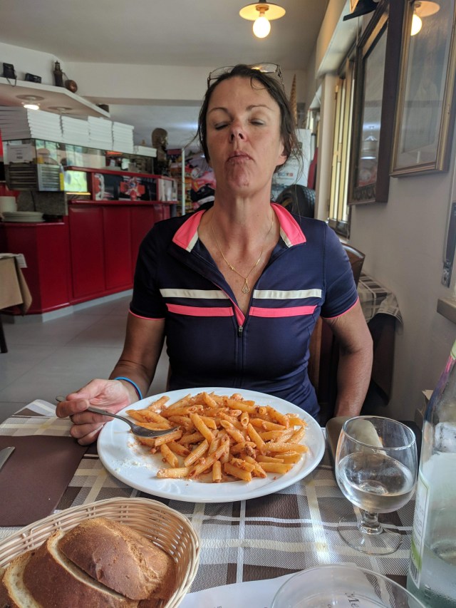
The second funny thing is this picture taken by my riding companion Geoff. I was not that hungry and I was not really enjoying this dish…too many carbs 😂😂😂
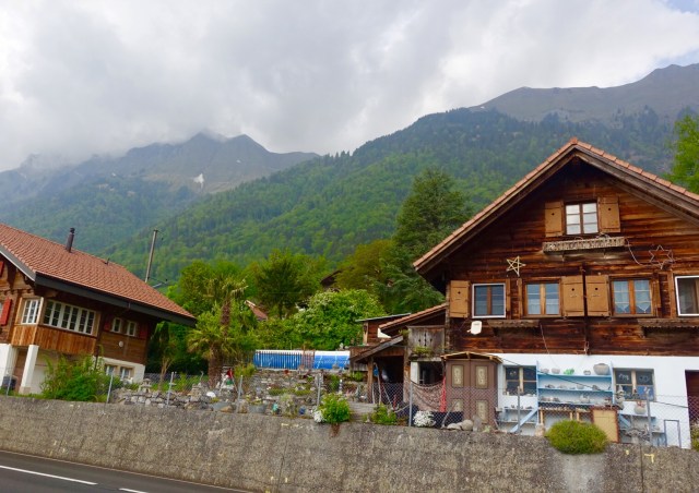
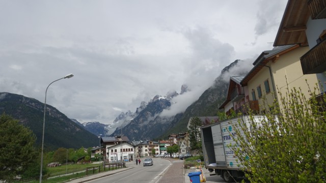
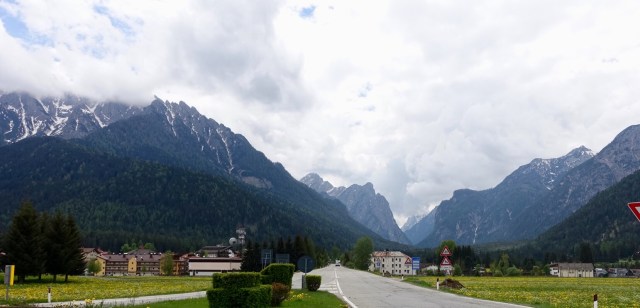
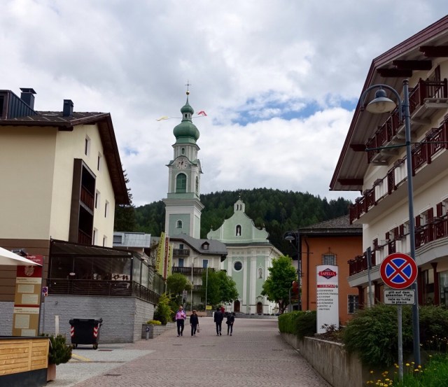
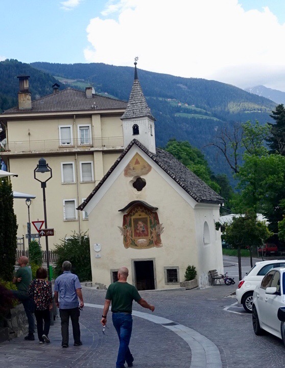
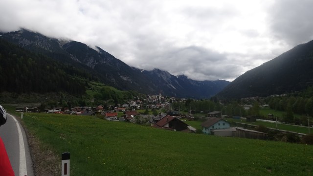
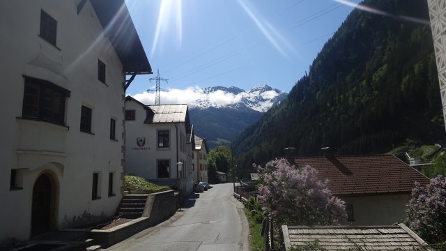
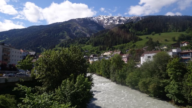
The last few km into Asolo were up a nasty hill of around ten percent. The old town looks really interesting.
I have now met a couple of our Giro touring team ( Italy Bike Tours) looking after us including Alberto, Daniele and Georgio. Daniele is a former professional rider, having won a stage of the Vuelta. He was also a team mate of my favourite cyclist Peter Sagan for many years. He had many stories to share over dinner.
Also met two other guys doing the same tour. Luke from London ( expat Aussie) and Peter ( Sydney)
So tomorrow the plan is to check out Asolo better in the morning. We then ride in the afternoon to watch the Giro stage finish.
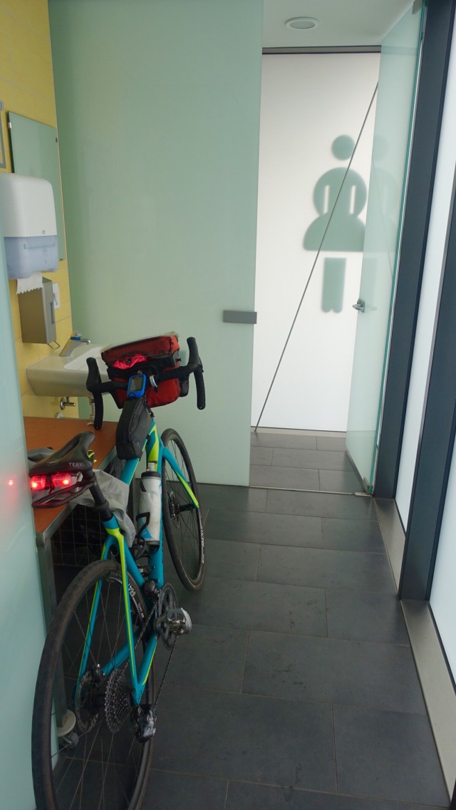
Back at our accomodation, here is the scene is the shared bathroom aka laundry….
Those are NOT my clothes soaking in the bidet! My riding companion is using the bidet to wash his clothes!!! 😩
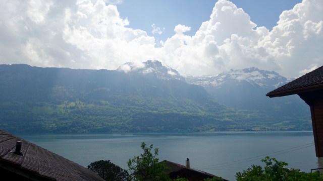
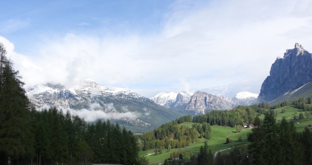
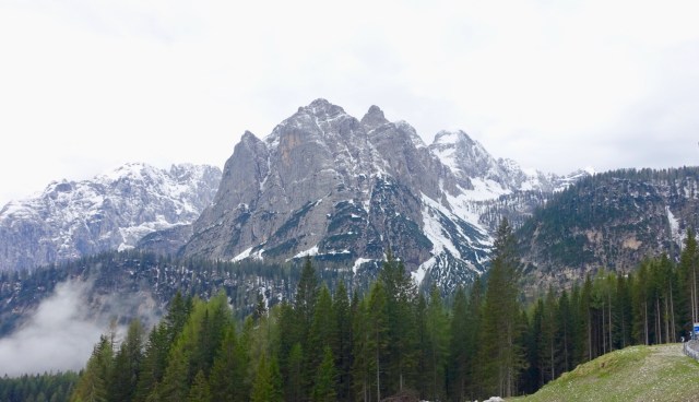
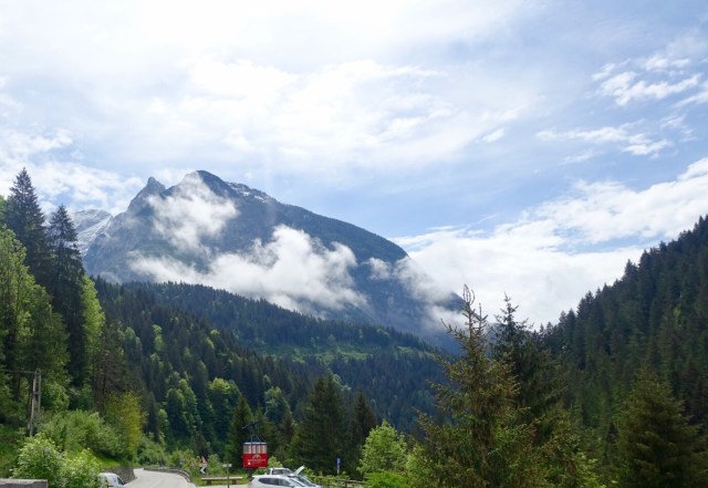
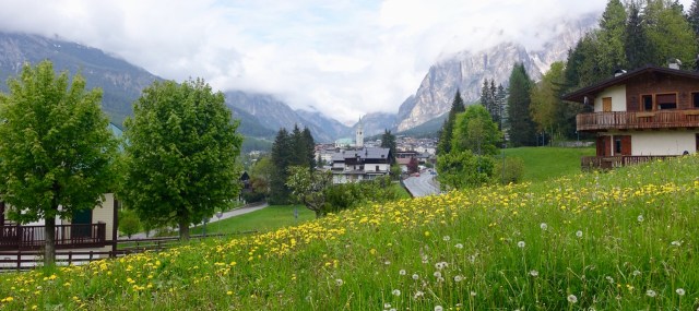
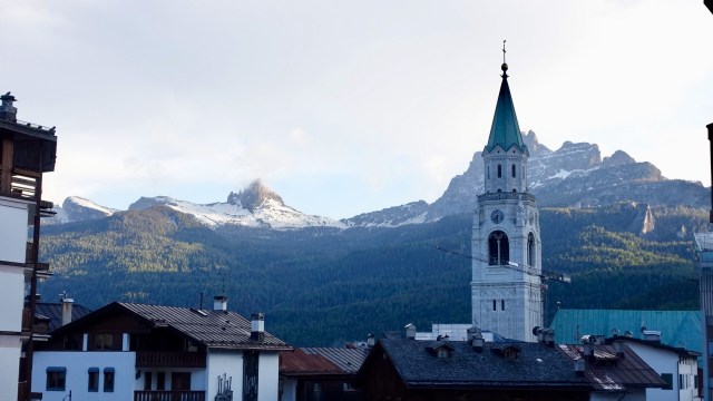
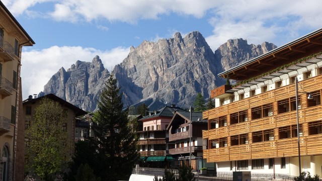
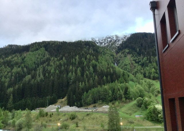
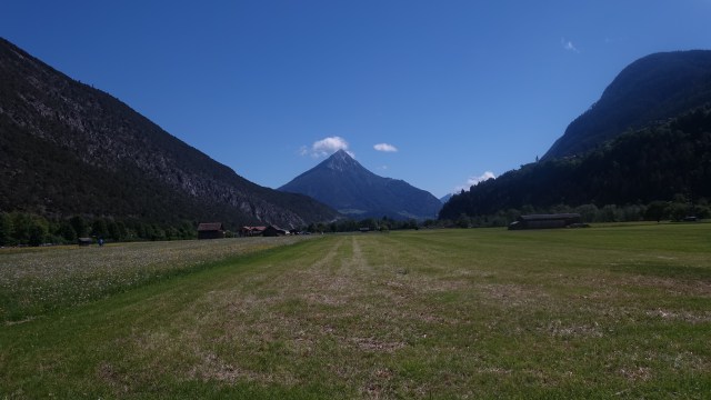
The weather looked promising when I walked out onto the balcony this morning. Yesterday I could not see the base of this mountain.
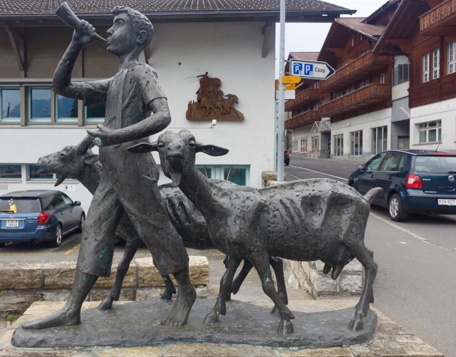
Big breakfast with lots of coffee and we were ready to roll. I quite liked this statue as we headed off from Cortina.
Immediately the road climbed, steeply! This was the view after 200 meters of climbing.
Then there was this sign……hopefully not!
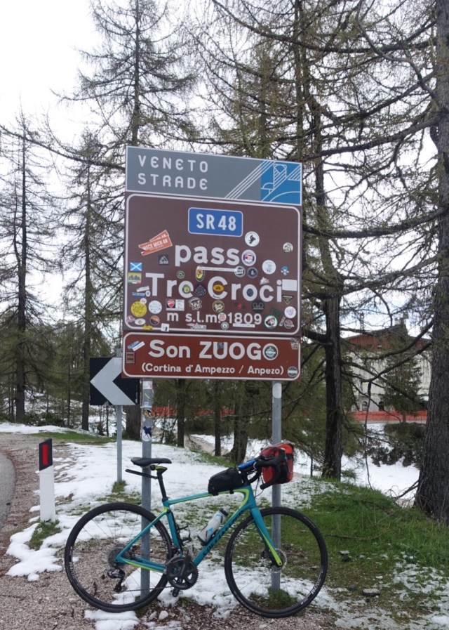
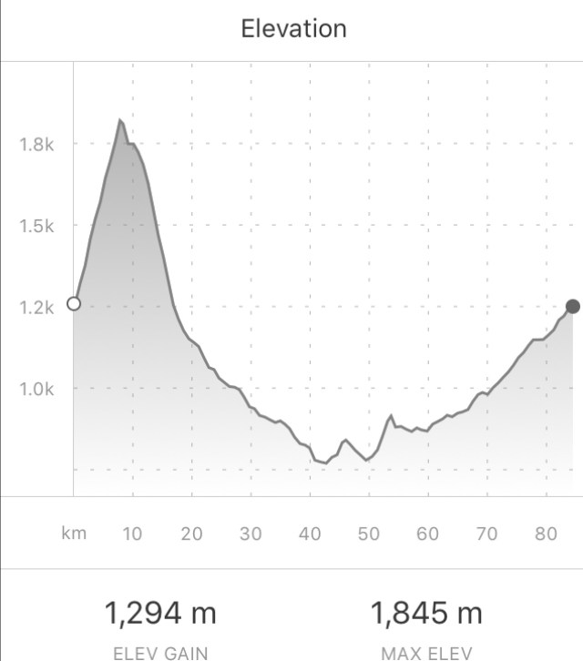
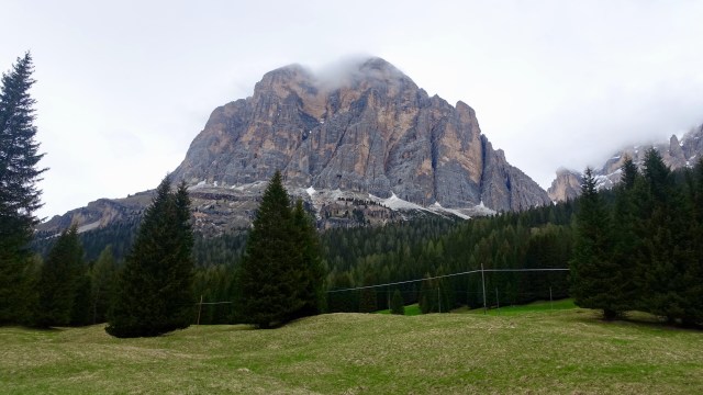
When the ride starte today in Cortina we were at 1224m above sea level. We were riding up to Passo Tre Croci at 1809 metres. On the previous ride to Passo Falzarego (2117m) the snow was at 1800m. Today the snow started at 1600m. It appeared that there had been significant snow falls yesterday.
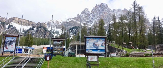
First goal achieved. The Giro d’Italia riders do this same climb on Sunday ( well I think it is Sunday?)…
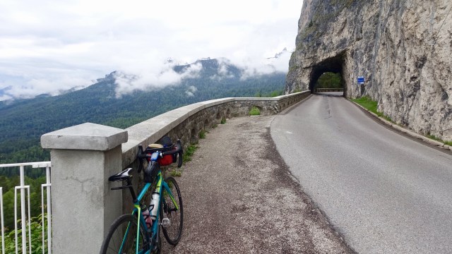
Very scenic and a nice climb. 7.95 km from Cortina and 584 metres of climbing in that short distance. The weather was nice for climbing, little traffic.
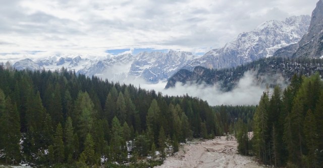
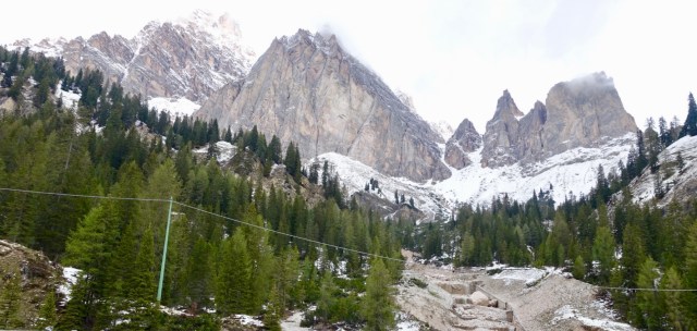
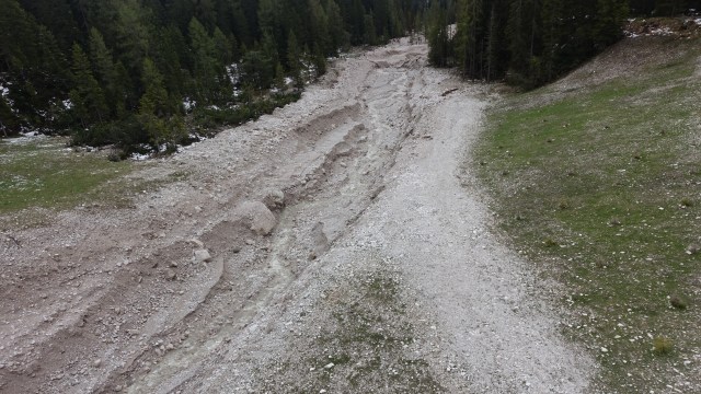
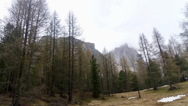
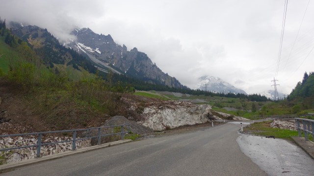
Some beautiful views on the descent. You can see the dry river beds caused from avalanches of snow. Many had heavy machinery clearing tonnes of gravel material.
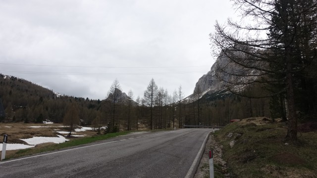
It was a nice long descent. Many sections were under repair as quite pot holed in places…new bitumen was nice to ride on.
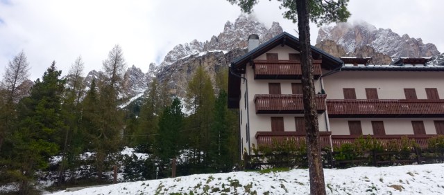
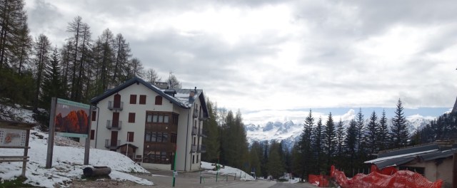
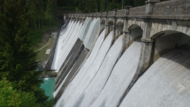
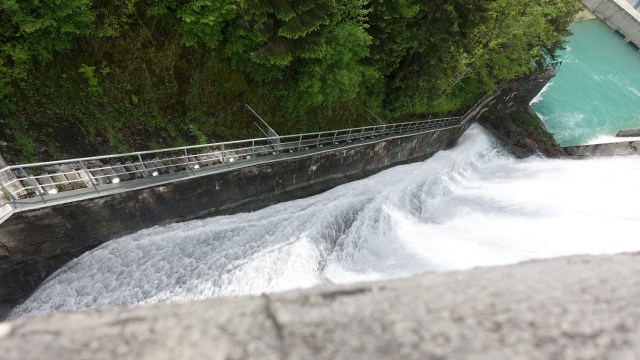
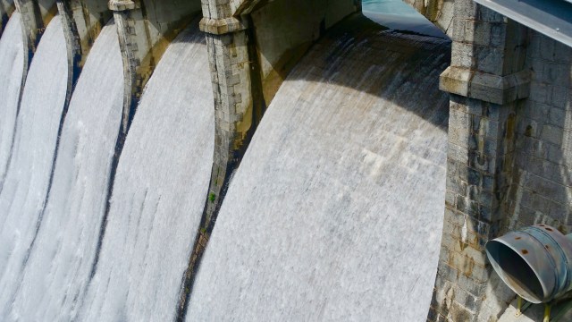
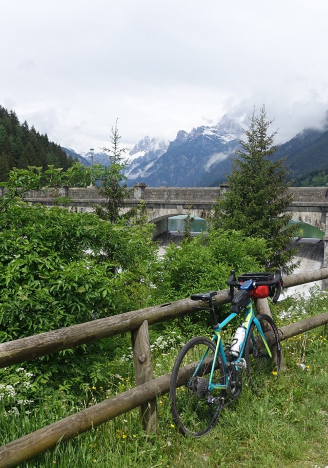
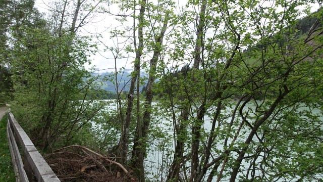
At 864m we arrived in Auronzo di Cadore where we stopped for coffee. An interesting town that boasts ski slopes, old churches and a huge dam.
Just where the wisp of cloud is you can just see a Refugio perched above the groomed ski fields
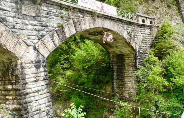
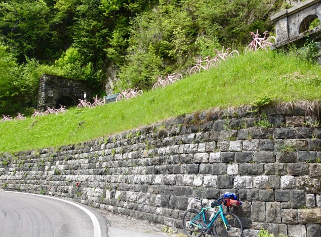
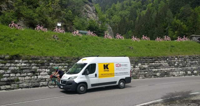
Many towns were gearing up for the Giro with town beautification projects including lots of new plants in garden beds, rose coloured ribbons and flowers being tied to railings and so on, as well as a massive road resealing program.
This caught my eye.
And then this…
As you can see above, there is no verge on the road here. As I recommended riding from taking the photo above, Geoffmshot this photo…nice and close….😩
The weather had started to deteriorate somewhat so just after the rain jacket was donned we came across a cafe…time for minestrone soup…and hey presto, the weather had improved.
We followed a bike track for the last 15 km or so. I took this photo of an old train station, as I was putting my wet weather gear back on. I particularly liked the roof line.
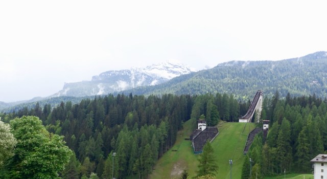
A few km before Cortina I noted the old Olympic ski jump from the 1956 winter games.
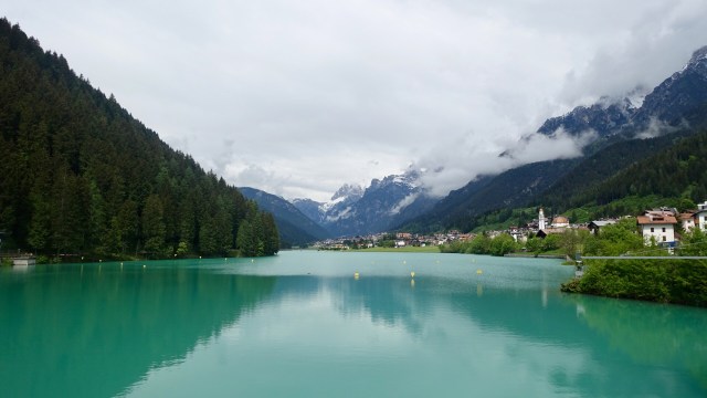
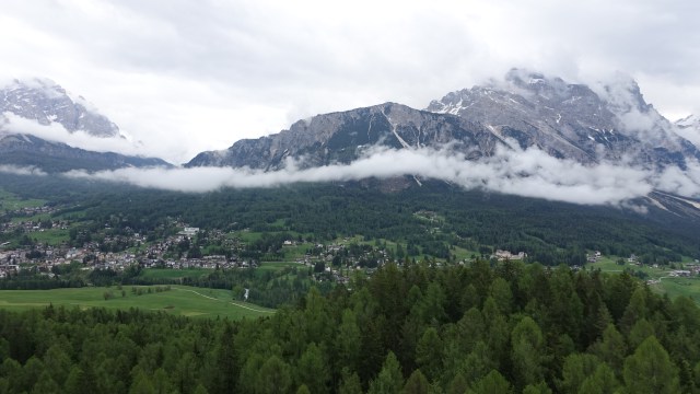
Approaching Cortina this view was really nice.
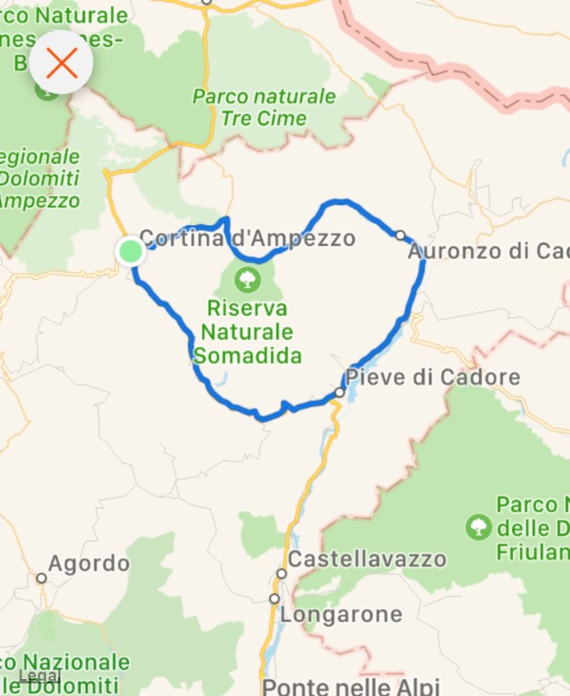
A great ride that I could recommend to anyone..only 83 km or so, nice loop.
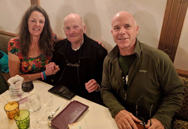
In the evening, we shared a meal with a lovely bloke staying at the same hotel, John, from County Clare, Ireland. A retired theoretical physicist, now working as a tour guide in German, French and English. He was a great raconteur with jokes and stories aplenty. He insisted on holding my hand for the photo.
Tomorrow we leave Cortina and ride to Asolo, about 130 km from here, to join up with a Giro d’Italia tour. Exciting for me, as I will be reunited with warmer clothing, as I have paid 375 euro to have my luggage collected from Bern and transported to Asolo.
Leggings, puffer jacket, Scarpa boots….oh I have missed you!! 😊
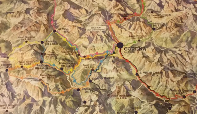
The idea of being based in the Dolomites for three full days was to do day rides out and back to and from Cortina. Maps were obtained with suggested road routes.
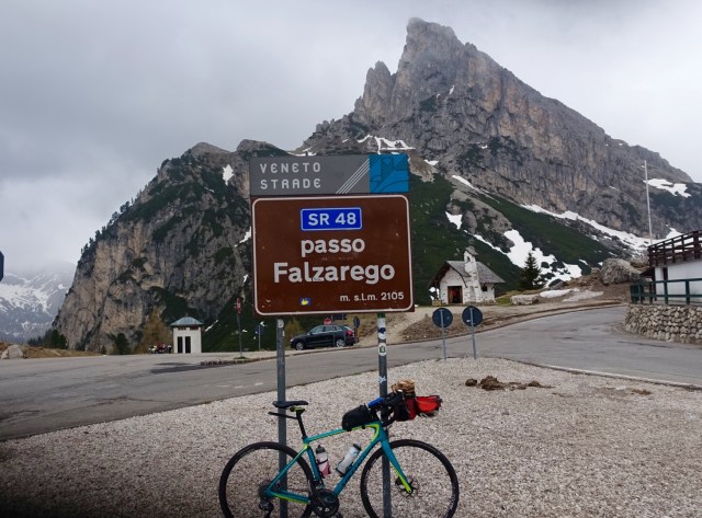
So the plan was, starting in Cortina (1,224m), climb up to Passo Falzarego (2,117m), Passo Valparola (2,192m), descend to La Villa (1,483m), Corvara (1,568m), up to Passo Campolongo (1,875m), Pieve di Livinallongo (1,475m), possibly Passo Giau (2,236m) or Passo Falzarego (2,127m) and back to Cortina.
A big ask for this chook but one I was willing to do as I knew I would do it, just a matter of pace.
Starting in Cortina it was not too bad. I had my short sleeved merino jersey, long sleeved Assos jacket, and Rapha winter short legged nicks for climbing. I carried my rain jacket, merino arm warmers, winter leggings, long fingered winter gloves in my front panier ( to be used if needed).
Cortina looked pretty ok.
Climbing started pretty well immediately. The views were great. These photos are after 200 metres climbing, and only a few km riding. (1425m).
As I approached the lookout area, half a dozen very flash Porsche’s had screamed past having their own little roaring race up the Pass.
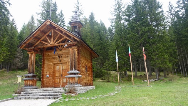
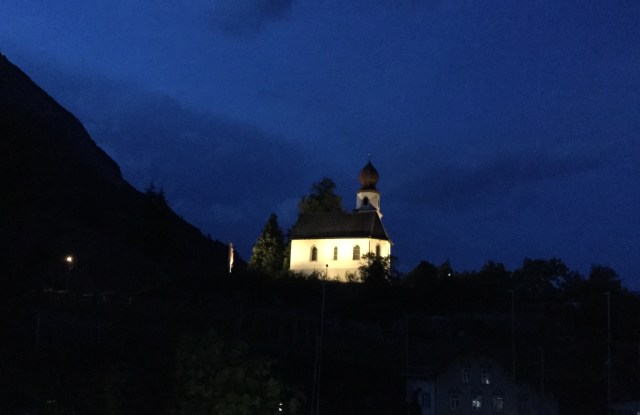
Riding on I came across this little church.
The snow started at 1800 metres.
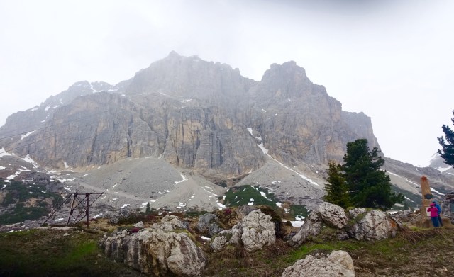
Just two km before the top of the climb it started to lightly drizzle. When you are climbing you are generating plenty of body heat so the lower temperatures not so much of an issue. I was hoping the rain would hold off long enough to get to the top as I did not want to stop and cool down.
Photo of my bike at the top and one looking to the right hand side. To the right of the Passo sign you can see a small church. That is where Geoff was to be found, huddled and cold.
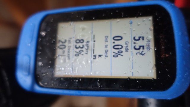
The rain started to come down heavier, and it suddenly got colder. I put my bike inside the tiny church and you can see the inside temperature on my Garmin….and that is probably 10-15 min after I entered the church.
There was a bit of a debate..what to do….we both wanted to keep climbing, but knew that we needed to be sensible. The next Pass was only another 85 metres up, but the weather likely to be worse.
The descent to La Villa and Corvara would be cold, and it certainly looked like it was raining down that valley.
With great reluctance we knew we should descend back to Cortina. All clothes were now on.
I don’t ordinarily mind descents but I prefer dry descents as they are much safer and faster.
This descent was cold and wet. The road was pot holed, in places, to boot. The temperature dropped down to 4.2 on my Garmin.
Normally descending I just control my speed with brakes…pedal when I have to. today I was riding my brakes and trying to pedal a bit to generate body warmth.
The further I descended, the worst my shivering got to the point that I was not able to keep tight corners.
With 5 km to go I noted a little pub like establishment with a light on. We pulled off the road and knocked. A lady opened the door and ushered us in. I hugged her!
Despite being wet, she insisted we sit on their cushioned bench seats. An incredible hot chocolate was made. It was more like heated chocolate custard, it was so thick, sweet and rich. We followed that up with a coffee.
I could have sat there for ages…we were only 5km out of Cortina. The rain had eased and the temperature was now a balmy 5 degrees!
Here is the reluctant Sharron ready to finish off the descent.
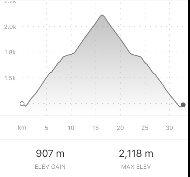
A perfectly symmetrical graph today! As you can see the climbing of 907 metres done in 16 km. A nice climb I am hoping to do in slightly warmer weather.
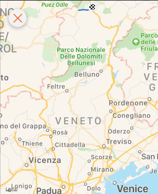
I have expanded the map so you can see where I am in the Veneto area.
The forecast tomorrow is worse. Maximum of 9 degrees and rain. Wednesday looks a bit better. Will a ride be done tomorrow? Not sure….will wait and see if the meteorologists are right!
Leaving Muhlbach the weather looked a bit ominous. The forecast was not great. Low cloud on the surrounding hills looked eerie, particularly around this old castle.
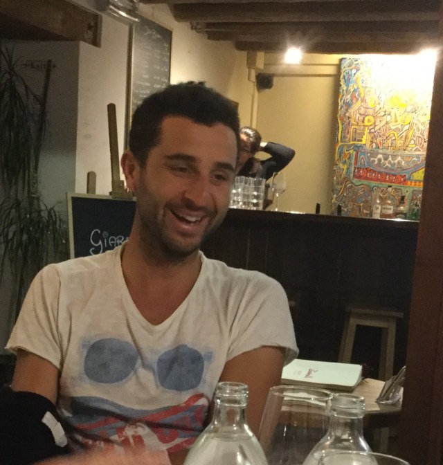
Today we spent a lot of time on cycle pathways, both sealed and unsealed. We met a guy named Chris from Austria who was heading home on a 185km ride.
Geoff and Chris
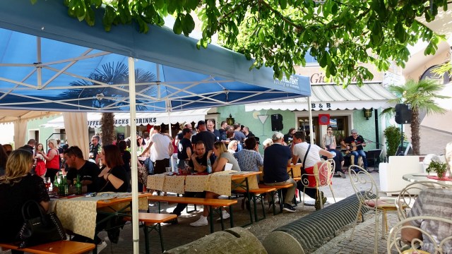
The track took us into what we thought was a quiet and deserted village….until we rode into this square. It was not quite 10am and people were sitting around drinking wine already. Cyclists rode through. It was the hub of all activity.
There were a number of people wearing the Tyrol costumes looking like Oompa Loompa’s. They must be getting ready for something big if they needed to drink wine so early.
Then they all lined up with their instruments and I waited and waited….ever so patiently….
I had no idea this photo was being taken….I am getting a tad bored and impatient waiting for the big oompa loompah event…
Then they started to play…stick with the video…the band are riveting and I have an extra who was ever so keen to be in my video…kind of sweet and makes me smile…twice! In fact the highlight of the video, and I mean that in a really nice way..😊
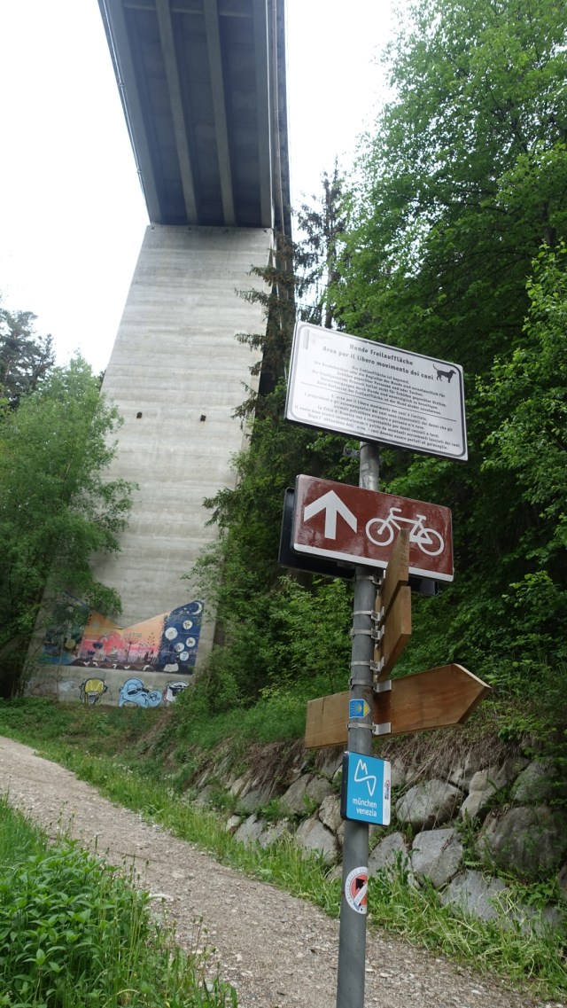
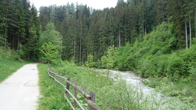
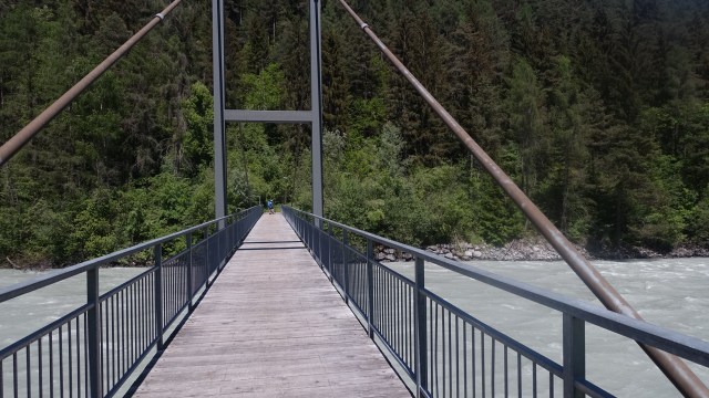
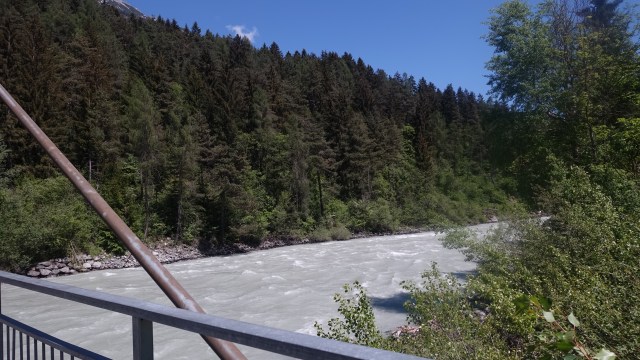
Back onto the cycle path following a river through forests, under motorways.
It was interesting to note the structure across the river. It appears, from signage, to exist to prevent major debris floating downstream during flooding.
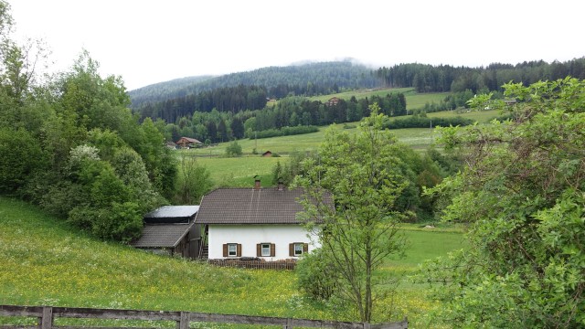
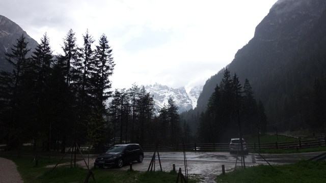
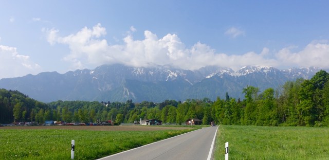
Pushing on, snow clad mountains returned as we approached the Dolomites.
Still following rivers…
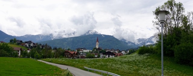
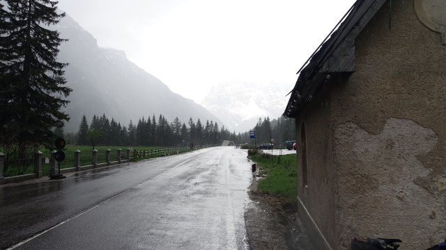
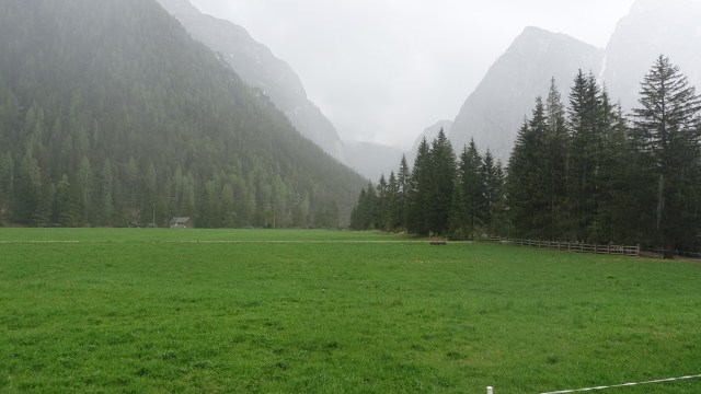
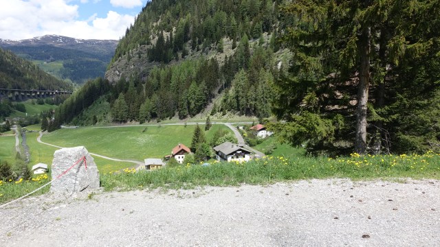
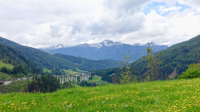
With only 28 km to go until Cortina, this was our view. We needed to turn right to head towards that V, part of the mightily impressive Dolomites.
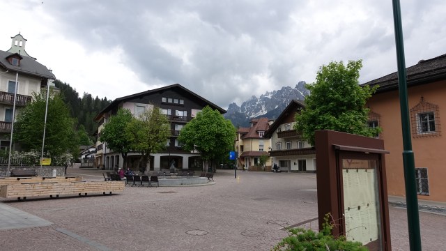
Before turning right, we peeled left into the village for a bite of lunch. A nice village with beautiful backdrops.
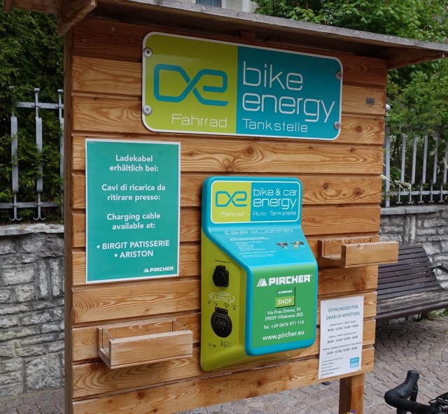
It also had this station for charging electric cars and bikes.
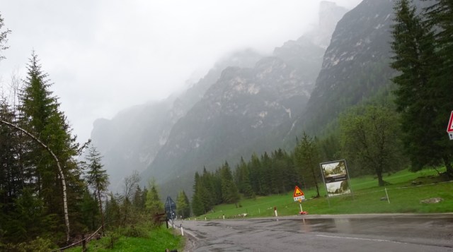
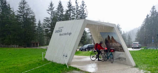
We were there for nearly 90 minutes….I think they forgot about our soup….so long that the weather had really deteriorated and we got wet!
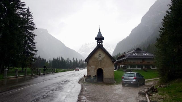
We sheltered under this UNESCO information portal and waited a tad longer as the sun was trying to break through further north.
The portal also represented the top of the climb, so it was pretty well flat or downhill to Cortina. No photos taken as it was a cold descent around 8 degrees, and whilst I had my rain jacket on, my legs were bare, and I wanted to just keep pedalling. I was cold!
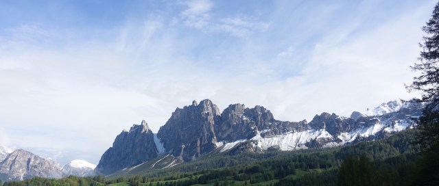
Cortina is a nice town, very quiet as the ski season has finished. Walking around I was impressed by the surrounding mountains but the last one was my favourite.
The plan is to stay here until moving onto Asolo to hook up with the Giro. I suspect climbing maybe involved in the next few days, if the weather holds. Current forecasts not looking great.
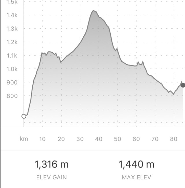
Leaving beautiful Innsbruck after a filling breakfast…some little extras packed away in my front panier including chocolate cake! Yes, from breakfast.
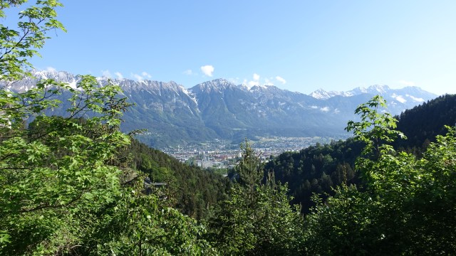
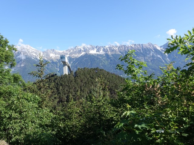
We had left the traffic of the city behind after perhaps 1.5 km and started climbing…quite steeply..up those mountains. The climbs were up around 9 percent until we had reached Igls. The views back over Innsbruck were great.
That is a ski jump,Tower you can see
We kept climbing for a long time today..some 30 plus km heading to Brenner Pass, which is on the border with Italy. After Igls, we left the main road and rode in cycling tracks again. Whilst they are invariably slower, they are safer. They also travel through man more villages.
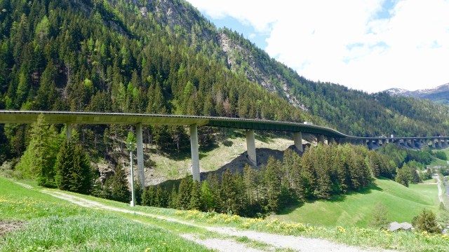
Just above you can see the main motorway. Incredible infrastructure that went for so many kilometres.
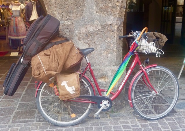
Do you remember the photo in yesterday’s blog of a heavily laden bike that included a guitar? That same guy was walking his bike up Brenner Pass, and when I got to him, he was scrounging through a rubbish bin on the side of the road. Sad, perhaps he was looking for food…?
A few km before the top of the Pass I stopped to eat my banana. Nice views back down the valley.
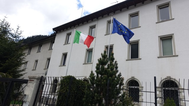
Brenner Pass was not what I expected at all. It is quite heavily saturated with discount shopping stores, a railway station, truck depots and the like. So we did not stop until I found an Italian flag to photograph.
Looking down into Italy.
The cycle tracks from Brenner Pass were amazing. Wide, great condition and through great forests until we arrived in Vipitono. It was so inviting we decided to stop for coffee and apple strudel.
Despite now being in Italy, the area is still very much Austrian and German speaking.
We were now only about 30 km from our destination. Rain threatened, but again we were lucky and only scored a few drops. We rode further down the valley, eventually arriving at our destination, where the sun shone, and it was now about 26 degrees.
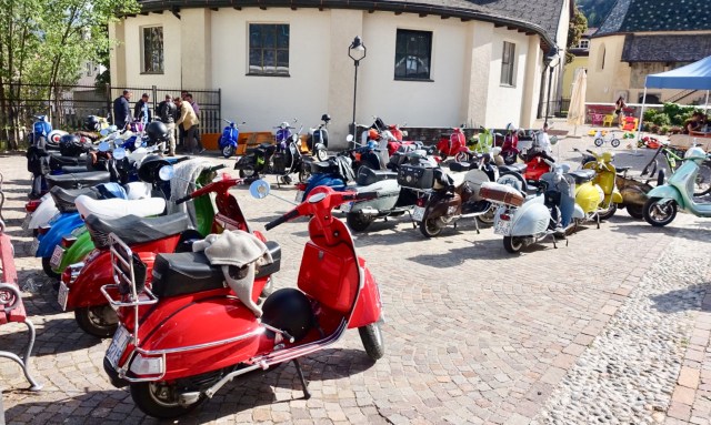
We found our accomodation…and there was a party out the front, complete with a band. The party was to celebrate vespa’s. We created quite a scene trying to get through the crowds with our bikes, and into the hotel.
A couple of men grabbed my arms to indicate ‘strong’ 😂😂😂
Many also wore these Austrian leather pants.
A really nice little village…still buzzing with partying as I write.
Todays route and climbs.
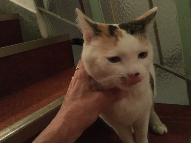
The wifi is really poor in this hotel. As I write, I am sitting on the stairwell, just above reception, trying to get a strong enough signal. I have had company….now I know it looks like I am strangling him, but I’m not…trying to rub his neck as I take the photo.
The Austrian Italian cat!
So another day done and dusted. Tomorrow is the Dolomites!
Heading out the door this morning we were all rugged up. Leg warmers, jackets as it was only around 7 degrees. The photos are looking down the valley leaving the St Anton accomodation where we really pigged out on a great breakfast.
I was told today was a rest day riding wise…easy…all downhill…sounds good!
Sure on the data for the day it looks all downhill too.
However the ride was not that quick as for the most part, we were on cycle tracks which weave around, winding through little villages, dirt, gravel and sealed.
The advantage is you see so much more of local life and gain great vistas.
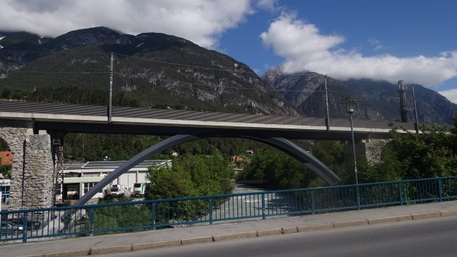
We were really slowed down in the major city of Landeck with bumper to bumper traffic. I pulled over to take a photo of the bridge. There is a small castle on the mountain as well.
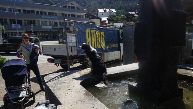
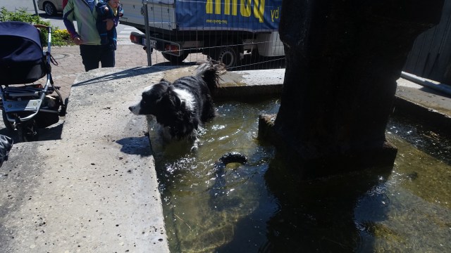
A couple strolled past with their dog, who jumped straight into the fountain splashing water around. Reminded me of my beautiful dogs at home as Simba would do the same thing if she could make the fountain height.
More views from the bike route.
We crossed the river numerous times.
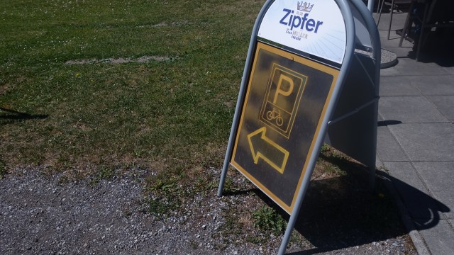
Stopping for lunch at a cafe adjacent to the cycle track, including signage for bike parking.
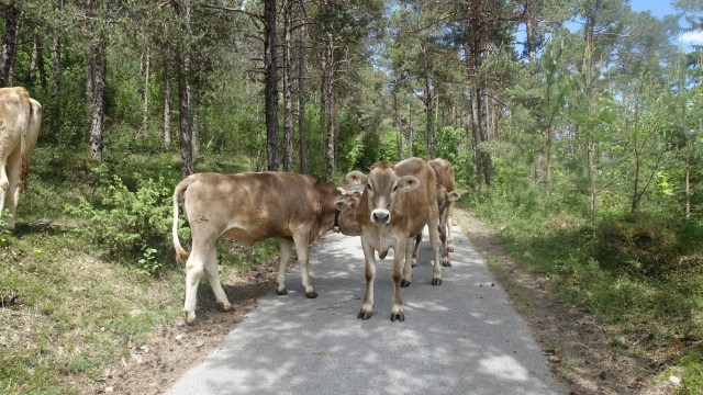
Leaving lunch the track climbed steeply, around a corner, push, push, push and woah! Track blockage ahead….
Now these beautiful cows were not moving…off my bike and I slowly pushed my bike past.
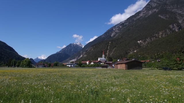
Another nice village…
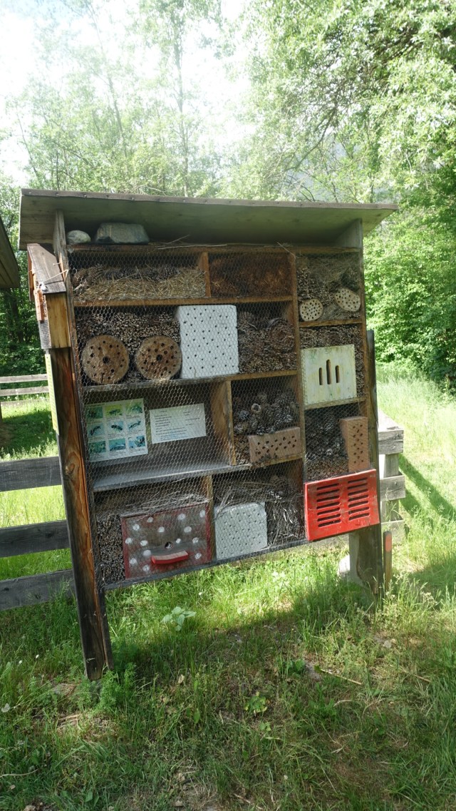
Here is a nesting box for 9 different types of wasps…I hope they all know who goes where and there is no co-habitating!
The last 10 km into Innsbruck was fairly straight forward, locating our accomodation that has been prebooked. I had a guy sitting behind me the whole way… he thanked me when he finally passed..you g
Todays route:
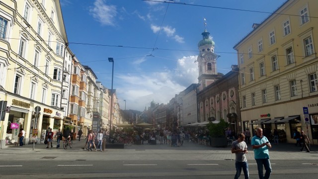
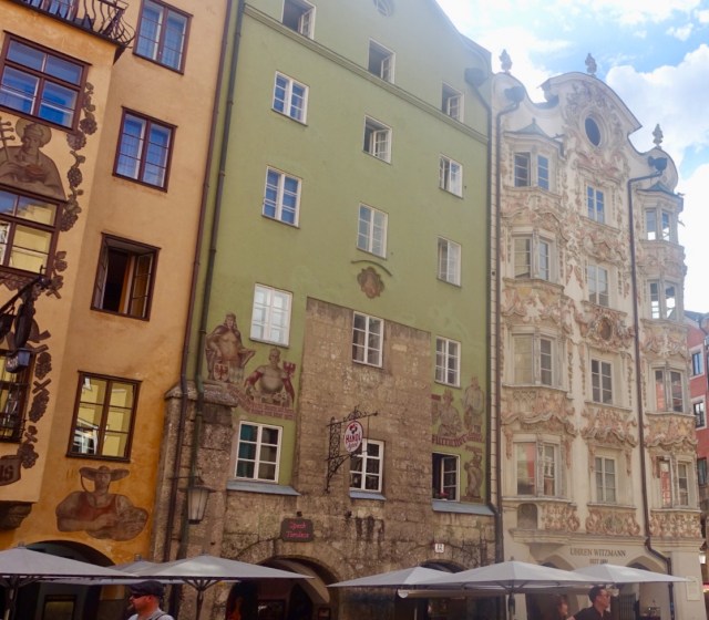
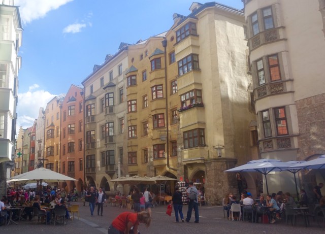
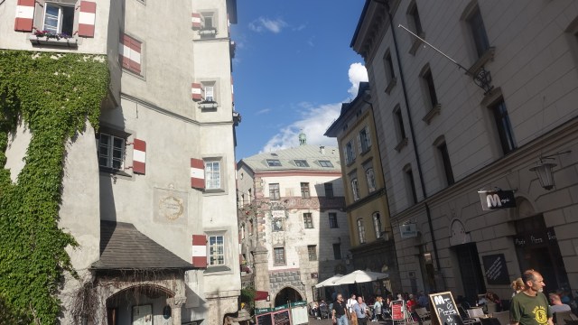
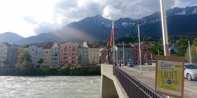
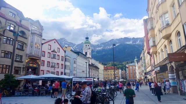
After washing our clothes and showering it was time to hit the streets and check out this old city that has great architecture, and surrounded by mountains all around.
Unfortunately the sun angle was not supporting me with photographs.
Two other items of interest. Firstly this group played beautiful music.
I watched a guy dressed in Austrian styled costume ride into the square on this bike. He was obviously very trusting as he left the bike and wandered off into a shop.. totally the opposite of me, as I never leave my bike unattended.
Just check it out…umberella, llama bag, sheep wool lined jacket, guitar..
So, another 105 km knocked off today and tomorrow we cross the Brenner Pass into Italy. A day of climbing …aaarghhh.
Today was going to be busy and interesting, riding in 3 countries, with the weather forecast indicating rain and thunderstorms.
I was up early and had my breakfast. This was the early morning view.
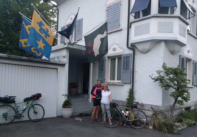
Said goodbye to Marion. She and her husband Peter were very kind hosts.
Marion and I
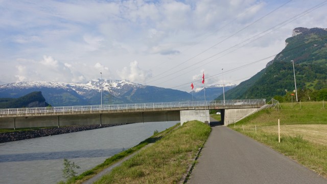
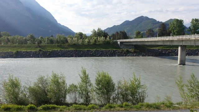
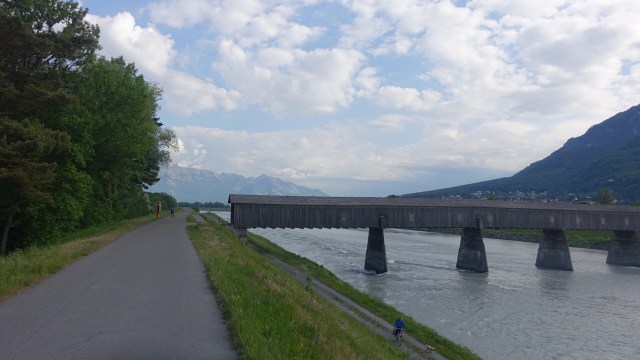
We left Sargans and headed straight to the Rhine River, travelling down the bike path. I had been on this path before, but travelling in the opposite direction, en route London to Venice in 2016.
Liechenstein loomed ahead.
We crossed the Rhine via this wooden tunnel bridge…trying to avoid dollops of horse poo.
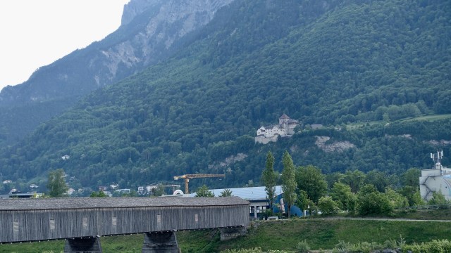
An old Schloss (castle) in Liechenstein.
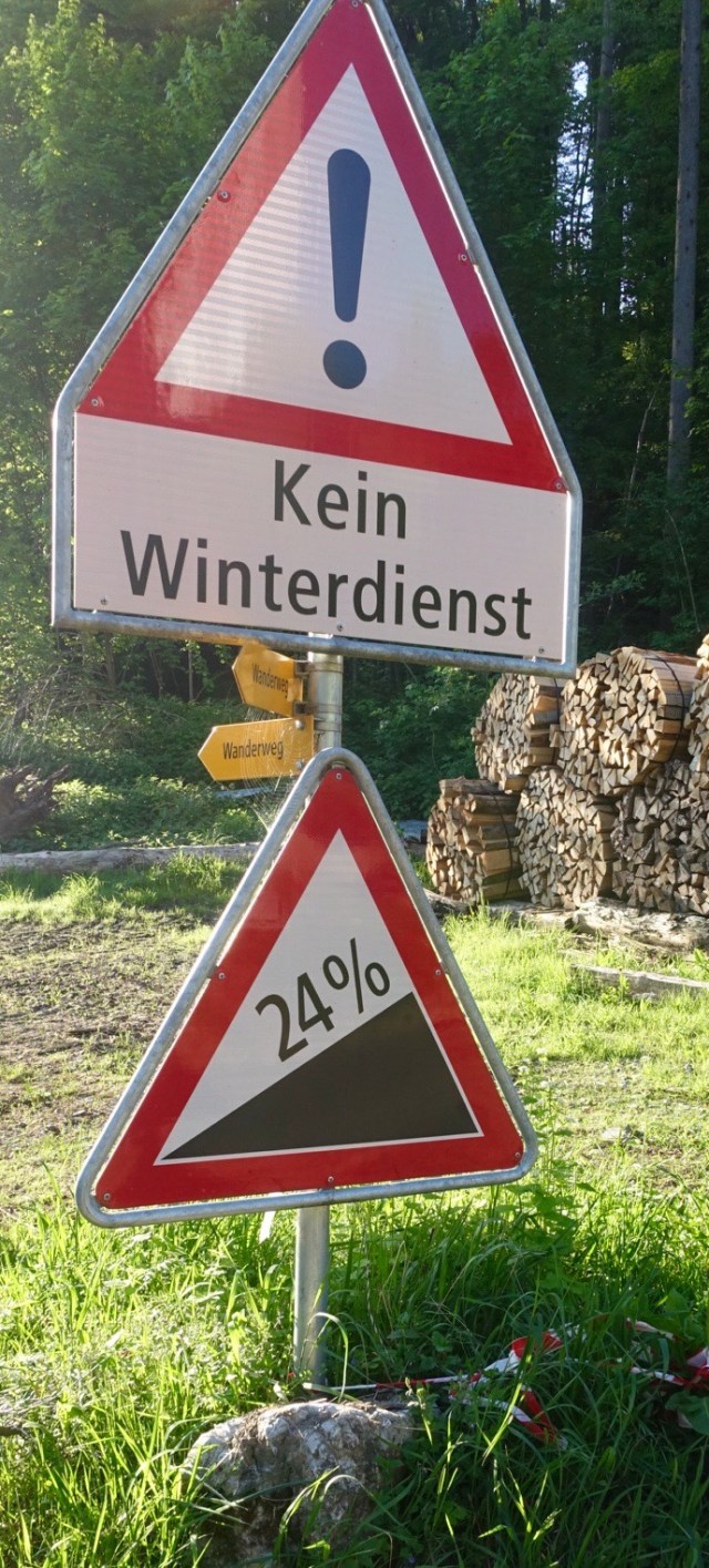
Garmin maps sent us on a few interesting routes today. In Liechenstein we climbed a nasty little pinch in a village to drop down to this vegetated track, that had pinches of 24 percent. Needless to say, I walked my bike down as it got steeper and ruttier.
This happened numerous times in the morning, pushing the bike up or down gravel.
Today was a public holiday in Austria. Very little was open. When we saw a little restaurant open in a small village we stopped for a bite of lunch.
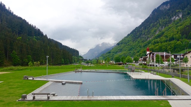
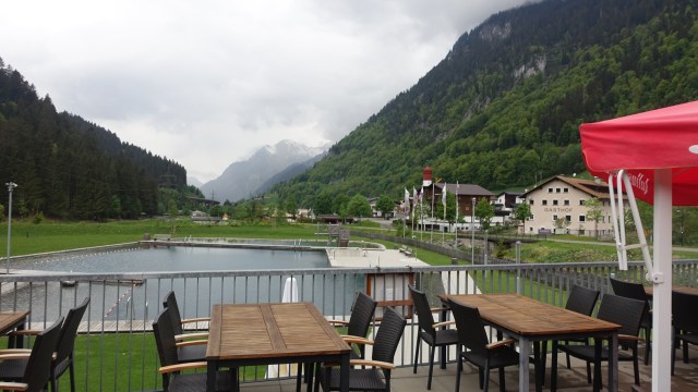
Nice views towards the mountains from where we had just ridden. This is the local swimming pool filled with water from the adjacent river.
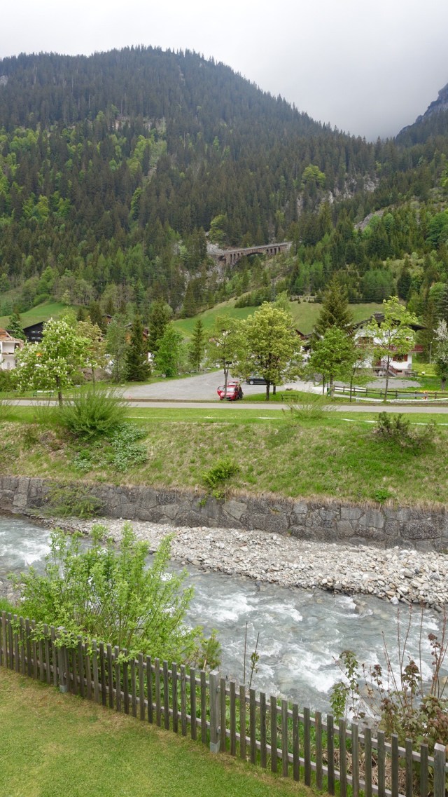
Note the old rail bridge up the hill.
Leaving lunch we started climbing (walking up a steep gravel track, as well as crossing three railway tracks carrying our bikes!)
First snow on the side of the road….large drifts that seem to have slid down the hilly escarpments, gathering dirt and trees in its path.
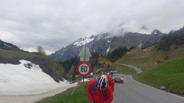
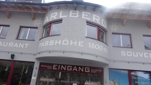
Stubens is the village ahead that indicates the start of the climb up the Arlberg Pass. As I approached I watched cars weaving their way up the hairpin bends knowing it would be me up there soon enough.
It was a nice climb…nice in that the gradient was a fairly steady 9 plus percent, with relief on some hairpins.
I was eating some nuts as I climbed, and breathed in a small chunk and started coughing so stopped to keep coughing, stretch my back, have a drink, take some photos.
At the top of the hairpin bends I found Geoff waiting and we pottered off on another steady climb of around 6-7 percent, until he scored a puncture and we needed to stop.
Looking back down the hill whilst Geoff fixes his bike.
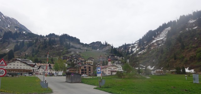
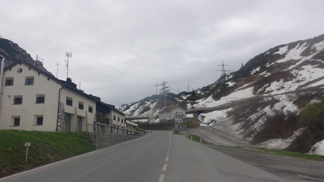
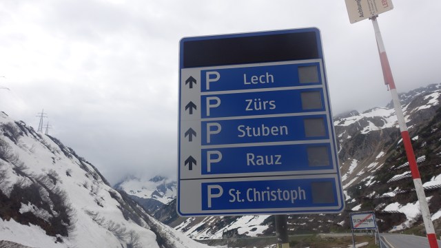
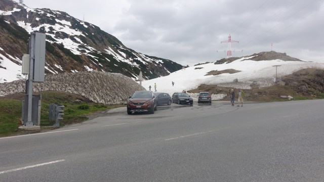
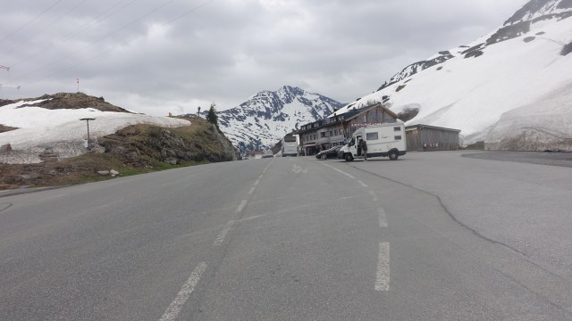
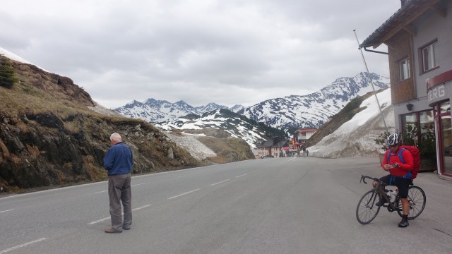
At the top of the climbing is St Christoph, but nothing open there today bar roads to different villages.
The top of Arlberg Pass is at 1800 metres
From St Christophs it was downhill to St Anton, a large ski village. Great cruise with no issues…you can see the graph below for the day. We are currently at 1200 metres above sea level.
I have never cruised through such a large, yet dead, village. There are so many accomodation places here, but none open.
A local bakery was open and a fuel station. We were very lucky to find an accomodation place nearby, but charging like wounded bulls.
Tomorrow more rain is forecast, but so far been a bit lucky avoiding most of the worst weather. It will be a shorter day of around 85 km as we are heading for Innsbruck.
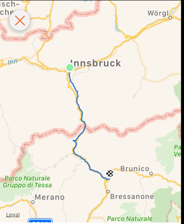
Todays route via three countries.
So thanks for reading and supporting and encouraging me via Facebook and strava and on here. I am most appreciative.
😊🚴
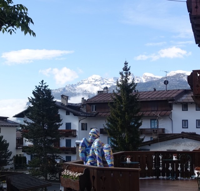
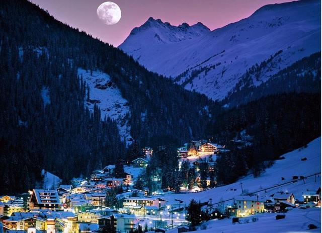
My final photo is a borrowed one….taken in winter, to show what this place is like when buzzing. Great photo.
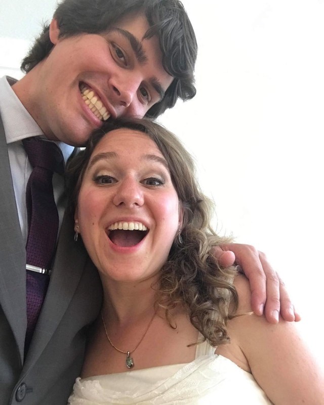
Yesterday was a day to celebrate my son Ben’s wedding to Sharon. It was a beautiful event, with meaningful vows, surrounded by close family and a few friends. We later celebrated with more friends and family back at the Steinemann household.
Festivities included a traditional Steinemann treasure hunt in the nearby forest, bride and groom included.
Massive kudos to Judy, Stefan, Joy and Devita for all the work behind the scenes and on the day.
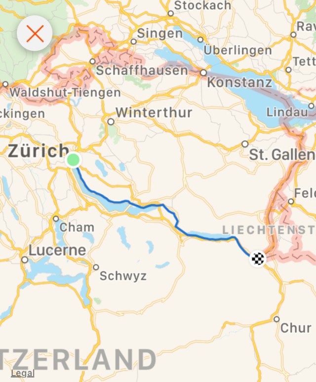
This morning it was farewell to Bern and my home for the last 7 nights. I was up early, packed for my next adventure – bikepacking across to Italy.
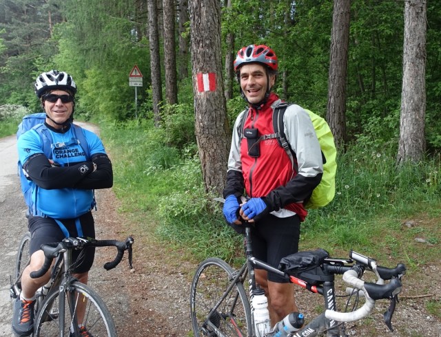
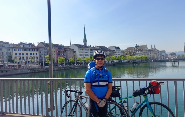
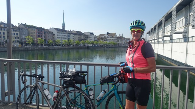
I arrived in Zurich by train and needed to meet my first navigational challenge……I needed to find my riding companion Geoff at an allotted cafe!! Up and down a few escalators in the sprawling Zurich railway station and I found him ready to roll…well not quite, he needed a coffee first.
Geoff hails from Mudgee in New South Wales and is a friend of Tony and I, whom we met on the London to Venice trip. He flew in this morning on the long haul flight from Sydney, put his bike together at Zurich airport and rode to the railway station.
Jetlagged he was determined to get 100 km done and dusted.
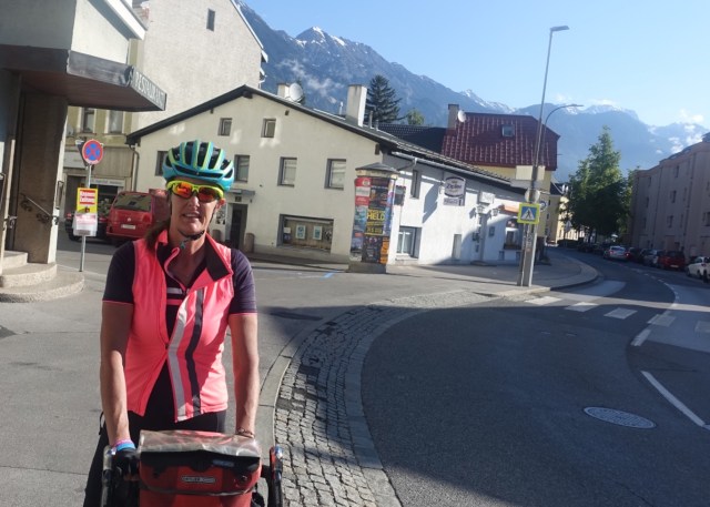
So the obligatory starting photos:
Navigationally the plan was simple….follow Zurichsee, Obsersee, and Walensee until we hit the border with Liechtenstein. We would follow a variety of surfaces including sealed roads, sealed bike paths and gravel tracks.
This next picture is near the base of Zurichsee where there is a thin isthmus before Obersee.
For lunch we stopped at a village supermarket and sat by the river beteeen two lakes. Heading off this view way nice ( the mountains I am referring to!). But check the size of Geoff’s backpack. Don’t think I could carry that up some of the mountain passes we need to cross!
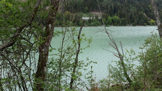
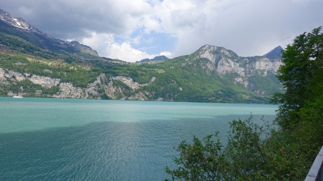
The colour of the lakes water is an amazing green.
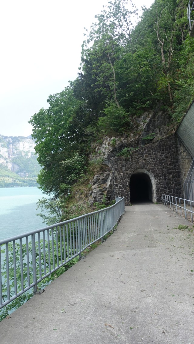
Riding along the edge of the third lake, Walensee a tunnel looked ahead…after my scary experiences a few days earlier I was feeling ok, as we were on a bike track ! Probably not long…
It was not 1325 metres long, but a decent length as you can see…how awesome as this is infrastructure just for cyclists, and walkers. There were about three we travelled through.
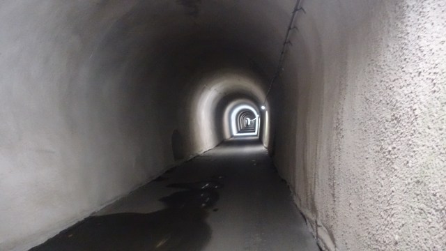
Nope you can’t see the end, and it is not as light as it appears…my flash brightened it up.
Nice house and backdrop.
Bike path signs..
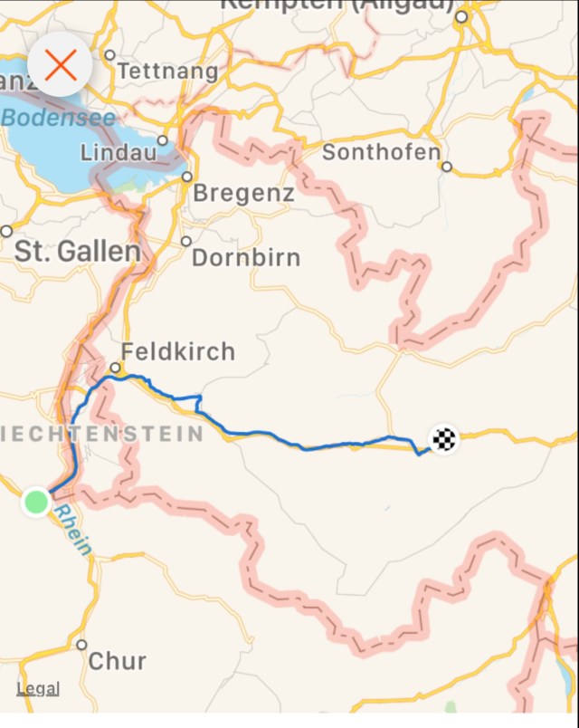
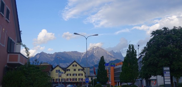
By mid afternoon rain was looming high in the mountains and we felt a few spots of rain. we had just ridden into Sargans, which is bordered by the Rhine River and Liechtenstein just a few km down the street.
We had no accomodation booked and we saw a sign for Marion’s Bed and Breakfast. Geoff tried unsuccessfully to haggle the price. A very lovely, welcoming couple who have a fan going on our hand washed cycle clothing.
They made suggestions for dinner, and the lady who worked at that restaurant just happened to be driving past and they arranged or us to have a lift.
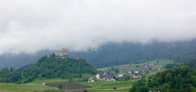
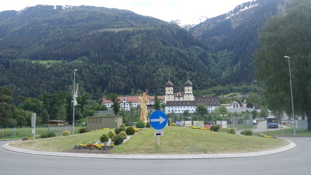
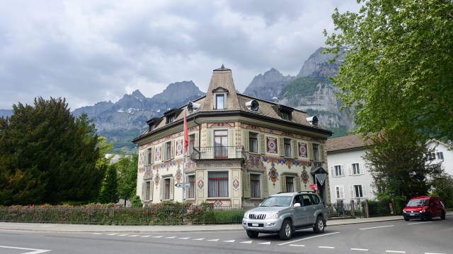
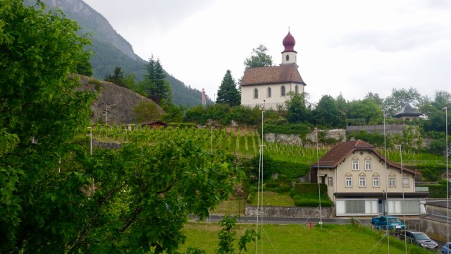
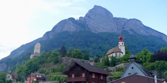
We had a wander around town which boasts an interesting history dating back to medieval times, a Schloss ( castle) from 1282, and the dominating Mt Gonzem.
Enter a caption
Todays route of just over 100 km.
Geoff hit the sack early, not surprisingly tired from his flight. I learned two things today about him. Firstly, he has asked me to ensure he does not have more than two beers, otherwise he might become belligerent and sarcastic. He only had one!
Secondly, he seeems to steal stuff. He found a set of VW keys in his pocket. He is unsure how they got there, or even whose keys they could possibly be? Did he collect them in Australia or Switzerland?? Who knows, but if you are missing your keys, they are at Marion’s B&B in Sargans, Switzerland…😬😂
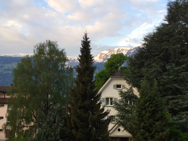
Time for me to get some sleep for tomorrow’s big climb. As I finish up, this is the view out the kitchen window of the B&B. Goodnight Switzerland.
The plan after breakfast was to ride to Interlaken, and if the weather was ok and the road open, do the ride up Grosse Scheidegg. I knew from the outset there were a few things going against me doing this ride.
It was possible that the road was not yet passable, due to snow. Secondly, even if it was open, rain, thunder and lightening were forecast. Finally, there was was the omnipresent rib issue and deep breathing needed for such a tough climb.
I decided to deal with each as the day unfolded.
I had mapped a ride out on Ride with GPS so set off with a multitude of pages and instructions. What confused the matter was a plethora of cycling trail routes, with various route numbers that crisscrossed.
Within minutes I was doubling back and headed up this road with this sign on the left. Fortunately my climb was not nearly as steep.
I stopped countless times to check my navigational points. I have no wifi on my phone, so I had taken many enlarged map images as photos on my iPad, so I would check and double check.
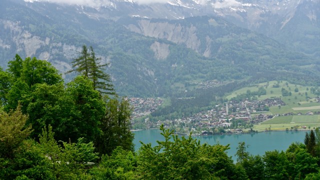
The Berner Oberland approached.
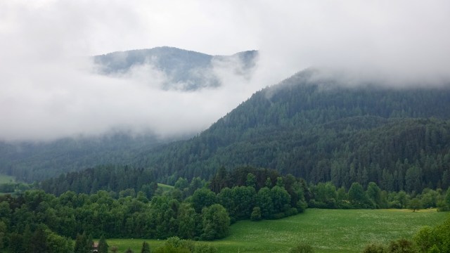
As you can see, the view was awful. This is the view I had for most of the day…various aspects of the Swiss Alps. This is the range behind Thun.
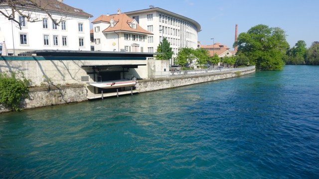
I rode straight through Thun, which is a historic market town set on the River Aare, at the northern end of the Thunersee. A very old town with a castle on a hill. The town is quite spread out and I headed across the river as I was going to head down to Interlaken on the Alps side.
Crossing the River Aare, it’s the small Police boat.
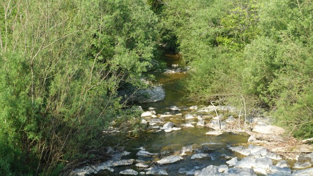
I followed a nice bush trail before turning back towards Thun to find the secondary road. The bush trail was lovely, but slow going.
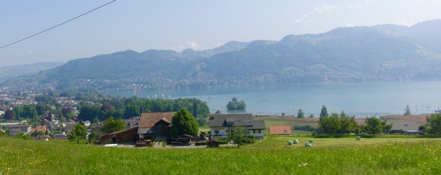
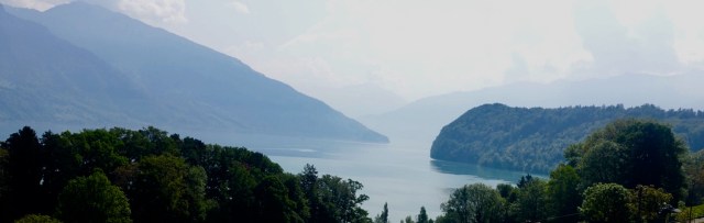
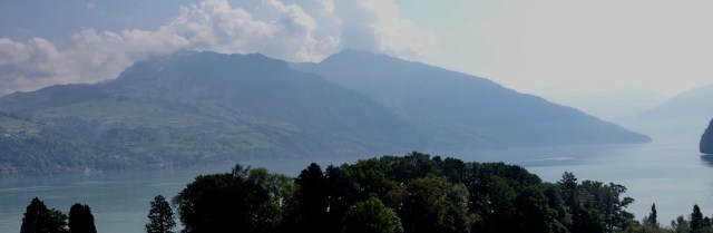
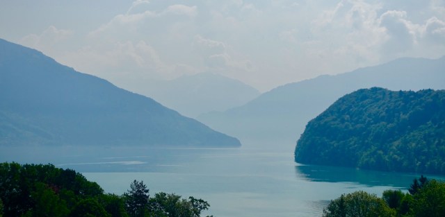
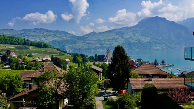
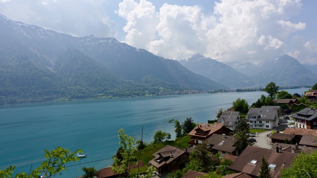
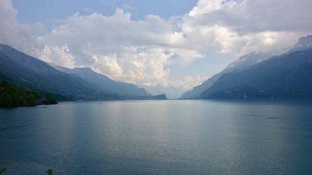
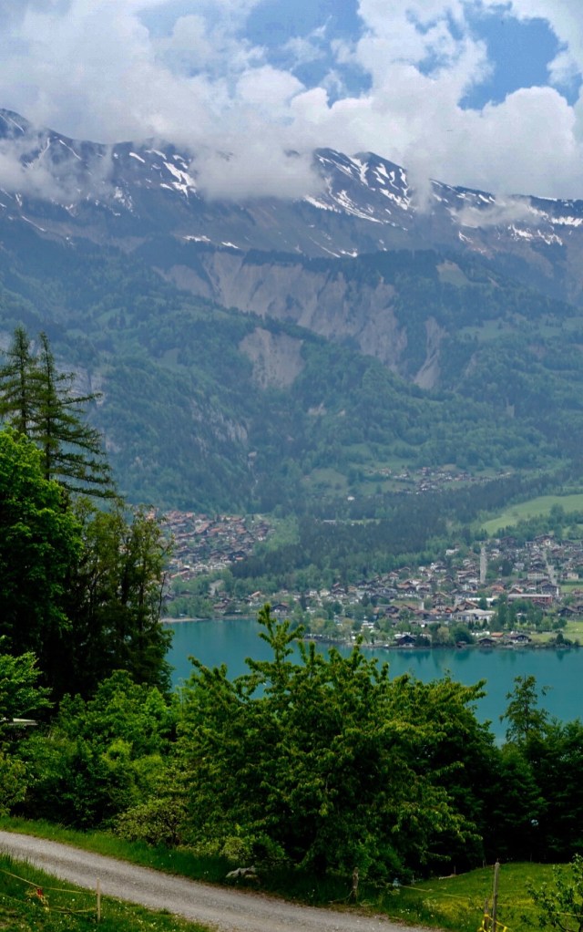
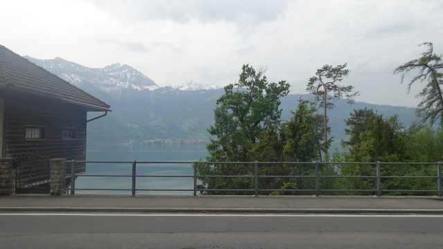
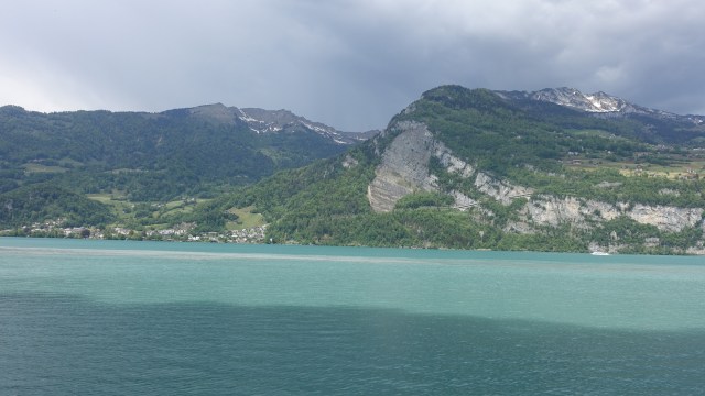
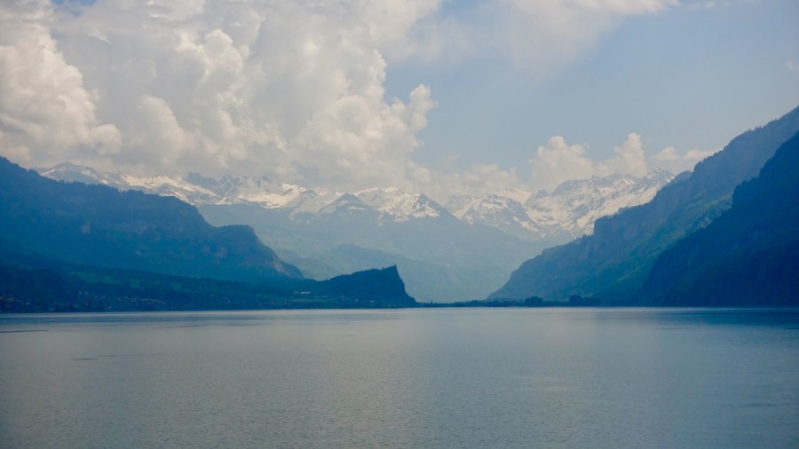
I found the secondary road to Interlaken with great views of Thunersee. Thunersee is a slender arc of a lake sited between Thun and Interlaken in the valley of the River Aare. It is 18 km long and 4 km wide.
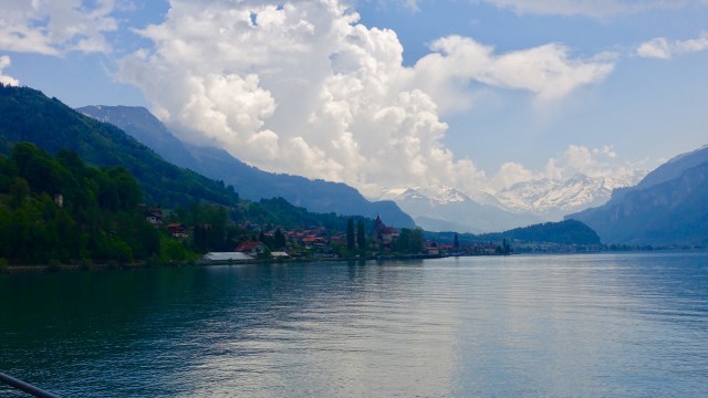
I passed the town of Spiez, and you can see the medieval castle, set on a slur jutting towards the lake. The church to the right is baroque.
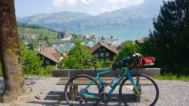
A little further up the road, looking back. My bike blends in nicely 😊
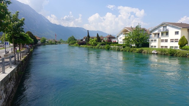
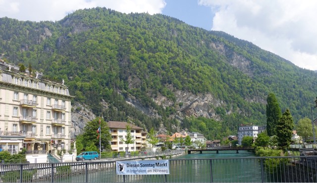
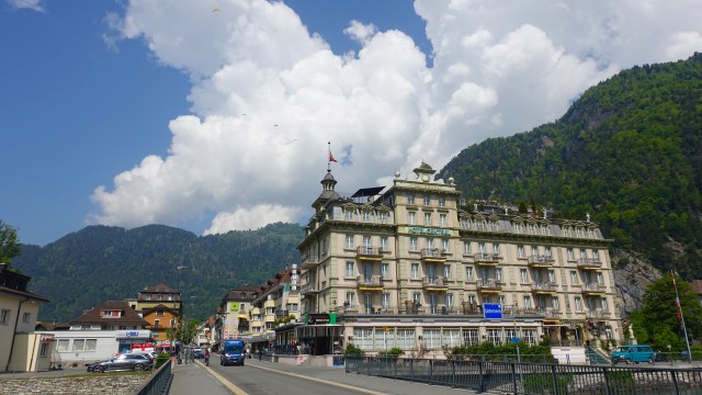
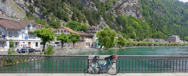
Arriving in Interlaken I was given a choice of Interlaken East or West. I chose the wrong one, but ended up in the town centre via a convoluted route.
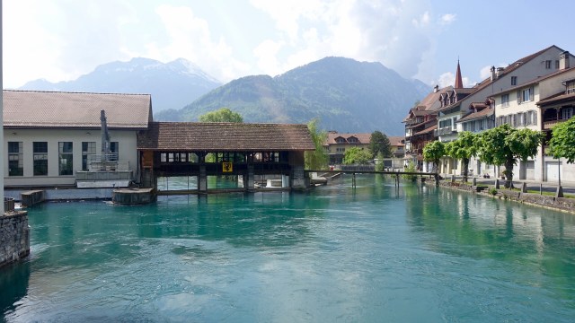
Crossing the River Aare again.
Interlaken lies on a narrow strip of land between Thunersee and Brienzersee. It is a base for bushwalking, skiing and for trillions of tourists who wander aimlessly over the roads without a care in the world.
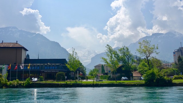
Time to keep moving, but a few more photos first.
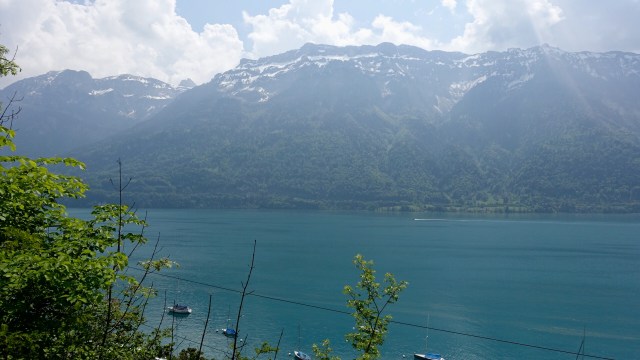
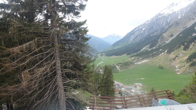
I sat in a chair, in a park, adjacent to the river and ate a croissant (taken from breakfast!) Nice views. The snow is quite low and that looks to be below the 1980 m mark of Grosse Scheidegg, so the climb was looking more and more remote.
Note the heavily snowed Alps in the deep background
I was enjoying ride down the side of the lake, until the thunder and then rain started.
Just before the rain
As the rain got heavier, I pulled over and sheltered in someone’s carport. I sat there for about 20 minutes, putting some wet weather gear on, and admiring the views.
View from the carport
The house over the road from the carport, very eclectic.
Time to keep moving, rain or not. As the rain settled, the sun on the distant Alps was beautiful. The photos do not do it justice.
I arrived in Brienze and needed to find a loo. Now this loo is the best on the planet. As I entered, with my bike, I was assaulted by heat. this toilet has floor heating! I had a wet bum and wondered how long I could sit in the floor for to dry my Knicks?
The time had come to seek information about Grosse Scheidegg. To do the climb, I needed to ride another 10 km or so, before starting to climb. Alternatively I could ride back, on the opposite side of the lakes.
I found a bike shop and definitely the road had not yet opened due to snow. So I either hopped on the train, or I rode back to Interlaken or Thun.
I thought it might be nice to ride the opposite side of both lakes I had just ridden down. The turn was only a km or so up the road.
As I was taking this photograph, the town was overcome by incredible noise. Four ( I assume) Swiss Airforce jets were doing a low altitude swoop over the lake and then up and over the Alps, and a few minutes later they returned.
There was a bit of a climb on this side of the lake to get past a huge rocky outcrop. The views back over Brienze were great.
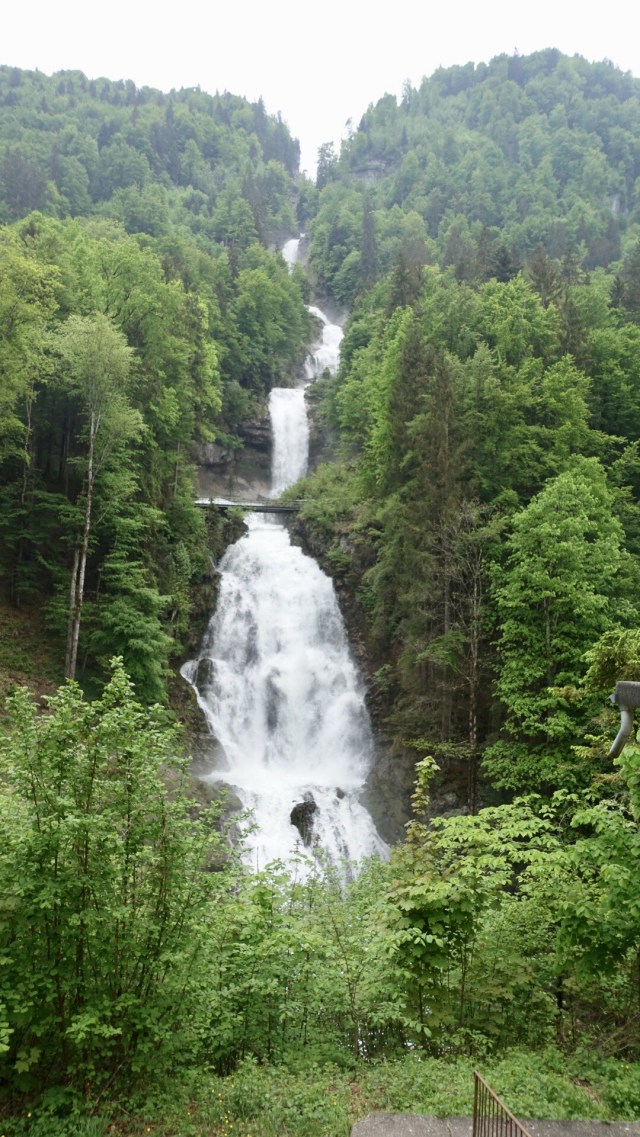
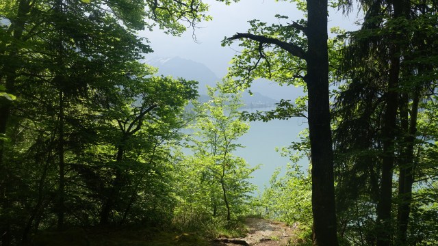
This is where my trip started to get interesting. I had no notes for this side of the lake…I had not planned to do this route. A bike route sign appeared for Interlaken so I turned off the road to follow it…it went down…I thought I hope this is right, I don’t want to ride back up here…but I found this magnificent waterfall.
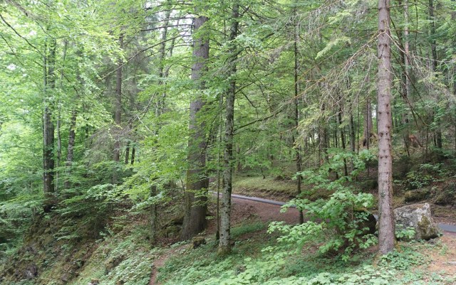
In a nice forest….
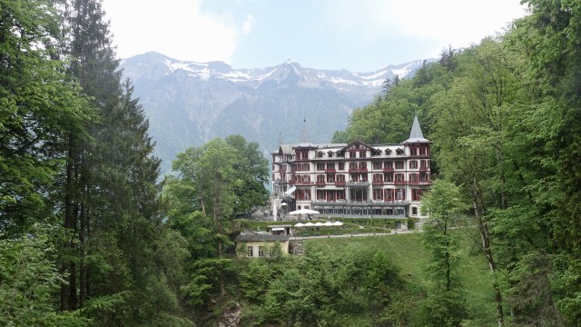
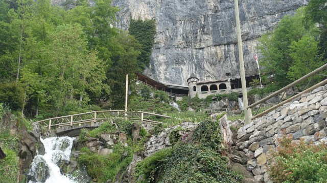
Across a little bridge….
That has nice views to the Château…
…and this path…
Well I meandered around up and down this trail very slowly and wondered where the secondary road was….I found a fence and a gate and dropped my bike over, squeezed through but was not sure if it was the secondary road or primary one heading along the lake.
A few km down the road I experienced one of the most nerve wracking moments of my cycle touring ever. A sign indicated a tunnel 350 m ahead…cool, been through quite a few now.
I got to the tunnel, and it said it was 1325 metres long….oh crap!! There was no way around over or past….there was a narrow ledge on the side, and I chose to walk my bike down it ( rear rail lights flashing).
It was the longest 1325 metres of my life, in a very dark, very busy tunnel…I was so glad to make it out alive!
A little further down this same road, I saw a sign to turn off to a hamlet…I took it….it went down and down, and there were chairs off the side that you could sit on and admire the view! I recovered there!
Back through Interlaken I headed to the opposite side of Thunersee heading straight to Thun. The photo below does not look much but it is looking up a cliff to where the sign says are “Swiss Caves”.
A final look towards the Alps as the rain started to descend on Thun, including thunder..quite appropriate I guess..😂
Once in Thun I needed to decide whether to hop on a train, or ride back to Bern. Given the rain and slippery conditions, and the fact I’d done 124 km already, I decided I’d head home nice and safe!
Today is a rest day…family celebration as my second eldest child Ben marries Sharon in Bern and we have a small celebration at her parents place in Stettlen, next village to where I am staying.
Then tomorrow I am up early as I need to be in Zurich around 9 am to meet my riding companion and head off to Italy for the next stage of my European adventures bikepacking from Switzerland to Italy.


 The weather had started to deteriorate somewhat so just after the rain jacket was donned we came across a cafe…time for minestrone soup…and hey presto, the weather had improved.


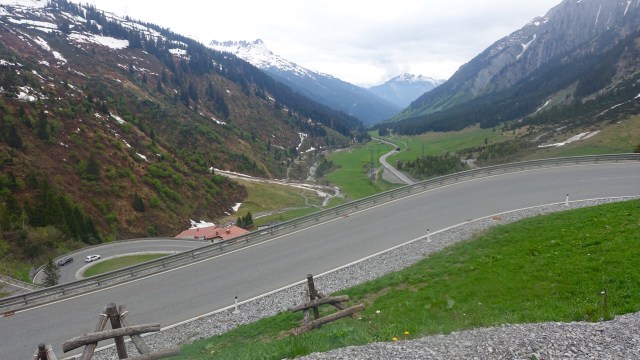

 From St Christophs it was downhill to St Anton, a large ski village. Great cruise with no issues…you can see the graph below for the day. We are currently at 1200 metres above sea level.
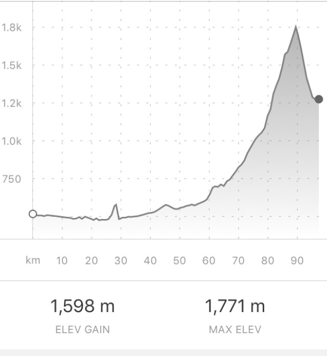
 For lunch we stopped at a village supermarket and sat by the river beteeen two lakes. Heading off this view way nice ( the mountains I am referring to!). But check the size of Geoff’s backpack. Don’t think I could carry that up some of the mountain passes we need to cross!
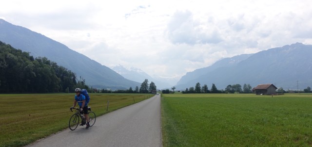

 I rode straight through Thun, which is a historic market town set on the River Aare, at the northern end of the Thunersee. A very old town with a castle on a hill. The town is quite spread out and I headed across the river as I was going to head down to Interlaken on the Alps side.