Picton to Nelson

Overnight there was a lot of rain. Each time I woke it had not eased up.

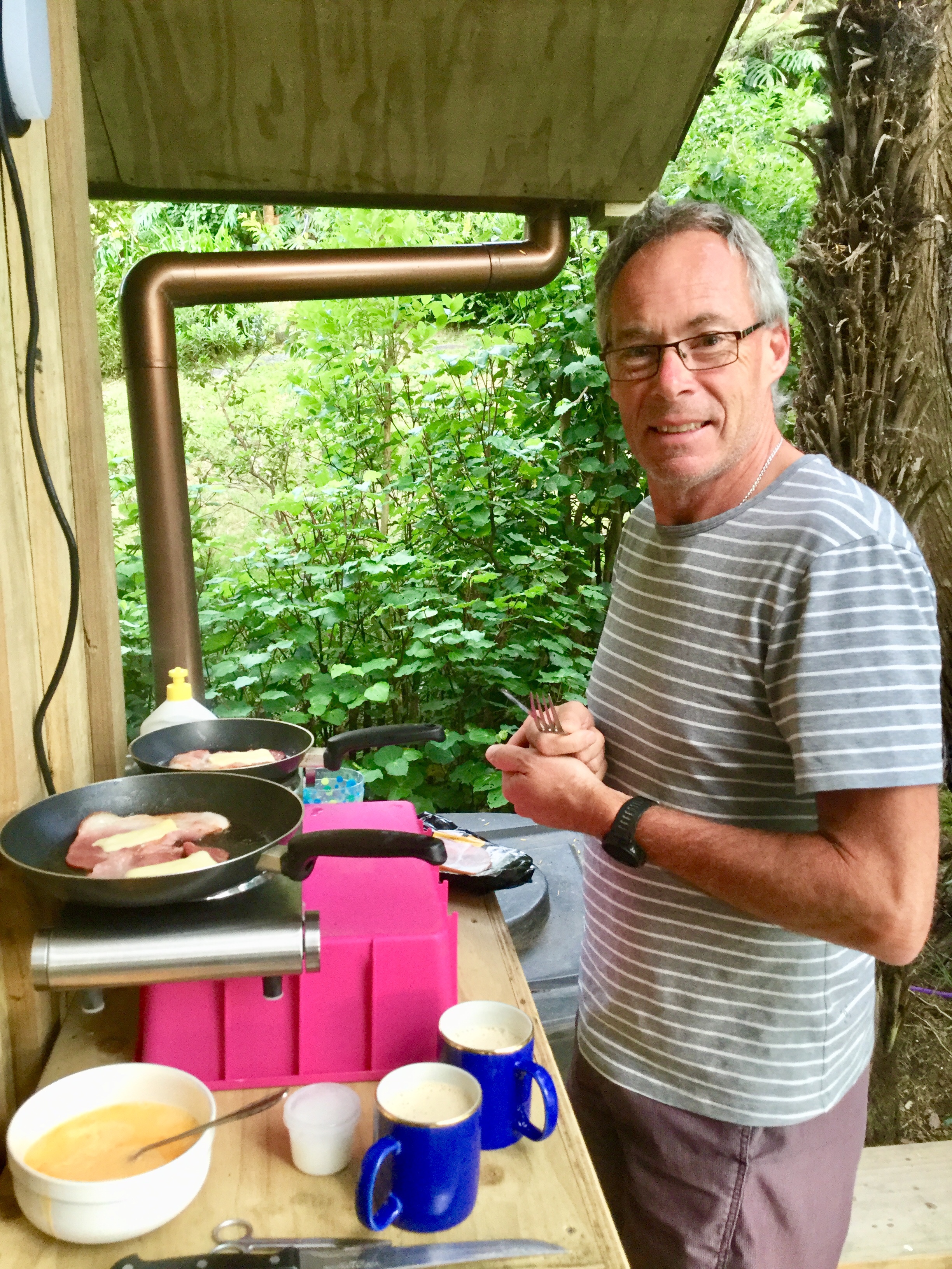
When we finally rose, we had no power. We fumbled around with my little torch packing and having breakfast that had been provided, sans coffee. Sacrilege!

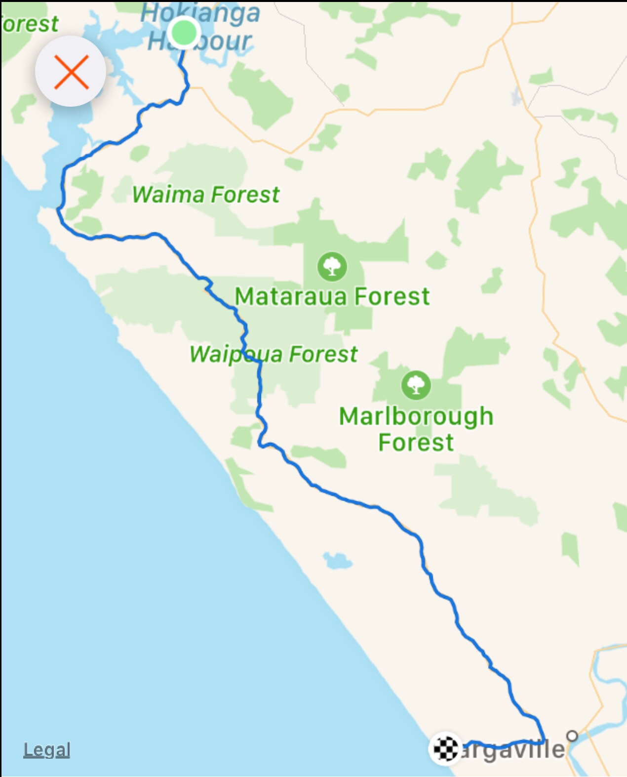
We headed off about 7.30 am keen to start riding before it got too busy.

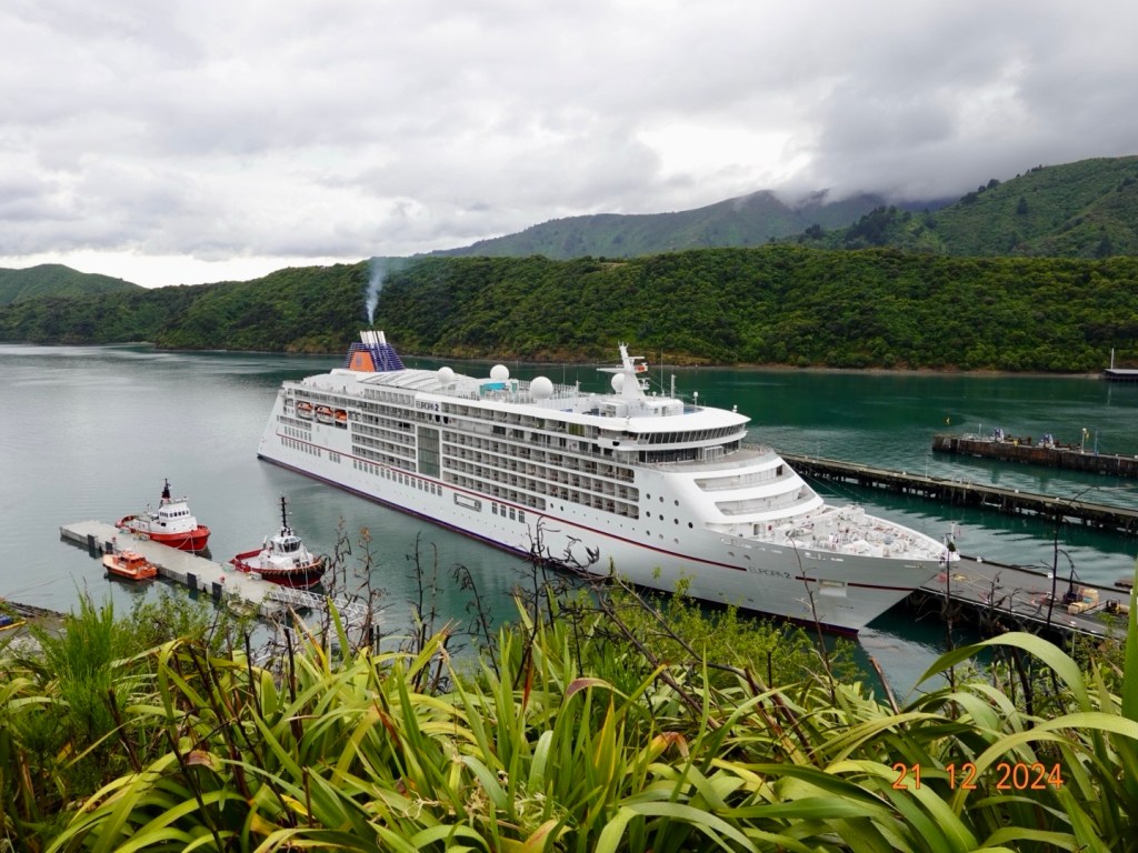
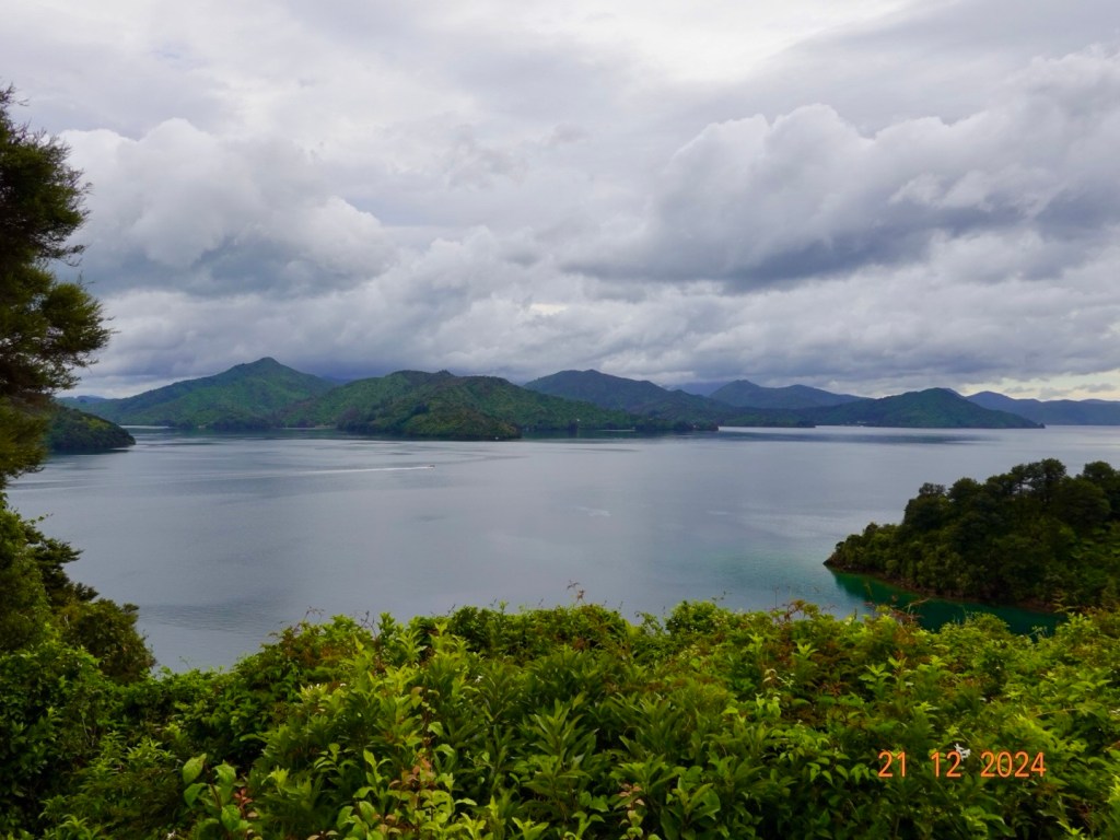
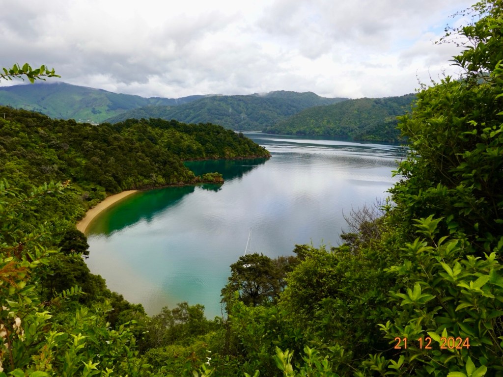
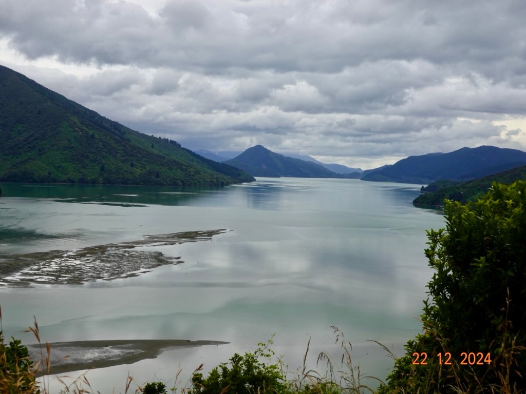
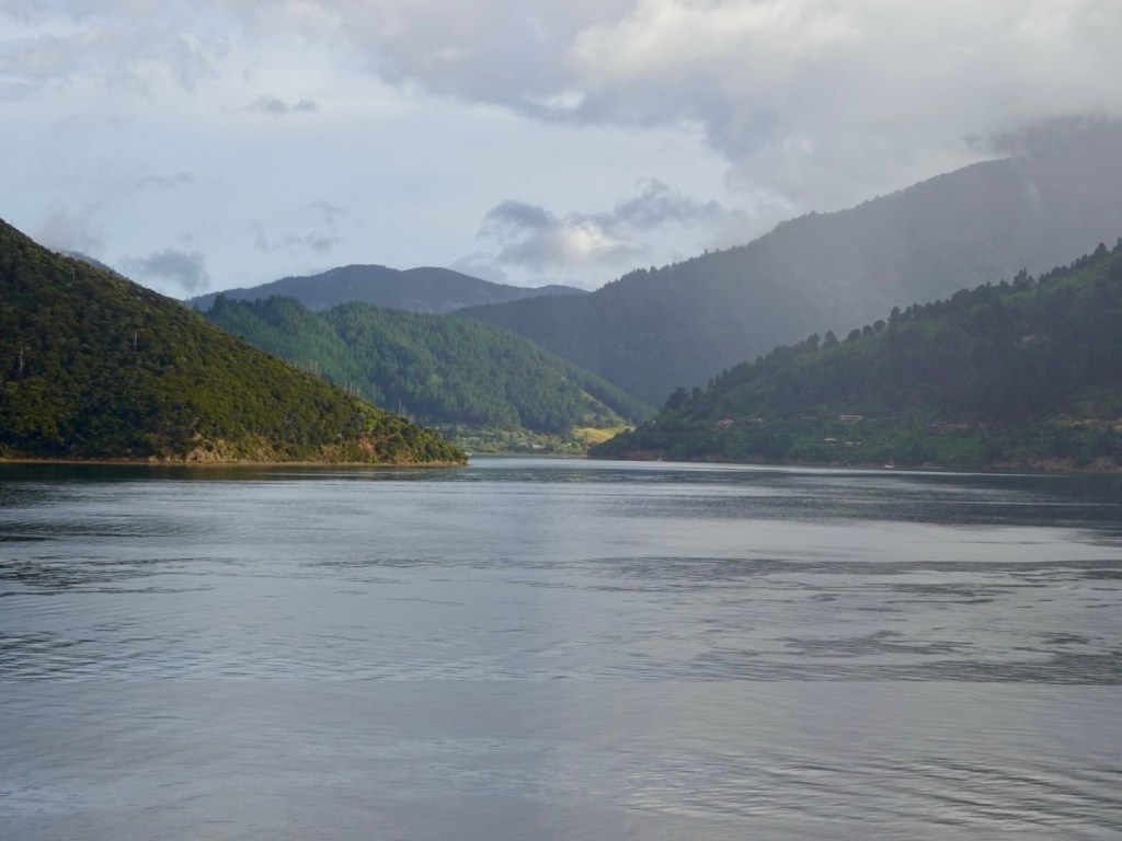
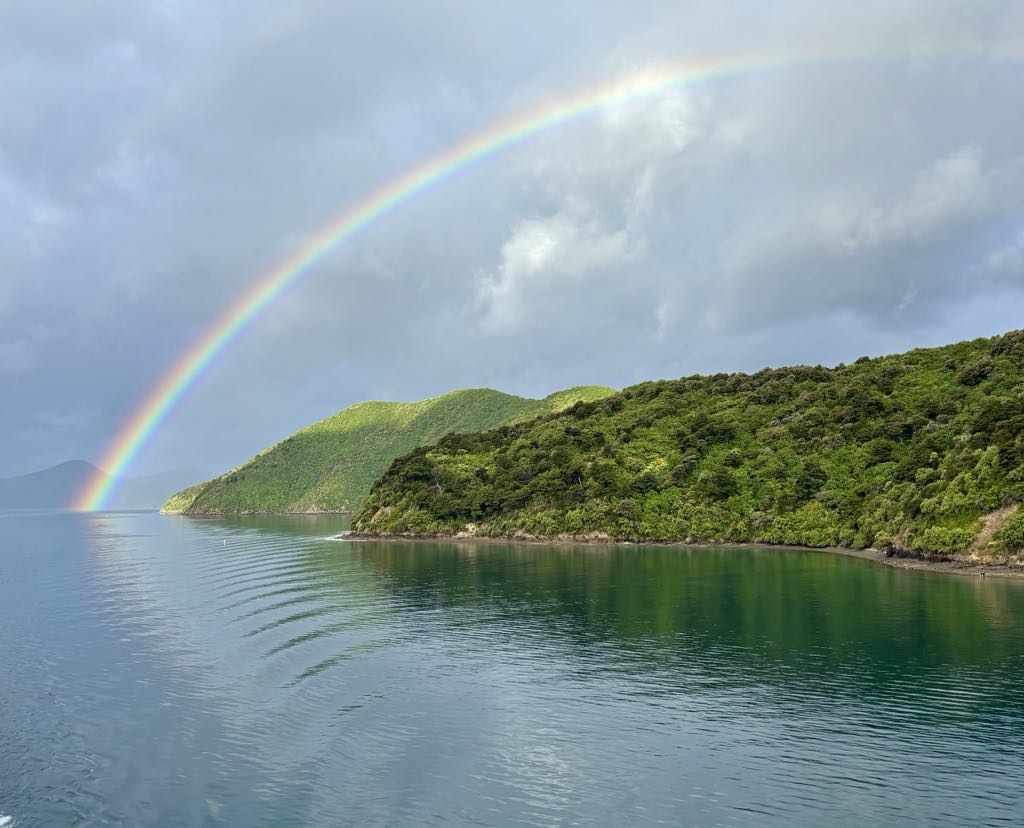
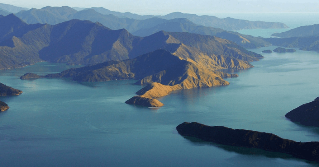
The first 35 km was a super scenic ride from Picton to Havelock on Queen Charlotte Drive. There were some fantastic vistas.

Climbing out of Picton a cruise ship was docked.
Further on a port seemingly dedicated to plantation timber.
There was a nice bay off to the side of the port.
More distant views across Grove Arm
Beautiful bay
Closer up

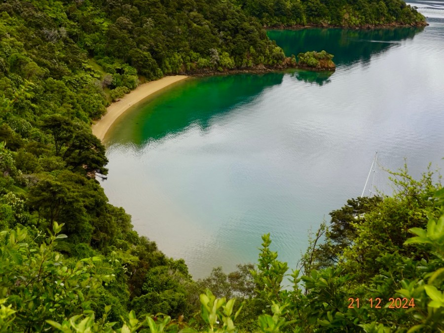
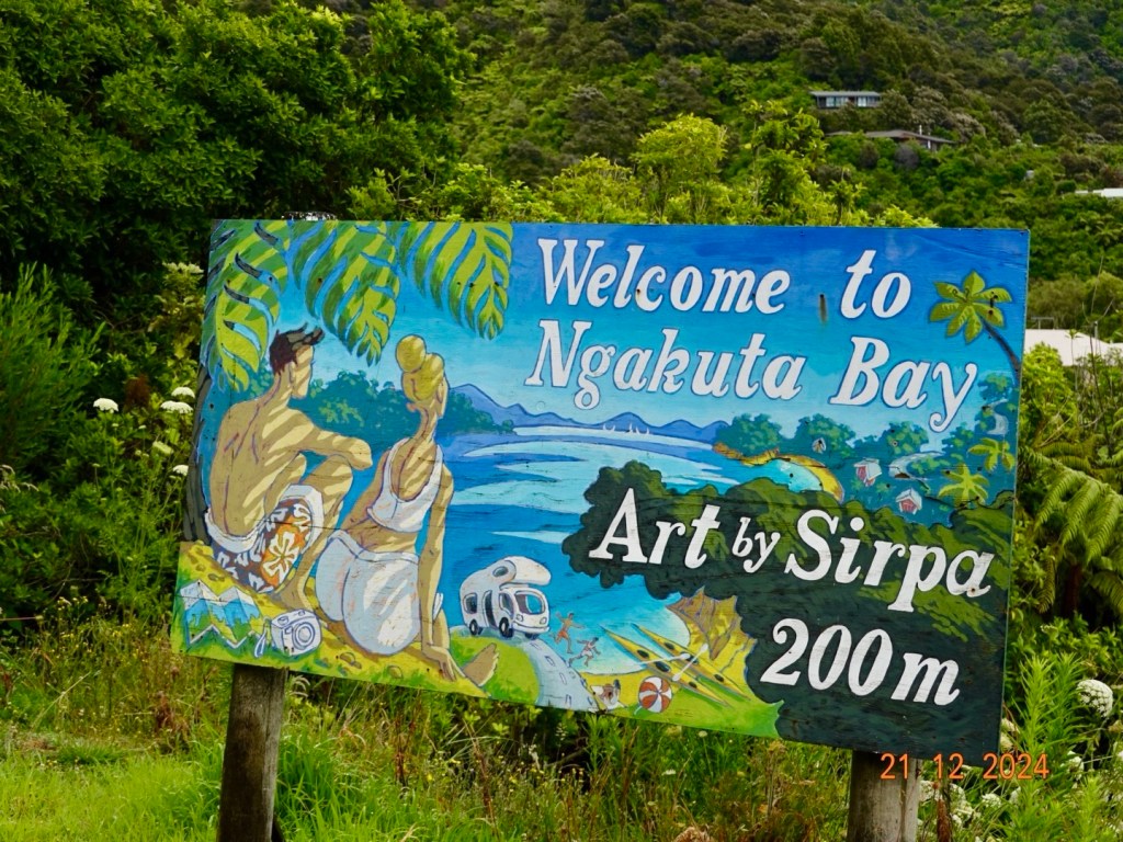
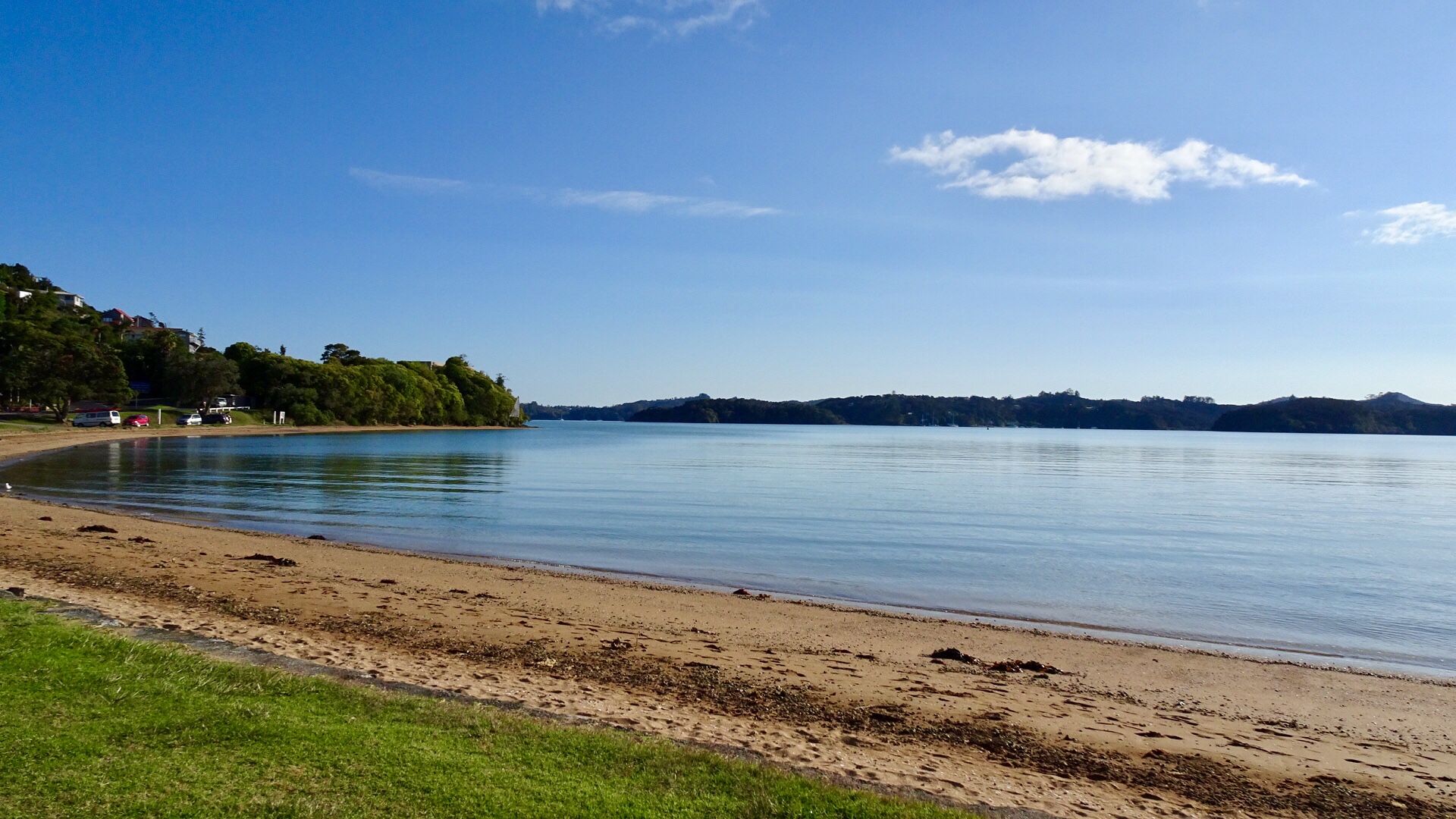
Ngakuta Bay, is small settlement and bay in the Marlborough Sounds.

Low tide
Local art, we passed numerous artists shops, all closed today.
We continued on.
Momorangi Bay
Momorangi Bay at sea level, tide is out
We stopped at Momorangi Bay to eat our bananas before they became inedible. Bananas do not survive long in pristine condition touring.
I wonder why we snapped this photo?

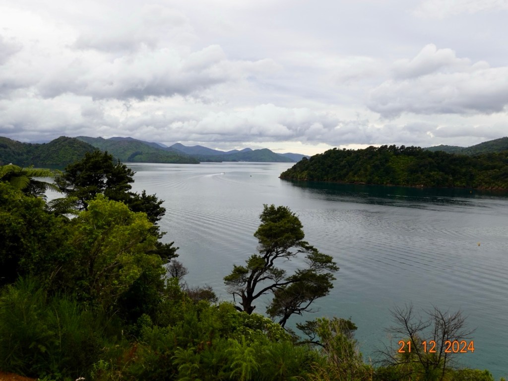
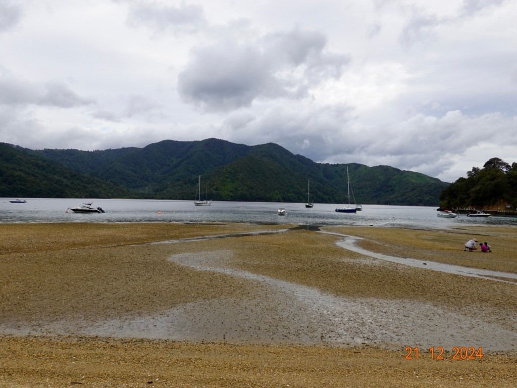
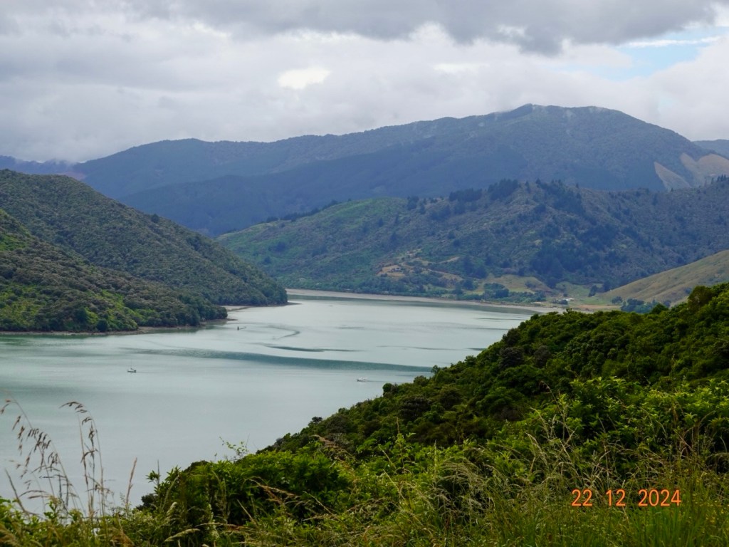
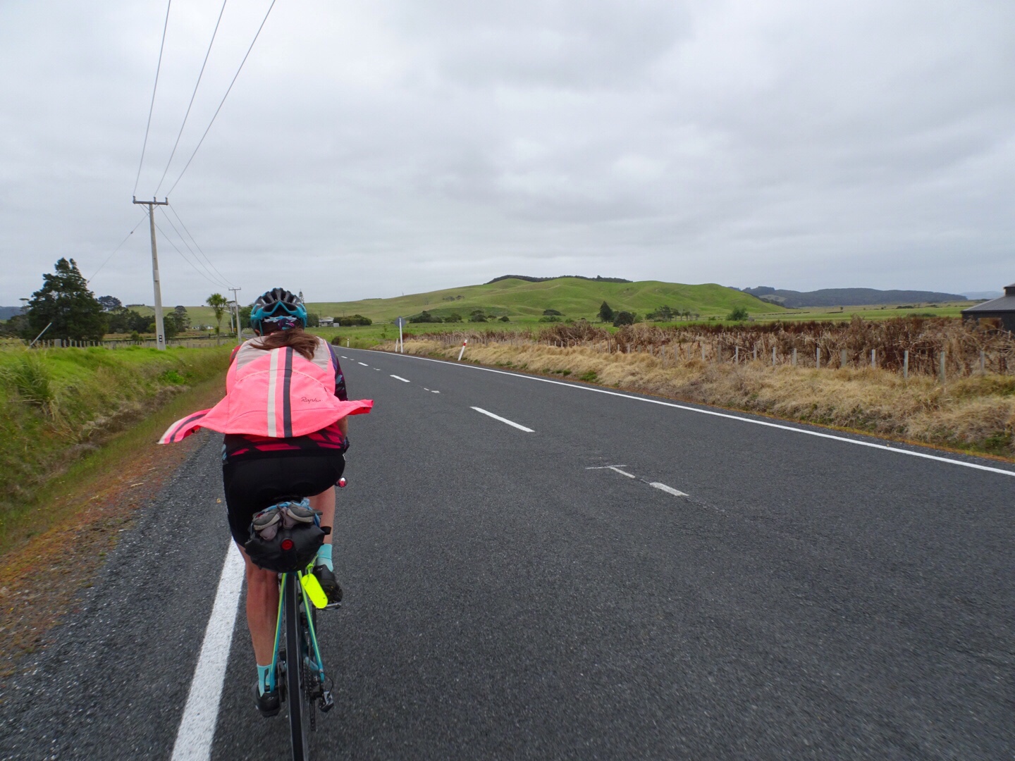
A few more vistas from Queen Charlotte Drive before arriving in Havelock. This section of our ride was excellent. Wonderful views and no wind! Whilst it was overcast and we started off with our rain jackets, we quite enjoyed the cooler conditions as more like home. Traffic was not too bad, mainly camper vans.

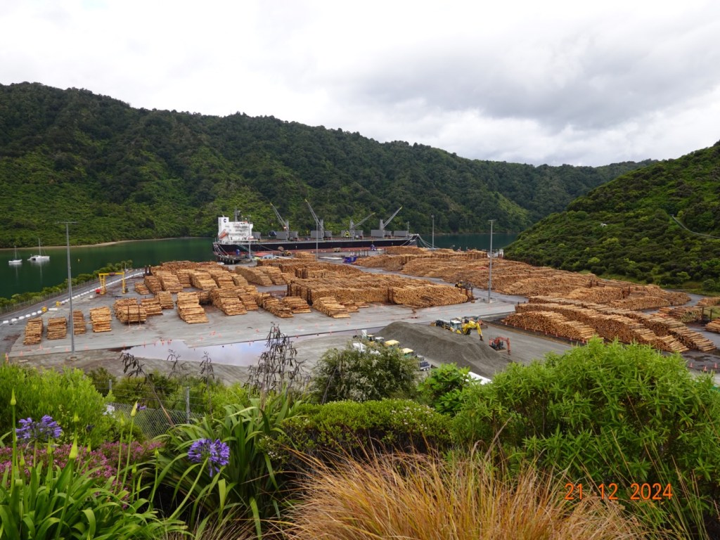
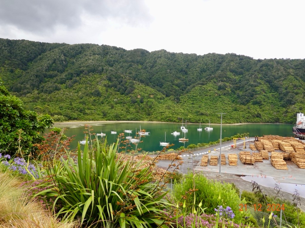
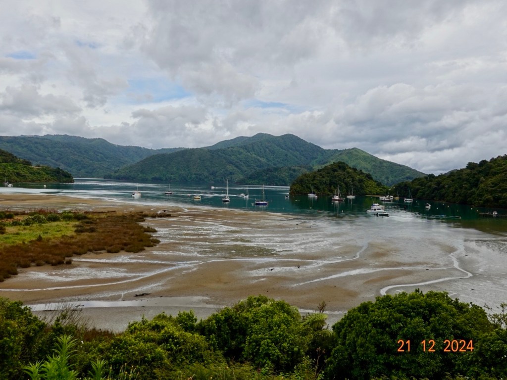
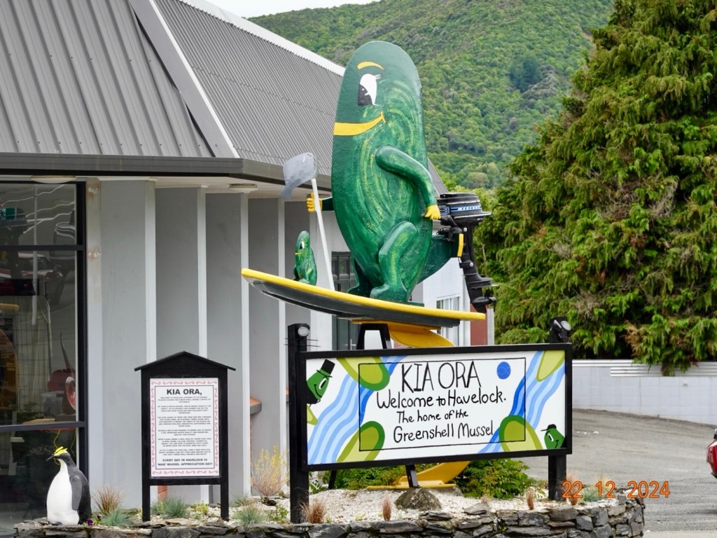
Havelock calls itself the “Greenshell Mussel capital of the world” and is located at the meeting point of the Pelorus and Kaituna Rivers.

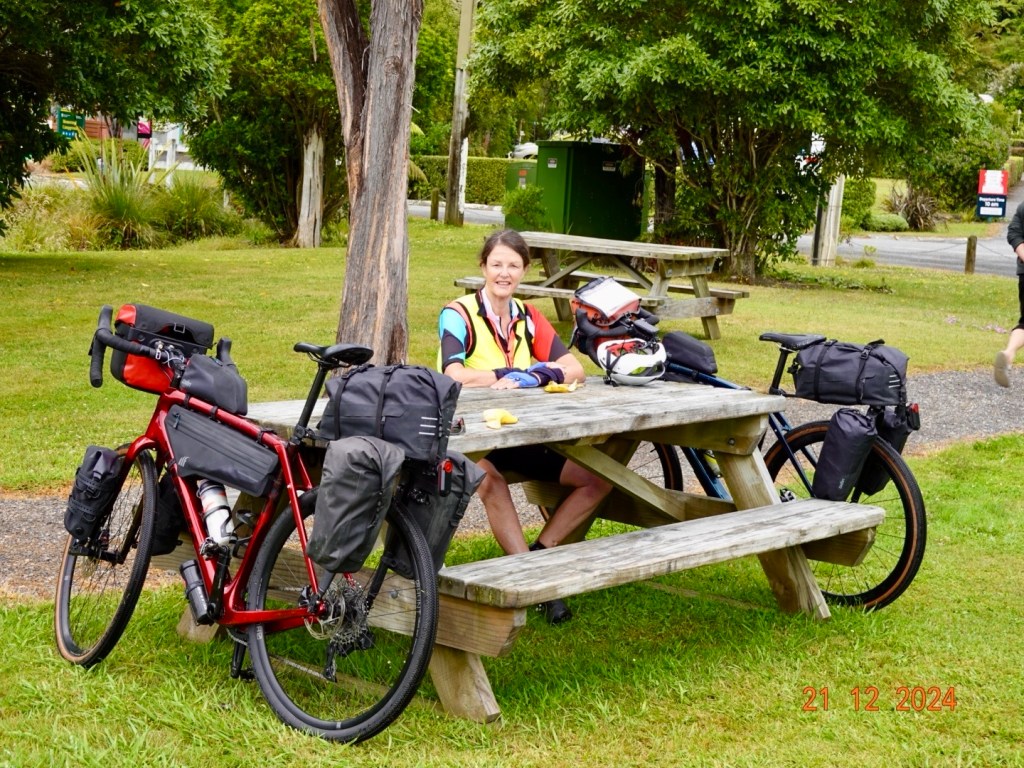
We had a decent break in Havelock, grabbing a much needed coffee and tasty morsels! Some cyclists from Wellington wanted to chat enquiring about our bike radars that were beeping and flashing. They suggested some great dirt tracks. My response? “You’d need a chopper on standby as I would surely break a bone!”

Mussels riding surfboards…think surging the super flat local waters a tad optimistic.

Leaving Havelock our ride quiet road sojourn ended and we were on a state highway. The trucks were back plus caravans, campers, 4WD with trailers, heaps of cars.

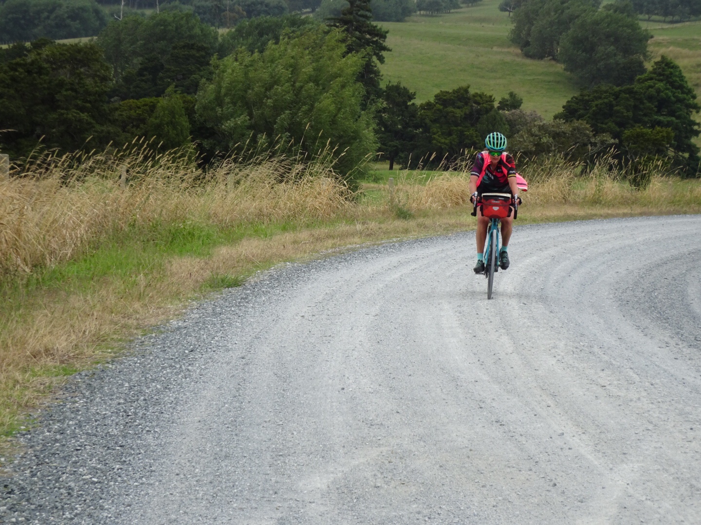
It was very windy with a strong headwind challenging us in places.

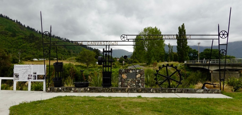
Canvastown is a small village where the Wakamarina River joins the Pelorus River. Once home to gold miners in the 1860’s. We stopped to look at the local historical memories.


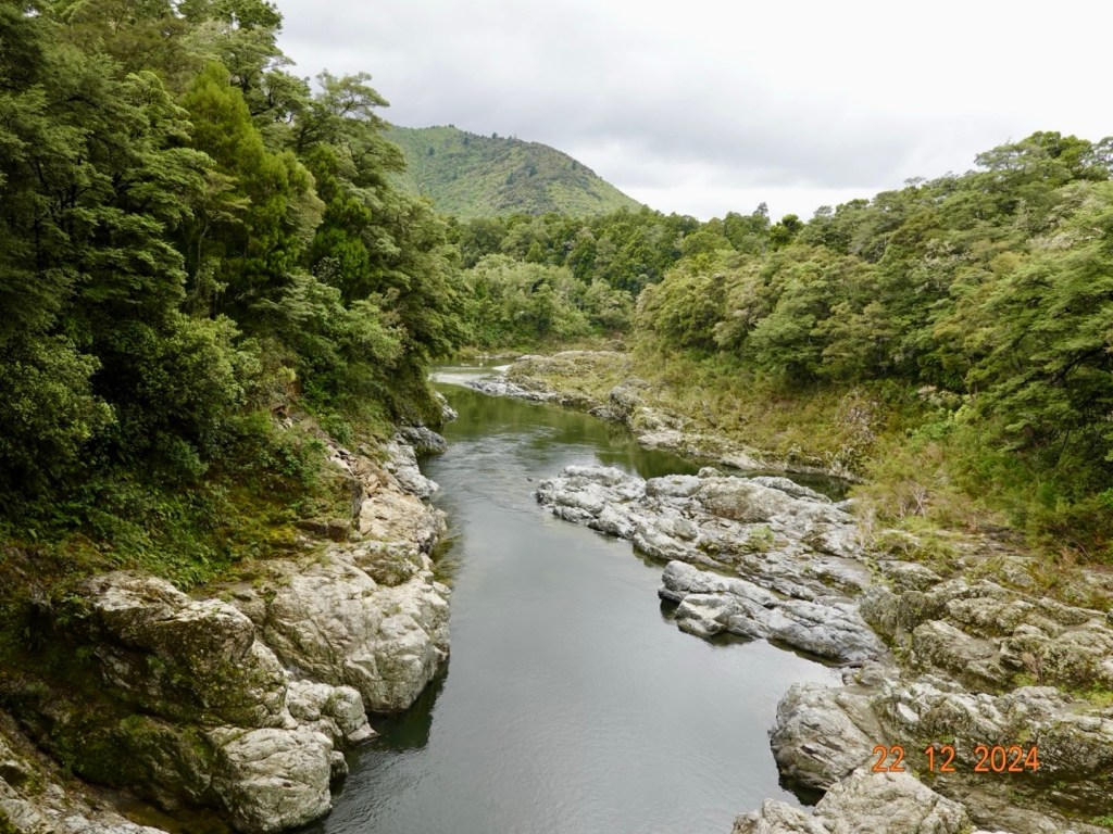
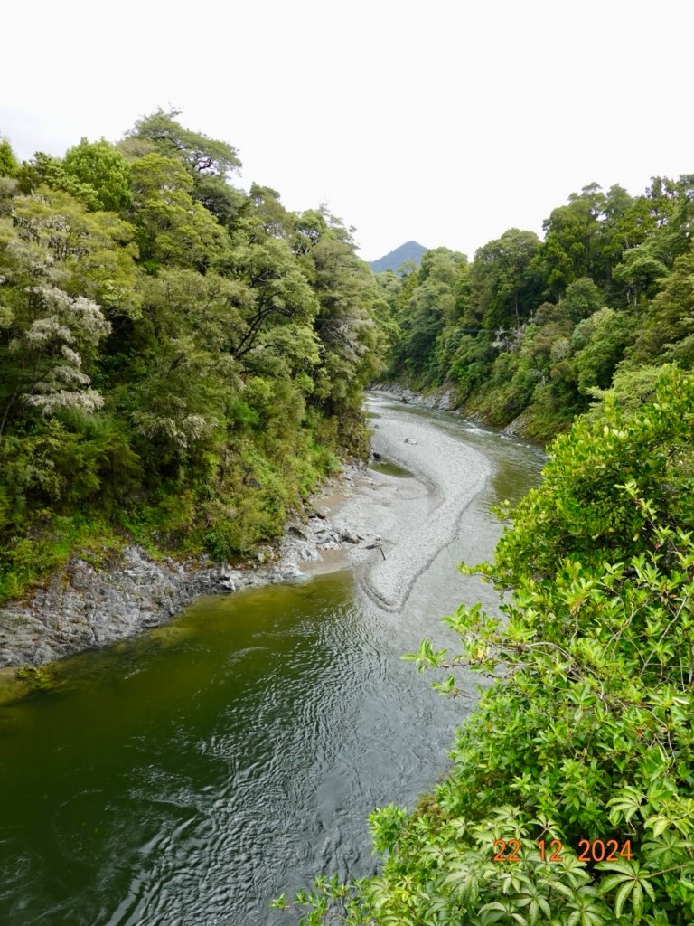
Pelorus Bridge featured in The Hobbit – The Desolation of Smaug. Not having watched the movie, apparently there were dwarves filmed floating in barrels down the river! Surely that should be outlawed? Tyrion Lannister would surely say 🤷‍♀️. ( for non GOT readers, Tyrion is THE best character ever seen on tv, and he is also very height challenged. He was whip and wit smart and one of the ultimate survivors).

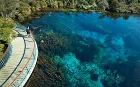
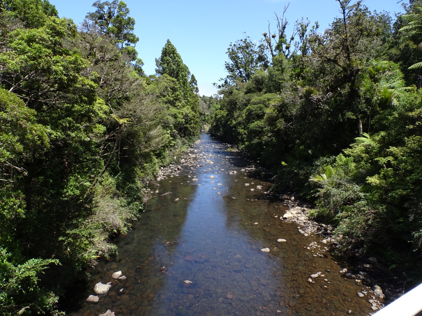
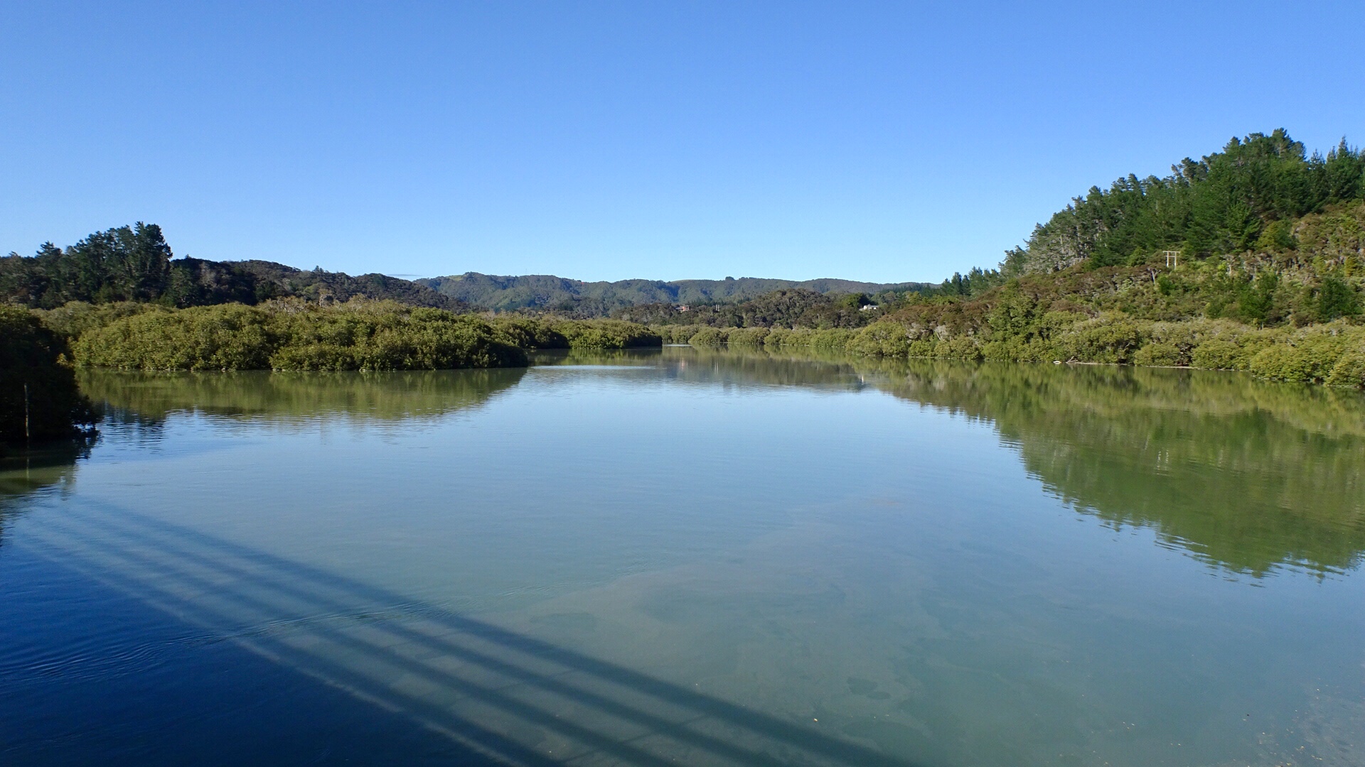
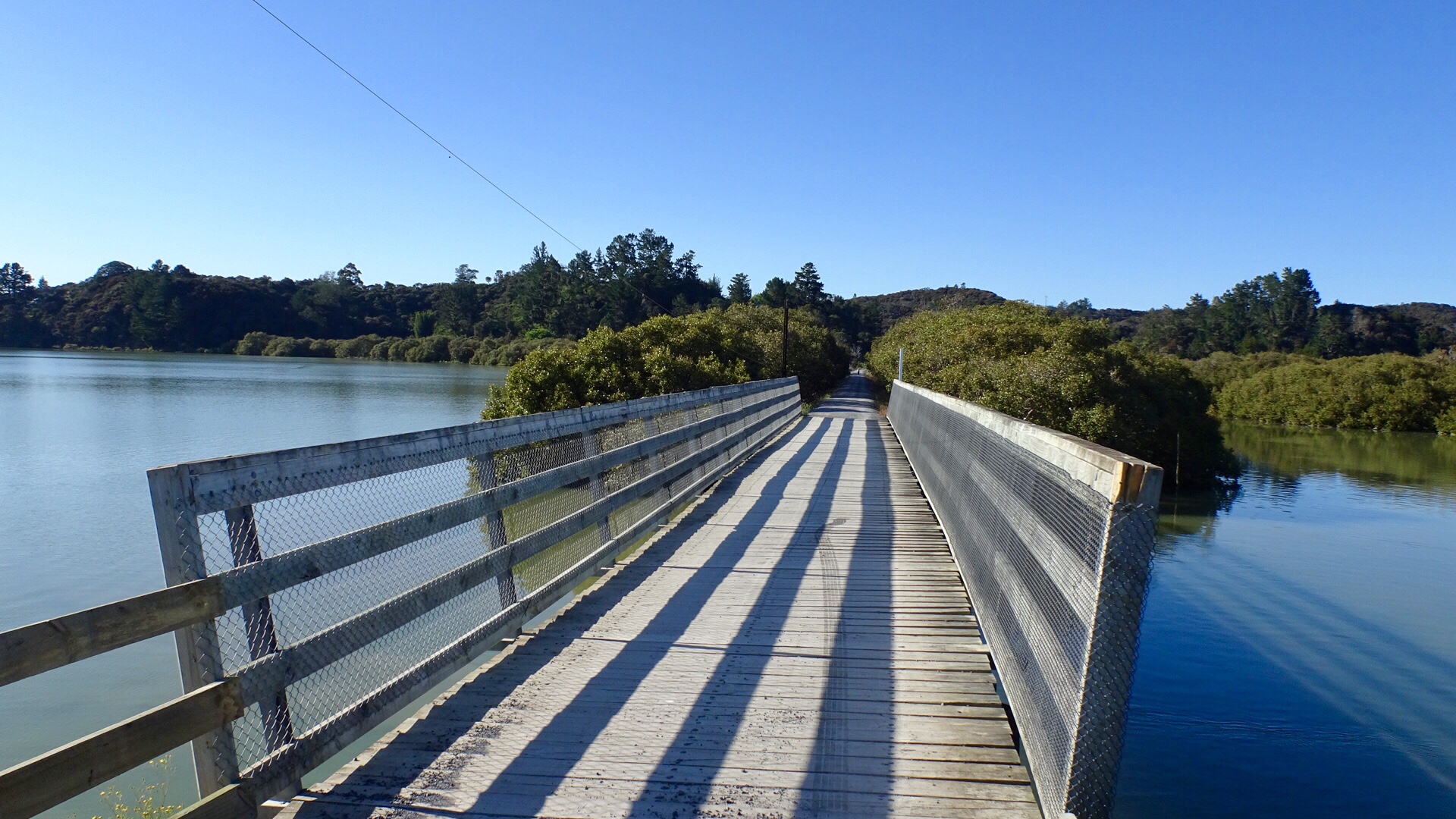
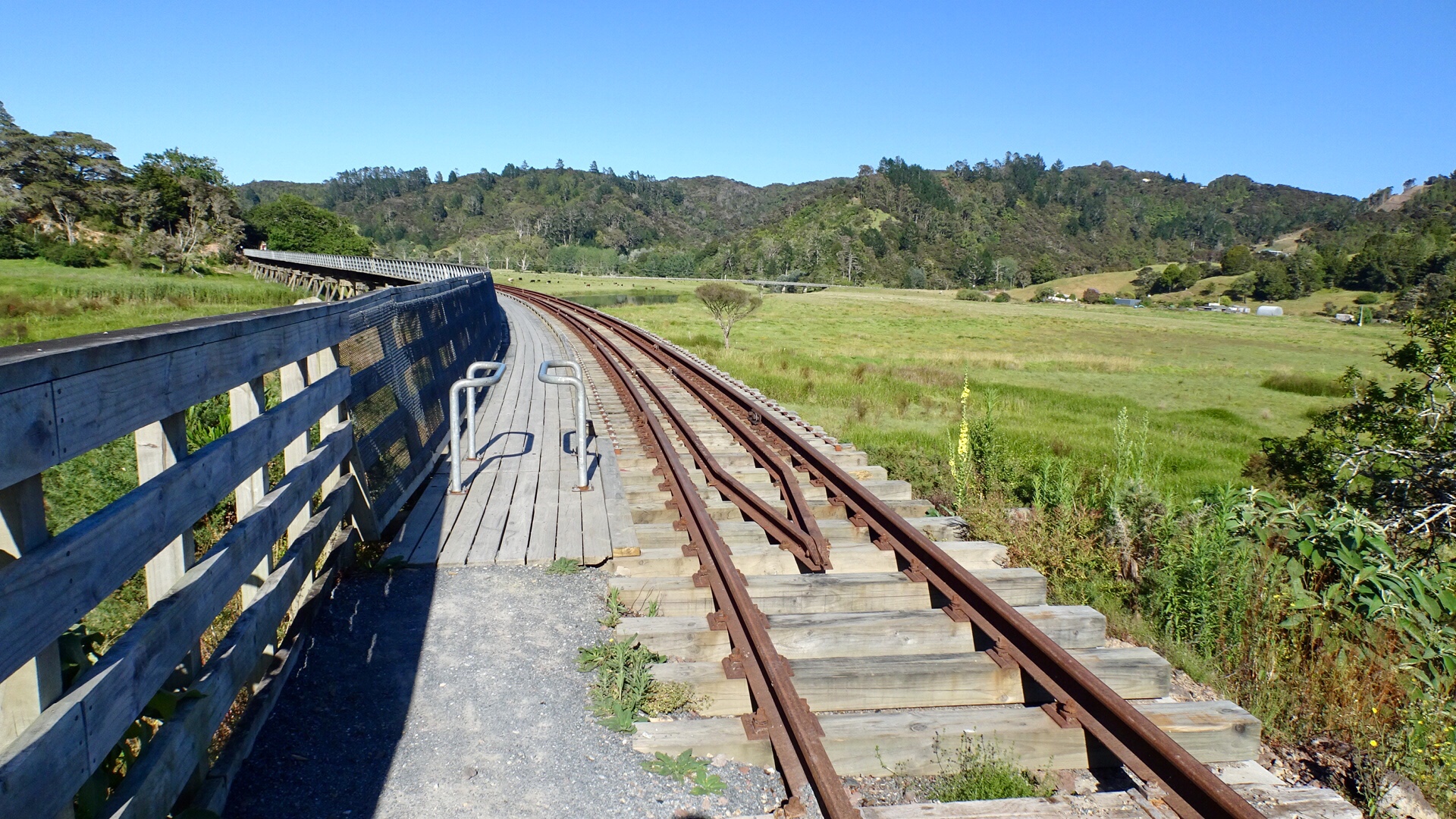
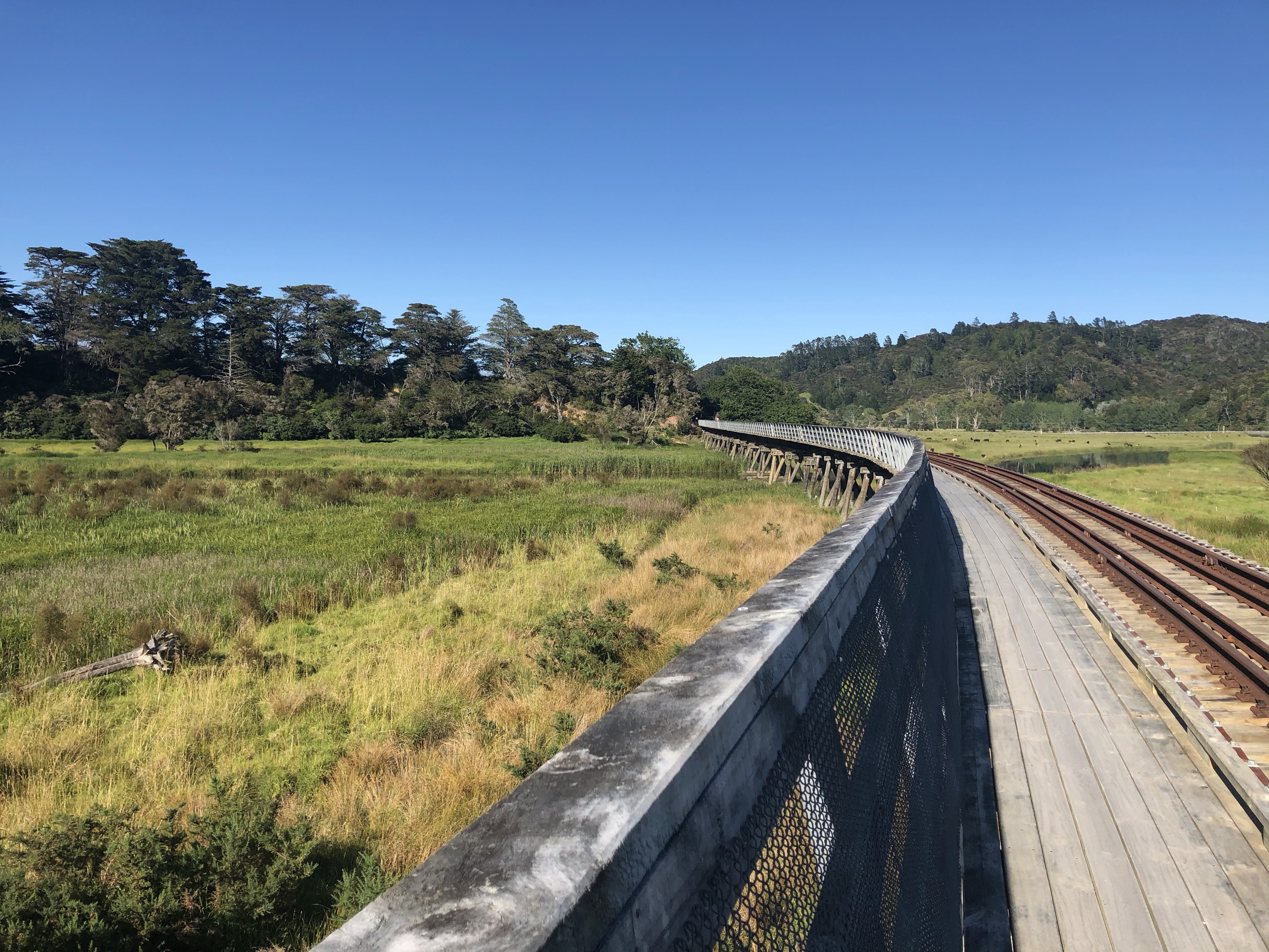
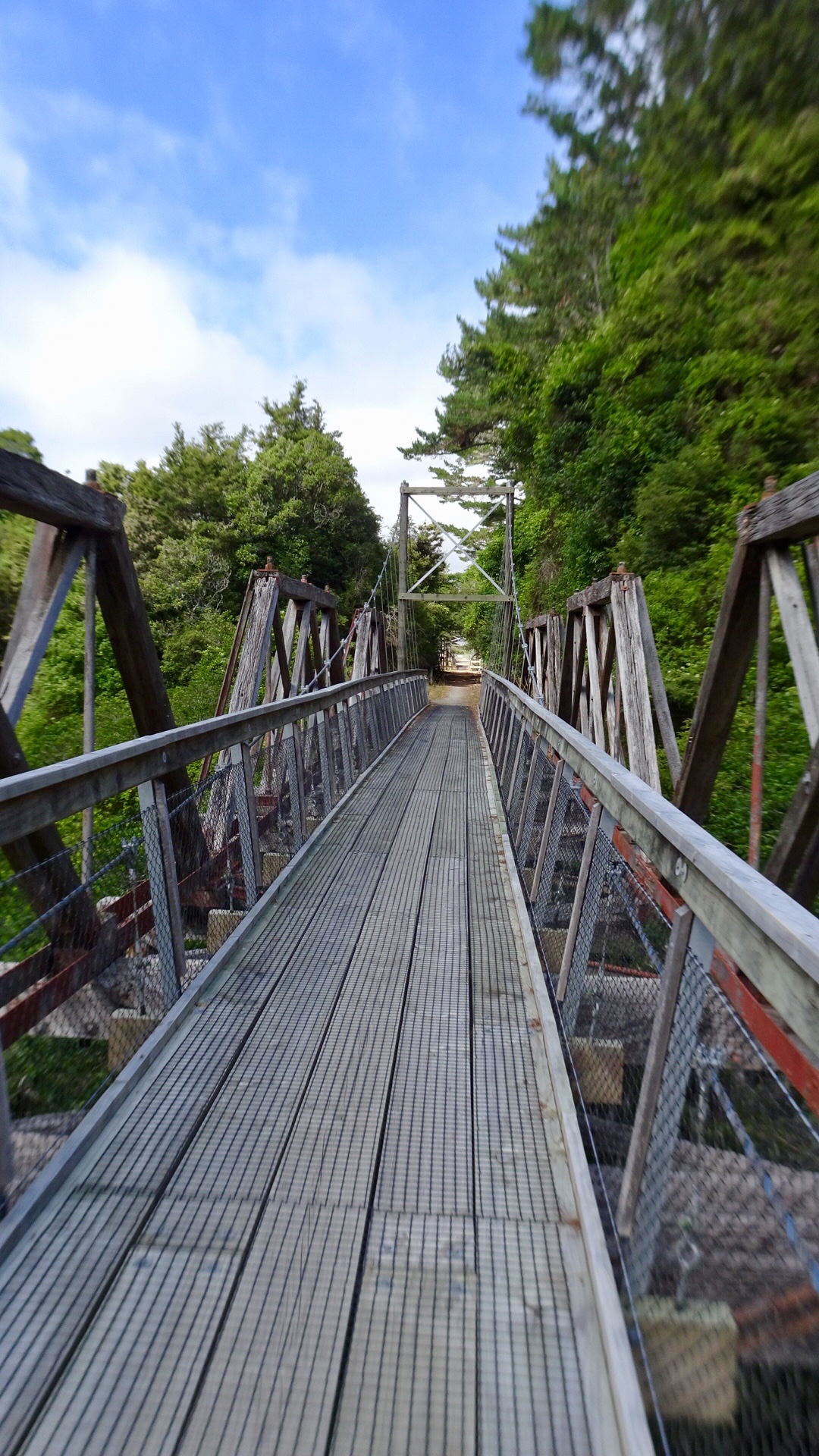
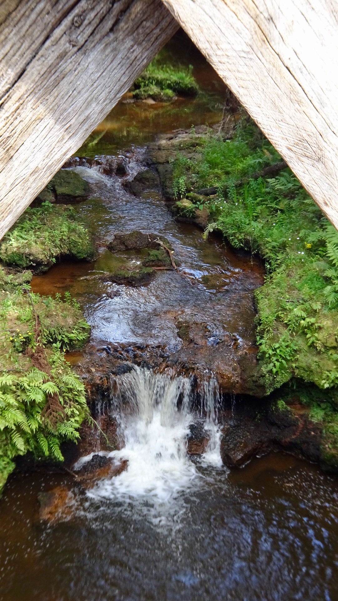
Pelorus Bridge crosses the Pelorus River, and is surrounded by a super nice reserve. There are tracks leading to waterfalls and rock pools, or you can walk along a ride to a viewing peak and walk across a small suspension bridge.

Pelorus bridge view to the east
Pelorus bridge view to the west

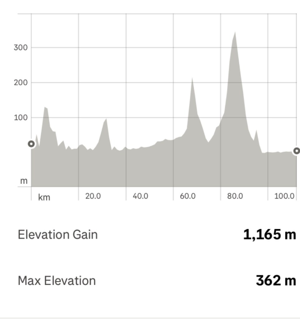
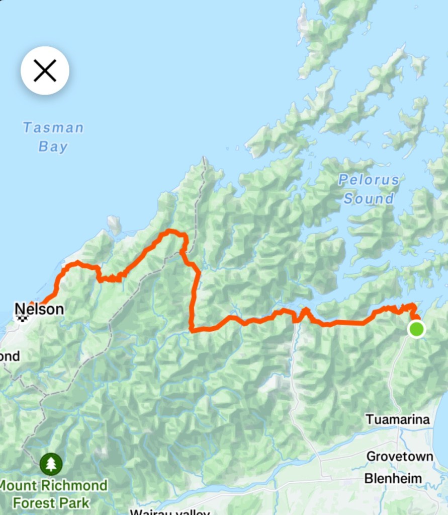
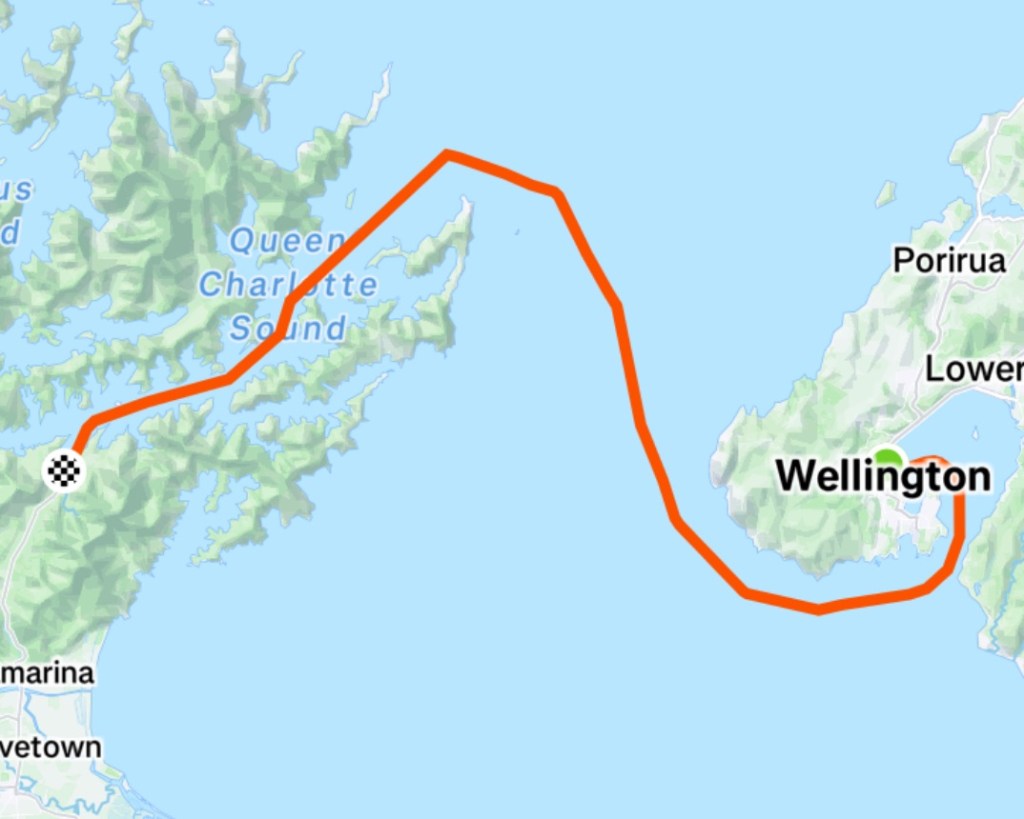
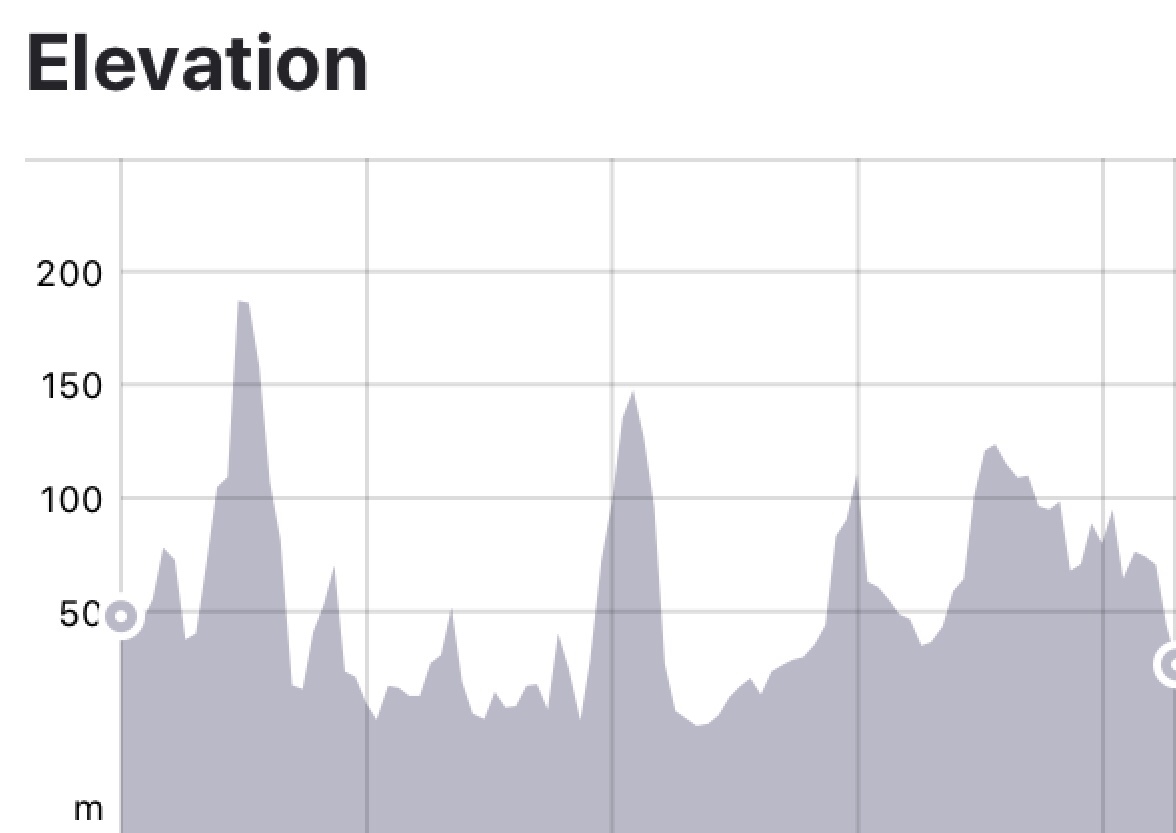
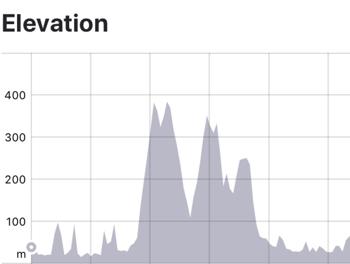
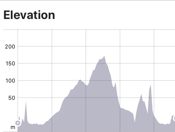
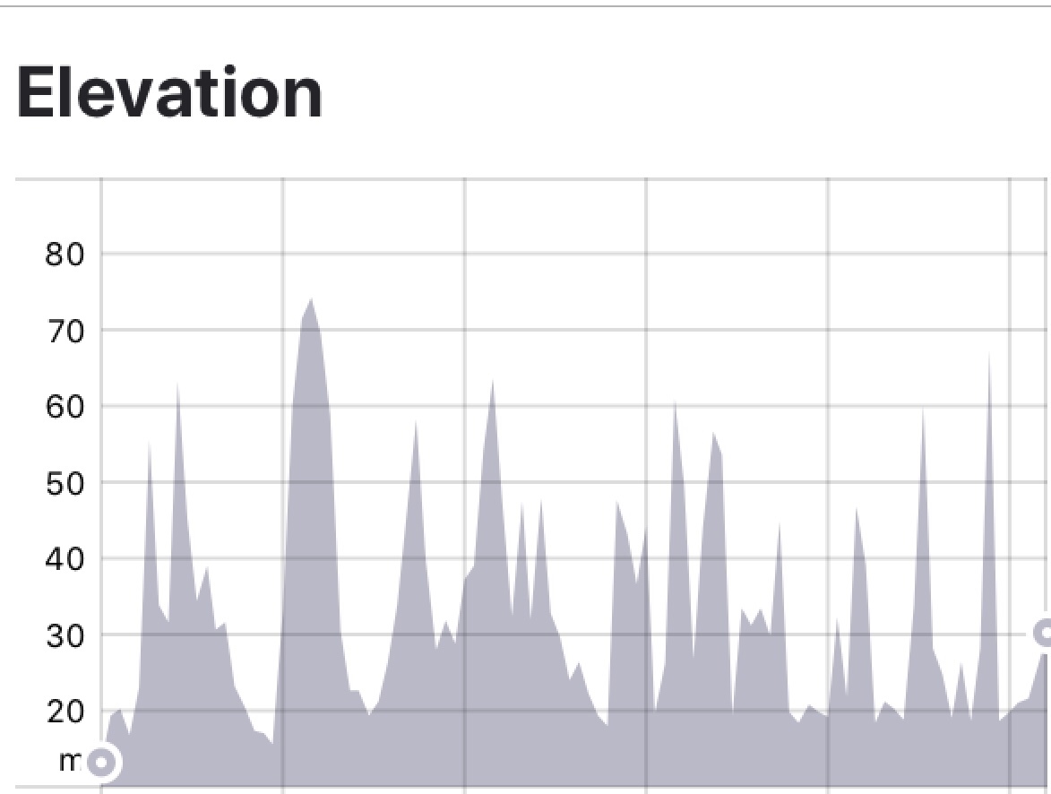
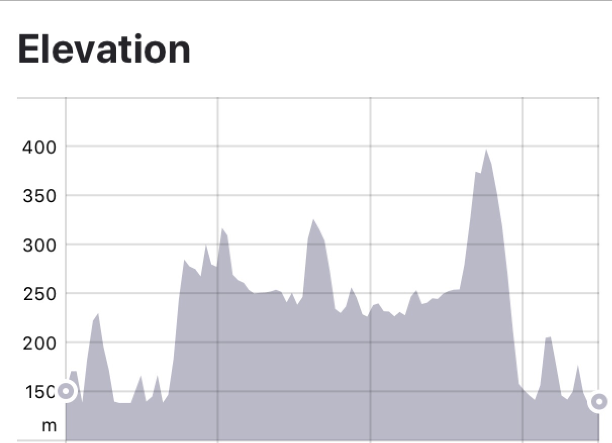
Today was a solid ride of 112 km and 1165 metres climbing. The climb at around 60 km was hard due to an incredibly strong headwind, reminding me of HellFire Pass in Wales where we had awful headwinds.

Descending we then had the longer 5.5 km climb, with section of just over 13%…where I am wondering do I jump off and push? I got through it though. Fortunately we were fairly sheltered wind wise on this climb but it did start raining about 1 km in requiring a stop to throw on our rain jackets.

Glasses were off as they fogged up. About 500 m short of the top the rain stopped .

Near the top was this decorated tree. I did not stop as the gradient was 10% here and I cannot reclip my bike shoes in at that gradient. Tony can 😊
From the top looking across the valleys still with rain haze
Low clouds but lifting

The descent was slow and considered as the roads were wet and therefore potentially slippery particularly if any oil on the road.

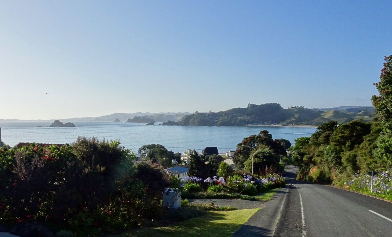
Nice tailwind into Nelson along the flats and a shared pathway through parklands.

The guy in yellow was telling us our accomodation was another 3 km in the direction he pointed. The guy in red agreed.

Our accomodation was at the top of a seriously steep driveway that I had trouble pushing my loaded bike up! The views are nice.

View from our unit.

We wandered down the street in search of food and quickly found Monteith Brewery where we had a nice meal. I did enjoy my lamb shank and vegetables.

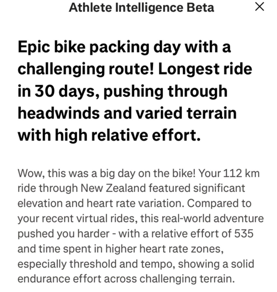
Strava now has artificial intelligence summarising rides. This is what it said about today’s ride. It did make me laugh…big brother is watching!

Todays route

So there we have it folks, first full daytime and dusted, and what a start! Usually I map a few easier days before hills but not possible this trip.

Thanks for reading, smile on 😊❣️

Day O: Wellington to Picton

Kia Ora!

We safely arrived in Wellington and into bed by 1 am.

We were both appreciative of the hotel location, within Wellington Airport. We could see our aircraft from the window, maybe 250 metres away.

Up at 5 am after a fitful sleep, to reassemble the bikes, have breakfast and ride to the ferry.

Hotel lobby. I feel a bit like that statue.

It was a cruisey but super windy ride from the airport initially riding under one of the airport runways.

We followed the coast into central Wellington.

We headed directly to the ferry terminal, checked in, then told….there is a delay of a few hours. Groan.

Both feeling tired, neither of us were keen on a ride around Wellington as we didn’t feel super alert enough, so found a spot near New Zealand’s Parliament at The Hive to chill.

Tony undertaking some additional maintenance whilst killing time

Wellington is the capital city of New Zealand, located on the south western tip of North Island. Its Maori history goes back to the 10th century.

It is the most densely populated city in New Zealand, primarily due to the restricted amount of land between the harbour and the hills.

The area has high seismic activity with a major fault, the Wellington Fault running through the centre of the city.

Whilst New Zealand does not have any deadly animals (no snakes, no deadly spiders) it does have the potential for life threatening earthquakes (remember Christchurch) and of course volcano’s (White Island).

Wandering around the area as I got bored, I took a few photos.

Mahatma Ghandi….not sure of his link to New Zealand but think this was more in recognition of his peace crusader efforts.
I quite liked the railway station signage
Part of New Zealand’s Parliament building
The Hive
Close up of this dude sitting on top of a wooden totem
Bikes waiting more patiently than us at the ferry terminal.

Some 3 hours after the original scheduled departure we were on board. The bikes were stored on the lowest vehicle level.

Our ferry ride takes us across Cook Strait – the section of water separating the North and South Islands of New Zealand. It is considered one of the most dangerous and unpredictable waters in the world! Where are those sea sick tablets??

We were ok though, having paid extra for a cabin. We did both sleep for the first hour of the trip.

Marlborough Sound is regarded as one of New Zealand’s top areas of outstanding natural beauty and its not hard to see why.

We are staying in a quirky Air BnB. The little wooden cottage with an outside bath.

After grabbing sandwiches for a quick dinner, it’s off to bed we go, listening to the rain pour down.

Aotearoa – long overdue return

I have often wondered how many km I have cycled overseas – I have guessed in the past. Today I went through all my Strava data files and did a nice little spreadsheet. I have ridden 27, 762 km internationally in 20 countries.

France is sitting in first place with 6,565 km, followed by Italy on 4,757 km and New Zealand 4,750 km

I cannot believe that we are only 13 sleeps away from returning to New Zealand, our first trip there since 2019. It certainly rates highly for us as a cycling destination.

We will fly into Wellington, arriving late at night. The next morning we will have to move with haste to put the two bikes together, store our travel luggage and head off to the ferry.

We will be on a four-hour ferry trip across Cook Strait to Picton – and hopefully the weather is nice as I think the closer we get to South Island, the better the scenery will be. Queen Charlotte Sound looks spectacular (photo courtesy http://www.newzealandtrails.com)

Then off we head the following morning with a 111 km ride, and around 1100 metres climbing. We will spend two nights in Nelson and complete a circuit ride on the second day heading out through Stoke, Richmond to Norris Gully and Kohatu via Spooners Tunnel following the Great Taste Trail.

I have borrowed this map from a cycling company promotion. We are not involved with this company as we are independent riders – I map all of our rides, upload them to our bike computer, and make all necessary accommodation and ferry transfers. For riders new to cycle touring, I do initially recommend using a company – as we did ourselves in the earlier years.

Then we have another tougher day – 108 km and 1078 metres ascent to climb over Takaka Hill to Motupipi, riding along the edge of the Abel Tasman National Park.

There is a degree of trepidation as this road features on a website highlighting dangerous roads. The Pass is described as “very steep and a winding road with 257 corners and some almost 320-degree hairpins”. There is no other route over though and we will leave Nelson as early as we can (there is no breakfast where we are staying so we will likely eat a little before we leave and pick up food along the way).

This day will also be Christmas Eve and I expect traffic will increase exponentially.

We will be in Motupipi for Christmas, a small village in the middle of nowhere staying in a renovated train carriage. We will aim to buy some food from Takaka so we can eat on Christmas Day!

A few things planned include a river swim at a local river spot, visiting Tata Beach and Te Waikoropupu Springs – a beautiful sacred site – no swimming allowed. Maybe a bath?

Collingwood is next – yes New Zealand also has a Collingwood – and we have three nights there as we have two-day trips planned including heading towards Cape Farewell and the West Coast.

I have mapped a ride to head in and around the Whanganui Inlet and possibly up towards Puponga. What we end up doing will depend on the weather, how we feel as we may also head to the famous and historic Langford Store at Banhaim – in a totally different direction.

Leaving Collingwood, we weave back and over Takaka Hill (we love climbing hills with a loaded bike – said noone ever).

We are going to St Arnaud for two nights, overlooking Lake Rotoiti. We will cycle around to Lake Rotoroa the following day.

Then we have our easiest day riding out to Blenheim following the Wairau River and valley.

Finally we head back to Picton the following day to return to Wellington on the ferry and a possible short ride before cleaning and packing our bikes up.

We are hoping for nice weather, fair winds, minimal rain, no spills or illness.

New Zealand will then move up to number two on my all-time km list, overtaking Italy!

I will blog each day, assuming wifi is strong enough – with Tony’s photos and my words.

Thankyou for reading, and I look forward to sharing our journey vicariously.

Ooroo.

2019 done and dusted

Just like that our current cycle tour finishes, and it is 2020 with the blink of an eye.

Leaving Barry and Kerry early (to minimise NYE traffic) we headed out on 5 km of gravel road, climbing 100 metres. I stayed upright. Miracle number 1.

The traffic was minimal on the State Highway and only 18 degrees, nice climbing weather. The first climb was only a few km after leaving the gravel.

It was very overcast making sombre photos.

Refuelling with a shared lasagne at DD’s and it was outer Auckland and our North Shore destination arriving back at 1.30 pm.

It was straight into cleaning and stripping down the bikes ready to transport them home to Tasmania.

Another great tour concluded. A short one at over 800 km and over 9000 metres climbing, but we are both due back at work Jan 2nd.

A phenomenal cycling year that saw me amass over 43,000 km for 2019 alone, moving into 8th position overall out of over one million zwifters globally, leading female and scheduled to be the first female to attain 100,000 km globally ( June if all goes well).

I also broke the Zwift world record for 24 hours riding (women) with an 836.1 km ride in August.

I continue to be a passionate advocate for ‘older’ riders, in the face of being told I am ‘too old’. Zwift management has lost its marbles politically speaking with so called leaders/ambassadors in Australia who are more interested in their take home dollars than true advocacy and ambassadorship, engagement and motivation.

On the road we achieved a huge 3,300 km and 8 countries touring in May, facing challenges including central Europe’s wettest spring in 30 years.

2020 will be huge. Aside my 100,000 km goal I have been appointed as a ride leader and ambassador for Italy Bike Tours which will see me at the Giro d’Italia supporting riders, as best I can. This is a huge acknowledgement for what I do in encouraging others to challenge themselves, and supporting riders achieve their goals.

I have made so many wonderful friends through cycling around the world, and this year caught up with them in the Czech Republic and New Zealand.

Last night we were with a few of them in Auckland. Suzanne, Deb and Gervase are in the first photo, John, Vic and Tony in the second.

I am forever thankful for my cycling extended family, those who accept me as I am, encourage and support. You all know who you are….but in particular Gervase for being my sage and Mirek for being my little brother.

To Tony for his boots and all attitude to my crazy ideas, love and hugs.

So 2019 – behind me now!

Sweet and sour

Second last day of this cycle tour…boo,hoo…but being down the business end means needing to navigate traffic into larger cities, and in our case, peak holiday period.

Our day started off pleasantly enough at Baylys Beach. This is the view we could see from our breakfast table. The rolling hills remind me of King Island, where links golf courses have been established in two coastal areas.

As breakfast was not until 8 am, we left later than usual. Not ideal as we knew we had about 118 km and 1150 metres climbing, and the latter half on New Zealand’s busiest Highway SH1. No options really.

Today’s route. Essentially east, then south, east and south.

After rejoining SH12 first town was Dargaville. Not a particularly inspiring town, and in overcast weather looked a bit dreary. The toilets were nice and bright. We also crossed that long bridge, over the Wairoa River, which has no verge so we zipped across as fast as we could.

Then the road was very straight for quite a long time. Agricultural region boasting kumara and plenty of maize including trial crops.

There were interesting geological features that stood out in otherwise flat farmland. The first is Maungaraho Rock, an extinct volcano plug that has eroded over time.

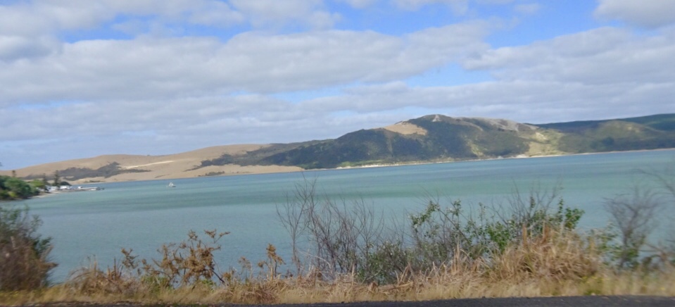
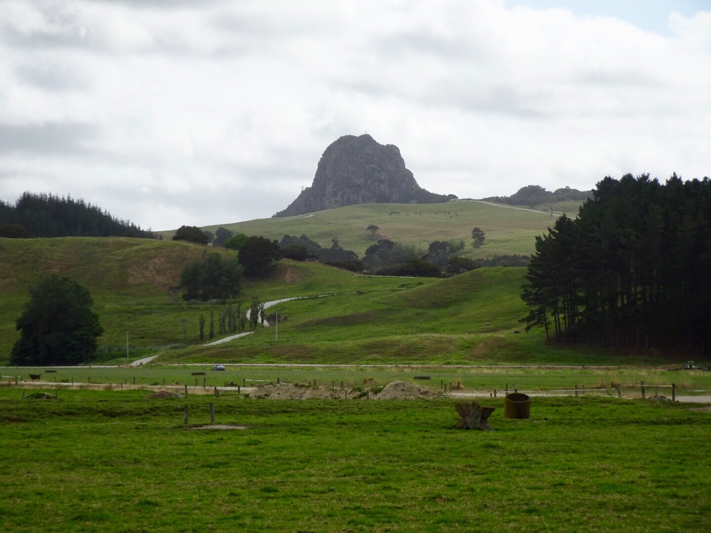
The peak below is Tokatoka Peak. It is a rare phenomenon as it is the plug of an ancient volcano. The material around the plug has also eroded over time, leaving only the hardened lava core.

in the pioneering days, the river pilot lived at the base of Totatoka and would climb the peak to watch for sailing ships in Kaipara Harbour.

Wairoa River continuing its journey out to Kaipara Harbour.

In the small town of Ruawai we stopped for refreshments. I recalled stopping here last year on my solo trip, and also recall the same scooter. Must be a local hangout for the elderly gentlemen.

Moving on nice rural scenery.

Before you know it, we have clocked up 75 km and decide to grab some lunch in Maungaturoto.

We were having to work a bit harder now as the hills became more regular. We climbed up to Brynderwyn and where else do you park your bike at the junction with SH1 to take a photo?

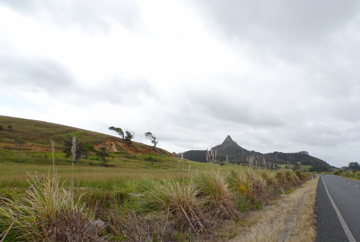
The local shop has a collection of bikes. Lost yours? Might be here!

I needed more water and purchased the very last bottle from the staff member who seemed to be having a bad day. Very grumpy. When assistants are like that, I am extra nice, wishing her a fantastic afternoon. She just looked at me……
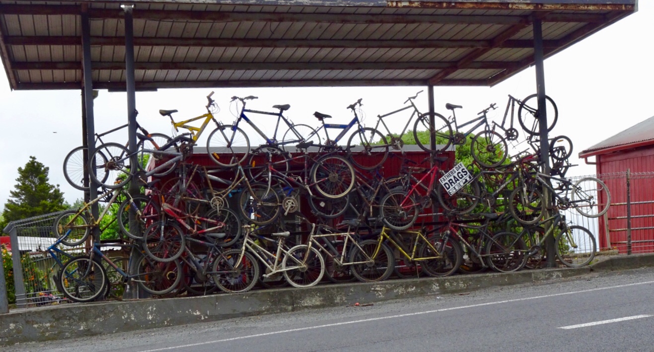
This is when our ride today got ugly. It was pretty horrid really as we were on a major highway, with verge ranging from zero to reasonable. It was incredibly busy and to make it more interesting (as if more challenges were required) it was drizzling lightly. Just nuisance value whereby your glasses end up with water on them to reduce visibility.

Utmost concentration was required. As can be seen from the elevation graph, it was hillier now too.

Lighter moments in the town of Kaiwaka. What this place is I am not sure…maybe a cafe?

This building? No idea….

This cheese shop amused me. You can see on the left that it is a Dutch Deli…..but….they have the Welsh flag flying.

It was such a relief to arrive in Wellsford, despite the last climb. Curiously, traffic was crawling up the hill slower than us!

We picked up some food for dinner, as we are staying some 7 km south of Wellsford with no local food options.

Aagh it was gravel….not again! 🙈 A picture of concentration as I climb up this gravel road.

It is a lovely area though.

We are staying at Barry’s Air BnB. I stayed here last year on my solo journey, final night.

Barry is an interesting guy, currently working on set design for the next Lord of the Ring movie. He hand draws all set designs.

He constructed his house and is into recycling parts where possible.

Since I visited last, he has constructed an external kitchen. We prepared and ate our dinner here. Useful for storing bikes too! If you look carefully you can see my cycle clothing hanging out to dry in the wind.

So here we are on the eve of our final day. We intend to get cracking early for a few reasons. Traffic for one and we want to be back at Gervase and Deb’s house by mid afternoon to start cleaning and packing our bikes up. Thats the worst bit…no time to celebrate!

Anyway that is tomorrow and we rest on our laurels for surviving today!

Thanks for reading,

Ooroo!!!

Tane Mahuta

A beautiful morning, fabulous breakfast, great company….hard to get moving! Enjoying our breakfast on Blair’s deck. This is my second visit to Blair, who lives in Rawene, a village on the shores of Hokianga Harbour.

He’s one of those guys you just get on with! You do not have to to watch what you say…as there are no pretentious airs, but a down to earth good fun guy. We had some quite numerous conversations over dinner on topics that the politically correct would rue.

The view across the back yard is very peaceful and serene.

Yummy breakfast cooked on Blair’s bbq and fresh food including bananas from his neighbours garden.

But farewell we had to bid, as today was all about hills.

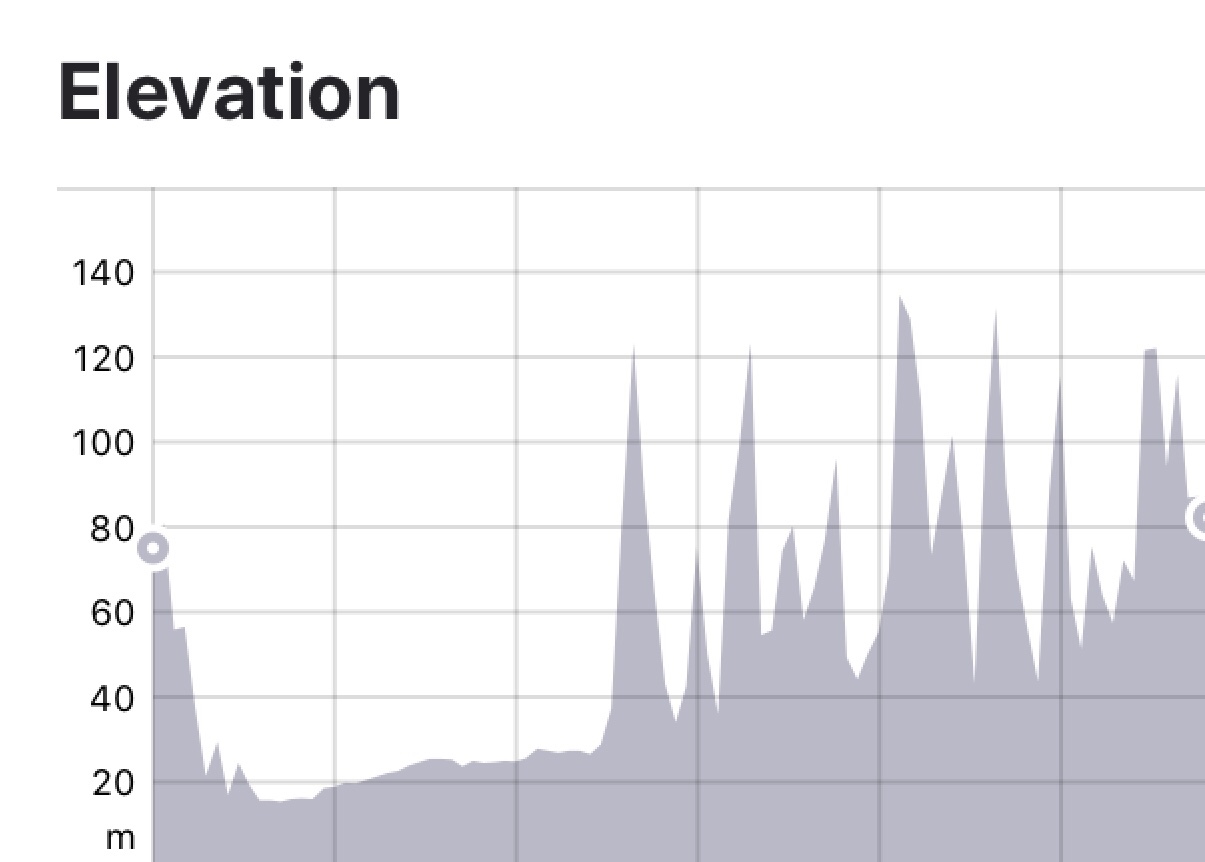
Leaving Rawene views of Hokianga Harbour. Unfortunately our camera has developed an issue we cannot resolve, hence blurred edges.

Out to greet the roosters at the intersection , we turned right onto SH12. Fortunately it was fairly quiet still being early Sunday morning.

Opononi was awake and we grabbed some items from the 4 Square store for the day. I like Opononi. The waterway here is still Hokianga Harbour, but close to the mouth where it enters the Tasman Sea.

After Omapere, the hills kicked in, but nice views again. I think a house on this land where the cows graze would be really nice!

The road turned south after the climb, and we hit a headwind that was to become a real pain in the butt later in the day.

I’m going to throw the climbing graph in now. You can see that there are a couple of descent climbs. Carrying luggage makes these climbs tougher…slower…anything over 10% with luggage is hard work. We’ve had heaps of 15% climbs.

The longest climb today though was the one up through Waipoua Forest. It is an enjoyable climb though as it has a steady gradient. It provided relief from the wind, shelter from the sun and is scenic. Hawkers not welcome either!

After you peak the first climb, you descend about 75 metres in altitude and arrive at Tane Mahuta.

Tane Mahuta is reputed to be over 2,000 years old. The tree is also called Lord of the Forest and is a Kauri. It is named for the Maori god or forests and of birds.

In 2002 measurements were taken of the tree dimensions. The tree girth is 15.44 metres. The trunk height is 17.8 metres. The tree height is 45.2 metres. It is reputed to be one of the oldest and largest trees in the world, but is under threat from Kauri dieback that is decimating many of the native trees.

Some refreshments from the well located van.

Onwards we rolled up and down.

We visited a Kauri shop on top of a hill. An old piece of what we assume is Kauri decorated with….garden gnomes…..once upon a time, in my younger years, a friend and I were known for selective gnome relocations!

In the shop, the little old bespectacled lady with bucked teeth and gold fillings asked where we were riding to. She advised one small hill and down hill the whole way.

My memory of having ridden this section last year was foggy but looking at the surrounds it seemed a little impossible. It also made me recall similar advice Sue and I received on a stinking hot day en route Auckland to Wellington. That time a little old lady told us all the hills were done.

Both were wrong, both need new glasses, and I suspect both drove automatic cars! I stopped counting after 10 climbs of varying length. Never trust little old ladies assessment of what constitutes a hill on a bicycle!

The last few hours we really battled strong winds…not behind us either, making tough work of the easier sections! The west coast of North Island is in view, and we rode reasonably parallel south to it.

Our route map.

The traffic on SH12 really built up during the afternoon. We had a few dickhead drivers (my term for those drivers who deliberately buzz us and take no action to be anything other than selfish road hogs).

On the other hand, we had an awesome milk tanker driver…

On the back of Tony’s bike is his rear red flashing light ( I ride with my rear light flashing too) but his has an inbuilt radar. It notes cars before we can hear them. It sends a message to both of our Garmins (bike computers mounted on our front stem) with a beep and a dot that moves up the screen the closer the car gets to us.

When I hear the beep I then check my Italian cycle mirror, mounted off the right hand handlebar, look to see if I can move off the road anymore than I am, to provide the greatest margin I can between myself and vehicle. (These mirrors are excellent, and were recommended to me by a Kiwi riding friend Greg. When we ride in Europe, we swap the mirrors over to the left hand side).

In the case of the milk tanker, Tony was a bit further ahead and the radar had unsynched, but as I climbed I could head a truck well back changing down through his gears, but seemed a bit too low. Checking my mirror I realised he was moving slower than he was capable of to protect me as he had a few cars behind him.

So I got up out of the saddle and put in a bigger effort to get to the top of the climb, where Tony was, and off the verge.

He gave us a huge wave, as we did back. He was a great example of someone looking after us!!

Approaching the outskirts of Dargaville reminded us of what this town is famous for.

The last 8 km was a real slog. Again, I had inadvertently found accomodation that required climbing to get to. The wind was very strong and we had tired and at the 110 km point, having climbed nearly 1700 m with our gear on board, we were pleased to arrive in Baily’s Beach.

Nice view from our bedroom.

The local shop is the dairy, takeaway and restaurant so off we headed for a steak, starting with garlic bread. As we finished, I was amused to note the paper lining the base of the garlic bread plate.

Here we are in New Zealand, where they do a fantastic job of promoting their products. But sometimes, you just cannot get away from home…..

Thanks for reading,

Ooroo

The good, the bad and the ugly…not necessarily in that order.

After I finished my blog last night, I jumped into bed. As I lay there I was aware of something touching my upper legs (and it was not Tony!). I reached my hand down and grabbed what I assumed to be a moth, and threw it out across the bed, towards Tony as I expected it to fly.

The room was still quite light and when I checked to see if maybe I had inadvertently killed the moth, I was alarmed to see a reasonably large spider on Tony!

I jumped out of bed, as did he as he was alarmed at the sound I made.

The spider having been flicked off by Tony then tried to hide between the mattress and tucked in sheet…we ultimately won the battle and New Zealand has one spider less.

I have since identified it as a Tunnelweb spider..described as a very fast New Zealand spider and somewhat shy!

Shy or not, it was not sharing my bed and crawling over my body! This creeped me out! I do not think this has ever happened to me (knowingly) before.

Despite that, we both slept very soundly in lovely accomodation at an Air BnB.

We were on the road by 8 am and look what had already arrived in the harbour…yes, 3,500 Aussies. We beat a retreat and headed out of town!

Looking in the opposite direction provided a nicer vista.

We climbed a few hills and had one final view back towards Russell and the Aussie’s.

Following the harbour shores….

We hopped onto the Twin Coast cycle trail.

The first few km were excellent quality. Compacted gravel on top of existing railway infrastructure. At the bridge, an additional deck had been constructed on one side.

We entered at our own risk, but could not see what the issue was.

We arrived at the old Taumarere Railway Station, now used as a tourist railway from Kawakawa, but formerly supporting a thriving town of 1,500 people with industry and tourism benefits.

Our first stop was Kawakawa. Originally we were going to head further north to KeriKeri, as it is a lovely old colonial town, well preserved but after having been in Whangarei we learned of Freidensreich Hundertwasser, an Austrian born architect who spent the latter years of his life living in New Zealand.

His designs feature all around the world, and Kawakawa has a toilet block he designed that is regarded as an international work of art.

The style is typical Hundertwasser with wavy lines, irregular ceramic tiles, integrated small sculptures, coloured glass and a live tree incorporated into the architecture.

Hundertwasser requested that any vegetation removed for construction should be replanted on the buildings green roof.

The toilets are Kawakawa’s main tourist attraction, and the most visited toilet in New Zealand, with tourists buses arriving to photograph the toilets.

The toilets are fully functioning.

Back on the rail trail we crossed the Kawiti Truss Bridge that passes through the Ngapipto River Valley, where the descendants of the great Ngati Hine leader Kawiti live to this day.

Although Kawiti cautioned his people never to sell their land, it was confiscated for the North Auckland railway line in 1913.

This impressive truss bridge took 500 men to build and is 74 metres long.

I like this photo showing some of the truss work and the river below.

On the track we found an alive hedgehog. In the five previous trips to New Zealand we had only witnessed flattened dead ones!

I think it is cute, but apparently they pose a significant threat to many New Zealand native species due to their voracious appetites.

Hedgehogs are not endemic, having been first brought here by ‘acclimatisation societies’ to remind settlers of their homelands. They were later introduced in greater numbers to control garden pests such as slugs, snails and grass grubs.

We thought he was cute!

Further along the cycle trail, which certainly was not as well constructed as the first few km, and in many parts, was just a single true track, we found this sign. Interesting.

Kaihoke was the town we hoped to grab some refreshments, apparently a thriving town in its history. When the train line opened in 1914, 1000 people came out to celebrate. The town peaked as a trading centre in the 1950’s before falling on harder times.

Heading into the local Countdown supermarket for a cold, large bottle of water proved a futile exercise. Despite two laps of the supermarket I could not locate any large bottles. I asked and was told not available, but proudly showed me their extensive range of cold alcohol! 😂😂🙈

So in desperation I headed into McDonalds to buy iced coffee and fill our water bottles up in their bathrooms!!

Back onto the road for the last 40 plus km to Rawene, with minimal verge. Groan. Nice countryside though.

We were very glad to turn off to Rawene.

These critters seemed pleased to see us too. We later learned that this is the local dump point for roosters!

Quick trip to Rawene, as it is only 6 km in from SH12.

Down to the ferry at the road end….I caught this ferry last year on my return journey from Cape Reinga, arriving into Rawene to stay with Blair, an Air BNB guy that I have kept in contact with since on Facebook.

Great to see Blair again. Blair is a professional chef, and we have just finished an awesome meal that he cooked. Vegetables and greens all from his garden. We sat on his deck looking out to the harbour.

Todays route and elevation that has taken us from the east to west coast of New Zealand.

Tomorrow is another day…more climbing and over 100 km ride as we head south towards Auckland.

Thanks for reading, I need my beauty sleep…first I’ll check for spiders!!

Ooroo

Bay of Islands

The Bay of Islands comprises around 140 sub tropical islands, known for undeveloped beaches, big game fishing, and Maori cultural artefacts.

It is home to the 19th century port of Russell, with a waterfront promenade lined with remnants from its days as New Zealand’s first colonial capital.

To get to this area from Oakura means a lot of hills and today did not disappoint, with an 18 percent climb from our overnight accomodation…..again!! Around the corner, and again, climb out of the village. Nice views looking back towards Oakura Bay.

I have had to stop riding many times for various animals, but never for pigs! These guys must have escaped knowing the inherent dangers for them, particularly at Christmas time.

Climbing gives great perspective to the surrounding landscape. This first one is looking south.

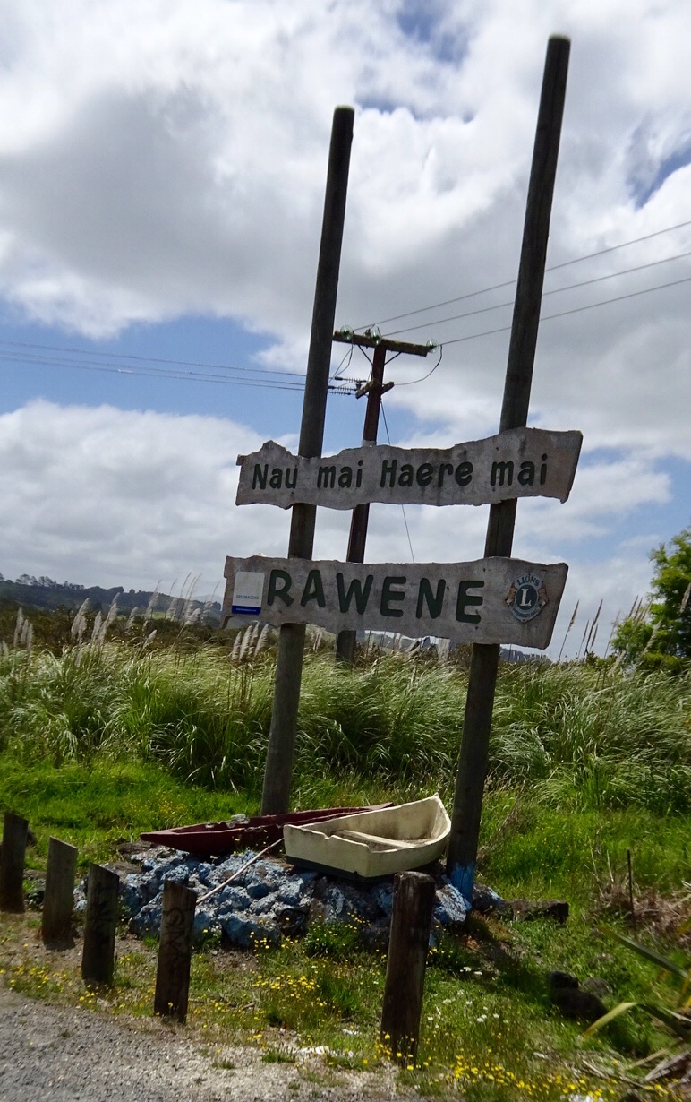
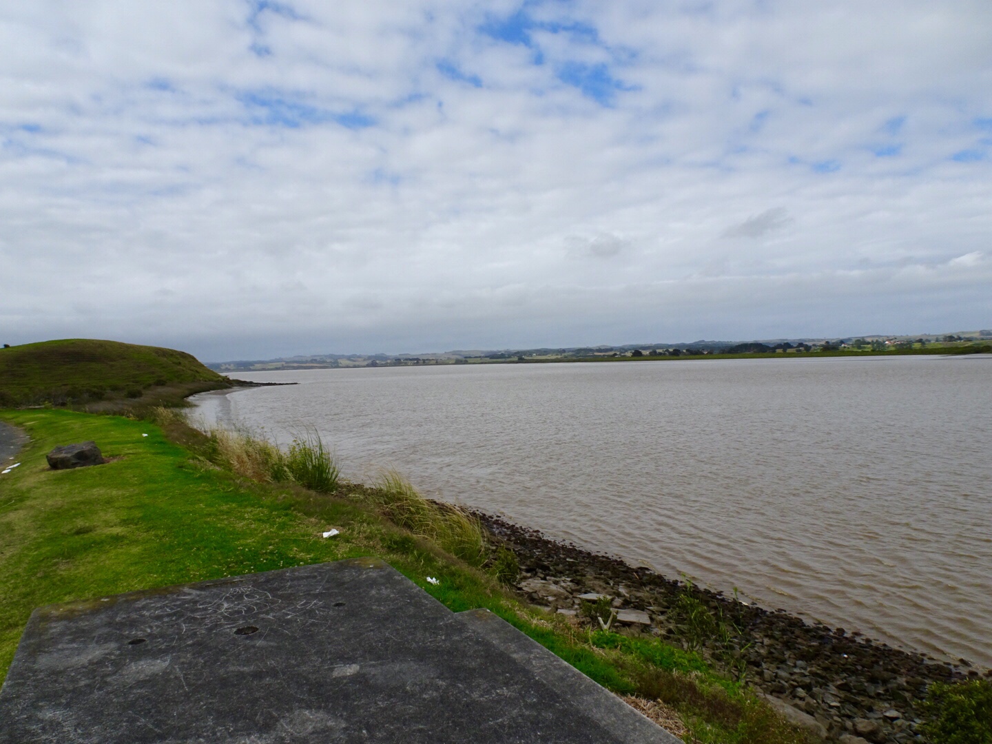
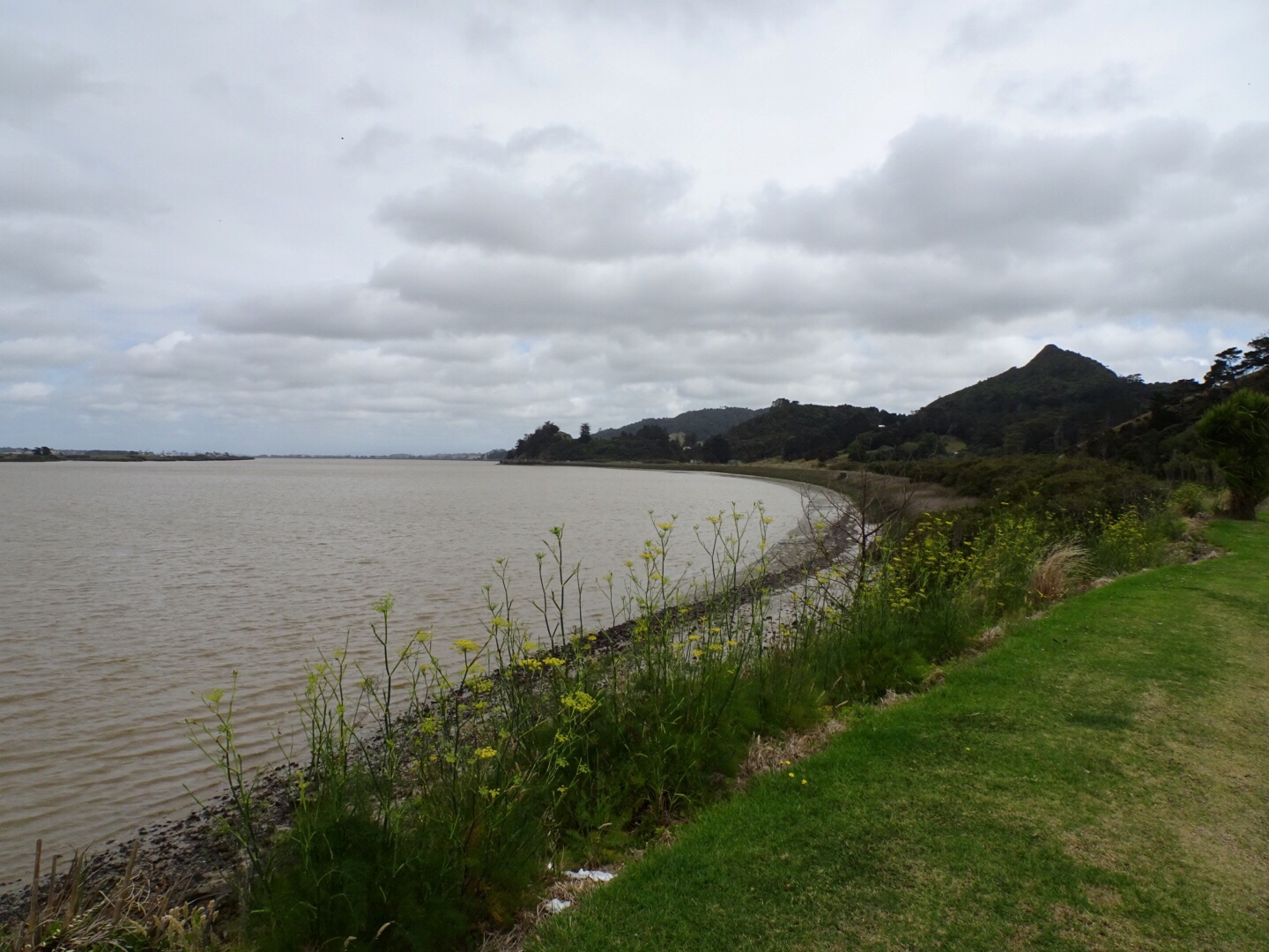
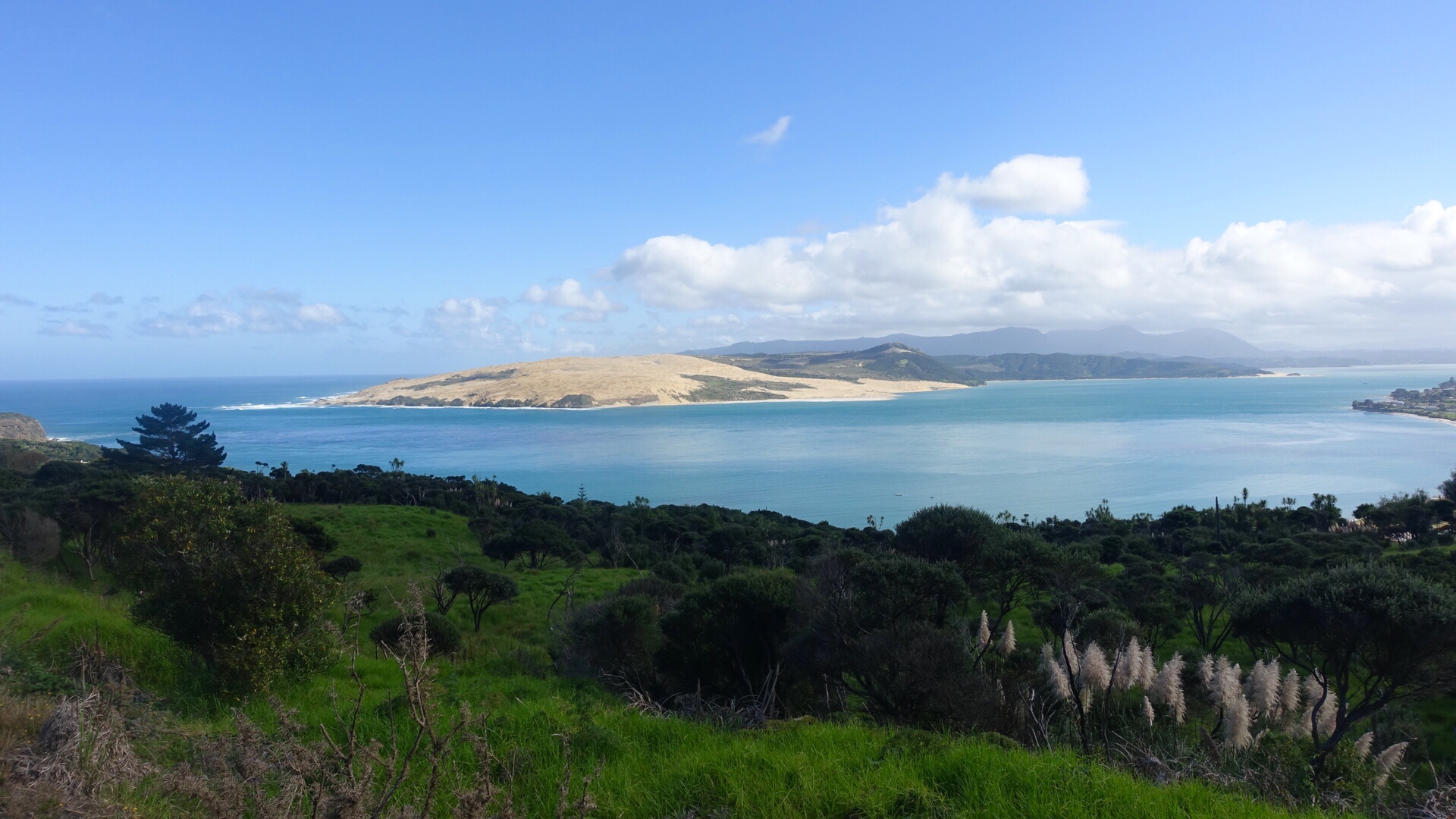
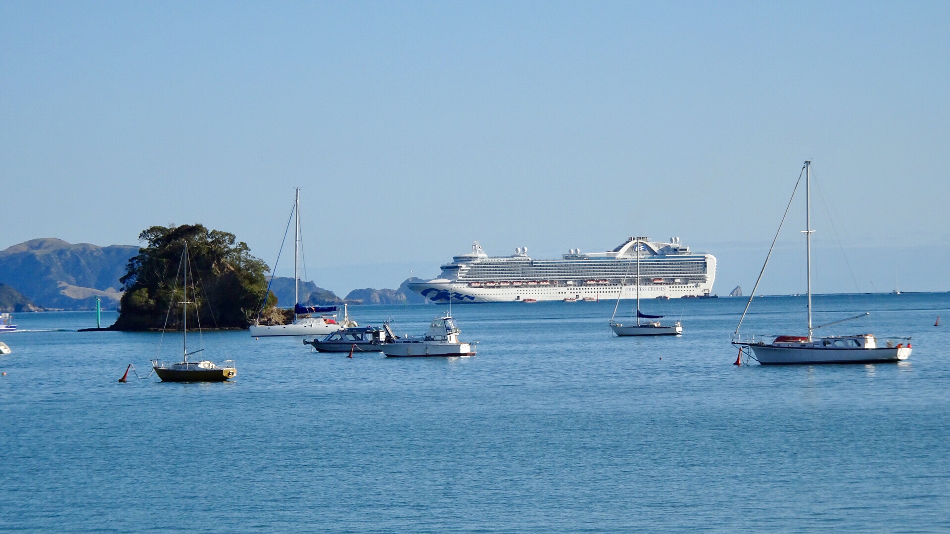
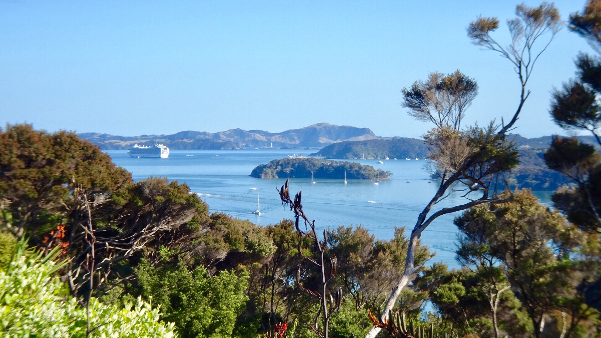
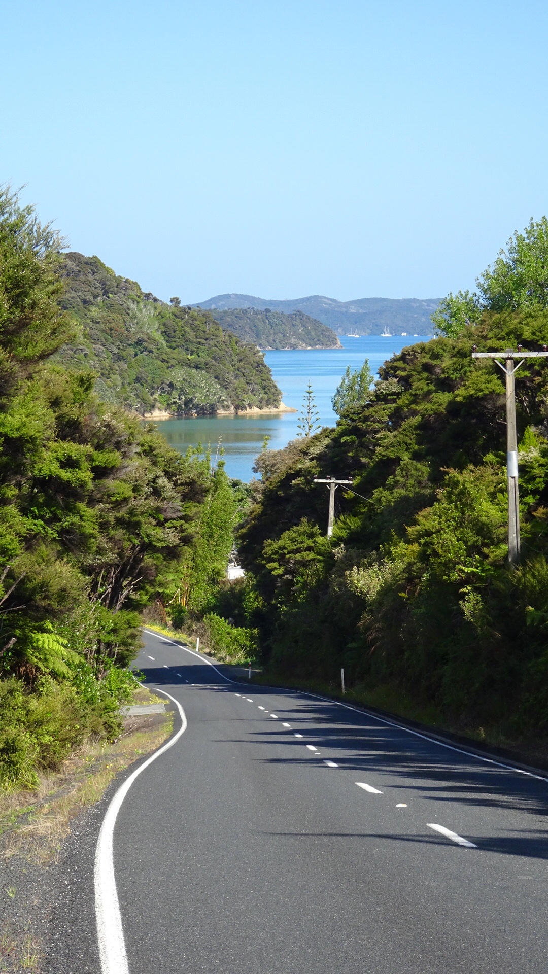
From the same viewpoint is this boat…waiting for the tsunami action plan? It is about 75 metres above sea level and not in the greatest condition either.
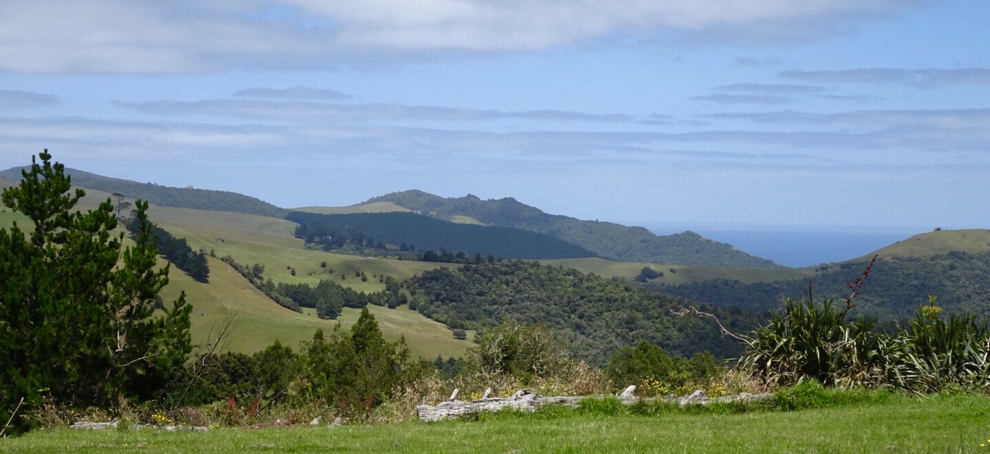
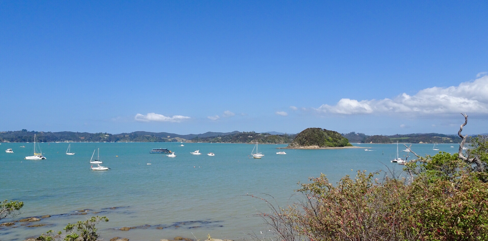
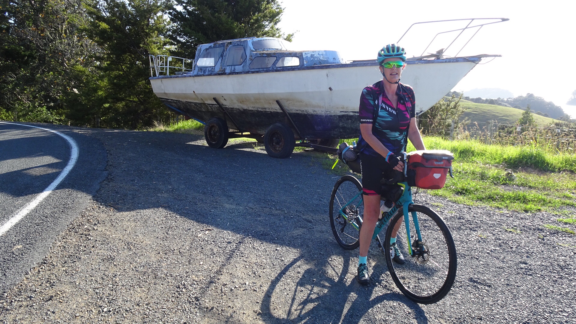
Looking north towards the Bay of Islands.

I quite liked the campsite chosen by these people. Highly unlikely to have many others join, as to get there you need to clamber down a steep bank with your gear.

We liked this view, just before a descent, looking at the boats in the harbour.

A few more coastal views before we headed towards Russell.

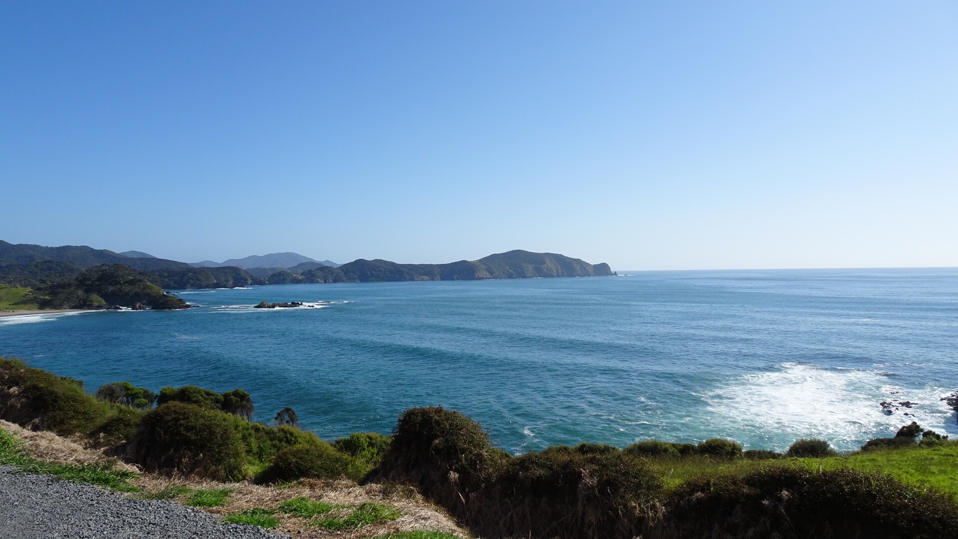
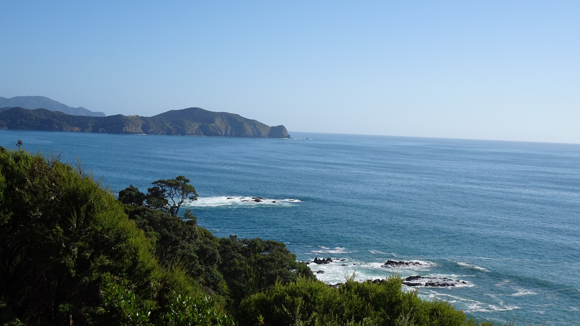
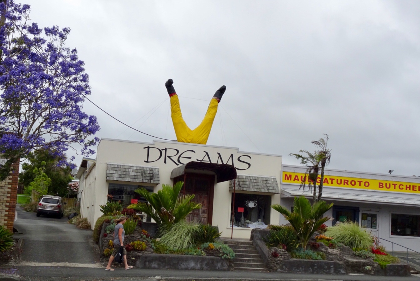
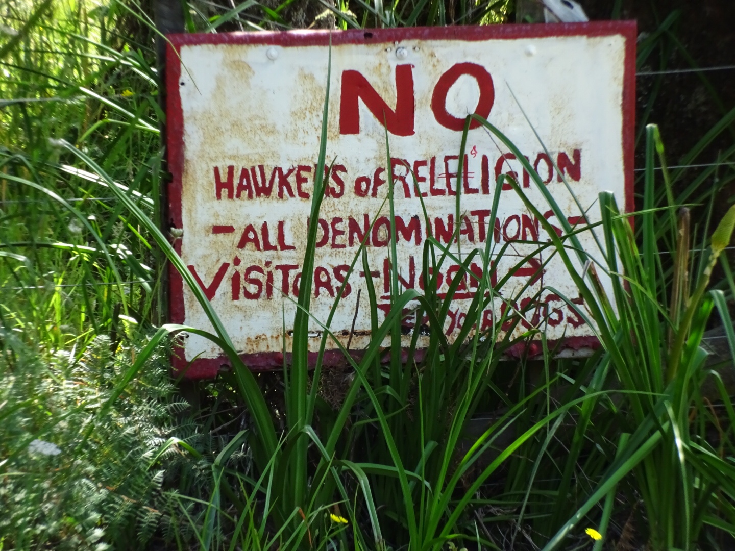
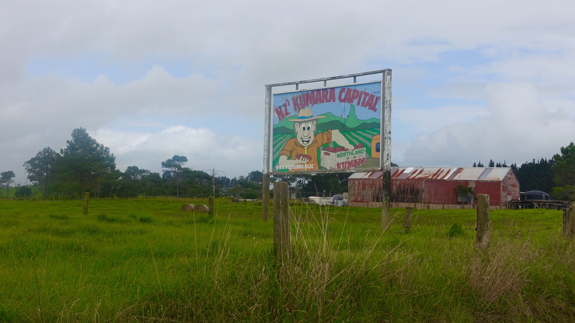
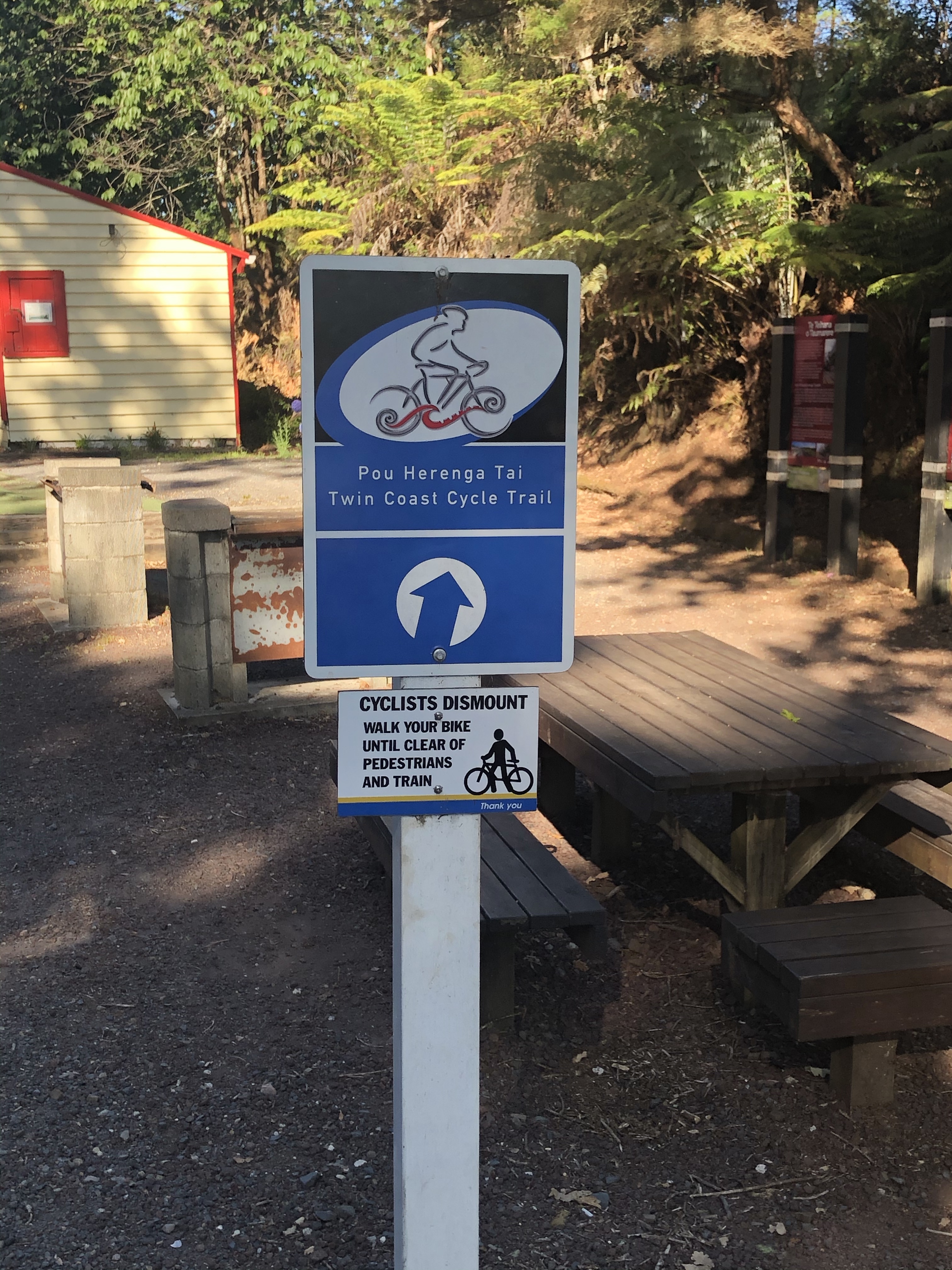
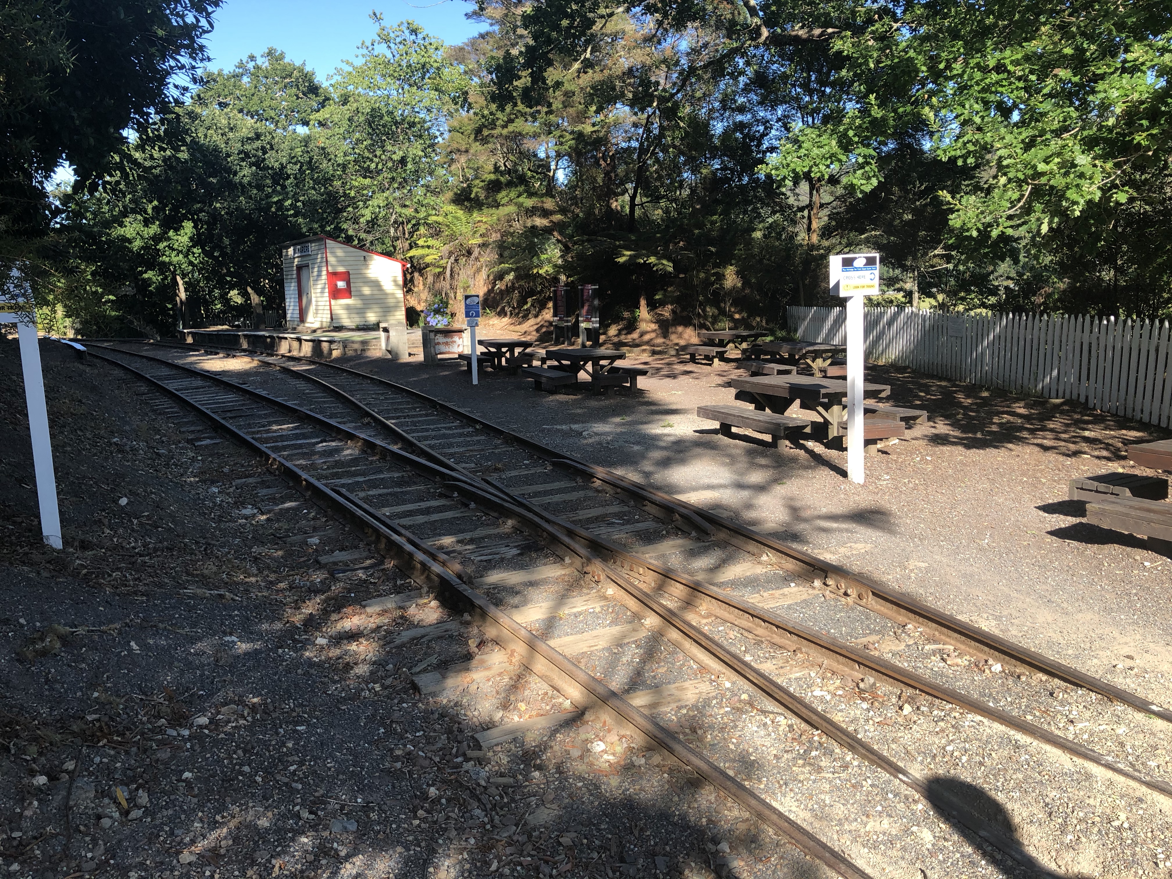
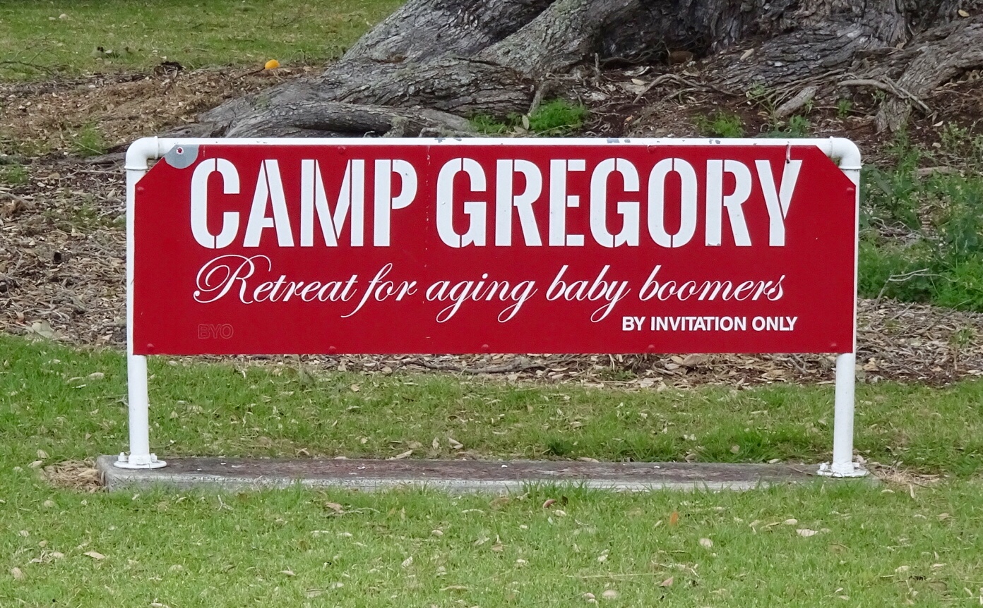
I could not resist taking a photo of this sign. 😂🙈
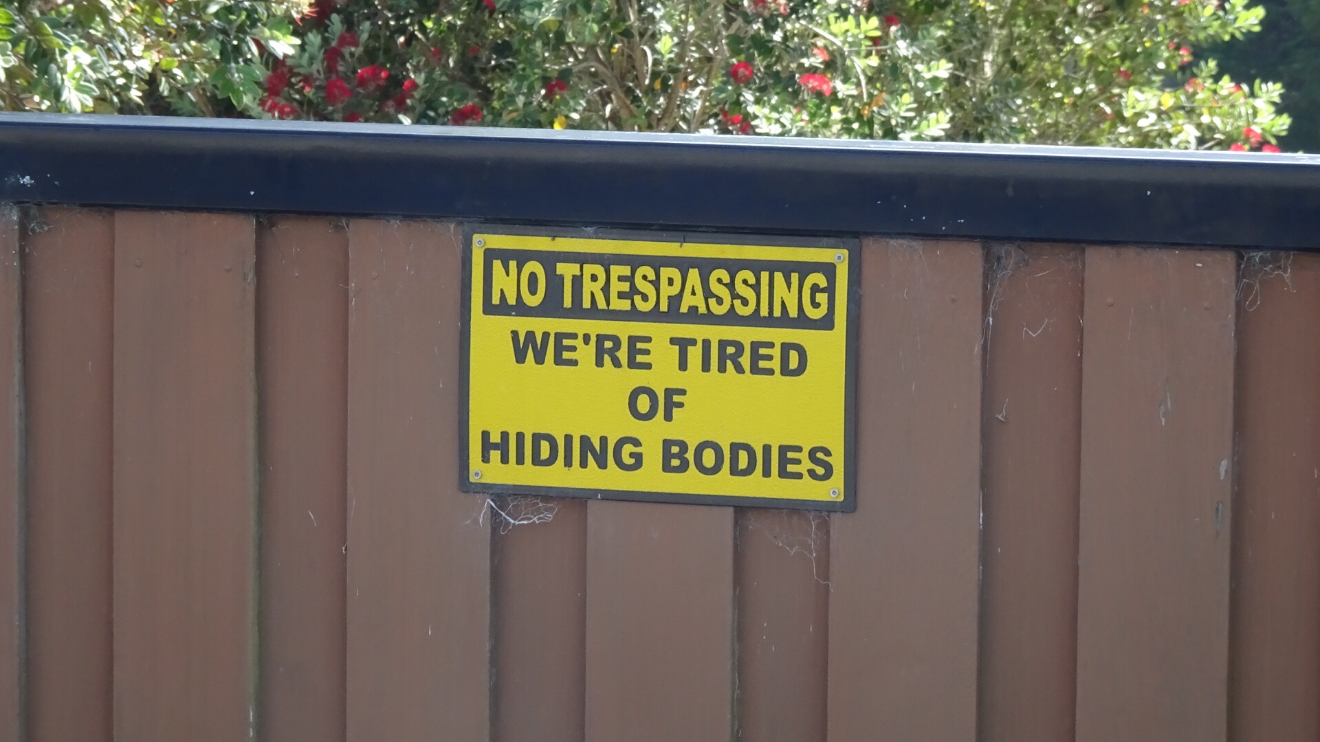
Arriving in Russell we headed straight to a cafe I had been to before for an iced coffee….but they gave us iced chocolate. Ho hum, but for the first time in 5 days we had more than two bars reception.

We met a father and daughter (Dave and Annelise), who had just ridden into town. They are on holidays in the region, but live in Whakatane, near White Island volcano. Lovely to have a chat before they headed off for a family lunch.

Russell was the first permanent European settlement and seaport in New Zealand. A small population of 720 in the last census, numbers are swelled by significant tourism.

Before European settlement, Russell was inhabited by the Maori, attracted to the area by its climate, and the abundance of fish, food and fertile soil.

In the early 1800’s the indigenous Maori recognised the advantages of trading with the Europeans, and started to supply food and timber to the Europeans using the Bay of Islands for safe anchorage.

In return, Maori sought respect, firearms, alcohol and other goods of European manufacture.

However, whilst Russell (then known as Korarareka) blossomed, it quickly earned a bad reputation for a town with no laws and rife with prostitution. It became known as the “Hell hole of the Pacific”.

The Main Street today is colonial and quite sedate, bearing no resemblance to its former reputation.

Nevertheless, we headed out of town via the ferry to cross over the harbour to Paihia.

Nice views whilst crossing.

Farewell Russell.Looks like funHello, or Hi ya Paihia and the big marlin. You can see me pushing my bike through here.

Paihia is very touristy. There are less colonial looking buildings, replaced by many modern accomodation businesses. There are some little gems though, such as this ‘wee’ toilet.

Camp Gregory also appealed to me. I think this is a sign in a private home garden….I do like their sense of humour.

Nice views from a lookout, just above the ‘wee’ toilet. The first one you can see Russell on the far shore.

This one is looking South.

The local ferry terminal with requisite tourist activity businesses selling everything from parasailing, helicopter tours, kayaking, artisan arts and crafts to plastic junk.

Tomorrow 3,500 Australians arrive on a large cruise ship!! Horrid!! Glad we’ll be on the road out of town!

In town earlier I had noted this stall promoting a Maori made product for eczema and dermatitis. I have both skin conditions and I have a spot of eczema on my arm currently driving me nuts. So we went back to check it out. I met two lovely local Maori sisters, Karina (left) and Judy (right).

I have purchased a small tub of the Taiamai balm made from the kumarahou plant, used by indigenous Maori for the treatment of bronchial, kidney infections and topical remedy.

The best value tub size was the large one but given my ceramic purchases yesterday, space is now ultra critical! Fortunately Karina can post to Australia. Check out her Facebook page, as I can tell you now, the itching has already stopped, so that should allow the skin to heal. ( Facebook….Taiamaiheritage).

Heading back to our accomodation, we passed an interesting stone church with an information plaque.

In 1831, thirteen Maori members of the northern tribes petitioned the King of England, William IV for a representative of the English Crown to be sent to New Zealand to establish law and order and give protection to all Maori people.

In response, the King appointed James Busby the first British resident, who in 1833 landed on the beach nearby. He was accorded a naval salute of seven guns and greeted by 600 Maori’s with a ceremonial haka.

Both Maoris and Europeans then assembled in the church grounds to break the letter on the royal seal. This ceremony was the precursor to the signing of the Treaty of Waitangi seven years later. This current church is the fifth built on the grounds.

Another day done and dusted. Route and elevation maps.

A shorter ride today, but plenty of climbing to keep us ‘honest’. We have been lucky with the weather, and hoping that continues.

Thanks for reading

Ooroo

Oakura

For those regular readers of my blog, you may recall Oakura was an overnight stop on my solo Auckland to Cape Reinga and return ride March 2018. It was an unmitigated disaster, as it was the day Cyclone Hola hit this region and I was on my bike. Alone.

It was also the day I really needed a friendly face and warm accomodation but found myself in danger of electrocution in a dodgy, sub standard caravan operated by an even dodgier character, Jason.

Nevertheless, I found a kind couple who helped me out, picking me up from the dodgy accomodation and transferring me a kilometre or so to their motel/caravan park, greeting me with a mug of hot soup and a token to operate the clothes dryer.

I was so thankful and decided to revisit their site.

First off, we needed breakfast and had purchased eggs, bacon and cheese when the Tutukaka General Store was open on Christmas Eve.

Bidding our Air BNB host Michael farewell we tackled his driveway…18 percent gradient, warming us up for a day of hills.

Up and down into Tutukaka we then climbed and descended to Matapouri Bay where we spent time chillaxing yesterday.

Climbing up another hill to the parking bay for walks to Whale Bay. Some beautiful views and more tsunami warning signs.

Descended to Woolley’s Bay where the surfers were out in the water waiting patiently for their big wave!

Sandy Bay was next, and we then headed in a westerly direction through rural farming properties, up and down hills. More wild turkeys, and then another one cresting yet another climb.

Passing through the small settlements of Waipaipai and Marua we stopped to buy water and iced coffee in Hikurangi, a quaint little town.

There we met Tim, a very friendly guy who stopped us as we left the General store to talk cycling. He suggested we could wander up to the Curios shop, as that was where he had left his bike.

So after refuelling and using the local amenities we did that.

Turns out Tim lived in Tasmania for a number of years and still owns a property at Carlton Beach. Small world. He is now a drilling engineer in the oil industry working down at Taranaki near where we spent Christmas last year.

Tim also took a photo of us, which he kindly emailed.

Bidding Tim farewell (but not before a rendition of Waltzing Matilda played on a sheep herders whistle), we headed out of town to join State Highway 1. Air raid sirens sounded, and it was a very eerie sound.

We had only ridden about one km on the highway when we encountered all traffic at a complete standstill. We kept riding down the verge until we got to the front of the queue, and it was apparent why the air raid sirens had sounded.

We were hoping no one was inside the car. The car was making many loud explosive noises as bits started flying up in the air. We were well clear….in this photo Tony has used the zoom feature.

The fuel tank exploded and flames extended along the road.

The boys in red arrived.

They quickly extinguished the fire. Then the police arrived…having missed everything!

Fortunately the occupants were fine. A young Maori couple were brought through by police, including their very cute puppy. We were very relieved that they were safe and sound.

We were given the all clear to proceed, which was handy as the road was blocked on the other side for about 2-3 km. Many asked us what was going on.

We were pleased to leave SH1 and turn off towards Oakura. The traffic, curiously enough, was far busier than SH1 with most vehicles towing something ( trailers full of holiday items, caravans, boats).

Rolling hills looking considerably drier now.

Descending towards Helena Bay we noticed signs for a cafe and art gallery. We ummed and aaahed before deciding to check it out. It was down a gravel track!!

What a find it was. Bike racks and out of sight from this picture, security cameras watching the bikes!

Beautiful gardens, fantastic gallery, and scrumptious cafe with some amazing views.

Touring means you cannot buy much in the way of extras. Soooo we needed to rearrange our luggage as I purchased two ceramic items. The bikes really need to stay upright now!! I would photograph the items but they are nicely secured within bubble wrap and tape. They can stay like that until we return home.

Next stop, Oakura Bay.

The dodgy Air BnB is still running, and I noticed that the even dodgier Jason replaced the cracked caravan windows but still has a power lead running through the window to the power point.

Moving right along, we climbed the last hill and descended to our accomodation on the shores of Whangaruru Bay.

Interestingly the lady at reception remembered me from last year!

A curious place as the beach is used by owners of shacks on the next bay, only accessible at lower tides. Traffic gets a bit tricky at times.

Some really lovely shacks and views.

Here is a map of today’s route.

Today is day 6, and it was thoroughly enjoyable. We loo, forward tomorrow as we arrive in the Bay of Islands region.

Thanks for reading,

Ooroo

Matapouri

Christmas Day, our third in New Zealand. Twizel, New Plymouth and now Kowharewa Bay, just outside Tutukaka. Beautiful views, very serene.

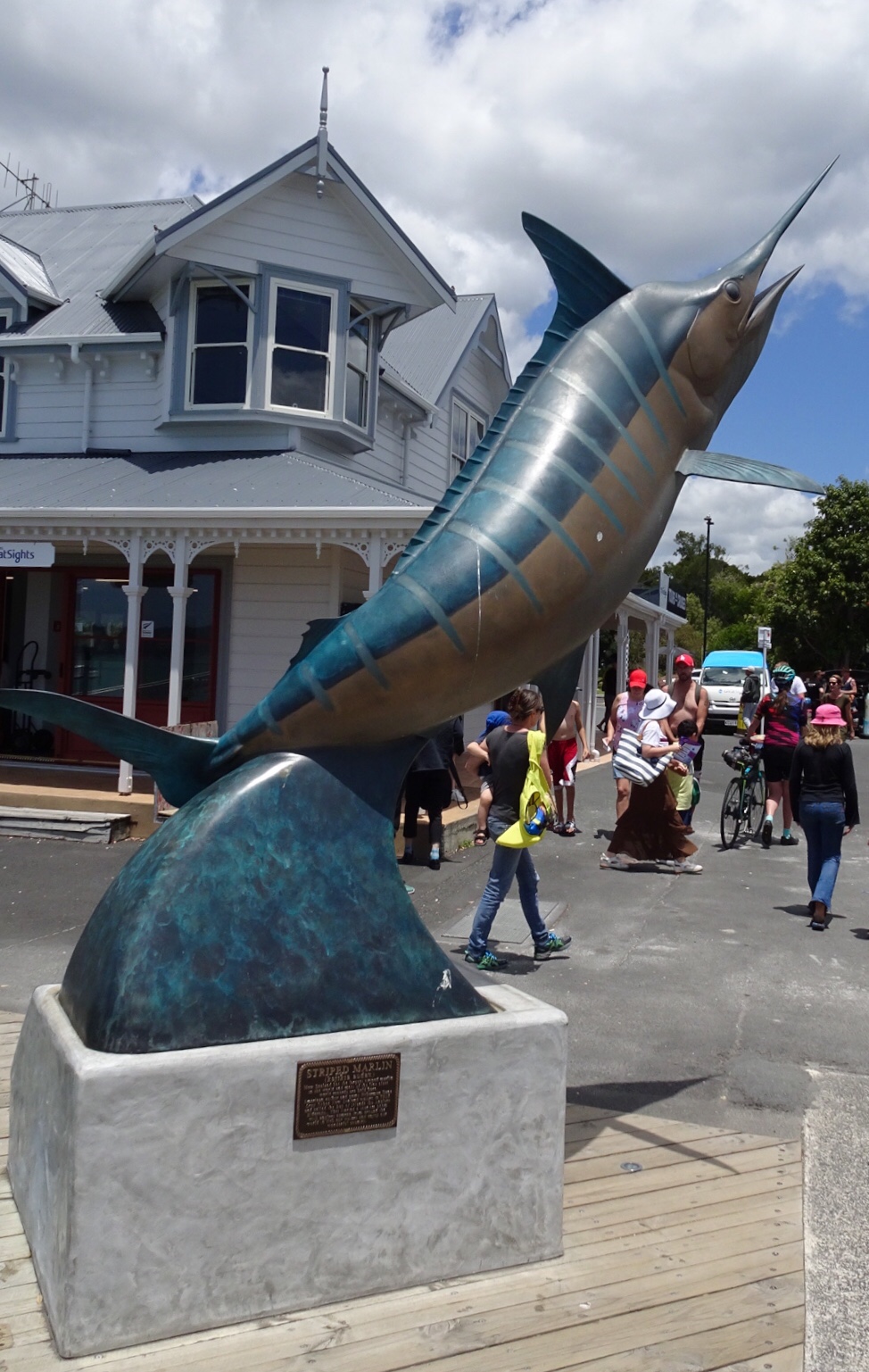
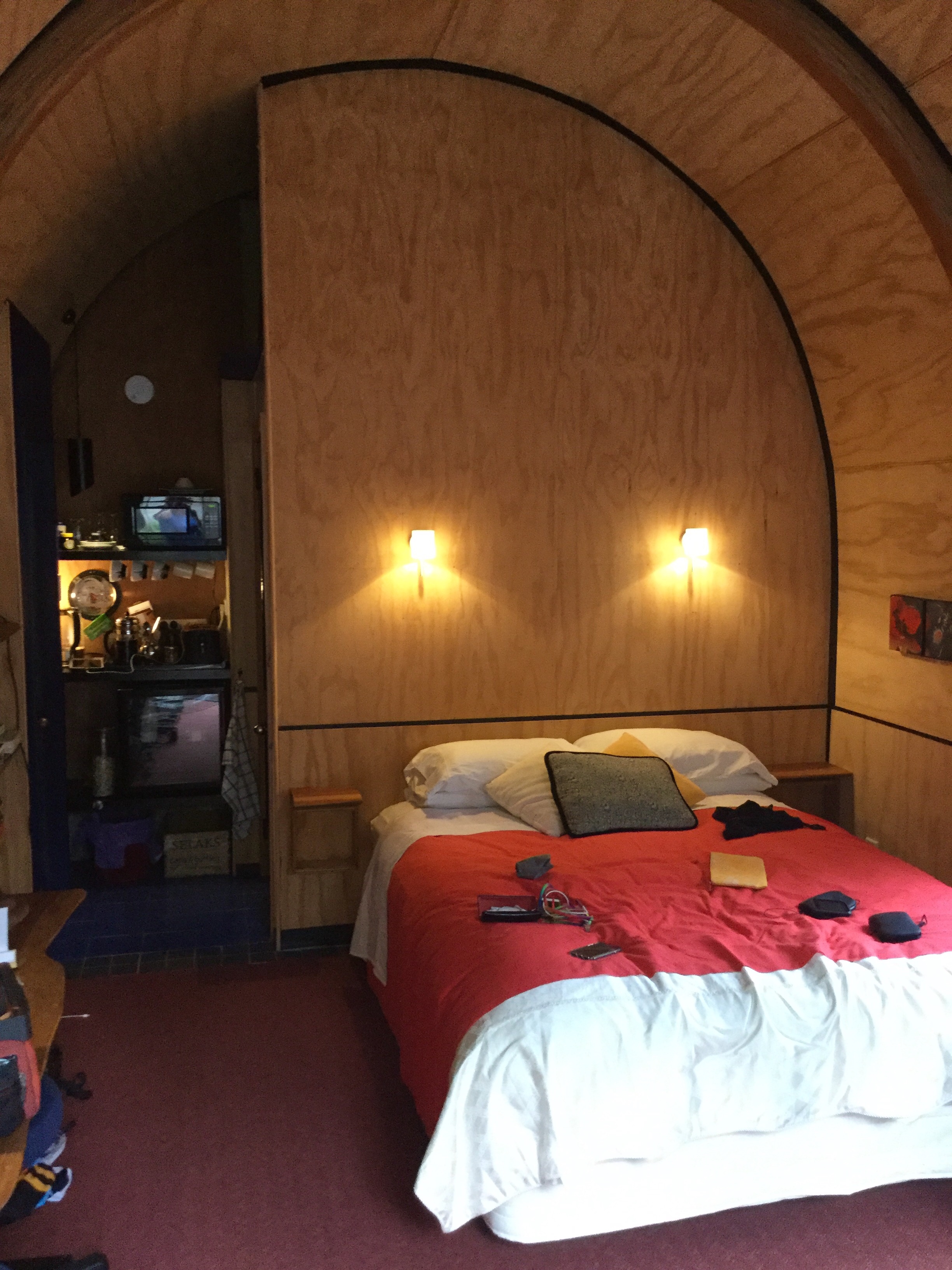
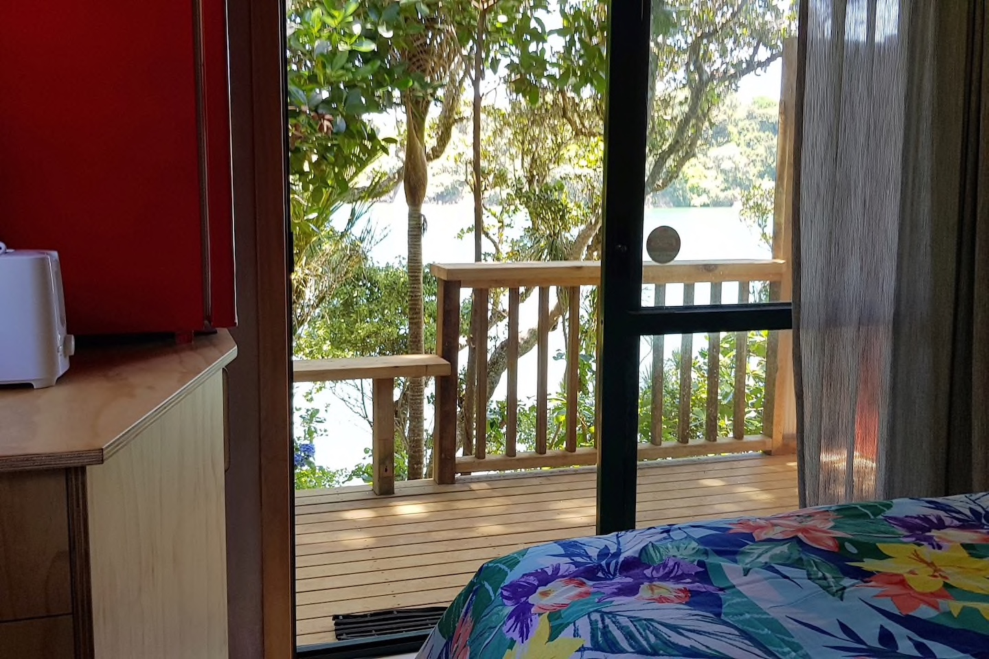
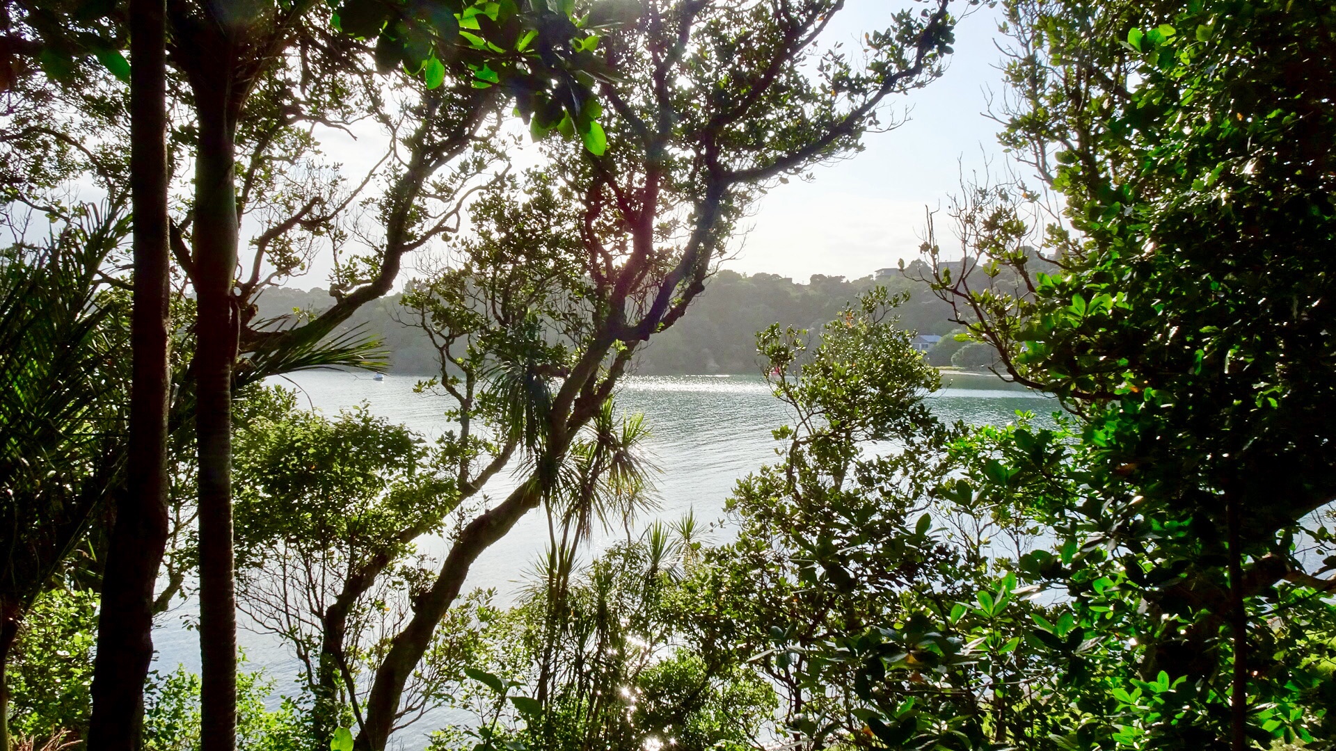
We are staying in a cosy little cabin, akin to an enlarged cubby house.

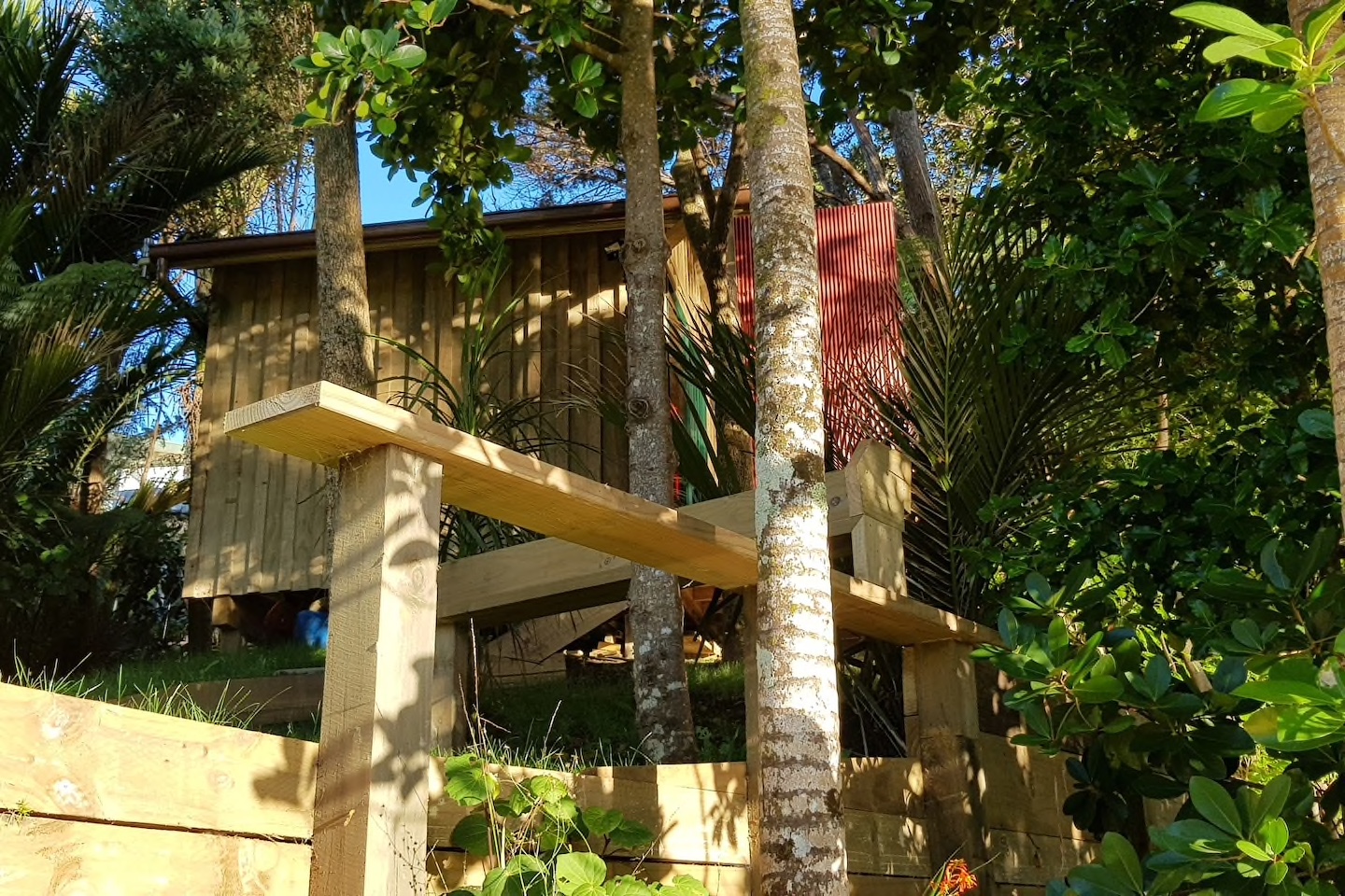
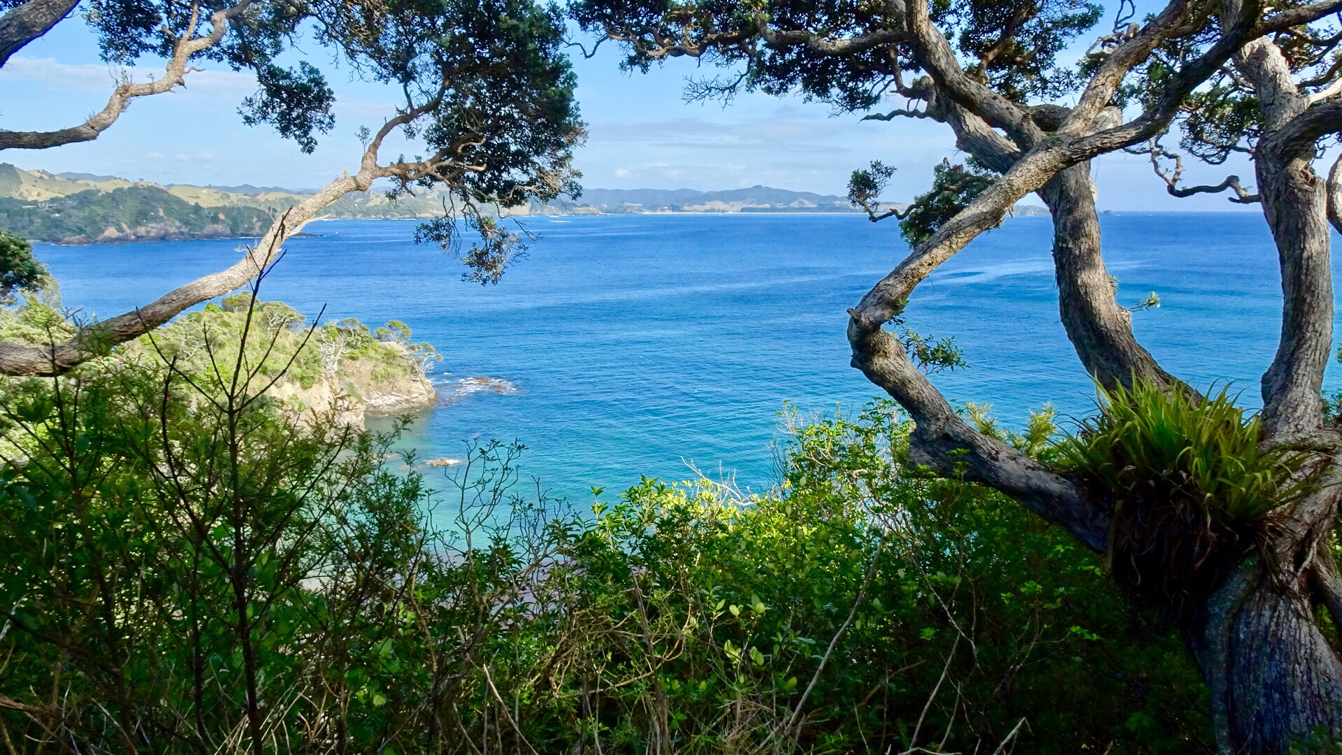
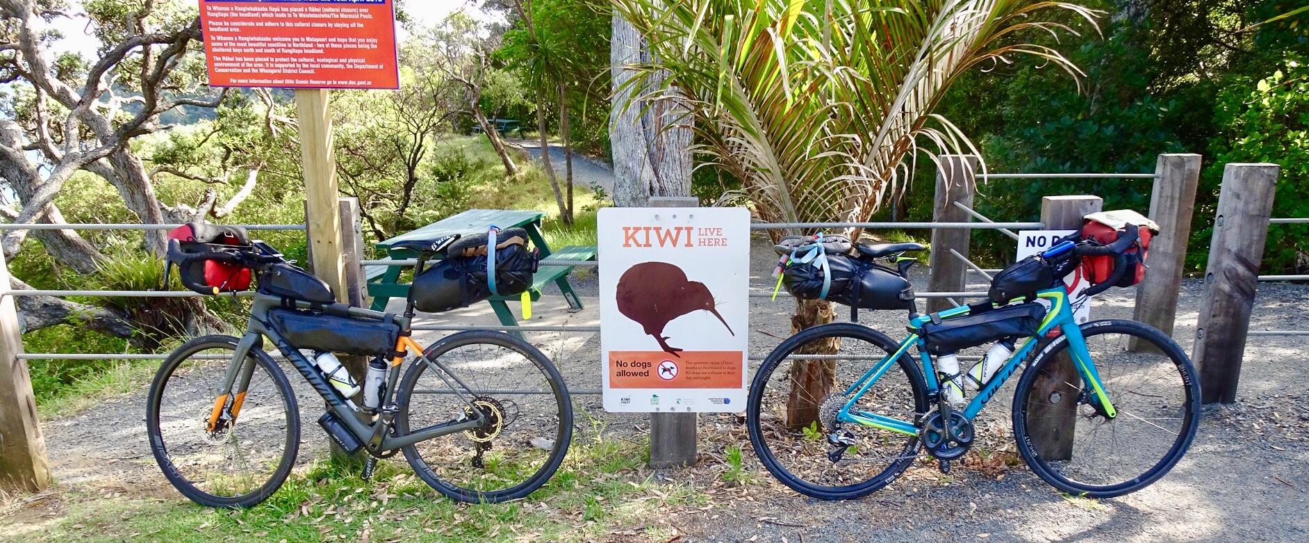
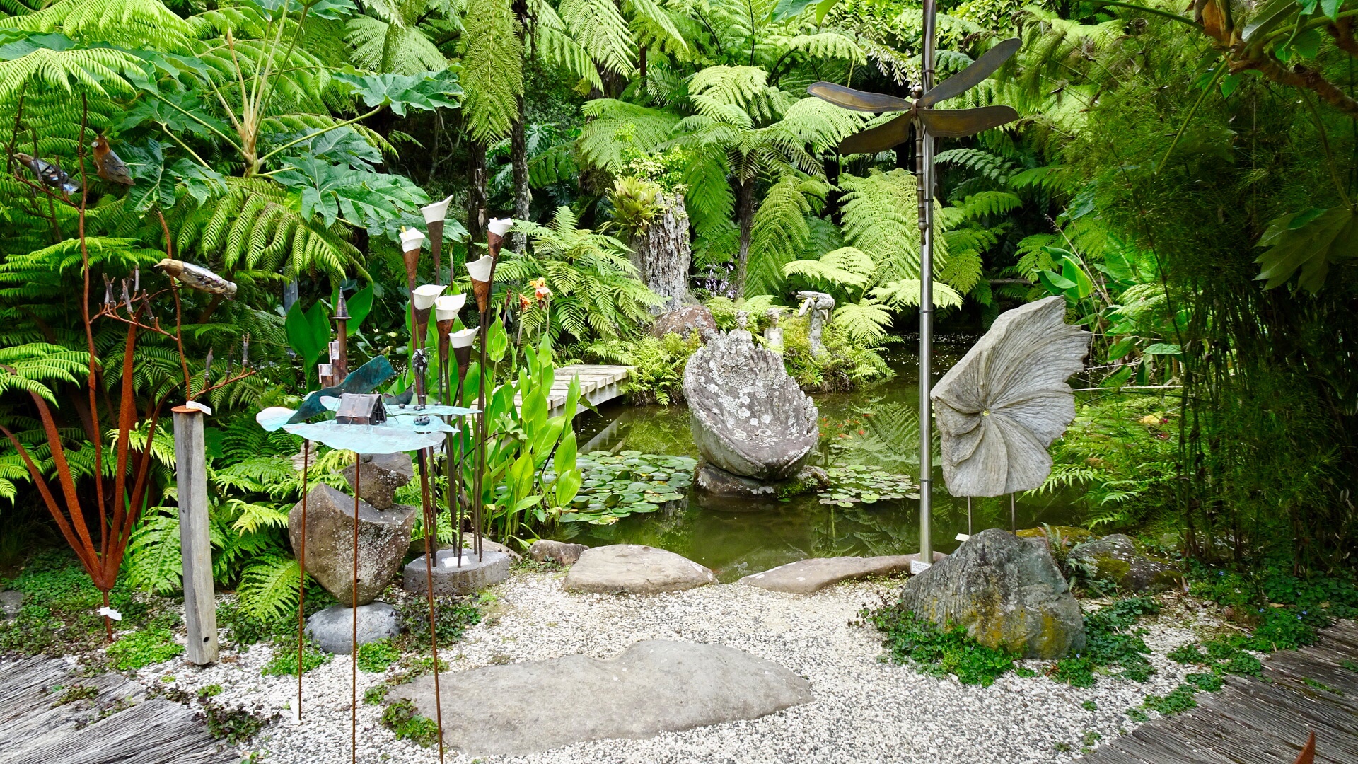
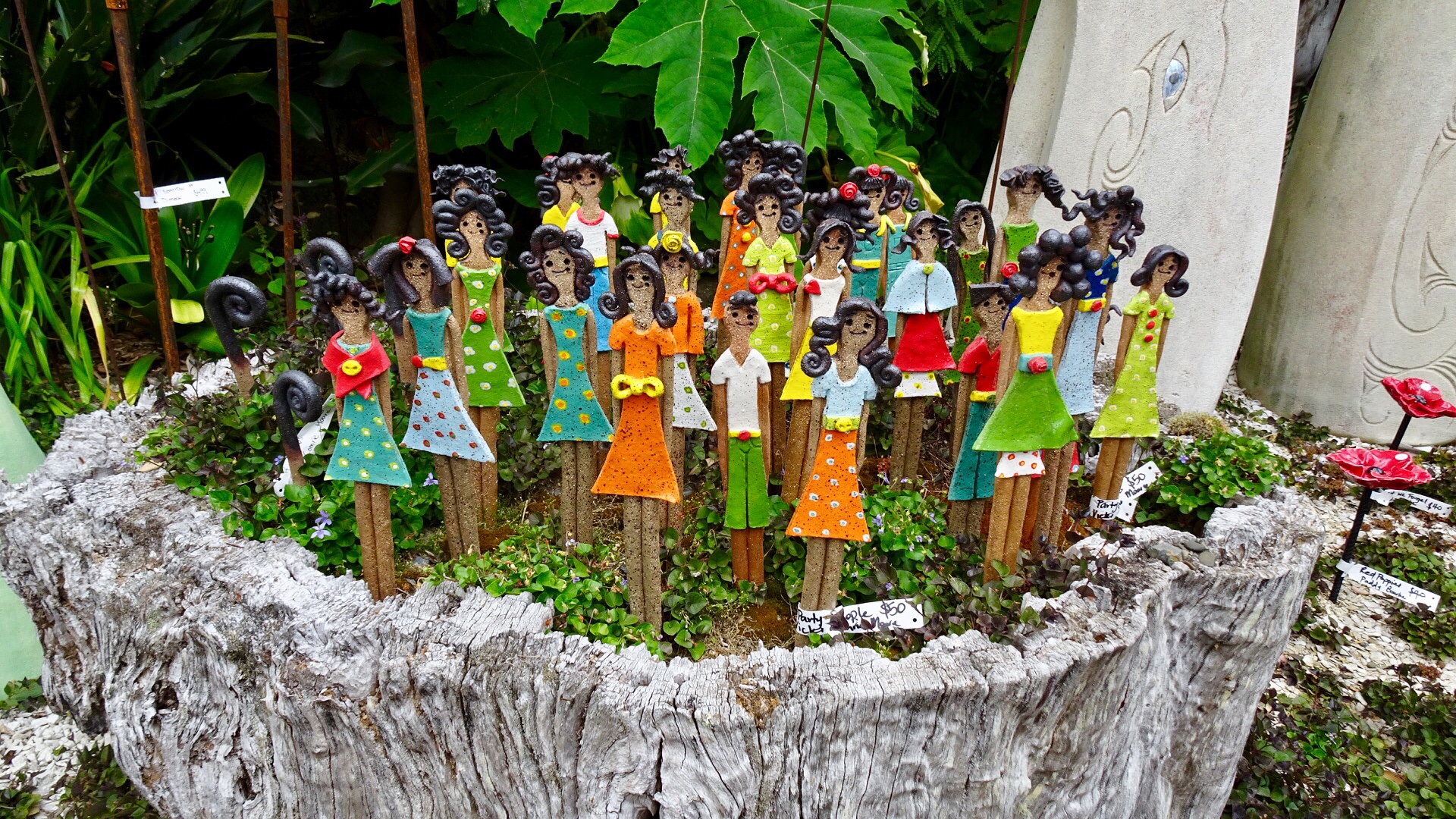
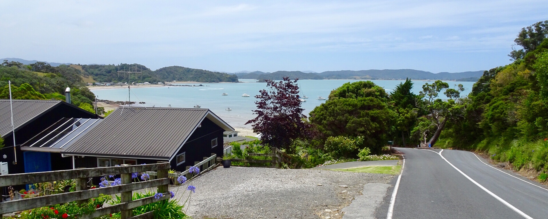
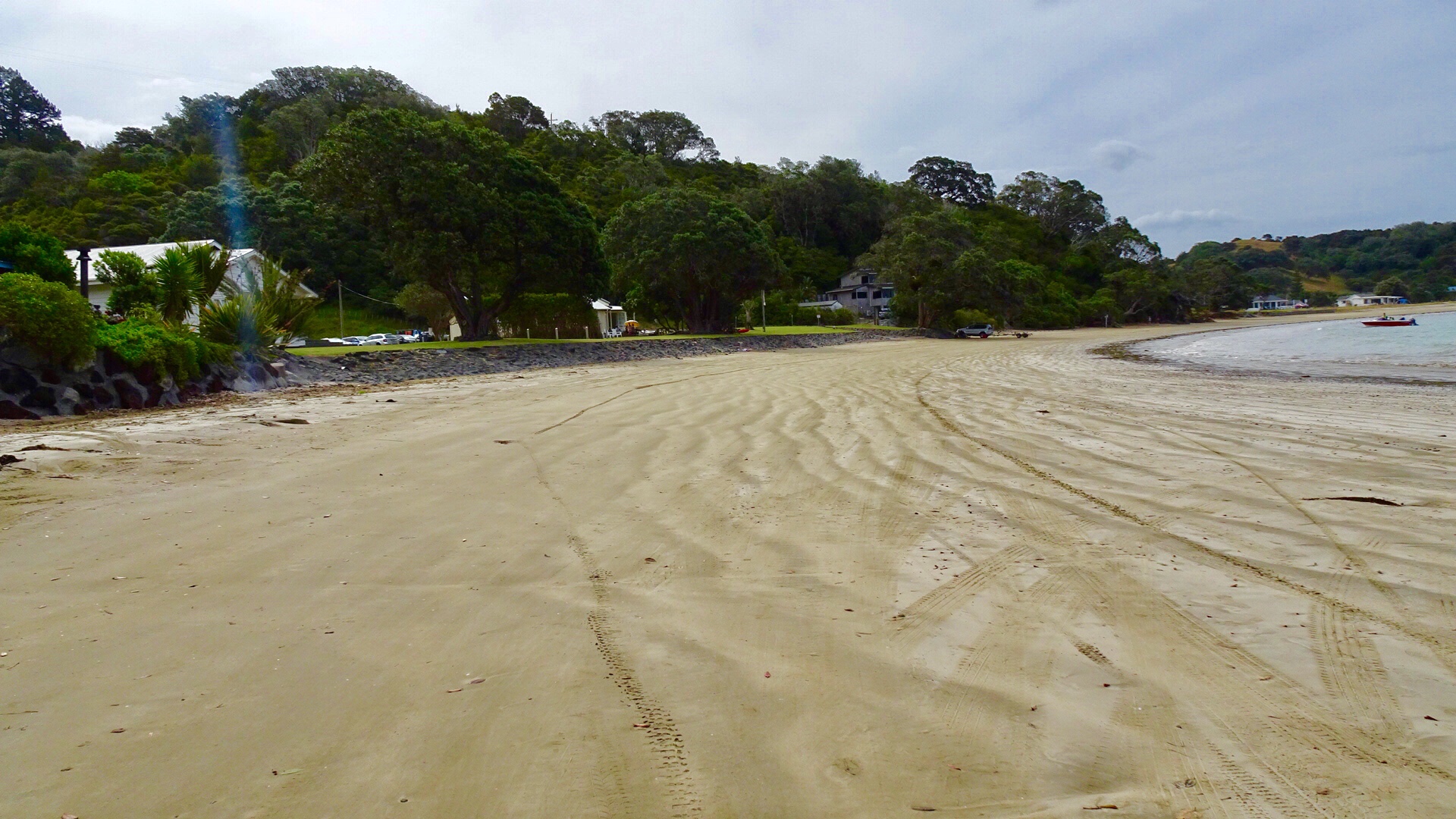
We decided to do a short Christmas ride cruise to Matapouri Bay, some 9 hilly km away. Bonus was the local store was open and we were able to grab a nice coffee. The owner was doing a roaring trade with a constant stream of customers.

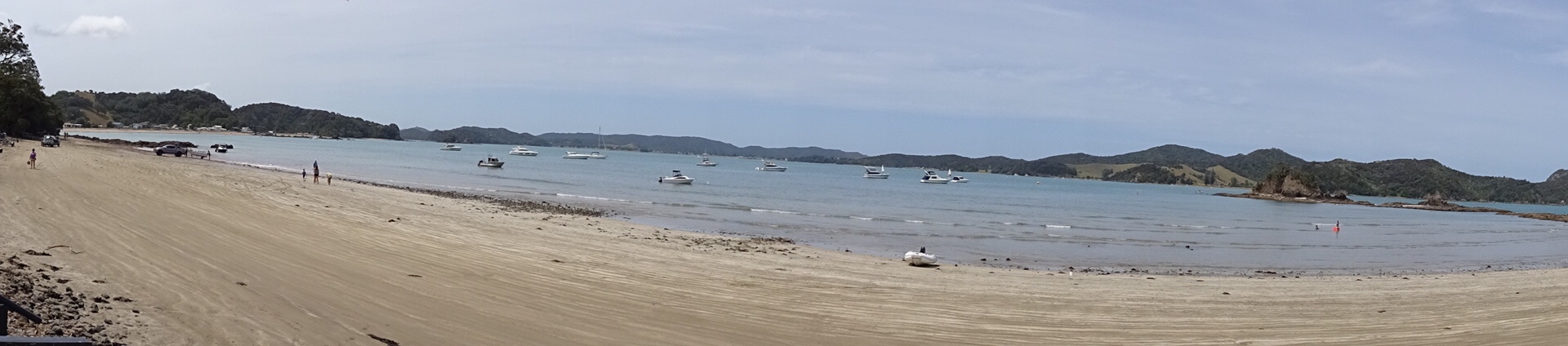
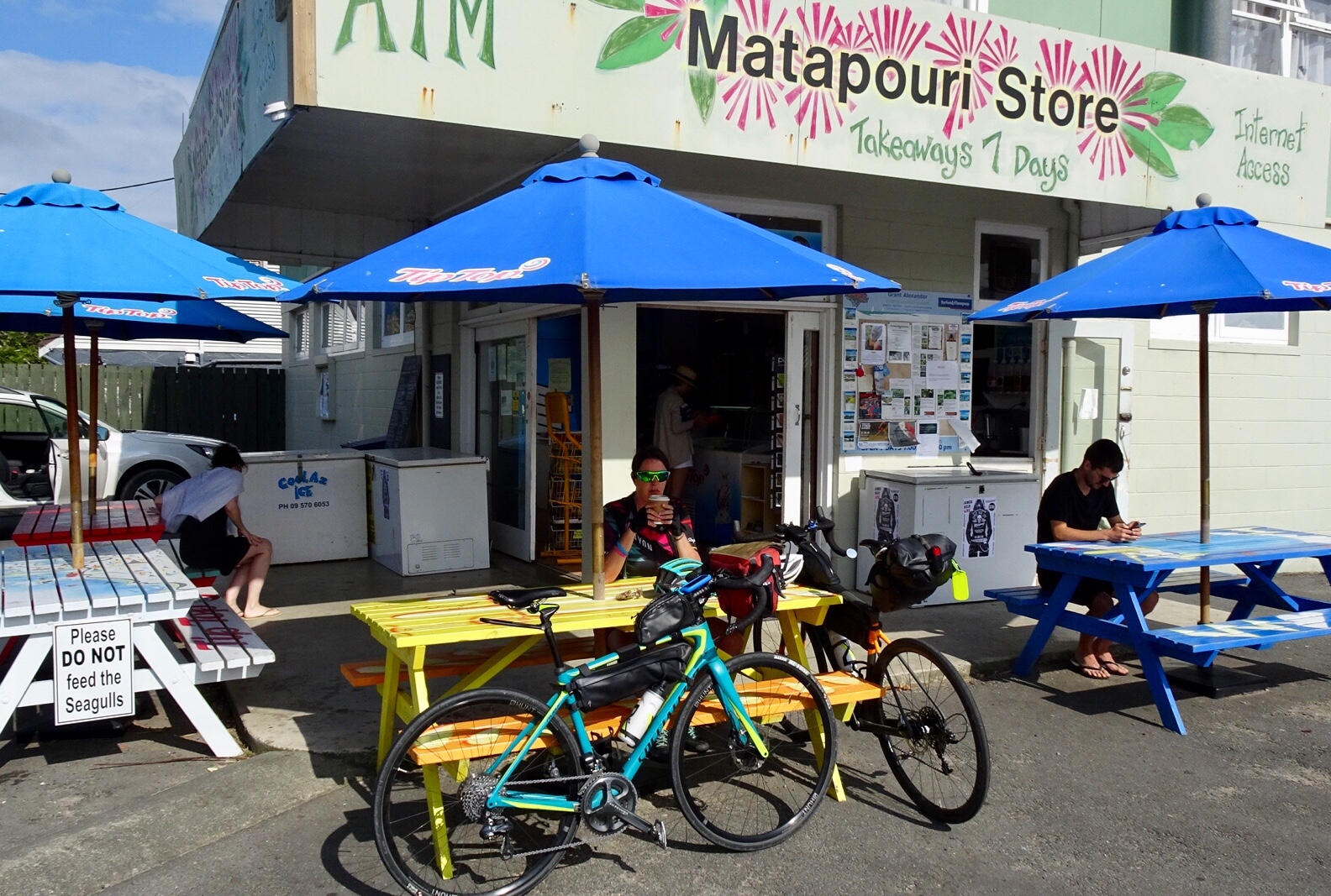
Matapouri Beach is a long crescent shaped beach.
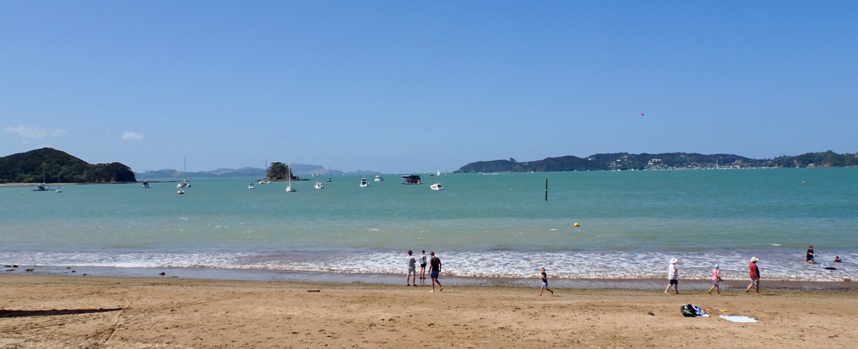
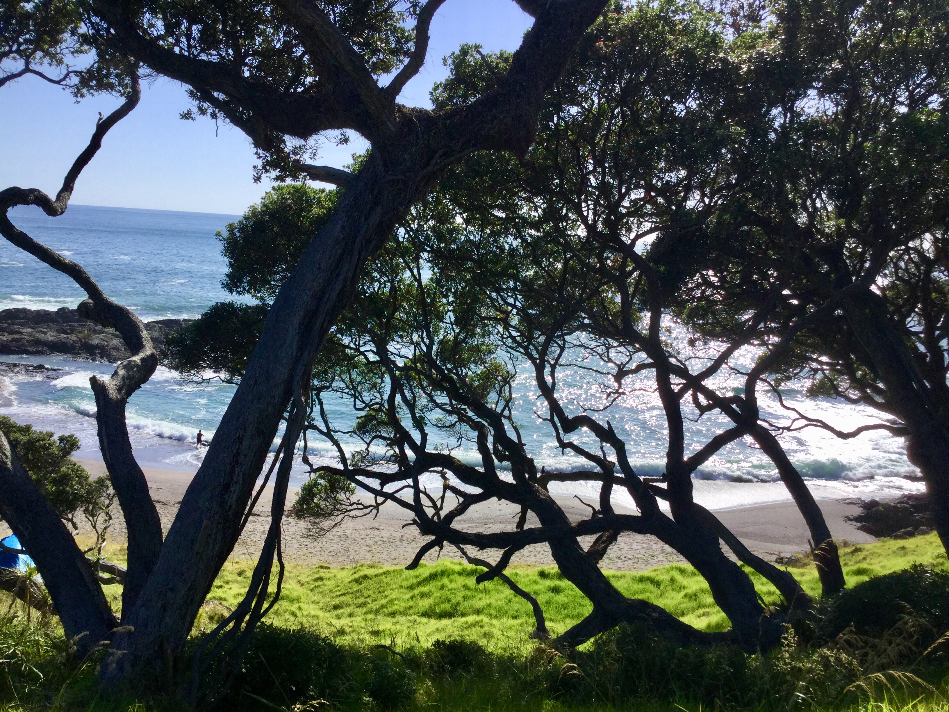
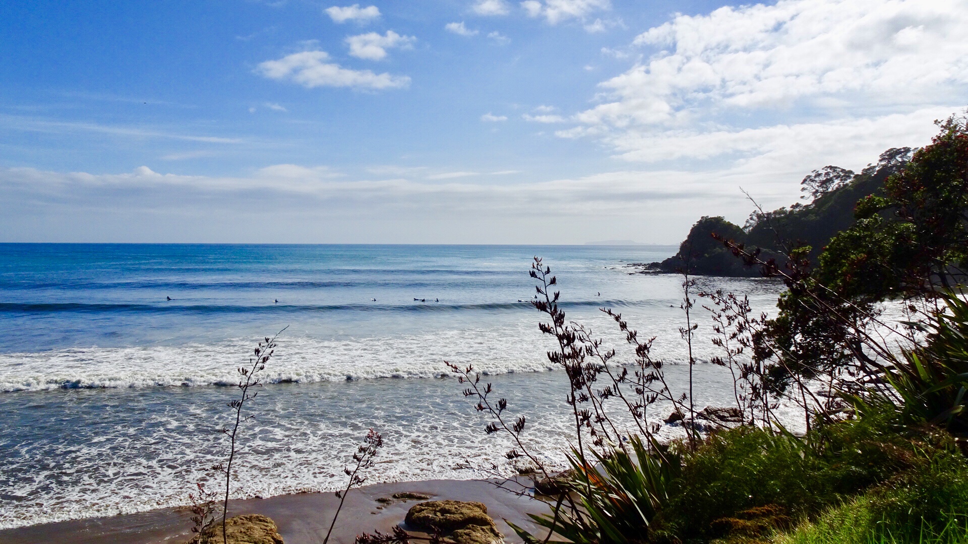
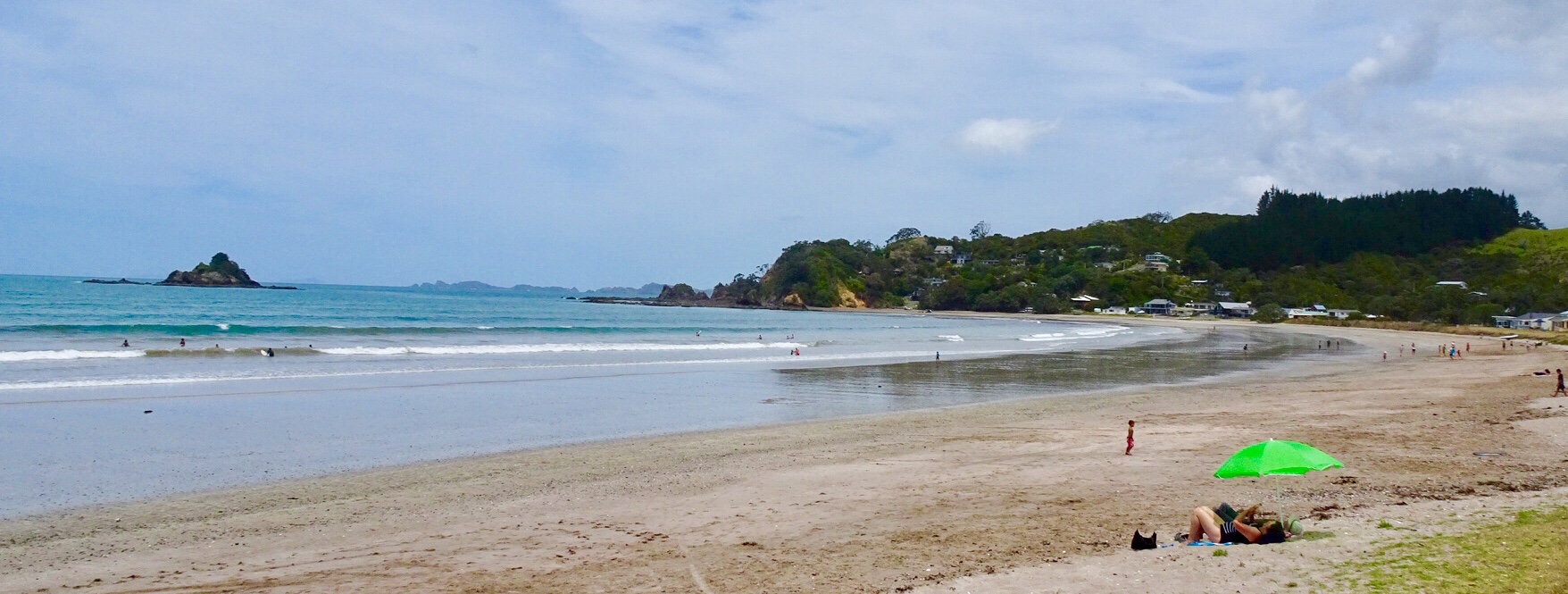
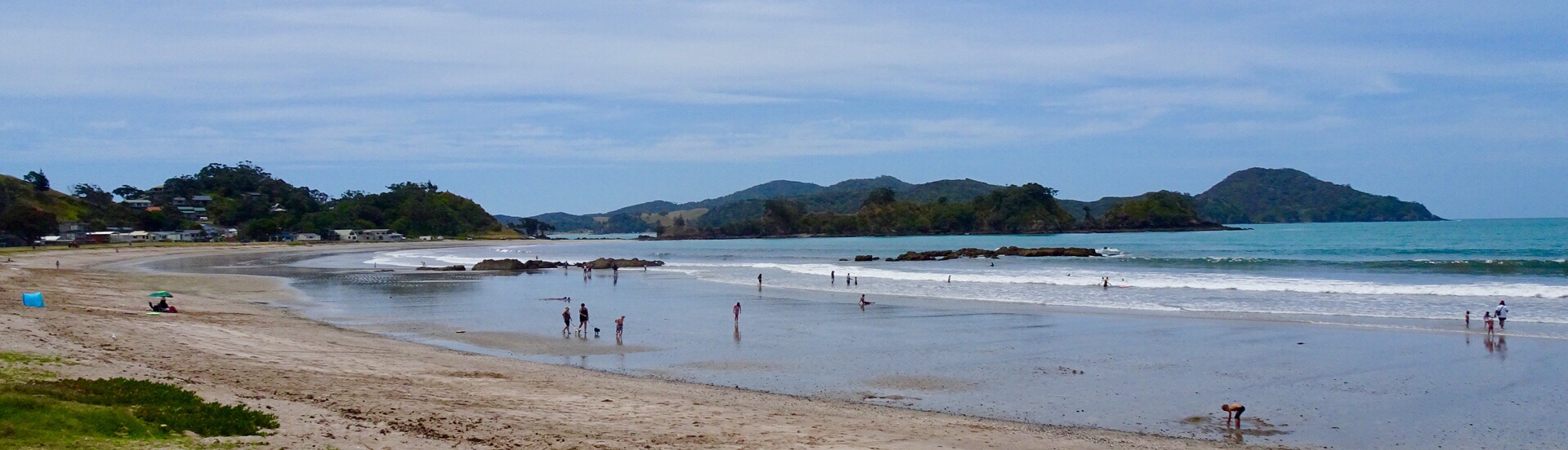
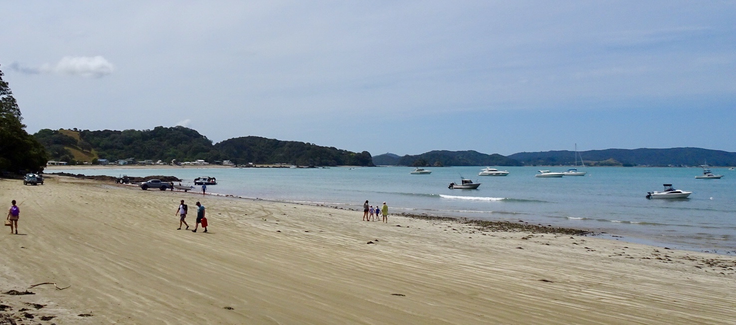
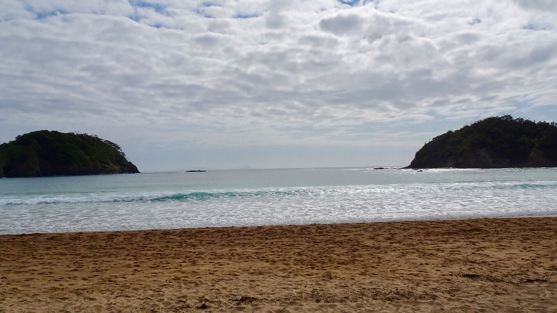
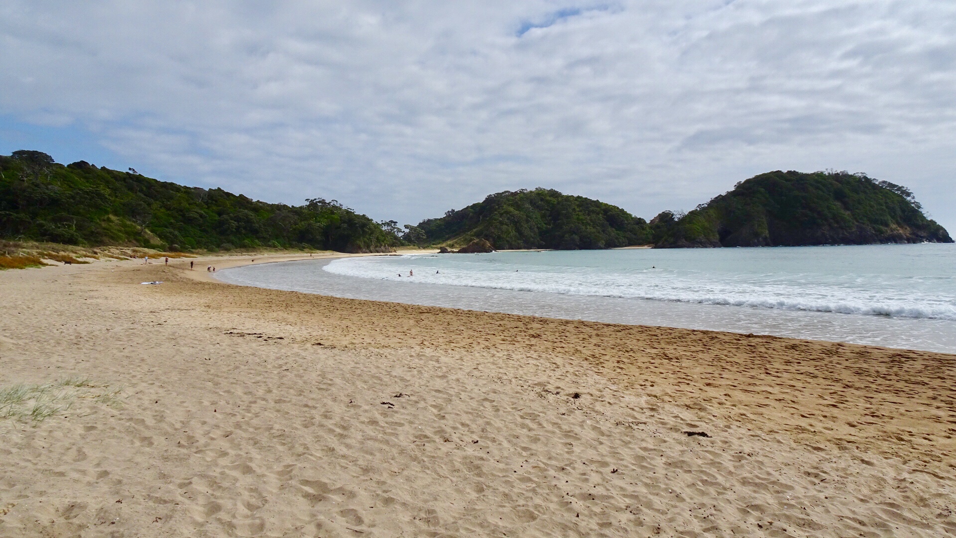
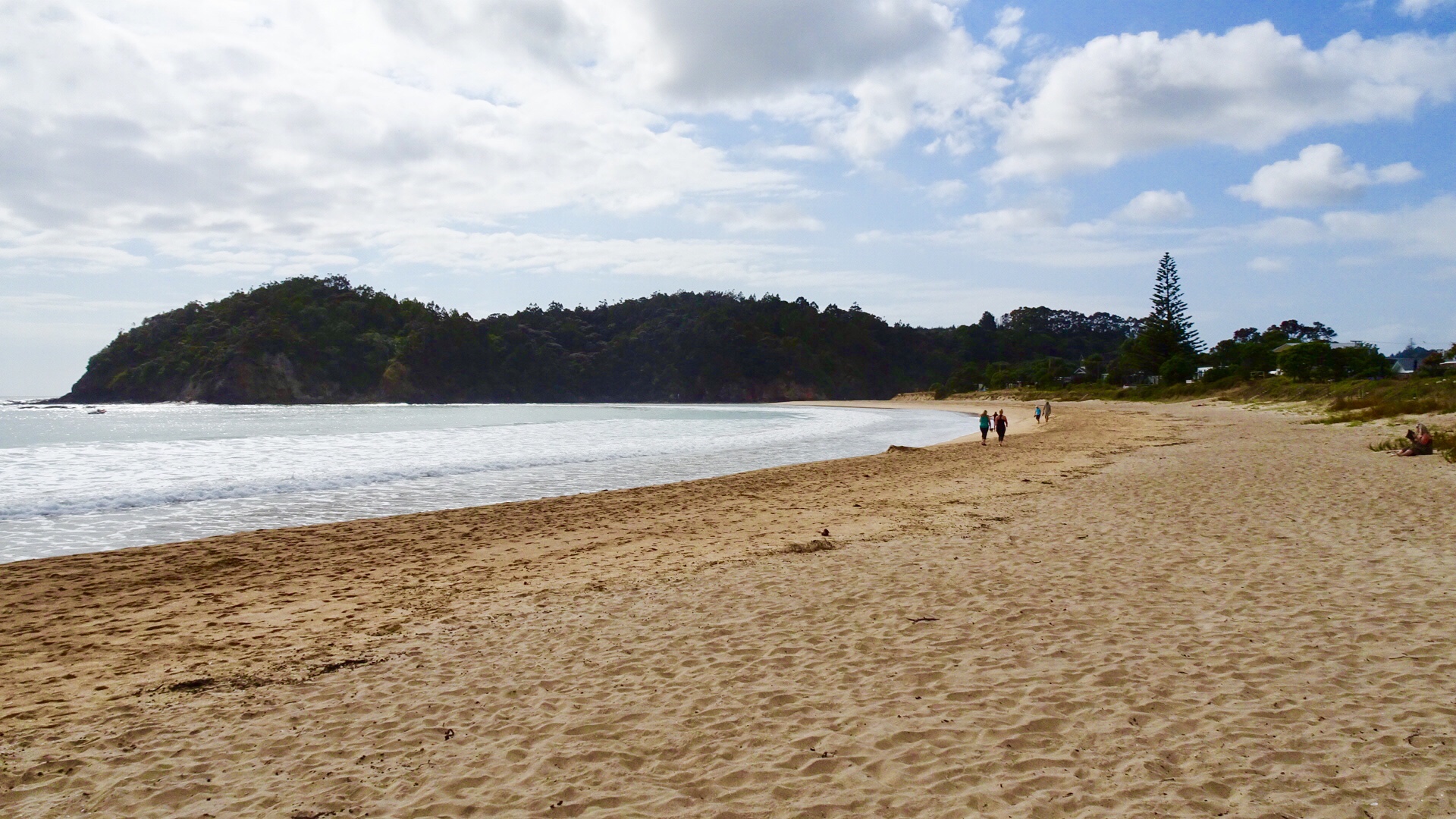
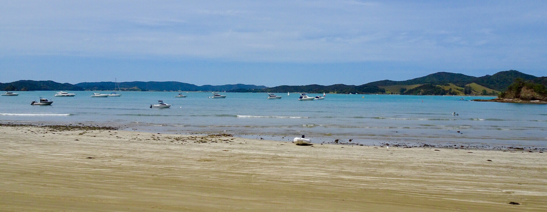
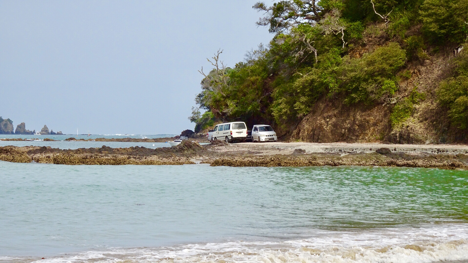
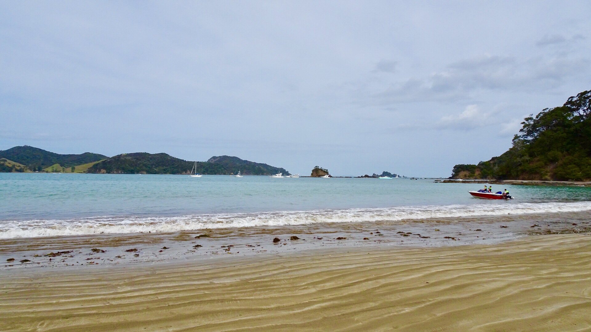
We parked the bikes on the beach and got our bathers our to test the waters.
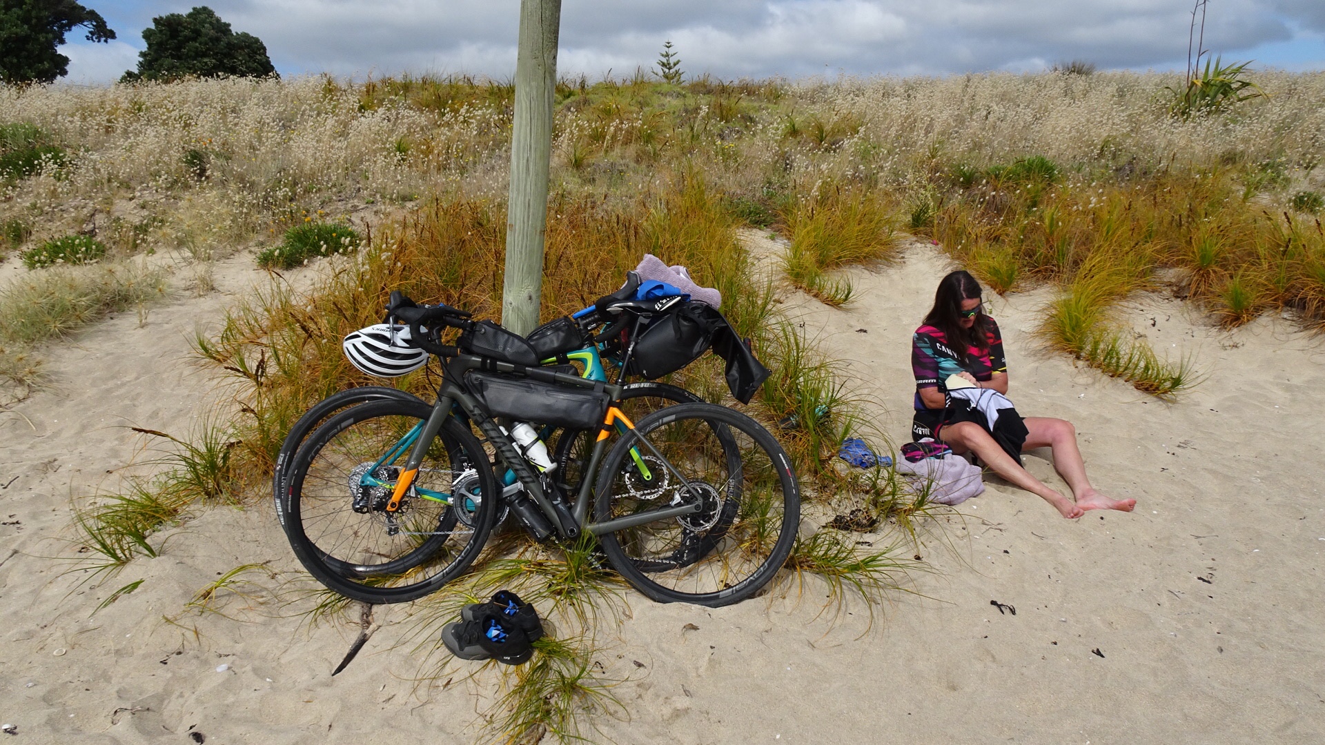
Brrrrrr….not immersing the whole body!
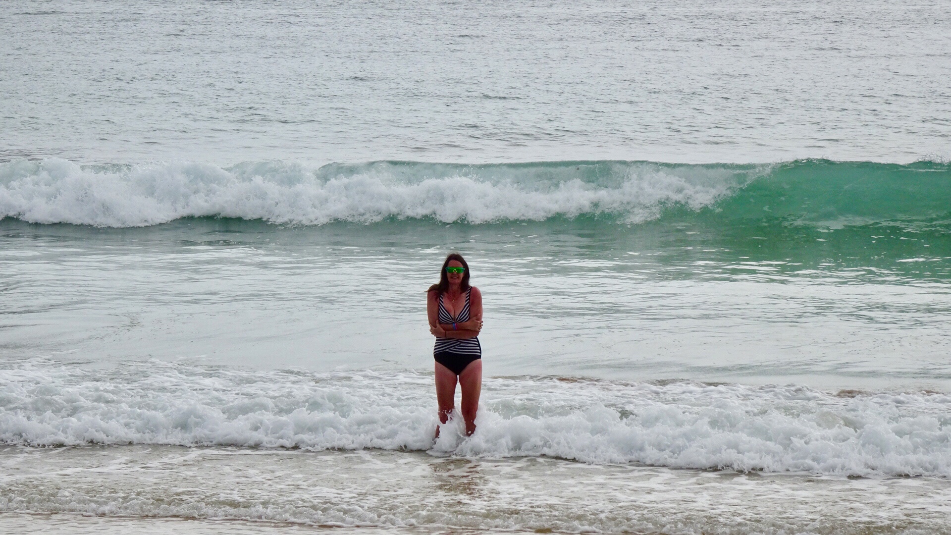
Heading down the beach….

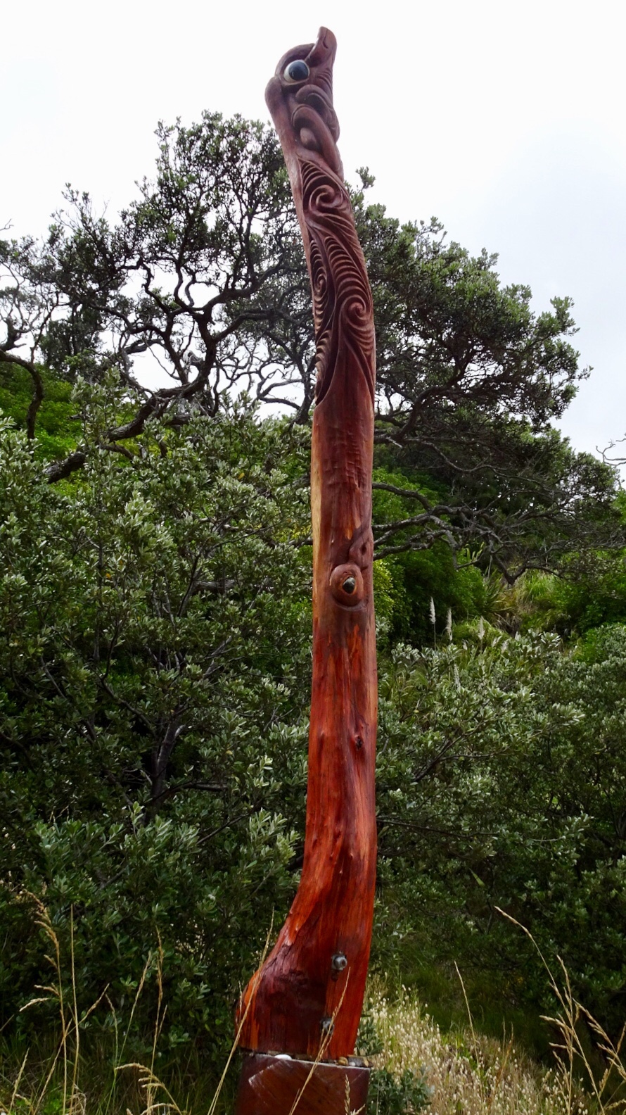
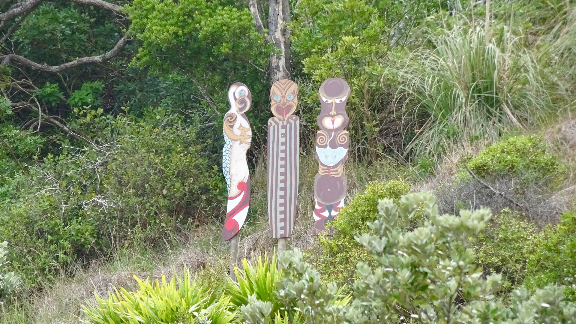
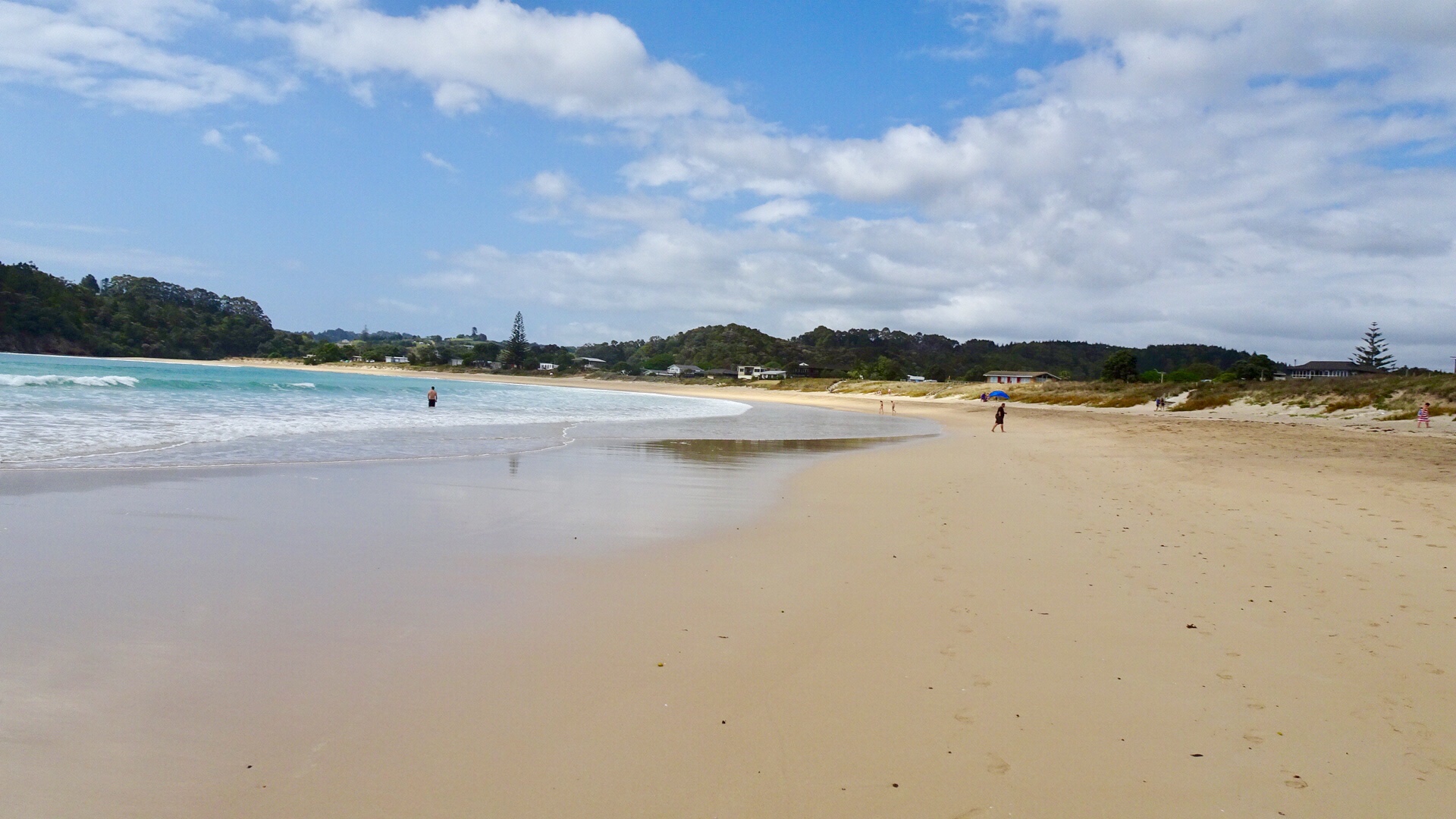
A walkway to another beach reveals these Maori totems.

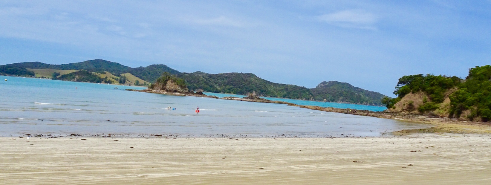
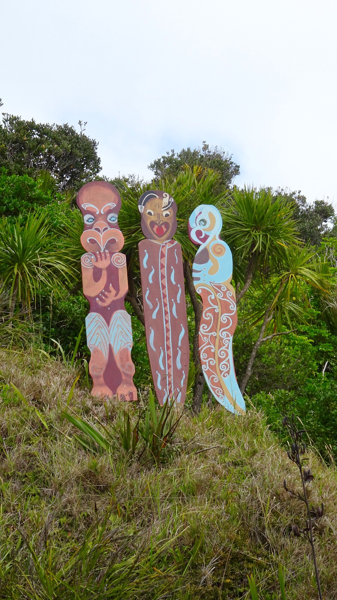
Volcanic beach on the other side.

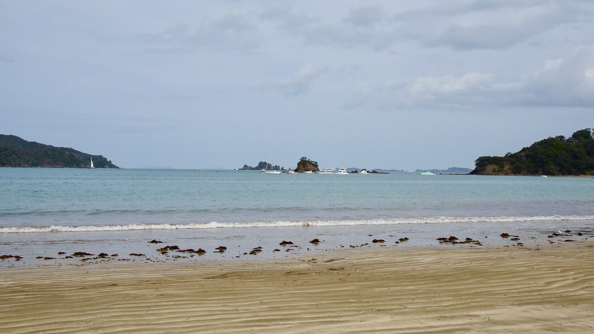
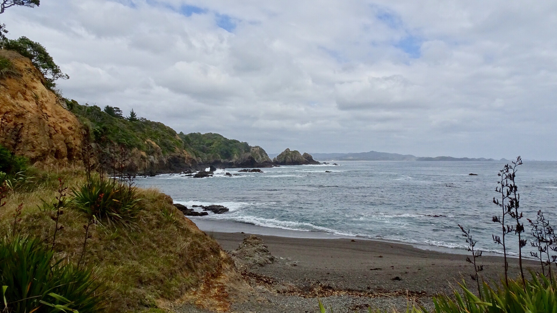
Continuing along Matapouri Bay…wading through water to find a couple of small and private beaches.
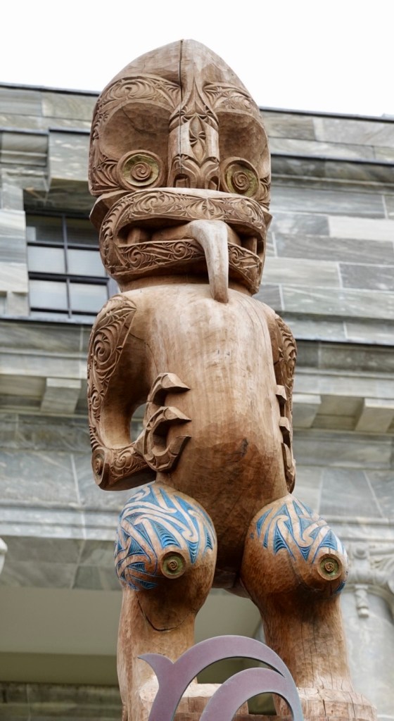
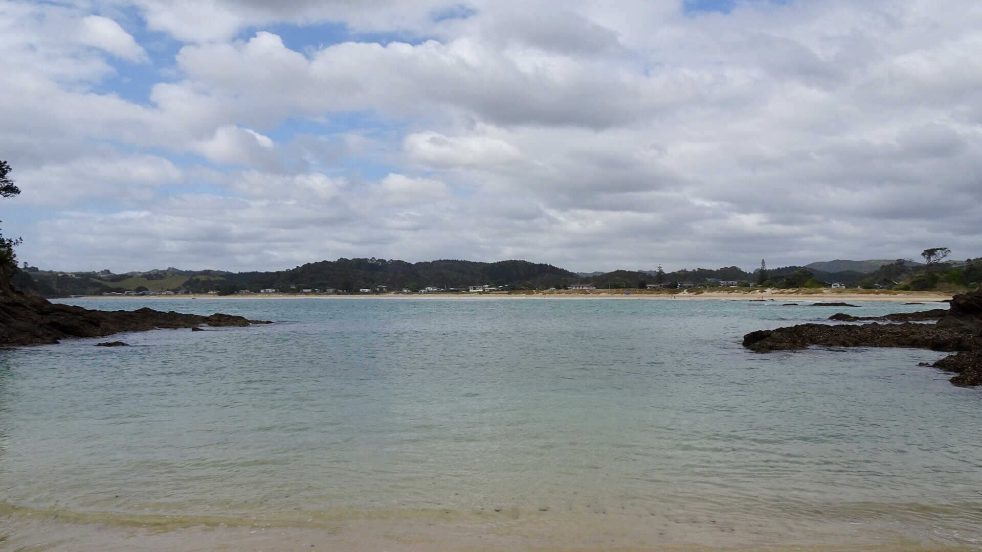
More totems. The area where these totems are has a tapu on it, and is closed for regeneration.

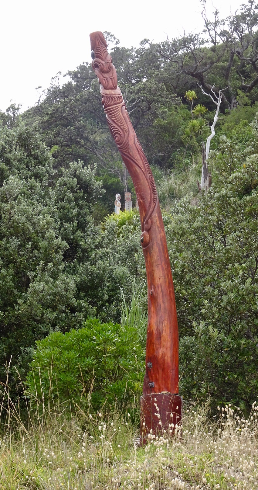
A lazy day, but very pleasant day.

Our Air BNB host Michael invited us to share some food and company with him, which was exceedingly kind.

We are ready to move onto our next destination, keen to get back into touring mode.

Ooroo.