Our last full day in New Zealand before flying home tomorrow.
The weather forecast is for rain and wind. Got to love summer, sounds like a Tasmanian weather forecast.
We are staying at Rydges Wellington Airport. I had prevaricated with making a booking here being right at the airport, but there were advantages given we were arriving around midnight and the bike path to the ferry was around 10 km and flat.
More importantly they agreed to store our bike bags for our return.
When we left to start our ride, we were told to take the back lift that would take us to the carpark. On our return, press the buzzer and they will electronically open the door.
That did not work upon returning. No one answered. So we rang and were told we would have to enter the airport and wheel the bikes through the airport to the hotel.
That alarmed us. Seemed odd to us to wheel loaded bikes through. Nevertheless we did as requested, up two escalators in the process (not easy with the extra weight on the bike).
They did not blink with our bikes going to our room.
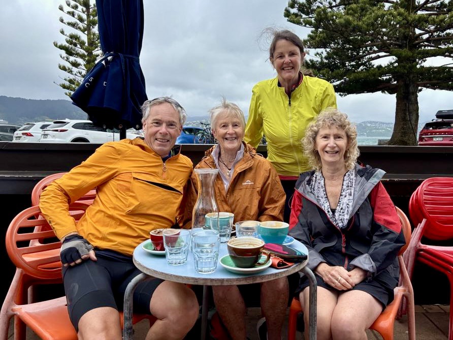
Today we went back down through the hotel and airport to do a short coffee ride into the city to meet up with friends, sisters Dale and Shona, who had been bushwalking and visiting family. Great to catch up and share adventure stories.
Headed back to our hotel via the coastline. The weather was forecast to deteriorate as the day went on.
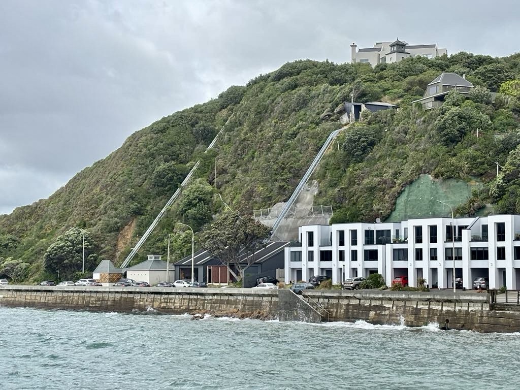
Wellington is hilly and the hill elevators are quite common for transporting people and goods from the road level up to their homes with a view.
Couple of hill elevators ahead. Many have a garage at road level.
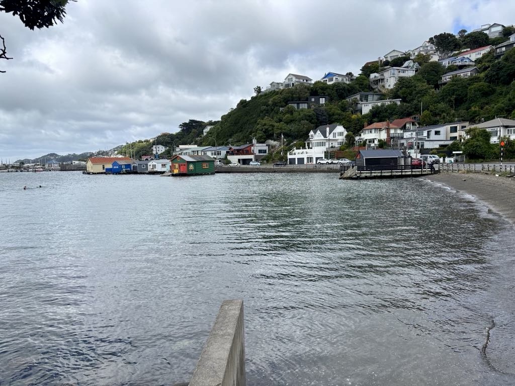
This bay had people swimming the previous day. In fact, there are a few to the left today. This bay was much calmer and sheltered, featuring boat houses.
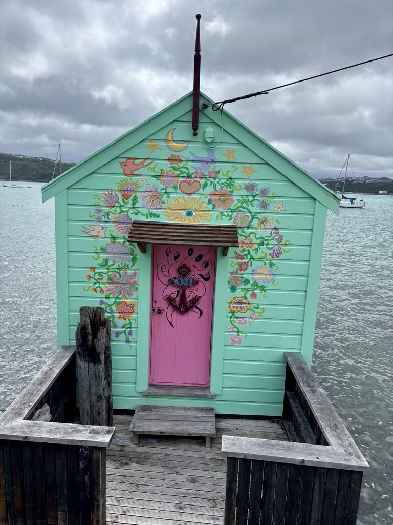
I liked this boat house.
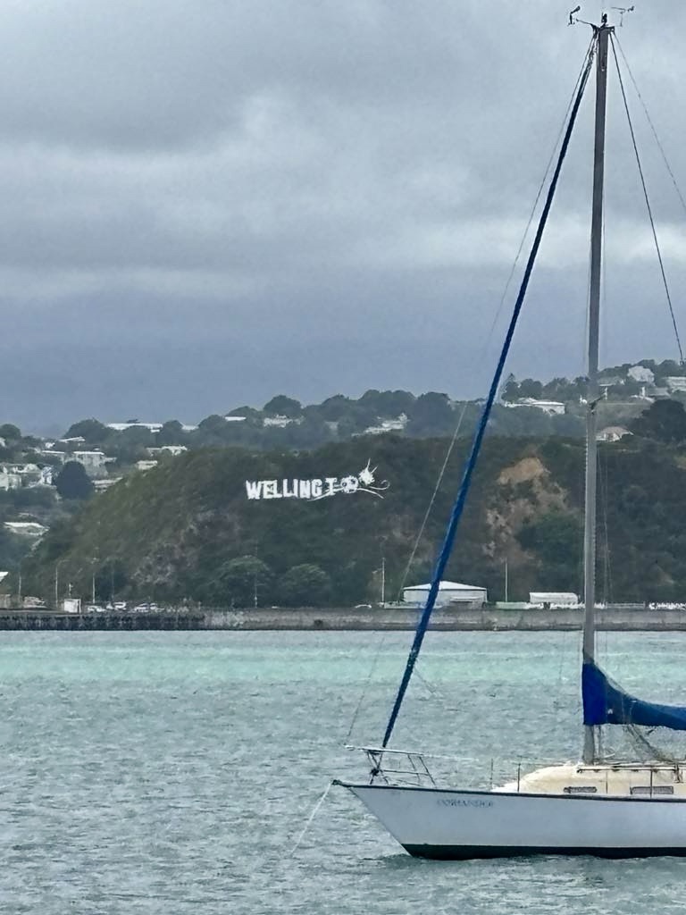
Nearly back at the airport, we swung right at this point, a Hollywood like Wellington sign on the hill.
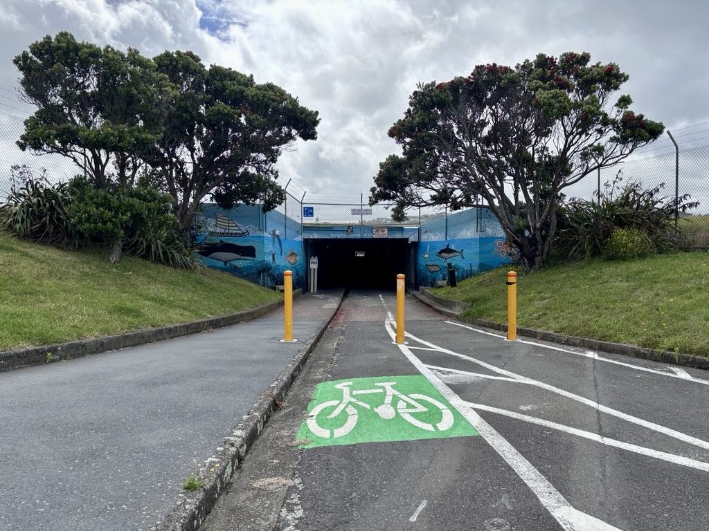
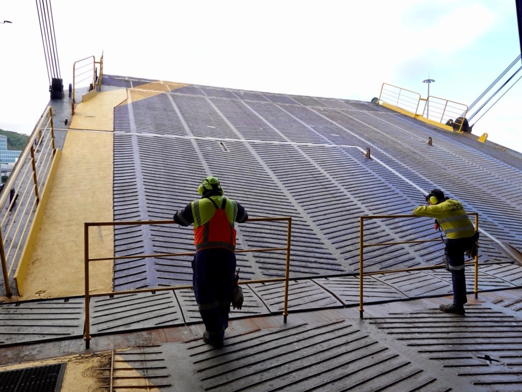
This tunnel goes under the main Wellington airport runway.
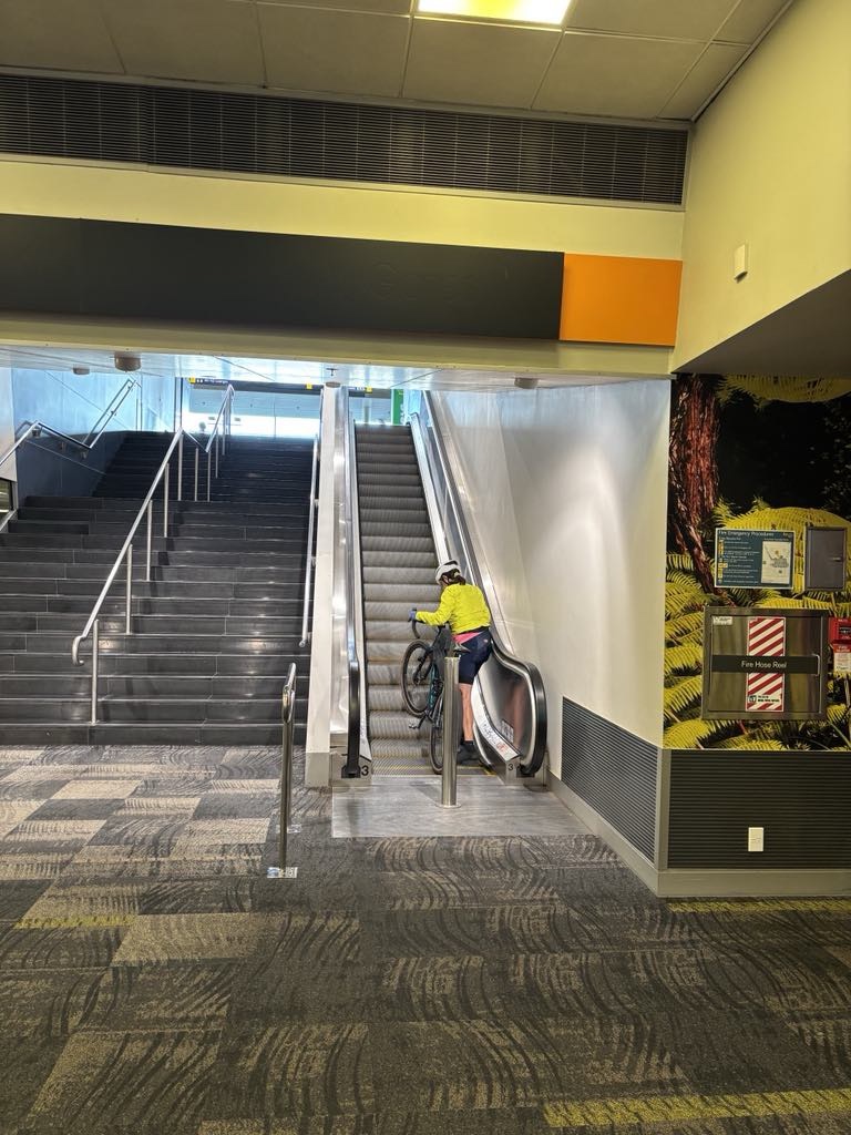
We ride up to the airport main doors, walk in and up this escalator, turn right up a second escalator and we’re in our hotel.
Bikes can fit on escalators. Easier without the luggage to balance.
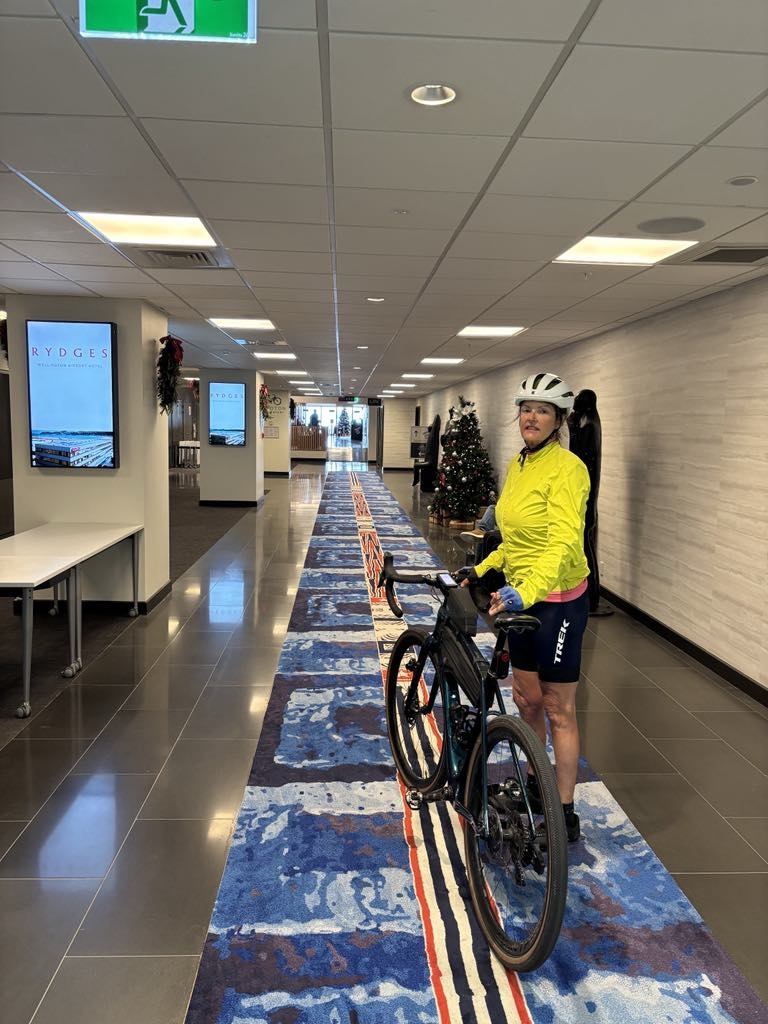
Off the second escalator and onto this long carpet strip to reception, turn right to head to the accomodation room lifts. super convenient.
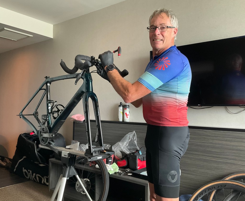
Back in our room and it’s the part Tony hates. He is smiling here….for now 😁
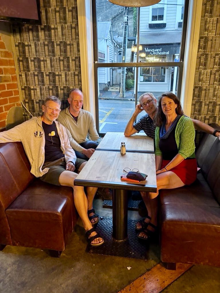
Our Zwift friend Thomas kindly picked us up for dinner, just as a massive storm hit Wellington. Super strong winds and a huge amount of water streaming from the hills into the gutters.
We joined another Zwift cyclist Peter and enjoyed a lovely few hours together talking all things cycling.
I first ‘met’ Thomas and Peter via the Trek team rides I’ve been involved with on Zwift.
The opportunity to meet like minded cyclists is one of the greatest gifts our touring has given us.
Thomas, Peter, Tony and Sharron.
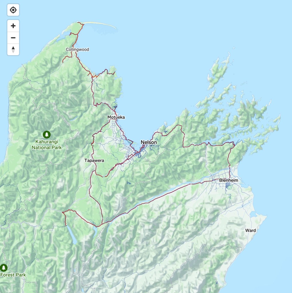
Our map loop has been completed. 12 days riding, 1,010km, 6986 m ascent. No injuries or mechanical issues.
Lots of good memories ❣️🚴
Thanks for reading. There is more to come, as I intend to do some various country highlight blogs leading into our next big adventure commencing in four months time.
Where? Well five countries, 3,000 km cycling and think Baltic and Scandinavia! ❣️❣️
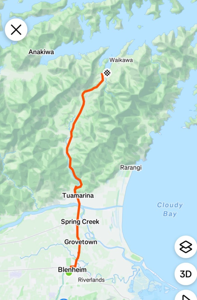
To finish this trip, we needed to ride to Picton to catch the ferry, then once in Wellington, ride to Wellington Airport to the Rydges Hotel.
We had both slept well in our hosts Air BnB, and had a delightful breakfast awaiting us. Anyone needing accomodation in Blenheim, I can highly recommend Ella.
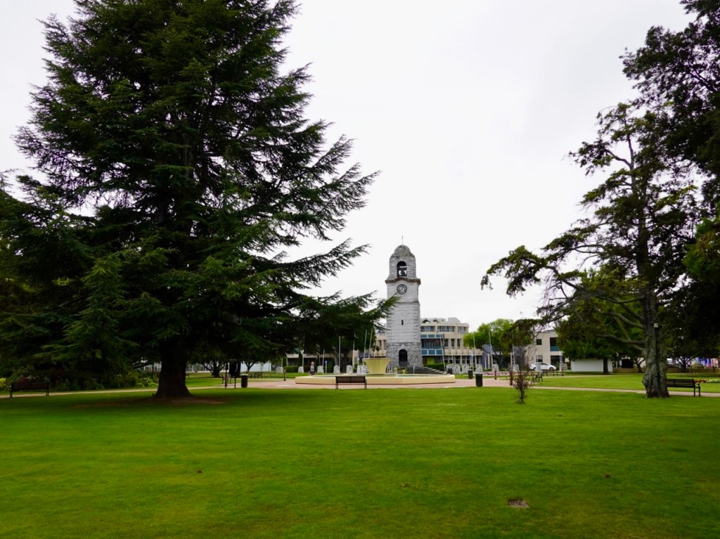
Leaving town we passed by Seymour Square and their town clock.
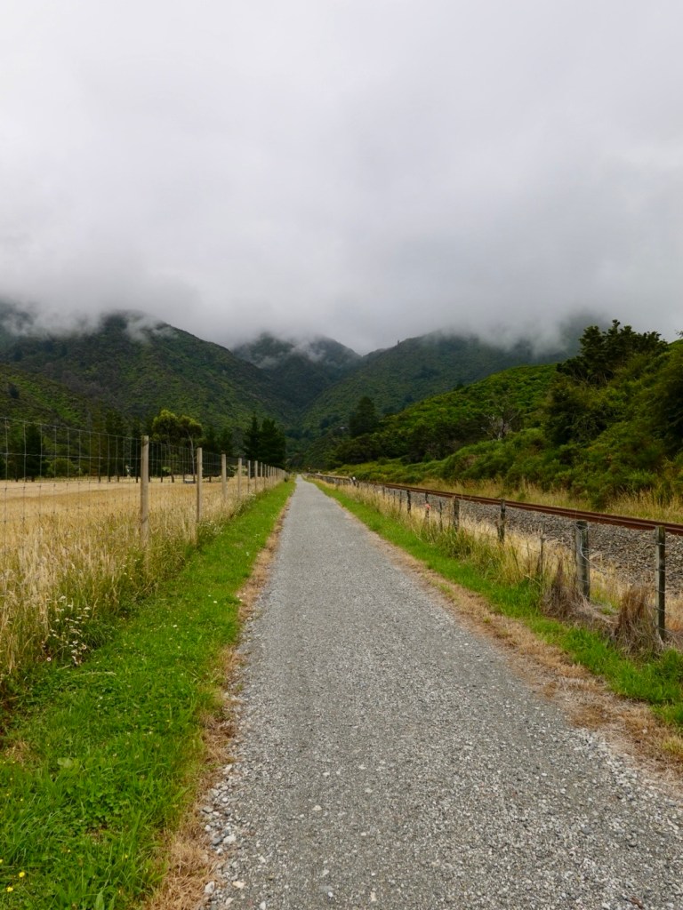
We started off on a mix of highway and gravel shared pathway adjacent to the highway which was quite busy with trucks and cars heading towards Picton and the two main companies that plough across Cook Strait.
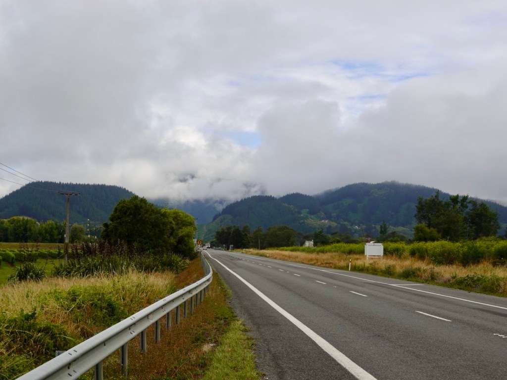
The day was very overcast with low clouds hanging over the hills and ranges thereby limiting views.
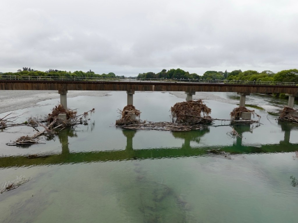
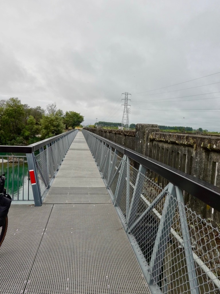
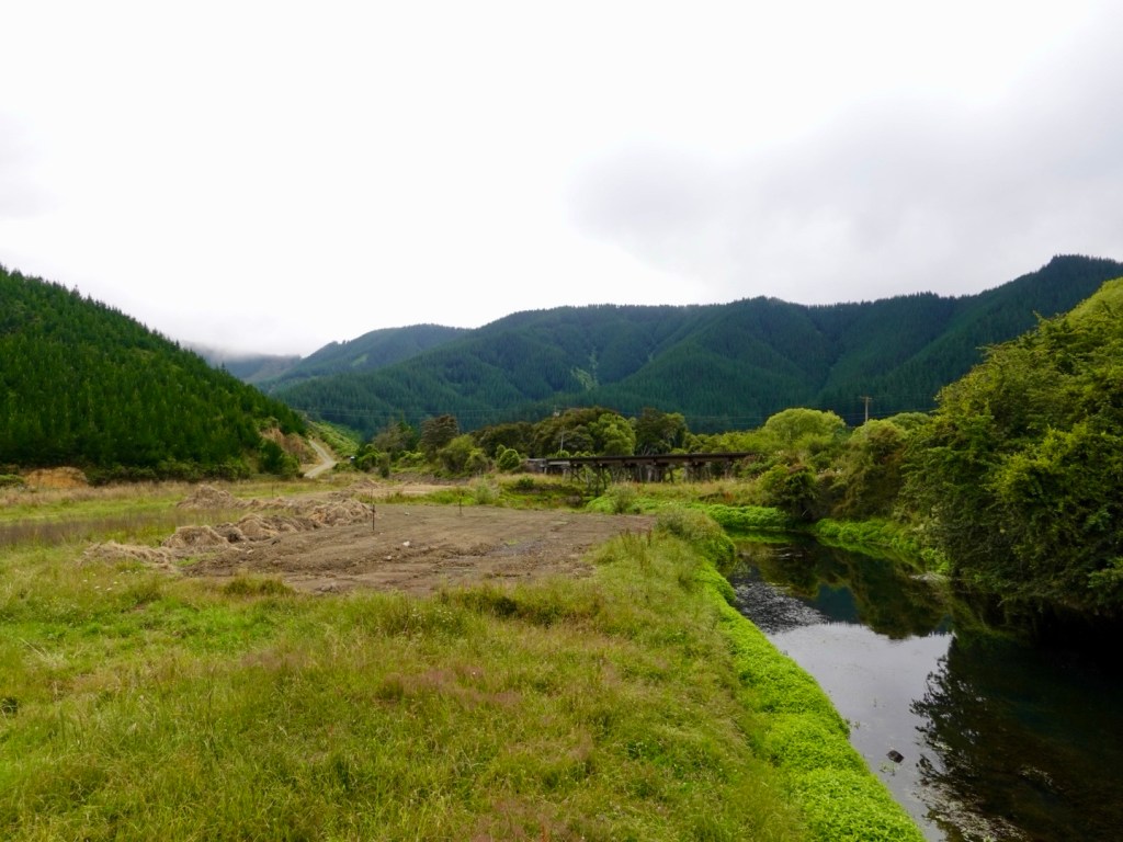
Crossing the Wairau River (followed for much of the previous day), two things of note. Firstly the amount of timber debris caught up on the pylons of the railway bridge. One would presume similar underneath the bridge we were standing on.
Secondly, as part of the shared pathway, a bridge had been attached adjacent without the use if online but using the main bridge structure for support. It’s a great, safe crossing and well done to the regional council.
Looking back towards Blenheim
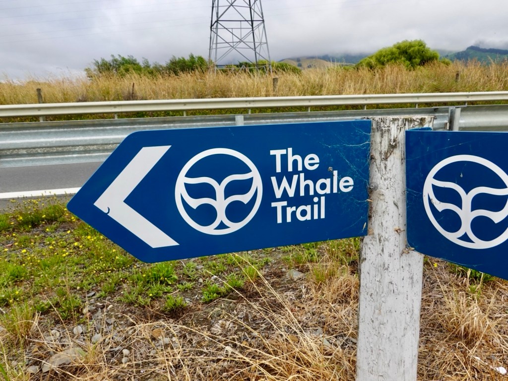
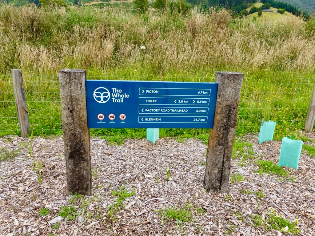
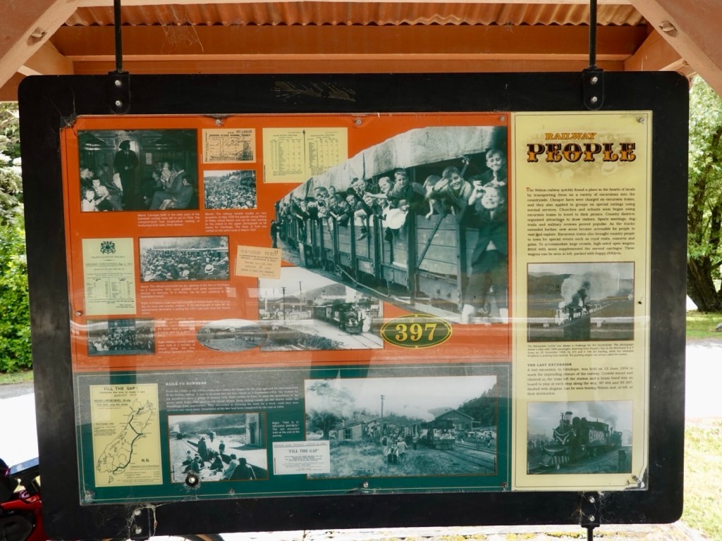
We noted signs for The Whale Trail and decided to follow it, given the calibre of signage.
Later research revealed that the Whale Trail inception was at 12.02 am on 14 November, 2016 when the magnitude 7.8 Kaikoura earthquake struck the region.
Sections of the state Highway and rail corridor were obliterated isolating communities.
The trail, upon completion, will be a 210 km cycling and walking trail from Picton to Kaikoura.
At one junction was this poignant reminder. The loss of a young persons life, and suffering friends and family. Unopened bottles and cans of beer, fruit juice, photos all serving those who loved him as a sad reminder of the tragic loss of a young life.
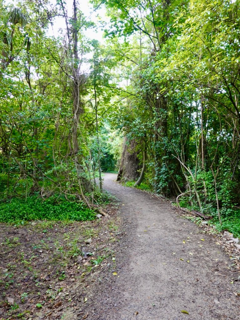
This section of pathway weaved through dense vegetation.
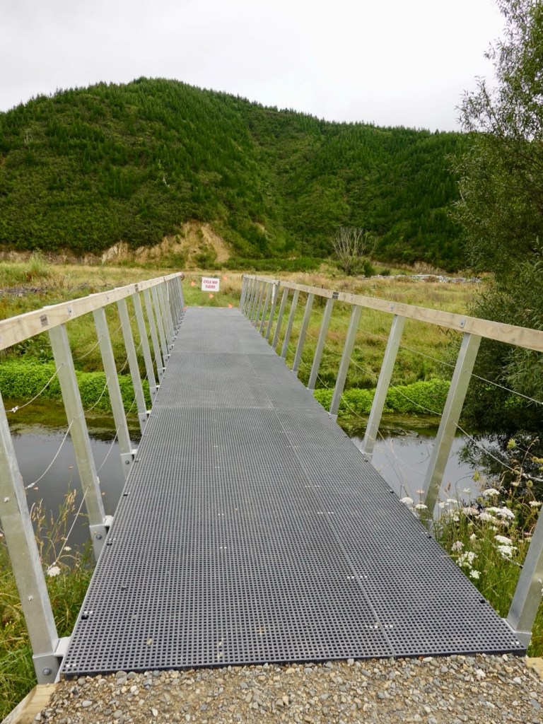
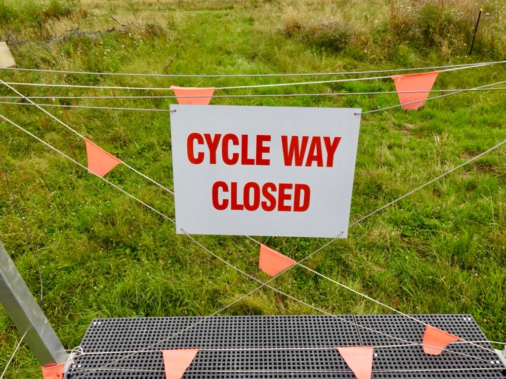
The signage continued with no warning of this…
There is a significant drop from this bridge. The track just ended. There is a 2-3 metre drop off the end.The track has not continued as far as we could see forward.
Whilst it’s a great track, there should have been a reroute sign nearby 2 km cycling back tracking cyclists back onto the highway.
We rode part way back until we found a spot we could push the bikes back up a hill to the highway.
On we continued. Still low clouds but pleasant views.
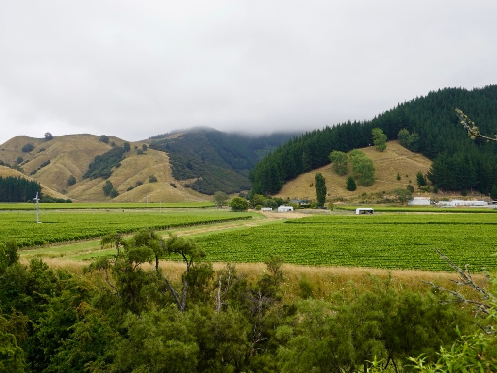
Still the vineyards continue
Then just as the track had suddenly stopped, we noted its reappearance, again with no signs to take you from the highway.
We hopped across just after Picton Airport as there had been a fenced railway in between.
An example of the signage, however you cannot ride to Blenheim as it suggests. Once completed it will be a fantastic and safer route for cyclists.
Back on the trail, this section gradually climbed around a hill, and was quite soft to ride on. It will compact more with time.
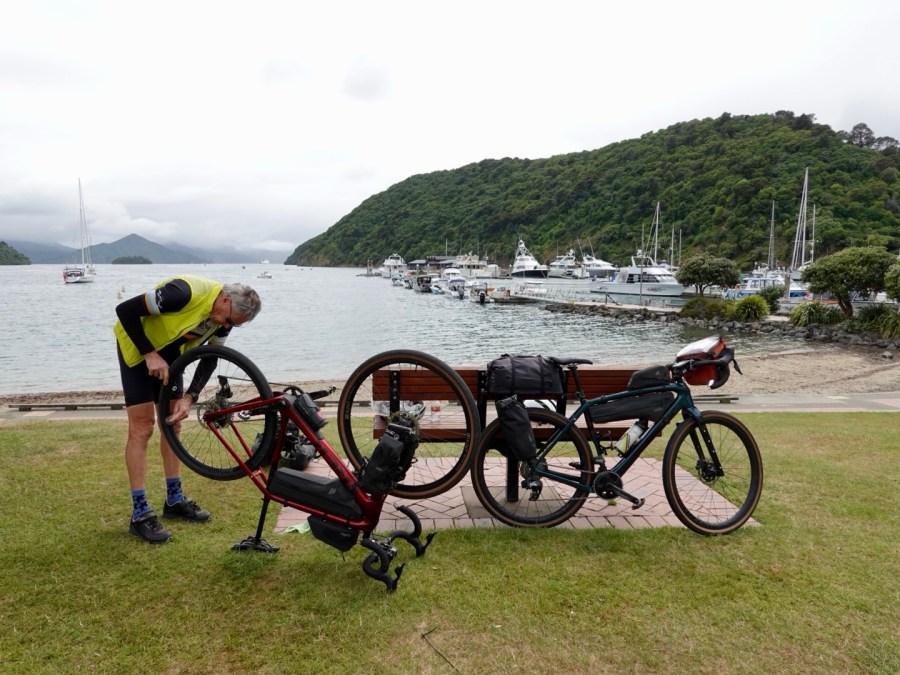
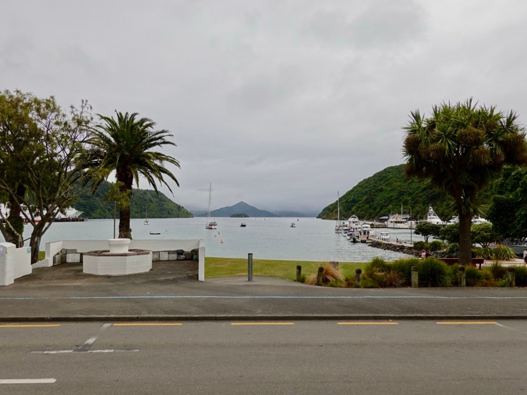
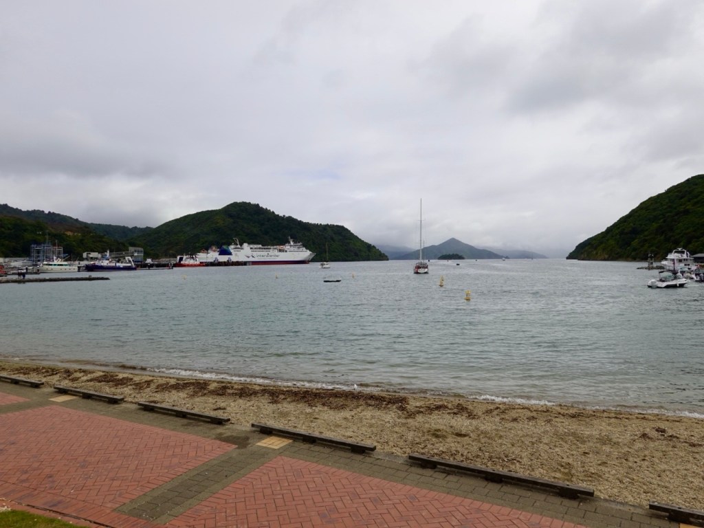
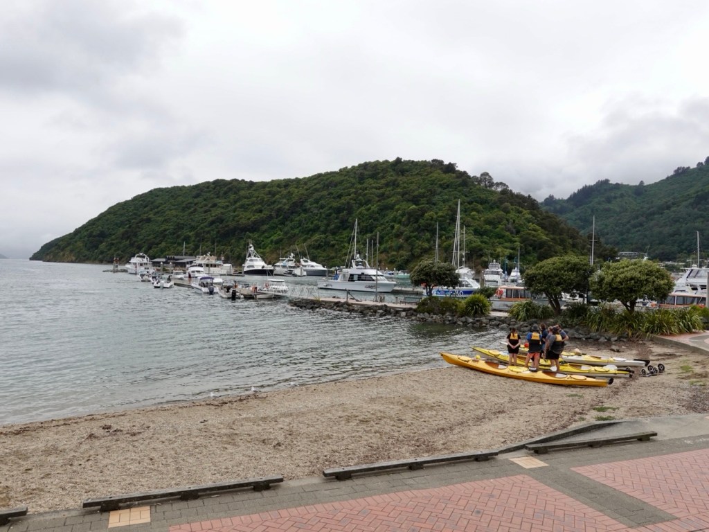
Arriving in Picton we decided against the additional 15 km planned along an adjacent hill to a lookout. The clouds were still low, rain threatened.
We found a cafe and had a coffee, then moving across the road to the picturesque park to start cleaning our bikes, as we had a few hours to kill.
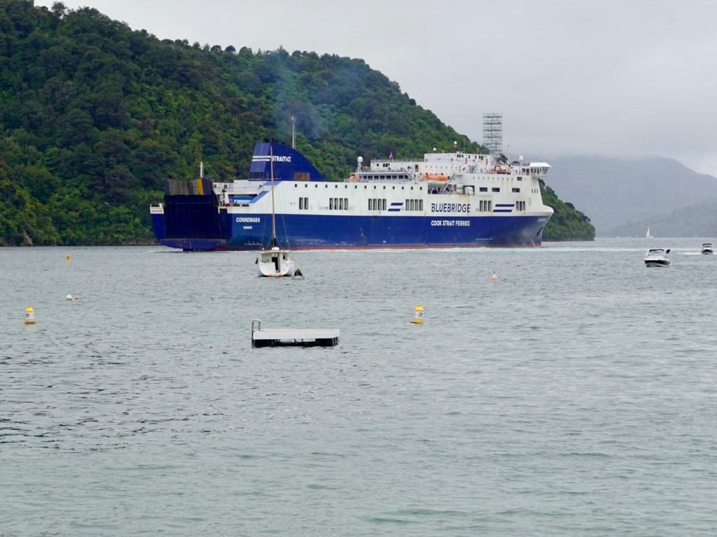
Cafe viewIn the park, a ferry us just departing Kayakers ready to head outBike cleaning in progress.That is our ferry arriving
We have been on many ferries now with our bikes. Procedures are different everywhere. Sometimes we line up with the cars, others have a lane for motorbikes and cyclists.
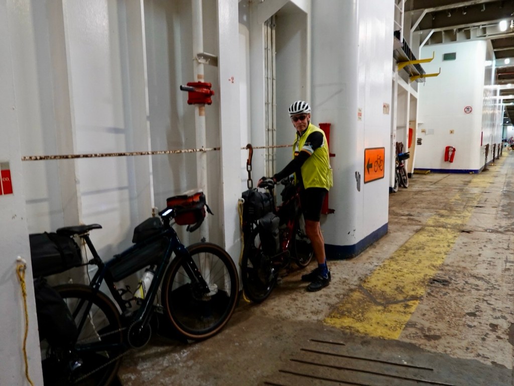
Once our bikes were strapped to trailers and we went aboard as a foot passenger.
Here, we were to wait until the luggage truck headed to the ferry after all passengers transferred in shuttle buses. It was a bit eerie being the last passengers so far away from the ferry wondering where that luggage truck was.
Just as I was chatting with a Maori, donning a very heavy backpack, wearing gumboots, with a sign saying Wellington (he was hoping to hitch a lift with a car going on the ferry obviously not realising that he needed a ticket) the truck appeared and waved at us to follow.
Before I could get a photo, off we sprinted to catch up with the truck and follow it across the dock. Onto the very back of the ferry we tied our bikes up and headed to our cabin.
There we remained as we both felt seedy with the ferry rocking and rolling a bit more.
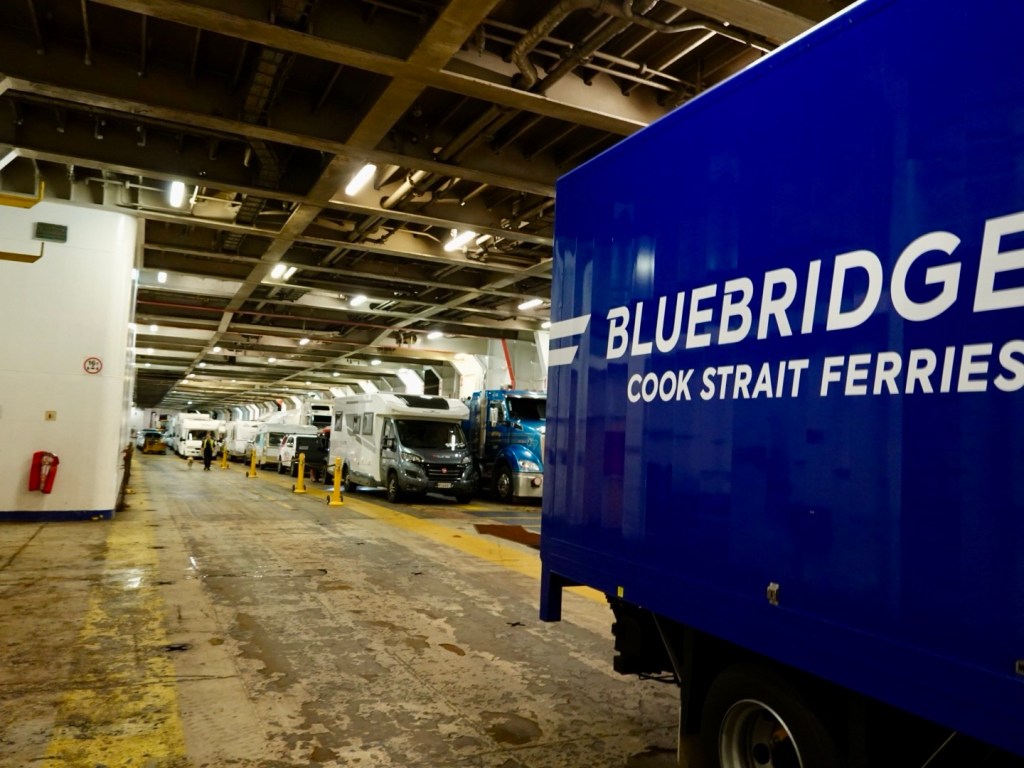
Last on, first off.
There are multiple vehicle levels. We are on the lowest deck, which is last to load, first off.
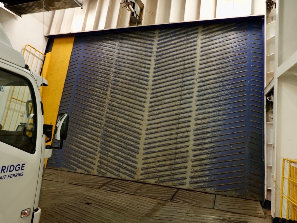
The door is still locked.
We were warned that the noise would be super loud as the hydraulics kicked in. They did not underestimate this!
The guys are waiting with their barriers. We are not that silly….
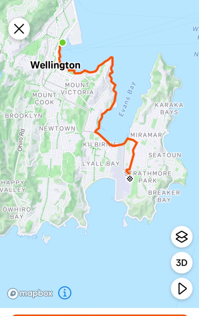
Anyhow it was a mere 10 km or so back to our accomodation following the coastline.
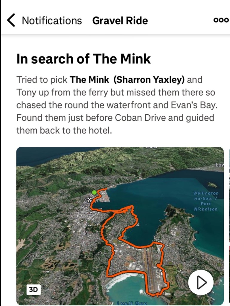
At one spot we debated which way to go and a cyclist passing by says ‘ Hi, I’m Thomas’.
Wow! Thomas is a Wellington based cyclist I know from Zwift ( but not previously met in person) who came out to find us! He found us and led us to our finishing line.
We were both very humbled by his kind gesture and will be having dinner with him and another Zwifter tomorrow night.
Thomas caption from his ride to find us.
So here we are. Wellington. One day remains and it will be social and practical. Thankyou for reading today’s blog. 😊❣️
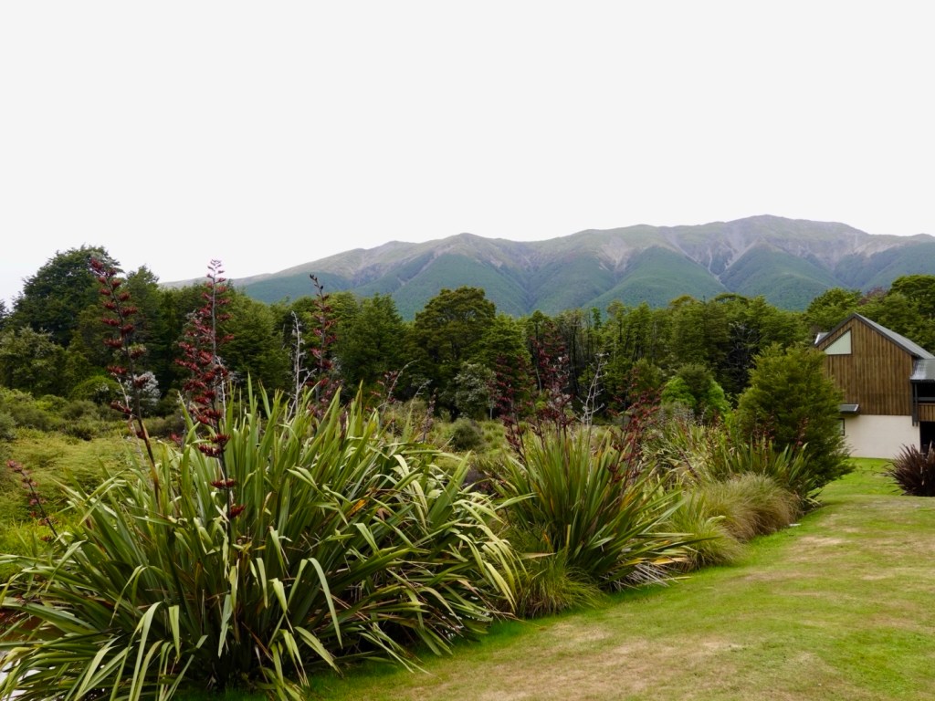
Packed up and ready to roll, we enjoyed a wholesome breakfast (large bowl porridge, granola, fresh fruits including strawberries, raspberries and blueberries) and the ubiquitous ‘Sharron cannot ride without’ coffee.
Great view from our table. We watched the melodious honey eaters searching for nectar in the flax flowers.
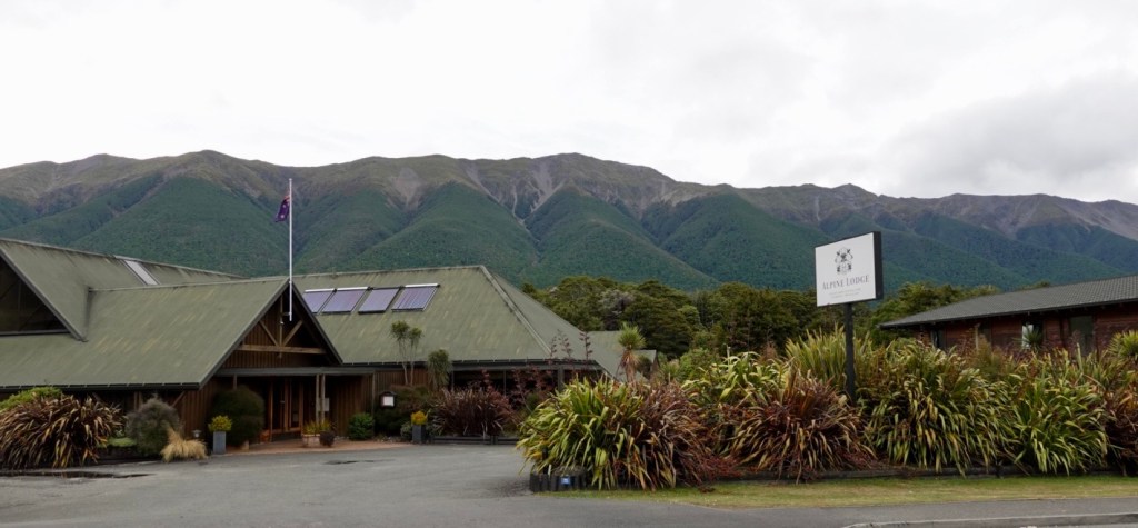
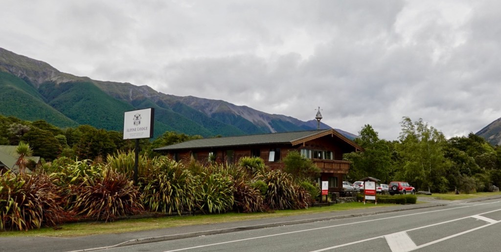
The front of our accomodation after forking out $1,025 NZ for two nights, two dinners, two breakfasts….gulp. I don’t feel quite so guilty for breaking the glass in the unit that shattered into so many pieces as we were leaving.
The accomodation itself is a common motel presentation but it is the location at this time of year that has driven the nightly price up. The meals were excellent too, with the porridge with add ons (fresh fruit and granola) being $32 each.
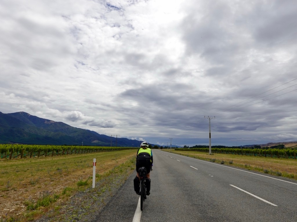
On paper today our ride into Blenheim would be an easier ride, despite its 103 km length.
There was a gently 5 km uphill section before a very gradual downhill run, which would have a few undulations.
The first half was wind free. We thought we were on easy street and then bang, just like that, there it was, as ubiquitous as my morning coffee. I like my coffee strong, and so it seems, wind too 🤣🙈. Happy New Year Sharron and Tony, love from the Weather Gods 🤣
View from the top of our climb.
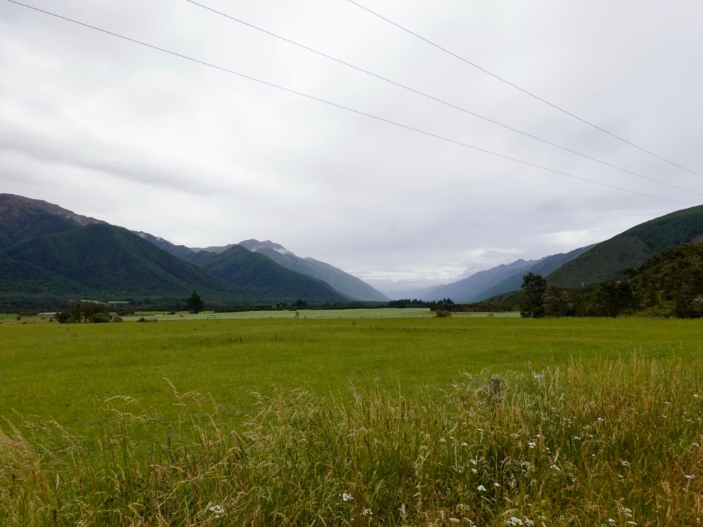
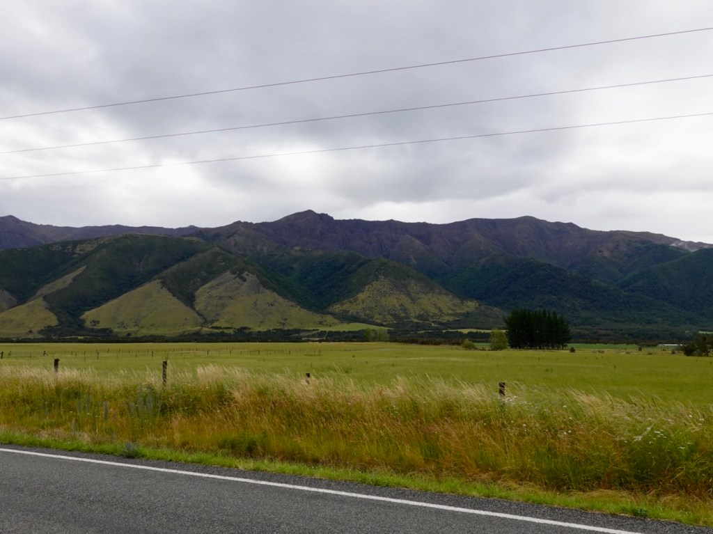
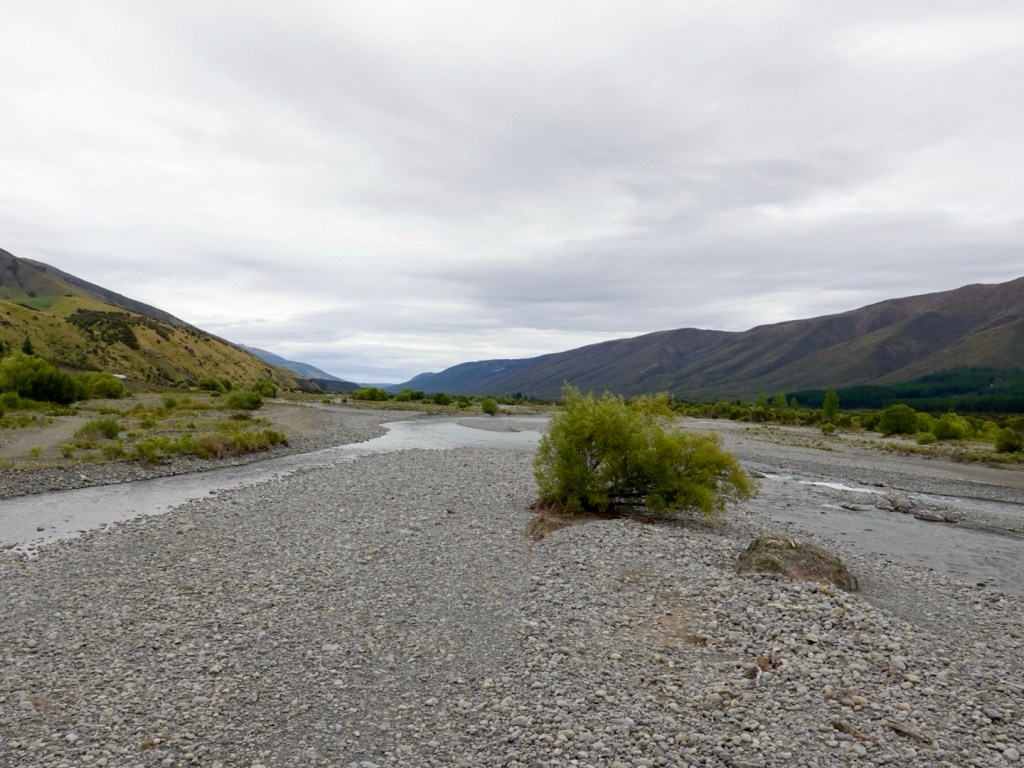
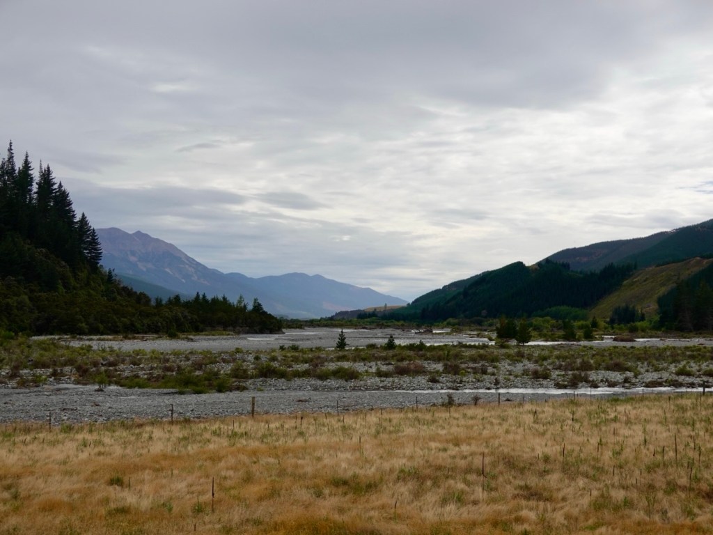
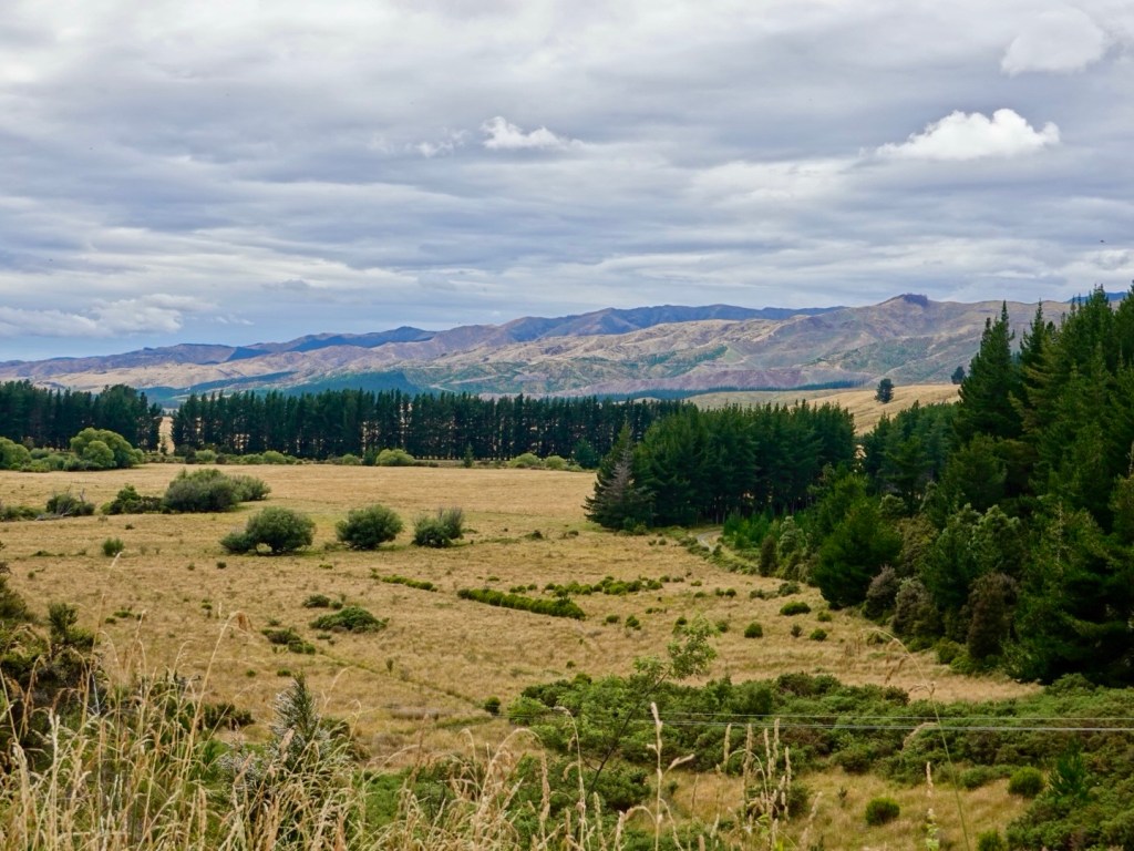
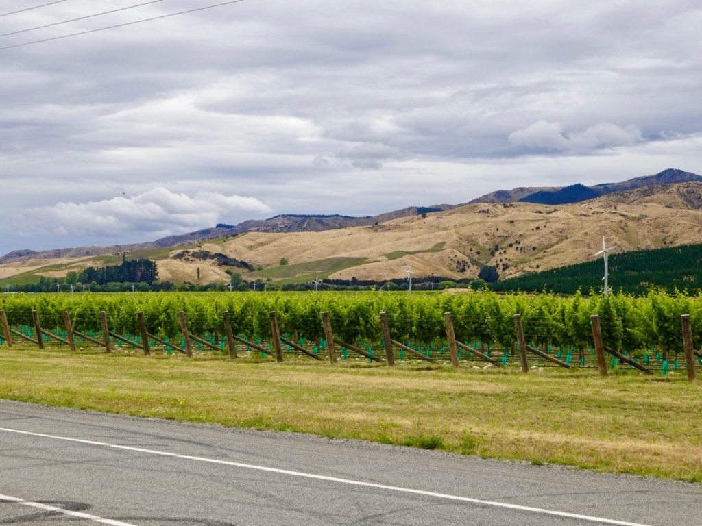
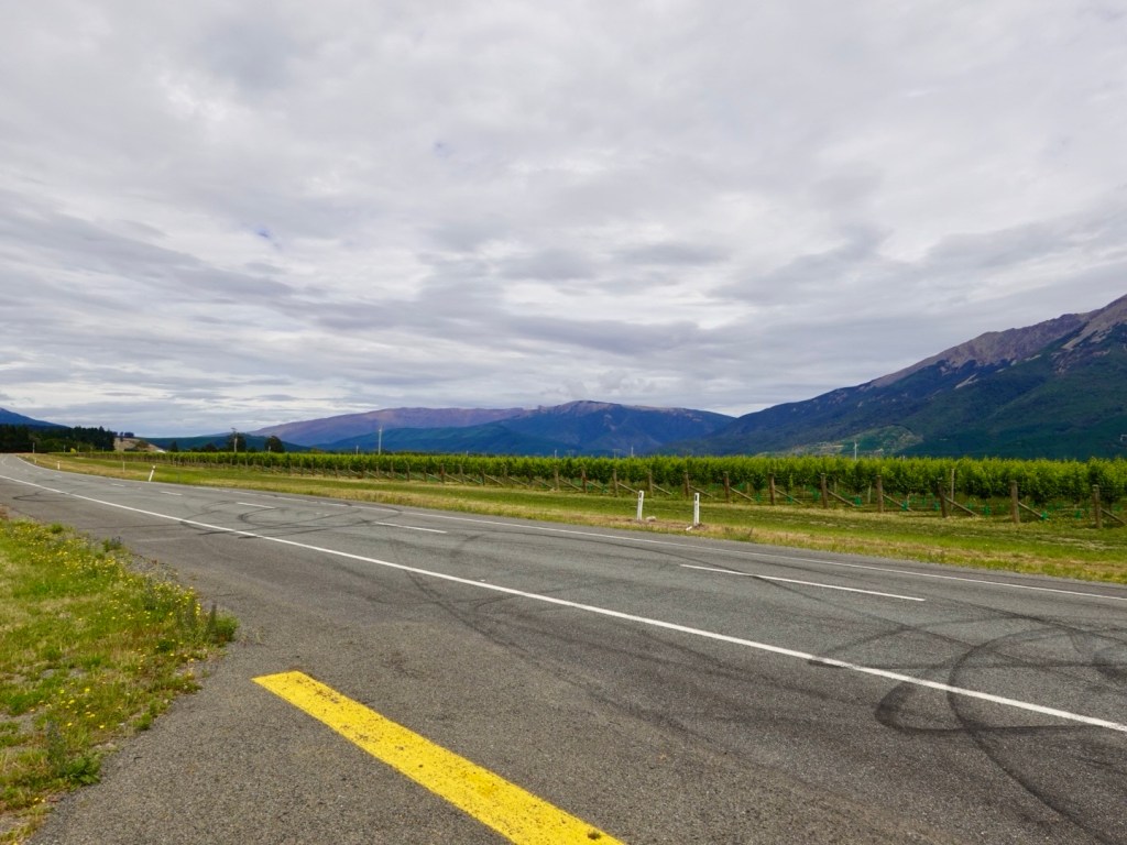
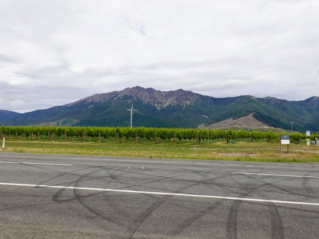
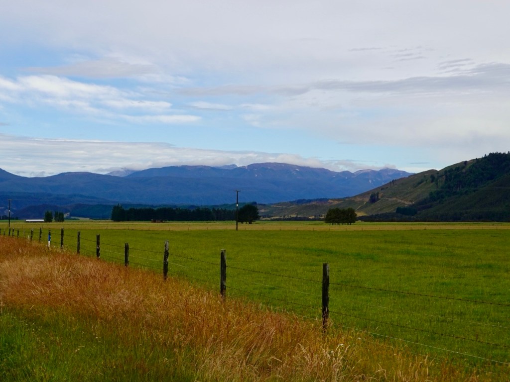
We were in the Wairau Valley, following the river of the same name, ridges and mountains including Mount Richmond either side.
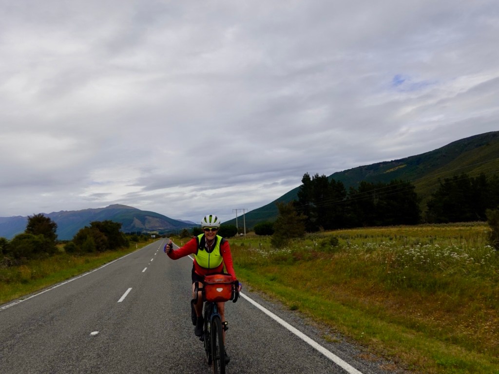
Enjoying the ride, I’m quite layered up here as it was quite cool.
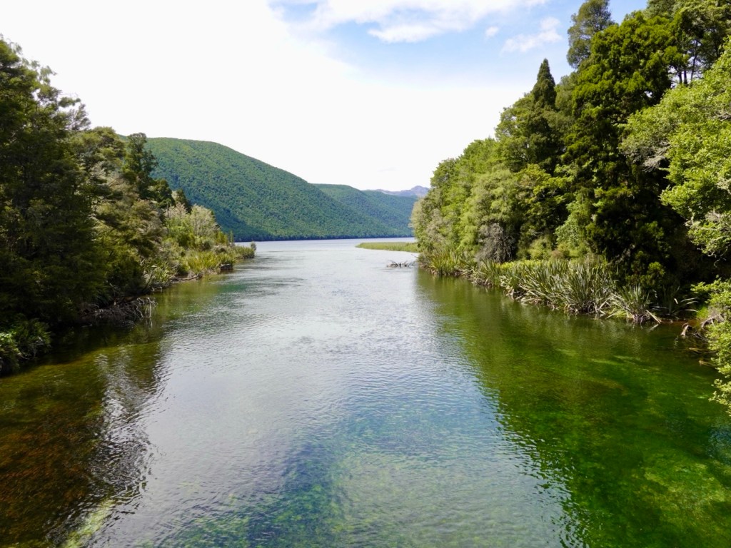
We crossed over the Wairau River, which is very wide and silted in places but you can see that gravel is removed regularly, similarly to what we see with European alpine river systems.
New Zealand does not have venomous creatures like Australia. You can go for a bush pee without fear!
However, they more than make up for it with geology. This valley forms part of the Alpine fault and is moving at 30 metres per 1,000 years. That is considered to be significant.
South Island is also overdue for a major earthquake. There is a 75% chance of major earthquake happening in the next 50 years. There is an 80% chance it will be a magnitude 8+ event.
The Alpine Fault has a regular history of producing large earthquakes. Over the last 8,000 years the Alpine Fault has ruptured 27 times.on average, every 300 years. The last significant quake being in 1717.
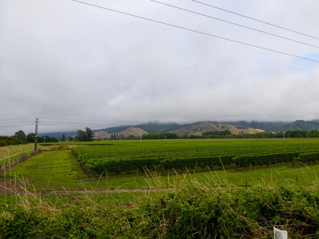
The valley is also famous for wine growing. 30 km or so, both sides of the road, were dedicated to grapes. the word Wairau in Maori means ‘river garden’ and today could see why. Fertile soils, multitude of labels and vineyards to visit.
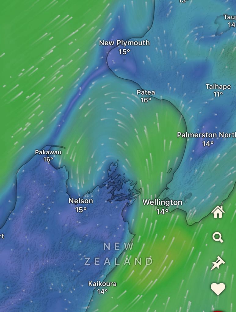
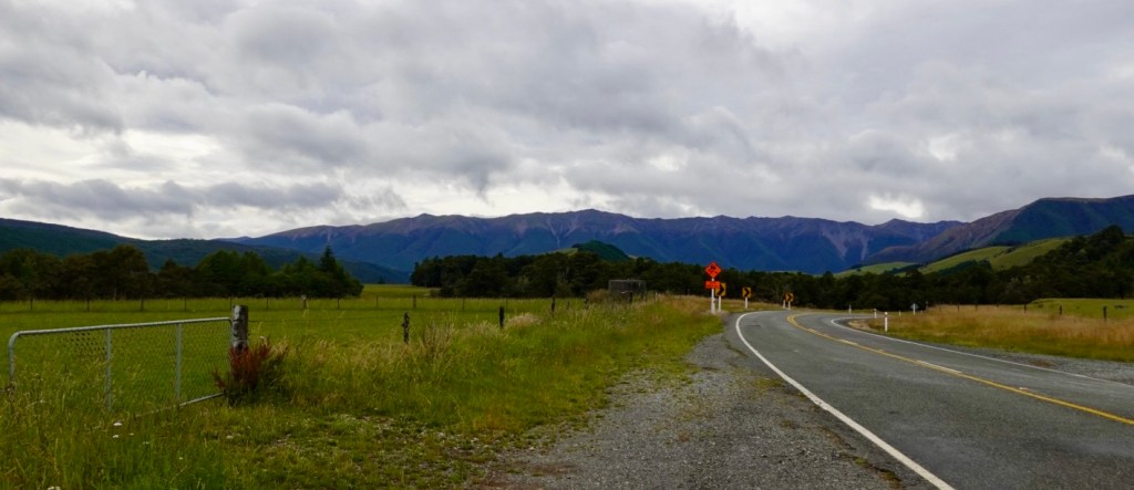
The road was incredibly long and straight. The last 50 km was headwind.
Look at the wind map. Seems common. The wind comes up the east side of South Island, swings west, then south across Nelson and bang into our faces riding.
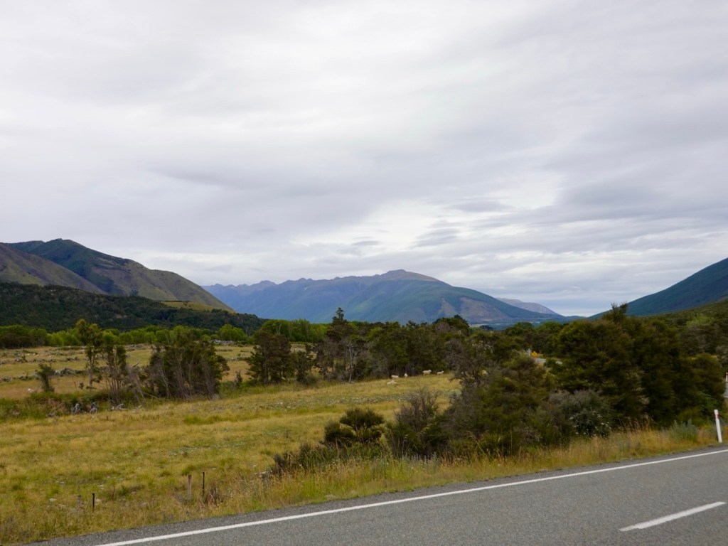
More views!
There were no places we could stop to grab a drink or food today for 90 km. It is a public holiday today here, but even on a business day, it would be necessary to be self sufficient for the ride.
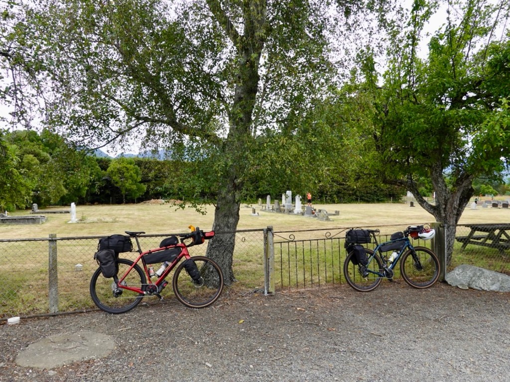
We stopped here at a small cemetery as there were toilets.
Our route took us through Renwick with only 13 km remaining. It had started to sprinkle rain. We found a supermarket open and grabbed a banana and roll and put the two together!
Rain jackets on it got heavier as we approached Blenheim, some two hours before we could check in to an Airbnb home.
We took shelter in a covered bus stop. By chance, our Airbnb just wrote to us confirming 4 pm. I let her know we were in town sheltering and she said we could check in at 3 pm. We were super grateful ❣️
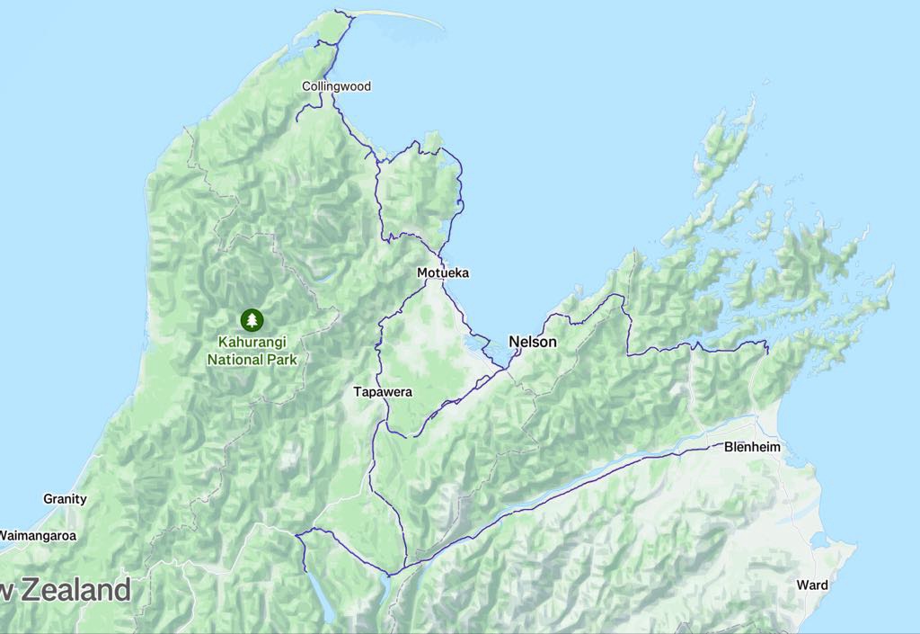
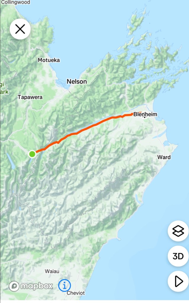
So here we are. Last full day of riding completed. here is our riding route to date. The blue lines are from our comp,eyed riding data. We will join that line from Blenheim to Picton tomorrow.
Todays route
Thanks for reading….two half days if riding remain.
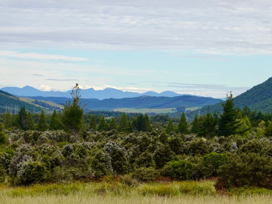
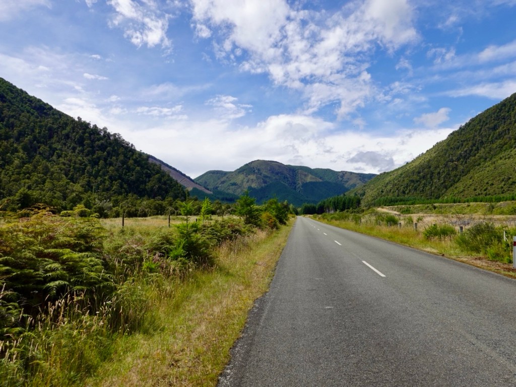
Today we were set to explore a section of the Nelson Lakes National Park, home to the beginning of the Southern Alps.
Our base is the town of St Arnaud that we arrived in last night.
Looking around at the other guests at our accomodation, many are here to do walks, mountain biking and boating.
Unlike Tasmanian National Parks, we have been able to access the parks here free of charge.
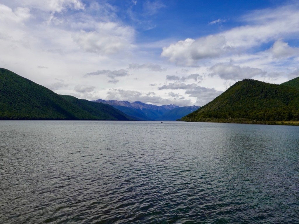
Two alpine lakes, Rotoroa and Rotoiti form the heart of this 102,000 hectares park.
Both lakes are surrounded by steep mountains, and surrounded at shore level by honeydew beech forests.
We had a great breakfast and set off.
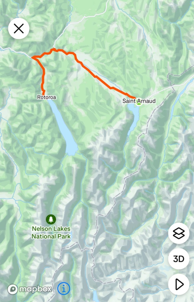
Here is today’s route. essentially only three roads were ridden on.
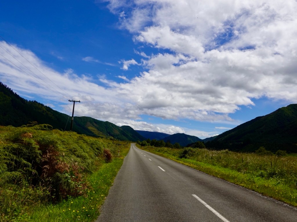
St Arnaud-Kawatiri Highway, turning into the Kawatiri-Murchison Highway, then turning left onto Gowan Valley Road. Hard to get lost today.
The roads were all good quality but the middle 6 km (each way) section on the Kawatiri-Murchison Highway was busy, narrow, little to no verge. The other two roads were quiet and far more enjoyable.
Essentially riding three valleys today
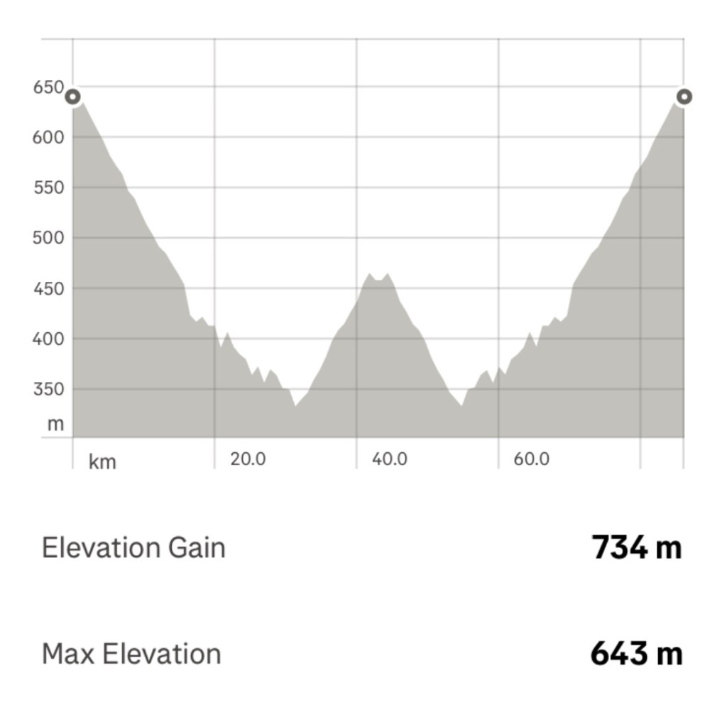
The gradient replicated the three roads. The down is the first two roads, then the up to the lake and opposite to return. Whilst it looks steep it wasn’t. The average gradient climbing was mostly 2-3%.
We had a headwind on the first downhill hoping it would not change direction for our return journey. Of course, it did and we did the climb home into a growing intensity headwind.
Our graph a mirror image being an out and back route.
Weather wise, it started overcast with a small probability of rain.
We left well rugged up. I pulled out my long sleeve thermal base to wear, then my cycling jersey, then my wind gilet, then my Assos wind jacket, then my Assos visibility vest. Legs were bare but they do all the work. I had leggings on the bike I could put on if need be.
Layering is what gets you through inclement weather…taking layers on and off, having somewhere to store them too as you ride.
By the time we returned I was down to my more usual kit with the thermal and jacket both off and stored away.
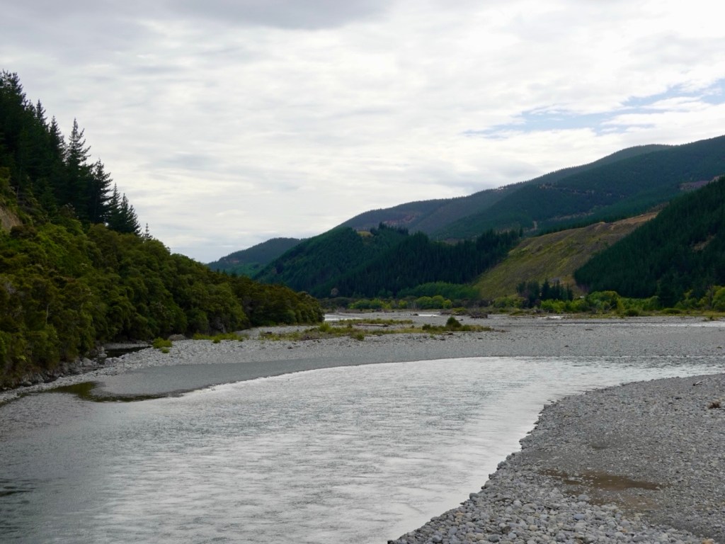
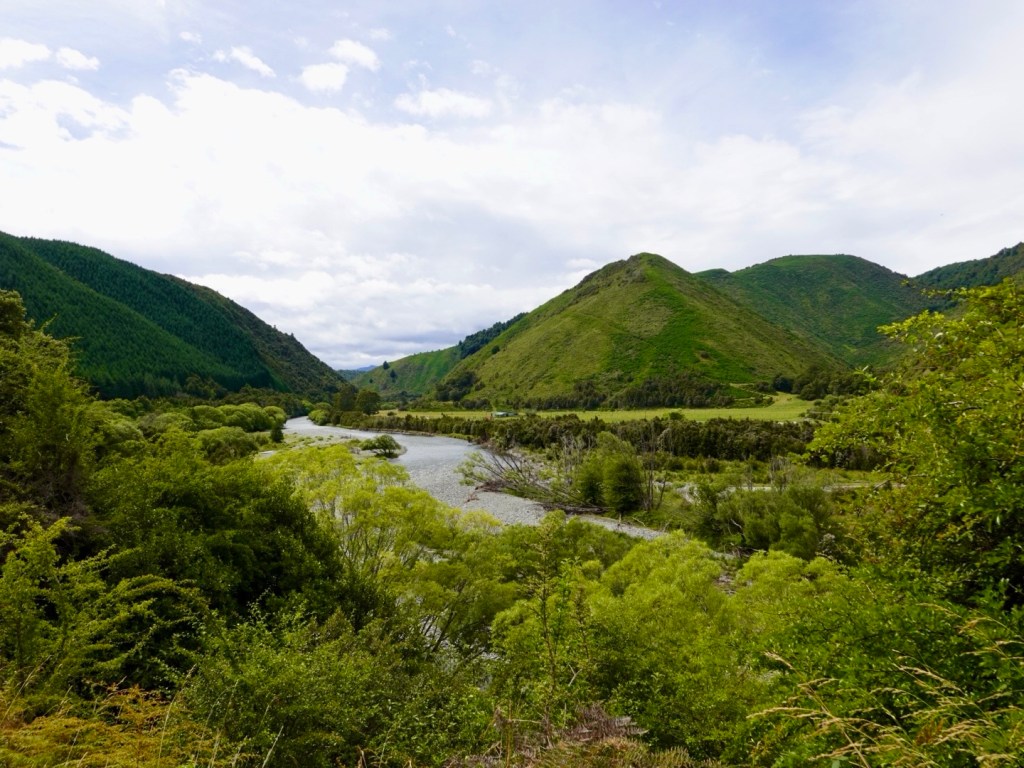
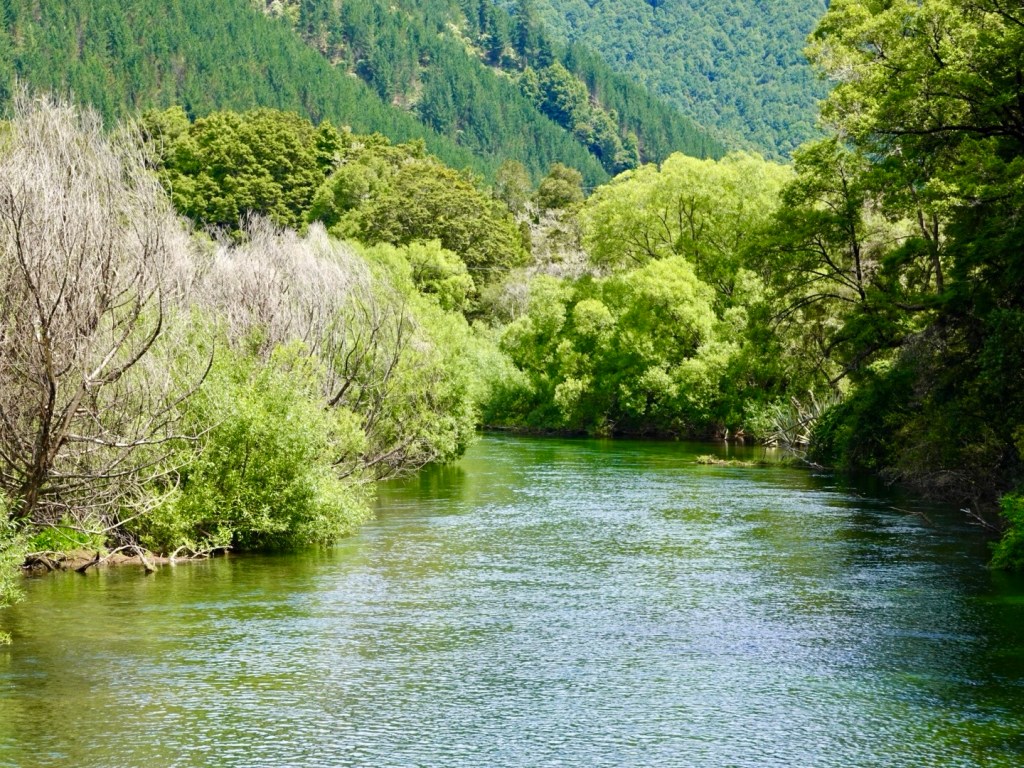
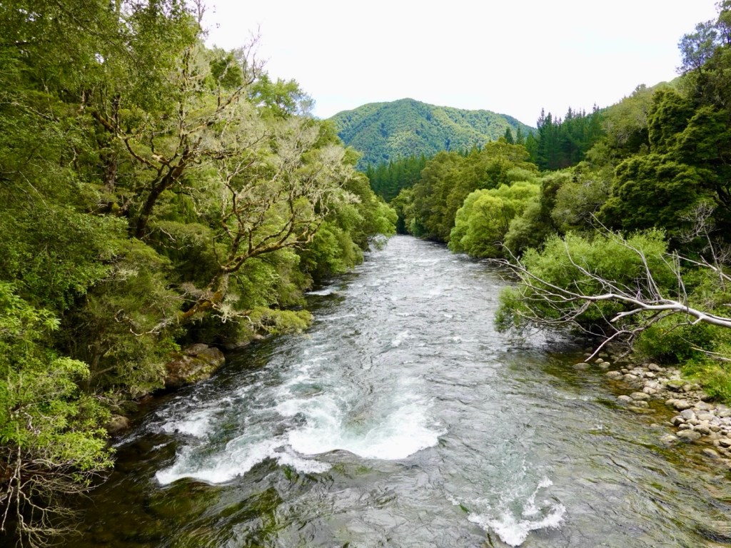
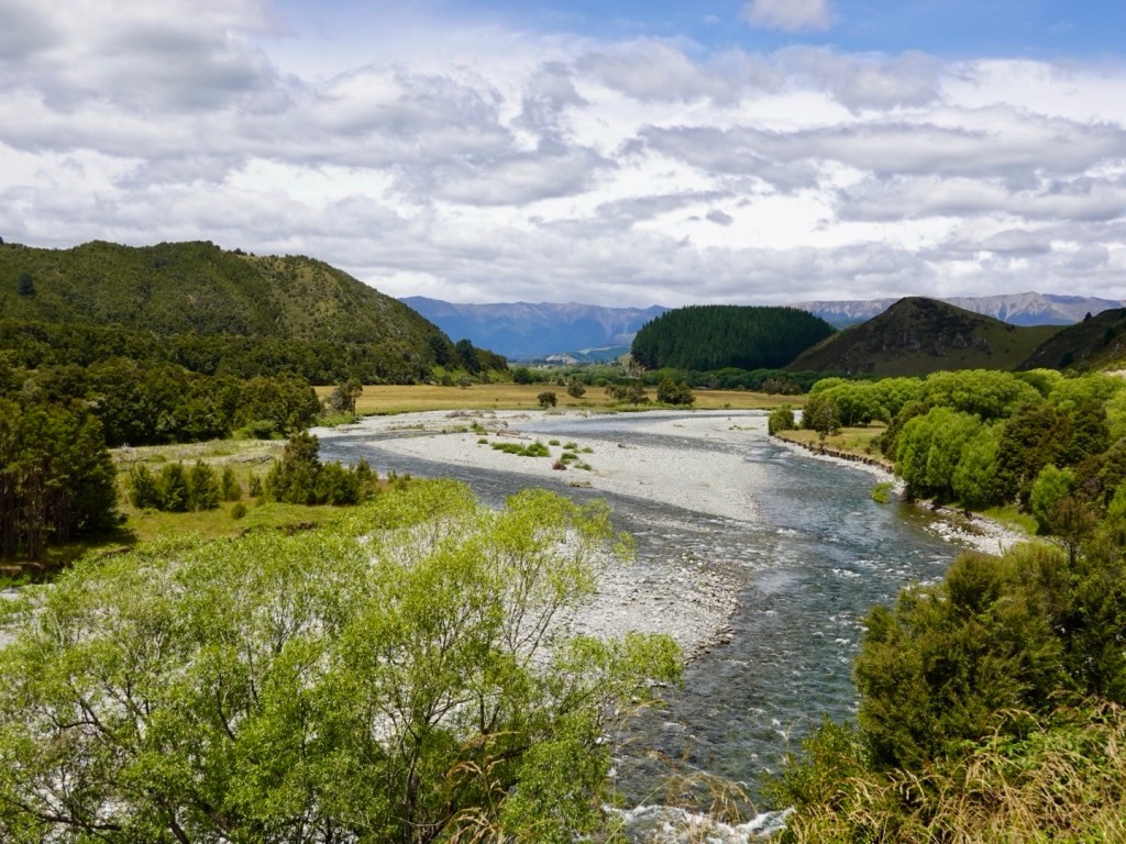
Looking back towards St Arnauds Looking forward Looking ahead We crossed many nice rivers. This is the Buller River.
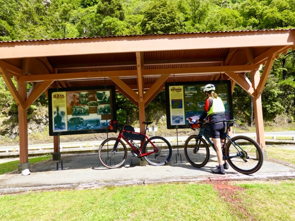
Reaching the junction of our second road, the Kawatiri-Murchison Highway there is a pleasant roadside stop, toilets, historical information.
The Great Taste rail trail that has featured heavily earlier in our trip used to connect with the former station here.
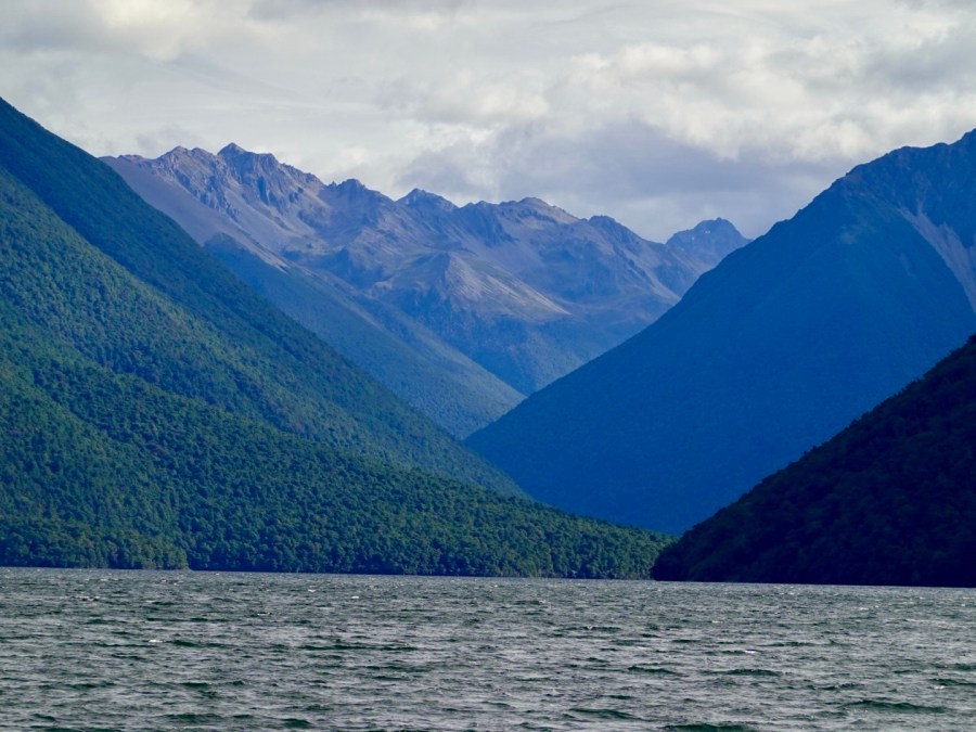
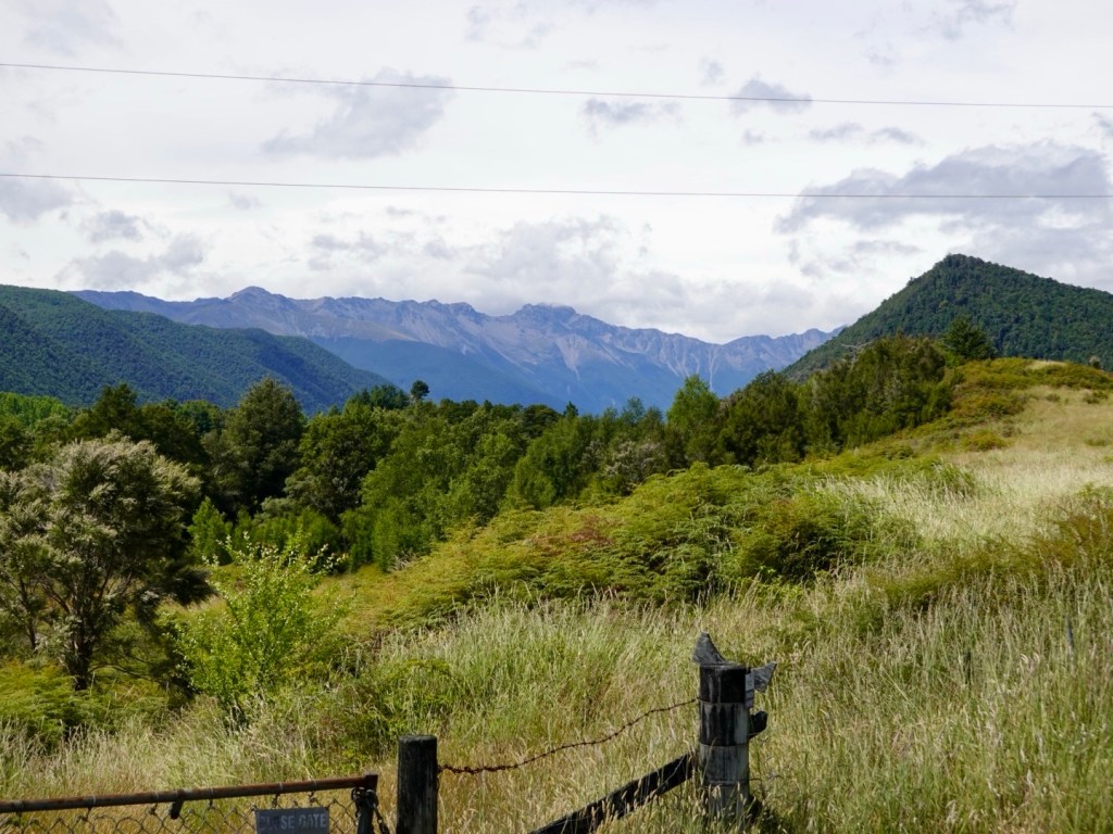
Turning towards Lake Rotoroa we see the mountains again forming the St Arnaud Ranges.
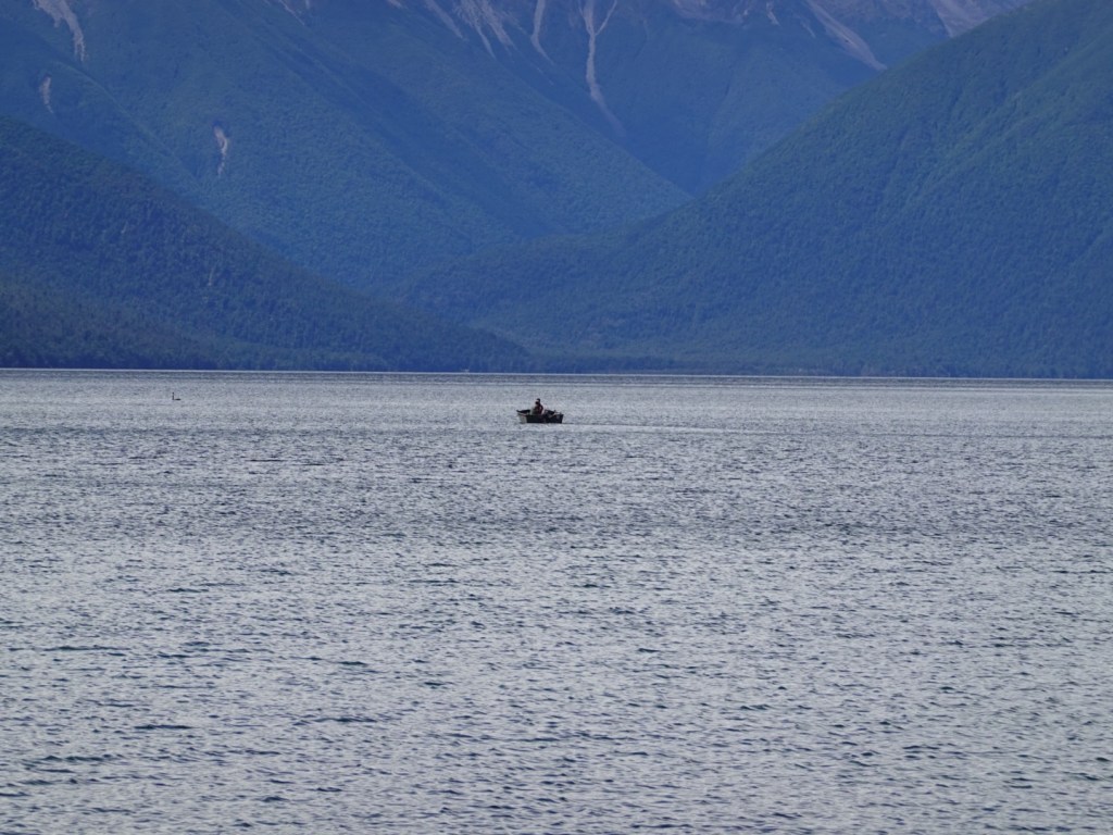
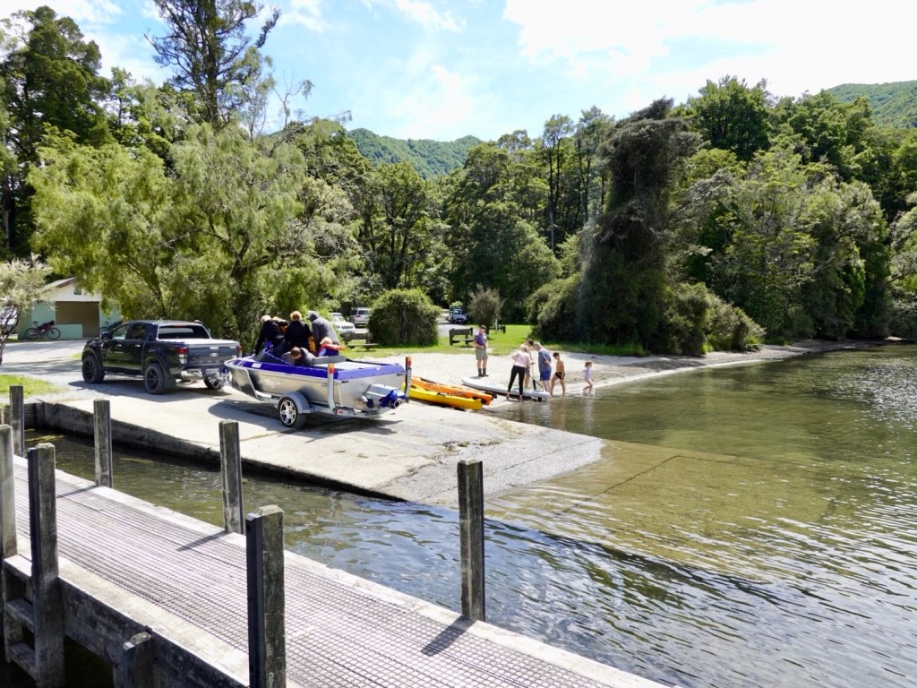
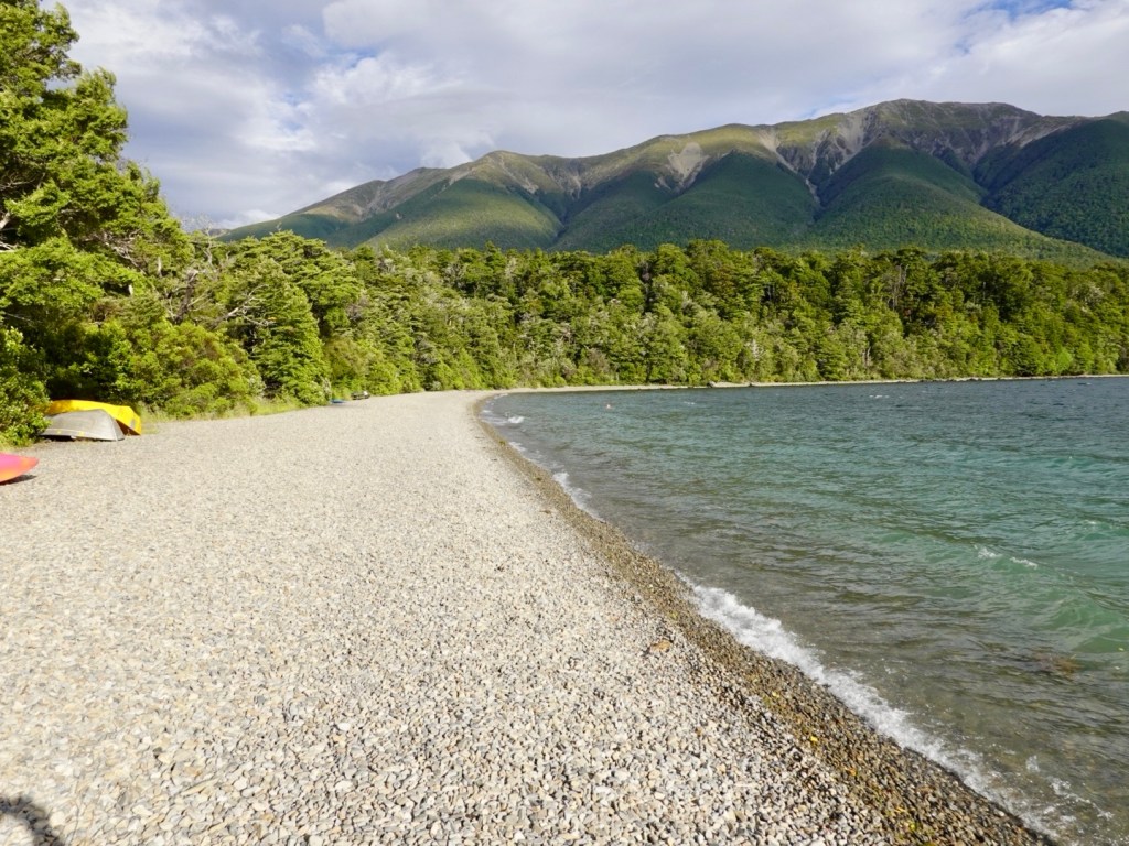
Finally after 43 km we arrived at the lake. Superbly majestic.
This is looking towards the St Arnaud RangesPopular with boaters
A family were preparing to launch their boat.
We had planned to spend time sitting by the lake. Little black biting insects had other plans and we stood there slapping our legs silly.
New takeaway? Find a small insect repellant to add to the first aid kit I carry. Preferably flat sachets!
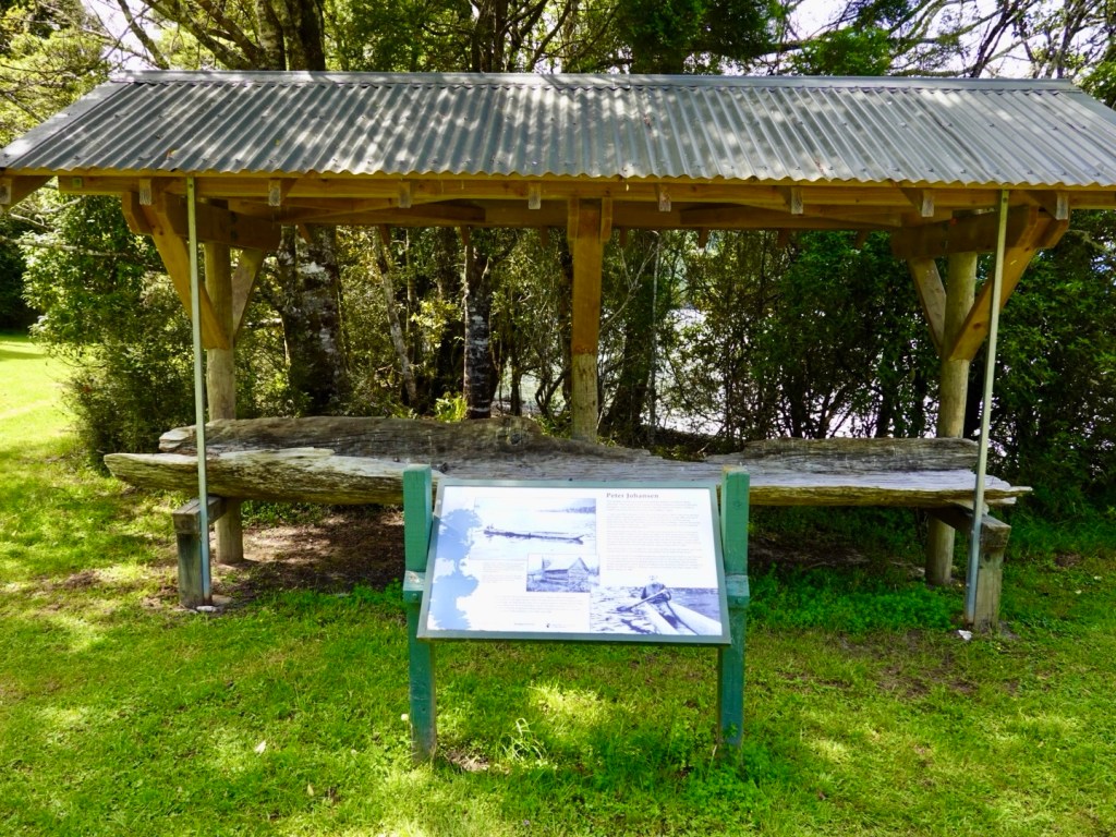
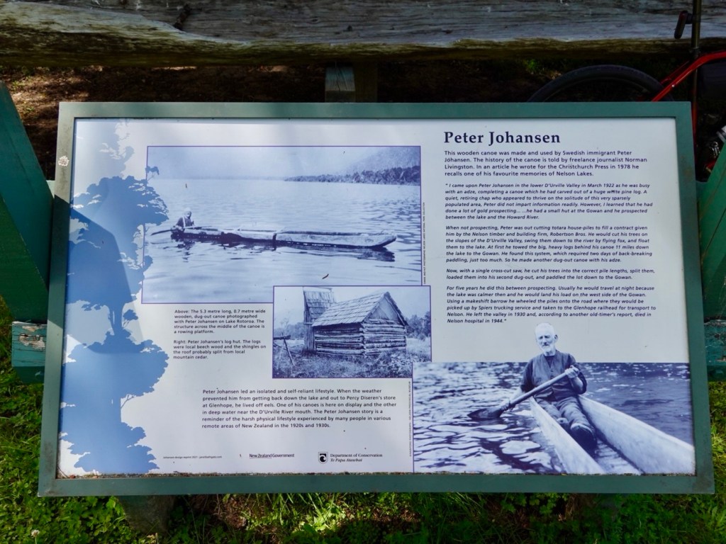
As we ate some food, slapped our legs like a crazy Finland Fish Song Dancer we read about Peter Johanson, a Swedish immigrant and early pioneer of the area.
This is the remnant of one of his hand cut canoes.
An interesting story. Click the photo to enlarge the writing.
Heading out from the lake we crossed this bridge where the Gowan River flows into the lake.
The road out was still quiet. Mostly the traffic was heading towards the lake.
The Gowan River flows adjacent to the road.
An interesting scar. Forestry to the left, native to the right. Very steep banks with evidence of little soil to replant the pines.
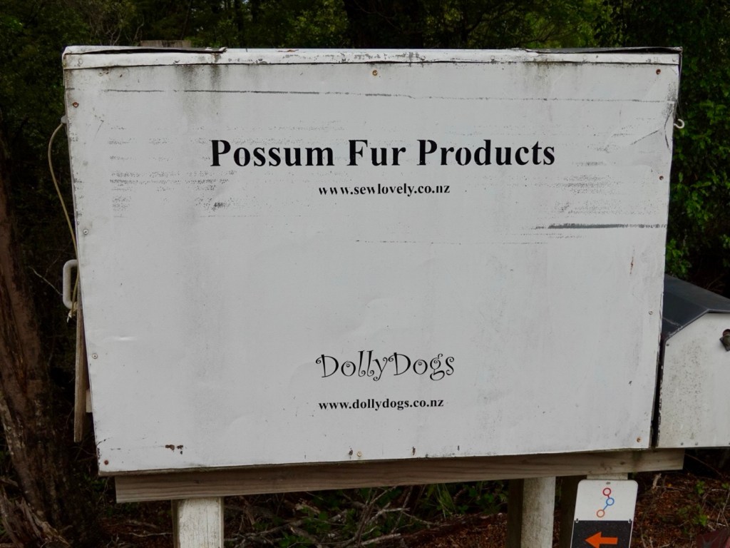
I have read before that it was a Tasmanian who introduced possums to New Zealand. Whilst regarded as a pest, there are others who make products from their fur.
Living in Possum Lane, Turners Beach, we have two types of possum (brush tail and ringtail) that visit (as seen on our security cameras at night and evidenced by Khaleesi carrying on when they walk along the fence).
The only time they have annoyed us, or should I say me, is when one destroyed my zucchini’s last year. I was unimpressed.
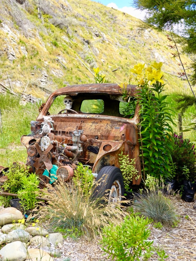
Quirky and someone with a sense of humour set this up in a paddock.
Heading back along that final road was the steady climb and the most annoying wind direction had swung around to be a headwind with increased gusty intensity.
It is a cyclists curse when that happens as you hope you will benefit one way at least. Not today….again!!
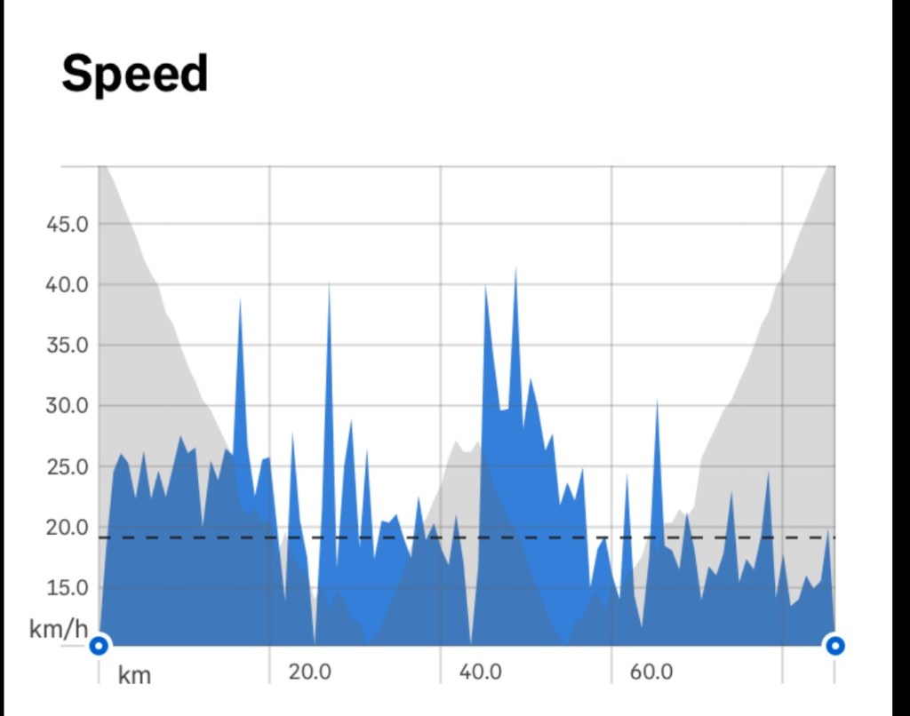
We made slow you going of the last 20 km. At times the wind was so strong I could not even do 12 kmh.
Here is our speed graph for the ride. you can see how the speed dropped from just before 60 km. That is the wind factor.
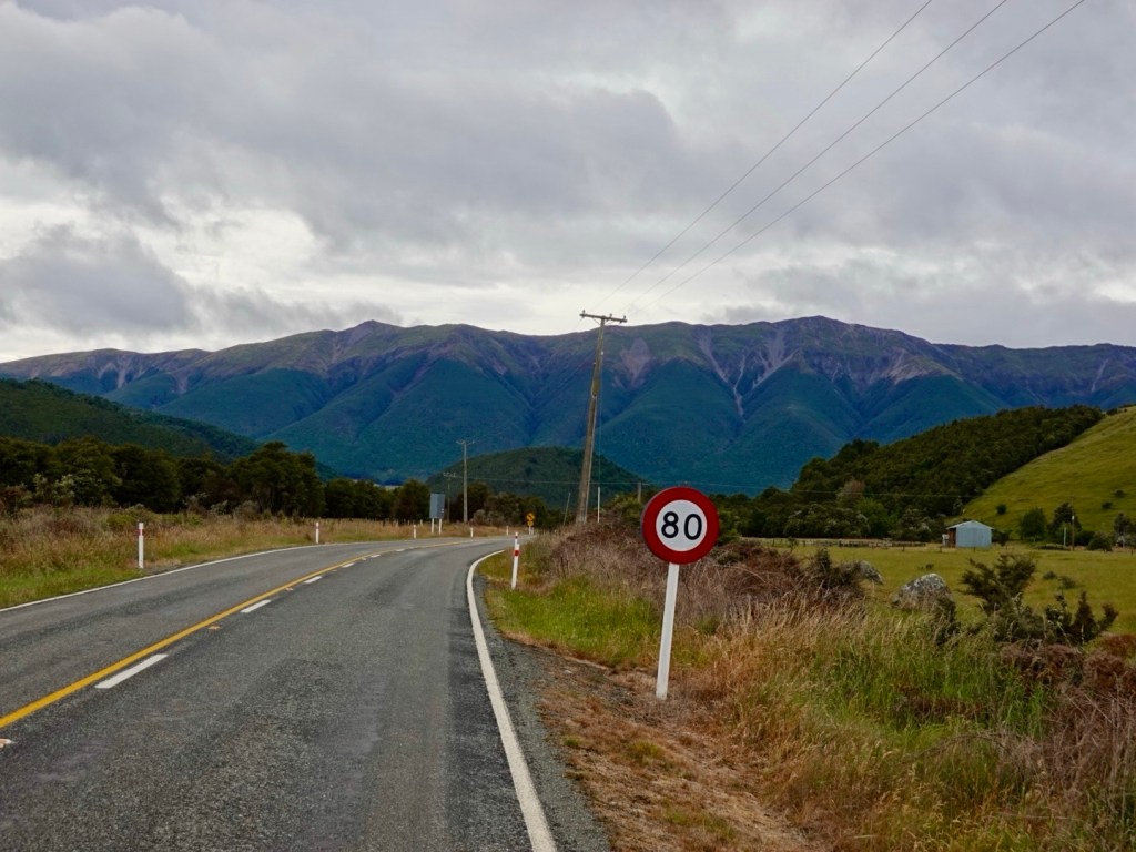
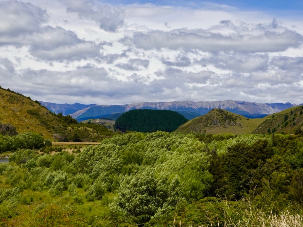
We had great views looking back towards St Arnaud’s. This is a great road for cycling, despite the wind. cars were considerate and the road was quite wide.
Buller RiverGetting closer
After 85 km and 734 m climbing we were back at our accomodation
After dinner we went on a 3 km walk down the road to Lake Rotoiti.
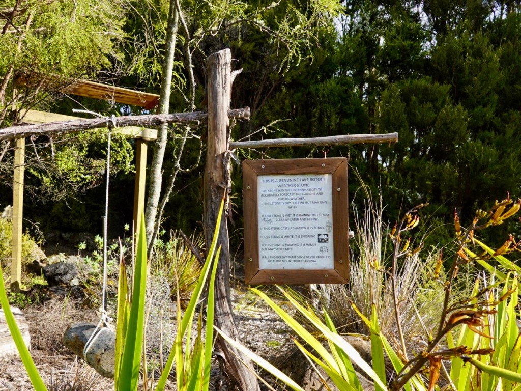
A local resident had this natural weather indicator in their front yard. Click the photo to enlarge the writing.
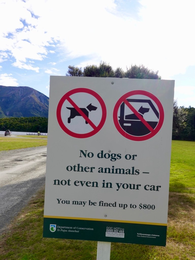
No dogs, not even in your car!
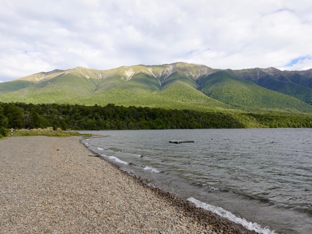
Lovely views along the lake. It was quite windy and cool down by the lake, nevertheless there were a group of kids swimming as their well rugged up parents watched.
Views around the lake.
Various watercraft hidden under bushes around the lake
It’s been great visiting the alpine lakes and seeing the northern mountains of the Southern Alps. Quite the contrast after our predominantly sea view trip.
Tomorrow is a new year, 2025.
We’ve had a great 2024 with our cycling adventures, visiting Italy, Switzerland, Slovenia, San Marino, New Zealand completing over 4,000 km outside of Australia.
My strava data tells me I did over 21,000 km in total for the year.
Whilst that sounds pretty ok, a lot of that is on Zwift, an easier way of amassing training km than outdoors as there are no weather elements and cars to contend with and the cycling speeds are higher, draft benefits are strong. It keeps me fit though for what we do touring wise.
I want to pay homage to our friend Kat Secteur in the Czech Republic.
Kat has done over 55,000 km for the year and it is all outside. 100%. She does not have a trainer. What’s more, the weather whilst she rides now is winter, so lots of snow and her ride a few days ago was minus 1c.
Well done Kat. I had the pleasure of doing a day ride with Kat back in 2018 of about 235 km. We rode out towards the border of Czech Republic, Poland and Germany. That is my biggest outside ride and it was with a wonderful group.
Well done Kat, inspiring women globally.
Happy New Year readers. Thankyou for your continued support and may 2025 be happy and healthy. 😊❣️